Items Similar to Antique Map of Polynesia and Australasia by Neele, 1825


Want more images or videos?
Request additional images or videos from the seller
Antique Map of Polynesia and Australasia by Neele, 1825
About the Item
Antique map titled 'Polynesia and Australasia'. It shows Australia (New Holland), part of Asia, New Zealand and many islands. This map originates from 'Encyclopedia Londinensis'.
- Dimensions:Height: 8.67 in (22 cm)Width: 11.23 in (28.5 cm)Depth: 0.02 in (0.5 mm)
- Materials and Techniques:
- Period:
- Date of Manufacture:1825
- Condition:Wear consistent with age and use. General age-related toning. Please study images carefully.
- Seller Location:Langweer, NL
- Reference Number:
About the Seller
5.0
Platinum Seller
These expertly vetted sellers are 1stDibs' most experienced sellers and are rated highest by our customers.
Established in 2009
1stDibs seller since 2017
1,956 sales on 1stDibs
Typical response time: <1 hour
- ShippingRetrieving quote...Ships From: Langweer, Netherlands
- Return PolicyA return for this item may be initiated within 14 days of delivery.
More From This SellerView All
- Antique Map of Australasia by Lowry, 1852Located in Langweer, NLAntique map titled 'Australasia'. Original map of Australasia. This map originates from 'Lowry's Table Atlas constructed and engraved from the most recent Authorities' by J.W. Lowry....Category
Antique Mid-19th Century Maps
MaterialsPaper
- Antique Map of Eastern Polynesia, 1849Located in Langweer, NLAntique map titled 'Ost-Polynesien'. Interesting variant issue, with large detailed insets top right of Hawaii volcanos near Kilauea. Insets lower right of Honolulu harbour, island o...Category
Antique Mid-19th Century Maps
MaterialsPaper
- Antique Map of Western Polynesia, 1849Located in Langweer, NLAntique map titled 'Ost-Polynesien'. Detailed map of the western Pacific extending from the Celebes to Samoa and including part of Australia. Insets of...Category
Antique Mid-19th Century Maps
MaterialsPaper
- Original Hand-colored Antique Map of Denmark by S. Neele, 1790Located in Langweer, NLAntique very decorative engraving of Denmark engraved by S. Neele. Published in November 1790 by John Trusler. Tape on verso.Category
Antique Late 18th Century Maps
MaterialsPaper
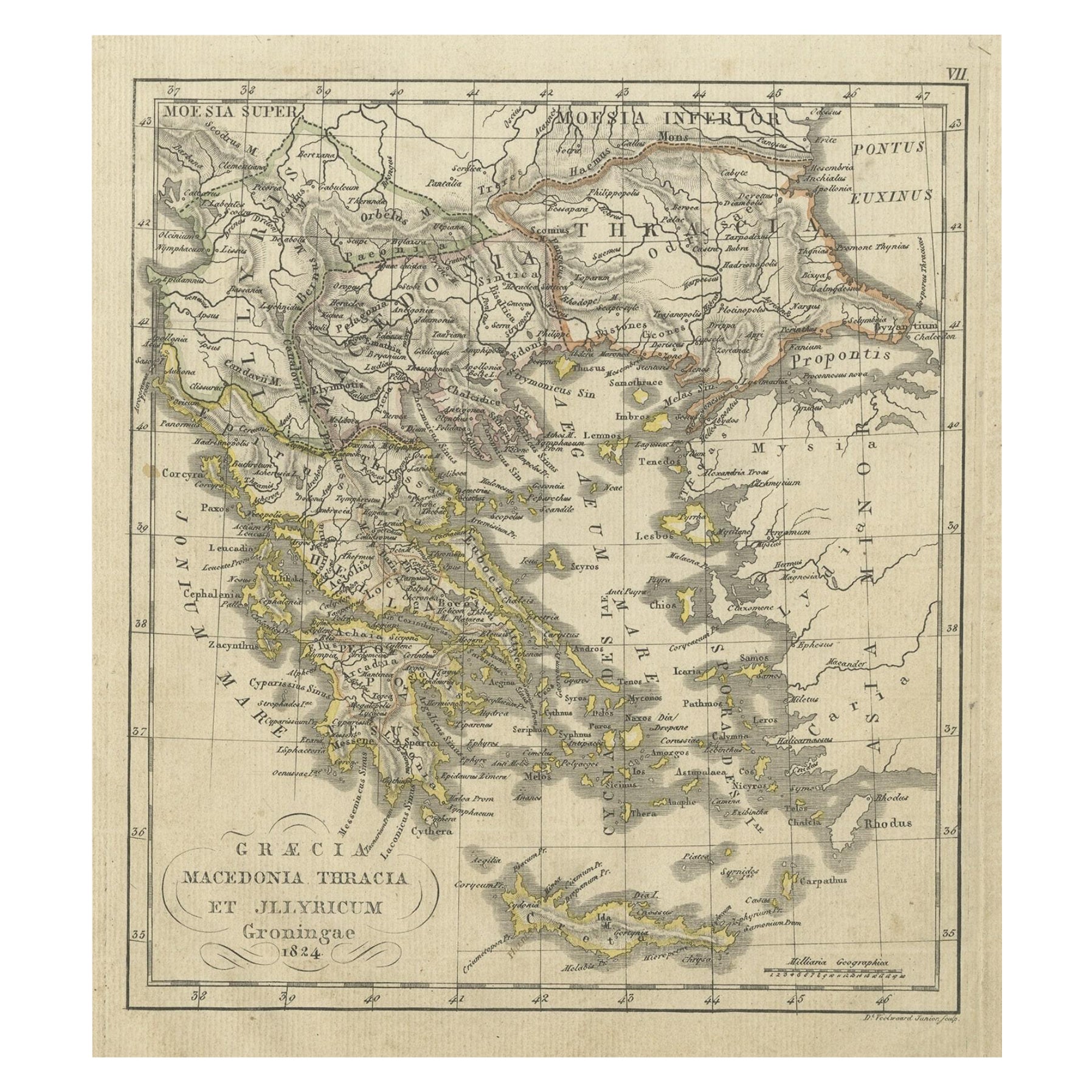
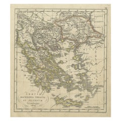
- Antique Map of Greece and Macedonia, 1825Located in Langweer, NLAntique map titled 'Graecia, Macedonia Thracia et Jllyricum'. Old map of Greece and Macedonia originating from 'Atlas der Oude Wereld'. Artists and Engravers: Published by C. Ph. Fun...Category
Antique 19th Century Maps
MaterialsPaper
- Antique Map of the Island of Tahiti, Polynesia, 1803Located in Langweer, NLAntique map Tahiti titled 'Kaart van het Eiland Otahiti'. Antique map of the Island of Tahiti, Polynesia. Originates from 'Reizen Rondom de Waereld door James Cook (..)'. Art...Category
Antique Early 1800s Maps
MaterialsPaper


You May Also Like
- Antique Map of Italy by Andriveau-Goujon, 1843By Andriveau-GoujonLocated in New York, NYAntique Map of Italy by Andriveau-Goujon, 1843. Map of Italy in two parts by Andriveau-Goujon for the Library of Prince Carini at Palazzo Carini i...Category
Antique 1840s French Maps
MaterialsLinen, Paper
- Antique Map of Principality of MonacoBy Antonio Vallardi EditoreLocated in Alessandria, PiemonteST/619 - "Old Geographical Atlas of Italy - Topographic map of ex-Principality of Monaco" - ediz Vallardi - Milano - A somewhat special edition ---Category
Antique Late 19th Century Italian Other Prints
MaterialsPaper
- Original Antique Map of Spain and Portugal by Thomas Clerk, 1817Located in St Annes, LancashireGreat map of Spain and Portugal Copper-plate engraving Drawn and engraved by Thomas Clerk, Edinburgh. Published by Mackenzie And Dent, 1817 Unframed.Category
Antique 1810s English Maps
MaterialsPaper
- Original Antique Map of Spain and Portugal, Engraved By Barlow, 1806Located in St Annes, LancashireGreat map of Spain And Portugal Copper-plate engraving by Barlow Published by Brightly & Kinnersly, Bungay, Suffolk. 1806 Unframed.Category
Antique Early 1800s English Maps
MaterialsPaper
- Original Antique Map of Russia By Arrowsmith. 1820Located in St Annes, LancashireGreat map of Russia Drawn under the direction of Arrowsmith Copper-plate engraving Published by Longman, Hurst, Rees, Orme and Brown, 1820 Unframed.Category
Antique 1820s English Maps
MaterialsPaper
- Original Antique Map of Ireland- Tipperary and Waterford. C.1840Located in St Annes, LancashireGreat map of Tipperary and Waterford Steel engraving Drawn under the direction of A.Adlard Published by How and Parsons, C.1840 Unframed.Category
Antique 1840s English Maps
MaterialsPaper


Recently Viewed
View AllMore Ways To Browse
Encyclopedia Antique
Map Australia
Antique Encyclopedias
Maps Of Australia
Antique New Zealand
Antique Collectables Australia
Antique Encyclopedia
New Zealand Antique Furniture
Antique Furniture New Zealand
Antique Maps Australia
Antique Map Australia
Australia Antique Map
Antique Australia Map
Antique Australian Map
Antique Maps Of Australia
Antique Map Of Australia
Antique Australian Maps
Map Zealand