Early 19th Century Maps
35
233
to
74
223
7
233
233
233
8
6
1
1
2,889
2,122
411
5
227
31
11
84
7
56
7
3
3
4
5
2
225
12
3
3
3
50
42
39
5
2
4
1
1
1
1
Period: Early 19th Century
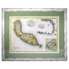
Curaçao map - C. van Baarsel en zoon
Located in UTRECHT, UT
“Kaart van het eiland Curaçao.”, “Algemeene kaart der Caraïbische eilanden”, “Plan van het fort Amsterdam op Curaçao” from the atlas “Atlas der overzeesche bezittingen van Zijne Maje...
Category
Dutch Other Antique Early 19th Century Maps
Materials
Paper
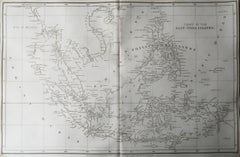
Original Antique Map of South East Asia, Arrowsmith, 1820
Located in St Annes, Lancashire
Great map of South East Asia
Drawn under the direction of Arrowsmith
Copper-plate engraving
Published by Longman, Hurst, Rees, Orme and Brown, 1820
Unframed.
Category
English Antique Early 19th Century Maps
Materials
Paper
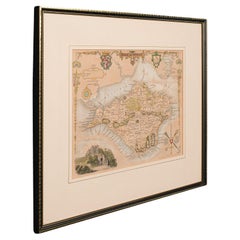
Antique Lithography Map, Isle of Wight, English, Framed, Engraving, Cartography
Located in Hele, Devon, GB
This is an antique lithography map of the Isle of Wight. An English, framed atlas engraving of cartographic interest, dating to the early 19th century and later.
Superb lithography ...
Category
British Regency Antique Early 19th Century Maps
Materials
Wood
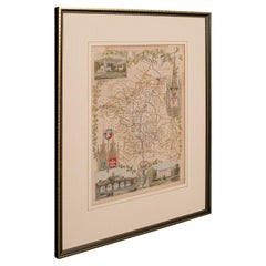
Antique Lithography Map, Worcestershire, English, Framed Engraving, Cartography
Located in Hele, Devon, GB
This is an antique lithography map of Worcestershire. An English, framed atlas engraving of cartographic interest, dating to the early 19th centur...
Category
British Regency Antique Early 19th Century Maps
Materials
Wood
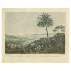
Serene Vista of Messina and its Strait: An Engraved Jewel, circa 1800
Located in Langweer, NL
Title: "Vue de Messine & de Son Détroit"
This evocative print titled "Vue de Messine & de Son Détroit" presents a picturesque view of Messina and its strait, a vital waterway separa...
Category
Antique Early 19th Century Maps
Materials
Paper
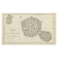
Antique Map of the Island of Tahiti, Polynesia, 1803
Located in Langweer, NL
Antique map Tahiti titled 'Kaart van het Eiland Otahiti'.
Antique map of the Island of Tahiti, Polynesia. Originates from 'Reizen Rondom de Waereld door James Cook (..)'.
Art...
Category
Antique Early 19th Century Maps
Materials
Paper
1817 Map of Puerto Rico and the Virgin Islands with Original Hand Coloring
Located in Langweer, NL
The title provided for this map is "Porto Rico and Virgin Isles," and it is an antique map from an early 19th century atlas, dated 1817, featuring original hand coloring. This histor...
Category
Antique Early 19th Century Maps
Materials
Paper
Original Antique Map of the West Indies by J. Arrowsmith, 1842
Located in Langweer, NL
Title: "J. Arrowsmith's 19th Century Map of the West Indies"
This original antique map, crafted by J. Arrowsmith, details the West Indies with a focus on the Caribbean Sea and its s...
Category
Antique Early 19th Century Maps
Materials
Paper
Large Antique Map of Guadeloupe and Antigua with Adjacent Isles, 19th Century
Located in Langweer, NL
Title: "Antique Map of Guadeloupe and Antigua with Adjacent Isles, 19th Century"
Source: New General Atlas (circa 1817), published in Edinburgh
Description: This detailed antique m...
Category
Antique Early 19th Century Maps
Materials
Paper
Copper Engraved Grenada Map by John Thompson Published in 1810
Located in Langweer, NL
John Thomson's original antique map of Grenada, dating back to 1810 and hailing from Edinburgh, stands as a testament to meticulous cartography. This historical piece, adorned with o...
Category
Antique Early 19th Century Maps
Materials
Paper
Original Antique Map of India. C.1780
Located in St Annes, Lancashire
Great map of India
Copper-plate engraving
Published C.1780
Three small worm holes to right side of map and one bottom left corner
Unframed.
Category
English Georgian Antique Early 19th Century Maps
Materials
Paper
Ptolemaic Armillary Sphere Charles-François Delamarche Paris, 1805-1810 Circa
Located in Milano, IT
Charles-François Delamarche
Ptolemaic armillary sphere
Paris, circa 1805-1810
Wood and papier-mâché
covered with printed and partly hand-coloured paper
It measures 15.74” in height, ...
Category
French Empire Antique Early 19th Century Maps
Materials
Paper, Wood
Original Antique Map of Italy. C.1780
Located in St Annes, Lancashire
Great map of Italy
Copper-plate engraving
Published C.1780
Unframed.
Category
English Georgian Antique Early 19th Century Maps
Materials
Paper
Antique Map of Hindustan, or India
Located in Langweer, NL
Antique map titled 'Hindoostan, or India'. Original antique map of India (Hindustan) and Sri Lanka (Ceylon). Engraved by Russell. Published by Nuttall, Fisher & Co, 1814.
Category
Antique Early 19th Century Maps
Materials
Paper
Antique Map of British India with Insets of Kabul and Nepal
Located in Langweer, NL
Antique map titled 'British India, northern part'. Large format map of the northern area of the Indian subcontinent. The map is engraved in the minimalist English style pioneered in ...
Category
Antique Early 19th Century Maps
Materials
Paper
Original Antique Map of Asia. C.1780
Located in St Annes, Lancashire
Great map of Asia
Copper-plate engraving
Published C.1780
Two small worm holes to right side of map
Unframed.
Category
English Georgian Antique Early 19th Century Maps
Materials
Paper
Original Antique Map of South America. C.1780
Located in St Annes, Lancashire
Great map of South America
Copper-plate engraving
Published C.1780
Two small worm holes to left side of map
Unframed.
Category
English Georgian Antique Early 19th Century Maps
Materials
Paper
Antique Geographical, Historical and Statistical Map of Massachusetts, 1822
Located in Langweer, NL
This attractive map of Massachusetts presents a finely detailed overview of the state in the first quarter of the 19th century.
Transportation ...
Category
Antique Early 19th Century Maps
Materials
Paper
Antique Map of Britain in Roman Times
Located in Langweer, NL
Antique map titled 'Britannia Romana collected from Ptolemy (..)'. Map of Britain in Roman times drawn from several sources, including the works of Ptolemy and The Itinerary of the E...
Category
Antique Early 19th Century Maps
Materials
Paper
Old Print of Captain Cook Witnessing a Human Sacrifice, in a Morai, Tahiti, 1803
Located in Langweer, NL
Antique print titled 'Menschelijke Offerhande in eene Morai of Otahiti verrigt'.
Antique print depiciting a Human Sacrifice, in a Morai, in Otaheite. Originates from 'Reizen Rondom...
Category
Antique Early 19th Century Maps
Materials
Paper
Antique Map of Mauritania, Massaesylia, Numidia, Tunisia, Cyrenaica & Marmarica
Located in Langweer, NL
Three maps on one sheet showing Mauritania, Massaesylia, Numidia, Tunisia, Cyrenaica and Marmarica (ancient Libya). This map originates from 'Schul-Atlas für die alte Erdbeschreibung...
Category
Antique Early 19th Century Maps
Materials
Paper
Miniature Antique Map of England and Wales
Located in Langweer, NL
Miniature map titled 'England & Wales'. Original antique map of England & Wales. This map originates from 'Darton's New Miniature Atlas' publis...
Category
Antique Early 19th Century Maps
Materials
Paper
Original Antique Map of Asia
Located in Langweer, NL
Antique map titled 'Asien'. Original old map of Asia. Published in Berlin by Simon Schropp et Comp, 1819.
Category
Antique Early 19th Century Maps
Materials
Paper
Antique Map of Saxon England according to the Anglo-Saxon Chronicle
Located in Langweer, NL
Antique map titled 'Saxon England According to the Saxon Chronicle'. Map of Saxon England based upon descriptions in the Anglo-Saxon Chronicle, a collection of annals in Old English ...
Category
Antique Early 19th Century Maps
Materials
Paper
Large Antique Map of England and Wales
Located in Langweer, NL
Antique map titled 'An Accurate Map of England and Wales'. Original old map of England and Wales. Engraved by John Cary. Originates from 'New British Atlas' by John Stockdale, publis...
Category
Antique Early 19th Century Maps
Materials
Paper
Large Antique County Map of Northumberland, England
Located in Langweer, NL
Antique map titled 'A Map of Northumberland from the best Authorities'. Original old county map of Northumberland, England. Engraved by John Cary. Originates from 'New British Atlas'...
Category
Antique Early 19th Century Maps
Materials
Paper
Large Antique County Map of Surrey, England
Located in Langweer, NL
Antique map titled 'A Map of Surry from the best Authorities'. Original old county map of Surrey, England. Engraved by John Cary. Originates from 'New British Atlas' by John Stockdal...
Category
Antique Early 19th Century Maps
Materials
Paper
Large Antique County Map of Lincolnshire, England
Located in Langweer, NL
Antique map titled 'A Map of Lincolnshire from the best Authorities'. Original old county map of Lincolnshire, England. Engraved by John Cary. Originates from 'New British Atlas' by ...
Category
Antique Early 19th Century Maps
Materials
Paper
Large Antique Map of England Hand Colored by Counties
Located in Langweer, NL
Antique map titled 'A New Map of England from the latest Authorities'. Large map of England, hand colored by counties. Published by John Cary, 1821.
John Cary (1755-1835) was a B...
Category
Antique Early 19th Century Maps
Materials
Paper
Large Antique County Map of Essex, England
Located in Langweer, NL
Antique map titled 'A Map of Essex from the best Authorities'. Original old county map of Essex, England. Engraved by John Cary. Originates from 'New Brit...
Category
Antique Early 19th Century Maps
Materials
Paper
Large Antique County Map of Northamptonshire, England
Located in Langweer, NL
Antique map titled 'A Map of Northamptonshire from the best Authorities'. Original old county map of Northamptonshire, England. Engraved by John Cary. Originates from 'New British At...
Category
Antique Early 19th Century Maps
Materials
Paper
Large Antique County Map of Suffolk, England
Located in Langweer, NL
Antique map titled 'A Map of Suffolk from the best Authorities'. Original old county map of Suffolk, England. Engraved by John Cary. Originates from 'New British Atlas' by John Stock...
Category
Antique Early 19th Century Maps
Materials
Paper
Large Antique Map of France with Original Hand Coloring
Located in Langweer, NL
Antique map titled 'France in Provinces'. Beautiful antique map of France. Drawn and engraved for John Thomson's 'New General Atlas' published circa 1814.
Category
Antique Early 19th Century Maps
Materials
Paper
Antique Map of South Africa showing the Travels of Truter and Somerville
Located in Langweer, NL
Antique map titled 'Charte von Süd-Afrika'. Original antique map of South Africa showing the travels of Truter and Somerville. Published ci...
Category
Antique Early 19th Century Maps
Materials
Paper
Large Antique County Map of Cornwall and the Isles of Scilly, England
Located in Langweer, NL
Antique map titled 'A Map of Cornwall from the best Authorities'. Original old county map of Cornwall, England. With inset map of the Scilly Islands. Engraved by John Cary. Originate...
Category
Antique Early 19th Century Maps
Materials
Paper
Large Antique County Map of South Wales, England
Located in Langweer, NL
Antique map titled 'A Map of South Wales from the best Authorities'. Original old county map of South Wales, England. Engraved by John Cary. Originates from 'New British Atlas' by Jo...
Category
Antique Early 19th Century Maps
Materials
Paper
Large Antique County Map of Derbyshire, England
Located in Langweer, NL
Antique map titled 'A Map of Derbyshire from the best Authorities'. Original old county map of Derbyshire, England. Engraved by John Cary. Originates from 'New British Atlas' by John...
Category
Antique Early 19th Century Maps
Materials
Paper
Large Antique County Map of Middlesex, England
Located in Langweer, NL
Antique map titled 'A Map of Middlesex from the best Authorities'. Original old county map of Middlesex, England. Engraved by John Cary. Originates from 'New British Atlas' by John S...
Category
Antique Early 19th Century Maps
Materials
Paper
Antique Map of England and Wales, with References to the Counties
Located in Langweer, NL
Antique map titled 'England and Wales'. Original antique map of England and Wales, with references to the counties. Source unknown, to be determined. Published circa 1820.
Category
Antique Early 19th Century Maps
Materials
Paper
Large Antique County Map of Leicestershire, England, 1805
Located in Langweer, NL
Explore Leicestershire's Past: Antique Map by John Cary
Step into the history of Leicestershire, England, with this original old county map engraved by the renowned cartographer Joh...
Category
Antique Early 19th Century Maps
Materials
Paper
Large Antique County Map of Buckinghamshire, England
Located in Langweer, NL
Antique map titled 'A Map of Buckinghamshire from the best Authorities'. Original old county map of Buckinghamshire, England. Engraved by John Cary. Originates from 'New British Atla...
Category
Antique Early 19th Century Maps
Materials
Paper
Large Antique County Map of Durham, England
Located in Langweer, NL
Antique map titled 'A Map of Durham from the best Authorities'. Original old county map of Durham, England. Engraved by John Cary. Originates from 'New ...
Category
Antique Early 19th Century Maps
Materials
Paper
Large Antique County Map of Hertfordshire, England
Located in Langweer, NL
Antique map titled 'A Map of Hartfordshire from the best Authorities'. Original old county map of Hertfordshire, England. Engraved by John Cary. Originates from 'New British Atlas' b...
Category
Antique Early 19th Century Maps
Materials
Paper
Large Antique County Map of Norfolk, England
Located in Langweer, NL
Antique map titled 'A Map of Norfolk from the best Authorities'. Original old county map of Norfolk, England. Engraved by John Cary. Originates from 'N...
Category
Antique Early 19th Century Maps
Materials
Paper
Large Antique County Map of Cumberland, England
Located in Langweer, NL
Antique map titled 'A Map of Cumberland from the best Authorities'. Original old county map of Cumberland, England. Engraved by John Cary. Originates from 'New British Atlas' by John...
Category
Antique Early 19th Century Maps
Materials
Paper
Antique Map of British Isles with Outline Hand Coloring
Located in Langweer, NL
Antique map titled 'Carte des Isles Britanniques et des Côtes qui les Avoisinent (..)'. Original old map of the British Isles with outline hand coloring. Published by P.G. Chanlaire ...
Category
Antique Early 19th Century Maps
Materials
Paper
Large Antique County Map of Nottinghamshire, England
Located in Langweer, NL
Antique map titled 'A Map of Nottinghamshire from the best Authorities'. Original old county map of Nottinghamshire, England. Engraved by John Cary. Originates from 'New British Atla...
Category
Antique Early 19th Century Maps
Materials
Paper
Large Antique County Map of North Wales, England
Located in Langweer, NL
Antique map titled 'A Map of North Wales from the best Authorities'. Original old county map of North Wales, England. Engraved by John Cary. Originates from 'New British Atlas' by Jo...
Category
Antique Early 19th Century Maps
Materials
Paper
Large Antique County Map of the East Riding of Yorkshire, England
Located in Langweer, NL
Antique map titled 'A Map of the East Riding of Yorkshire from the best Authorities'. Original old county map of the East Riding of Yorkshire, England. Engraved by John Cary. Origina...
Category
Antique Early 19th Century Maps
Materials
Paper
Large Antique County Map of the West Riding of Yorkshire 'North Part', England
Located in Langweer, NL
Antique map titled 'A Map of the North Part of the West Riding of Yorkshire from the best Authorities'. Original old county map of the north part of the West Riding of Yorkshire, Eng...
Category
Antique Early 19th Century Maps
Materials
Paper
Large Antique County Map of Huntingdonshire, England
Located in Langweer, NL
Antique map titled 'A Map of Huntingdonshire from the best Authorities'. Original old county map of Huntingdonshire, England. Engraved by John Cary. Originates from 'New British Atla...
Category
Antique Early 19th Century Maps
Materials
Paper
Large Antique County Map of Warwickshire, England
Located in Langweer, NL
Antique map titled 'A Map of Warwickshire from the best Authorities'. Original old county map of Warwickshire, England. Engraved by John Cary. Originates from 'New British Atlas' by ...
Category
Antique Early 19th Century Maps
Materials
Paper
Large Antique County Map of Worcestershire, England
Located in Langweer, NL
Antique map titled 'A Map of Worcestershire from the best Authorities'. Original old county map of Worcestershire, England. Engraved by John Cary. Originates from 'New British Atlas'...
Category
Antique Early 19th Century Maps
Materials
Paper
Large Antique County Map of Wiltshire, England, 1805
Located in Langweer, NL
Antique map titled 'A Map of Wiltshire from the best Authorities'. Original old county map of Wiltshire, England. Engraved by John Cary. Originates from 'New British Atlas' by John S...
Category
Antique Early 19th Century Maps
Materials
Paper
Large Antique County Map of Warwickshire, England, with Hand Coloring
Located in Langweer, NL
Antique map titled 'A Map of Warwickshire from the best Authorities'. Original old county map of Warwickshire, England. Engraved by John Cary. Originates from 'New British Atlas' by ...
Category
Antique Early 19th Century Maps
Materials
Paper
Large Antique County Map of the West Riding of Yorkshire 'South Part', England
Located in Langweer, NL
Antique map titled 'A Map of the South Part of the West Riding of Yorkshire from the best Authorities'. Original old county map of the south part of the West Riding of Yorkshire, Eng...
Category
Antique Early 19th Century Maps
Materials
Paper
Large Antique County Map of Somersetshire, England
Located in Langweer, NL
Antique map titled 'A Map of Somersetshire from the best Authorities'. Original old county map of Somersetshire, England. Engraved by John Cary. Originates from 'New British Atlas' b...
Category
Antique Early 19th Century Maps
Materials
Paper
Large Antique County Map of Ruthlandshire, England
Located in Langweer, NL
Antique map titled 'A Map of Ruthlandshire from the best Authorities'. Original old county map of Ruthlandshire, England. Engraved by John Cary. Originates from 'New British Atlas' b...
Category
Antique Early 19th Century Maps
Materials
Paper
Recently Viewed
View AllMore Ways To Browse
Antique Classroom
Antique Mexican Maps
Antique Map Box
Antique Nautical Map
Sea Chart Map
Antique Nautical Maps
Mexican Antique Map
King Charles I Of England
Antique Nautical Charts
17th Century Corpus
Antique Celestial Maps
Antique Celestial Map
Celestial Maps Antique
Antique Map Middle East
Vintage Wooden Roller
Middle East Antique Map
Topographical Plate
Central America Map
