Items Similar to Antique Map of The Province Noord-Holland in The Netherlands, 1864

Want more images or videos?
Request additional images or videos from the seller
1 of 5
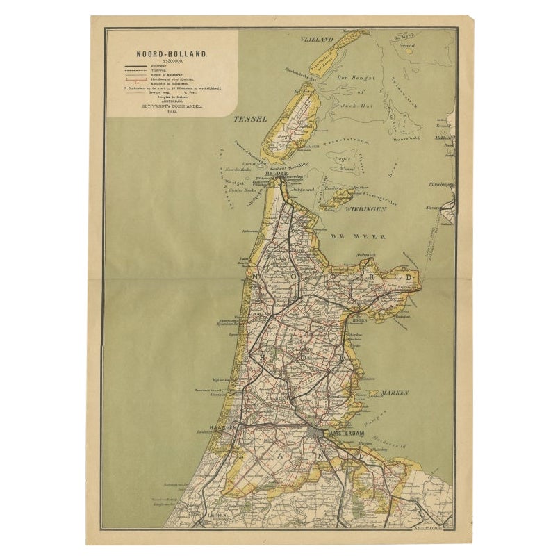
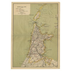
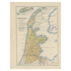
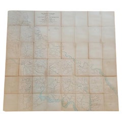
Antique Map of The Province Noord-Holland in The Netherlands, 1864
About the Item
Antique map titled 'De Provincie Noord-Holland'. Map of the province of Noord-Holland, the Netherlands. This map originates from 'F. C. Brugsma's Atlas van het Koninkrijk der Nederlanden (..)'. Artists and Engravers: Author: Frederik Carel Brugsma. Published by J.B. Wolters.
Artist: Author: Frederik Carel Brugsma. Published by J.B. Wolters.
Condition: Good, general age-related toning. Original folding line, minor wear. Blank verso. Please study image carefully.
Date: 1864
Overall size: 25.5 x 30.5 cm.
Image size: 20 x 24 cm.
- Dimensions:Height: 10.04 in (25.5 cm)Width: 12.01 in (30.5 cm)Depth: 0 in (0.01 mm)
- Materials and Techniques:
- Period:
- Date of Manufacture:1864
- Condition:
- Seller Location:Langweer, NL
- Reference Number:
About the Seller
5.0
Platinum Seller
These expertly vetted sellers are 1stDibs' most experienced sellers and are rated highest by our customers.
Established in 2009
1stDibs seller since 2017
1,960 sales on 1stDibs
Typical response time: <1 hour
- ShippingRetrieving quote...Ships From: Langweer, Netherlands
- Return PolicyA return for this item may be initiated within 14 days of delivery.
More From This SellerView All
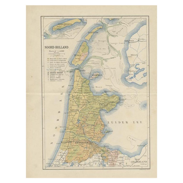
- Antique Map of Noord-Holland, Province of The Netherlands, 1902Located in Langweer, NLAntique map titled 'Noord-Holland'. Lithographed map of the province of Noord-Holland, the Netherlands. This map originates from 'Atlas van Nederland'. Artists and Engravers: Publish...Category
20th Century Maps
MaterialsPaper
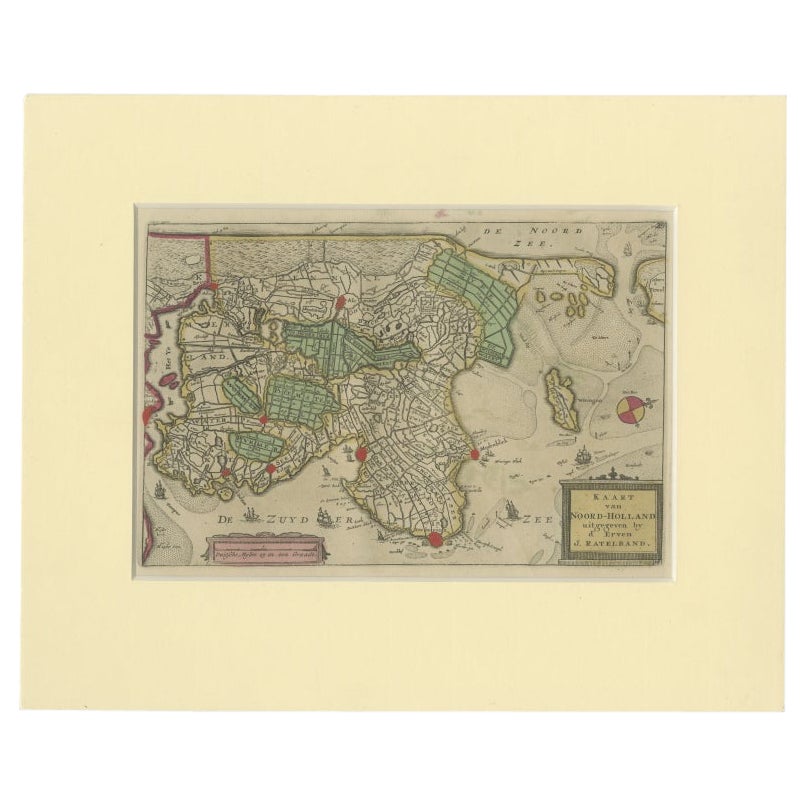
- Rare Antique Map of Noord-Holland, Province in The Netherlands, c.1750Located in Langweer, NLAntique map titled 'Kaart van Noord-Holland'. Map of the province of Noord-Holland, the Netherlands. Published circa 1750. Artists and Engravers: Published by 'de Erven van J. Ratelb...Category
Antique 18th Century Maps
MaterialsPaper
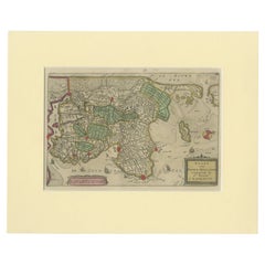
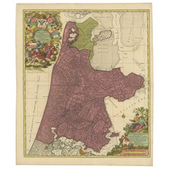
- Beautiful Antique Map of the Province of Noord-Holland, the Netherlands, Ca.1730Located in Langweer, NLAntique map titled 'Kennemaria et Westfrisia vulgo et vernaculé Noord-Holland'. Beautiful original antique map of the province of Noord-Holland, the Netherlands. Two large elaborat...Category
Antique 1730s Maps
MaterialsPaper
- Antique Map of the Dutch Province of Noord-Holland, 1883Located in Langweer, NLAntique map titled 'Noord-Holland'. Map of Noord-Holland, a province of the Netherlands. This map originates from 'Atlas van Nederland volgens de nieuwe spelregels' by J. Kuyper. Art...Category
Antique 19th Century Maps
MaterialsPaper
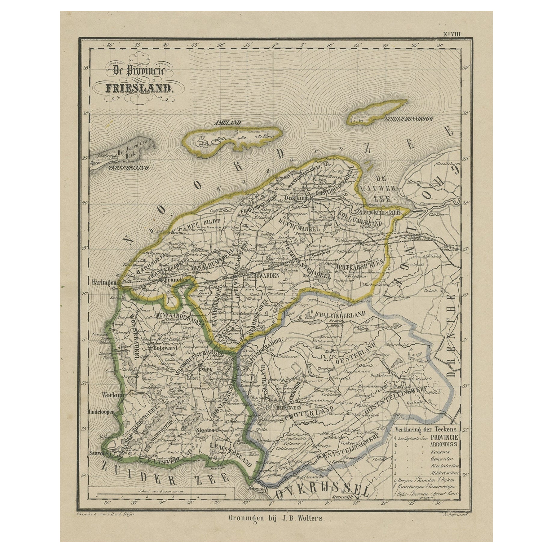
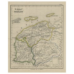
- Antique Map of Friesland, Province in The Netherlands, 1864Located in Langweer, NLAntique map titled 'De Provincie Friesland'. Map of the province of Friesland, the Netherlands. This map originates from 'F. C. Brugsma's Atlas van het Koninkrijk der Nederlanden (.....Category
Antique 19th Century Maps
MaterialsPaper
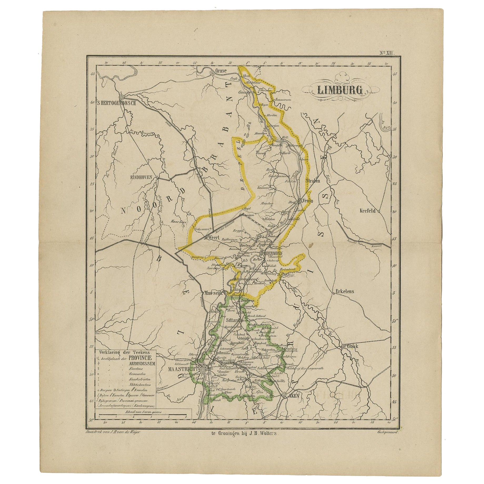
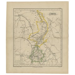
- Antique Map of the Province Limburg, The Netherlands, 1864Located in Langweer, NLAntique map titled 'De Provincie Limburg'. Map of the province of Limburg, the Netherlands. This map originates from 'F. C. Brugsma's Atlas van het Koninkrijk der Nederlanden (..)'. ...Category
Antique 19th Century Maps
MaterialsPaper
You May Also Like
- Antique 18th Century Map of the Province of Pensilvania 'Pennsylvania State'Located in Philadelphia, PAA fine antique of the colony of Pennsylvania. Noted at the top of the sheet as a 'Map of the province of Pensilvania'. This undated and anonymous map is thought to be from the Gentleman's Magazine, London, circa 1775, although the general appearance could date it to the 1760's. The southern boundary reflects the Mason-Dixon survey (1768), the western boundary is placed just west of Pittsburgh, and the northern boundary is not marked. The map has a number of reference points that likely refer to companion text and appear to be connected to boundaries. The western and southern boundaries are marked Q, R, S, for example. A diagonal line runs from the Susquehanna R to the Lake Erie P. A broken line marked by many letters A, B, N, O, etc., appears in the east. There are no latitude or longitude markings, blank verso. Framed in a shaped contemporary gilt wooden frame and matted under a cream colored matte. Bearing an old Graham Arader Gallery...Category
Antique 18th Century British American Colonial Maps
MaterialsPaper
- 1864 Map of North America, Antique Hand-Colored Map, by Adolphe Hippolyte DufourLocated in Colorado Springs, COOffered is a map of North America entitled Amerique du Nord from 1864. This rare, separately published wall map was produced by Adolphe Hippolyte Dufour. This map includes vibrant an...Category
Antique 1860s French Maps
MaterialsPaper
- Original Antique Map of The Netherlands, Sherwood, Neely & Jones, Dated 1809Located in St Annes, LancashireGreat map of The Netherlands Copper-plate engraving by Cooper Published by Sherwood, Neely & Jones. Dated 1809 Unframed.Category
Antique Early 1800s English Maps
MaterialsPaper
- 1864 Johnson's Map of the World on Mercator's Projection, Ric.B009Located in Norton, MAAn 1864 Johnson's map of the World on Mercator's Projection Ric.b009 About this Item "This antique map came from Johnson's New Illustrated (Steel Plate) Family Atlas, publ...Category
Antique 19th Century Dutch Maps
MaterialsPaper
- Important Confederate Field Map of Richmond VA 1864 with ProvenanceLocated in Dallas, TXPRESENTING AN HISTORIC AND EXCEPTIONALLY RARE AND IMPORTANT American Civil War Collection consisting of: (1) ORIGINAL and FULLY AUTHENTIC Confederate Field Map of Richmond, VA 1864 belonging to Capt W.A. Obenchain C.S. Engineers, (2) ORIGINAL and FULLY AUTHENTIC Surrender/Parole Paper for Capt. W.A. Obenchain dated 1st May 1865 at Greensboro, NC (3) ORIGINAL and FULLY AUTHENTIC Pamphlet for Hillsborough Military Academy, NC with Major W.M. A. Obenchain listed as 'Military Staff'. These ALL belonged to Captain (later promoted to rank of Major) William Alexander Obenchain and the battlefield map was his 'personal' field map for the Battle of the Richmond Peninsula in 1864, at the end of the US Civil War...Category
Antique Mid-19th Century American American Classical Historical Memorabilia
MaterialsCanvas, Paper
- School Chart or Pull Down Map of Geography of the Netherlands, 1950sLocated in Hemiksem, VANA beautiful old school map of the Netherlands, painted on linen. The map shows the 3 different reliefs (low, middle, high) of the Netherlands. The beau...Category
Vintage 1950s Belgian Mid-Century Modern Maps
MaterialsLinen, Paint


Recently Viewed
View AllMore Ways To Browse
J Blank
World Map Globe
Antique Furniture Rollers
Swiss Antiques And Collectables
Antique Roman Map
Antique School Map
Antique School Maps
East India Map
Map Hondius
Antique Maps South America
Ireland Antiques
16th Century Pay
Vans Coat Of Arms
Antique Map Of South America
Atlas Globe
Roman Map
Map Of Austria
United States Map Vintage