Items Similar to Antique Map of the Region involved in the Conquest of Cyrus the Great

Want more images or videos?
Request additional images or videos from the seller
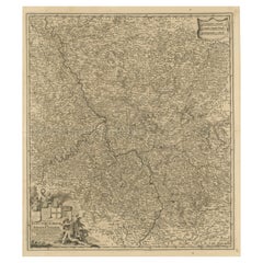
Antique Map of the Region involved in the Conquest of Cyrus the Great
About the Item
Antique map titled 'Tabula Itineris Decies Mille (..)'. This historical map illustrates the region involved in the conquest of Cyrus the Great (558-528 BC), the founder of the Persian Empire under the Achaemenid dynasty. It covers all of Asia Minor through to Armenia and Babylon. Three superb cartouches featuring putti adorn the map, which was compiled and drawn by Pierre Duval for Jansson's historical atlas.
- Dimensions:Height: 20.56 in (52.2 cm)Width: 22.76 in (57.8 cm)Depth: 0.02 in (0.5 mm)
- Materials and Techniques:
- Period:Mid-17th Century
- Date of Manufacture:c.1660
- Condition:General age-related toning. Minor wear and soiling. Blank verso. Please study image carefully.
- Seller Location:Langweer, NL
- Reference Number:
About the Seller
5.0
Platinum Seller
These expertly vetted sellers are 1stDibs' most experienced sellers and are rated highest by our customers.
Established in 2009
1stDibs seller since 2017
1,949 sales on 1stDibs
Typical response time: <1 hour
- ShippingRetrieving quote...Ships From: Langweer, Netherlands
- Return PolicyA return for this item may be initiated within 14 days of delivery.
More From This SellerView All
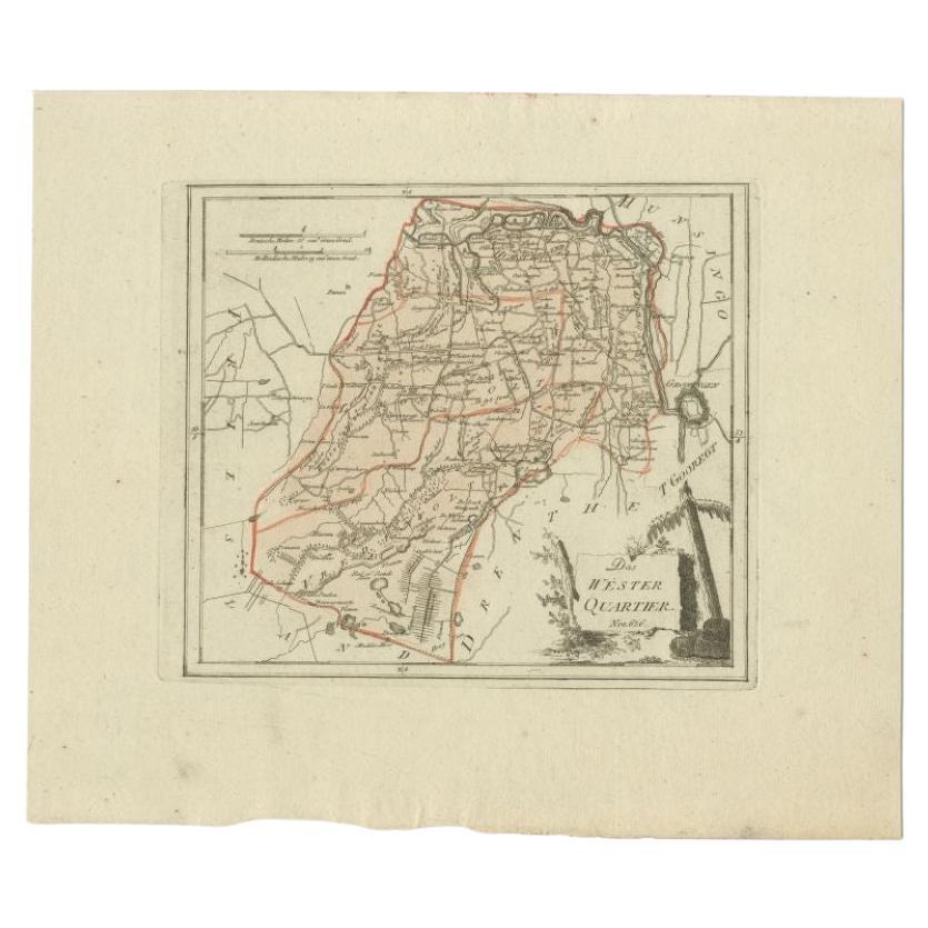
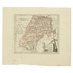
- Antique Map of the Westerkwartier Region, a Region in Groningen, 1791Located in Langweer, NLAntique map titled 'Das Wester Quartier'. Original antique map of Westerkwartier, a region in the province of Groningen, the Netherlands. This map orginates from 'Schauplatz der fünf...Category
Antique 18th Century Maps
MaterialsPaper
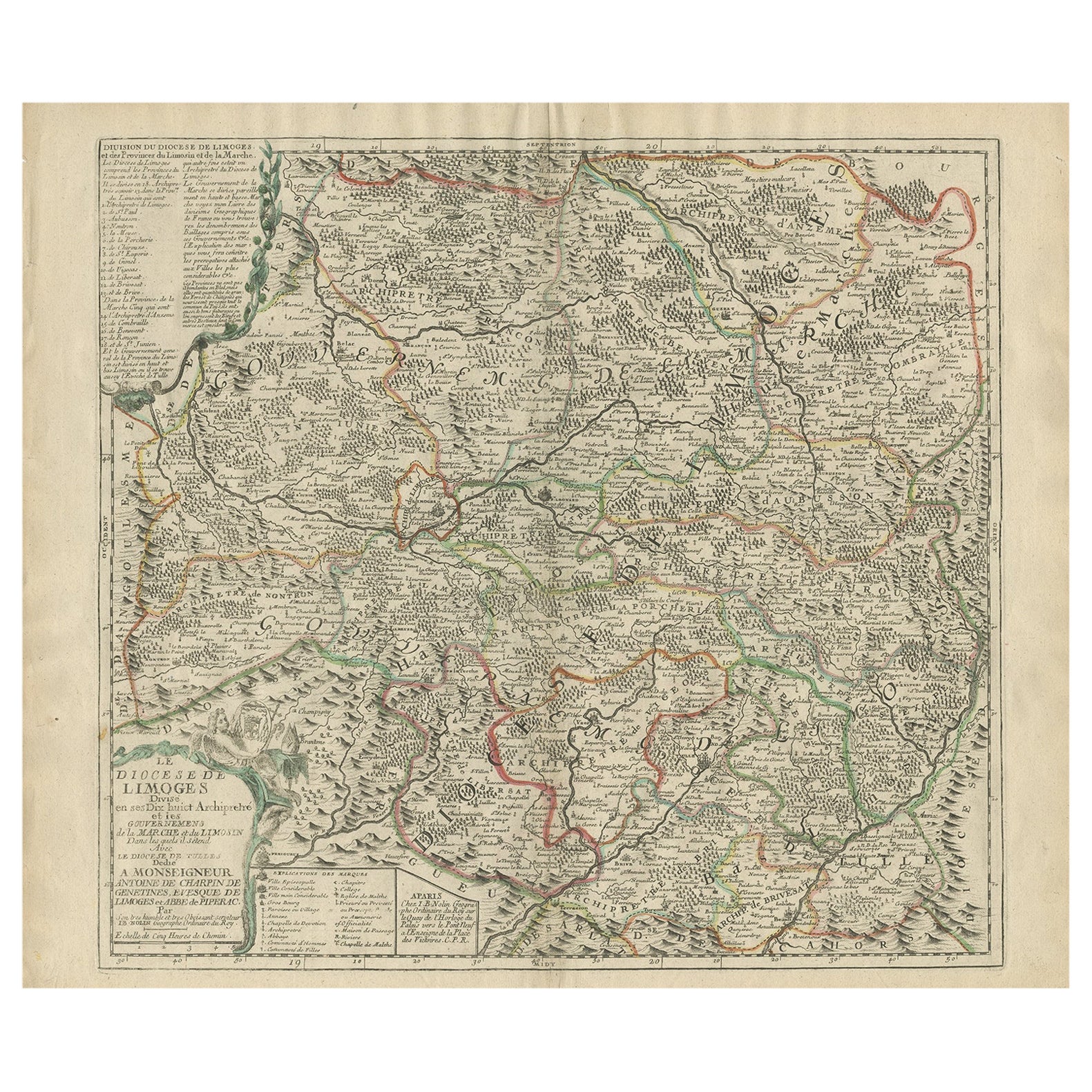
- Antique Map of the Limoges Region in France, c.1690Located in Langweer, NLAntique map titled 'Le Diocèse de Limoges'. Large map of the Limoges region, France. The map is dedicated to the bishop of Limoges, Antoine de Charpin. Artists and Engravers:...Category
Antique 17th Century Maps
MaterialsPaper
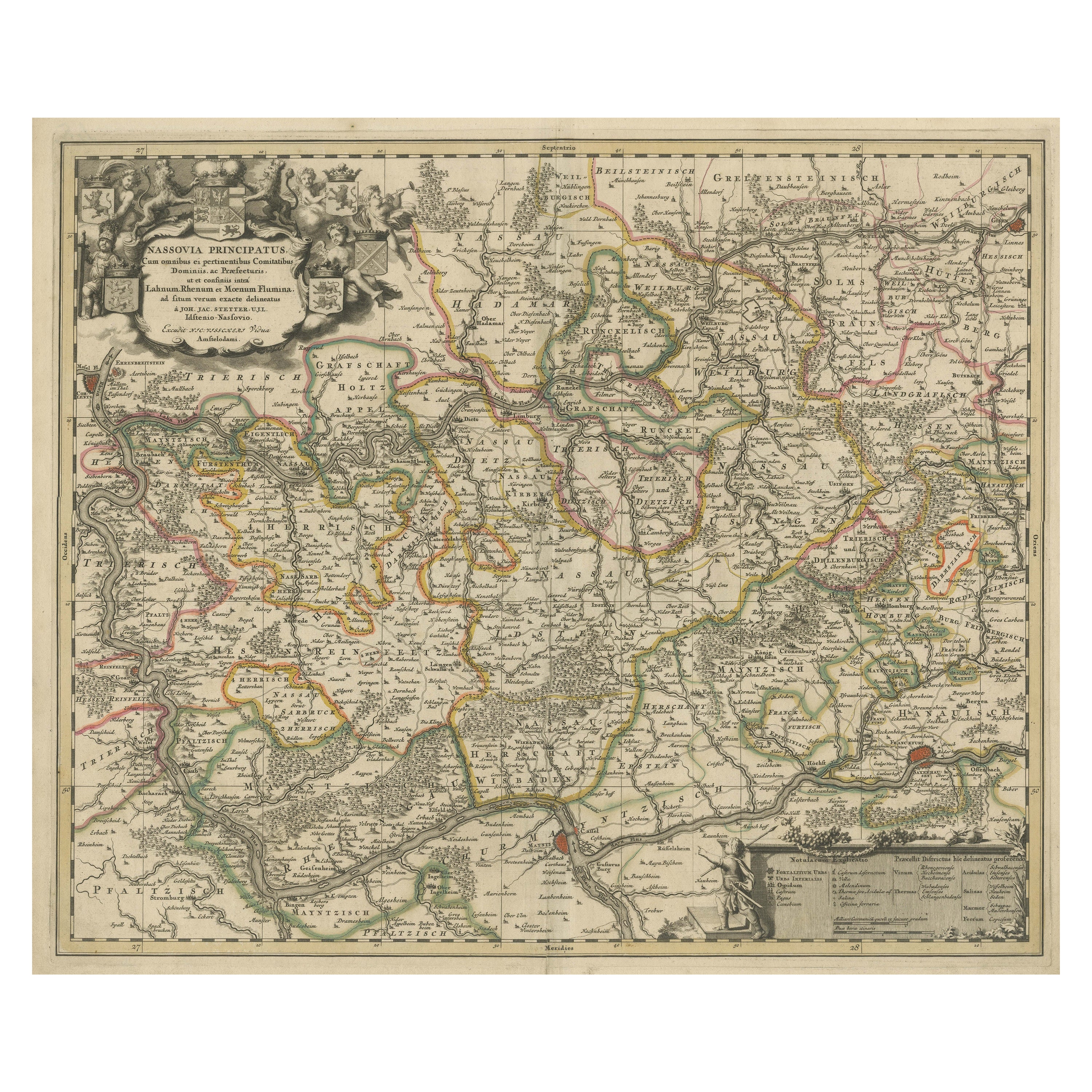
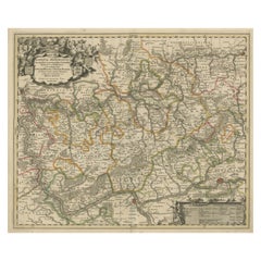
- Antique Map of the Nassau Region in Western GermanyLocated in Langweer, NLAntique map titled 'Nassovia Principatus (..)'. Detailed map of the Nassau region in western Germany between Koblenz, Hadamar, Giessen, Frankfurt and Mainz. The map is filled with in...Category
Antique Early 18th Century Maps
MaterialsPaper
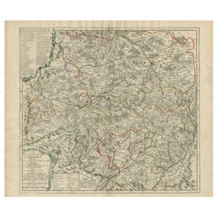
- Antique Map of the Lorraine Region, c.1760Located in Langweer, NLUntitled antique map of the Lorraine region, France. A cultural and historical region in north-eastern France, now located in the administrative region of Grand Est. Lorraine's name ...Category
Antique 18th Century Maps
MaterialsPaper
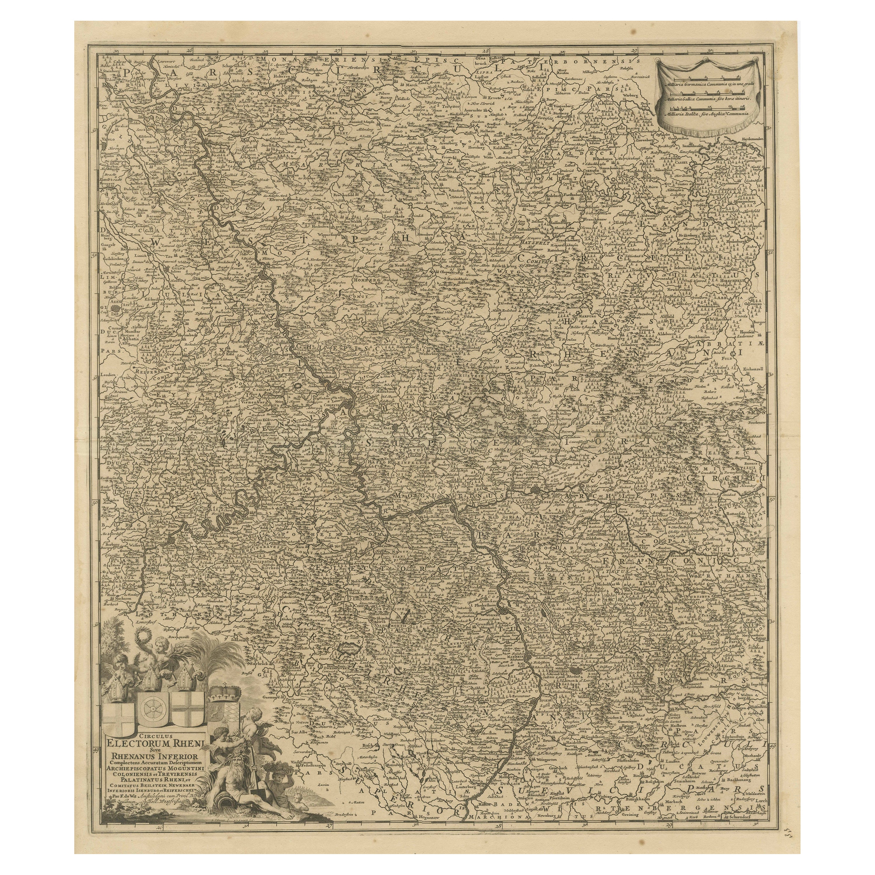
- Antique Map of the Niederrhein region, GermanyLocated in Langweer, NLAntique map titled 'Circulus Electorum Rheni sive Rhenanus Inferior (..)'. Original antique map of the Niederrhein region, Germany. By F. de Wit, circa 1690. Frederick de Wit (1629-...Category
Antique Late 17th Century Maps
MaterialsPaper
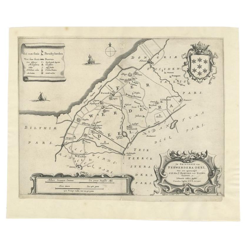
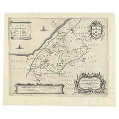
- Antique Map of the Region of Ferwerderadeel in The Netherlands, 1664Located in Langweer, NLAntique map titled 'De Grietenye van Ferwerdera-Deel (..)'. Map of the Grietenij of Ferwerderadeel, Friesland, The Netherlands. Originates from "Beschrijvinge ende nieuwe caerten van...Category
Antique 17th Century Maps
MaterialsPaper

You May Also Like
- 1594 Maurice Bouguereau Map of the Region Limoges, France, Ric0015Located in Norton, MA1594 Maurice Bouguereau map of the region Limoges, France, entitled "Totivs Lemovici et Confinium Pro Uinciarum Quantum ad Dioecefin Lemo Uicenfen Fpectant," Hand Colored Ric0015 Jean IV Le Clerc...Category
Antique 16th Century Dutch Maps
MaterialsPaper
- 17th Century Hand Colored Map of the Liege Region in Belgium by VisscherBy Nicolaes Visscher IILocated in Alamo, CAAn original 17th century map entitled "Leodiensis Episcopatus in omnes Subjacentes Provincias distincté divisusVisscher, Leodiensis Episcopatus" by Nicolaes Visscher II, published in Amsterdam in 1688. The map is centered on Liege, Belgium, includes the area between Antwerp, Turnhout, Roermond, Cologne, Trier and Dinant. This attractive map is presented in a cream-colored mat measuring 30" wide x 27.5" high. There is a central fold, as issued. There is minimal spotting in the upper margin and a tiny spot in the right lower margin, which are under the mat. The map is otherwise in excellent condition. The Visscher family were one of the great cartographic families of the 17th century. Begun by Claes Jansz Visscher...Category
Antique Late 17th Century Dutch Maps
MaterialsPaper
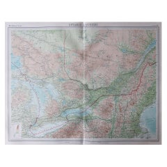
- Large Original Vintage Map of the Great Lakes, Canada, circa 1920Located in St Annes, LancashireGreat map of The Great Lakes. Unframed. Original color. By John Bartholomew and Co. Edinburgh Geographical Institute Published, circa 1920 ...Category
Vintage 1920s British Maps
MaterialsPaper
- 1861 Topographical Map of the District of Columbia, by Boschke, Antique MapLocated in Colorado Springs, COPresented is an original map of Albert Boschke's extremely sought-after "Topographical Map of the District of Columbia Surveyed in the Years 1856 ...Category
Antique 1860s American Historical Memorabilia
MaterialsPaper
- The Normandy Region of France: A 17th C. Hand-colored Map by Sanson and JaillotBy Nicolas SansonLocated in Alamo, CAThis large hand-colored map entitled "Le Duché et Gouvernement de Normandie divisée en Haute et Basse Normandie en divers Pays; et par evêchez, avec le Gouvernement General du Havre ...Category
Antique 1690s French Maps
MaterialsPaper
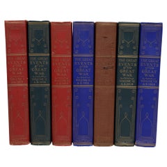
- The Great Events of Great War in 7 Volumes Complete, First EditionLocated in valatie, NYThe Great Events of Great War in 7 Volumes Complete. The National Alumni, 1920. 7 vols. First edition hardcovers. This set done for Henry J. McKenney, Lieutenant 46th Infantry, 9th Division U.S. Army. Plate signed by the Commander and Chief Huston and the Adjutant General Elton with the official embossed seal. Illustrated with full-page gravures and protective tissues guards over each. Each volume is a facsimile of a famous binding ("The original art binding of the official French copy of the Versailles Peace Treaty which was signed by President...Category
Vintage 1920s American Books
MaterialsPaper


Recently Viewed
View AllMore Ways To Browse
Map Of The Netherlands
Italian Maps
Antique Old World Maps
Paris Antique Map
Vintage Map World
Vintage Maps World
Furniture From Portugal Antique
Map Of Indonesia
United States Antique Map
Antique Map Coats Of Arms
Antique North American Map
Antique North American Maps
New York Antique Maps
Old Compass
Antique Book Map France
Antique Map Of South Of France
Office Depot
Old Maps England