Italian Maps
24
to
164
975
490
517
457
426
380
226
183
171
158
123
103
62
49
48
45
42
42
39
37
36
36
35
34
33
32
28
25
22
18
17
14
8
7
7
7
7
6
6
5
5
5
5
5
5
5
4
4
4
4
4
4
3
3
3
3
3
2
2
2
1
63
54
42
42
31
Sort By
Antique 1803 Italian Map of Asia Including China Indoneseia India
Located in Amsterdam, Noord Holland
Antique 1803 Italian Map of Asia Including China Indoneseia India
Very nice map of Asia. 1803
Category
Antique 19th Century European Maps
Materials
Paper
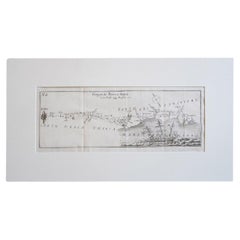
Antique Italian Map of Viaggio da Roma a Napoli 1775
Located in Roma, IT
An original print from 1775 showing an early route map of the journey from Rome to Naples. This
Category
Antique 1770s Italian Maps
Materials
Parchment Paper
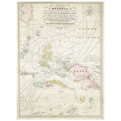
Large Italian Map of Islands of Oceania, incl Papua, Timor, Banda, Ceram, 1855
Located in Langweer, NL
Description: Antique map titled 'Carta di una parte dell'Oceania'. Beautiful large map of the
Category
Antique 1850s Maps
Materials
Paper
H 29.14 in W 21.26 in D 0 in
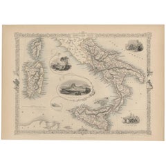
Antique Map of Southern Italy by J. Tallis, circa 1851
Located in Langweer, NL
Decorative and detailed mid-19th century map of Southern Italy which was drawn and engraved by John
Category
Antique Mid-19th Century Maps
Materials
Paper
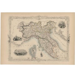
Antique Map of Northern Italy by J. Tallis, circa 1851
Located in Langweer, NL
A highly decorative mid-19th century map of Northern Italy which was drawn and engraved by John
Category
Antique Mid-19th Century Maps
Materials
Paper
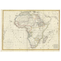
Antique Map of Africa by Bordiga Fratelli 'circa 1818'
Located in Langweer, NL
Antique map titled 'Carta dell Africa'. Large and quite scarce Italian map of Africa, reflecting
Category
Antique Early 19th Century Maps
Materials
Paper
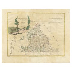
Antique Map of Northern England and Wales by Zatta, 1784
Located in Langweer, NL
Italian map publisher of the late 18th and early 19th century. His firm, based in Venice, produced maps
Category
Antique 18th Century Maps
Materials
Paper
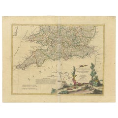
Antique Map of Southern England and Wales by Zatta, 1784
Located in Langweer, NL
. Zatta. Artists and Engravers: Antonio Zatta (active 1757-1797) was the most prominent Italian map
Category
Antique 18th Century Maps
Materials
Paper
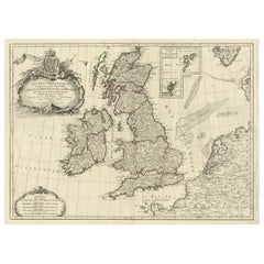
Attractive Map of the British Isles with an Inset of the Shetland Islands, c1770
Located in Langweer, NL
most prominent French, English and Italian map publishers of his day, including Faden, Lattre, Bonne
Category
Antique 1770s Maps
Materials
Paper
H 20.87 in W 29.53 in D 0 in
Antique Map of the Region of Dauphiné by Zatta, 1779
Located in Langweer, NL
. Zatta.
Artists and Engravers: Antonio Zatta (active 1757-1797) was the most prominent Italian map
Category
Antique 18th Century Maps
Materials
Paper
Antique Map of the Region of Brie and Champagne by Zatta, 1779
Located in Langweer, NL
: Antonio Zatta (active 1757-1797) was the most prominent Italian map publisher of the late 18th and early
Category
Antique 18th Century Maps
Materials
Paper
Antique Map of the Region of Languedoc, Foix, Roussillon and Rouergue by Zatta
By Antonio Zatta
Located in Langweer, NL
Italian map publisher of the late 18th and early 19th century. His firm, based in Venice, produced maps
Category
Antique 18th Century Maps
Materials
Paper
H 20.67 in W 14.97 in D 0 in
Antique Map of the Region of Poitou and Saintonge by Zatta (1779)
Located in Langweer, NL
) was the most prominent Italian map publisher of the late 18th and early 19th century. His firm, based
Category
Antique 18th Century Maps
Materials
Paper
Puzzle Atlas with Maps, Italy, circa 1900
Located in Milan, IT
80 little wooden cubes covered with printed paper that depending on which side they form the maps
Category
Early 20th Century Italian Maps
Materials
Wood, Paper
Original Antique Map of Italy. C.1780
Located in St Annes, Lancashire
Great map of Italy
Copper-plate engraving
Published C.1780
Unframed.
Category
Antique Early 1800s English Georgian Maps
Materials
Paper
Original Antique Map of Italy. Arrowsmith. 1820
Located in St Annes, Lancashire
Great map of Italy
Drawn under the direction of Arrowsmith
Copper-plate engraving
Published by
Category
Antique 1820s English Maps
Materials
Paper
Antique Map of Italy by Lapie, 1842
Located in Langweer, NL
Antique map titled 'Carte de l'Italie Ancienne'. Map of Italy. This map originates from 'Atlas
Category
Antique Mid-19th Century Maps
Materials
Paper
Detailed Antique Map of Italy and surrounding Islands
Located in Langweer, NL
antique map, based on D'Anville's important map of Italy. The map extends to Sicily, Corsica, Sardinia
Category
Antique Mid-18th Century Maps
Materials
Paper
Antique Map of Italy by Andriveau-Goujon, 1855
Located in Langweer, NL
Antique folding map of Italy titled 'Italie'. Detailed map of Italy. The map originates from 'Atlas
Category
Antique Mid-19th Century Maps
Materials
Paper
Antique Map of Northern Italy by Levasseur, 1875
Located in Langweer, NL
Antique map titled 'Carte l'Italie (..)'. Large map of Northern Italy. This map originates from
Category
Antique Late 19th Century Maps
Materials
Paper
Antique Map of Italy and Corsica, c.1860
Located in Langweer, NL
Antique map titled 'North & Central Italy and the Island of Corsica'.
Old map of North and
Category
Antique 19th Century Maps
Materials
Paper
Antique Map of Italy by Andriveau-Goujon, 1843
By Andriveau-Goujon
Located in New York, NY
Antique Map of Italy by Andriveau-Goujon, 1843. Map of Italy in two parts by Andriveau-Goujon for
Category
Antique 1840s French Maps
Materials
Linen, Paper
Antique Map of Northern Italy by Migeon, 1880
Located in Langweer, NL
Antique map titled 'Italie Septentrionale'. Old map of the northern part of Italy. This map
Category
Antique 19th Century Maps
Materials
Paper
Antique Map of Southern Italy by Migeon, 1880
Located in Langweer, NL
"Antique map titled 'Italie Méridionale'. Old map of southern Italy including Sicily/Sicilia. This
Category
Antique 19th Century Maps
Materials
Paper
Antique Map of Northwest Italy by Cluver, 1685
Located in Langweer, NL
Antique map titled 'Ligures, Taurini, etc.' Miniature map of northwest Italy. From the pocket atlas
Category
Antique 17th Century Maps
Materials
Paper
Italian Parchment Map of the City of Pisa Dated, 1640
By Matthäus Merian the Elder
Located in Roma, IT
An antique map of the Tuscan city of Pisa engraved for The 'Itinerarium Italiæ Nov-antiquæ' by
Category
Antique 1640s Italian Maps
Materials
Paper
Antique Map of Northern Italy by Cluver, 1685
Located in Langweer, NL
Antique map titled 'Histri, Carni, Veneti item Rhaetiae Pars.' Charming miniature map of northern
Category
Antique 17th Century Maps
Materials
Paper
1880s Map of The Italian Alps from Milan to Lake Garda
Located in Roma, IT
Geographical Map of the Profile and Elevation of the Italian Alps from Milano to Lake Garda. The
Category
Antique 1880s Italian Maps
Materials
Parchment Paper
Old Antique Colourful Decorative Map of Northern Italy, 1846
Located in Langweer, NL
Description: Antique map titled 'Italy North Part'.
Old map of Northern Italy. This map
Category
Antique 1840s Maps
Materials
Paper
Antique Map of Italy by Keizer & de Lat, 1788
Located in Langweer, NL
Antique map titled 'Kaart van Italie (..)'. Uncommon original antique map of Italy. This map
Category
Antique Late 18th Century Maps
Materials
Paper
Antique Map of Italy with Hand-Colored Borders, 1852
Located in Langweer, NL
Antique map titled 'Italië'. Map of Italy. This map originates from 'School-Atlas van alle deelen
Category
Antique 19th Century Maps
Materials
Paper
Antique Map of Italy by R. Bonne, circa 1780
Located in Langweer, NL
Beautiful map of Italy, Corsica, Sardinia and Sicily. Highly detailed, showing towns, rivers, some
Category
Antique Late 18th Century Maps
Materials
Paper
Antique Map of Southern Italy by Janssonius, C.1650
Located in Langweer, NL
primum de prica aerugine est abstersa (..)'. Beautiful map of Southern Italy, viewed from south to north
Category
Antique 17th Century Maps
Materials
Paper
Nice Decorative Hand-Colored Antique Map of Italy, ca.1745
Located in Langweer, NL
Antique map Italy titled 'A New Map of Italy from the lastest observations'.
Antique map of Italy
Category
Antique 1740s Maps
Materials
Paper
Antique Engraved Map of Italy in Roman Times, ca.1730
Located in Langweer, NL
Plain engr. map of Italy according to the division of Emperor Augustus by G. Delisle.
Title
Category
Antique 1730s Maps
Materials
Paper
Antique Map of Italy from an Old French Atlas, 1842
Located in Langweer, NL
Antique map titled 'Carte de l'Italie'. Map of Italy.
This map originates from 'Atlas universel
Category
Antique 19th Century Maps
Materials
Paper
Antique Map of Italy and Corse in Ancient Times, 1848
Located in Langweer, NL
Antique map titled 'Italia Superior et Corsica'.
Old map of northern Italy and Corse
Category
Antique 19th Century Maps
Materials
Paper
Antique Map of Italy with an Inset of Rome, 1812
Located in Langweer, NL
Antique map titled 'Italie Ancienne'.
Old map of ancient Italy, with an inset map of the region
Category
Antique 19th Century Maps
Materials
Paper
Antique Map of Southern Italy and Sardinia by Johnston, 1882
Located in Langweer, NL
"Antique map titled 'South Italy and the Island of Sardinia'. Old map of Southern Italy and the
Category
Antique 19th Century Maps
Materials
Paper
Antique Map of Italy, Corsica, Sardinia and Sicily, ca.1780
Located in Langweer, NL
Description: Antique map titled 'L'Italie.'
Map of Italy, Corsica, Sardinia and Sicily. Highly
Category
Antique 1780s Maps
Materials
Paper
Antique Map of Northern Italy by Homann Heirs, c.1730
Located in Langweer, NL
map of northern Italy by J. B. Homann. This map shows Venice and its adjacent states Parma, Modena
Category
Antique 18th Century Maps
Materials
Paper
Antique Map Covering Northern Italy, Austria, Slovenia & Croatia, ca.1690
Located in Langweer, NL
Antique map titled 'Exactissima Tabula, qua tam Danubii Fluvii Pars Superior'.
Detailed map
Category
Antique 1690s Maps
Materials
Paper
H 21.07 in W 25.2 in D 0 in
Antique Map of Northern Italy by F. de Wit, 1690
Located in Langweer, NL
A very decorative map centered on Genua, and including the towns of Milan, Torino, Parma, Cremona
Category
Antique Late 17th Century Maps
Materials
Paper
Stunning Decorative Antique Map of Venice in Italy, ca.1787
Located in Langweer, NL
, later coloring, blank verso. First issued as a separate map circa 1630, according to Wüthrich, and in
Category
Antique Late 18th Century Maps
Materials
Paper
Original Antique Map of Italy with an Inset of Sardinia, 1882
Located in Langweer, NL
Embark on a historical odyssey with an original Antique Map of Italy from the esteemed
Category
Antique 1880s Maps
Materials
Paper
Antique Map of Italy and Other Regions Near the Adriatic Sea
Located in Langweer, NL
Antique map titled 'Italie et Provinces Autrichnes sur l'Adriatique'. Original old map of Italy and
Category
Antique Mid-19th Century Maps
Materials
Paper
Old Horizontal Map of England
By Tasso
Located in Alessandria, Piemonte
ST/520 - Old rare Italian map of England, dated 1826-1827 - by Girolamo Tasso, editor in Venise
Category
Antique Early 19th Century Italian Other Prints
Materials
Paper
Antique Map of Italy, North Part, by W. G. Blackie, 1859
Located in Langweer, NL
The "Antique Map of Italy, North Part" by W. G. Blackie, dated 1859, is a historically significant
Category
Antique Mid-19th Century Maps
Materials
Paper
Antique Map of the Siege of Syracuse, Sicilia, Italy, 'ca.1675'
Located in Langweer, NL
Antique map titled 'Syracus beseeged by the Athenians.' This original uncommon antique map shows
Category
Antique 1670s Maps
Materials
Paper
Finely Detailed Map Covering Northern Italy, Austria, Slovenia & Croatia, c.1690
Located in Langweer, NL
detailed map covering the region of northern Italy, Austria, Slovenia and Croatia. The course of the Danube
Category
Antique 1690s Maps
Materials
Paper
H 20.63 in W 23.31 in D 0 in
Antique Map of Italy and Greece by H. Kiepert, circa 1870
By Heinrich Kiepert
Located in Langweer, NL
Antique map titled 'Italiae pars media'. This map originates from 'Atlas Antiquus. Zwölf Karten zur
Category
Antique Late 19th Century Maps
Materials
Paper
Antique Map of South Italy, illustrating the Invasion of Naples in, 1806
Located in Langweer, NL
Antique battle map titled 'Map of South Italy, to illustrate the invasion of Naples in 1806 etc
Category
Antique Mid-19th Century Maps
Materials
Paper
H 7.09 in W 8.98 in D 0.02 in
Antique Map of the Region of Pavia, Lodi, Novara, Tortona & Alessandria, Italy
Located in Langweer, NL
Stato di Milano'. Original old map of the region of Pavia, Lodi, Novara, Tortona and Alessandria, Italy
Category
Antique Early 17th Century Maps
Materials
Paper
H 16.42 in W 21.54 in D 0.02 in
Original Italian Antique Map of Asia Minor and Cyprus and Neighboring Regions
Located in Langweer, NL
Antique map titled 'Natolia detta anticamente Asia Minor (..)'. Rare map of Asia Minor (Turkey) and
Category
Antique Late 17th Century Maps
Materials
Paper
H 19.02 in W 24.22 in D 0.02 in
Antique Map of the Region of Verona 'Italy' by Ortelius, circa 1584
Located in Langweer, NL
Antique map titled 'Veronae Urbis Terratorium'. Original antique map of the Verona region, Italy
Category
Antique Late 19th Century Maps
Materials
Paper
Set of Two Antique Maps of Northern Italy by Homann Heirs, 1754
Located in Langweer, NL
Set of two maps of northern Italy showing the position of troups during the war in April and March
Category
Antique Mid-18th Century Maps
Materials
Paper
Italy, Sicily, Sardinia, Corsica and Dalmatian Coast: A 17th Century Dutch Map
By Theodorus Danckerts
Located in Alamo, CA
This hand colored 17th century Dutch map entitled "Novissima et Accuratissima totius Italiae
Category
Antique Late 17th Century Dutch Maps
Materials
Paper
H 18.13 in W 31.25 in D 1.38 in
Hand-Colored 18th Century Homann Map of the Danube, Italy, Greece, Croatia
By Johann Baptist Homann
Located in Alamo, CA
"Fluviorum in Europa principis Danubii" is a hand colored map of the region about the Danube river
Category
Antique Early 18th Century German Maps
Materials
Paper
H 20 in W 23.88 in D 0.07 in
Stunning Antique Map of Northern Italy by J.B. Homann, circa 1745
By Johann Baptist Homann
Located in Langweer, NL
This beautiful hand-colored map covers from Bergamo east as far as Albona (Labin) and from Vipiteno
Category
Antique Mid-18th Century Maps
Materials
Paper
Antique Map of Piedmonte and Savoie 'Italy' by N. Visscher, circa 1683
Located in Langweer, NL
Antique map titled 'Regiae Celsitudinis Sabaudicae Status consistens in Sabaudiae ac Montisferrati
Category
Antique Late 17th Century Maps
Materials
Paper
H 20.79 in W 25.2 in D 0.02 in
- 1
- ...
Get Updated with New Arrivals
Save "Italian Maps", and we’ll notify you when there are new listings in this category.
More Ways To Browse
Johann Baptist Homann On Sale
Serbia Antique Map
Albania Map
Frontier Map
Map Of Armenia
Saudi Arabia Antique Map
Antique Map Puzzle
Jean Desnos
Old Cypriot Maps
Map Of French Alps
X Line Nuova
Giovanni Maria Cassini On Sale
Antique Map Tuscany
Rossi Giuseppe
Antique Map Florence
Armenia Map
Armenian Map
Linen Map Italy

