Items Similar to Antique Map of The Regions of Italy and Sicily during the Roman Empire, 1880


Want more images or videos?
Request additional images or videos from the seller
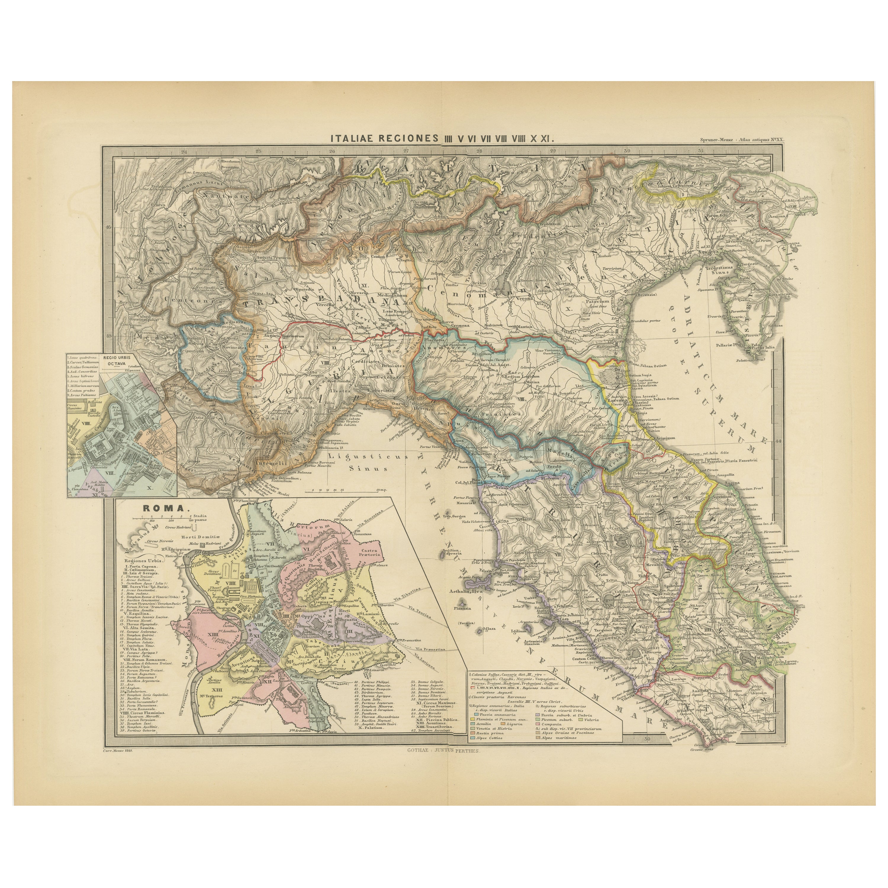
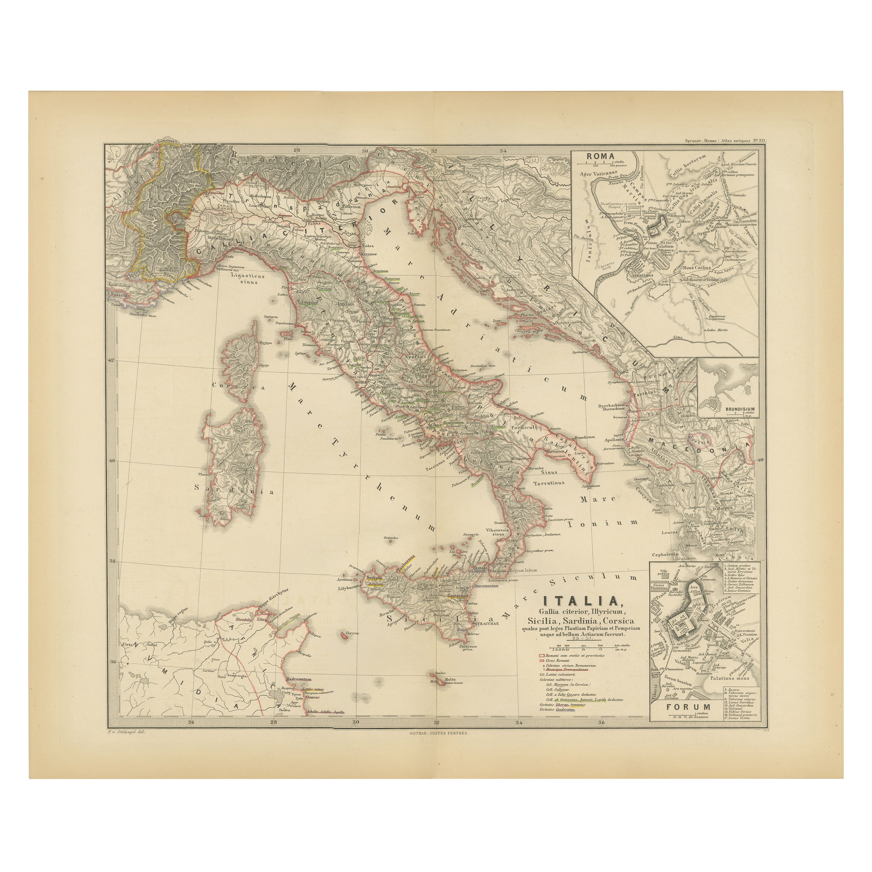
Antique Map of The Regions of Italy and Sicily during the Roman Empire, 1880
About the Item
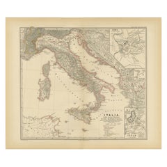
This map is an original antique engraving titled "ITALIAE REGIONES IIII SICILIA," which translates to "The Regions of Italy and Sicily." This detailed historical map portrays the regions of ancient Italy along with the island of Sicily.
Key features of this map include:
1. **Mainland Italy**: The Italian peninsula is divided into several regions, likely corresponding to the administrative divisions during the Roman Empire. These regions are distinguished by different colors outlining their boundaries.
2. **Topography**: The map illustrates mountain ranges, valleys, and plains, with shading and contour lines to indicate elevation. Rivers and lakes are also marked, adding to the geographical detail.
3. **Inset Maps**: There are several inset maps:
- **Sicily (SICILIA)**: A detailed map of Sicily, with topographical features and important cities of the time.
- **Pompeii (POMPEII)**: A detailed plan of the ancient city of Pompeii, providing an archaeological layout of the city that was buried by the eruption of Mount Vesuvius in 79 AD.
- **Corsica and Sardinia**: Smaller maps of the islands of Corsica and Sardinia, also detailed with topographical features and regional divisions.
- **Campanian Plains (CAMPANIAE PARS)**: A focused map of the Campania region around the Bay of Naples, an area rich in ancient history and the site of cities like Pompeii and Herculaneum.
4. **Roads and Cities**: The map likely shows ancient roads such as the famous Roman roads (e.g., the Via Appia) and includes symbols to denote the location of major Roman cities, towns, and possibly villas or other notable sites.
5. **Latin Labels**: The map features Latin nomenclature for all geographical and historical features, staying true to the period it represents.
6. **Ancient Sites**: The location of significant archaeological and historical sites, such as battlefields, important villas, and cultural landmarks, might be indicated.
7. **Geographical Legends**: The map includes legends that provide explanations for the symbols used, the scale, and possibly notes on the historical significance of certain areas.
As with the other maps from the "Spruner-Menke Atlas Antiquus," this map would be an important educational tool for the study of the geography and history of ancient Italy and its regions during the Roman era. It combines detailed cartography with historical insights, making it a valuable resource for understanding the complexities of ancient Roman geography.
- Dimensions:Height: 18.51 in (47 cm)Width: 15.56 in (39.5 cm)Depth: 0 in (0.02 mm)
- Materials and Techniques:
- Period:
- Date of Manufacture:1880
- Condition:Good, given age. General age-related toning, especially around the edges. Vertical folding line as issued. Please study scan carefully.
- Seller Location:Langweer, NL
- Reference Number:
About the Seller
5.0
Platinum Seller
These expertly vetted sellers are 1stDibs' most experienced sellers and are rated highest by our customers.
Established in 2009
1stDibs seller since 2017
1,950 sales on 1stDibs
Typical response time: <1 hour
- ShippingRetrieving quote...Ships From: Langweer, Netherlands
- Return PolicyA return for this item may be initiated within 14 days of delivery.
More From This SellerView All
- Ancient Italy: Regions and Rome in the Roman Empire, Published in 1880Located in Langweer, NLThis print is an original detailed map titled "ITALIAE REGIONES I VII VIII IX XI," representing the regions of ancient Italy. Key Features of the Print: 1. **Regional Demarcations...Category
Antique 1880s Maps
MaterialsPaper
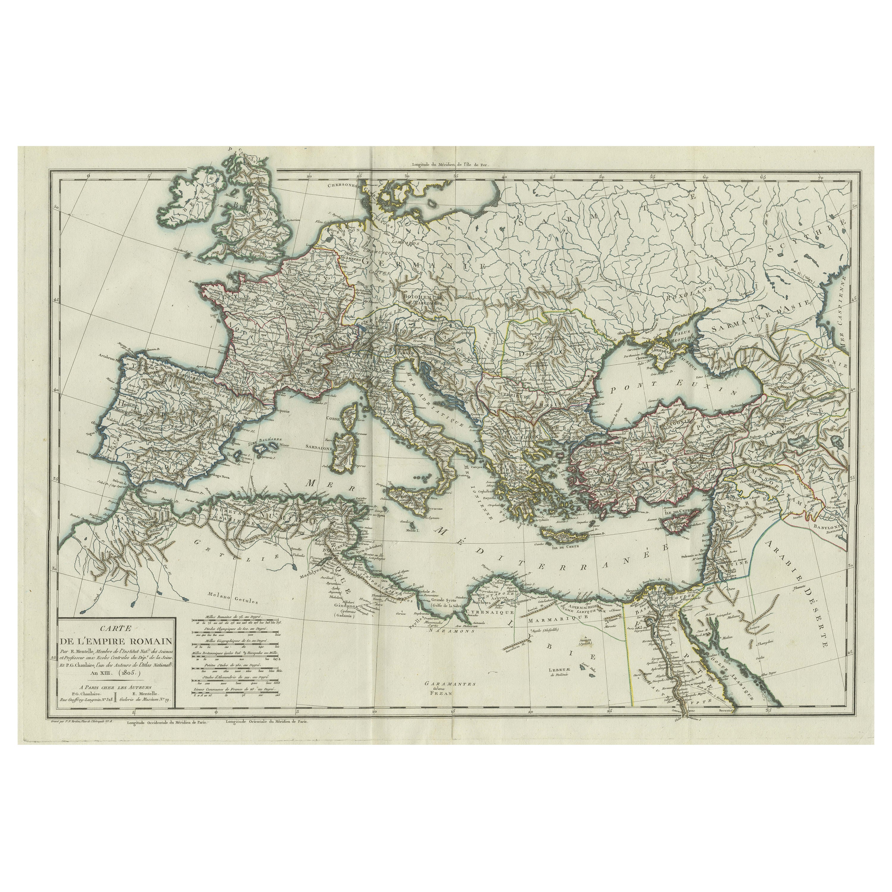
- Original Antique Map of the Roman EmpireLocated in Langweer, NLAntique map titled 'Carte de l'Empire Romain'. Original antique map of the Roman Empire, two sheets joined. Engraved by Pierre Francois Tardieu and published by Edme Mentelle, circa ...Category
Antique Late 18th Century Maps
MaterialsPaper
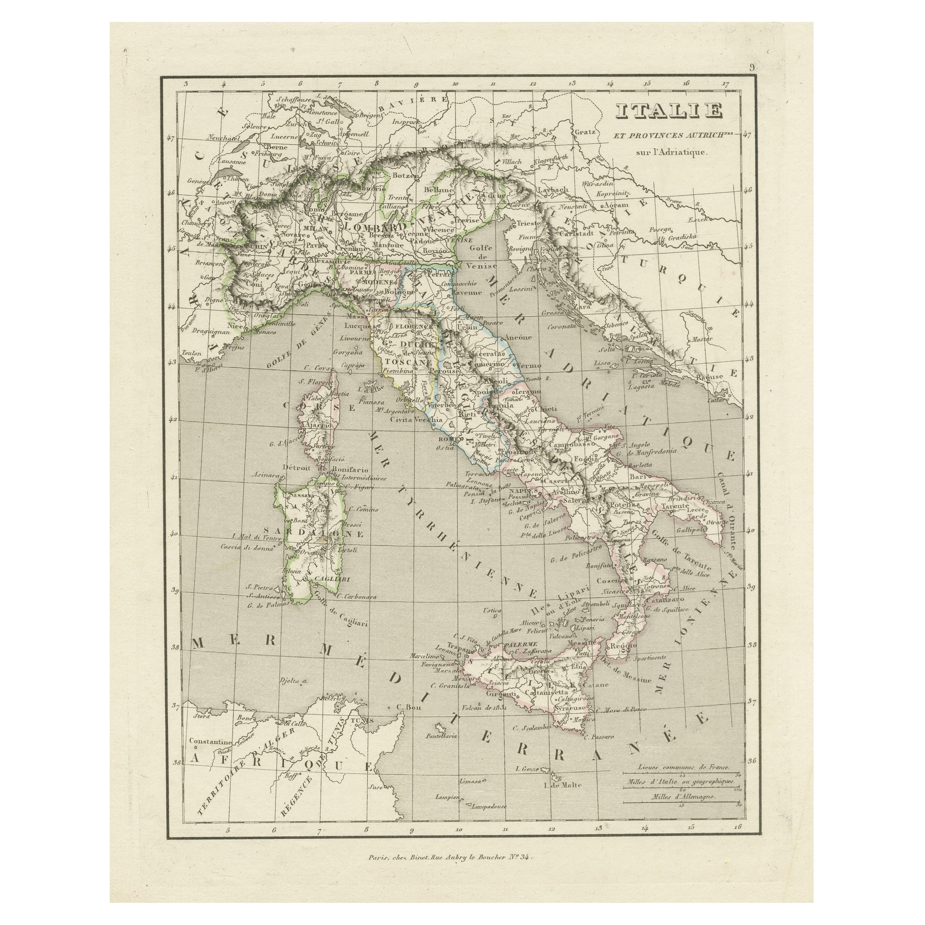
- Antique Map of Italy and Other Regions Near the Adriatic SeaLocated in Langweer, NLAntique map titled 'Italie et Provinces Autrichnes sur l'Adriatique'. Original old map of Italy and surroundings. Also shows Sicily and Sardinia. Ori...Category
Antique Mid-19th Century Maps
MaterialsPaper
- Antique Map of the Roman Empire by Lapie, 1842Located in Langweer, NLAntique map titled 'Carte de l'Empire Romain'. Map of the Roman Empire. This map originates from 'Atlas universel de géographie ancienne et moderne (..)' by Pierre M. Lapie and Alexa...Category
Antique Mid-19th Century Maps
MaterialsPaper
- Map of The Italian Peninsula with the islands of Sicily, Sardinia, Corsica, 1880Located in Langweer, NLThis map, titled "ITALIA, Sicilia, Sardinia, Corsica," represents the Italian Peninsula along with the islands of Sicily, Sardinia, and Corsica. Inset maps offer detailed views of "R...Category
Antique 1880s Maps
MaterialsPaper
- Antique Map of Champagne and surrounding Regions, FranceLocated in Langweer, NLAntique map titled 'Carte de la Champagne et des Pays Voisins (..)'. Detailed map of Champagne and surrounding regions of Chalons and Soissons, Reims, Vedun, Mouzon, Sean, Charlemont...Category
Antique Mid-18th Century Maps
MaterialsPaper


You May Also Like
- Gilt Framed Vintage Wine Regions of France MapLocated in Alton, GBFramed French wine region map 1973. The print has been removed to clean the glass, the frame has minor damage in places but nothing that detracts from ...Category
Vintage 1970s French Posters
MaterialsPaper
- Super Rare Antique French Map of Chine and the Chinese Empire, 1780Located in Amsterdam, Noord HollandSuper Rare Antique French Map of Chine and the Chinese Empire, 1780 Very nice map of Asia. 1780 Made by Bonne. Additional information: Type: Map ...Category
Antique 18th Century European Maps
MaterialsPaper
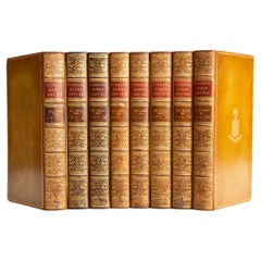
- 8 Volumes. Edward Gibbon, The Decline and Fall of the Roman Empire.Located in New York, NY8 Volumes. Edward Gibbon, The Decline and Fall of the Roman Empire. Bound in full brown calf. The covers and raised band spines are gilt-tooled with purple and blue morocco labels. A...Category
Antique Mid-19th Century English Books
MaterialsLeather
- 1880s Map of The Italian Alps from Milan to Lake GardaLocated in Roma, ITGeographical Map of the Profile and Elevation of the Italian Alps from Milano to Lake Garda. The map features the name of each peak and key cities including Monza, Brescia and Bergam...Category
Antique 1880s Italian Maps
MaterialsParchment Paper
- 8 Vols. Edward Gibbon, The History of the Decline and Fall of the Roman EmpireLocated in New York, NY8 Volumes. Edward Gibbon, The History of the Decline and Fall of the Roman Empire. Bound in full tan calf with the covers displaying a floral border and a central crest, both gilt-to...Category
Antique 19th Century English Books
MaterialsLeather
- Italy, Sicily, Sardinia, Corsica and Dalmatian Coast: A 17th Century Dutch MapBy Theodorus DanckertsLocated in Alamo, CAThis hand colored 17th century Dutch map entitled "Novissima et Accuratissima totius Italiae Corsicae et Sardiniae Descriptio" by Theodore Danckerts depicts the Italian Peninsula in ...Category
Antique Late 17th Century Dutch Maps
MaterialsPaper