Items Similar to Antique Map of the War Situation in Europe and Asia, 1944


Want more images or videos?
Request additional images or videos from the seller
1 of 5
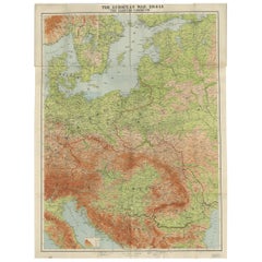
Antique Map of the War Situation in Europe and Asia, 1944
About the Item
Antique map titled 'Newsmap for the Armed Forces'. This "newsmap" was issued on Monday, December 18, 1944, and covers the news from December 6-13, 1945 - the 275th week of the war. This large sheet, measuring nearly 4 feet by 3 feet, includes five inset maps of the war situation in both Europe and Asia including the "European Front", "The Saar", "Hungarian Front", "Pacific Action", and "Leyte Area."
The verso of this newsmap contains a large illustration of an American convoy with various vehicles and artillery identified. Text at bottom encourages preventative maintenance and states "For every spare part you don't use - You reduce the cost of victory!" Prepared by the Army Information Branch and issued by the U.S. Government Printing Office.
From 1942-46, the U.S. Army published "newsmaps" to keep American troops updated on the war. These weekly posters were distributed and posted in every American installation in the world and were intentionally more visual than descriptive to help engage and motivate personnel.
- Dimensions:Height: 33.71 in (85.6 cm)Width: 46.11 in (117.1 cm)Depth: 0.02 in (0.5 mm)
- Materials and Techniques:
- Period:
- Date of Manufacture:1944
- Condition:Issued folding on a clean sheet with a few small separations at the fold junctions.
- Seller Location:Langweer, NL
- Reference Number:
About the Seller
5.0
Platinum Seller
These expertly vetted sellers are 1stDibs' most experienced sellers and are rated highest by our customers.
Established in 2009
1stDibs seller since 2017
1,932 sales on 1stDibs
Typical response time: <1 hour
- ShippingRetrieving quote...Ships From: Langweer, Netherlands
- Return PolicyA return for this item may be initiated within 14 days of delivery.
More From This SellerView All
- Antique Detailed Map of the Mountain Chains of Europe and Asia, c.1850Located in Langweer, NLAntique map titled 'The Mountain Chains of Europe & Asia'. Old map depicting the mountain chains of Europe and Asia. Originates from 'The Physical Atlas of Natural Phenomena'. Ar...Category
Antique 19th Century Maps
MaterialsPaper
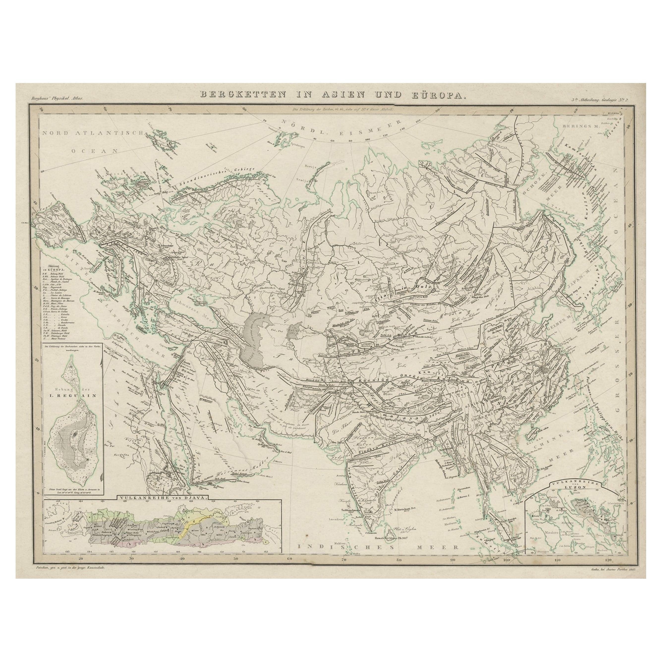
- Original Antique Map Showing the Mountain Ranges in Asia and Europe, 1849Located in Langweer, NLAntique map titled 'Bergketten in Asien und Eüropa'. Original antique map showing the mountain ranges in Asia and Europe. In outline color with inset maps of Java, Luzon, and Reguain...Category
Antique 1840s Maps
MaterialsPaper
- Antique Map of the Mountain Chains of Europe and Asia by Johnston '1850'Located in Langweer, NLAntique map titled 'The Mountain chains of the Europe and Asia '. Original antique map of the mountain chains of Europe and Asia. This map originates from 'The Physical Atlas of Natu...Category
Antique Mid-19th Century Maps
MaterialsPaper
- Antique Map of the River Systems of Europe and Asia by Johnston '1850'Located in Langweer, NLAntique map titled 'The River Systems of Europe and Asia showing the boundaries and comparative extent of the river basins'. Original antique map of the river systems of Europe and A...Category
Antique Mid-19th Century Maps
MaterialsPaper
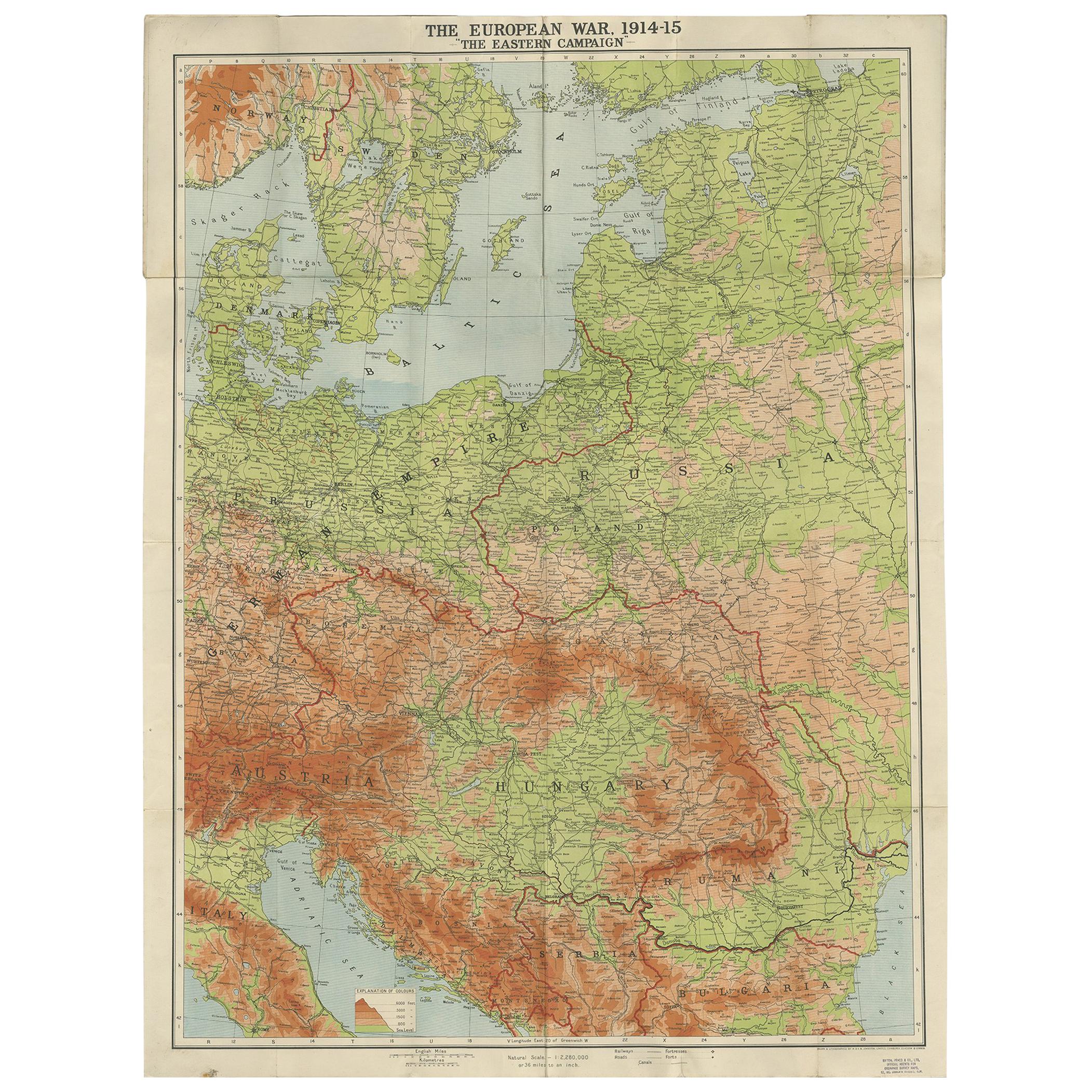
- Antique European War Folding Map, ‘circa 1915’Located in Langweer, NLAntique folding map of the European War (1914-1915) titled 'The Eastern Campaign '. From Petrograd to Berlin, geographically colored. Published on linen b...Category
Early 20th Century Maps
MaterialsPaper
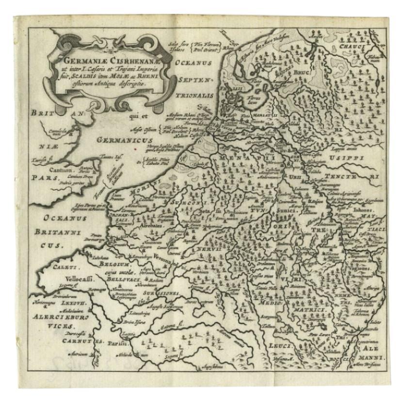
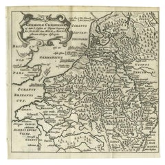
- Antique Map of the Low Countries and Surroundings in Europe, 1685By Philipp ClüverLocated in Langweer, NLAntique map titled 'Germaniae Cisrhenanae ut ineter I Caesaris et Traiani Suit imperia Scaldis Item Mose ac Rheni.' Miniature map of the Low Countries and part of Germany and France....Category
Antique 17th Century Maps
MaterialsPaper


You May Also Like
- Original Antique Map of Asia. C.1780Located in St Annes, LancashireGreat map of Asia Copper-plate engraving Published C.1780 Two small worm holes to right side of map Unframed.Category
Antique Early 1800s English Georgian Maps
MaterialsPaper

- Original Antique Map of Europe, Arrowsmith, 1820Located in St Annes, LancashireGreat map of Europe Drawn under the direction of Arrowsmith. Copper-plate engraving. Published by Longman, Hurst, Rees, Orme and Brown, 1820 ...Category
Antique 1820s English Maps
MaterialsPaper
- Original Antique Map of South East Asia, Arrowsmith, 1820Located in St Annes, LancashireGreat map of South East Asia Drawn under the direction of Arrowsmith Copper-plate engraving Published by Longman, Hurst, Rees, Orme and Brown, 1820 Unframed.Category
Antique 1820s English Maps
MaterialsPaper
- Original Antique Map of South East Asia by Thomas Clerk, 1817Located in St Annes, LancashireGreat map of South East Asia Copper-plate engraving Drawn and engraved by Thomas Clerk, Edinburgh. Published by Mackenzie And Dent, 1817 Unframed.Category
Antique 1810s English Maps
MaterialsPaper
- Hand-Colored 18th Century Homann Map of the Black Sea, Turkey and Asia MinorBy Johann Baptist HomannLocated in Alamo, CAAn attractive original early 18th century hand-colored map of the Black Sea and Turkey entitled "Carte de L'Asie Minevre ou de la Natolie et du Pont Evxin Tiree des Voyages et des Ob...Category
Antique Early 18th Century German Maps
MaterialsPaper
- Civil War Panorama of the Seat of War by John Bachmann, Antique Print circa 1864Located in Colorado Springs, COPanorama of the seat of war. Bird's-eye View of Virginia, Maryland, Delaware and the District of Columbia. This third state of this fascinating bird's eye view of the northernmost p...Category
Antique 1860s American Maps
MaterialsPaper


Recently Viewed
View AllMore Ways To Browse
The Vintage Map
Maps Europe
Map Europe
Map Of Europe
Maps Of Europe
Antique Poster War
Antique World War Posters
Large Map Of The World
World Map Vintage Map
World Map Vintage Maps
The World Map Vintage
Map Of World Vintage
Map Of The World Vintage
U S Map
Asia Poster
Antique Map Europe
Antique Map Of Europe
Map Of The Pacific