Items Similar to French Antique Map of Northern Africa and Libya, c.1840

Want more images or videos?
Request additional images or videos from the seller
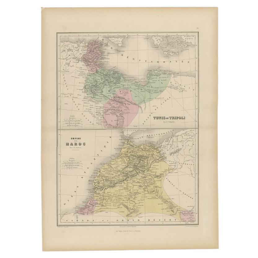
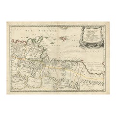
French Antique Map of Northern Africa and Libya, c.1840
About the Item
Antique map titled 'Marok, Alger et Tunis - Etat de Tripoli'. Map of Northern Africa and Libya. This map originates from 'Le globe Atlas classique Universel de géographie ancienne et moderne, pour servir a l'étude de la géographie et de l'histoire dressé par M. A.H.Dufour, Et revu par M.Jomard' by Jules Renouard. Artists and Engravers: Jules Renouard was a publisher, active at 6 Rue de Tournon, Paris. A line in bottom part informs the reader that Jules Renouard was the editor of "La Géographie de Balbi". Afterwards the company was called "Jules Renouard et Cie" and known for his plans and panoramas of Paris. The business was continued by his widow.
Artist: Jules Renouard was a publisher, active at 6 Rue de Tournon, Paris. A line in bottom part informs the reader that Jules Renouard was the editor of "La Géographie de Balbi". Afterwards the company was called "Jules Renouard et Cie" and known for his plans and panoramas of Paris. The business was continued by his widow.
Condition: Good, general age-related toning. Minor wear, original folding line. Blank verso, please study image carefully.
Date: c.1840
Overall size: 41 x 27 cm.
Image size: 38.5 x 24 cm.
Antique prints have long been appreciated for both their aesthetic and investment value. They were the product of engraved, etched or lithographed plates. These plates were handmade out of wood or metal, which required an incredible level of skill, patience and craftsmanship. Whether you have a house with Victorian furniture or more contemporary decor an old engraving can enhance your living space. We offer a wide range of authentic antique prints for any budget.
- Dimensions:Height: 10.63 in (27 cm)Width: 16.15 in (41 cm)Depth: 0 in (0.01 mm)
- Materials and Techniques:
- Period:
- Date of Manufacture:circa 1840
- Condition:Condition: Good, general age-related toning. Minor wear, original folding line. Blank verso, please study image carefully.
- Seller Location:Langweer, NL
- Reference Number:
About the Seller
5.0
Platinum Seller
These expertly vetted sellers are 1stDibs' most experienced sellers and are rated highest by our customers.
Established in 2009
1stDibs seller since 2017
1,950 sales on 1stDibs
Typical response time: <1 hour
- ShippingRetrieving quote...Ships From: Langweer, Netherlands
- Return PolicyA return for this item may be initiated within 14 days of delivery.
More From This SellerView All
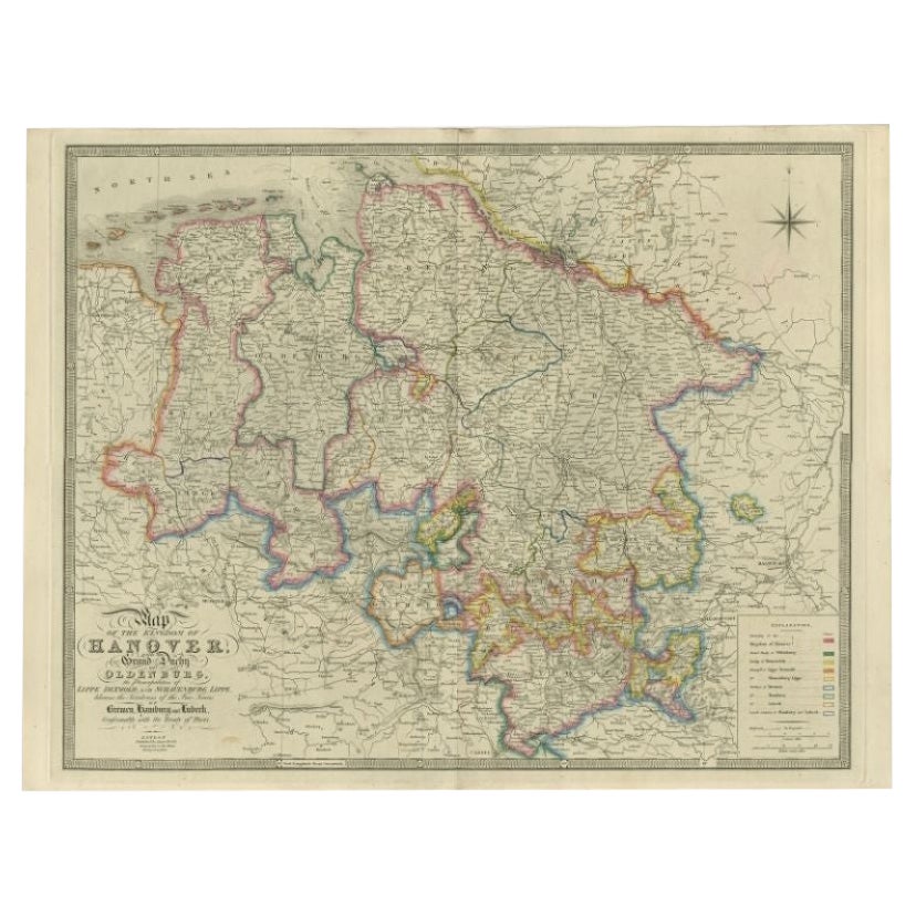
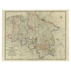
- Antique Map of Northern Germany by Wyld, c.1840Located in Langweer, NLAntique map titled 'Map of the Kingdom of Hanover, with the Grand Duchy of Oldenburg, the Principalities of Lippe Detmold and Schauenburg Lippe, likewise the Territories of the Free ...Category
Antique 19th Century Maps
MaterialsPaper
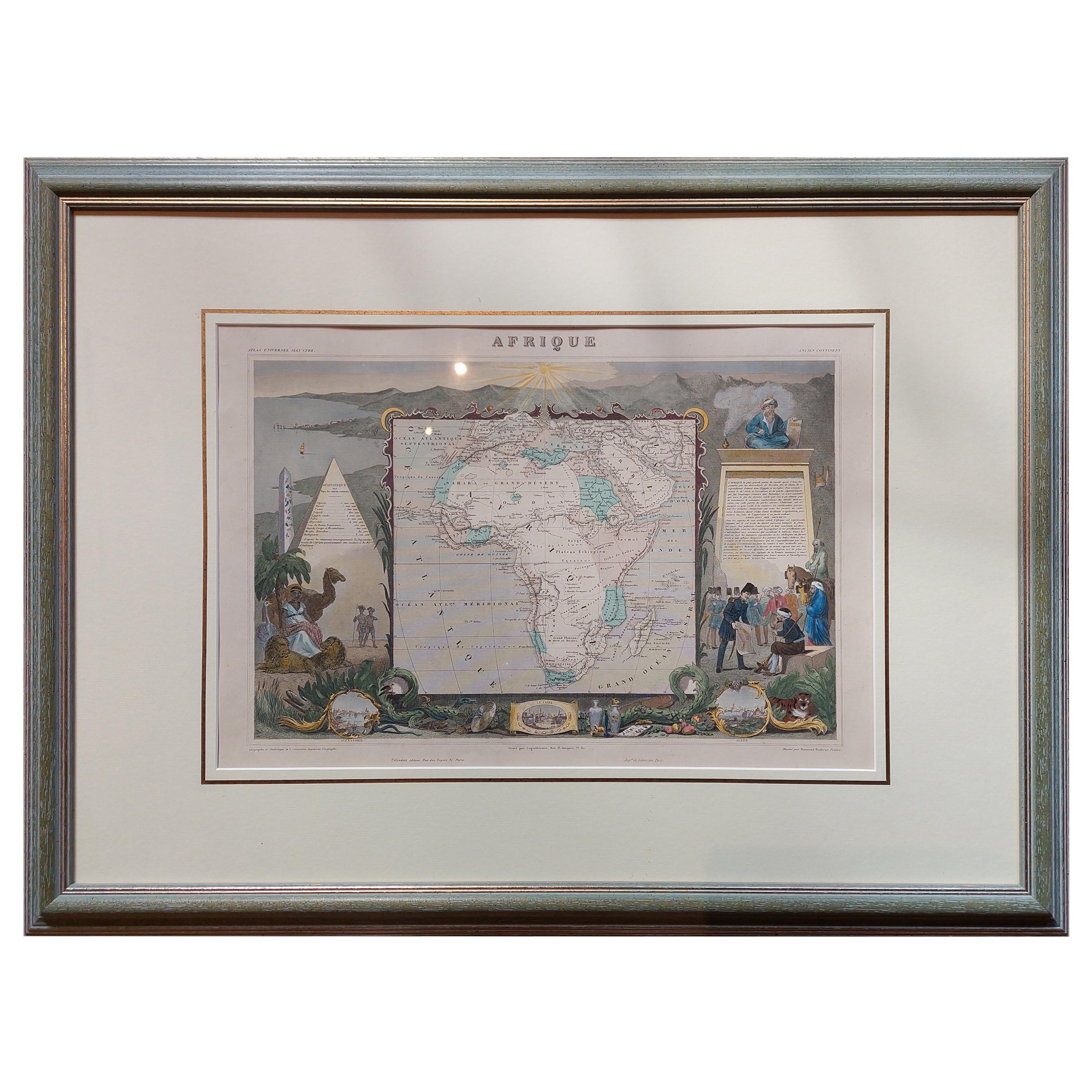
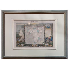
- Antique Map of Africa by Levasseur 'c.1840'Located in Langweer, NLAntique map titled 'Afrique'. Original antique map of Africa. Decorative map of the continent surrounded by allegorical vignettes. Engraved by Raimond Bonheur, father of the famous F...Category
Antique Mid-19th Century Maps
MaterialsPaper
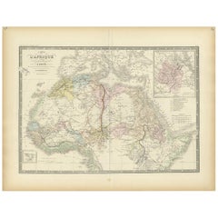
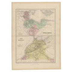
- Antique Map of Northern Africa by Levasseur, '1875'Located in Langweer, NLAntique map titled 'Carte de l'Afrique Septentrionale'. Large map of Northern Africa. This map originates from 'Atlas de Géographie Moderne Physique et...Category
Antique Late 19th Century Maps
MaterialsPaper
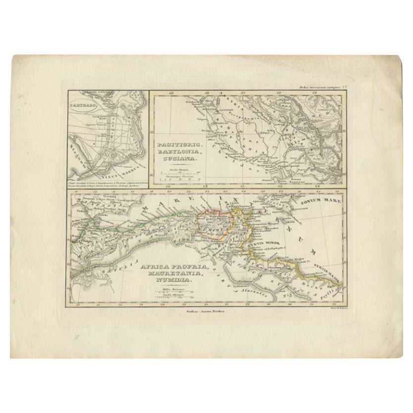
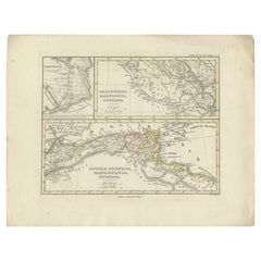
- Antique Map of Northern Africa by Perthes, 1848Located in Langweer, NLAntique map titled 'Africa Propria (..)'. Old map of North Africa and the region of Babylon originating from 'Orbis Terrarum Antiquus in usum Scholarum'. Artists and Engravers: Publi...Category
Antique 19th Century Maps
MaterialsPaper
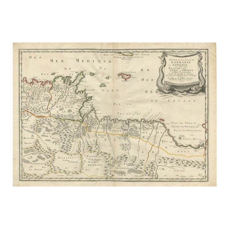
- Rare Antique Map of 'Barbarie' or Northern Africa, 1655Located in Langweer, NLAntique map titled 'Partie de la Coste de Barbarie en Africque ou sont les Royaumes de Tunis et Tripoli et Pays Circomvoisins'. This map depicts North Africa with Malta and originate...Category
Antique 17th Century Maps
MaterialsPaper
- Antique Map of Tunis and Tripoli in Northern Africa, circa 1880By J. MigeonLocated in Langweer, NLAntique map titled 'Tunis et Tripoli & Empire de Maroc'. Old map of Tunis and Tripoli and the Empire of Morocco. This map originates from 'Géographie Universelle Atlas-Migeon' by J. ...Category
Antique 19th Century Maps
MaterialsPaper
You May Also Like
- Original Antique Map of Ireland- Tipperary and Waterford. C.1840Located in St Annes, LancashireGreat map of Tipperary and Waterford Steel engraving Drawn under the direction of A.Adlard Published by How and Parsons, C.1840 Unframed.Category
Antique 1840s English Maps
MaterialsPaper
- Original Antique Map of Ireland- Kerry. C.1840Located in St Annes, LancashireGreat map of Kerry Steel engraving Drawn under the direction of A.Adlard Published by How and Parsons, C.1840 Unframed.Category
Antique 1840s English Maps
MaterialsPaper
- Original Antique Map of South Africa, Arrowsmith, 1820Located in St Annes, LancashireGreat map of South Africa. Drawn under the direction of Arrowsmith. Copper-plate engraving. Published by Longman, Hurst, Rees, Orme and Br...Category
Antique 1820s English Maps
MaterialsPaper
- 1635 Willem Blaeu Map of Northern France"Comitatvs Bellovacvm" Ric.a08Located in Norton, MA1635 Willem Blaeu map of northern France, entitled. "Comitatvs Bellovacvm Vernacule Beavvais," Colored Ric.a008 “COMITATVS BELLOVACVM…” Amsterdam: W...Category
Antique 17th Century Unknown Maps
MaterialsPaper
- Original Antique Map of South East Asia by Becker, circa 1840Located in St Annes, LancashireGreat map of South East Asia Steel engraving with original color outline Engraved by Becker Published by Virtue, circa 1840. Unframed.Category
Antique 1840s English Other Maps
MaterialsPaper
- Original Antique Map of France, Arrowsmith, 1820Located in St Annes, LancashireGreat map of France Drawn under the direction of Arrowsmith. Copper-plate engraving. Published by Longman, Hurst, Rees, Orme and Brown, 1820 Unframed.Category
Antique 1820s English Maps
MaterialsPaper


Recently Viewed
View AllMore Ways To Browse
Antique Decor And More
1840 C
Northern French Furniture
French Long Line
African Plate
19th Century Africa Collectibles
Paris Et Cie
Antique Metal Globes
Victorian African
Old Map Of Paris
Antique Paris Map Print
Antique Map Globe
Northern France Map
Atlas Globe
19th Century Map Of Africa
Globe Engraving
Antique Africa Maps And Atlases Africa Maps
Le Classique