Items Similar to Rare Antique Map of 'Barbarie' or Northern Africa, 1655


Want more images or videos?
Request additional images or videos from the seller
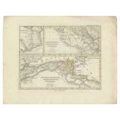
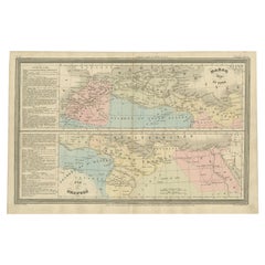
Rare Antique Map of 'Barbarie' or Northern Africa, 1655
About the Item
Antique map titled 'Partie de la Coste de Barbarie en Africque ou sont les Royaumes de Tunis et Tripoli et Pays Circomvoisins'. This map depicts North Africa with Malta and originates from 'Cartes generales de la Geographie ancienne et nouvelle', Paris, 1655. Artists and Engravers: Nicholas Sanson d'Abbeville (1600 - 1667) and his descendents were important French cartographer's active through the 17th century. Sanson started his career as a historian where, it is said, he turned to cartography as a way to illustrate his historical studies. In the course of his research some of his fine maps came to the attention of King Louis XIII who, admiring the quality of his work, appointed Sanson 'Geographe Ordinaire du Roi'. Sanson's duties in this coved position included advising the King on matters of Geography and compiling the royal cartographic archive. Sanson's corpus of some three hundred maps initiated the golden age of French Cartography.
Artist: Nicholas Sanson d'Abbeville (1600 - 1667) and his descendents were important French cartographer's active through the 17th century. Sanson started his career as a historian where, it is said, he turned to cartography as a way to illustrate his historical studies. In the course of his research some of his fine maps came to the attention of King Louis XIII who, admiring the quality of his work, appointed Sanson 'Geographe Ordinaire du Roi'. Sanson's duties in this coved position included advising the King on matters of Geography and compiling the royal cartographic archive. Sanson's corpus of some three hundred maps initiated the golden age of French Cartography.
Condition: Good, General age-related toning, minor defects from handling. Please study image carefully.
Date: 1655
Overall size: 59.5 x 43 cm.
Image size: 54 x 37.5 cm.
Antique prints have long been appreciated for both their aesthetic and investment value. They were the product of engraved, etched or lithographed plates. These plates were handmade out of wood or metal, which required an incredible level of skill, patience and craftsmanship. Whether you have a house with Victorian furniture or more contemporary decor an old engraving can enhance your living space.
- Dimensions:Height: 16.93 in (43 cm)Width: 23.43 in (59.5 cm)Depth: 0 in (0.01 mm)
- Materials and Techniques:
- Period:
- Date of Manufacture:1655
- Condition:Condition: Good, General age-related toning, minor defects from handling. Please study image carefully.
- Seller Location:Langweer, NL
- Reference Number:
About the Seller
5.0
Platinum Seller
These expertly vetted sellers are 1stDibs' most experienced sellers and are rated highest by our customers.
Established in 2009
1stDibs seller since 2017
1,950 sales on 1stDibs
Typical response time: <1 hour
- ShippingRetrieving quote...Ships From: Langweer, Netherlands
- Return PolicyA return for this item may be initiated within 14 days of delivery.
More From This SellerView All
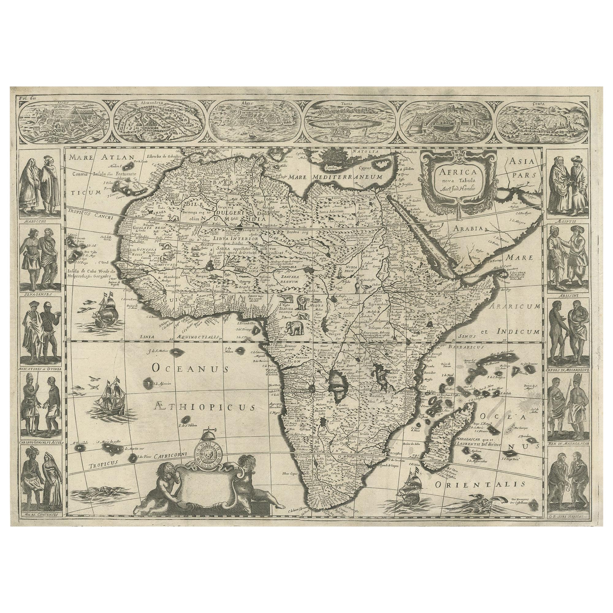
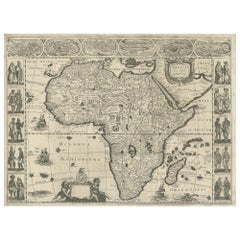
- Antique Map of Africa Made after Hondius, circa 1655Located in Langweer, NLAntique map titled 'Africa Nova Tabula Auct Jud. Hondio'. Beautiful and rare paneled map of Africa, Based Upon Hondius' map. The first derivative of the map was issued separately by ...Category
Antique Mid-17th Century Maps
MaterialsPaper
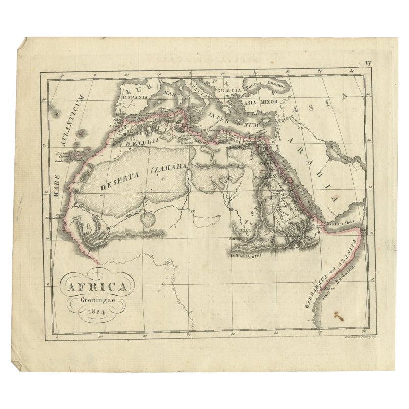
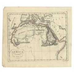
- Antique Map of Northern Africa from a Rare Dutch Atlas, 1825Located in Langweer, NLAntique map titled 'Africa'. Old map of the African continent originating from 'Atlas der Oude Wereld'. Artists and Engravers: Published by C. Ph. Funke and W. van Boekeren, Gron...Category
Antique 19th Century Maps
MaterialsPaper
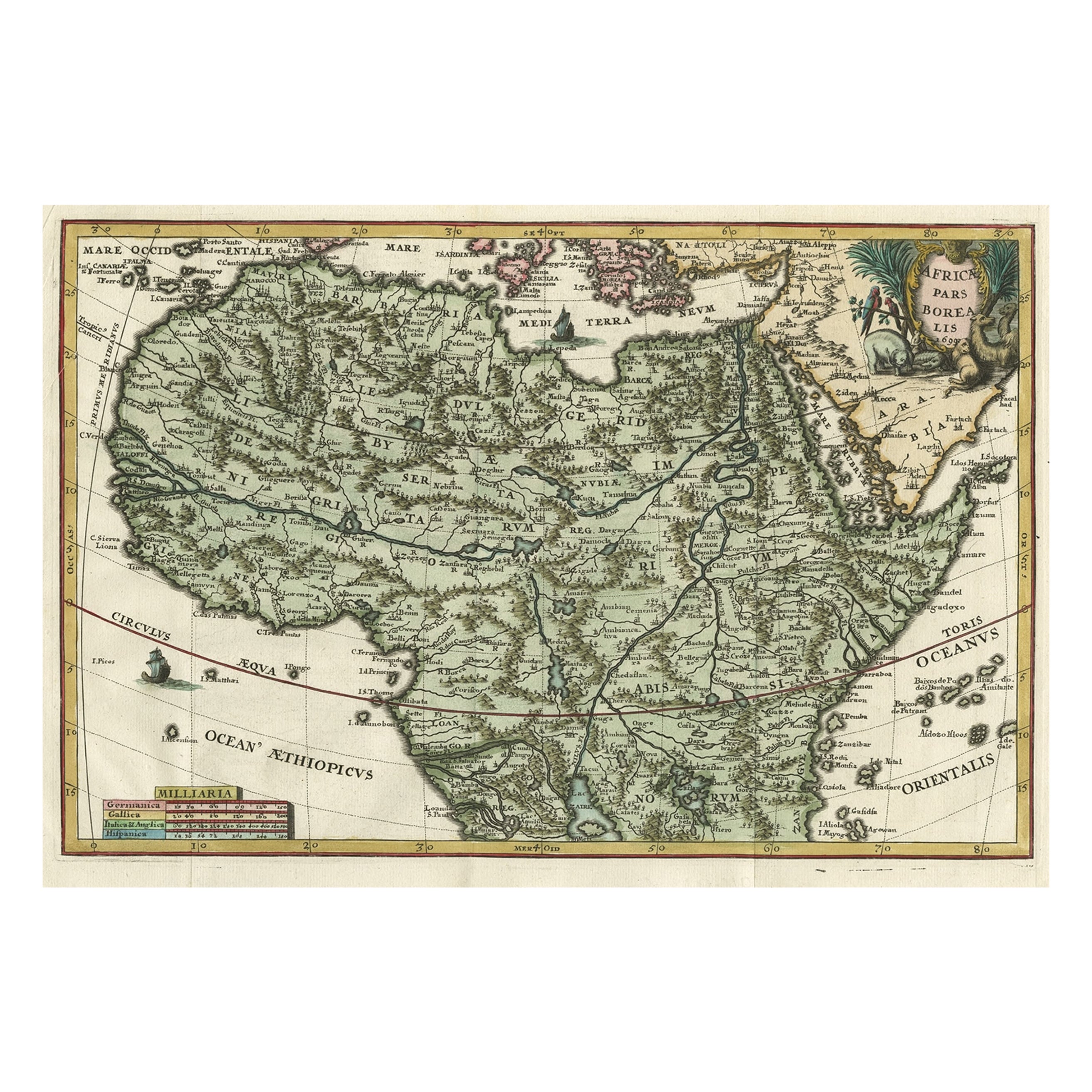
- Very Decorative Rare Antique Map of the Northern Part of Africa, 1702Located in Langweer, NLAntique map titled 'Africae Pars Borealis.' Very decorative antique map of the northern part of Africa by Heinrich Scherer. The map is full of the spurious geography of the perio...Category
Antique Early 1700s Maps
MaterialsPaper
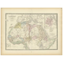
- Antique Map of Northern Africa by Levasseur, '1875'Located in Langweer, NLAntique map titled 'Carte de l'Afrique Septentrionale'. Large map of Northern Africa. This map originates from 'Atlas de Géographie Moderne Physique et...Category
Antique Late 19th Century Maps
MaterialsPaper
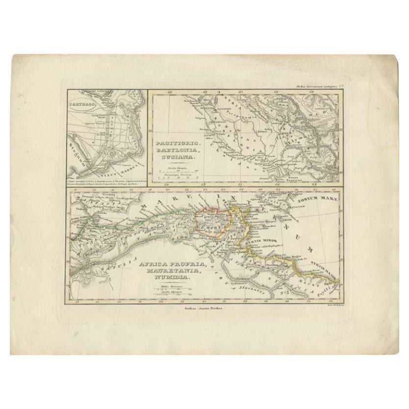
- Antique Map of Northern Africa by Perthes, 1848Located in Langweer, NLAntique map titled 'Africa Propria (..)'. Old map of North Africa and the region of Babylon originating from 'Orbis Terrarum Antiquus in usum Scholarum'. Artists and Engravers: Publi...Category
Antique 19th Century Maps
MaterialsPaper
- French Antique Map of Northern Africa and Libya, c.1840Located in Langweer, NLAntique map titled 'Marok, Alger et Tunis - Etat de Tripoli'. Map of Northern Africa and Libya. This map originates from 'Le globe Atlas classique Universel de géographie ancienne et...Category
Antique 19th Century Maps
MaterialsPaper

You May Also Like
- Original Antique Map of South Africa, Arrowsmith, 1820Located in St Annes, LancashireGreat map of South Africa. Drawn under the direction of Arrowsmith. Copper-plate engraving. Published by Longman, Hurst, Rees, Orme and Br...Category
Antique 1820s English Maps
MaterialsPaper
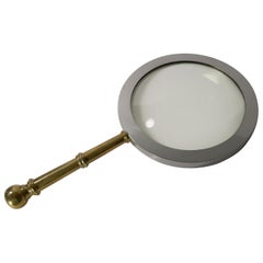
- Rare Antique English Mammoth Map or Library Magnifying Glass, circa 1930Located in Bath, GBWow, you need to hands to lift this mammoth magnifying glass, a great look for the library and a real talking point. The handle is made from cast brass and the frame for the glass...Category
Vintage 1930s English Art Deco Scientific Instruments
MaterialsMetal
- Antique Lithography Map, West Africa, English, Framed, Cartography, VictorianLocated in Hele, Devon, GBThis is an antique lithography map of Western Africa. An English, framed atlas engraving of cartographic interest by John Rapkin, dating to the early Victorian period and later, circ...Category
Antique Mid-19th Century British Early Victorian Maps
MaterialsWood
- London 1744 Published Watercolour Antique Map of East Africa by Eman BowenLocated in GBWe are delighted to offer for sale this New and Accurate Map of Nubia & Abissinia, together with all the Kingdoms Tributary Thereto, and bordering upon them published in 1744 by Emanuel Bowen This is a decorative antique engraved map of East Africa...Category
Antique 1740s English George III Maps
MaterialsPaper
- 1635 Willem Blaeu Map of Northern France"Comitatvs Bellovacvm" Ric.a08Located in Norton, MA1635 Willem Blaeu map of northern France, entitled. "Comitatvs Bellovacvm Vernacule Beavvais," Colored Ric.a008 “COMITATVS BELLOVACVM…” Amsterdam: W...Category
Antique 17th Century Unknown Maps
MaterialsPaper
- Large Original Vintage Map of South Africa, circa 1920Located in St Annes, LancashireGreat map of South Africa Original color. Good condition / repair to a minor edge tear middle bottom Published by Alexander Gross Unframed. ...Category
Vintage 1920s English Edwardian Maps
MaterialsPaper


Recently Viewed
View AllMore Ways To Browse
Northern French Furniture
Antique Cartography
Antique Wood Cart
African Plate
King Size Antique French
Antique Maltese
King Louis Plater
Antique Wood Trolley
Victorian African
Louis Trolley
Le Roi A Paris
Victorian Trolley
Old Map Of Paris
Old Map Paris
Antique Paris Map Print
North Africa Map
Antique Metal Carts
Antique Maltese Furniture