Items Similar to A Gold Highlighted Antique Map of Northamptonshire by Blaeu '1659'


Want more images or videos?
Request additional images or videos from the seller
1 of 5
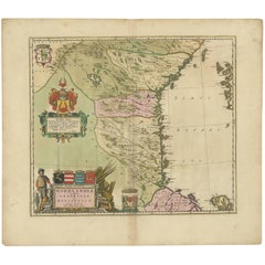
A Gold Highlighted Antique Map of Northamptonshire by Blaeu '1659'
About the Item
Antique map titled 'Comitatus Northantonensis vernacule Northamtonshire'. Original antique map of Northamptonshire, England. This map originates from 'Atlas Universal y Cosmographico de las Orbes Celestes y Terrestres' by J. Blaeu. Published 1659.
- Dimensions:Height: 18.9 in (48 cm)Width: 22.05 in (56 cm)Depth: 0.02 in (0.5 mm)
- Materials and Techniques:
- Period:Mid-17th Century
- Date of Manufacture:1659
- Condition:Beautiful coloring, heightened with gold! Spanish text on verso. General age-related toning, minor wear. Few small holes affecting image. Please study images carefully.
- Seller Location:Langweer, NL
- Reference Number:
About the Seller
5.0
Platinum Seller
These expertly vetted sellers are 1stDibs' most experienced sellers and are rated highest by our customers.
Established in 2009
1stDibs seller since 2017
1,959 sales on 1stDibs
Typical response time: <1 hour
- ShippingRetrieving quote...Ships From: Langweer, Netherlands
- Return PolicyA return for this item may be initiated within 14 days of delivery.
More From This SellerView All
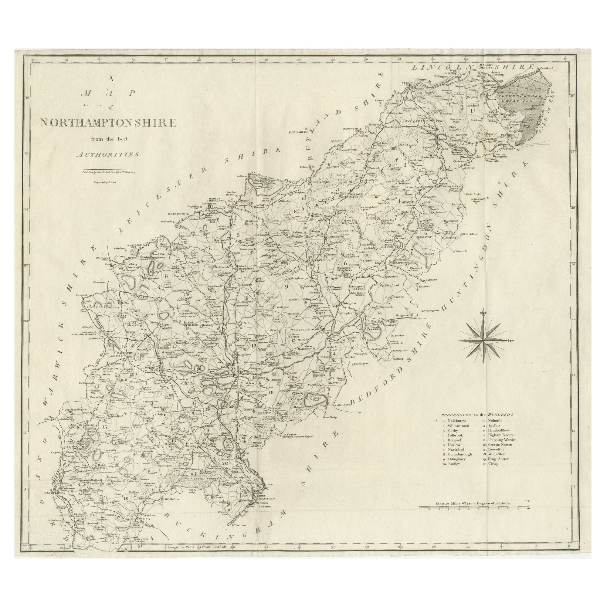
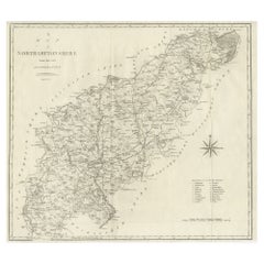
- Large Antique County Map of Northamptonshire, EnglandLocated in Langweer, NLAntique map titled 'A Map of Northamptonshire from the best Authorities'. Original old county map of Northamptonshire, England. Engraved by John Cary. Originates from 'New British At...Category
Antique Early 19th Century Maps
MaterialsPaper
- Antique Map of Catalonia by Blaeu, circa 1650Located in Langweer, NLAntique map titled 'Catalonia'. Antique map of Catalonia, extending from C. De Romani on the Northern Coast to Alfachs and Panicola in Valencia on the southern end of the coast and s...Category
Antique Mid-17th Century Maps
MaterialsPaper
- Antique Map of Prussia by Blaeu, circa 1635By Willem BlaeuLocated in Langweer, NLAntique map titled 'Prussiae Nova Tabula'. Rare early edition of Blaeu's map of Prussia, embellished with a gorgeous large format cartouche, compass ros...Category
Antique Mid-17th Century Maps
MaterialsPaper
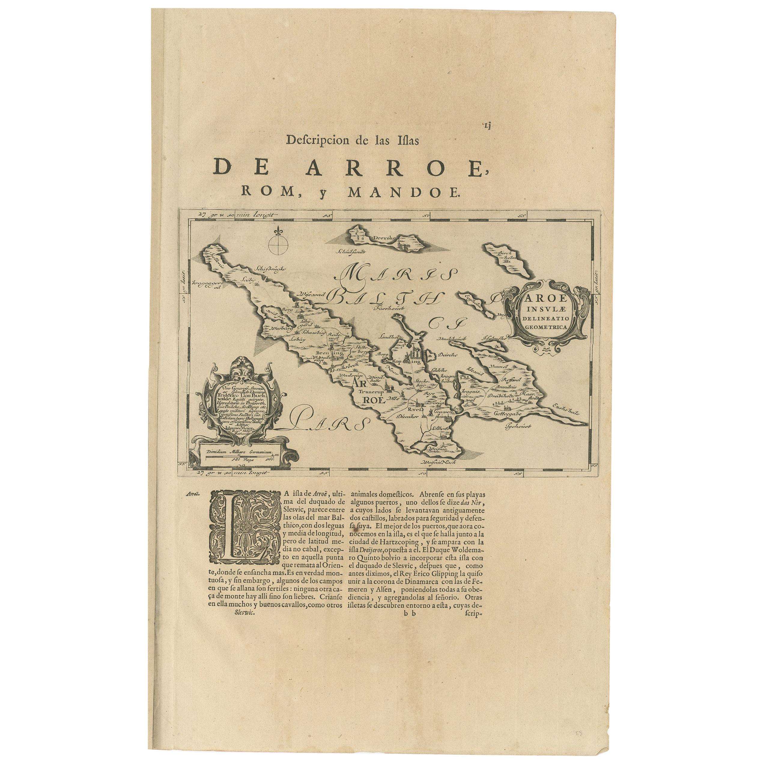
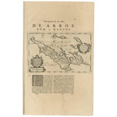
- Antique Map of Aero by Blaeu, 'circa 1670'Located in Langweer, NLAntique map titled 'Aroe Insulae delineatio geometrica'. Old map of Aero, a small Danish island in the Baltic Sea. This map originates from a Spanish edition of 'Atlas Maior' by J. B...Category
Antique Mid-17th Century Maps
MaterialsPaper
- Antique Map of Central Sweden by J. Blaeu, 1662Located in Langweer, NLA striking, rare map with a cartouche dedicated to Gabriel Bengtsson Oxenstierna. Published by J. Bleau, Amsterdam, 1662. Contemporary coloring.Category
Antique Mid-17th Century Maps
MaterialsPaper
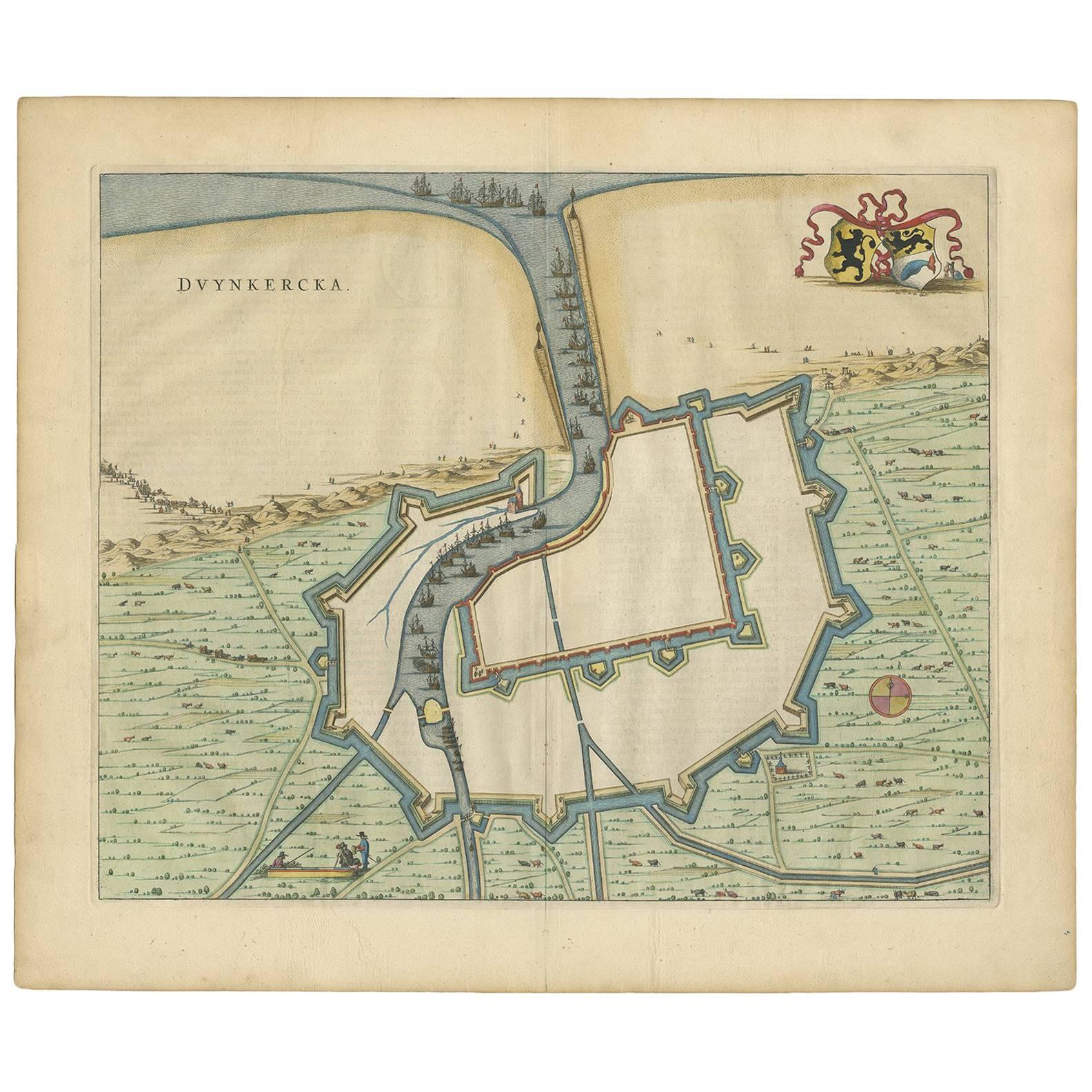
- Antique Map of Dunkirk 'France' by J. Blaeu, 1649Located in Langweer, NLAntique map titled 'Duynkercka'. Published by J. Blaeu, 1649. Dutch text on verso.Category
Antique Mid-17th Century Maps
MaterialsPaper


You May Also Like
- Antique Map of Italy by Andriveau-Goujon, 1843By Andriveau-GoujonLocated in New York, NYAntique Map of Italy by Andriveau-Goujon, 1843. Map of Italy in two parts by Andriveau-Goujon for the Library of Prince Carini at Palazzo Carini i...Category
Antique 1840s French Maps
MaterialsLinen, Paper
- Antique Map of Principality of MonacoBy Antonio Vallardi EditoreLocated in Alessandria, PiemonteST/619 - "Old Geographical Atlas of Italy - Topographic map of ex-Principality of Monaco" - ediz Vallardi - Milano - A somewhat special edition ---Category
Antique Late 19th Century Italian Other Prints
MaterialsPaper
- Original Antique Map of Russia By Arrowsmith. 1820Located in St Annes, LancashireGreat map of Russia Drawn under the direction of Arrowsmith Copper-plate engraving Published by Longman, Hurst, Rees, Orme and Brown, 1820 Unframed.Category
Antique 1820s English Maps
MaterialsPaper
- Original Antique Map of Sweden, Engraved by Barlow, 1806Located in St Annes, LancashireGreat map of Sweden Copper-plate engraving by Barlow Published by Brightly & Kinnersly, Bungay, Suffolk. 1806 Unframed.Category
Antique Early 1800s English Maps
MaterialsPaper
- Original Antique Map of Belgium by Tallis, Circa 1850Located in St Annes, LancashireGreat map of Belgium Steel engraving Many lovely vignettes Published by London Printing & Publishing Co. ( Formerly Tallis ), C.1850 Origin...Category
Antique 1850s English Maps
MaterialsPaper
- Original Antique Map of China by Thomas Clerk, 1817Located in St Annes, LancashireGreat map of China Copper-plate engraving Drawn and engraved by Thomas Clerk, Edinburgh. Published by Mackenzie And Dent, 1817 Unframed.Category
Antique 1810s English Maps
MaterialsPaper


Recently Viewed
View AllMore Ways To Browse
Map Of England
Antique 17th Century Map
Antique Maps Of England
Antique Map Of England
Blaeu Maps
Map Blaeu
Antique Orb
Antique Map Blaeu
Antique Furniture Northamptonshire
Map Plate
Island Maps
Antique Maps Of France
Antique Map Of France
Antique Historical Maps
16th Century World Map
Antique Old Maps
Old Antique Maps
Germany Map