Items Similar to Large Topographical and Geological Map of the Teshio Oil Field, '1936'


Want more images or videos?
Request additional images or videos from the seller
1 of 7
Large Topographical and Geological Map of the Teshio Oil Field, '1936'
About the Item
Topographical and geological map of the Teshio oil field. Shows location of oil well, oil sand, natural gas, coal, Sulphur spring, anticlinal axis, profile line, and fault line.
- Dimensions:Height: 72.64 in (184.5 cm)Width: 38.39 in (97.5 cm)Depth: 0.02 in (0.5 mm)
- Materials and Techniques:
- Period:
- Date of Manufacture:1936
- Condition:Large folding map mounted on linen. General age-related toning, minor wear. Please study images carefully.
- Seller Location:Langweer, NL
- Reference Number:
About the Seller
5.0
Platinum Seller
These expertly vetted sellers are 1stDibs' most experienced sellers and are rated highest by our customers.
Established in 2009
1stDibs seller since 2017
1,947 sales on 1stDibs
Typical response time: <1 hour
- ShippingRetrieving quote...Ships From: Langweer, Netherlands
- Return PolicyA return for this item may be initiated within 14 days of delivery.
More From This SellerView All
- Antique Geological Map of the World by Johnston '1850'Located in Langweer, NLAntique map titled 'The Geological Structure of the Globe'. Original antique geological map of the world. This map originates from 'The Physica...Category
Antique Mid-19th Century Maps
MaterialsPaper
- Antique Map of Wisconsin with Inset Geological Map of WisconsinLocated in Langweer, NLAntique map titled 'Wisconsin'. Original antique map of Wisconsin, United States. With inset geological map of Wisconsin. This print originates from '...Category
Antique Late 19th Century Maps
MaterialsPaper
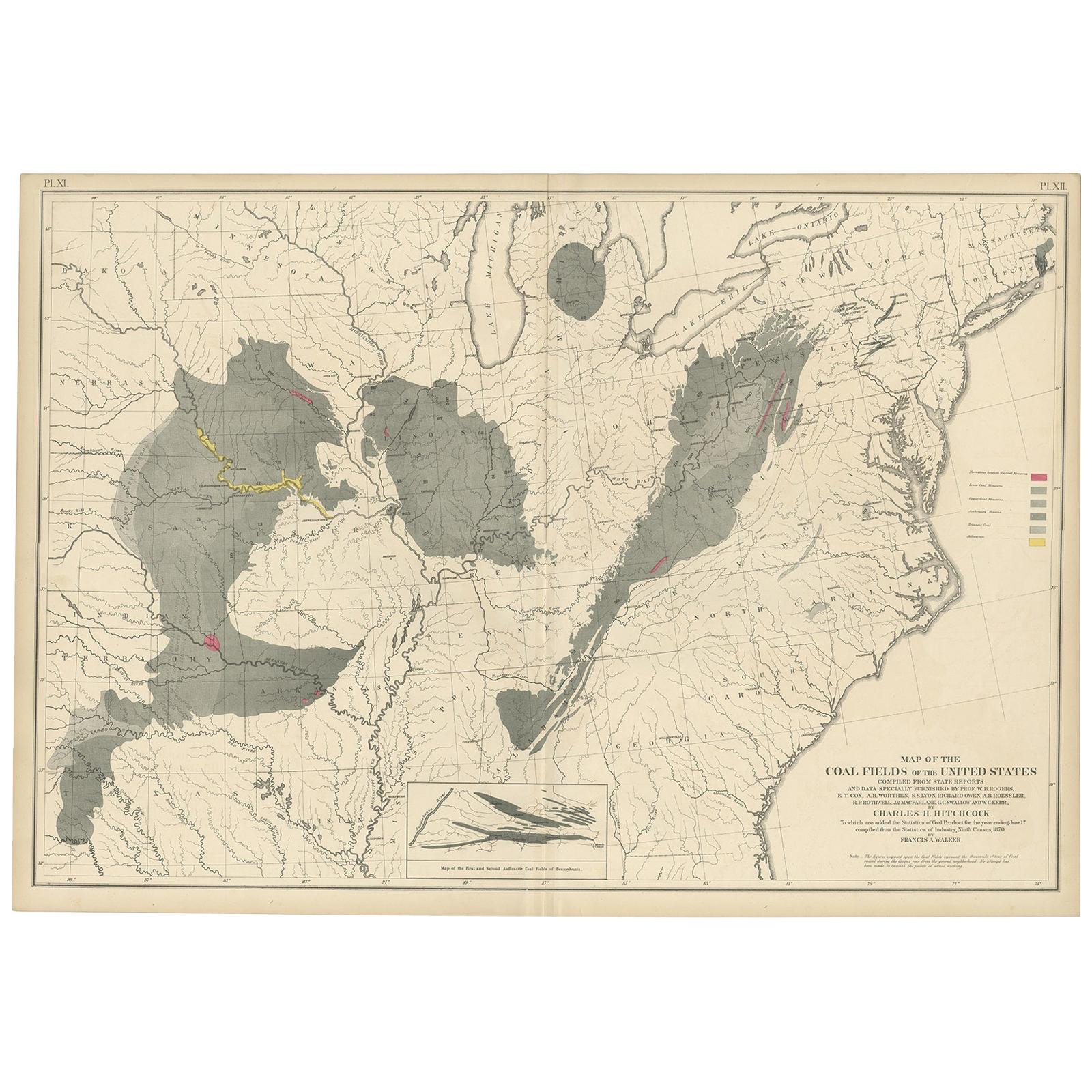
- Antique Map of the Coal Fields of the United States by Walker '1874'Located in Langweer, NLAntique map titled 'Map of the coal fields of the United States, compiled from state reports and data specially furnished by Prof. W.B. Rogers, E.T. Cox, A.H. Worthen, S.S. Lyon, Ric...Category
Antique Late 19th Century Maps
MaterialsPaper
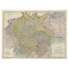
- Large Antique Map of the German EmpireLocated in Langweer, NLAntique map titled 'A Map of Germany (..)'. Large antique map of the German Empire, highly detailed. Engraved by T. Kitchin. Published J. Blair, cir...Category
Antique Late 18th Century Maps
MaterialsPaper
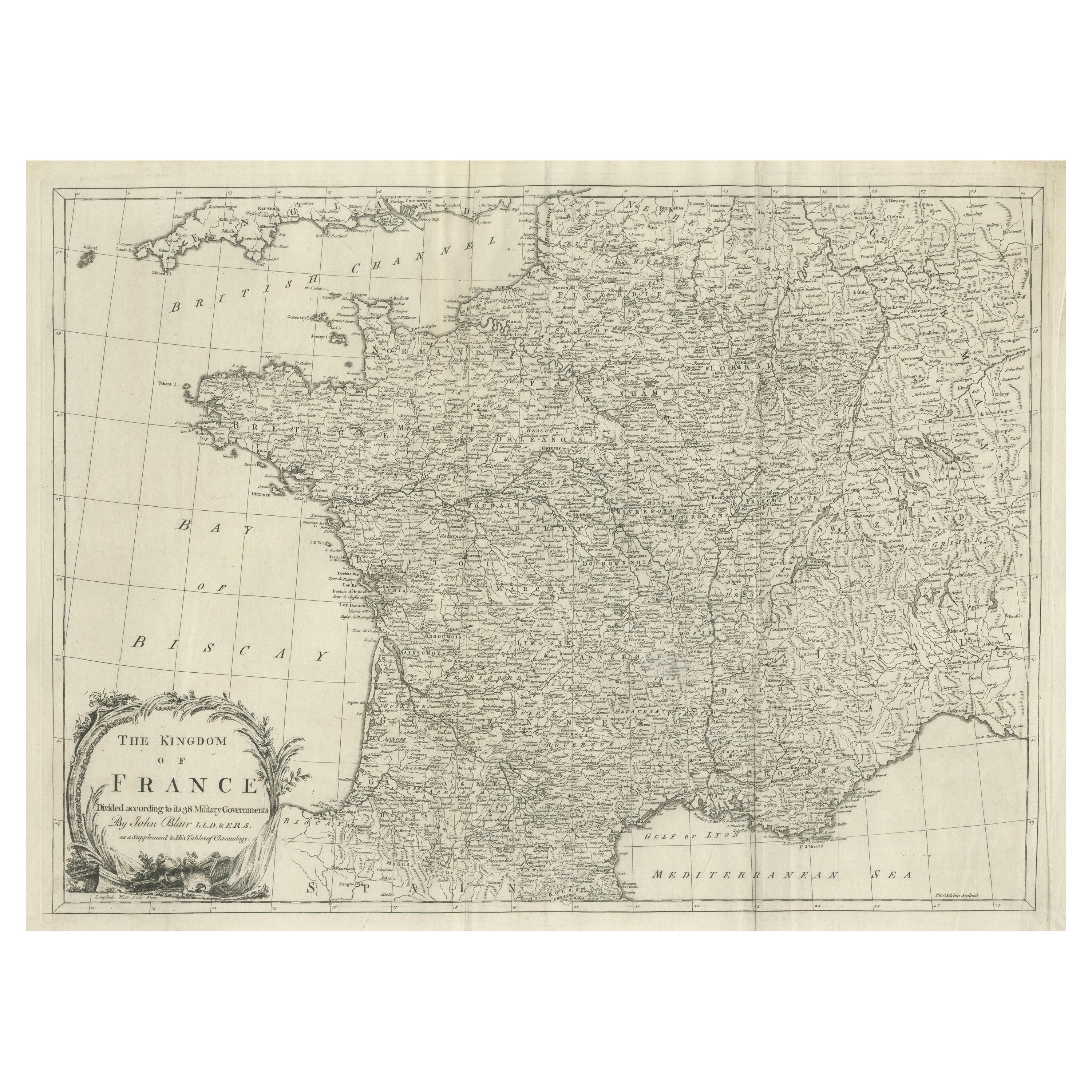
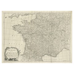
- Large Antique Map of the Kingdom of FranceLocated in Langweer, NLAntique map titled 'The Kingdom of France (..)'. Large antique map of the Kingdom of France. Engraved by T. Kitchin. Published J. Blair, circa 1779.Category
Antique Late 18th Century Maps
MaterialsPaper
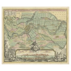
- Large Antique Map of the City of Bremen and Surroundings, GermanyLocated in Langweer, NLOriginal antique map titled 'Prospect und Grundris der Keiserl Freyen Reichs und Ansee Stadt Bremen (..)'. This is a superb chart of the city of Bremen and the surrounding small vill...Category
Antique Early 18th Century Maps
MaterialsPaper


You May Also Like
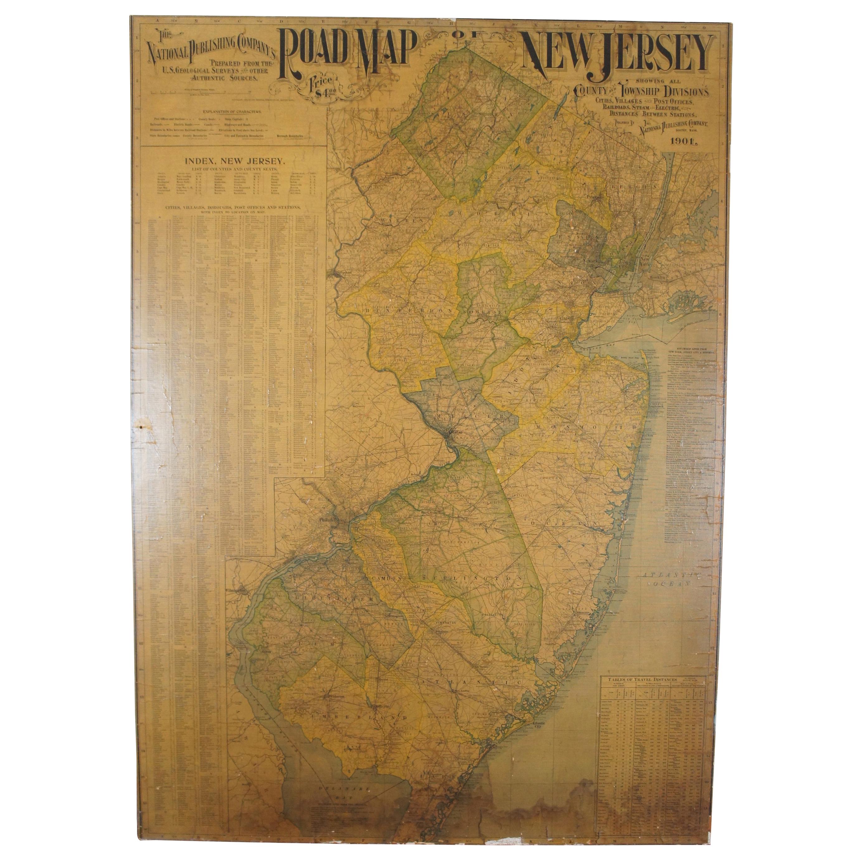
- Antique 1901 National Publishing Company's Road Map of New Jersey GeologicalLocated in Dayton, OHThe National Publishing Company's road map of New Jersey, showing all county and township divisions, cities villages and post-offices, railroads, ste...Category
Antique Early 1900s Victorian Prints
MaterialsPaper
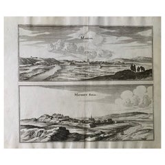
- 17th Century Topographical Map, Champagne-Ardenne, Marsal, Maubert Iohan PeetersLocated in New York, NYFine topographical 17th century map by Iohan Peeters of Marsal and Maubert Fontaine in the Champagne-Ardennes Region of North Eastern France. Fabulous period engraving for a Wine Ce...Category
Antique 17th Century Dutch Maps
MaterialsPaper
- 17th Century Toulouse, Savve, Sommieres Topographical Map by Iohan PeetersLocated in New York, NYFine topographical 17th century map of Toulouse, Savve and Sommieres by Iohan Peeters Beautiful engraving of the capital of France's Occitanie Region, Toulouse, called La Ville Rose- the Pink City, for the terracotta bricks used in its many buildings, giving the city a distinct apricot-rose hue. An important cultural and educational center, the city's residents included Nobel Prize winners and world renown artists- Henri de Toulouse-Lautrec, Henri Martin, Jean-Auguste-Dominique Ingres, Antonin Mercie, Alexandre Falguiere and more recently Cyril Kongo...Category
Antique 17th Century Dutch Maps
MaterialsPaper
- 17th Century Topographical Map, French Champagne Region, Epernay, Iohan PeetersLocated in New York, NYFine topographical 17th century map by Iohan Peeters of the towns of Epernay and Lametz in the Champagne Region of North Eastern France. Fabulous period engraving for a Wine Cellar,...Category
Antique 17th Century Dutch Maps
MaterialsPaper
- 17th Century Topographical Map of Cote D'azur, Avignon, Frejus by Iohan PeetersLocated in New York, NYFine topographical 17th century map by Iohan Peeters of the towns of Avignon and Frejus in the Cote d'Azur-Provence-Alpes Region of Southeastern France. Beautifully suited decorativ...Category
Antique 17th Century Dutch Maps
MaterialsPaper
- Map of the Republic of GenoaLocated in New York, NYFramed antique hand-coloured map of the Republic of Genoa including the duchies of Mantua, Modena, and Parma. Europe, late 18th century. Dimension: 25...Category
Antique Late 18th Century European Maps


Recently Viewed
View AllMore Ways To Browse
The Vintage Map
Topographical Map
Coal Vintage
Natural Gas
Vintage Geology
Oil And Gas
Vintage Topographic Map
Vintage Topographical Map
Vintage Topographical Maps
Vintage Topographic Maps
Vintage Geological Maps
Map Plate
Island Maps
Antique Map Of France
Antique Maps Of France
Antique Historical Maps
16th Century World Map
Antique Old Maps