Items Similar to Large Wall Map of Europe by George Philip & Son, circa 1920


Want more images or videos?
Request additional images or videos from the seller
1 of 7
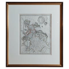
Large Wall Map of Europe by George Philip & Son, circa 1920
About the Item
Antique map titled 'Philips' New Commercial Map of Europe'. Very large wall map of Europe including the North African coast and Turkey. Decorative borders. Dissected into 48 segments and mounted on linen, folding into original boards. Published by George Philip & Son for London Geographical Institute.
- Dimensions:Height: 72.05 in (183 cm)Width: 66.15 in (168 cm)Depth: 0.02 in (0.5 mm)
- Materials and Techniques:
- Period:
- Date of Manufacture:circa 1920
- Condition:General age-related toning. Split between two segments. Shows some wear and soiling. Please study images carefully.
- Seller Location:Langweer, NL
- Reference Number:Seller: M24301stDibs: LU3054321246292
About the Seller
5.0
Platinum Seller
These expertly vetted sellers are 1stDibs' most experienced sellers and are rated highest by our customers.
Established in 2009
1stDibs seller since 2017
1,947 sales on 1stDibs
Typical response time: <1 hour
- ShippingRetrieving quote...Ships From: Langweer, Netherlands
- Return PolicyA return for this item may be initiated within 14 days of delivery.
Auctions on 1stDibs
Our timed auctions are an opportunity to bid on extraordinary design. We do not charge a Buyer's Premium and shipping is facilitated by 1stDibs and/or the seller. Plus, all auction purchases are covered by our comprehensive Buyer Protection. Learn More
More From This SellerView All
- Antique Map of Europe by Hederichs, circa 1740Located in Langweer, NLAntique map titled 'Europa Christiani Orbis Domina'. Rare miniature map of Europe. This map originates from 'Anleitung Zu den fürnehmsten Historischen Wissenschaften, Benanntlich Der...Category
Antique Mid-18th Century Maps
MaterialsPaper
- Antique Map of Western Europe by H. Kiepert, circa 1870By Heinrich KiepertLocated in Langweer, NLAntique map titled 'Gallia, Britannia, Germania'. This map depicts a large part of Western Europe including countries like Germany, France, Great Britain, The Netherlands and more. T...Category
Antique Late 19th Century Maps
MaterialsPaper
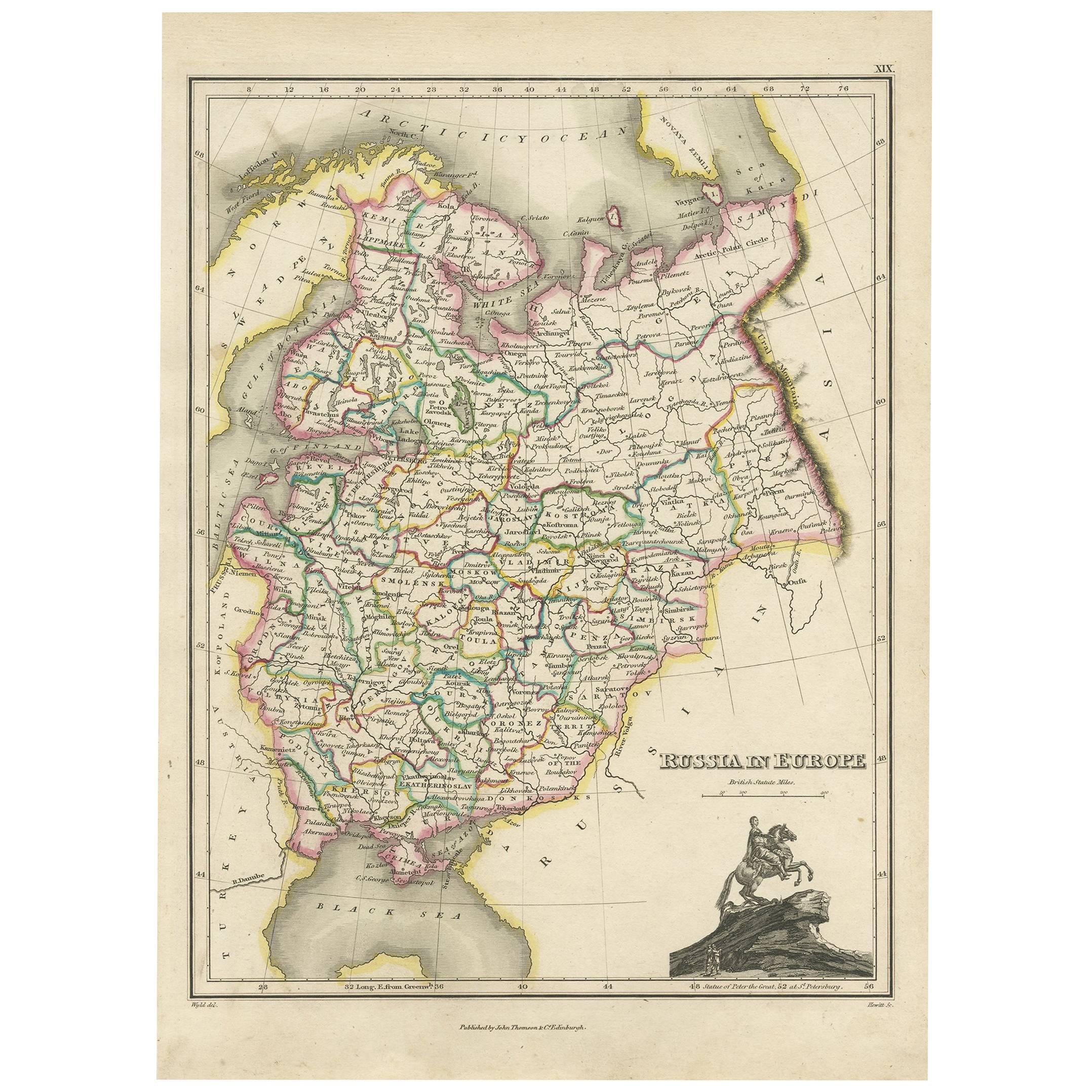
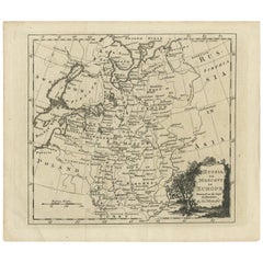
- Antique Map of Russia in Europe by T. Kitchin, circa 1770Located in Langweer, NLAntique map titled 'Russia or Moscovy in Europe, drawn from the latest authorities (..)'. An interesting and attractive early 19th century map of Russia in Europe which was engraved ...Category
Antique Late 18th Century Maps
MaterialsPaper
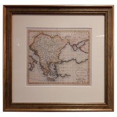
- Antique Map of Turkey in Europe by Russell, circa 1795Located in Langweer, NLAntique map titled 'Turkey in Europe and Hungary'. Original map of Turkey in Europe. Covers present day Northern Turkey, Greece, Albania, Romania, Hungary, Croatia, Bosnia Herzogovin...Category
Antique Late 18th Century Maps
MaterialsPaper
- Antique Map of Europe by Levasseur 'c.1840'Located in Langweer, NLAntique map titled 'Europe'. Original antique map of Europe. Decorative map of the continent surrounded by allegorical vignettes. Engraved by Raimond Bonheur, father of the famous Fr...Category
Antique Mid-19th Century Maps
MaterialsPaper
- Antique Map of Europe by Lapie, '1809'Located in Langweer, NLAntique map titled 'Europe'. Original antique map of Europe by P. Lapie, published 1809. Frame included.Category
Antique Early 19th Century Maps
MaterialsPaper


You May Also Like
- Southern & Eastern Europe: A Large 17th C. Hand-colored Map by Sanson & JaillotBy Nicolas SansonLocated in Alamo, CAThis large hand-colored map entitled "Estats de L'Empire des Turqs en Europe, ou sont les Beglerbeglicz our Gouvernements" was originally created by Nicholas Sanson d'Abbeville and t...Category
Antique 1690s French Maps
MaterialsPaper
- Large Antique 1859 Map of North AmericaLocated in Sag Harbor, NYThis Map was made by Augustus Mitchell in 1859 It is in amazing condition for being 163 years old. This price is for the rolled up easy to ship version of this piece. I will be Frami...Category
Antique Mid-19th Century American Maps
MaterialsCanvas, Paper

- Scandinavia & Portions of Eastern Europe: 18th Century Hand-Colored Homann MapBy Johann Baptist HomannLocated in Alamo, CAAn early 18th century hand-colored copper-plate map entitled "Regni Sueciae in omnes suas Subjacentes Provincias accurate divisi Tabula Generalis" by Johann Baptist Homann (1663-1724...Category
Antique Early 18th Century German Maps
MaterialsPaper
- Antique Map of Italy by Andriveau-Goujon, 1843By Andriveau-GoujonLocated in New York, NYAntique Map of Italy by Andriveau-Goujon, 1843. Map of Italy in two parts by Andriveau-Goujon for the Library of Prince Carini at Palazzo Carini i...Category
Antique 1840s French Maps
MaterialsLinen, Paper
- Africa: A Large 17th Century Hand-Colored Map by Sanson and JaillotBy Nicolas SansonLocated in Alamo, CAThis large original hand-colored copperplate engraved map of Africa entitled "L'Afrique divisee suivant l'estendue de ses principales parties ou sont distingues les uns des autres, L...Category
Antique 1690s French Maps
MaterialsPaper
- Southern Greece: A Large 17th C. Hand-colored Map by Sanson and JaillotBy Nicolas SansonLocated in Alamo, CAThis large original hand-colored copperplate engraved map of southern Greece and the Pelopponese Peninsula entitled "La Moree Et Les Isles De Zante, Cefalonie, Ste. Marie, Cerigo & C...Category
Antique 1690s French Maps
MaterialsPaper


