Antique European Map
33
to
153
680
287
528
352
285
180
107
95
92
92
75
63
56
48
43
41
39
38
30
30
26
16
14
13
13
12
12
10
10
10
10
9
8
8
8
7
7
7
6
6
6
5
5
5
5
5
4
4
3
3
3
2
33
20
15
10
9
Sort By
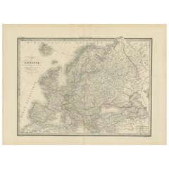
Antique Map of Europe by Lapie, 1842
Located in Langweer, NL
Antique map titled 'Carte de l'Europe'. Map of Europe. This map originates from 'Atlas universel de
Category
Mid-19th Century Antique European Map
Materials
Paper
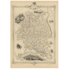
Antique Map of Russia in Europe by Tallis, '1851'
Located in Langweer, NL
Antique map titled 'Russia in Europe'. Map of European Russia. Showing vignettes of the Neoskoi
Category
Mid-19th Century Antique European Map
Materials
Paper
1790 Thomas Stackhouse Map, Entitled "Russia in Europe, " , Ric.a004
Located in Norton, MA
1790 Thomas Stackhouse map, entitled
"Russia in Europe"
Ric.a004
Stackhouse, Thomas
Russia
Category
17th Century Unknown Antique European Map
Materials
Paper
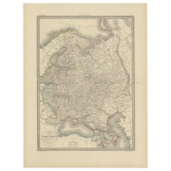
Antique Map of Russia in Europe, 1842
Located in Langweer, NL
Antique map titled 'Carte de la Russie d'Europe'. Map of Russia in Europe. This map originates from
Category
19th Century Antique European Map
Materials
Paper
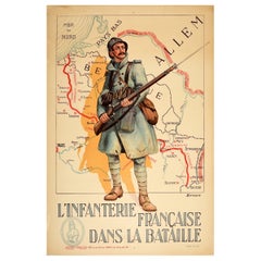
Original Antique Poster French Infantry In Battle WWI Hindenburg Line Europe Map
Located in London, GB
bayonet rifle gun in front of a map of Europe showing the Hindenburg Line in red with the title text below
Category
1910s French Antique European Map
Materials
Paper
H 47.25 in W 31.5 in D 0.04 in
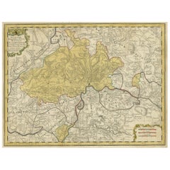
Original Hand-Colored Antique Regional Map of Switzerland, 1753
Located in Langweer, NL
enjoyed a major place in the European map market throughout the eighteenth century. Founded in 1702 by
Category
1750s Antique European Map
Materials
Paper
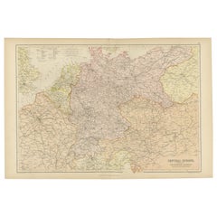
Antique Map of Central Europe Showing The Railways and The Political Bounderies
Located in Langweer, NL
Explore the Heart of Europe with the 'Central Europe' Map, Featuring Principal Railways and
Category
1880s Antique European Map
Materials
Paper
H 14.97 in W 22.45 in D 0 in
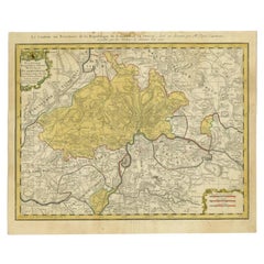
Antique Map of Switzerland by Homann, 1753
Located in Langweer, NL
a major place in the European map market throughout the eighteenth century. Founded in 1702 by
Category
18th Century Antique European Map
Materials
Paper
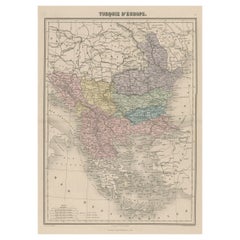
Antique Map of Moldova to Thessaly and from the Adriatic to the Black Sea, 1880
Located in Langweer, NL
Antique map titled 'Turquie d'Europe'.
Map of the european parts of Turkey. The map covers from
Category
1880s Antique European Map
Materials
Paper
H 18.71 in W 13.59 in D 0 in
Scandinavia & Portions of Eastern Europe: 18th Century Hand-Colored Homann Map
By Johann Baptist Homann
Located in Alamo, CA
, becoming the leading map publisher in Germany and an important entity in the European map market. In 1715
Category
Early 18th Century German Antique European Map
Materials
Paper
H 20.75 in W 23.5 in D 0.07 in
Antique Map of France by Homann Heirs, c.1745
Located in Langweer, NL
enjoyed a major place in the European map market throughout the eighteenth century. Founded in 1702 by
Category
18th Century Antique European Map
Materials
Paper
Antique Map of France by Homann, 1738
Located in Langweer, NL
Engravers: Homann Heirs was a German publishing firm that enjoyed a major place in the European map market
Category
18th Century Antique European Map
Materials
Paper
1627 Map Entitled "Loudunois, " Signed on the Back, Ric.a013
Located in Norton, MA
geographical 17th century increased artist European map · 17th-century · geography · double-page · artist
Category
17th Century Dutch Antique European Map
Materials
Paper
Antique Map and Views of Batavia by Homann Heirs, '1733'
Located in Langweer, NL
German publishing firm that enjoyed a major place in the European map market throughout the 18th century
Category
Mid-18th Century Antique European Map
Materials
Paper
Map of Russia with Vignettes of the Neoskoi Prospect, St. Petersburg, ca.1851
Located in Langweer, NL
Antique map titled 'Russia in Europe'.
Map of European Russia. Showing vignettes of the Neoskoi
Category
1850s Antique European Map
Materials
Paper
H 14.38 in W 10.63 in D 0 in
Antique Map of the Region of Namen by Homann, 1746
By Johann Baptist Homann
Located in Langweer, NL
in the European map market throughout the eighteenth century. Founded in 1702 by Johann Baptist
Category
18th Century Antique European Map
Materials
Paper
Antique Map of the Danube River by Homann, c.1720
By Homann Heirs
Located in Langweer, NL
German publishing firm that enjoyed a major place in the European map market throughout the eighteenth
Category
18th Century Antique European Map
Materials
Paper
Hand Colored 18th Century Homann Map of Austria Including Vienna and the Danube
By Johann Baptist Homann
Located in Alamo, CA
European map market. In 1715, Johann was named Imperial Geographer to the Holy Roman Empire by Charles VI
Category
Early 18th Century German Antique European Map
Materials
Paper
H 20.25 in W 23.63 in D 0.07 in
Sweden & Adjacent Portions of Scandinavia: A Hand-Colored 18th C. Map by Homann
By Johann Baptist Homann
Located in Alamo, CA
, becoming the leading map publisher in Germany and an important entity in the European map market. In 1715
Category
1720s German Antique European Map
Materials
Paper
H 21 in W 23.38 in D 0.07 in
Antique Map of the Provinces of Madrid, Toledo and La Mancha by Homann, 1781
Located in Langweer, NL
major place in the European map market throughout the eighteenth century. Founded in 1702 by Johann
Category
18th Century Antique European Map
Materials
Paper
H 24.41 in W 20.67 in D 0 in
Hand-Colored 18th Century Homann Map of the Danube, Italy, Greece, Croatia
By Johann Baptist Homann
Located in Alamo, CA
the leading map publisher in Germany and an important entity in the European map market. In 1715
Category
Early 18th Century German Antique European Map
Materials
Paper
H 20 in W 23.88 in D 0.07 in
18th Century Hand-Colored Homann Map of Germany, Including Frankfurt and Berlin
By Johann Baptist Homann
Located in Alamo, CA
, becoming the leading map publisher in Germany and an important entity in the European map market. In 1715
Category
Early 18th Century German Antique European Map
Materials
Paper
H 20.25 in W 23.5 in D 0.07 in
Antique Map of Harvey Island and Surroundings by Cook, 1803
Located in Langweer, NL
surveyed and named features, and recorded islands and coastlines on European maps for the first time. He
Category
19th Century Antique European Map
Materials
Paper
Free Shipping
H 13.19 in W 16.34 in D 0 in
Danube River Incl Serbia, Moldavia, Transylvania, Romania, Bulgaria Etc, ca.1720
Located in Langweer, NL
Heirs was a German publishing firm that enjoyed a major place in the European map market throughout the
Category
1720s Antique European Map
Materials
Paper
H 20.08 in W 24.41 in D 0 in
Hand-Colored 18th Century Homann Map of Denmark and Islands in the Baltic Sea
By Johann Baptist Homann
Located in Alamo, CA
, becoming the leading map publisher in Germany and an important entity in the European map market. In 1715
Category
Early 18th Century German Antique European Map
Materials
Paper
H 20.25 in W 23.25 in D 0.07 in
The Kingdom of Naples and Southern Italy: A Hand-Colored 18th Century Homann Map
By Johann Baptist Homann
Located in Alamo, CA
and an important entity in the European map market. In 1715, Johann was named Imperial Geographer to
Category
Early 18th Century German Antique European Map
Materials
Paper
H 20 in W 23.88 in D 0.07 in
West Africa Entitled "Guinea Propria": An 18th Century Hand Colored Homann Map
By Johann Baptist Homann
Located in Alamo, CA
flourished, becoming the leading map publisher in Germany and an important entity in the European map market
Category
Mid-18th Century German Antique European Map
Materials
Paper
H 20.5 in W 23.5 in D 0.13 in
Antique Map of Northern Europe and European Russia, ca.1780
Located in Langweer, NL
Antique map titled 'Le Nord de L'Europe, Contenant Le Danemark, La Norwege; La Suede et La Laponie
Category
1780s Antique European Map
Materials
Paper
Antique Map of Europe by Balbi '1847'
Located in Langweer, NL
Antique map titled 'Europe'. Original antique map of Europe. This map originates from 'Abrégé de
Category
Mid-19th Century Antique European Map
Materials
Paper
Antique Map of Europe by Lapie, '1809'
Located in Langweer, NL
Antique map titled 'Europe'. Original antique map of Europe by P. Lapie, published 1809. Frame
Category
Early 19th Century Antique European Map
Materials
Paper
Antique Map of Europe by Wyld '1845'
Located in Langweer, NL
Antique map titled 'Europe'. Original antique map of Europe. This map originates from 'An Atlas of
Category
Mid-19th Century Antique European Map
Materials
Paper
Antique Map of Europe by Johnson, '1872'
Located in Langweer, NL
Antique map titled 'Johnson's Europe'. Original map of Europe. This map originates from 'Johnson's
Category
Late 19th Century Antique European Map
Materials
Paper
Antique Map of Europe by Lowry, 1852
Located in Langweer, NL
Antique map titled 'Europe'. Original map of Europe. This map originates from 'Lowry's Table Atlas
Category
Mid-19th Century Antique European Map
Materials
Paper
Antique Map of Europe by Levasseur, '1875'
Located in Langweer, NL
Antique map titled 'Carte générale de l'Europe'. Large map of Europe. This map originates from
Category
Late 19th Century Antique European Map
Materials
Paper
Antique Map of Europe by Krevelt '1786'
Located in Langweer, NL
Antique map titled 'Nieuwe Generale Kaart van Europa (..)'. Original antique map of Europe. This
Category
Late 18th Century Antique European Map
Materials
Paper
Antique Map of Germany and Central Europe
Located in Langweer, NL
Königreichen und Provincien'. Original antique map of Germany covering the central part of Europe with Germany
Category
Late 17th Century Antique European Map
Materials
Paper
Antique Map of the Europe Continent, 1880
Located in Langweer, NL
Antique map titled 'Europe'. Old map of the European continent. This map originates from
Category
19th Century Antique European Map
Materials
Paper
Original Antique Map of Europe, Arrowsmith, 1820
Located in St Annes, Lancashire
Great map of Europe
Drawn under the direction of Arrowsmith.
Copper-plate engraving
Category
1820s English Antique European Map
Materials
Paper
Antique Map of Old European Russia, 1846
Located in Langweer, NL
Antique map titled 'Russia in Europe'. Old map of European Russia. This map originates from 'A New
Category
19th Century Antique European Map
Materials
Paper
Antique Map of the European Continent, 1882
Located in Langweer, NL
Antique map titled 'Europe'. Old map of the European continent. This map originates from 'The Royal
Category
19th Century Antique European Map
Materials
Paper
Antique European War Folding Map, ‘circa 1915’
Located in Langweer, NL
Antique folding map of the European War (1914-1915) titled 'The Eastern Campaign '. From Petrograd
Category
Early 20th Century Antique European Map
Materials
Paper
1849 Map of "Europaische Russland", 'Meyer Map of European Russia', Ric. R017
Located in Norton, MA
1849 Map of
"Europaische Russland"
( Meyer Map of European Russia)
Ric.r017
A lovely map of
Category
19th Century Unknown Antique European Map
Materials
Paper
H 11.82 in W 9.06 in D 0.4 in
Antique Map of Eastern Europe, Incl Montenegro & Serbia & a Budapest Map, 1890
Located in Langweer, NL
Antique map titled 'Osterreich-Ungarn in 4 Blattern, Blatt 4.'
Map of Eastern Europe, with
Category
1890s Antique European Map
Materials
Paper
H 15.63 in W 19.22 in D 0 in
Original Antique Map of Russia in Europe, 1882
Located in Langweer, NL
Embark on an enthralling journey with an original Antique Map of European Russia from the esteemed
Category
1880s Antique European Map
Materials
Paper
Antique Hand Colored Framed Map of Europe
Located in West Palm Beach, FL
Antique reproduction copied from an edition dated 1595 by Ortelius.
Category
Late 19th Century Antique European Map
Old Original Map of Russia in Europe, 1849
Located in Langweer, NL
Antique map titled 'Russia in Europe'.
Old map of Russia in Europe. This map originates from
Category
1840s Antique European Map
Materials
Paper
Antique Rain Map of Europe by Johnston '1850'
Located in Langweer, NL
Antique map titled 'Hyetographic or Rain Map of Europe'. Original antique rain map of Europe. This
Category
Mid-19th Century Antique European Map
Materials
Paper
Antique Map of Europe by Levasseur 'c.1840'
Located in Langweer, NL
Antique map titled 'Europe'. Original antique map of Europe. Decorative map of the continent
Category
Mid-19th Century Antique European Map
Materials
Paper
Antique Map of Turkey in Europe, c.1780
Located in Langweer, NL
Antique map titled 'Bowles's new pocket map of Turky in Europe divided into its Provinces'. Large
Category
18th Century Antique European Map
Materials
Paper
Original Antique Map of West Europe, circa 1870
Located in Langweer, NL
Antique map titled 'Gallia, Britannia, Germania'. Old map of West Europe including France, Germany
Category
19th Century Antique European Map
Materials
Paper
Antique Map of Celtic Europe by Cluver, 1678
Located in Langweer, NL
Antique map Europe titled 'Europam sive Celticam Veterem'. Rare map of Celtic Europe. Made after A
Category
17th Century Antique European Map
Materials
Paper
Hand-Colored 18th Century Homann Map of the Black Sea, Turkey and Asia Minor
By Johann Baptist Homann
Located in Alamo, CA
and an important entity in the European map market. In 1715, Johann was named Imperial Geographer to
Category
Early 18th Century German Antique European Map
Materials
Paper
H 20 in W 23.63 in D 0.07 in
Antique Map of Europe by Hederichs, circa 1740
Located in Langweer, NL
Antique map titled 'Europa Christiani Orbis Domina'. Rare miniature map of Europe. This map
Category
Mid-18th Century Antique European Map
Materials
Paper
Map Turkey in Europe & Hungary Thomas Kitchin, 1783
Located in BUNGAY, SUFFOLK
Thomas Kitchen (1718 - 1784) : Map of Turkey in Europe & Hungary 1783
Visible sheet within the
Category
18th Century English Georgian Antique European Map
Materials
Paper
Antique Map of Eastern Europe by Stieler, 1890
Located in Langweer, NL
Antique map titled 'Osterreich-Ungarn in 4 Blattern, Blatt 4.' Map of Eastern Europe, with
Category
19th Century Antique European Map
Materials
Paper
17th Century Nicolas Visscher Map of Southeastern Europe
Located in Hamilton, Ontario
A beautiful, highly detailed map of southeastern Europe by Nicolas Visscher. Includes regions of
Category
17th Century Dutch Antique European Map
Materials
Paper
Antique Map of Europe by R. Bonne, 1780
Located in Langweer, NL
A fine example of Rigobert Bonne and Guilleme Raynal’s 1780 map of Europe. Drawn by R. Bonne for G
Category
Late 18th Century Antique European Map
Materials
Paper
Colorful Detailed Antique Map of Europe, Published in 1882
Located in Langweer, NL
"The Antique Map of Europe from 'The Comprehensive Atlas and Geography of the World,' published in
Category
1880s Antique European Map
Materials
Paper
Antique Map of Europe by W. G. Blackie, 1859
Located in Langweer, NL
Antique map titled 'Europe'. Original antique map of Europe. This map originates from ‘The Imperial
Category
Mid-19th Century Antique European Map
Materials
Paper
Antique Map of Russia in Europe by Johnston (1909)
Located in Langweer, NL
Antique map titled 'European Russia'. Original antique map of Russia in Europe. With inset maps of
Category
Early 20th Century Antique European Map
Materials
Paper
- 1
- ...
Get Updated with New Arrivals
Save "Antique European Map", and we’ll notify you when there are new listings in this category.
Antique European Map For Sale on 1stDibs
Find many varieties of an authentic antique European map available at 1stDibs. Frequently made of paper, wood and fabric, every antique European map was constructed with great care. You’ve searched high and low for the perfect antique European map — we have versions that date back to the 18th Century alongside those produced as recently as the 20th Century are available. When you’re browsing for the right antique European map, those designed in Baroque, Georgian and Industrial styles are of considerable interest. Many designers have produced at least one well-made antique European map over the years, but those crafted by Jacques-Nicolas Bellin, Emanuel Bowen and Frederick de Wit are often thought to be among the most beautiful.
How Much is a Antique European Map?
An antique European map can differ in price owing to various characteristics — the average selling price 1stDibs is $434, while the lowest priced sells for $50 and the highest can go for as much as $12,500.
