Ethiopia Antique Map

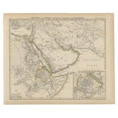
Antique Map of Africa and Arabia with Inset Map of Ethiopia and Eritrea, 1845
Located in Langweer, NL
Central Africa and Arabia with an inset map of Habesch (Ethiopia and Eritrea). Artists and Engravers
Category

19th Century Ethiopia Antique Map

Materials

Paper

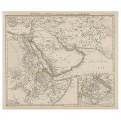
North & Central Africa & Arabia, Inset Map of Habesch 'Ethiopia & Eritrea', 1845
Located in Langweer, NL
and Central Africa and Arabia with an inset map of Habesch (Ethiopia and Eritrea). Artists and
Category

1840s Ethiopia Antique Map

Materials

Paper

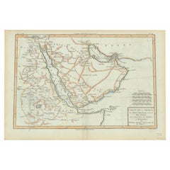
Old Map of the Arabian Peninsula with Parts of Egypt, Sudan, Eritrea & Ethiopia
Located in Langweer, NL
du Globe Terrestre This handsome map of the Arabian Peninsula extends to show parts of Egypt, Sudan
Category

1780s Ethiopia Antique Map

Materials

Paper

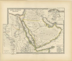
Ancient Realms of Northeast Africa: Arabia, Ethiopia, and Egypt, Published 1880
Located in Langweer, NL
This map, titled "ARABIA, AETHIOPIA, AEGYPTUS," illustrates the regions of ancient Arabia, Ethiopia
Category

1880s Ethiopia Antique Map

Materials

Paper

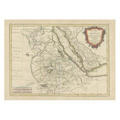
Original Antique Map of Abyssinia, Sudan and the Red Sea, 1749
Located in Langweer, NL
Antique map titled 'Nubie, Abissinie et Cote d'Ajan'. Map of Abyssinia, Sudan and the Red Sea by
Category

1740s Ethiopia Antique Map

Materials

Paper

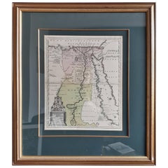
Original Antique Map of Egypt in Frame by C. Weigel, circa 1720
Located in Langweer, NL
The map is an antique depiction of ancient Egypt, divided into its regions and nomes, also
Category

Early 18th Century Ethiopia Antique Map

Materials

Paper

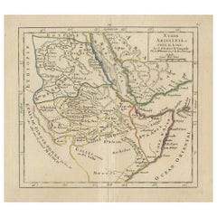
Antique Map of Arabia including Nubia and Abyssinia, also shows the Red Sea
Located in Langweer, NL
river, and Abyssinia or the Ethiopian Empire. This map originates from 'Atlas moderne ou collection de
Category

Late 18th Century Ethiopia Antique Map

Materials

Paper

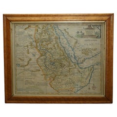
London 1744 Published Watercolour Antique Map of East Africa by Eman Bowen
Located in GB
Medin. The map centres on Nubia and Ethiopia, it is very detailed, with lots of annotations in English
Category

1740s English George III Ethiopia Antique Map

Materials

Paper

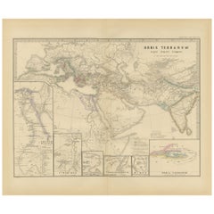
The World in the Assyrian Empire's Era: A Historical Map, Published in 1880
Located in Langweer, NL
This map from the "Spruner-Menke Atlas Antiquus" is titled "ORBIS TERRARVM regni Assyrii tempore
Category

1880s Ethiopia Antique Map

Materials

Paper

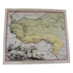
West Africa Entitled "Guinea Propria": An 18th Century Hand Colored Homann Map
By Johann Baptist Homann
Located in Alamo, CA
This is a scarce richly hand colored copper plate engraved map of Africa entitled "Guinea Propria
Category

Mid-18th Century German Ethiopia Antique Map

Materials

Paper

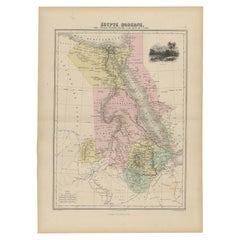
Antique Map of The Nile, Egypt, Nubia and Abyssinia and Inset of Jerusalem, 1880
Located in Langweer, NL
Antique map titled 'Égypte Moderne'. Old map of Egypt, Nubia and Abyssinia (Ethiopia), Kordofan and
Category

19th Century Ethiopia Antique Map

Materials

Paper

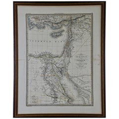
Map of the Holy Land "Carte de la Syrie et de l'Egypte" by Pierre M. Lapie
By Pierre M. Lapie
Located in Alamo, CA
, including Ethiopia, Asia Minor and Mesopotoamia. The map is hand-colored in outline. It is presented in a
Category

Early 19th Century French Ethiopia Antique Map

Materials

Paper

Antique Print of a Member of the Order of Saint Anthony, Ethiopia, 1845
Located in Langweer, NL
: 9 x 16 cm. We sell original antique maps to collectors, historians, educators and interior
Category

19th Century Ethiopia Antique Map

Materials

Paper

West Africa: 18th Century Hand-colored Homann Map Entitled "Guinea Propria"
By Johann Baptist Homann
Located in Alamo, CA
This is a scarce richly hand colored copper plate engraved map of Africa entitled "Guinea Propria
Category

1740s Other Art Style Ethiopia Antique Map

Materials

Engraving

Persia, Armenia & Adjacent Regions: A Hand-colored 17th Century Map by De Wit
By Frederick de Wit
Located in Alamo, CA
This colorful and detailed 17th century copperplate map by Frederick De Wit was published in
Category

Late 17th Century Old Masters Ethiopia Antique Map

Materials

Engraving

Map of the Holy Land "Carte de la Syrie et de l'Egypte" by Pierre Lapie
By Pierre M. Lapie
Located in Alamo, CA
the south, including Ethiopia, Asia Minor and Mesopotoamia. The map is hand-colored in outline. It
Category

1830s Ethiopia Antique Map

Materials

Engraving

A huge pair of 21 inches Cruchley Library Globes
By G.F. Cruchley
Located in ZWIJNDRECHT, NL
, published by G.F. Cruchley, map-seller & globe maker, 81 Fleet street. Signed: CRUCHLEY in London England
Category

1850s British Victorian Ethiopia Antique Map

Materials

Other

A truly delightful miniature terrestrial pocket globe
By Nathaniel Mills
Located in ZWIJNDRECHT, NL
turning overhead. In line with its counterpart, the terrestrial globe, celestial globes are mapped by a
Category

Mid-18th Century British Dutch Colonial Ethiopia Antique Map

Materials

Other

People Also Browsed

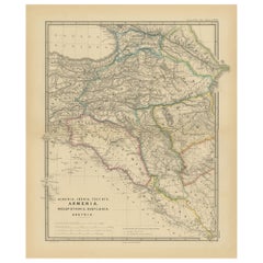
Ancient Crossroads: Albania to Assyria in Antiquity, Published in 1880
Located in Langweer, NL
The map titled "ALBANIA, IBERIA, COLCHIS, ARMENIA, MESOPOTAMIA, BABYLONIA, ASSYRIA" portrays the ancient regions that would encompass parts of modern-day Eastern Turkey, Armenia, Aze...
Category

1880s Ethiopia Antique Map

Materials

Paper

Early 20th Century Syrian Oversized Side Table
Located in London, GB
Early 20th Century Syrian Oversized Side Table A rare example due to its share size, this early 20th century example of a hand-crafted Syrian side table is a real interior designe...
Category

1920s Late Victorian Ethiopia Antique Map

Materials

Wood

Mamluk revival Quran casket, Damascus, c. 1900.
By Mamluke
Located in Gargrave, North Yorkshire
Mamluk revival brass Quran casket, Damascus, c. 1900. Inlaid in silver and copper, with Quranic inscriptions, in thuluth and kufic script, amongst elaborate floral scroll, to both th...
Category

Early 1900s Syrian Islamic Ethiopia Antique Map

Materials

Brass

Islamic Inlaid Side Table
Located in Leamington Spa, Warwickshire
Small inlaid Islamic lamp / side table. 1890. Reference: 8267 Dimensions 22.5 inches (57 cms) High 18.5 inches (47 cms) Diameter
Category

19th Century Syrian Ethiopia Antique Map

Materials

Wood

Islamic Inlaid Side Table
H 22.5 in Dm 18.5 in
Framed Antique Coptic Textile
Located in Atlanta, GA
A small piece of antique coptic textile woven as a horizontal band with two linear Greek key borders flanking the central designs clustered in smaller abstract medallion forms, in th...
Category

15th Century and Earlier Egyptian Archaistic Ethiopia Antique Map

Materials

Wood, Wool

Framed Antique Coptic Textile
H 10 in W 19 in D 0.5 in
Authentic Antique Map of the Caribbean, Gulf Coast and Central America, 1787
Located in Langweer, NL
Antique map titled 'Les Isles Antilles et le Golfe du Méxique'. Original old map of the Caribbean, Gulf Coast and Central America. With inset map of Bermuda. Originates from 'Histoir...
Category

Late 18th Century Ethiopia Antique Map

Materials

Paper

Ethiopian Coptic Processional Cross
Located in Los Angeles, CA
Very unique Ethiopian processional cross, brass, early 20th century. Base is covered in Yves Klein Blue lucite measuring 12.5" D x 16.5" W x 6" H Provenance: Collection of Lillian Fl...
Category

Early 20th Century Ethiopia Antique Map

Materials

Brass

Ethiopian Coptic Processional Cross
H 34 in W 24.5 in D 12.5 in
1900s Antique Syrian Corner Armchairs: Timeless Elegance & Craftsmanship
Located in Los Angeles, CA
Experience the historical elegance of our pair of circa 1900s antique Syrian corner armchairs, showcasing unparalleled craftsmanship and timeless design. These exquisite chairs have ...
Category

Early 1900s Syrian Other Ethiopia Antique Map

Materials

Fabric, Upholstery, Velvet, Foam, Wood

African Shield Oromo from Ethiopia Early 20th Century
Located in Paris, FR
African shield Oromo from Ethiopia, early 20th century. Base 34 x 20cm.
Category

Early 20th Century Ethiopian Ethiopia Antique Map

Materials

Leather

Historical Map of Canaan with Insets of Jerusalem and Surrounding Regions, 1880
Located in Langweer, NL
The map titled "CANAAN" depicts the historical region known as Canaan, located in the Levant, which corresponds to modern-day Israel, Palestinian territories, Lebanon, and parts of S...
Category

1880s Ethiopia Antique Map

Materials

Paper

Unusual cupboard with intricate Moucharbiya panels, French c1870.
Located in London, GB
An unusual cupboard with intricate moucharabiya panels and Moorish architectural detail. French c1870. ‘Orientalism’ was extremely fashionable at the end of the 19th Century, furni...
Category

1870s French Ethiopia Antique Map

Materials

Wood

Old Map of The Mughal Empire and the Indian Peninsula South of the Ganges, 1787
Located in Langweer, NL
This is a historical map titled "L'Empire Du Mogol, Et La Presqu Isle De L'Inde En Deca Du Gange." An original authentic map, created by Rigobert Bonne (1727-1794), an influential ...
Category

1780s Ethiopia Antique Map

Materials

Paper

Bronze Currency Bangle/Manilla, Oromo People, Burkina Faso, Ethiopia, 19th C.
Located in Aramits, Nouvelle-Aquitaine
19th-century bronze currency bangle / Manilla with a fixed opening. Minimalist, simple design work with engraved geometrical circles and lines. This type of bracelet was used and wor...
Category

Mid-19th Century Ethiopian Tribal Ethiopia Antique Map

Materials

Bronze

African Shield Wallaïta from Ethiopia Early 20th Century
Located in Paris, FR
African shield Wallaïta from Ethiopia, early 20th century. Base: 40 x 17cm.
Category

Early 20th Century Ethiopian Ethiopia Antique Map

Materials

Leather

Moorish Mother of Pearl Games Table
Located in Brooklyn, NY
Antique Moorish mother of pearl inlaid games table, likely Syrian. Table includes chess board (on red felt), backgammon and checkers. Fifteen backgammon pieces and die included. In a...
Category

Early 20th Century Syrian Moorish Ethiopia Antique Map

Materials

Wood, Mother-of-Pearl

Moorish Mother of Pearl Games Table
H 33 in W 34.5 in D 17 in
Bible, Biblia Sacra, Utrecht, Cornelius Guillielmus Le Febvre, 1732
Located in Delft, NL
Bible,, Biblia Sacra, dat is, de H. Schriftuer van het Oude, en het Nieuwe Testament, Naar de laetste Roomsche Keure der gemeine Latijnsche Overzettinge, in nederduitsch Vertaeld, me...
Category

18th Century Dutch Ethiopia Antique Map

Materials

Leather, Paper

Recent Sales

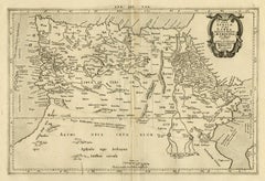
Ptolemaic map of North Africa, Libya, Egypt by Mercator - Engraving - 17th c
By Gerard Mercator
Located in Zeeland, Noord-Brabant
(…).' - A beautiful Ptolemaic map covering ancient North Africa, specifically Libya and part of Ethiopia but
Category

1690s Old Masters Ethiopia Antique Map

Materials

Engraving

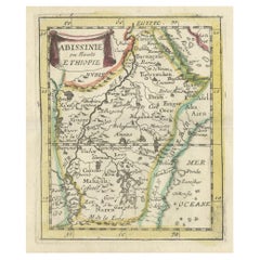
Antique Miniature Map of Abyssinia or Ethiopia, 1688
Located in Langweer, NL
Antique map titled 'Abissinie ou Haute Ethiopie'. Miniature map of Ethiopia, this map originates
Category

17th Century Ethiopia Antique Map

Materials

Paper

Antique Map of Abyssinia 'Ethiopia' Incl a Part of Arabia & the Red Sea, 1794
Located in Langweer, NL
Antique map titled 'Landkaart van Abyssinie, door James Bruce'. Rare map of Abessinia (Ethiopia
Category

18th Century Ethiopia Antique Map

Materials

Paper

Map of Africa by Tanner
Located in Alamo, CA
An early to mid 19th century hand-colored map of Africa by Henry Schenk Tanner, published in
Category

Mid-19th Century Other Art Style Ethiopia Antique Map

Materials

Engraving

Important giant Map of Africa, for the King of France, 1698
By Nicolas de Fer
Located in Amsterdam, NL
copperplates, later hand colouring, 109.5 x 163 cm (Find our Giant map of Africa by the same artist in our
Category

Late 17th Century Old Masters Ethiopia Antique Map

Materials

Watercolor, Engraving

Antique Map of Ethiopia 'Africa' by H. Ludolf, 1683
Located in Langweer, NL
Antique map titled 'Habessinia & Abassia (..)'. Highly decorative map showing Ethiopia with its
Category

Late 17th Century Ethiopia Antique Map

Materials

Paper

Rare Old Map of Abessinia 'Ethiopia' Incl. a Part of Arabia & the Red Sea, 1794
Located in Langweer, NL
Antique map titled 'Landkaart van Abyssinie, door James Bruce'. Rare map of Abessinia (Ethiopia
Category

1790s Ethiopia Antique Map

Materials

Paper

19th Century Hand-Colored Map of Africa by Henry Tanner
By Henry Schenck Tanner
Located in Alamo, CA
An early to mid-19th century hand-colored map of Africa by Henry Schenk Tanner, published in
Category

Mid-19th Century American Ethiopia Antique Map

Materials

Paper

Antique Map of Arabia and Part of Africa, c.1780
Located in Langweer, NL
Antique map titled 'Carte de l'Arabie du Golfe Persique et de la Mer Rouge, avec l Egypte, La Nubie
Category

18th Century Ethiopia Antique Map

Materials

Paper

Antique Map of Egypt and Palestine, with Frame Style Border, 1852
Located in Langweer, NL
This antique map, titled "Égypte Palestine et Phénicie," presents a detailed depiction of the
Category

Mid-19th Century Ethiopia Antique Map

Materials

Paper

Antique Map of Arabia and the Red Sea by Bonne, 1780
Located in Langweer, NL
Antique map titled 'Carte de l'Arabie du Golfe Persique et de la Mer Rouge, avec l Egypte, La Nubie
Category

18th Century Ethiopia Antique Map

Materials

Paper

Antique Map of Abyssinia, Sudan and the Red Sea by Vaugondy, 1750
Located in Langweer, NL
Antique map titled 'Nubie, Abissinie et Cote d'Ajan'. Map of Abyssinia, Sudan and the Red Sea by
Category

18th Century Ethiopia Antique Map

Materials

Paper

Collection of Antique Prints of Robert Napier and the Magdala Expedition, 1870
Located in Langweer, NL
", depicts the rugged terrain of the Sooroo Pass in Abyssinia (present-day Ethiopia). The work originates
Category

1870s Ethiopia Antique Map

Materials

Paper

Antique Map of Abyssinia, Sudan and the Red Sea, Arabia and Egypt South, 1749
Located in Langweer, NL
Antique map titled 'Nubie, Abissinie et Cote d'Ajan'. Map of Abyssinia, Sudan and the Red Sea by
Category

18th Century Ethiopia Antique Map

Materials

Paper

Get Updated with New Arrivals
Save "Ethiopia Antique Map", and we’ll notify you when there are new listings in this category.

Ethiopia Antique Map For Sale on 1stDibs

Find many varieties of an authentic ethiopia antique map available at 1stDibs. A ethiopia antique map — often made from paper, mahogany and wood — can elevate any home. There are many kinds of the ethiopia antique map you’re looking for, from those produced as long ago as the 18th Century to those made as recently as the 19th Century. A ethiopia antique map, designed in the Georgian style, is generally a popular piece of furniture. Many designers have produced at least one well-made ethiopia antique map over the years, but those crafted by G.F. Cruchley's, Johann Baptist Homann and Pierre M. Lapie are often thought to be among the most beautiful.

How Much is a Ethiopia Antique Map?

Prices for a ethiopia antique map start at $197 and top out at $240,832 with the average selling for $775.

Read More

Pamela Shamshiri Shares the Secrets behind Her First-Ever Book and Its Effortlessly Cool Interiors

The sought-after designer worked with the team at Hoffman Creative to produce a monograph that beautifully showcases some of Studio Shamshiri's most inspiring projects.

Moroccan Artworks and Objects Take Center Stage in an Extraordinary Villa in Tangier

Italian writer and collector Umberto Pasti opens the doors to his remarkable cave of wonders in North Africa.

Montecito Has Drawn Royalty and Celebrities, and These Homes Are Proof of Its Allure

Hollywood A-listers, ex-pat aristocrats and art collectors and style setters of all stripes appreciate the allure of the coastal California hamlet — much on our minds after recent winter floods.

Whaam! Blam! Pow! — a New Book on Pop Art Packs a Punch

Publishing house Assouline and writer Julie Belcove have teamed up to trace the history of the genre, from Roy Lichtenstein, Andy Warhol and Yayoi Kusama to Mickalene Thomas and Jeff Koons.

The Sparkling Legacy of Tiffany & Co. Explained, One Jewel at a Time

A gorgeous new book celebrates — and memorializes — the iconic jeweler’s rich heritage.

What Makes a Gem-Encrusted Chess Set Worth $4 Million?

The world’s most opulent chess set, weighing in at 513 carats, is literally fit for a king and queen.

Tauba Auerbach’s Geometric Pop-Up Book Is Mighty Rare, Thanks to a Hurricane

This sculptural art book has an epic backstory of its own.

Step inside the Storied Mansions of Palm Beach’s Most Effervescent Architect

From Spanish-style courtyards to fanciful fountains, these acclaimed structures abound in surprising and elegant details.