Items Similar to Map Shropshire Joseph Ellis Robert Sayer Carington Bowles Framed
Want more images or videos?
Request additional images or videos from the seller
1 of 6
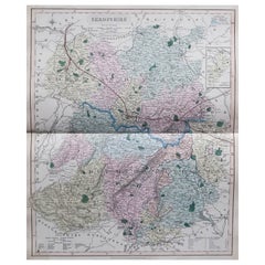
Map Shropshire Joseph Ellis Robert Sayer Carington Bowles Framed
About the Item
A modern map of Shropshire Drawn from the latest surveys corrected and improved by the best authorities.
Artist Joseph Ellis sculptor.
Joseph Ellis was an engraver and publisher from Clerkenwell in London and was apprenticed to Richard William Seale in 1749. He is best know to county map collectors for The New English Atlas published in 1765 which was later reissued as Ellis's English Atlas in 1766, 1768 1777, 1786, 1790 and 1796.
Maker carington bowles 1724 - 1793.
Carington Bowles worked in London as a publisher in partnership with his father John Bowles from about 1752 until 1763. Carington Bowles worked as a publisher in partnership with his father John Bowles from about 1752 until 1763 before taking over his uncle's business. His address was 69 St. Pauls Church Yard, London. He worked with a number of well known cartographers of the day including Emanuel Bowen, Thomas Kitchin, Robert Sayer and John Ellis.
Bibliography Printed for Robert Sayer in Fleet Street & Carington Bowles in St Pauls Church Yard
- Dimensions:Height: 15.36 in (39 cm)Width: 13 in (33 cm)Depth: 1.19 in (3 cm)
- Style:Georgian (Of the Period)
- Materials and Techniques:
- Place of Origin:
- Period:
- Date of Manufacture:circa 1766
- Condition:Wear consistent with age and use.
- Seller Location:BUNGAY, GB
- Reference Number:1stDibs: LU3867332642102
About the Seller
5.0
Vetted Seller
These experienced sellers undergo a comprehensive evaluation by our team of in-house experts.
Established in 1985
1stDibs seller since 2018
85 sales on 1stDibs
Typical response time: 12 hours
- ShippingRetrieving quote...Ships From: BUNGAY, United Kingdom
- Return PolicyA return for this item may be initiated within 7 days of delivery.
More From This SellerView All
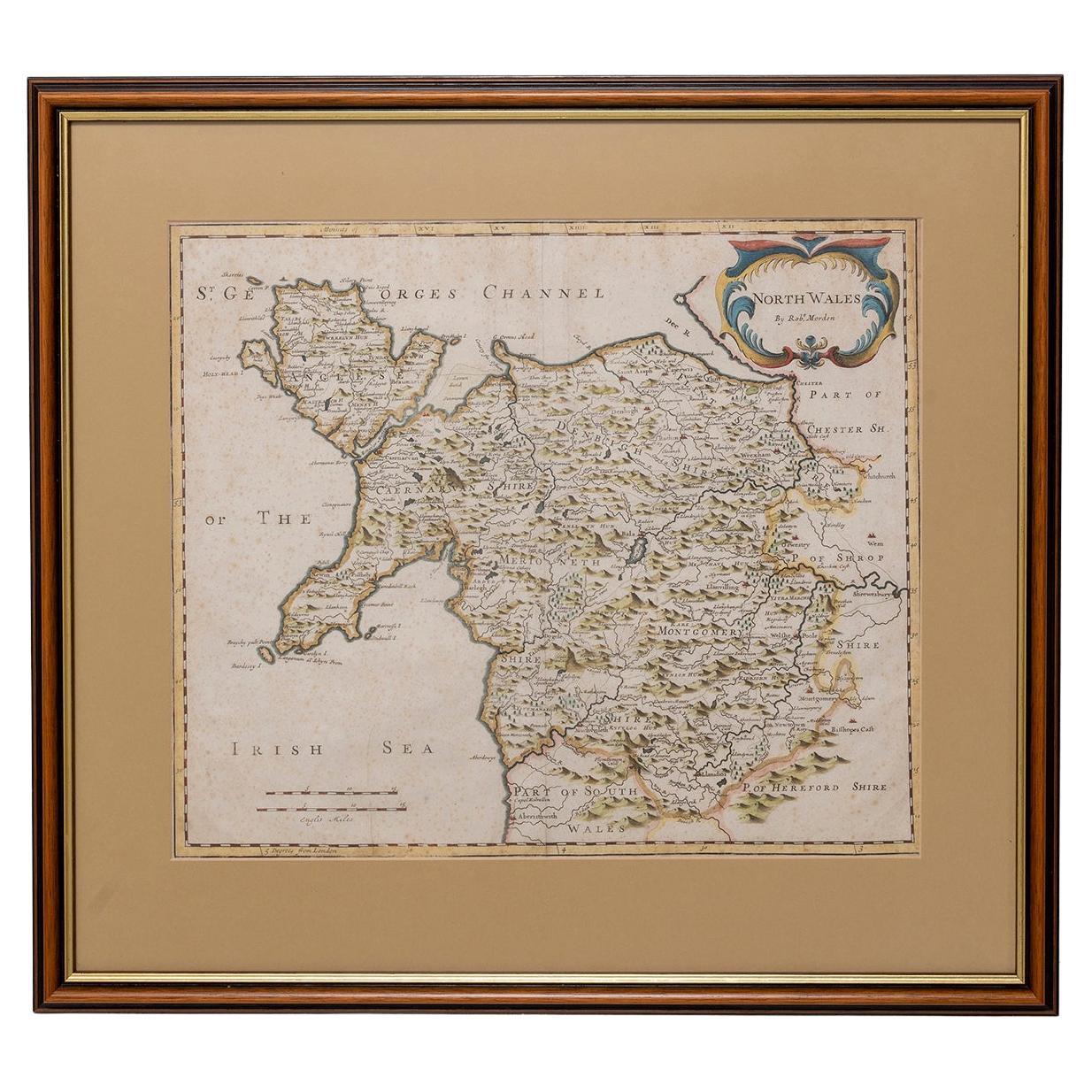
- Map North Wales Robert Marsden AngleseyLocated in BUNGAY, SUFFOLKMap of North Wales by Robert Marsden Including Anglesey Charming topography and detail and colouring just purchased more information to follow.Category
Antique 18th Century English Georgian Maps
MaterialsPaper
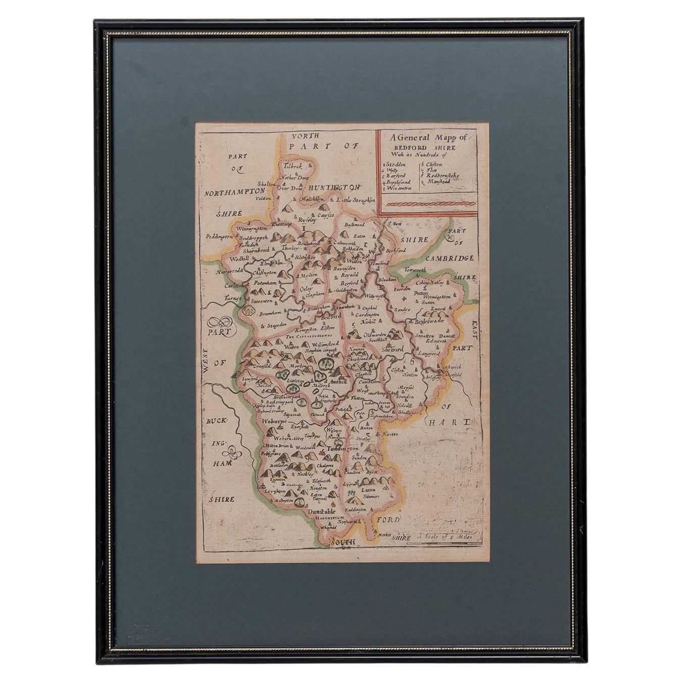
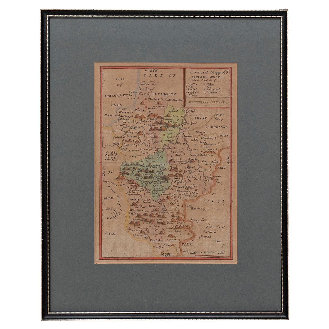
- Map Bedfordshire General FramedLocated in BUNGAY, SUFFOLKA general map of Bedfordshire with its hundreds A scale of 5 miles in the original green mount and traditional black and gold frame. Measures: 36cm 14" high.Category
Antique 18th Century English Georgian Maps
MaterialsPaper
- Map Bedfordshire No 3 General FramedLocated in BUNGAY, SUFFOLKA general map of Bedfordshire with its hundreds. Measure: 37cm 14 1/2" high A scale of 5 miles. in the original green mount and traditional black and gold frame. charming map with...Category
Antique 18th Century English Georgian Maps
MaterialsPaper
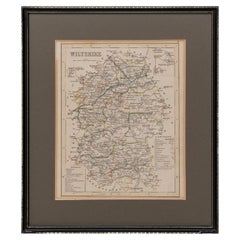
- Map Wiltshire Joshua Archer Pentonville London framed 35cm 14" highLocated in BUNGAY, SUFFOLKMap of Wiltshire Drawn & Engraved by Joshua Archer Pentonville London Window Parts of Wiltshire in Berkshire Explanation of Salisbury County DivisionsCategory
Antique 19th Century English Georgian Maps
MaterialsPaper
- Map Holy Promise Land Canaan Richard Palmer Richard Blome 1687 Joseph MoxonLocated in BUNGAY, SUFFOLKCanaan comonly called the Holy Land or the Land of Promise, being the Possesion of the Israelites & travelled through by Our Lord & Saviour Iesus Christ and his Apostles. Engraven by Richard Palmer for Richard Blome. 1687 Blome, Richard, 1641-1705. London. 283 x 452 mm. Copperplate. Probably from an English Bible...Category
Antique 17th Century British Baroque Maps
MaterialsPaper
- Road Map, John Ogilby, London, Barwick, York, Chester, Darlington, Durham FramedBy John OgilbyLocated in BUNGAY, SUFFOLKThe continuation of the road from London to Barwick beginning at York and extending to Chester in ye Street. Plate ye 4th continuing 76 ½ miles. No 8. York to Burrowbridge, to Top...Category
Antique 1670s English Baroque Maps
MaterialsPaper


You May Also Like
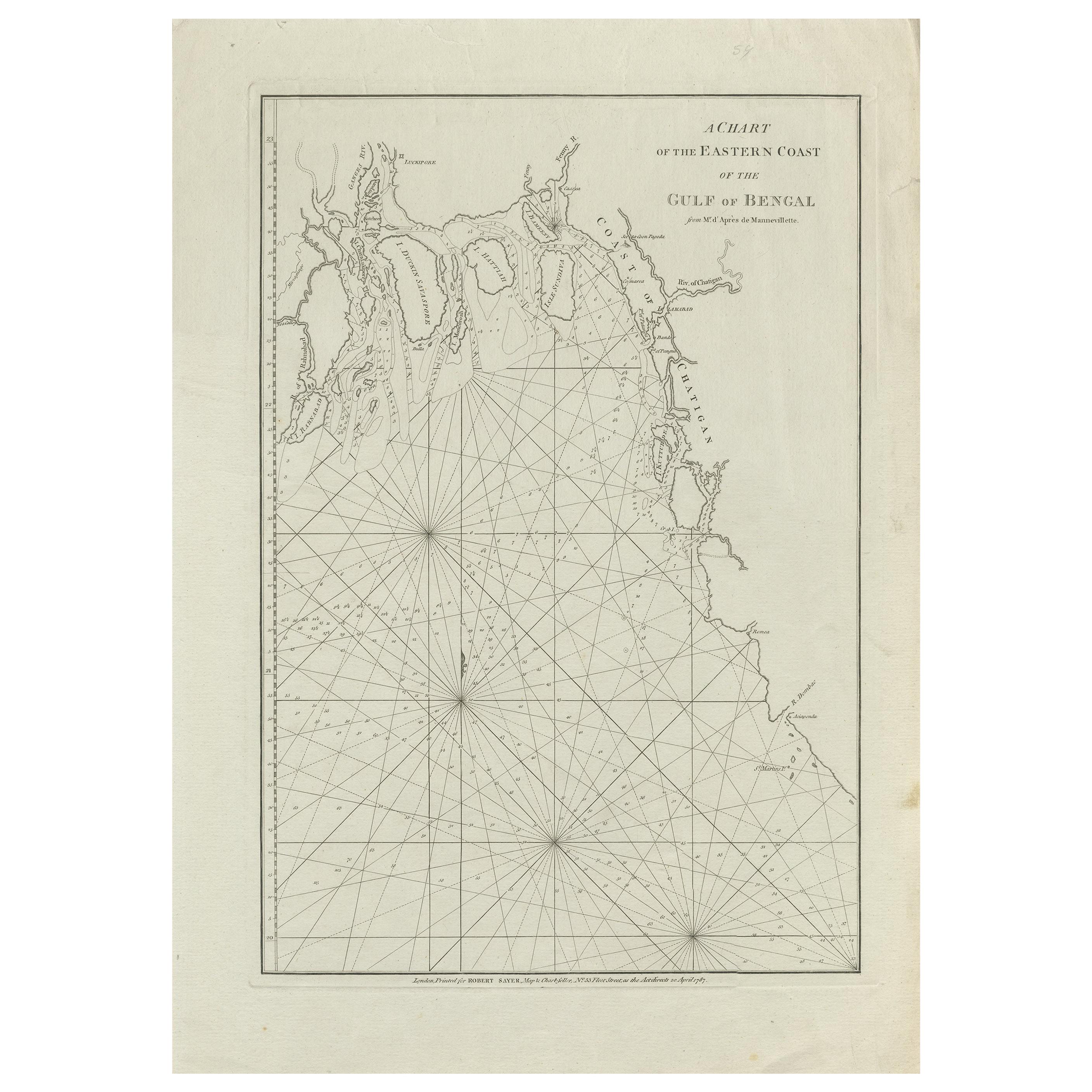
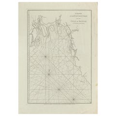
- Antique Map of the Bay of Bengal Printed for Robert Sayer, 1787Located in Langweer, NLAntique map titled 'A Chart of the Eastern Coast of the Gulf of Bengal'. Original antique map of the Bay of Bengal. The Bay of Bengal is the northeastern...Category
Antique Late 18th Century Maps
MaterialsPaper
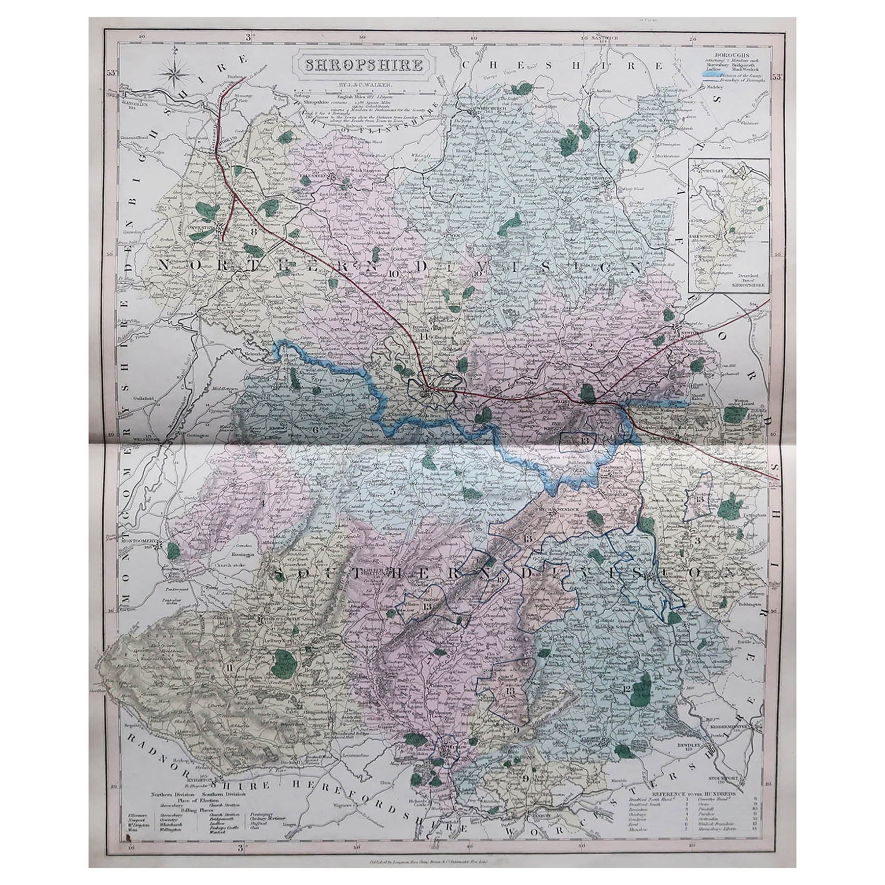
- Original Antique English County Map, Shropshire. J & C Walker, 1851Located in St Annes, LancashireGreat map of Shropshire Original colour By J & C Walker Published by Longman, Rees, Orme, Brown & Co. 1851 Unframed.Category
Antique 1850s English Other Maps
MaterialsPaper
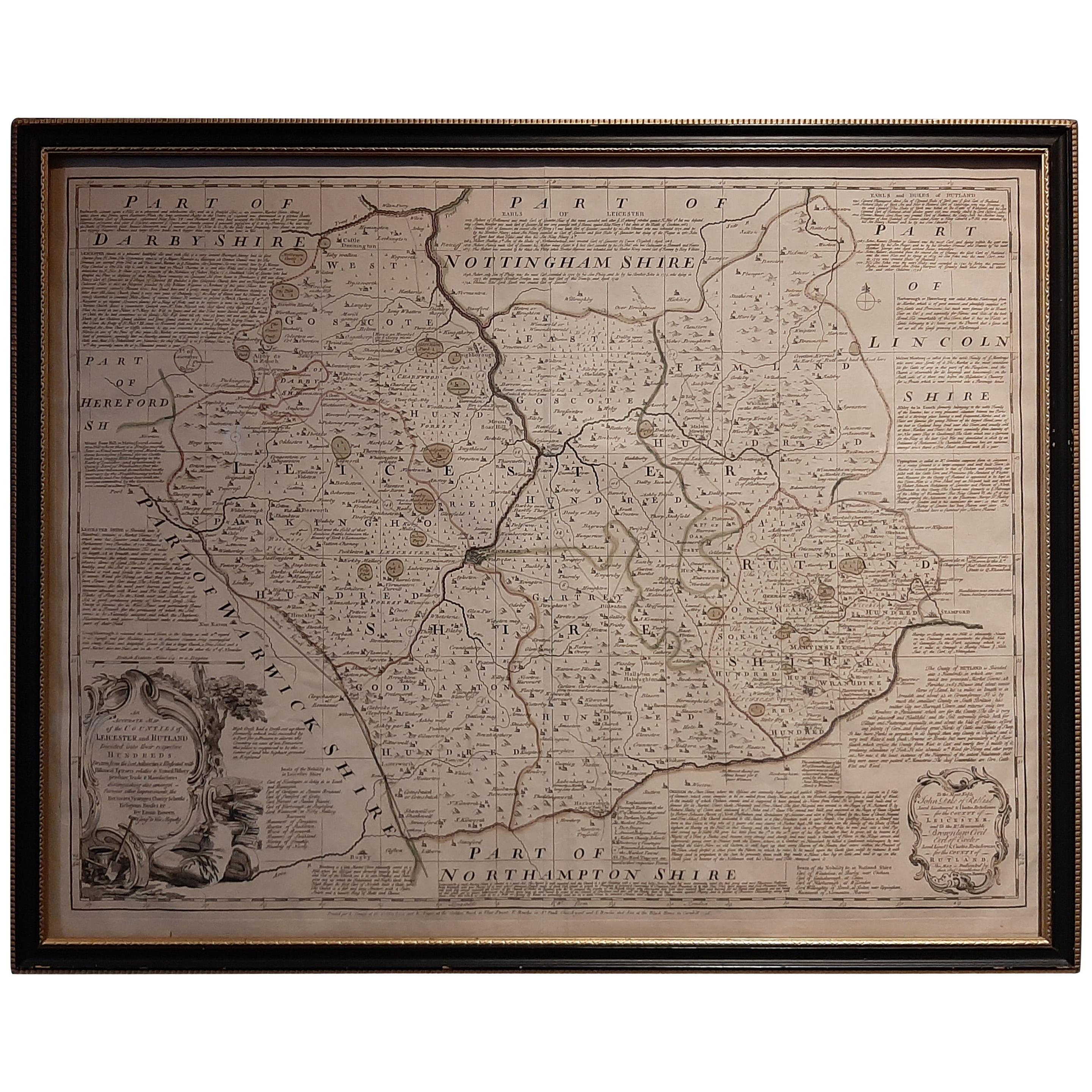
- Antique Map of Leicester and Rutland by Tinney & Sayer, 'circa 1756'Located in Langweer, NLAntique map titled 'An Accurate Map of the Counties of Leicester and Rutland (..)'. Large map of Leicester and Rutland with dedications to the Most Noble John Duke of Rutland, and to...Category
Antique Mid-18th Century Maps
MaterialsPaper
- Framed Map of ChinaLocated in Greenwich, CTMap of China, 19th century. European print map of China Conservation frame with walnut frame Overall dimension : 28 1/2" wide 31" high 2" depth with fra...Category
Antique 19th Century European Qing Prints
MaterialsPaper
- Antique Map of Quinam and the Côn ?ao Islands by Sayer, 1778Located in Langweer, NLAntique map titled 'A Chart of a part of the Coast of Cochinchina' and 'Plan of Pulo Condor'. Two maps on one sheet. The upper map shows part of the coast of Cochinchina from Cham Co...Category
Antique 18th Century Maps
MaterialsPaper
- Vintage Framed United States MapLocated in New York, NYVintage aged paper map of the United States mounted on particle board and framed in a simple wooden frame.Category
20th Century American Mid-Century Modern Maps
MaterialsWood, Paper


Recently Viewed
View AllMore Ways To Browse
Antique Improver
Antique Church Collectibles
Antique Survey
St Joseph Antique
Fleet Furniture Antique
Antique Furniture St Paul
18th Century English Bowl
New England 1790
Antique Furniture Shropshire
Fleet Street
Framed Atlas Map
Joseph Bowles
Antique English County Maps
Emanuel County
Georgia Map
Antique Georgia Maps
Antique Georgia Map
Church Yard