Items Similar to Map of Tasmania with Illustrations of Local Fauna and Colonial Landmarks, 1851


Want more images or videos?
Request additional images or videos from the seller
Map of Tasmania with Illustrations of Local Fauna and Colonial Landmarks, 1851
About the Item
John Tallis & Company was renowned for their detailed and ornate maps during the 19th century. Their maps are distinguished by the intricate borders and vignettes that are as informative as they are decorative.
The map is of Tasmania, known at the time as Van Diemen's Land, which was a significant British colony. Tasmania was an important outpost of the British Empire, largely due to its use as a penal colony, its strategic location, and its natural resources.
Robert Montgomery Martin's texts accompanying such maps often provided detailed descriptions of the colonial economies, geography, and insights into the British perspective on these distant territories. His work was a reflection of the Victorian era’s interest in the empire and its desire to document and understand its distant lands.
The countries and areas depicted in the Tallis series, like Tasmania, would be illustrated with great attention to detail. Key landmarks, topography, and regional borders would be carefully delineated. Insets on this map of Tasmania, for instance, may feature Hobart Town, which was a major administrative center, and might also include other significant locales or aspects of local interest such as fauna, flora, and important buildings.
The Tallis series serves as a visual record of the time, showcasing the British Empire’s reach and the period's aesthetic in map-making. These maps are now valuable historical documents, revealing how the British perceived and interacted with their colonies, and they are sought after for their combination of artistic merit and historical significance.
The images in more detail:
The images are detailed illustrations that complement the cartography of the Tallis map of Tasmania, providing a richer context of the island's features and colonial life:
1. **Thylacinus cynocephalus**: Also known as the Tasmanian tiger or thylacine, this image depicts the now-extinct carnivorous marsupial that was native to Tasmania. It is shown in a naturalistic pose, possibly on a rock or hill, set against a backdrop of sparse vegetation, symbolizing its existence in the wild Tasmanian landscape.
2. **Residence of the V.D.L. Company's Agent, Circular Head**: This vignette illustrates a stately residence, likely belonging to an agent of the Van Diemen's Land Company, a powerful agricultural company. The image shows a grand home surrounded by gardens, indicating the wealth and influence of the company within the colony. People are depicted strolling near the residence, suggesting a tranquil life away from the mainland's bustle.
3. **Hobart Town**: This illustration likely captures the early colonial period of Hobart, the capital city of Tasmania. It presents a view of the city from the water, showcasing the town's port with ships anchored in the bay, Mount Wellington in the background, and the city's buildings spreading out from the waterfront, indicating its status as a bustling port and administrative center.
These images serve not only as aesthetic enhancements to the map but also provide insights into the natural history and colonial development of Tasmania during the 19th century.
- Dimensions:Height: 14.26 in (36.2 cm)Width: 10.71 in (27.2 cm)Depth: 0 in (0.02 mm)
- Materials and Techniques:
- Period:
- Date of Manufacture:1851
- Condition:Good given age. Original fold in middle as published. General age-related toning, please study scan carefully.
- Seller Location:Langweer, NL
- Reference Number:
About the Seller
5.0
Platinum Seller
These expertly vetted sellers are 1stDibs' most experienced sellers and are rated highest by our customers.
Established in 2009
1stDibs seller since 2017
1,957 sales on 1stDibs
Typical response time: <1 hour
- ShippingRetrieving quote...Ships From: Langweer, Netherlands
- Return PolicyA return for this item may be initiated within 14 days of delivery.
More From This SellerView All
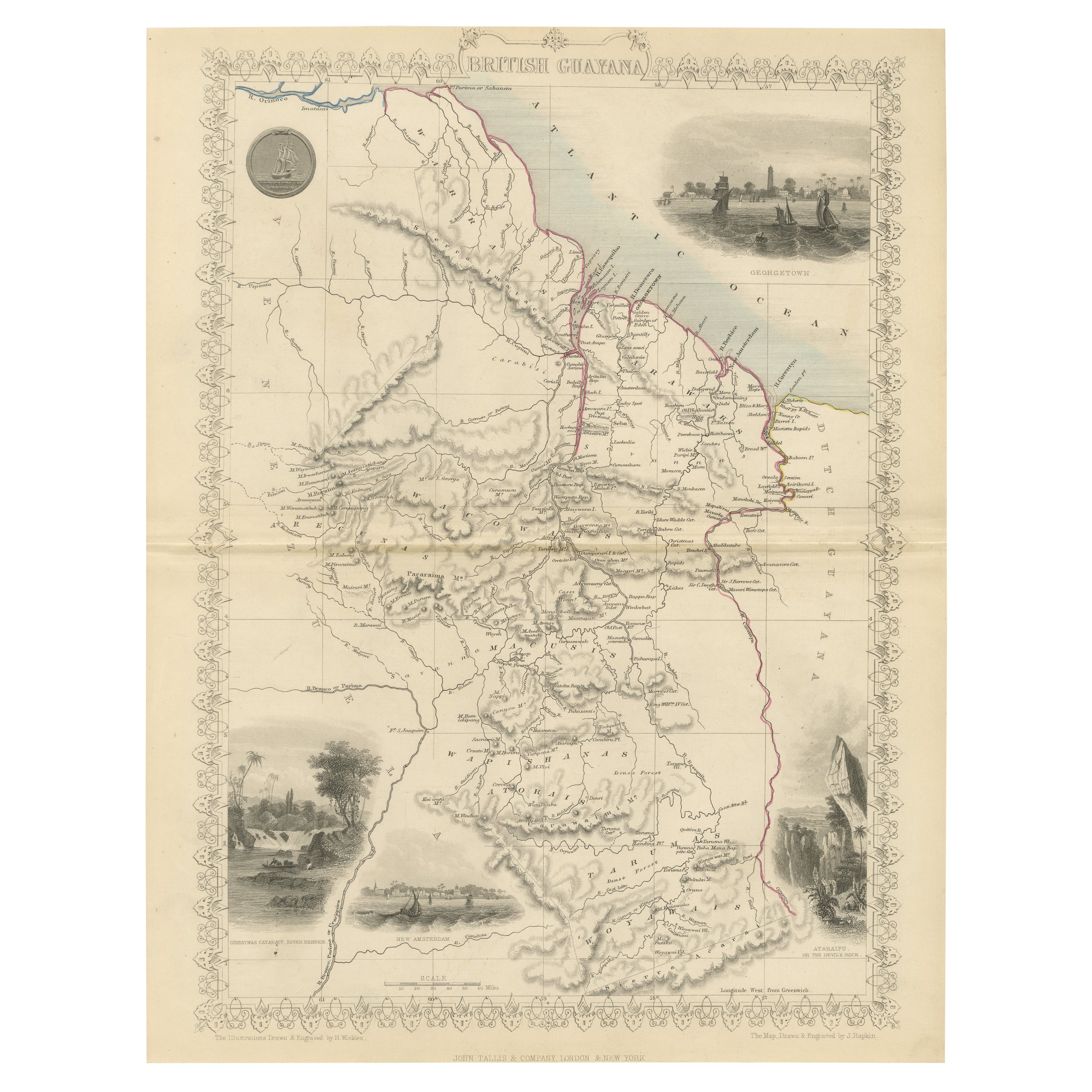
- A Tallis Map of British Guiana with Colonial Vignettes and Other Landmarks, 1851Located in Langweer, NLThis Tallis map of British Guiana (now known as Guyana) is a richly decorated document, much like other maps from the esteemed cartographic publisher John Tallis & Company. The firm,...Category
Antique 1850s Maps
MaterialsPaper
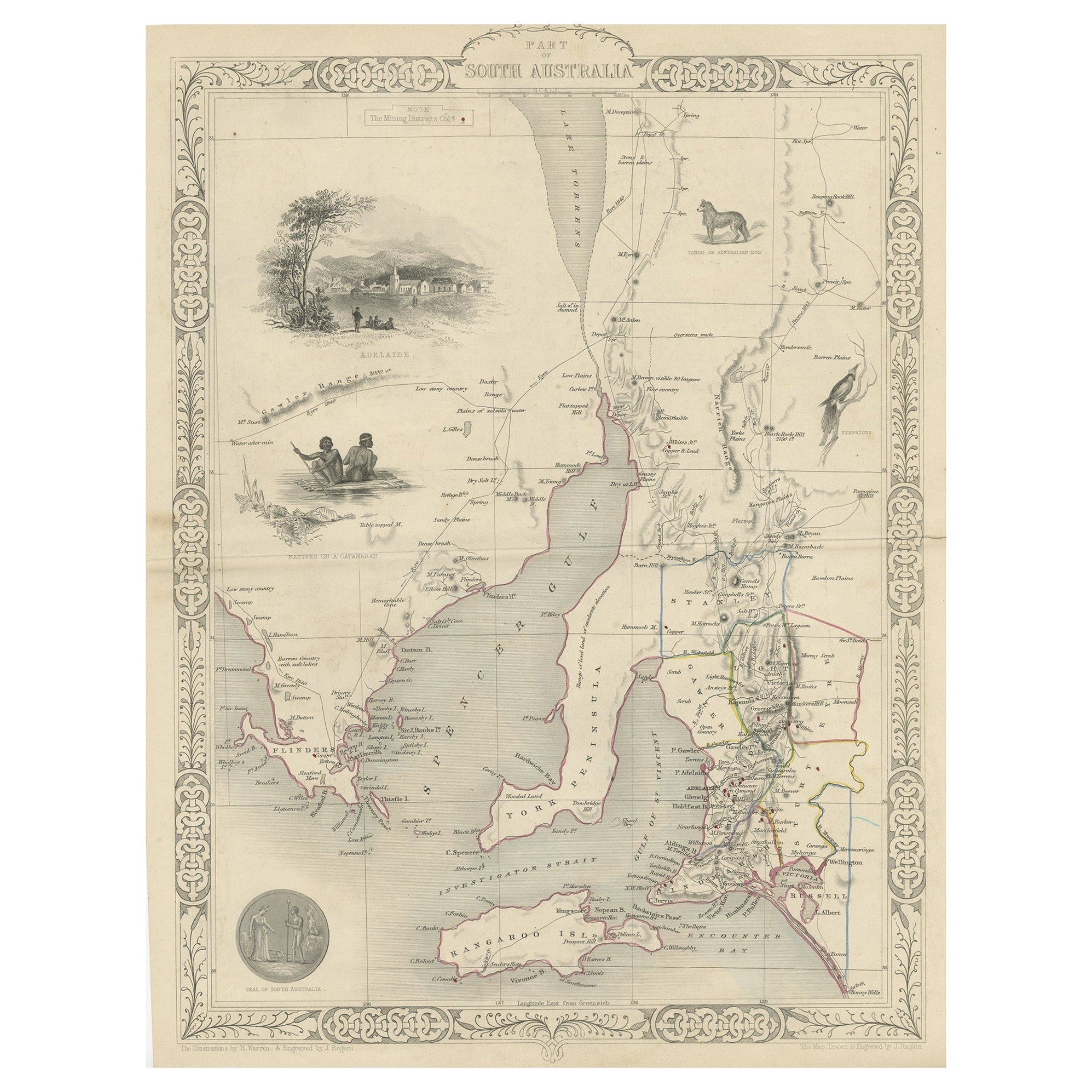
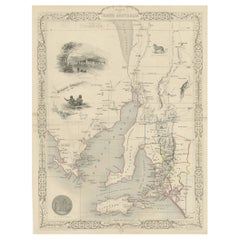
- Decorative Map of part of South Australia with Illustrations of Adelaide, 1851Located in Langweer, NLAntique map Australia titled 'Part of South Australia'. Decorative map of part of South Australia, surrounded by illustrations of Adelaide, ...Category
Antique 1850s Maps
MaterialsPaper
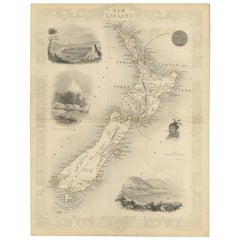
- Map of New Zealand Showing Maori Culture and Early Colonial Settlements, 1851Located in Langweer, NLJohn Tallis & Company were renowned for their ornate and detailed maps in the mid-19th century. Their works often featured elaborate borders, decorative motifs, and insets of vignett...Category
Antique 1850s Maps
MaterialsPaper
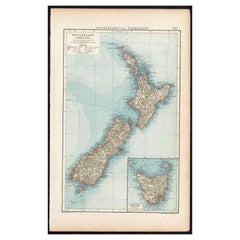
- Antique Map of New Zealand and Tasmania, 1904Located in Langweer, NLThis large antique map is taken from; 'Andrees Allgemeiner Handatlas in 126 Haupt-Und 139 Nebenkarten', Bielefeld; Leipzig: Velhagen & Klasing 1899. Andrees Allgemeiner Handatlas was...Category
20th Century Maps
MaterialsPaper
- Antique Map of Australia and Polynesia, inset of Tasmania c.1860Located in Langweer, NLGerman antique map titled 'Australien und Polynesien'. Old map of Australia (New Holland) and Polynesia. With an inset map of Southern Australia including Tasmania (Van Diemen's Land...Category
Antique 19th Century Maps
MaterialsPaper
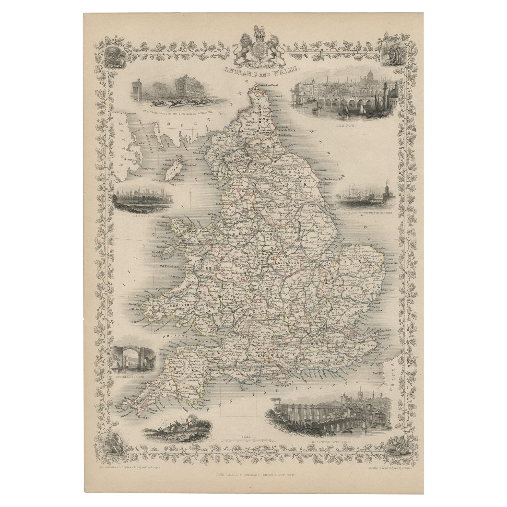
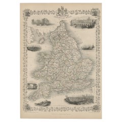
- Antique Map of England and Wales with Decorative Vignettes, 1851Located in Langweer, NLAntique map titled ‘England and Wales’. Includes decorative vignettes titled The grand stand on the race ground Doncaster, London, Oxford, Entrance to Portsmouth Harbour, Sunderland ...Category
Antique 19th Century Maps
MaterialsPaper

You May Also Like
- 1851 Map of "Independent Tartary", Ric. R018Located in Norton, MA1851 Map of Independent Tartary "Russia" Ric.r018 A highly decorative 1851 map of Independent Tartary by John Tallis and John Rapkin. Covers the regions between the Caspian Sea and Lake Bakquash and between Russia and Afghanistan. These include the ancient Silk Route kingdoms of Khiva, Tartaria, Kokand, and Bokhara. Today this region roughly includes Kazakhstan, Uzbekistan, Turkmenistan, Kyrgyzstan, and Tajikistan. This wonderful map offers a wealth of detail for anyone with an interest in the Central Asian portion of the ancient Silk Road. Identifies various caravan routes, deserts, wells, and stopping points, including the cities of Bokhara and Samarkand. Three vignettes by W. Bragg decorate the map, these including an image of Tartars on a Journey, a horseback Bride Chase, and a tartar camp site. Surrounded by a vine motif border. Engraved by J. Rapkin for John Tallis's 1851 Illustrated Atlas . Tartary Antique Map...Category
Antique 19th Century Unknown Maps
MaterialsPaper
- "San Francisco, Upper California” 1851 Antique Map of San FranciscoLocated in Colorado Springs, COThis is a pictorial lettersheet view of the city and harbor of San Francisco. This lithograph was printed on grey wove paper, across a double sheet, by famed lithographers Britton & ...Category
Antique 1850s American Prints
MaterialsPaper
- Original Antique English County Map, Derbyshire, J & C Walker, 1851Located in St Annes, LancashireGreat map of Derbyshire Original colour By J & C Walker Published by Longman, Rees, Orme, Brown & Co. 1851 Unframed.Category
Antique 1850s English Other Maps
MaterialsPaper
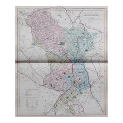
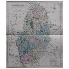
- Original Antique English County Map, Nottinghamshire, J & C Walker, 1851Located in St Annes, LancashireGreat map of Nottinghamshire Original colour By J & C Walker Published by Longman, Rees, Orme, Brown & Co. 1851 Unframed.Category
Antique 1850s English Other Maps
MaterialsPaper
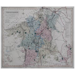
- Original Antique English County Map, Worcestershire, J & C Walker, 1851Located in St Annes, LancashireGreat map of Worcestershire Original colour By J & C Walker Published by Longman, Rees, Orme, Brown & Co. 1851 Unframed.Category
Antique 1850s English Other Maps
MaterialsPaper
- Original Antique English County Map, Hampshire, J & C Walker, 1851Located in St Annes, LancashireGreat map of Hampshire Original colour By J & C Walker Published by Longman, Rees, Orme, Brown & Co. 1851 Unframed.Category
Antique 1850s English Other Maps
MaterialsPaper


Recently Viewed
View AllMore Ways To Browse
Colonial Period Furniture
Tiger Garden
Antique Victorian Bustle
Building Anchor
John Tallis Map
Antique Outpost
Antique Map Dordogne
Antique Map Of Cornwall
Antique Maps Cornwall
Cannon Authentic
Mozambique Antique Map
Wenceslas Hollar
Antique Map Of Bermuda
Antique Maps Of Lithuania
Barbados Map
Map Of Barbados
Wisconsin Map
Antique Map Bahamas