Metal Maps
31
to
4
16
14
31
31
31
5
3
3
2
4
7
20
4
9
3
2
1
1
1
1
1
5,340
95
31
31
29
22
8
7
7
7
2
1
1
1
1
Material: Metal
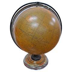
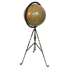
Cram's 16" Deluxe Globe W/Daily Sun Ray and Season Indicator
Located in San Francisco, CA
Cram's 16" Deluxe Globe W/Daily Sun Ray and Season Indicator
1936
Category
1930s Vintage Metal Maps
Materials
Metal
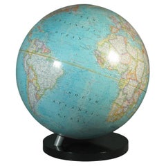
16-Inch Terrestrial Globe 1986 National Geographic
Located in Ottawa, Ontario
A 16-INCH TERRESTRIAL GLOBE 1986
NATIONAL GEOGRAPHIC
Large terrestrial globe with paper gores
on a stylish black lucite base
scale 1: 31,350,000
18" inches, (45.5cm.) high.
16" in...
Category
Late 20th Century American Modern Metal Maps
Materials
Metal
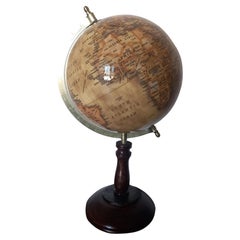
World Globe With Wooden Foot, and Brass 20th Century
Located in Mombuey, Zamora
Beautiful and elegant ball of the world to decorate any studio, living room or bedroom, it is small, with the base about 26 cm high and 10 wide.
Category
20th Century Italian Other Metal Maps
Materials
Brass
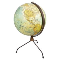
Italian modern Table globe map of the world in metal, 1960s
Located in MIlano, IT
Italian modern Table globe map of the world in metal, 1960s
Table map of the world with metal structure. The globe rotates thanks to the pins of the curved metal structure. The base ...
Category
1960s Italian Modern Vintage Metal Maps
Materials
Metal
Antique Webber Costello Globe on Metal Tripod Base c 1900 / 1920's
Located in New York, NY
Rare floor model globe made by Weber Costello, circa 1900. The 12" globe rests on a folding metal base. This example is in very good, original condition, showing only light wear, nor...
Category
Early 20th Century American Industrial Metal Maps
Materials
Metal
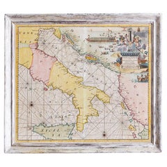
Antique Hand-Coloured Map of Venice with Vintage Frame, Italy, Late 18th Century
Located in Copenhagen K, DK
Italy, late 18th Century
Antique hand-coloured map of Venice.
Measures: H 52 x W 59 cm.
Category
Late 18th Century Italian Antique Metal Maps
Materials
Other
XL Old School Map of Belgium 'Printed by Procure', 1950s
Located in Oostende, BE
XL Old school map of Belgium (Printed by Procure). Presumably from around 1950-1960.
Category
1950s Belgian Mid-Century Modern Vintage Metal Maps
Materials
Metal
Terrestrial Table Globe by Félix Delamarche, Paris, 1821
By Félix Delamarche
Located in Milano, IT
Terrestrial table globe
Félix Delamarche
Paris, 1821
It measures 20.47 in height, Ø max 14.17 in; the sphere Ø 9.44 in (h 52 cm x Ø max 36.5 cm; the sphere Ø 24 cm)
Wood, printed...
Category
1820s French Restauration Antique Metal Maps
Materials
Metal
Pair of Philip & Son Globes, circa 1946
Located in London, GB
A wonderful set of Terrestrial and Celestial 12 inch globes by George Philip and Son. Presented on brass inclined plain mounts attached to original turned ebonized wooden bases and uprights with axes secured at the top by brass acorn finials. Unusually, the terrestrial globe has a copyright date shown under the cartouche, 1946.
The celestial globe is printed in beige against a dark blue background and shows the constellations and many named stars. Solid lines connect the stars within constellations rather than illustrating them as mythological and other figures.? A cartouche is present that includes the title and maker's address.
When looking at the stars from Earth the viewpoint is effectively inside a celestial sphere. The surface of a celestial globe shows the star field as a projection viewed from the outside and is therefore reversed, with the constellations appearing as their mirror images.
The terrestrial globe is printed in several colours and comprises of twelve coated lithographic paper gores with polar calottes over a twelve inch card sphere. The age of the globe has been confirmed by the political borders and named cities displayed. The globe is nicely detailed and has a grid network of parallels and meridians. It shows all the continents and countries as they were at the time it was printed and also indicates all the principal steamship routes with distances in nautical miles. The globe also has a printed Analemma - a diagram showing the declination of the Sun for every day in the year and the equation of time. The Analemma therefore shows the position of the Sun in the sky as seen from a fixed location on Earth at the same mean solar time, as the sun's position varies over the course of a year. A cartouche is present that includes the title and maker's address.
Dimensions of each globe: 30.5 cm/12 inches (diameter) x 59 cm/23 1/4 inches (max height).
George Philip, (1800–1882) was a cartographer and map publisher. He founded George Philip & Sons in 1834 in Liverpool primarily as a bookseller and stationer, but rapidly expanding to become a publisher of primarily maps, atlases and educational works. He had one son, also George (1823–1902), who was admitted to the business in 1848.
George senior was born in Huntly, Aberdeenshire and by 1819 he had become assistant to the Liverpool bookseller, William Grapel before going on to start his own business. He used cartographers (such as John Bartholomew the elder, August Petermann, and William Hughes) to produce maps on copper plates. Philip then had these printed and hand-coloured by his women tinters. The business expanded rapidly and by the time he produced his county maps of 1862 he was using machine...
Category
1940s British Vintage Metal Maps
Materials
Brass
Matthaus Seutter, Framed 1730 Color Engraving Map of "Belgium Fonderatum"
Located in Bridgeport, CT
Label on verso. From Grosser Atlas. The name Belgium comes from the ancient designation "Gallis Belgica". Figural decoration upper left. M. Seutter was a famed German mapmaker in the...
Category
18th Century European Renaissance Antique Metal Maps
Materials
Brass
Luminous Earth Globe on a Chrome Base, Italy, 1980
Located in Paris, FR
Unusual luminous globe on a large chromed metal base, made in Italy by Ricoscope Editions in Firenze.
In perfect condition, except for two very small missing pieces at the junction ...
Category
1980s Italian Space Age Vintage Metal Maps
Materials
Chrome
Mid-Century Modern 1970s Paul McCobb Style Brass Stand Replogle Globe
Located in St. Louis, MO
Often attributed to Paul McCobb, because of the same brass tubing that McCobb used in his furniture. Circa 1970s Replogle globe is in very nice condition with raised topography and t...
Category
1970s American Mid-Century Modern Vintage Metal Maps
Materials
Brass
Important Late 19th C. Terrestrial Globe on Stand for H.B. Nims After Copley
Located in Bridgeport, CT
Manufactured for H.B. Nims & Co., Troy New York, last quarter 19th c. After the original engravings by Charles Copley done in 1852.
Printed paper on wood with brass/ bronze meridian ring and a flat circular printed center horizon ring on wood labeled with the months of the year with notes. Mounted on a fine leafy iron baluster...
Category
Late 19th Century American Victorian Antique Metal Maps
Materials
Bronze, Iron
Mid-Century World Map Globe Table Light or Lamp
Located in Miami, FL
Good quality world map globe lamp.
If you are looking for stylish and beautiful quality item to upgrade your interior (whether at home or in your office) then this Parisian globe...
Category
Mid-20th Century French Mid-Century Modern Metal Maps
Materials
Chrome
Greece 1660 Jan Jansson Watercolour Map Peloponesus Sive Morea I Laurenbergio
Located in GB
We are delighted to offer for sale this Jan Jansson Date: 1660 (published) Amsterdam map of Greece.
This is an authentic antique map of Peloponnese or...
Category
1660s Danish Dutch Colonial Antique Metal Maps
Materials
Copper
Globe, Solid Rotating Brass Frame with Spinning Globe
Located in Dallas, TX
Globe, solid rotating brass frame with spinning globe, faux hardstone.
Category
Mid-20th Century French Metal Maps
Materials
Brass
Terrestrial Globe on a Metal Stand, France, Early 20th Century
Located in New York, NY
A charming globe on metal base dating from the early 20th century, and executed in France.
Category
Early 20th Century French Metal Maps
Materials
Metal
Large European 1930's Nautical Map Reader Magnifying Glass
Located in Haddonfield, NJ
This European set of two nautical magnifying glass map-readers are quite unusual and rarely found. It is fully encased in it's heavy wooden and metal enforced box. Hailing from betwe...
Category
1930s German Industrial Vintage Metal Maps
Materials
Metal
French 1930s Map of Paris à Vol d'Oiseau under Glass in Custom Iron Frame
Located in Atlanta, GA
A French map of Paris from the early 20th century, with custom iron frame. Created in Paris during the second quarter of the 20th century, this map of Paris à vol d'oiseau (as the Cr...
Category
Early 20th Century French Metal Maps
Materials
Iron
Miniature Terrestrial Globe Newton & Son London, Post 1833, Ante 1858
Located in Milano, IT
Miniature Terrestrial Globe
Newton & Son
London, post 1833, ante 1858
Paper, papier-mâché, bronze and wood
It measures: sphere diameter 2.95 in (7.6 cm); diameter of the wooden base 6.02 in (15.3 cm); height 8.36 in (21.24 cm).
Weight: 2,067 lb.
State of conservation: the globe still bears its original paint, but has various small gaps, abrasions and stains on the surface.
The globe is hinged with two pins at the meridian circle, which is in turn inserted perpendicular to the horizon circle; this is supported by four semi-arches connected at the bottom by a small goblet-shaped foot, resting on a wooden bell-shaped base.
Apart from the wooden base, the entire support structure is made of bronze; on the foot there are the scale reproductions of a compass, a telescope and an open book.
The sphere is made of papier-mâché and is covered with twelve printed paper gores.
In the North Pacific Ocean the globe bears a cartouche with the inscription (about 30% of the writing is illegible, but the missing parts can be easily integrated based on the rest):
NEWTON’S
New & Improved
TERRESTRIAL
Globe
Published by Newton & Son
66 Chancery Lane
LONDON
On the globe, much of central Africa is empty and the great lakes Tanganyika and Victoria are not marked (Europeans would begin to explore the area after 1858). Canada is called "British Territory" and Alaska "Russian Territory" (it would become part of the United States in 1867). Australia already bears its modern name (until 1829 it had been called New Holland) and its coasts are completely designed; Tasmania is listed as an island (Matthew Flinders circumnavigated it in 1798). The routes of Cook's various voyages are plotted; both the route followed by Biscoe in 1831 and the "Land of Enderby" which he discovered on the coast of Antarctica, south of Africa, are marked.
Bibliography
P. Van der Krogt, Old Globes...
Category
1840s English Early Victorian Antique Metal Maps
Materials
Bronze
Antique American "Rand Menally Co." Chicago Table-Top Globe on Stand, Circa 1900
Located in New Orleans, LA
Antique American "Rand Menally Co.," Chicago table-top globe on stand with map made By "G.W. Bacon & Co." of London, England, Circa 1900.
Some normal wear and tear: per the last 2 ...
Category
Early 20th Century American Metal Maps
Materials
Metal
World Map Silver Leaf Print Based on Original Willem Blaeu Wall Map 1571-1638
Located in GB
We are delighted to offer for sale this lovely Antique style pictorial plan map of the globe based on the original Willem Blaeu 1571-1638 engraved in silver leaf foil
This is a v...
Category
20th Century English Campaign Metal Maps
Materials
Silver Leaf
Silver Leaf Foil Wall World Map Engraving Based on the Original Moses Pitt, 1681
Located in GB
We are delighted to offer for sale this lovely antique style pictorial silver leaf foil world map taken from and original engraving my Moses Pitt, 1681
This is a very interesting ...
Category
20th Century English Modern Metal Maps
Materials
Silver Leaf
Gold Leaf Foil Pictorial Plan Map of the West Country of England Antique Style
Located in GB
We are delighted to offer for sale this lovely Antique style pictorial plan map of the West Country of England etched in gold leaf foil
This is a very interesting and decorative p...
Category
20th Century English Adam Style Metal Maps
Materials
Gold Leaf
Pair of Floor Standing Globes by Gilman Joslin
Located in Lymington, Hampshire
A pair of 16-inch floor standing globes by Gilman Joslin, each set into a cast-iron tripod base with an acanthus-leaf baluster support on three b...
Category
19th Century American Antique Metal Maps
Materials
Iron
Pair of Fine Desk Globes by J. Cary, 1816 and 1824
Located in Amsterdam, NL
A pair of desk globes by J. Cary
“Cary’s New Terrestrial Globe delineated from the best Authorities extant; exhibiting the late discoveries toward the North Pole and every improve...
Category
Early 19th Century Antique Metal Maps
Materials
Other
Pair of 19th Century English J & W Cary Celestial/Terrestrial Table Model Globes
Located in Milford, NH
A fine assembled pair of 12-inch English table model globes on stands manufactured by J & W. Cary, the left globe with cartouche labeled “The New Celestial Globe, on which are correc...
Category
Early 19th Century English Antique Metal Maps
Materials
Brass
Two Impressive and Huge Midcentury World Map Wall Globes, Austria, 1950s
Located in Vienna, AT
We proudly offer this outstanding pair of very large wall-mounted modernist globes / world maps with an incredible diameter of 95 inches each. Unique one-of-a-kind sculptures depicti...
Category
Mid-20th Century Austrian Mid-Century Modern Metal Maps
Materials
Aluminum, Iron
Mid-Century Illuminated Replogle World Floor Globe in Wood and Glass, Chicago
Located in Haddonfield, NJ
American 1950's back light green painted floor globe by Replogle, Mid-Century Modern.
Remarkable and charming Chicago made world globe featur...
Category
Mid-20th Century American Mid-Century Modern Metal Maps
Materials
Steel
John Cary Travel Celestial Globe in Box Marked Cary & Co London, No. 21540
By John Cary
Located in GB
We are delighted to offer for sale this lovely John Cary Travel Celestial Globe in Box marked Cary & Co London, No. 21540
This globe I believe is classed as a 14 inch which is the...
Category
19th Century English Victorian Antique Metal Maps
Materials
Brass
Framed Hand Colored Map of Persia by John Speed
Located in Essex, MA
Framed hand colored map of Persia by John Speed. Nicely matted.
Category
Late 17th Century English Antique Metal Maps
Materials
Other
Recently Viewed
View AllMore Ways To Browse
Antique Sailing Map
Antique Sailing Maps
Bay Area Antique Furniture
West Coat Of Arms
Greek Asia Minor
Hemisphere World Map
Speed Map
Antique Maps Canada
Antique Map Canada
Canada Antique Map
Malaysian Antique
West Indies Map
Blaeu World Map
Charing Cross
Antique Maps Of Canada
Bali Map
Map Of Brazil
Antique Portuguese Plates
