Items Similar to Northern Asia, Asiatic Russia, Old Map of Russia in Asia, 1849
Want more images or videos?
Request additional images or videos from the seller
1 of 6
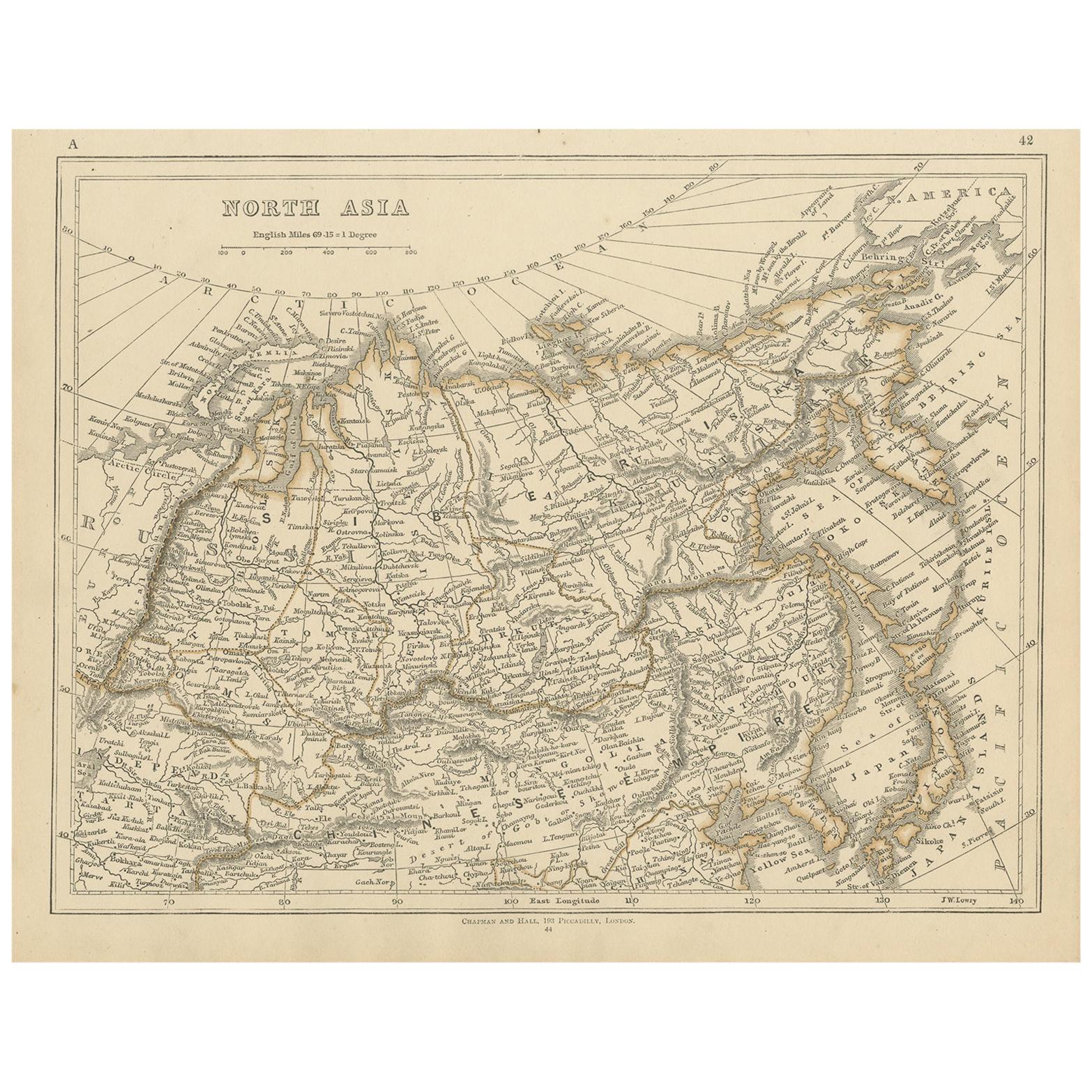
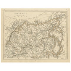
Northern Asia, Asiatic Russia, Old Map of Russia in Asia, 1849
About the Item
Antique map titled 'Northern Asia - Asiatic Russia'.
Old map of Russia in Asia. This map originates from 'Sharpe's Corresponding Atlas (..)' by J. Sharpe.
Artists and Engravers: Published by Chapman and Hall.
- Dimensions:Height: 13.98 in (35.5 cm)Width: 18.31 in (46.5 cm)Depth: 0 in (0.02 mm)
- Materials and Techniques:
- Period:
- Date of Manufacture:1849
- Condition:Wear consistent with age and use. Condition: Good, age-related toning. Some creasing of the paper, please study image carefully.
- Seller Location:Langweer, NL
- Reference Number:
About the Seller
5.0
Platinum Seller
These expertly vetted sellers are 1stDibs' most experienced sellers and are rated highest by our customers.
Established in 2009
1stDibs seller since 2017
1,947 sales on 1stDibs
Typical response time: <1 hour
- ShippingRetrieving quote...Ships From: Langweer, Netherlands
- Return PolicyA return for this item may be initiated within 14 days of delivery.
More From This SellerView All
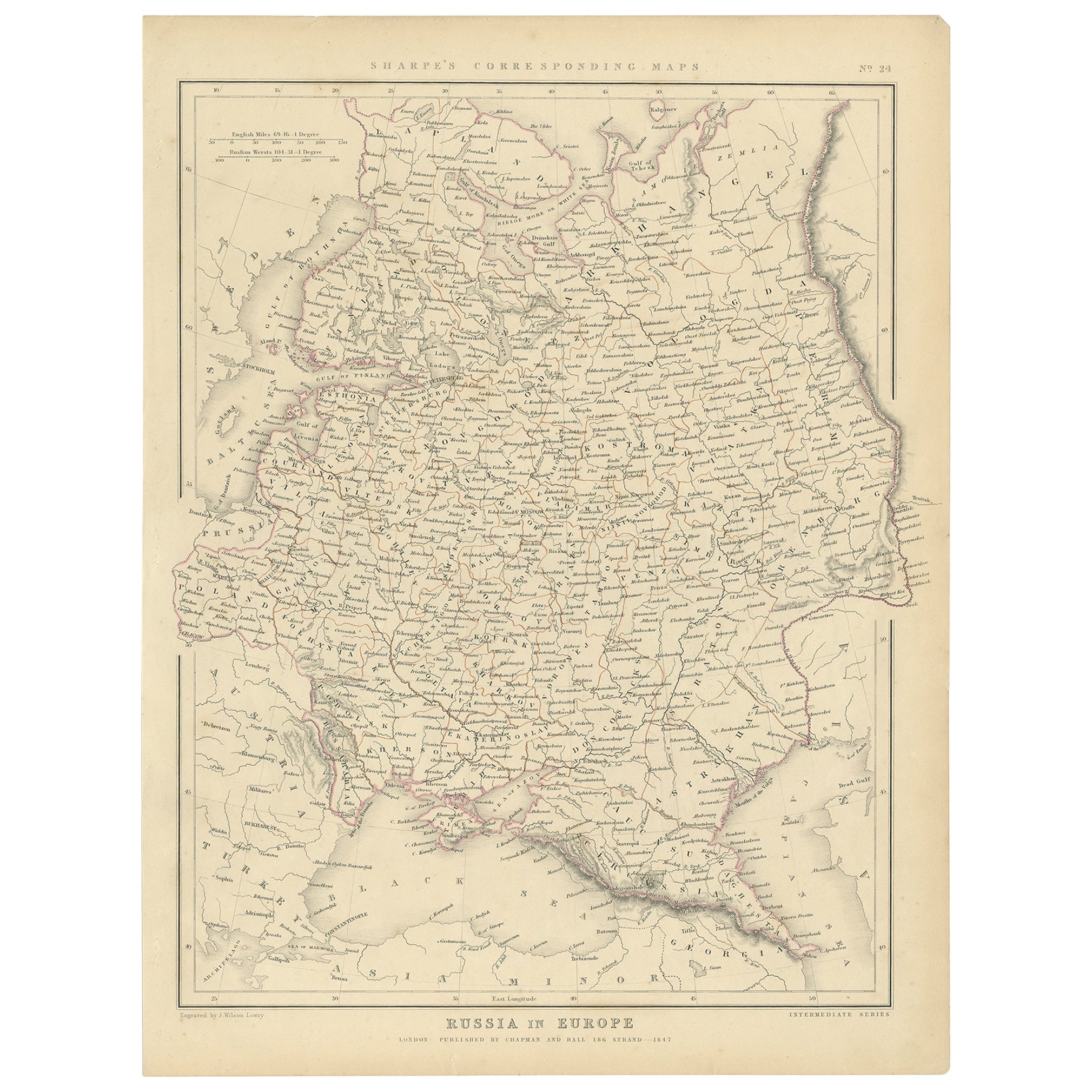
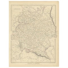
- Old Original Map of Russia in Europe, 1849Located in Langweer, NLAntique map titled 'Russia in Europe'. Old map of Russia in Europe. This map originates from 'Sharpe's Corresponding Atlas (..)' by J. Sharpe. Artists and Engravers: Published by Chapman and Hall.Category
Antique 1840s Maps
MaterialsPaper
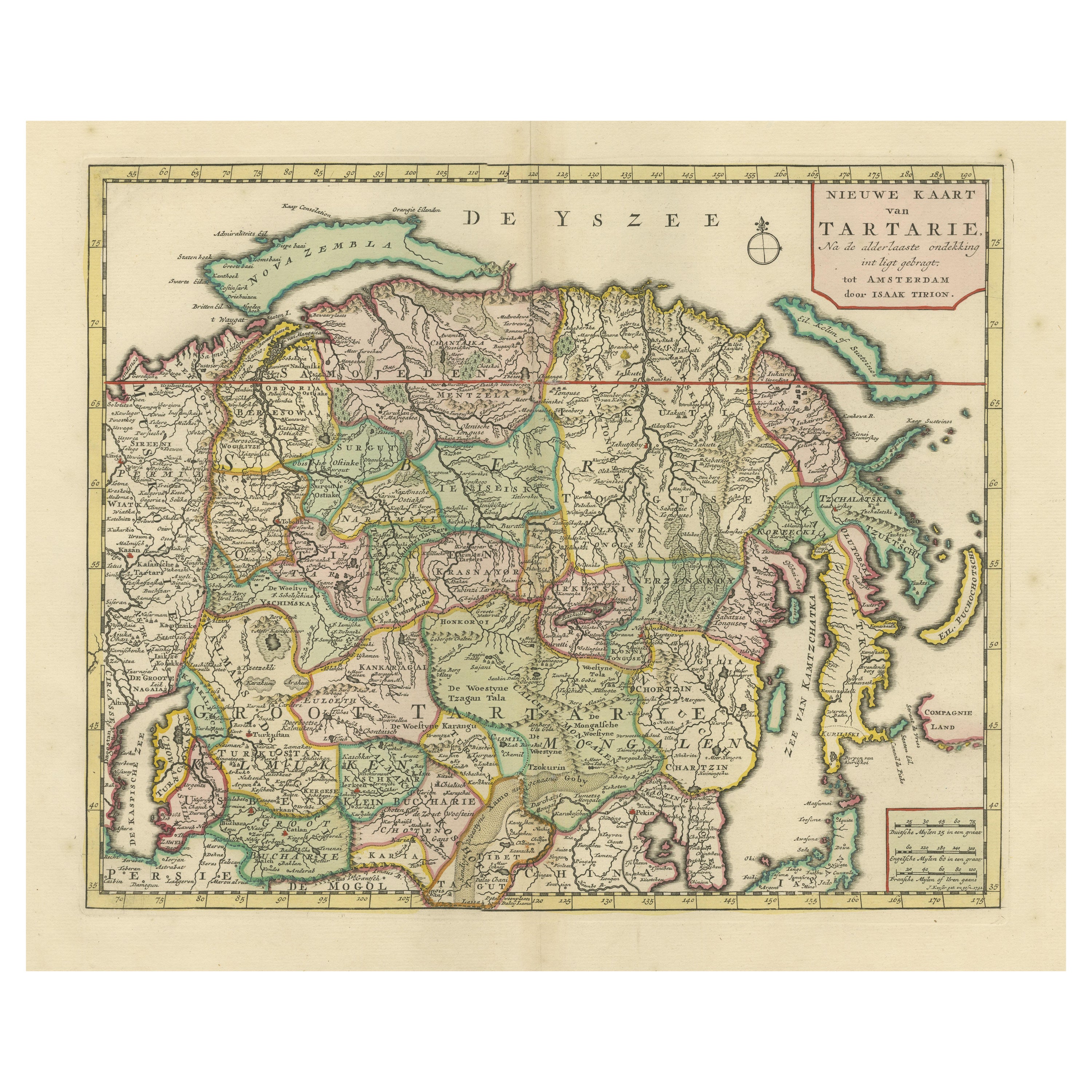
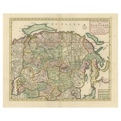
- Antique Map of Northern Asia, with Russia, Korea and Northern JapanLocated in Langweer, NLAntique map titled 'Nieuwe Kaart van Tartarie'. Map op Siberia and Chinese tartary. In the north Novaya Zemlya curls back to attach itself to the mainland by a narrow isthmus. In the...Category
Antique Mid-18th Century Maps
MaterialsPaper
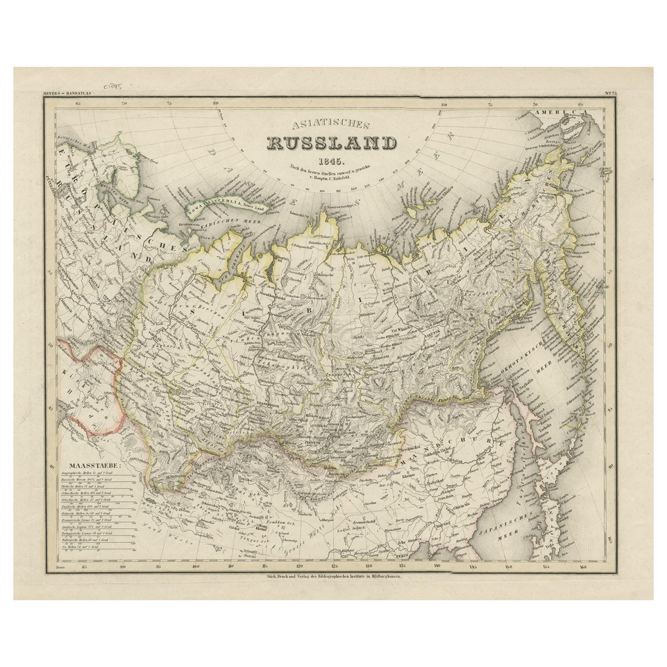
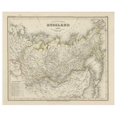
- Antique Map of Russia in Asia from An Old German Atlas, 1845By MeyerLocated in Langweer, NLAntique map titled 'Asiatisches Russland'. This map depicts Russia in Asia and originates from 'Meyers Handatlas'. Artists and Engravers: Engraved and published by 'Bibliographis...Category
Antique 19th Century Maps
MaterialsPaper
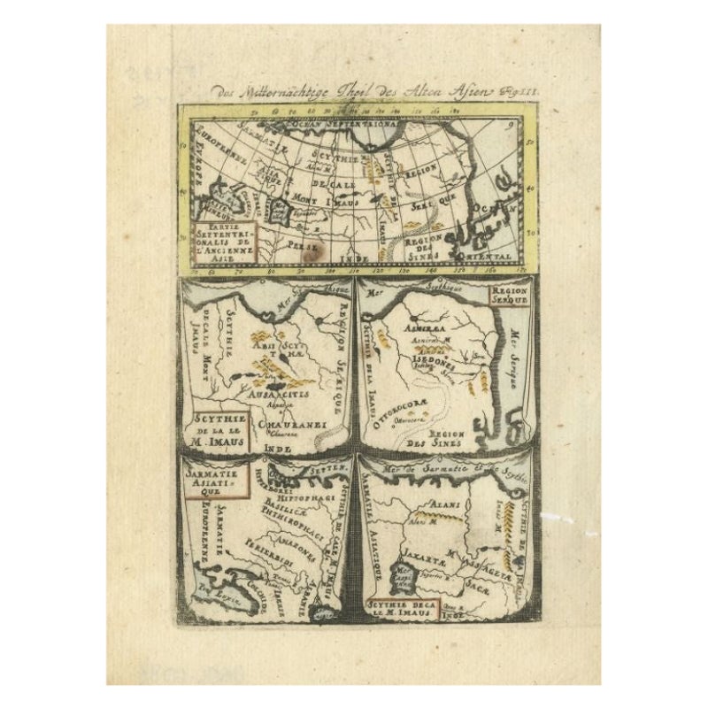
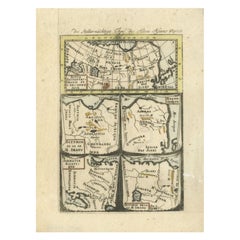
- Antique Map of Northern Asia by Mallet, 1719Located in Langweer, NLAntique map titled 'Das Mitternächtige Theil des Alten Asien'. This sheet of five miniature maps describes the northern part of Asia in classical times, perhaps circa 150 AD. At the top, an overview map shows the main regions and territories, which are pictured in more detail below. From left to right, the four maps below depict Scythia east of the Imaus (Pamir) Mountains, Serica, Sychia west of the Pamir mountains, and Sarmatia, the last of which borders the Black Sea. Originates from Alain Manesson Mallet's 'Description de l 'Univers' (German edition). Artists and Engravers: Alain Manesson Mallet (1630-1706) was a French cartographer and engineer. He started his career as a soldier in the army of Louis XIV, became a Sergeant-Major in the artillery and an Inspector of Fortifications. He also served under the King of Portugal, before returning to France, and his appointment to the court of Louis XIV. His military engineering and mathematical background led to his position teaching mathematics at court. His major publications were Description de L'Univers (1683) in 5 volumes, and Les Travaux de Mars ou l'Art de la Guerre (1684) in 3 volumes. His Description de L'Universe contains a wide variety of information, including star maps...Category
Antique 18th Century Maps
MaterialsPaper
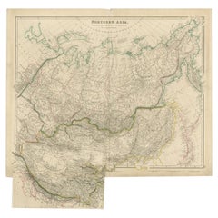
- Antique Map of Northern Asia by Lowry, 1852Located in Langweer, NLAntique map titled 'North Asia'. Original map of Northern Asia. This map originates from 'Lowry's Table Atlas constructed and engraved from the most recent authorities' by J.W. Lowry...Category
Antique Mid-19th Century Maps
MaterialsPaper
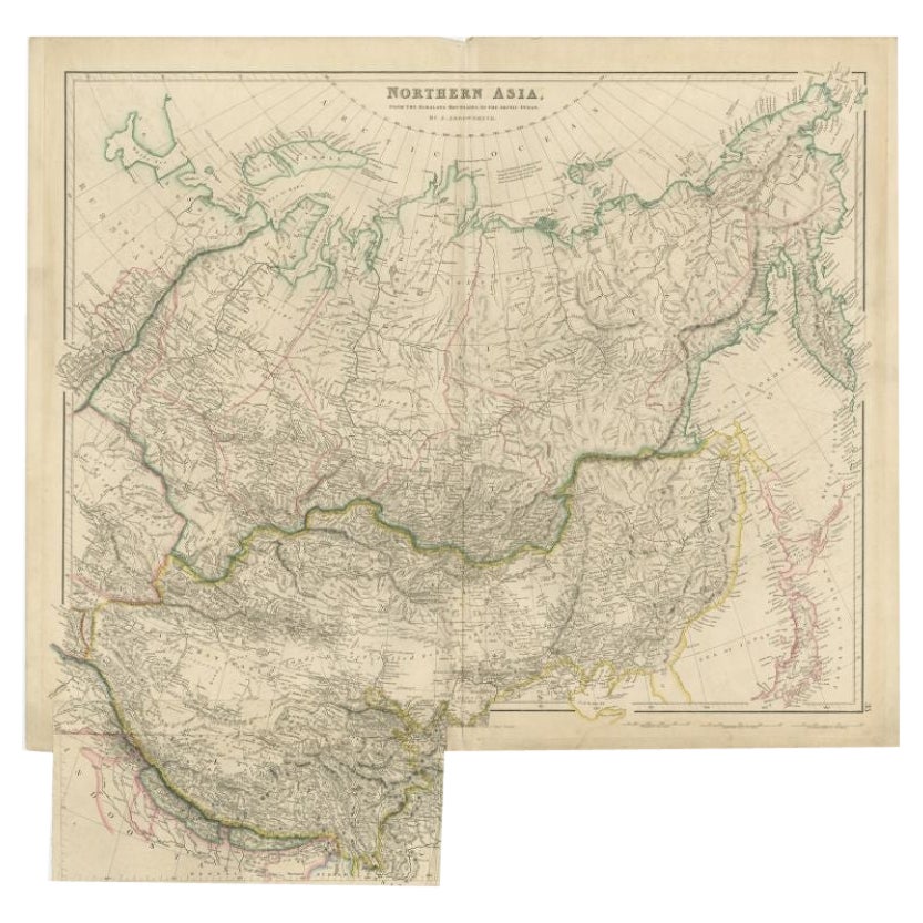
- Antique Map of Northern Asia by Arrowsmith, 1834Located in Langweer, NLAntique map titled 'Northern Asia, from the Himalaya Mountains to the Arctic Ocean'. Large and detailed map of Northern Asia, taking in Mongolia, Tibet, Bhutan, Tartary, Siberia and ...Category
Antique 19th Century Maps
MaterialsPaper
You May Also Like
- 1849 Map of "Europaische Russland", 'Meyer Map of European Russia', Ric. R017Located in Norton, MA1849 Map of "Europaische Russland" ( Meyer Map of European Russia) Ric.r017 A lovely map of European Russia dating to 1849 by Joseph Meyer. It covers the European portions of...Category
Antique 19th Century Unknown Maps
MaterialsPaper
- Original Antique Map of Asia. C.1780Located in St Annes, LancashireGreat map of Asia Copper-plate engraving Published C.1780 Two small worm holes to right side of map Unframed.Category
Antique Early 1800s English Georgian Maps
MaterialsPaper

- Old Nautical Map of CorsicaLocated in Alessandria, PiemonteST/556/1 - Old map of Corsica isle, surveyed by Captain Hell, of the French Royal Navy in 1824, engraved and published on 1874, with additions and corre...Category
Antique Early 19th Century English Other Prints
MaterialsPaper
- Old Horizontal Map of EnglandBy TassoLocated in Alessandria, PiemonteST/520 - Old rare Italian map of England, dated 1826-1827 - by Girolamo Tasso, editor in Venise, for the atlas of M.r Le-Sage.Category
Antique Early 19th Century Italian Other Prints
MaterialsPaper
- 1853 Map of "Russia in Europe Including Poland" Ric.r016Located in Norton, MADescription Russia in Europe incl. Poland by J Wyld c.1853 Hand coloured steel engraving Dimension: Paper: 25 cm W x 33 cm H ; Sight: 22 cm W x 28 cm H Condition: Good ...Category
Antique 19th Century Unknown Maps
MaterialsPaper
- 1814 Map of "Russian Empire" Ric.r032Located in Norton, MA1814 Map of "Russian Empire" Ric.r032 Russian Empire. Description: This is an 1814 John Thomson map of the Russian Empire. The map depicts the region from the Baltic Sea, Prussia, and Sweden to the Aleutian Islands and from the Arctic Ocean to the Yellow River. Highly detailed, myriad cities, towns, and villages are labeled throughout, including St. Petersburg, Moscow, Minsk, Kiev, and Kharkov. Rivers and mountain ranges are also identified, as are islands and numerous locations along the coastlines. It is important to note that the long-disputed sea between Korea and Japan is identified as the 'Sea of Japan. Historical Context: In 1815, Tsarist Russia emerged from the Napoleonic Wars economically insolvent and politically fearful of the Revolutionary fervor that had just swept through Europe. In order to shore up Russia's economic position, the Tsars began an aggressive series of expansions into the Caucuses and Central Asia that would vastly increase the landmass of the Russian Empire. Publication History Thomson maps are known for their stunning color, awe inspiring size, and magnificent detail. Thomson's work, including this map, represents some of the finest cartographic art...Category
Antique 19th Century Unknown Maps
MaterialsPaper


Recently Viewed
View AllMore Ways To Browse
Chapman And Hall
Antique Russian Map
Antique Map Russia
Antique Map Of Russia
Antique Maps Of Russia
Old Asia Map
J Chapman
Wood And Sons Plate
Antique Caribbean
Holland Utrecht
Antique Paper Globe
Small Antique Globes
Antique Map India
Antique Map Of India
Antique Maps Of India
Antique Surveying
Maps United Kingdom
Antique Style Map