1840s Maps
14
66
to
5
57
9
66
66
66
2
2,889
2,121
411
5
227
31
11
84
7
56
7
3
3
4
5
2
65
3
1
1
1
23
17
8
8
6
4
1
1
1
1
Period: 1840s
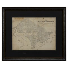
1840 Map of the City of Washington Published by William M. Morrison
Located in Colorado Springs, CO
This map, printed in 1840, is a detailed representation of Washington, D.C. in the mid-19th century. The map shows block numbers, wards, and government buildings as well as details o...
Category
American Federal Antique 1840s Maps
Materials
Paper
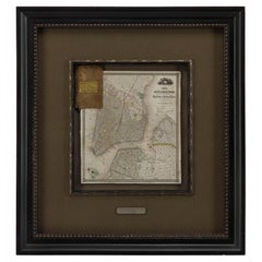
1840 "New Map of the City of New York With Part of Brooklyn & Williamsburg"
Located in Colorado Springs, CO
Presented is a hand-colored, engraved folding map titled "New Map of the City of New York With Part of Brooklyn & Williamsburg" by J. Calvin Smith. The map was issued bound in the bo...
Category
American Antique 1840s Maps
Materials
Paper
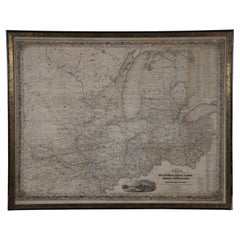
Antique 1844 J Calvin Smith JH Colton Midwest United States Survey Map 27"
By J.H. Colton
Located in Dayton, OH
Antique framed black and white map of seven Midwestern American states. Guide Through Ohio, Michigan, Indiana, Illinois, Missouri, Wisco...
Category
Antique 1840s Maps
Materials
Paper
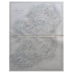
Large Original Antique Map of Ireland by Sidney Hall, 1847
Located in St Annes, Lancashire
Great map of Ireland
Drawn and engraved by Sidney Hall
Steel engraving
Original colour outline
Published by A & C Black. 1847
Unframed
Free shipping.
Category
Scottish Antique 1840s Maps
Materials
Paper
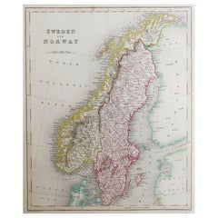
Original Antique Map of Sweden and Norway, Grattan and Gilbert, 1843
Located in St Annes, Lancashire
Great map of Sweden and Norway
Drawn and engraved by Archer
Published by Grattan and Gilbert
Original color
Unframed.
Category
English Other Antique 1840s Maps
Materials
Paper
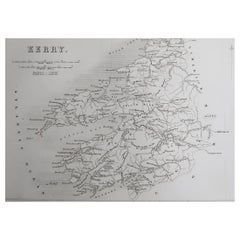
Original Antique Map of Ireland- Kerry. C.1840
Located in St Annes, Lancashire
Great map of Kerry
Steel engraving
Drawn under the direction of A.Adlard
Published by How and Parsons, C.1840
Unframed.
Category
English Antique 1840s Maps
Materials
Paper
Original Antique Map of Ireland- Tipperary and Waterford. C.1840
Located in St Annes, Lancashire
Great map of Tipperary and Waterford
Steel engraving
Drawn under the direction of A.Adlard
Published by How and Parsons, C.1840
Unframed.
Category
English Antique 1840s Maps
Materials
Paper
Large Original Antique Map of South Italy and Malta by Sidney Hall, 1847
Located in St Annes, Lancashire
Great map of South Italy and Malta
Drawn by Sidney Hall
Steel engraving by G.Aikman
Original color outline
Published by A & C Black. 1847
Un...
Category
Scottish Antique 1840s Maps
Materials
Paper
Large Original Antique Map of The West Indies by Sidney Hall, 1847
Located in St Annes, Lancashire
Great map of The West Indies
Drawn and engraved by Sidney Hall
Steel engraving
Original colour outline
Published by A & C Black. 1847
Unframed
Free shipping.
Category
Scottish Antique 1840s Maps
Materials
Paper
Large Original Antique Map of Poland by Sidney Hall, 1847
Located in St Annes, Lancashire
Great map of Poland
Drawn and engraved by Sidney Hall
Steel engraving
Original colour outline
Published by A & C Black. 1847
Unframed
...
Category
Scottish Antique 1840s Maps
Materials
Paper
Large Original Antique Map of Europe by Sidney Hall, 1847
Located in St Annes, Lancashire
Great map of Europe
Drawn and engraved by Sidney Hall
Steel engraving
Original colour outline
Published by A & C Black. 1847
Unframed
Free shipping.
Category
Scottish Antique 1840s Maps
Materials
Paper
Large Original Antique Map of United States by Sidney Hall, 1847
Located in St Annes, Lancashire
Great map of United States
Drawn and engraved by Sidney Hall
Steel engraving
Original colour outline
Published by A & C Black. 1847
...
Category
Scottish Antique 1840s Maps
Materials
Paper
Large Original Antique Map of Australia by Sidney Hall, 1847
Located in St Annes, Lancashire
Great map of Australia
Drawn and engraved by Sidney Hall
Steel engraving
Original colour outline
Published by A & C Black. 1847
Unframed
Free shipping.
Category
Scottish Antique 1840s Maps
Materials
Paper
Large Original Antique Map of Asia by Sidney Hall, 1847
Located in St Annes, Lancashire
Great map of Asia
Drawn and engraved by Sidney Hall
Steel engraving
Original colour outline
Published by A & C Black. 1847
Unframed
Free shipping
Category
Scottish Antique 1840s Maps
Materials
Paper
Original Antique Map of United States, Grattan and Gilbert, 1843
Located in St Annes, Lancashire
Great map of United States
Drawn and engraved by Archer
Published by Grattan and Gilbert. 1843
Original colour
Unframed.
Category
English Antique 1840s Maps
Materials
Paper
Old Map of the Black Sea, The Krim, Ukraine, Russia, etc in Historic Times, 1848
Located in Langweer, NL
Antique map titled 'Pontus Euxinus'. Old map of the black Sea and surroundings originating from 'Orbis Terrarum Antiquus in usum Scholarum'.
Artists and Engravers: Published by J...
Category
Antique 1840s Maps
Materials
Paper
Northern Asia, Asiatic Russia, Old Map of Russia in Asia, 1849
Located in Langweer, NL
Antique map titled 'Northern Asia - Asiatic Russia'.
Old map of Russia in Asia. This map originates from 'Sharpe's Corresponding Atlas (..)' by J. Sharpe.
Artists and Engravers: Published by Chapman and Hall.
Category
Antique 1840s Maps
Materials
Paper
Old Original Map of Russia in Europe, 1849
Located in Langweer, NL
Antique map titled 'Russia in Europe'.
Old map of Russia in Europe. This map originates from 'Sharpe's Corresponding Atlas (..)' by J. Sharpe.
Artists and Engravers: Published by Chapman and Hall.
Category
Antique 1840s Maps
Materials
Paper
Old Original Map of Africa and Arabia, 1848
Located in Langweer, NL
Antique map titled 'Africa et Arabia'.
Old map of Africa and Arabia originating from 'Orbis Terrarum Antiquus in usum Scholarum'.
Artists and Engravers: Published by Justus P...
Category
Antique 1840s Maps
Materials
Paper
Old Colourful Map of Sweden and Norway, 1846
Located in Langweer, NL
Antique map titled 'Sweden & Norway'. Old map of Sweden and Norway.
This map originates from 'A New Universal Atlas Containing Maps of the various Em...
Category
Antique 1840s Maps
Materials
Paper
Old Print of Anjer or Anyer, Coastal Town in Banten, West Java, Indonesia, 1844
Located in Langweer, NL
Antique print titled 'Anjer - Anjer'. View of Anyer (also known as Anjer or Angier), a coastal town in Banten, formerly West Java, Indonesia. This print originates from 'Gezigten uit...
Category
Antique 1840s Maps
Materials
Paper
Rare Fish Print of the Norway Redfish 'Sebastes Viviparus' and the Sculpin, 1842
Located in Langweer, NL
Antique print, titled: 'Poissons Plate 9 - La Sebaste du Nord (Sebastes septentrionalis) - Le Cotte Scorpion (Cottus scorpius).' - This rare plate shows the Norway redfish (Sebastes ...
Category
Antique 1840s Maps
Materials
Paper
Colourful Old Map of the Austrian Empire, with an Inset Map of Vienna, 1846
Located in Langweer, NL
Antique map titled 'Austrian Empire'.
Old map of the Austrian Empire, with an inset map of Vienna. This map originates from 'A New Universal Atlas Co...
Category
Antique 1840s Maps
Materials
Paper
Hand-Colored Print of Corporal Punishment with a Cangue (or Tcha), China, 1844
Located in Langweer, NL
Antique print titled 'Chine - Supplice du Tcha ou Kangue'.
View of corporal punishment with a cangue (or tcha). The cangue is a device that was...
Category
Antique 1840s Maps
Materials
Paper
Large Original Antique Map of the Dutchy of Holstein, Germany, ca.1840
Located in Langweer, NL
Antique map titled 'A Map of the Dutchy of Holstein, with the Territories of the Imperial Towns Hamburg & Lubek, Also The Bishoprick of Eutin, Laid down from Fischer's Map (..)'. Sca...
Category
Antique 1840s Maps
Materials
Paper
Large Lithograph of Princess Marie of Orleans, Duchess of Württember, 1844
Located in Langweer, NL
Antique print titled 'S.A.R. Madame Marie d'Orléans, Duchesse Alexandre de Wurtemberg'.
Large lithograph of Princess Marie of Orleans, Duchess of Württemberg with her son, Philip...
Category
Antique 1840s Maps
Materials
Paper
The Empires of Mauritania, Carthage & Numidia 'Barbary Coast', Africa, 1842
Located in Langweer, NL
Antique map titled 'Carte de l'Afrique Propre de la Numidie (..)'.
Map of the empires of Mauritania, Carthage and Numidia (Barbary Coast). This map originates from 'Atlas univers...
Category
Antique 1840s Maps
Materials
Paper
Steel Engraving of Shimoda, a Port Located in Shizuoka Prefecture, Japan, C.1840
Located in Langweer, NL
Antique print titled 'Simoda in Japan'.
Steel engraving of Shimoda, a city and port located in Shizuoka Prefecture, Japan. Originates from 'Meyers Univer...
Category
Antique 1840s Maps
Materials
Paper
Old Map of Spain and Portugal, with an Inset Map of the Region of Madrid, 1846
Located in Langweer, NL
Antique map titled 'Kingdom of Spain and Portugal'.
Old map of Spain and Portugal, with an inset map of the region of Madrid. This map originates from 'A New Universal Atlas Cont...
Category
Antique 1840s Maps
Materials
Paper
Old Rare Fish Print of the Witch Flounder or Torbay Sole, 1842
Located in Langweer, NL
Antique print, titled: 'Poissons Plate 13 - La Pole (Pleuronectes nigromanus).' - This rare plate shows the Witch flounder or Torbay sole (Glyptocephalus cynoglossus). From: 'Voyage ...
Category
Antique 1840s Maps
Materials
Paper
Original Antique Map Showing the Mountain Ranges in Asia and Europe, 1849
Located in Langweer, NL
Antique map titled 'Bergketten in Asien und Eüropa'. Original antique map showing the mountain ranges in Asia and Europe. In outline color with inset maps of Java, Luzon, and Reguain...
Category
Antique 1840s Maps
Materials
Paper
Decorative Antique Map of Germany, 1846
Located in Langweer, NL
Antique map titled 'Germany'. Old map of Germany.
This map originates from 'A New Universal Atlas Containing Maps of the various Empires, Kingdoms, ...
Category
Antique 1840s Maps
Materials
Paper
Old Fish Print Named Opah, Cravo, Moonfish, Kingfish or Jerusalem Haddock, 1842
Located in Langweer, NL
Antique print, titled: 'Poissons Plate 10 - Le Lampris Tachete (Lampris guttatus).' -
This rare plate shows the Lampris guttatus, commonly known as the opah, cravo, moonfish, kin...
Category
Antique 1840s Maps
Materials
Paper
Old Print Depicting Inhabitants of Van Diemen's Land, Tasmania, Australia, c1845
Located in Langweer, NL
Antique print titled 'Bewohner von Diemensland, Habitans de terre de Diemen'.
This print depicts inhabitants of Van Diemen's Land, Tasmania/Australia. O...
Category
Antique 1840s Maps
Materials
Paper
Rare Decorative Hand-coloured Antique Plate of The Gaimard's Ray Fish, 1842
Located in Langweer, NL
Antique print, titled: 'Poissons Plate 3 - La Raie de Gaimard (Raia gaimardi).' - This rare plate shows the Gaimard's ray. From: 'Voyage en Islande et au Groenland' by M. Paul Gaimar...
Category
Antique 1840s Maps
Materials
Paper
Antique Print of Warriors from Ombai Island, Alor, Archipel, Indonesia, ca.1845
Located in Langweer, NL
Antique print titled 'Bewohner von Ombai, Habitans de l'isle de Ombai'.
This print depicts natives from Ombai, Indonesia. Originates from 'Naturgeschichte und Abbildungen des Men...
Category
Antique 1840s Maps
Materials
Paper
North & Central Africa & Arabia, Inset Map of Habesch 'Ethiopia & Eritrea', 1845
Located in Langweer, NL
Antique map titled 'Mittel- und Nord-Africa (östl. Theil) und Arabien'.
This map depicts North and Central Africa and Arabia with an inset map of Habesch (Ethiopia and Eritrea).
...
Category
Antique 1840s Maps
Materials
Paper
Colourful Antique Map of Switzerland, 1846
Located in Langweer, NL
Antique map titled 'Switzerland'. Old map of Switzerland.
This map originates from 'A New Universal Atlas Containing Maps of the various Empires...
Category
Antique 1840s Maps
Materials
Paper
Hand-Colored Steel Engraving of Batavia 'Jakarta', Indonesia, Ca.1840
Located in Langweer, NL
Antique print titled 'Batavia'.
Steel engraving of Batavia (Jakarta), Indonesia. Originates from 'Meyers Universum'.
Artists and Engravers: Jos...
Category
Antique 1840s Maps
Materials
Paper
Old Colourful Decorative Map of Turkey in Europe, 1846
Located in Langweer, NL
Antique map titled 'Turkey in Europe'. Old map of Turkey in Europe.
This map originates from 'A New Universal Atlas Containing Maps of the various Em...
Category
Antique 1840s Maps
Materials
Paper
Original Antique Print of Two Women and a Man from Bolivia, South America, 1843
Located in Langweer, NL
Antique print titled 'Bolivia'.
Original antique print of two women and a man from Bolivia. This print originates from a work by Captain Gabriel-Pierre Lafond and illustrates peo...
Category
Antique 1840s Maps
Materials
Paper
Original Antique Map of the Dutch East Indies, Nowadays Indonesia, ca.1840
Located in Langweer, NL
Original antique map of the East Indies including Borneo, Celebes, Java, Sumatra and surrounding islands. Published circa 1840.
Artists and Engravers: Engraved by J. & C. Walker....
Category
Antique 1840s Maps
Materials
Paper
Steel Engraved Map of Central Asia Covering the Chinese Empire, Tibet Etc, C1843
Located in Langweer, NL
Antique map titled 'Central Asia (Middle Division)'.
Steel engraved map of Central Asia covering the Chinese Empire, Tibet and surroundings. This map originates from 'Gilberts Mo...
Category
Antique 1840s Maps
Materials
Paper
Old Print Depicting the Marble Mountain Rock of Hoi An, Vietnam, c.1840
Located in Langweer, NL
Description: Antique print Vietnam titled 'Rochers de marbre à l'extrémité ouest de l'Ile d'Hoïane, près de la petite ville de Tourane en Cochinchine'.
Old print depicting the marble mountain rock of Hoi An...
Category
Antique 1840s Maps
Materials
Paper
Antique Map of Southern Asia, the East Indies and the Indian Ocean, ca.1840
Located in Langweer, NL
Original antique map of Southern Asia, the East Indies and the Indian Ocean. Also shows part of Australia. Published circa 1840.
Artists and Engravers: ...
Category
Antique 1840s Maps
Materials
Paper
Antique Decorative Map of Portugal and Spain, 1842
Located in Langweer, NL
Antique map titled 'Carte de la Peninsule comprenant l'Espagne et le Portugal'.
Map of Spain and Portugal. This map originates from 'Atlas universel de géographie ancienne et mod...
Category
Antique 1840s Maps
Materials
Paper
Old Antique Colourful Decorative Map of Northern Italy, 1846
Located in Langweer, NL
Description: Antique map titled 'Italy North Part'.
Old map of Northern Italy. This map originates from 'A New Universal Atlas Containing Maps of the various Empires, Kingdoms, S...
Category
Antique 1840s Maps
Materials
Paper
Miniature Terrestrial Globe Newton & Son London, Post 1833, Ante 1858
Located in Milano, IT
Miniature Terrestrial Globe
Newton & Son
London, post 1833, ante 1858
Paper, papier-mâché, bronze and wood
It measures: sphere diameter 2.95 in (7.6 cm); diameter of the wooden base 6.02 in (15.3 cm); height 8.36 in (21.24 cm).
Weight: 2,067 lb.
State of conservation: the globe still bears its original paint, but has various small gaps, abrasions and stains on the surface.
The globe is hinged with two pins at the meridian circle, which is in turn inserted perpendicular to the horizon circle; this is supported by four semi-arches connected at the bottom by a small goblet-shaped foot, resting on a wooden bell-shaped base.
Apart from the wooden base, the entire support structure is made of bronze; on the foot there are the scale reproductions of a compass, a telescope and an open book.
The sphere is made of papier-mâché and is covered with twelve printed paper gores.
In the North Pacific Ocean the globe bears a cartouche with the inscription (about 30% of the writing is illegible, but the missing parts can be easily integrated based on the rest):
NEWTON’S
New & Improved
TERRESTRIAL
Globe
Published by Newton & Son
66 Chancery Lane
LONDON
On the globe, much of central Africa is empty and the great lakes Tanganyika and Victoria are not marked (Europeans would begin to explore the area after 1858). Canada is called "British Territory" and Alaska "Russian Territory" (it would become part of the United States in 1867). Australia already bears its modern name (until 1829 it had been called New Holland) and its coasts are completely designed; Tasmania is listed as an island (Matthew Flinders circumnavigated it in 1798). The routes of Cook's various voyages are plotted; both the route followed by Biscoe in 1831 and the "Land of Enderby" which he discovered on the coast of Antarctica, south of Africa, are marked.
Bibliography
P. Van der Krogt, Old Globes...
Category
English Early Victorian Antique 1840s Maps
Materials
Bronze
Antique Map of Australasia, New Zealand, Polynesia & the Pacific Ocean, 1840
Located in Langweer, NL
Antique map titled 'The Pacific Ocean'.
This map depicts Australasia, New Zealand, Polynesia and islands in the Pacific Ocean including the Sandwich Islands.
Artists and Engravers: Published by the Society for the Diffusion of Useful Knowledge, 1840. Engraved by J. & C. Walker.
Condition:
Good, general age-related toning. Few tiny tears...
Category
Antique 1840s Maps
Materials
Abalone, Paper
Original Antique Map of Ancient Asia, 1847
Located in Langweer, NL
Description: Antique map Asia titled 'Asie Ancienne'.
This is an original antique map of Ancient Asia and originates from 'Atlas de la Geographie ...
Category
Antique 1840s Maps
Materials
Paper
Decorative Dutch Antique Map of North and South America, 1841
Located in Langweer, NL
Description: Antique map titled 'Amerika'. Small map of North and South America.
This map originates from the Dutch publication 'De Aarde, beschouwd in haren Natuurlijken Toestan...
Category
Antique 1840s Maps
Materials
Paper
Interesting Antique Map of the Development of the Mapping of the America's, 1841
Located in Langweer, NL
Title: "De ontdekking van Amerika. Voorgesteld in eene reeks geschiedkundige kaarten".
Collection of hand-colored engraved maps by D. VEELWAARD on 1 sheet, "Dertiende aflevering,...
Category
Antique 1840s Maps
Materials
Paper
Original Antique Map of South East Asia by Becker, circa 1840
Located in St Annes, Lancashire
Great map of South East Asia
Steel engraving with original color outline
Engraved by Becker
Published by Virtue, circa 1840.
Unframed.
Category
English Other Antique 1840s Maps
Materials
Paper
Grand Panorama of London, the City Seen from the Thames, Evans & Whitelaw, 1849
Located in Milan, IT
Grand Panorama of London, a very special map of London seen from the Thames, published by Charles Evans and I. Whitelaw in 1849, realized on a long ...
Category
British Antique 1840s Maps
Materials
Paper
Pair of Miniature Globes Lane’s on Tripod Bases, London post 1833, ante 1858
By Lane's
Located in Milano, IT
Pair of miniature globes
Lane’s, London, post 1833, ante 1858
Papier-mâché, wood and paper
They measure:
Height 9.44 in (24 cm);
Sphere diameter 2.75 in (7 cm);
Diameter of t...
Category
English Early Victorian Antique 1840s Maps
Materials
Paper, Wood
1847 Antique Map of Mexico, Texas and California by Samuel Augustus Mitchell
By Samuel Augustus Mitchell 1
Located in Colorado Springs, CO
Presented is the second edition of Samuel Augustus Mitchell's Map of Mexico, Including Yucatan & Upper California, an important map showing the progress of the Mexican-American War. ...
Category
American Antique 1840s Maps
Materials
Paper
William IV Folio Stand, High Quality Work, circa 1840
Located in Saint-Ouen, FR
A William IV folio stand, circa 1840
High quality work.
English.
Category
English Antique 1840s Maps
Materials
Wood
1842 Wall Map of the United States by J. H. Young, Published by S. A. Mitchell
Located in Colorado Springs, CO
Presented is an 1842 hanging “Map of the United States,” engraved by J. H. Young and published by Samuel Augustus Mitchell, Philadelphia. This is a beautiful example of the rare 1842...
Category
American Antique 1840s Maps
Materials
Paper
Recently Viewed
View AllMore Ways To Browse
Greek Asia Minor
Antique Maps Canada
Antique Map Canada
Canada Antique Map
West Indies Map
Antique Portuguese Plates
Map Huge
Antique Maps Of Canada
Bali Map
Antique Map South Africa
Antique Map Of South Africa
South Africa Antique Map
Map Of West Indies
Belgium Army
Sweden Antique Map
Belgian Army
Cornelius Company
Antique Nautical Maps
