Items Similar to Grand Panorama of London, the City Seen from the Thames, Evans & Whitelaw, 1849

Want more images or videos?
Request additional images or videos from the seller
1 of 20
Grand Panorama of London, the City Seen from the Thames, Evans & Whitelaw, 1849
About the Item
Grand Panorama of London, a very special map of London seen from the Thames, published by Charles Evans and I. Whitelaw in 1849, realized on a long single strip of printed paper folded into a booklet with fabric cover and gold colored letters. Good condition, booklet cm 18 x 15.3 x 0.7; open map including the cover cm 576 x 15.3.
Shipping insured by Lloyd's London; it is available our free gift box (look at the last picture).
- Creator:Charles Evans and I. Whitelaw (Author)
- Dimensions:Height: 6.03 in (15.3 cm)Width: 7.09 in (18 cm)Depth: 0.28 in (7 mm)
- Materials and Techniques:
- Place of Origin:
- Period:
- Date of Manufacture:1849
- Condition:
- Seller Location:Milan, IT
- Reference Number:1stDibs: LU1020225255232
About the Seller
4.9
Vetted Seller
These experienced sellers undergo a comprehensive evaluation by our team of in-house experts.
Established in 1999
1stDibs seller since 2014
371 sales on 1stDibs
Typical response time: <1 hour
- ShippingRetrieving quote...Ships From: Milan, Italy
- Return PolicyA return for this item may be initiated within 3 days of delivery.
More From This SellerView All
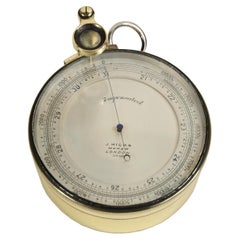
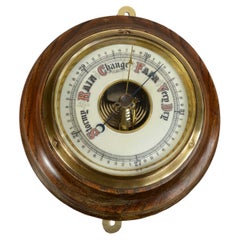
- Brass barometric altimeter signed J. Hicks Maker London from the early 1900sLocated in Milan, ITBrass compensated barometric altimeter complete with magnifying glass signed J. Hicks Maker London from the early 1900s. Diameter cm 7 - inches 2.8, thickness cm 3.2 - inches 1.3. Bu...Category
Antique Early 1900s Scientific Instruments
MaterialsBrass
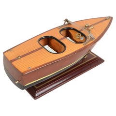
- Scale model of an Italian motorboat from the 1950sLocated in Milan, ITScale model of an Italian speedboat 1950s, wooden planking hull, mounted on wood and brass base. Length cm 25 - inches 9.8, width cm 8.8 - inches 3.4, height with base cm 8.5 - inc...Category
Vintage 1950s Nautical Objects
MaterialsWood
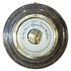
- Antique German aneroid barometer from the early 1900s made of turned marble.Located in Milan, ITAntique German aneroid barometer from the early 1900s made of turned marble, brass, and glass. Good state. Working order. Diameter cm 17 - inches 6.7, thickness cm 5- inches 1.9...Category
Vintage 1910s Scientific Instruments
MaterialsMarble
- Antique English aneroid barometer from the 1930s made of turned wood and brassLocated in Milan, ITAntique English aneroid barometer 1930s turned wood, brass, and glass. Bon état. Working order. Diameter cm 19.7 - inches 7.7, thickness cm 5.5 - inches 2.2. Last photo gift box....Category
Vintage 1930s Scientific Instruments
MaterialsWood
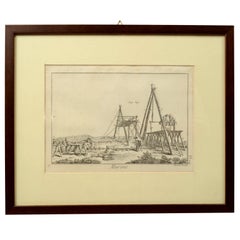
- Engraving Print from the Panckoucke Encyclopédie Nautical Subject 1782-1832Located in Milan, ITPrint by engraving on copper plate from the Panckoucke Encyclopédie méthodique, end of the 18th century,volume Marine Planches (more than 1,500 figures dealing with all subjects on the marina: planes, construction, carpentry, tree trunks, armaments of maneuvers, ropes, sails, artillery, ship maneuvers and combat tactics). This is the plate no. n. 24, pag. 69 fig. 341 ; with frame cm 38.3 x 31.5. Ship ropes are depicted. The Print has the "Benard direxit...Category
Antique 1790s French Nautical Objects
MaterialsPaper
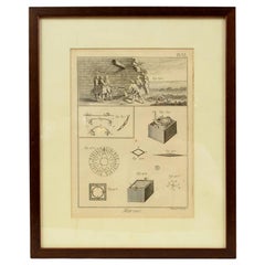
- Engraving Print from the Panckoucke Encyclopédie Nautical Subject 1782-1832Located in Milan, ITPrint by engraving on copper plate from the Panckoucke Encyclopédie méthodique, end of the 18th century, volume Marine Planches (more than 1,500 figures dealing with all subjects on ...Category
Antique 1790s French Nautical Objects
MaterialsPaper
You May Also Like
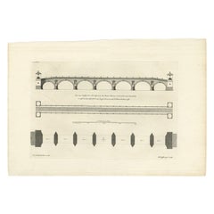
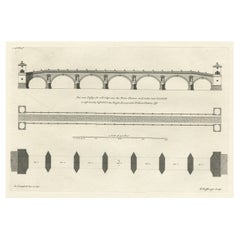
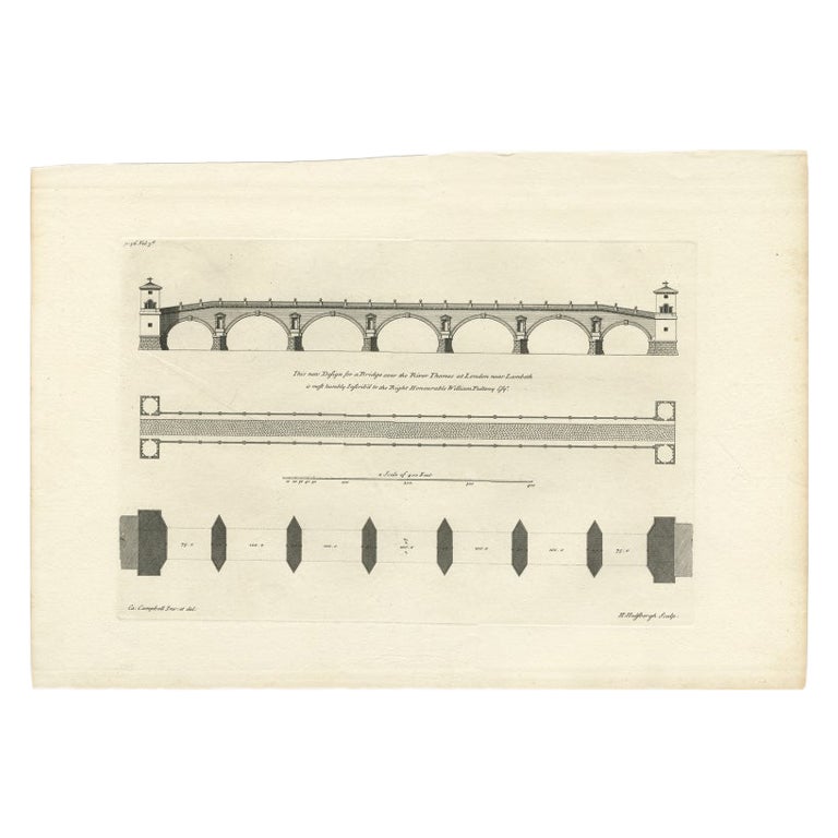
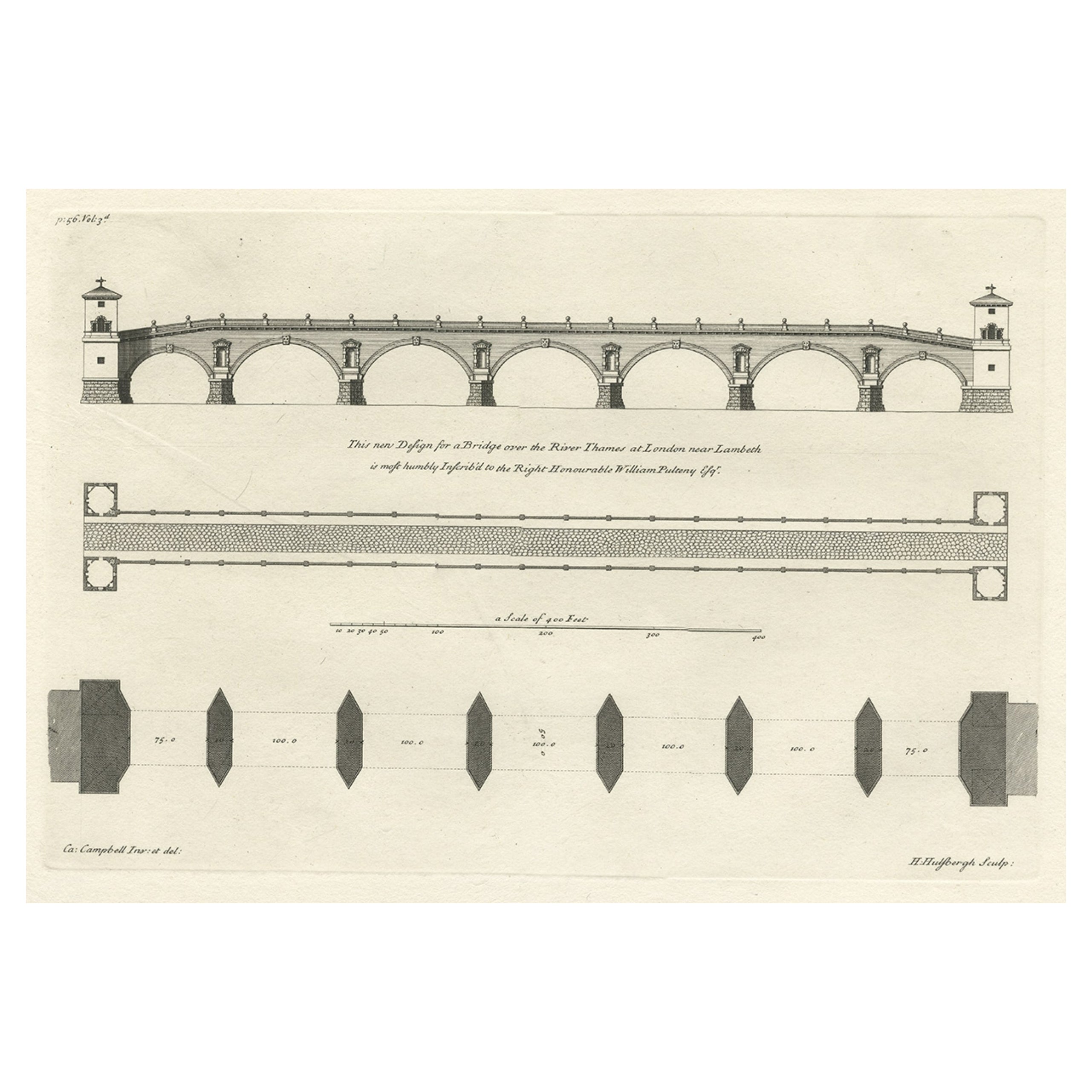
- Antique Print of a Design for a Bridge across the Thames, London, England, 1725Located in Langweer, NLAntique print titled 'This new Design for a Bridge over the River Thames at London (..)'. Print of the design for a new bridge across the Thames at Westminster. This print originates...Category
Antique 18th Century Prints
MaterialsPaper
- Antique Map of the City of London by Balbi '1847'Located in Langweer, NLAntique map titled 'London'. Original antique map of the city of London. This map originates from 'Abrégé de Géographie (..)' by Adrien Balbi. Published 1847.Category
Antique Mid-19th Century Maps
MaterialsPaper
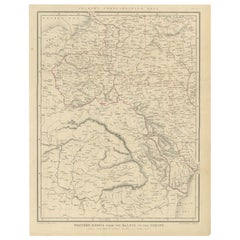
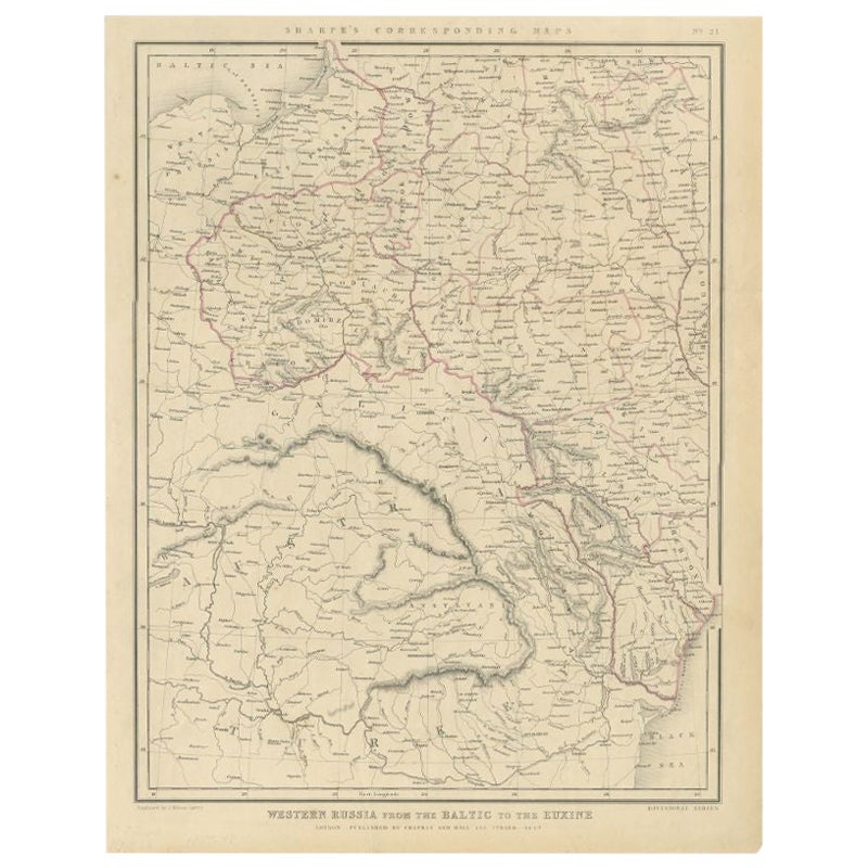
- Antique Map of Russia from the Baltic to the Black Sea by Sharpe, 1849Located in Langweer, NLAntique map titled 'Western Russia from the Baltic to the Euxine'. Old map of Western Russia from the Baltic to the Black Sea. This map originates from 'Sharpe's Corresponding Atlas ...Category
Antique 19th Century Maps
MaterialsPaper
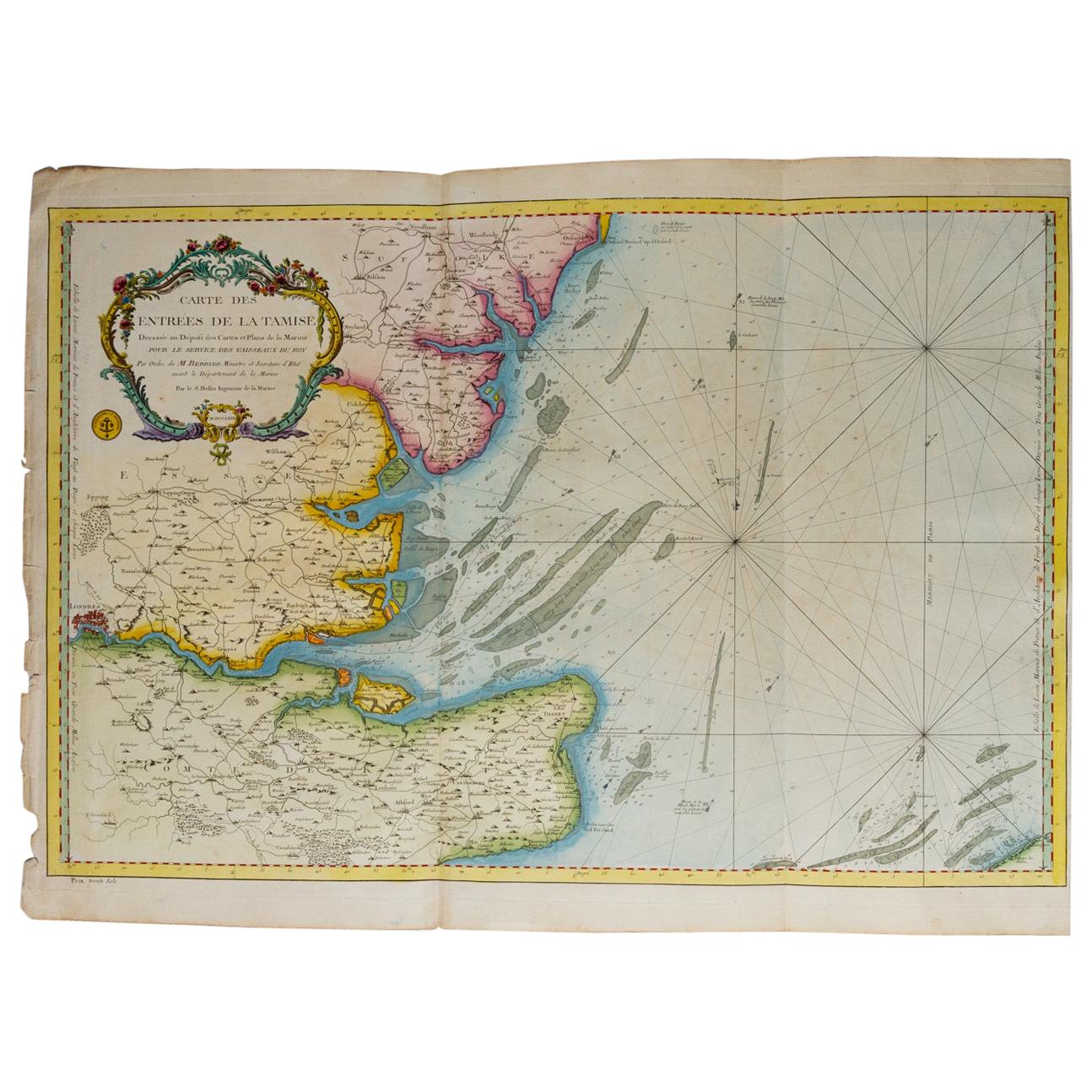
- Map "Estuary- Mouth of the Thames"Located in Alessandria, PiemonteST/426 - Antique French Map of the estuary of the Thames, map dated 1769 - "Mape of the entrance of the Thames. Designed by filing of Navy cards fo...Category
Antique Mid-18th Century French Other Prints
MaterialsPaper
- Antique Design for a New Bridge Across the Thames at Westminster, London, 1725Located in Langweer, NLAntique print titled 'This new Design for a Bridge over the River Thames at London (..)'. Print of the design for a new bridge across the Thames at Westminster. This print originates from 'Vitruvius Britannicus...Category
Antique 1720s Architectural Models
MaterialsPaper
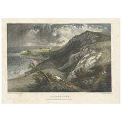
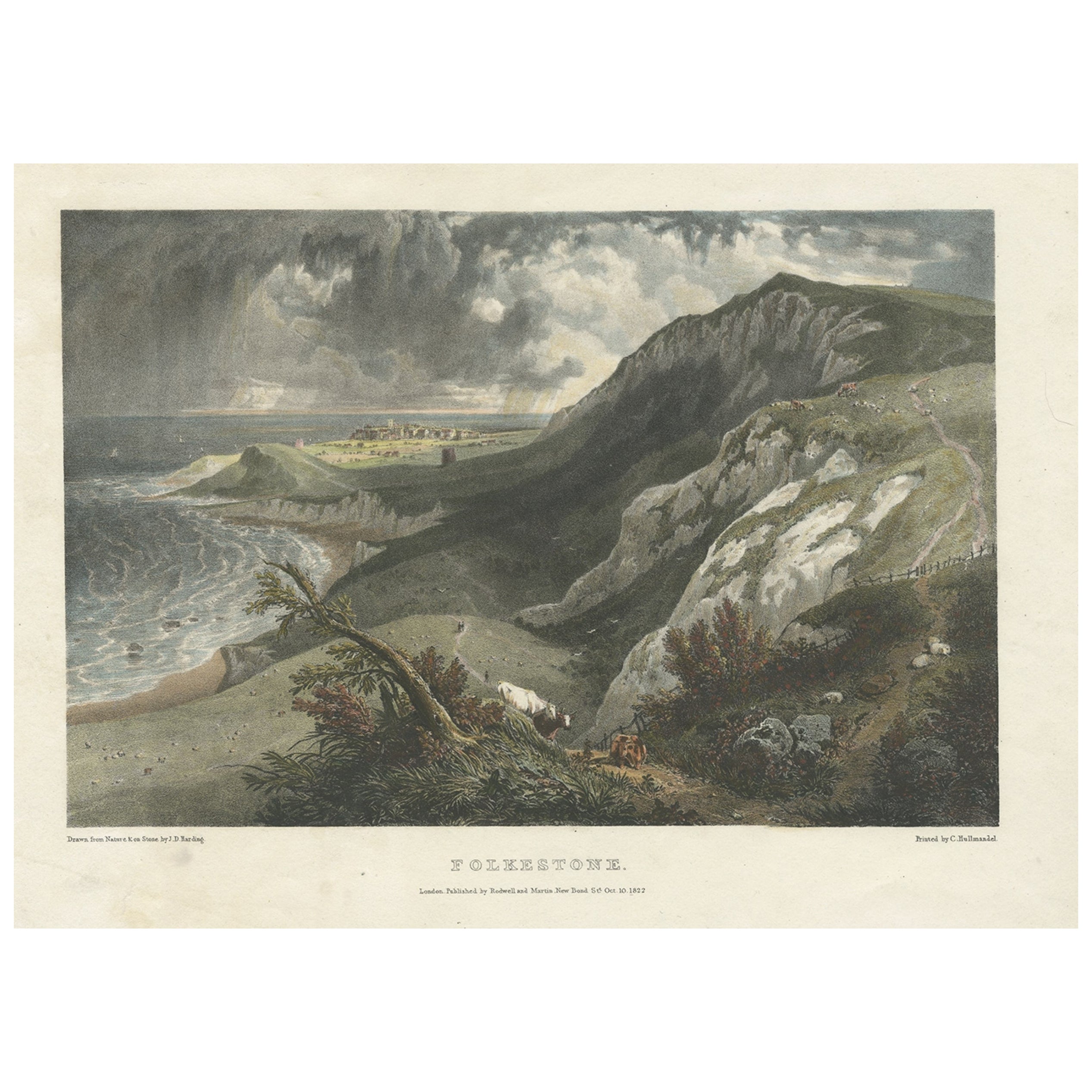
- Hand-Colored Print of Folkestone 'United Kingdom' as Seen from the East, 1822Located in Langweer, NLAntique print titled 'Folkestone'. This print depicts the town of Folkestone (United Kingdom) as seen from the East, the viewpoint high on the cliffs above the Warren, with cattl...Category
Antique 1820s Prints
MaterialsPaper