Items Similar to Original Old China Map, From Korea and the Sea of Japan to Teypin Island, 1803


Want more images or videos?
Request additional images or videos from the seller
1 of 6
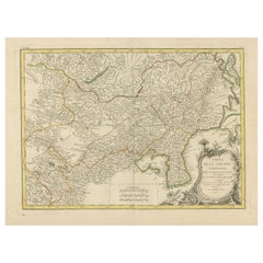
Original Old China Map, From Korea and the Sea of Japan to Teypin Island, 1803
About the Item
Antique map titled 'China, Contains 15 Subject Provinces Including the 2 Islands of Hainan, Formosa and the Tributary Kingdoms of Corea, Tonkin'.
Old map depicting China, extending from Korea and the Sea of Japan to Teypin Island in the south. Originates from Wilkinson's 'A General Atlas, being a Collection of Maps of the World and Quarters the Principal Empires, Kingdoms &c. with their several Provinces & other Subdivisions, Correctly Delineated'.
Artists and Engravers: Robert Wilkinson was active in London as a cartographic publisher from 1785 to 1825. He produced a number of nice works, including a General Atlas and a re-issuance of Bowen & Kitchen's English Atlas, along with excellent large format separate maps.
- Dimensions:Height: 10.63 in (27 cm)Width: 12.01 in (30.5 cm)Depth: 0 in (0.02 mm)
- Materials and Techniques:
- Period:
- Date of Manufacture:1803
- Condition:Wear consistent with age and use. Condition: Good, general age-related toning. Few splits, please study image carefully.
- Seller Location:Langweer, NL
- Reference Number:
About the Seller
5.0
Platinum Seller
These expertly vetted sellers are 1stDibs' most experienced sellers and are rated highest by our customers.
Established in 2009
1stDibs seller since 2017
1,948 sales on 1stDibs
Typical response time: <1 hour
- ShippingRetrieving quote...Ships From: Langweer, Netherlands
- Return PolicyA return for this item may be initiated within 14 days of delivery.
More From This SellerView All
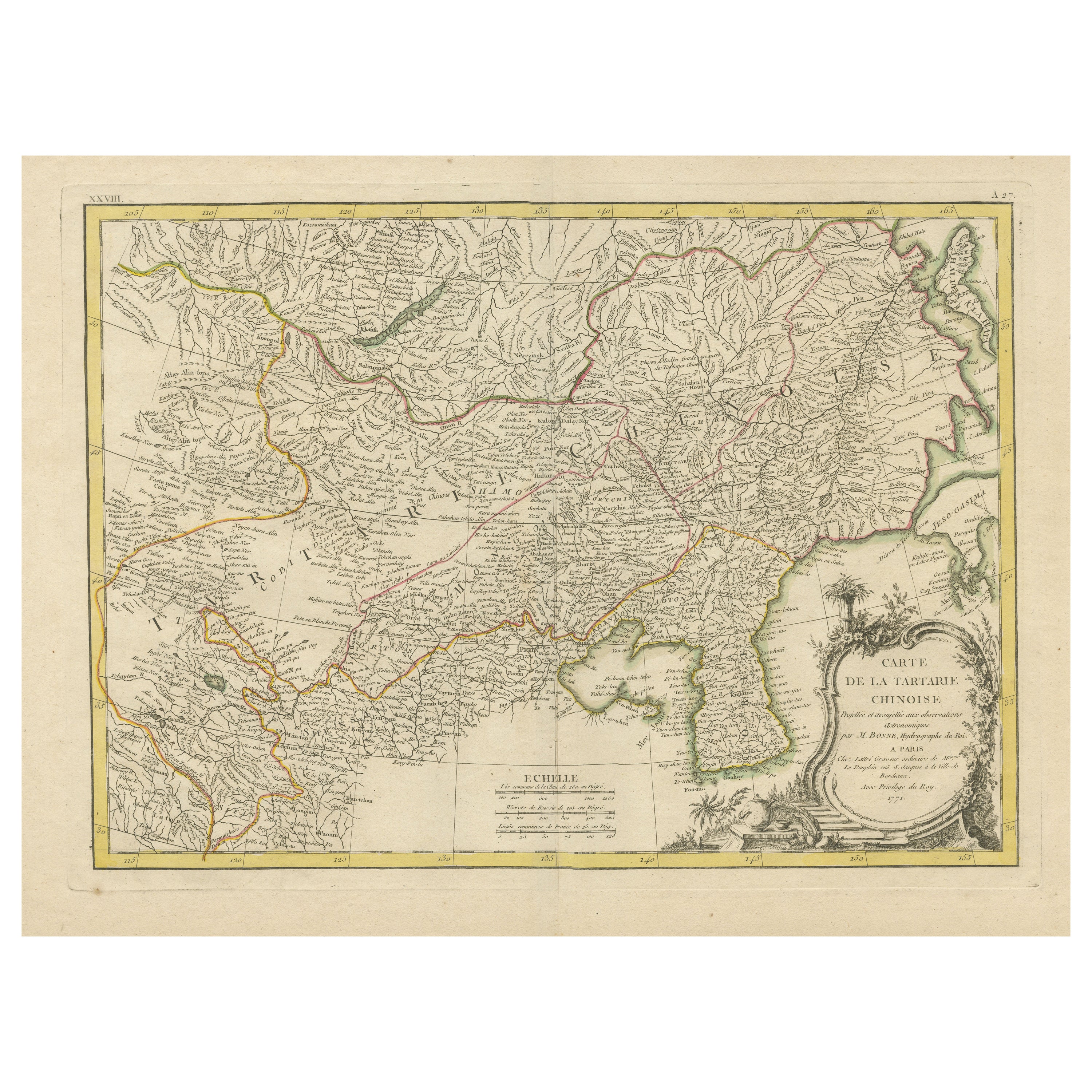
- Original Old Map of Present-Day Mongolia, Northeast China and KoreaLocated in Langweer, NLAntique map titled 'Carte de la Tartarie Chinoise. Projettee et assujettie aux observations astronomiques par M. Bonne, Hydrographe du Roi. A Paris, Chez Lattre Graveur, ordinaire de...Category
Antique Late 18th Century Maps
MaterialsPaper
- Antique Map of the Island of Tahiti, Polynesia, 1803Located in Langweer, NLAntique map Tahiti titled 'Kaart van het Eiland Otahiti'. Antique map of the Island of Tahiti, Polynesia. Originates from 'Reizen Rondom de Waereld door James Cook (..)'. Art...Category
Antique Early 1800s Maps
MaterialsPaper
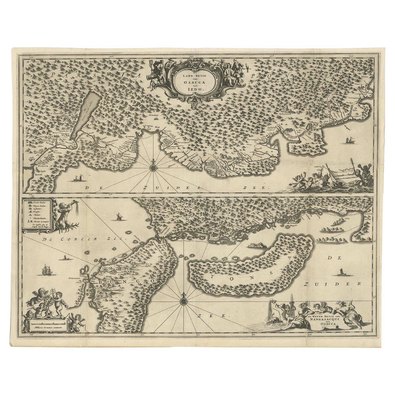
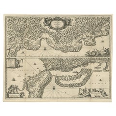
- Map of Japanese Coast from Osaka to Tokyo & the Kyushu and Shikoku Islands, 1669Located in Langweer, NLAntique map titled 'De Land Reyse van Osacca to Iedo. De Water eyse van Nangasacqui tot Osacca.' Two maps on one sheet. The top map shows the Japanese coast from Osaka to Tokyo (Jedo). The lower map shows the strait between mainland Japan and the two large islands...Category
Antique 1660s Maps
MaterialsPaper
- Antique Map of China, Korea, Japan and the Northern Philippines, circa 1780Located in Langweer, NLAntique map titled 'Carte de l'Empire de la Chine de la Tartarie Chinoise, et du Royaume de Corée'. Interesting and detailed map of China, Korea, Japan and the Northern Philippines. ...Category
Antique Late 18th Century Maps
MaterialsPaper
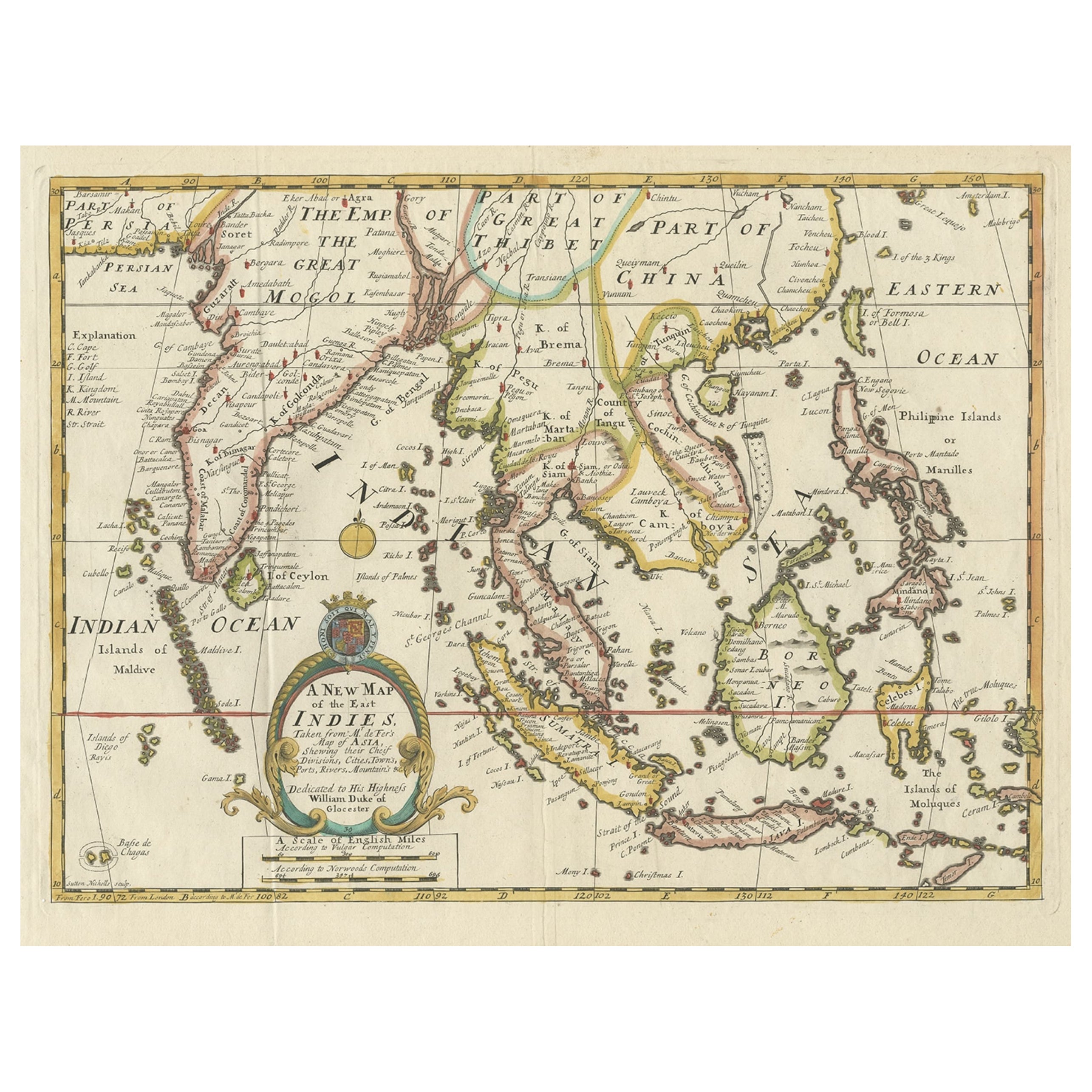
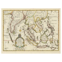
- Old Map Covering All of Southeast Asia from Persia to the Timor Island, 1712Located in Langweer, NLDescription: Antique map titled 'A New Map of the East Indies'. Old map covering all of Southeast Asia from Persia to the Timor Island, inclusive of the modern day nations of India, ...Category
Antique 1710s Maps
MaterialsPaper
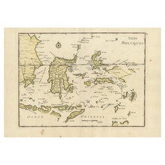
- Old Original Antique Map of the Islands of East Indonesia, 1756Located in Langweer, NLTitle: Isles Moluques. Old and rare, this decorative map of the Maluku Islands in the period it was still controlled by the Dutch colonial power. It also shows the island of Bali, Lombok, part of Borneo (Kalimantan), Celebes (Sulawesi), Timor, The Lesser Sunda Islands, West Papua...Category
Antique 1750s Maps
MaterialsPaper


You May Also Like
- Hand-Colored 18th Century Homann Map of Denmark and Islands in the Baltic SeaBy Johann Baptist HomannLocated in Alamo, CAAn 18th century copper plate hand-colored map entitled "Insulae Danicae in Mari Balthico Sitae utpote Zeelandia, Fionia, Langelandia, Lalandia, Falstria, Fembria Mona" created by Joh...Category
Antique Early 18th Century German Maps
MaterialsPaper
- Old Nautical Map of CorsicaLocated in Alessandria, PiemonteST/556/1 - Old map of Corsica isle, surveyed by Captain Hell, of the French Royal Navy in 1824, engraved and published on 1874, with additions and corre...Category
Antique Early 19th Century English Other Prints
MaterialsPaper
- Old Horizontal Map of EnglandBy TassoLocated in Alessandria, PiemonteST/520 - Old rare Italian map of England, dated 1826-1827 - by Girolamo Tasso, editor in Venise, for the atlas of M.r Le-Sage.Category
Antique Early 19th Century Italian Other Prints
MaterialsPaper
- New Map of North America from the Latest Discoveries, 1763Located in Philadelphia, PAA fine antique 18th century map of the North American seaboard. Entitled "A New Map of North America from the Latest Discoveries 1763". By the Cartographer/Engraver - John Spil...Category
Antique Mid-18th Century English Georgian Maps
MaterialsPaper
- Vintage "View of the Center of Paris Taken from the Air" Lithograph MapLocated in San Diego, CAA very stylish "View of the Center of Paris Taken from the Air" lithograph map published by the Paris Ministry of Tourism, circa early 1950s. The piece measures 27" x 43" and shows...Category
20th Century French Mid-Century Modern Prints
MaterialsPaper
- Hand-Colored 18th Century Homann Map of the Black Sea, Turkey and Asia MinorBy Johann Baptist HomannLocated in Alamo, CAAn attractive original early 18th century hand-colored map of the Black Sea and Turkey entitled "Carte de L'Asie Minevre ou de la Natolie et du Pont Evxin Tiree des Voyages et des Ob...Category
Antique Early 18th Century German Maps
MaterialsPaper


Recently Viewed
View AllMore Ways To Browse
Antique Kitchen Collectibles
Antique Kitchen Island Kitchen
Antique Kitchen Island Furniture
Kitchen Island Antique Furniture
Antique Chinese Furniture London
Antique Quarters
Korean Japanese
Large Kitchen Island
Chinese Antiques London
Japanese Empire
General Empire
Korea Antique Furniture
Korean Antiques
English Empire Antiques
Old Kitchen Island
Large Antique Kitchen Island
Map Of Japan
Large Antique Map Of The World