Mid-19th Century Maps
69
715
to
211
674
41
715
715
715
30
8
2
2,886
2,122
411
5
228
30
11
85
7
56
6
3
3
4
5
2
688
43
13
4
3
99
77
43
32
32
106
4
2
1
1
Period: Mid-19th Century
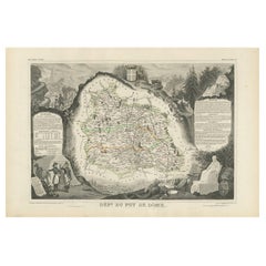
Antique Map of Puy de Dôme ‘France’ by V. Levasseur, 1854
Located in Langweer, NL
Antique map titled 'Dépt. du Puy de Dôme'. Map of the French department of Puy De Dome, France. This mountainous department includes Auvergne, one of the l...
Category
Antique Mid-19th Century Maps
Materials
Paper
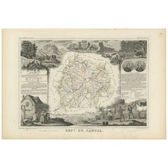
Antique Map of Cantal ‘France’ by V. Levasseur, 1854
Located in Langweer, NL
Antique map titled 'Dépt. du Cantal'. Map of the French department of Cantal, France. This area of France is known for its production of Cantal, a firm cheese, named after the region...
Category
Antique Mid-19th Century Maps
Materials
Paper
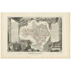
Antique Map of Gard ‘France’ by V. Levasseur, 1854
Located in Langweer, NL
Antique map titled 'Dépt. du Gard'. Map of the French department of Gard, France. This area of France is known mainly for its red wine and production of Bleu des Causses, a soft and ...
Category
Antique Mid-19th Century Maps
Materials
Paper
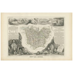
Antique Map of Eure ‘France’ by V. Levasseur, 1854
Located in Langweer, NL
Antique map titled 'Dépt. de l'Eure'. Map of the French department of Eure, France. This region of France is home to Giverny, where impressionist Claude Monet’s home and garden can b...
Category
Antique Mid-19th Century Maps
Materials
Paper
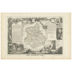
Antique Map of Eure Et Loir ‘France’ by v. Levasseur, 1854
Located in Langweer, NL
Antique map titled 'Dépt. d'Eure et Loir'. Map of the French department of Eure Et Loir, France. This area is home to the famous Chartres Cathedral....
Category
Antique Mid-19th Century Maps
Materials
Paper
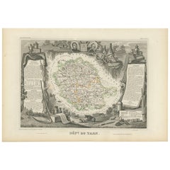
Antique Map of Tarn 'France' by V. Levasseur, 1854
Located in Langweer, NL
Antique map titled 'Dépt. du Tarn'. Map of the French department of Tarn, France. This area produces a variety of traditional wines, including Cahors, Mauzac, Loin de l'Oeil and Onde...
Category
Antique Mid-19th Century Maps
Materials
Paper
Antique Map of Indre ‘France’ by V. Levasseur, 1854
Located in Langweer, NL
Antique map titled 'Dépt. de l'Indre'. Map of the French department of Indre, France. Part of the Loire Valley wine region, this area is known for its production of Chinon wines, typ...
Category
Antique Mid-19th Century Maps
Materials
Paper
Antique Map of Tarn and Garonne in France, 1854
Located in Langweer, NL
Antique map titled 'Dépt. de Tarn et Garonne'. Map of the French department of Tarn et Garonne, France. This map is centered around the city of Moissac, which is known for its fine d...
Category
Antique Mid-19th Century Maps
Materials
Paper
Antique Map of Victoria ‘Australia’ by J. Tallis, circa 1855
Located in Langweer, NL
A highly decorative and finely engraved mid-19th century map of Victoria, Australia which appeared in John Tallis & co.'s The Illustrated Atlas (London...
Category
Antique Mid-19th Century Maps
Materials
Paper
Antique Map of Italy by Andriveau-Goujon, 1843
By Andriveau-Goujon
Located in New York, NY
Antique Map of Italy by Andriveau-Goujon, 1843. Map of Italy in two parts by Andriveau-Goujon for the Library of Prince Carini at Palazzo Carini i...
Category
French Antique Mid-19th Century Maps
Materials
Linen, Paper
Antique Map of Russia 'in Europe' by W. & A.K. Johnston, circa 1850
Located in Langweer, NL
Detailed map of the region with a decorative piano key border. This map shows towns, railroads, rivers, lakes, mountains, railroad lines, Sub-oceanic Telegraph lines, etc.
Category
Antique Mid-19th Century Maps
Materials
Paper
Empires of the East: An Ornate Tallis Map of Tibet, Mongolia, and Manchuri, 1851
Located in Langweer, NL
This original - with hand-colored borders- map of Tibet, Mongolia, and Manchuria is an example of the intricate work produced by John Tallis & Company, who were known for their detailed and artistic maps in the mid-19th century.
**The Maker - John Tallis & Company:**
Tallis maps were distinctive for their ornamental borders and detailed vignettes. They often contained illustrations that provided a snapshot of the culture, geography, and significant landmarks of the region they represented.
**The Map - Tibet, Mongolia, and Manchuria:**
This map would have represented the regions of Central and East Asia, areas of great interest during the British Empire's expansion, though not directly controlled by the British. They would be significant for trade routes, exploration, and for the British understanding of global geography.
**The Countries:**
- **Tibet**: Known for its unique cultural heritage and as the home of Tibetan Buddhism, it's a region of high plateaus and significant religious landmarks.
- **Mongolia**: Characterized by its vast steppes and as the homeland of the Mongol hordes that once conquered much of the known world.
- **Manchuria**: Rich in natural resources, it has been a region contested by various powers due to its strategic importance.
**The Tallis Series:**
"The British Colonies" by Robert Montgomery Martin was intended to educate and inform the British public about the wide-reaching impact of the British Empire and to provide detailed information about regions that were important for British interests. While Tibet, Mongolia, and Manchuria were not British colonies, their inclusion in the series suggests a British interest in the wider geopolitical landscape of Asia.
Collectors and enthusiasts today value these maps for their beauty, historical significance, and the insight they provide into the British perspective of the world during the era of their greatest colonial expansion.
More details on the insets:
The insets on this map are detailed illustrations depicting significant landmarks and cultural representations of Tibet, Mongolia, and Manchuria. They were a common feature in the Tallis maps, intended to provide a visual narrative to accompany the geographic information. Here's a description of the insets:
1. **Leh, Little Tibet**: A panoramic view of the cityscape of Leh, the capital of Ladakh in the region historically known as Little Tibet. The architecture is clearly influenced by Tibetan style, with multi-story white-washed buildings tightly packed together against a backdrop of rugged mountains.
2. **Chinese Wall**: This vignette depicts a section of the Great Wall of China, showcasing its massive fortifications and watchtowers. The wall snakes...
Category
Antique Mid-19th Century Maps
Materials
Paper
An Illustrated Map of Kabul, Punjab, and Baluchistan by Tallis, 1851
Located in Langweer, NL
This map, attributed to John Tallis and featuring the work of Robert Montgomery Martin, is part of a series created for the publication "The British Colonies." John Tallis & Company was known for its detailed and decorative maps in the mid-19th century, often including elaborate margins and vignettes that offer insight into the culture, landscape, and history of the region depicted.
The map shows the regions of Cabul (an older spelling of Kabul, Afghanistan), the Punjab (a region of northern India and eastern Pakistan), and Beloochistan (an alternative spelling of Balochistan, a region in southwestern Pakistan). The illustrated margins are typical of Tallis maps, adorned with decorative elements and scenes that are likely representations of local landmarks, people, and ways of life.
The vignettes are particularly interesting as they serve a dual purpose: they are ornamental and informative. They provide a visual narrative about the regions, complementing the geographical information with human interest. The scenes may depict local figures, architecture, landscapes, and activities that were thought to be characteristic of the area at the time.
John Tallis maps...
Category
Antique Mid-19th Century Maps
Materials
Paper
Antique Lithography Map of Cheshire, English, Framed, Cartography, Victorian
Located in Hele, Devon, GB
This is an antique lithography map of Cheshire. An English, framed atlas engraving of cartographic interest, dating to the mid 19th century and lat...
Category
British Victorian Antique Mid-19th Century Maps
Materials
Wood
Antique Map of the Southern United States with Inset Map of New Orleans
Located in Langweer, NL
Antique map titled 'Die Staaten von Arkansas Mississippi, Louisiana & Alabama'. Detailed map of the region, which includes the Florida Panhandle. Shows many roads, rivers, forts, etc...
Category
Antique Mid-19th Century Maps
Materials
Paper
Antique Map of Côte d'Or ‘France’ by V. Levasseur, 1854
Located in Langweer, NL
Antique map titled 'Dépt. de la Côte d'Or'. Map of the French department of Cote D’Or, France. Part of France's Burgundy or Bourgogne wine region, a premier wine-growing region of Fr...
Category
Antique Mid-19th Century Maps
Materials
Paper
Civil War Panorama of the Seat of War by John Bachmann, Antique Print circa 1864
Located in Colorado Springs, CO
Panorama of the seat of war. Bird's-eye View of Virginia, Maryland, Delaware and the District of Columbia.
This third state of this fascinating bird's eye view of the northernmost p...
Category
American Antique Mid-19th Century Maps
Materials
Paper
Mitchell's New National Wall Map Exhibiting the United States, circa 1856
Located in Colorado Springs, CO
"Mitchell's New National Map of the United States, North American British Provinces, Sandwich Islands, Mexico and Central America together with Cuba and other West India Islands."
This is the first edition of Mitchell's important 1856 wall map of the United States, Mexico and the West Indies. The map depicts the entire nation from Atlantic to Pacific, with inset maps of the World on Mercator's Projection and the World on Globular Projection, and Hawaii (The Sandwich Islands).
The map was one of the most commercially successful maps of its time, regularly amended to update the changing territorial and state borders of the West.
In his important book on "Mapping the Transmississippi...
Category
American Antique Mid-19th Century Maps
Decorative Antique Map of the Seine River and Paris in France, ca.1854
Located in Langweer, NL
Antique map titled 'Dépt. de la Seine'. Map of the French department of Seine. Focusing on Paris, this map covers from the Foret de St. Germain to the Bois Notre Dame and from Versai...
Category
Antique Mid-19th Century Maps
Materials
Paper
Recently Viewed
View AllMore Ways To Browse
Map Of Colorado
Ottoman Empire Map
Rene Descartes
The Gambia
Vintage Wooden Roller
Antique Furniture Arkansas
Antique Furniture Kingston
Antique Indian Furniture Australia
Antique Map Burgundy
Antique Map Of Yorkshire
Antique Maps Of Cape Of Good Hope
Antique Maps Yorkshire
Antique Outpost
Chinese Wall Pocket
Map Manila
Map Of Essex
Map Of Normandy
Victorian Floor Vase
