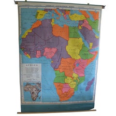
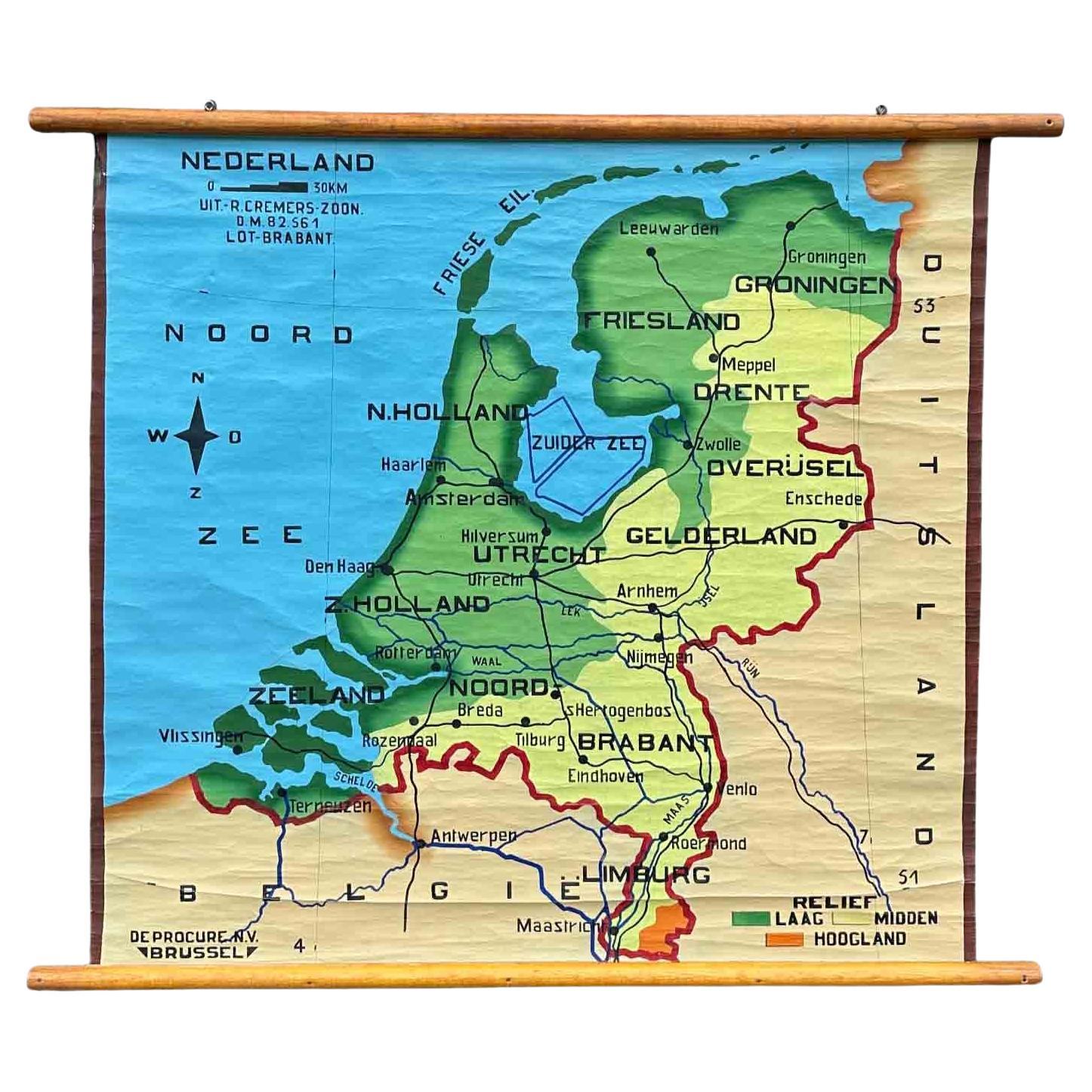
Schoolroom Geography Map of Africa, 1957 Edition
View Similar Items


1 of 10
Schoolroom Geography Map of Africa, 1957 Edition
About the Item
- Dimensions:Height: 72 in (182.88 cm)Width: 36 in (91.44 cm)Depth: 2 in (5.08 cm)
- Style:Schoolhouse (Of the Period)
- Materials and Techniques:Hardwood,Paper
- Place of Origin:
- Period:
- Date of Manufacture:1957
- Condition:Wear consistent with age and use.
- Seller Location:Madison, WI
- Reference Number:1stDibs: LU923510986431
You May Also LikeView All
- Geographical Antique Map of Principality of MonacoBy Bruno SantiniLocated in Alessandria, PiemonteST/609 - Interesting antique color map of Monaco Principality in French language : "Carte qui contient le Principauté de Piémont, le Monferrat et la comté de...Category
Antique Late 18th Century Italian Other Maps
MaterialsPaper
 $761 Sale Price20% Off
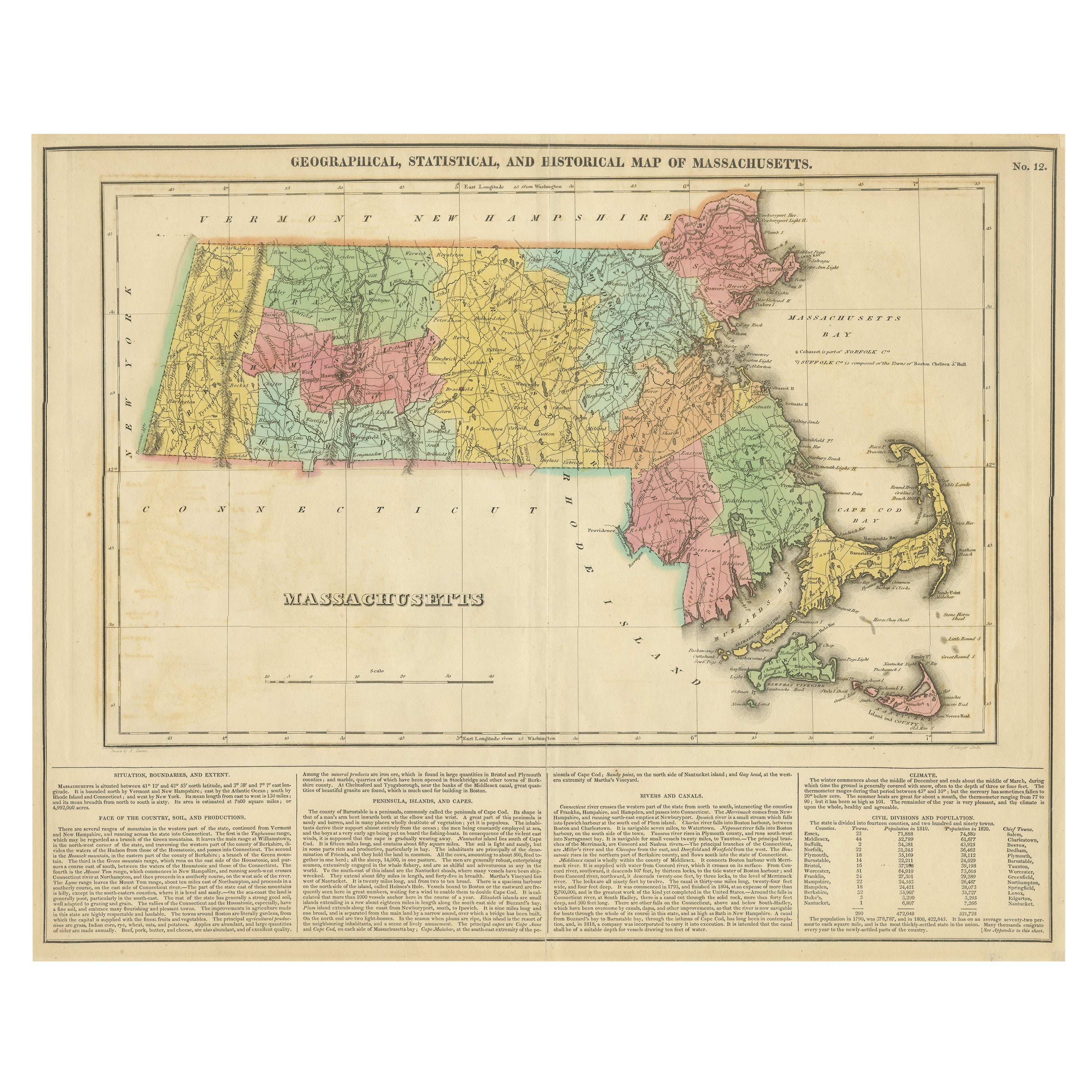
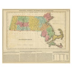
 - Antique Geographical, Historical and Statistical Map of Massachusetts, 1822Located in Langweer, NLThis attractive map of Massachusetts presents a finely detailed overview of the state in the first quarter of the 19th century. Transportation ...Category
Antique 1820s Maps
MaterialsPaper
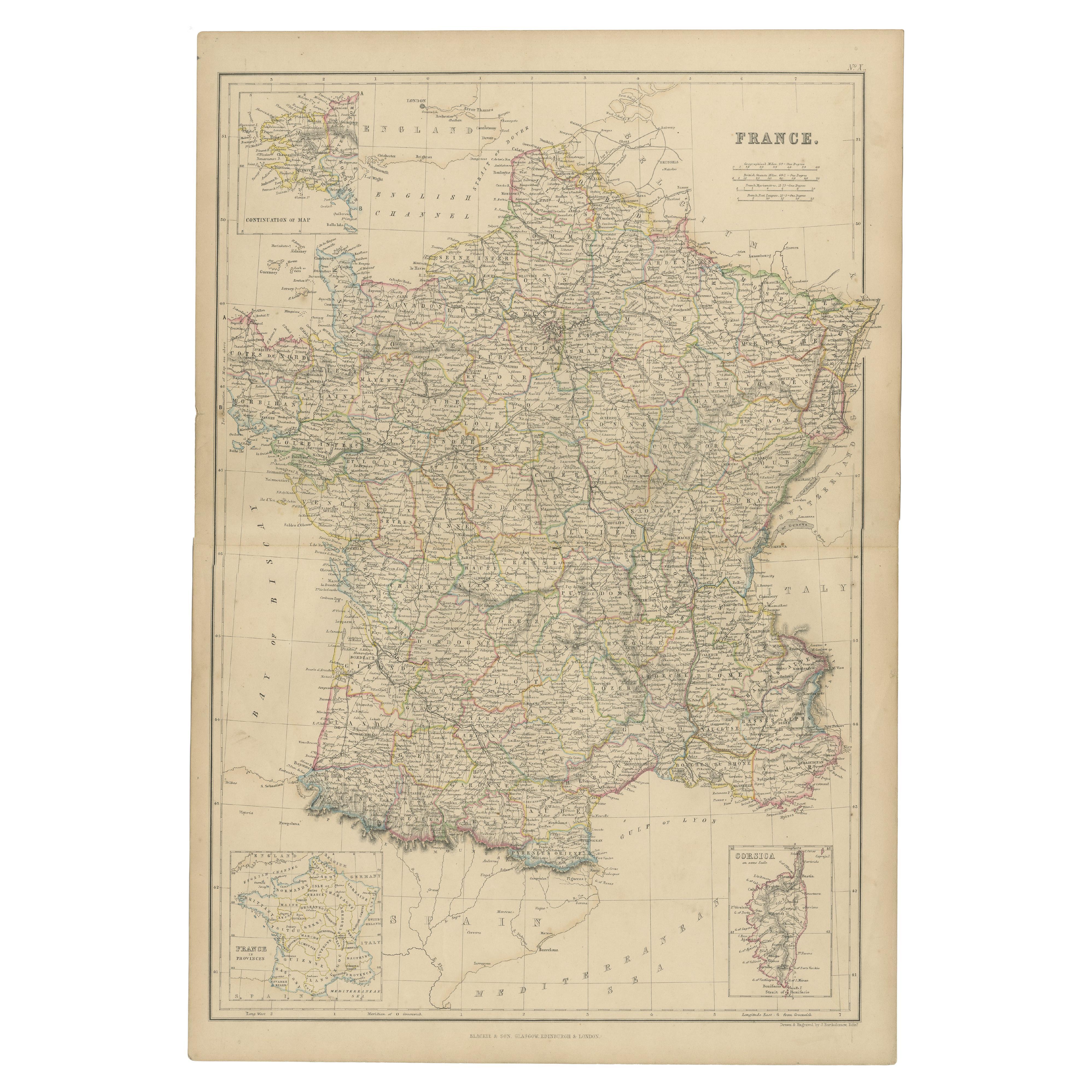
- 1859 Classic Map of France: Blackie's Imperial Geographic MasterpieceLocated in Langweer, NLThe "Antique Map of France" from 'The Imperial Atlas of Modern Geography', published in 1859 by W. G. Blackie, is a historically valuable cartographic work that offers a comprehensiv...Category
Antique Mid-19th Century Maps
MaterialsPaper
 $193 Sale Price30% Off
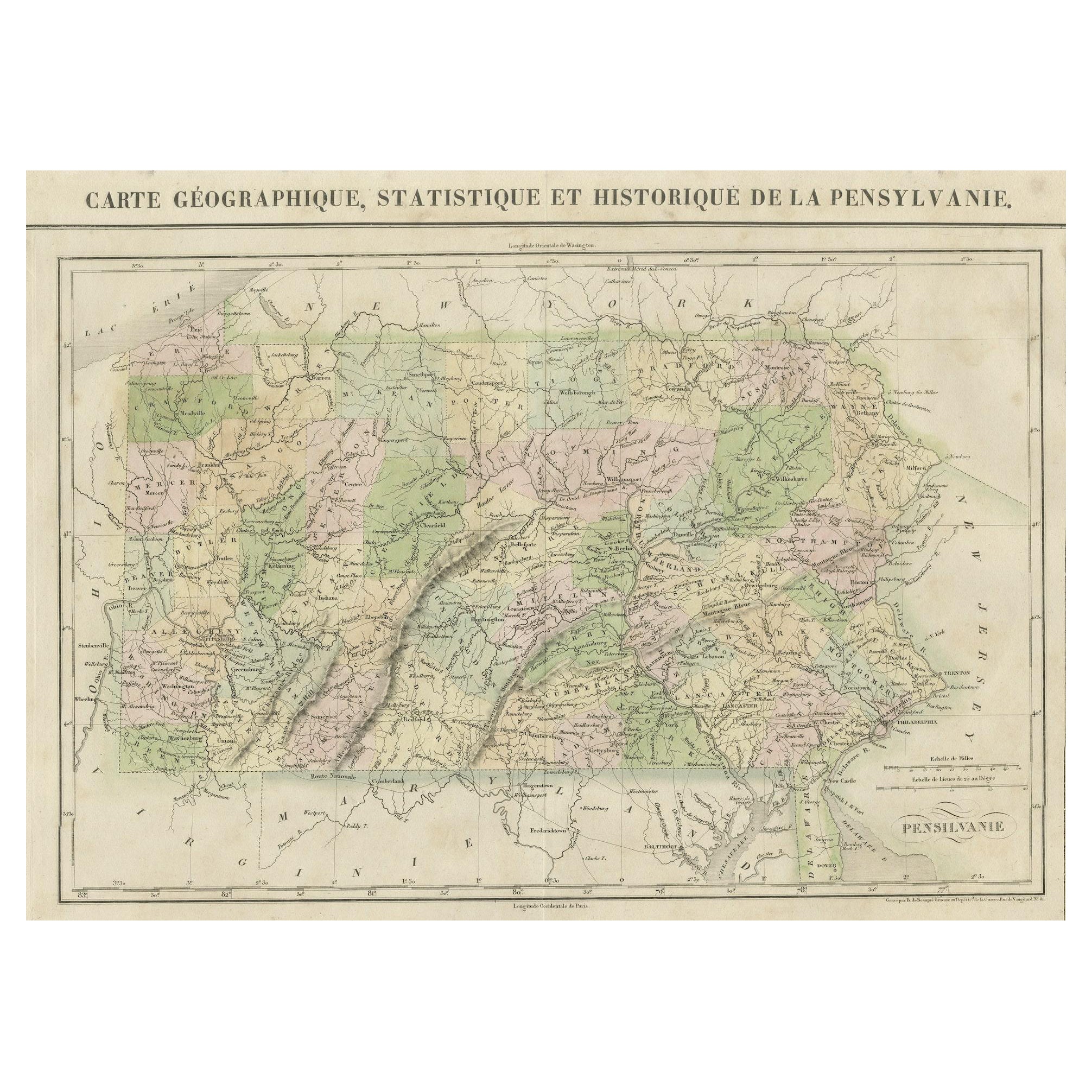
 - French Geographical, Statistical and Historical Map of Pensylvania, 1825Located in Langweer, NLTitle: Carte geographique, statistique et historique de la Pensylvanie. Beautiful Hand-Colored 1825 French Map of Pennsylvania, with a List of Prominent Rivers, Descriptions of Mountains, Climate and Government as well as a list of Colonial and post-American Revolution Governors Produced by: J. Carez in Paris. (1825) Hand colored engraved map. Relief shown by hachures. Text and tables at sides and bottom. Prime meridians: Washington and Paris. A very interesting 1825 French hand-colored map of Pennsylvania from Lucas' 1822 map, which breaks down county populations by Whites and Free Blacks. "Carte Geographique, Statistique et Historique de la Pensylvanie" Originally published in 1822 by Carey and Lea and then revised and republished in 1825 by J. A. C. Buchon (1791-1846 ) in a French edition entitled Atlas Geographique des Deux Ameriques, printed by J. Carez. Fielding Lucas, Jr. (1781-1854), a Baltimore mapmaker and publisher, drew the map. original hand-coloring. Shown on the map are parts of Maryland, Delaware, New York and New jersey. Printed on the same page as the map is geographical, statistical, and historical information about Pennsylvania, such as descriptions of the state's important rivers, a list of Governors since its founding as well as important French and Indian...Category
Antique 1820s Maps
MaterialsPaper
 $425 Sale Price20% Off
 - Original Antique Map of AfricaLocated in Langweer, NLAntique map titled 'Afrika'. Original antique map of Africa, drawn by Van Beusekom. Published by 'Seyffardt's Boekhandel' in Amsterdam, circa 1870.Category
Antique Late 19th Century Maps
MaterialsPaper
 $301 Sale Price20% Off
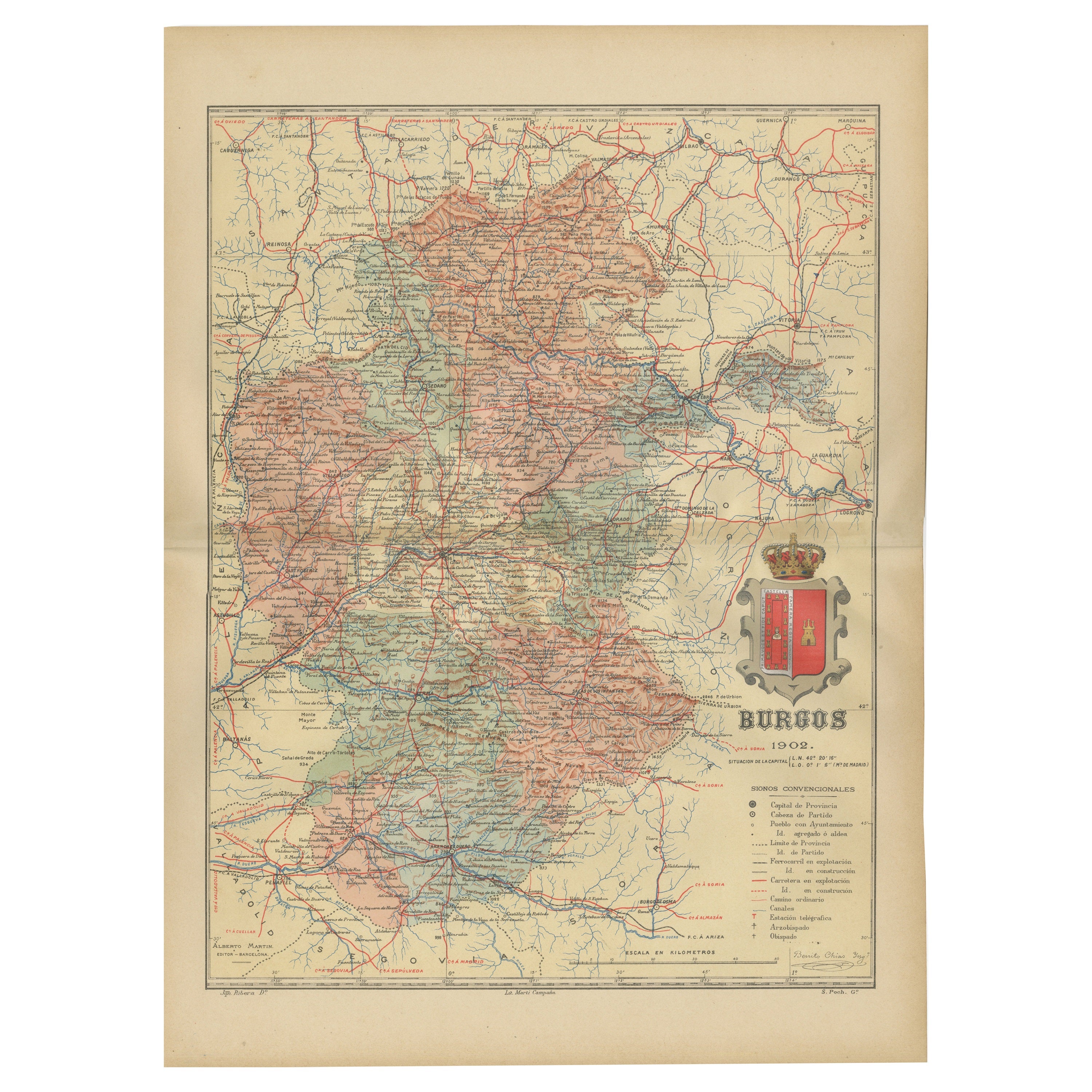
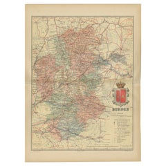
 - Burgos 1902: Geographic Map of Castile's Historic Heartland in SpainLocated in Langweer, NLThe map of the province of Burgos in the autonomous community of Castile and León in Spain, dated 1902. It includes the following features: The map highlights the varied terrain wit...Category
Antique Early 1900s Maps
MaterialsPaper
Recently Viewed
View AllMore Ways To Browse
Vintage Wooden Roller
Vintage Schoolroom
Antique Historical Maps
Rare Maps
Original Antique World Map
Authentic Antique Maps
Antique Rare Maps
Rare Antique Maps
Map Of Provence
16th Century World Map
Map Of France
Buy Antique Paper
Antique Collectible Plates
Map Of Itsly
World Atlas
Antique Maps 18th Century
Antique Land
Antique Old Maps