Items Similar to Engraving of A Savage of the Admiralty Isles in the Bismarck Archipelago, 1801

Want more images or videos?
Request additional images or videos from the seller
1 of 6
Engraving of A Savage of the Admiralty Isles in the Bismarck Archipelago, 1801
About the Item
The 1801 engraving depicts a figure labeled as "A Savage of the Admiralty Isles in the South Sea." The image portrays a solitary indigenous man standing with a paddle in hand, exuding a sense of strength and resilience. His attire and adornments suggest a cultural significance, and the backdrop of tropical foliage and distant canoes speak to his connection with the natural environment of the Admiralty Islands. The engraving serves as a historical representation of the people from this region during the era of exploration.
In his left hand, the figure is potentially holding a headrest, which is a type of personal support device used to keep one's head elevated. Headrests were commonly used in various cultures, especially in regions of Africa and Oceania, and can serve as a pillow to protect elaborate hairstyles while sleeping. This object in the figure's hand is detailed with a pattern, indicating its cultural and possibly personal significance.
Description: This is a circa 1801 copperplate engraving from George Alexander Cooke's "Universal Geography" .
The print is part of George Alexander Cooke's comprehensive work "A Modern and Authentic System of Universal Geography." This book was a significant compilation of geographical knowledge during the late 18th century, offering descriptions and accounts of various parts of the world, influenced by the age of exploration. It includes narratives of famed explorers like Captain James Cook and Ferdinand Magellan, detailing their discoveries and journeys that expanded the European understanding of the globe. Cooke's work served as both a chronicle and reference for the territories and cultures encountered by these voyagers.
- Dimensions:Height: 10.44 in (26.5 cm)Width: 7.88 in (20 cm)Depth: 0 in (0.02 mm)
- Materials and Techniques:Paper,Engraved
- Period:
- Date of Manufacture:circa 1801
- Condition:Good. Two small black spots in top left outside of the plate mark and thus image. Aged paper with typically warm, yellowish-brown hue. This is not a reproduction but an original engraving. Study the image carefully.
- Seller Location:Langweer, NL
- Reference Number:
About the Seller
5.0
Platinum Seller
These expertly vetted sellers are 1stDibs' most experienced sellers and are rated highest by our customers.
Established in 2009
1stDibs seller since 2017
1,947 sales on 1stDibs
Typical response time: <1 hour
- ShippingRetrieving quote...Ships From: Langweer, Netherlands
- Return PolicyA return for this item may be initiated within 14 days of delivery.
More From This SellerView All
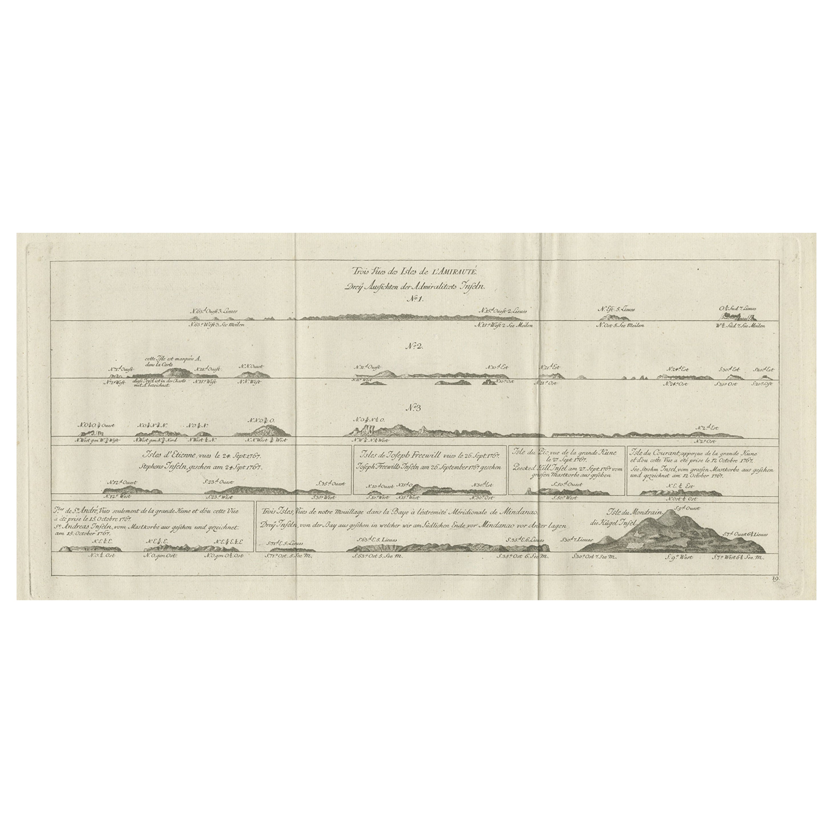
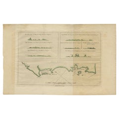
- Original Antique Engraving of the Admiralty Islands 'Bismarck Archipelago', 1774Located in Langweer, NLAntique print titled 'Trois Vues des Isles de l'Amirauté (..)'. Several coastal views of the Admiralty Islands. Originates from 'Geschichte der See-Reisen und Entdeckungen im Süd-Mee...Category
Antique 18th Century Prints
MaterialsPaper
- Antique Map of the Admiralty Islands, Bismarck ArchipelagoLocated in Langweer, NLAntique map titled 'Trois Vues des Isles de l'Amirauté'. Several coastal views of the Admiralty Islands, Bismarck Archipelago, to the north of New Guinea in the South Pacific Ocean. ...Category
Antique Late 18th Century Maps
MaterialsPaper
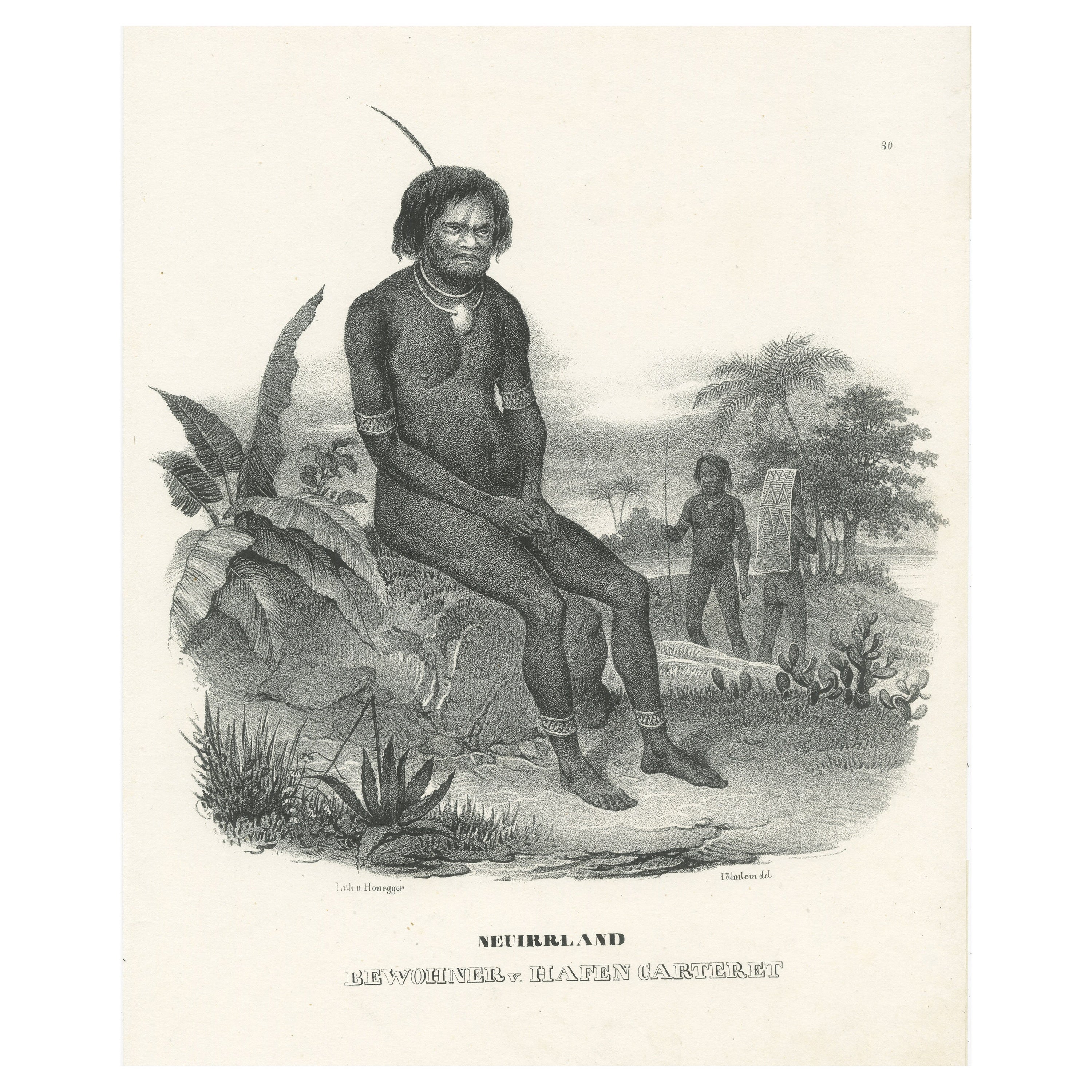
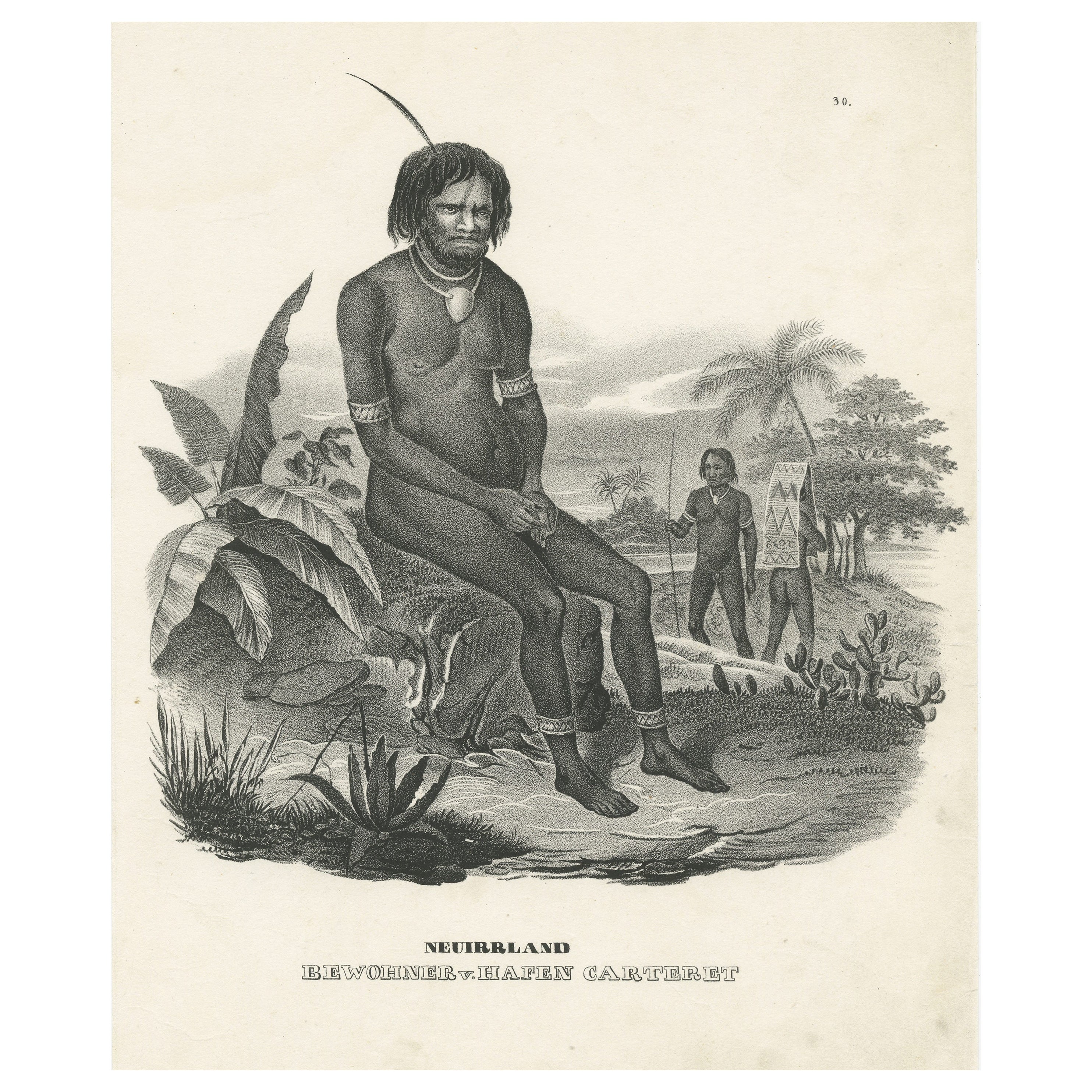
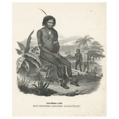
- Antique Print of a Native of the Port of Carteret, Bismarck ArchipelagoLocated in Langweer, NLAntique print titled 'Neuirrland, Bewohner v. Hafen Carteret'. Male native of the Bismarck Archipelago, seated on an overgrown rock, two fellow tribesmen on the right, one with a pla...Category
Antique Mid-19th Century Prints
MaterialsPaper
- Antique Print of a Native of the Bismarck Archipelago, Port of CarteretLocated in Langweer, NLAntique print titled 'Neuirrland, Bewohner v. Hafen Carteret'. Male native of the Bismarck Archipelago, seated on an overgrown rock, two fellow tribesmen on the right, one with a pla...Category
Antique Mid-19th Century Prints
MaterialsPaper
- Antique Map of New Ireland Island in the Bismarck Archipelago, New Guinea, 1772Located in Langweer, NLAntique map titled 'Nova Hibernia'. Antique map of New Ireland, an island in the Bismarck Archipelago, New Guinea. Lying just north of New Britain, from which it is separated by St. ...Category
Antique 18th Century Maps
MaterialsPaper
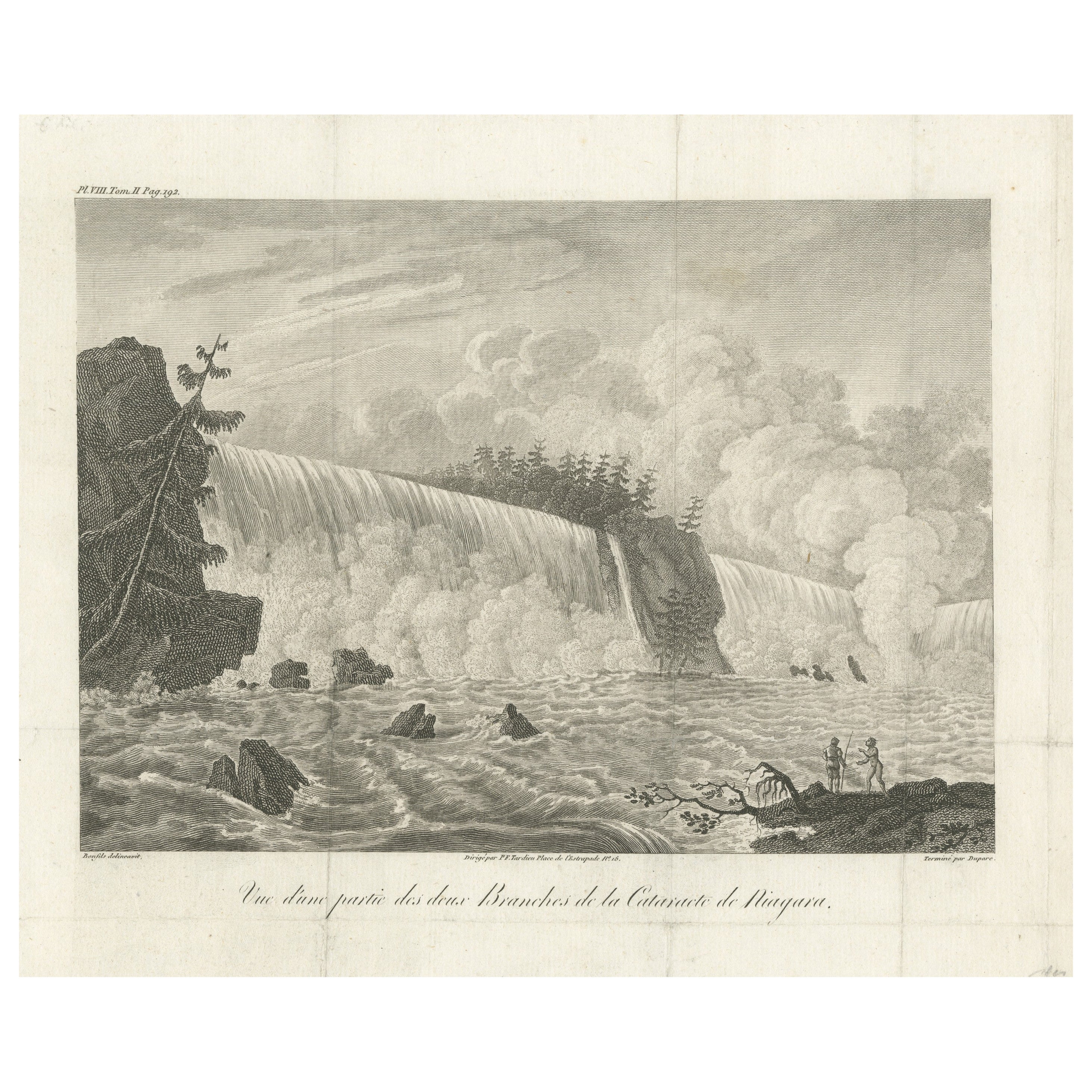
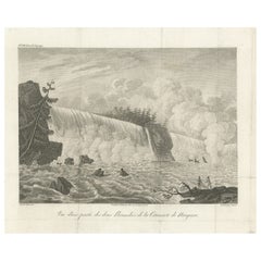
- Rare French Engraving of the Niagara Waterfalls in Ontario, Canada, 1801Located in Langweer, NLTitle: Vue d'une partie des deux Branches de la Cataracte de Niagara. Dirigé par P.F. Tardieu, Place de l'Estrapade No. 18. Upper Left: Pl.VIII, Tom.II Pag.192. Lower Left: Bonfil...Category
Antique Early 1800s Prints
MaterialsPaper


You May Also Like
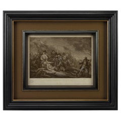
- "The Battle of Bunker's Hill, Near Boston" Engraving by James Mitan, 1801By John TrumbullLocated in Colorado Springs, COThis dramatic Revolutionary War engraving of the Battle of Bunker Hill is after the famous 1785 oil-on-canvas by John Trumbull. Capturing the intensity of the battle, the engraving centers on Major John Small restraining a “lobster-back” from bayoneting Major General Joseph Warren. Warren lies mortally wounded in the midst of chaos around him. In the background, British forces are seen cresting the last defenses of the brave, yet green army of Colonial soldiers. The Battle of Bunker Hill was fought on June 17, 1775, in the early stages of the American Revolutionary War. The battle is named after Bunker Hill in Charlestown, Massachusetts. Although it was the original objective of both the Colonial and British troops, the area was only peripherally involved in the battle. Rather, the majority of the combat took place on the adjacent Breed’s Hill. The battle pitted a more organized British force against a young and inexperienced American militia. Although considered a tactical victory for the British, it came at the cost of considerable casualties, including a large number of officers. The battle demonstrated that the inexperienced American militia was able to stand up to the British army troops in battle. The battle results discouraged the British from any further frontal attacks against well-defended front lines. American casualties were comparatively fewer, although their losses included Gen. Joseph Warren. During the battle, the patriot-turned-painter John Trumbull (1756-1843) was stationed in Roxbury on the far side of Boston, where he could hear the sounds of fighting. In late 1785, Trumbull decided to devote himself to the depiction of Revolutionary War scenes, a series of eight epic pictures. From the beginning, Trumbull intended for the paintings to be later engraved for sale. Trumbull began the oil-on-canvas of The Death of General Warren at the Battle of Bunker’s Hill and The Death of General Montgomery in the Attack of Quebec, in the studio of Benjamin West in London. Bunker’s Hill was completed in March 1786; Trumbull started Attack of Quebec in February 1785 and finished it before he brought it to Paris in 1786. He then started The Declaration of Independence at Thomas Jefferson's house in Paris. As soon as Bunker’s Hill was completed, Trumbull searched for a suitable engraver in London. He was unsuccessful, as many British engravers were nervous about engraving an American battle...Category
Antique Early 1800s English Federal Prints
MaterialsPaper
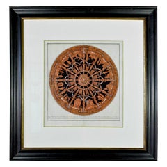
- Hand-Colored Engraving of the Ceiling of the Church of Santa Costanza in FrameLocated in Pembroke, MAA large, nicely-framed Italian hand-colored engraving in tones of terracotta and black (17th century, with more recent matte and frame) by Pietro Bartoli. The engraving depicts the mosaic ceiling in the church of Santa Costanza outside of Rome, which was studied by the ecclesiatical archaeologist Giovanni Ciampini. The mosaic ceiling no longer exists, but is known through various depictions of the artwork, such as this engraving. The images include Christian imagery including the sacrifice of Cain and Abel and possibly Noah building the ark. The upper row of mosaics is believed to represent scenes from the New Testament, with caryatids dividing the ceiling into twelve segments. The engraving is captioned in Latin: "Opus Musiuum olim in tholo Templi, quod vulgo creditur Bacchi, nunc Sancte Constantie extra Portam Piam cariatides, et Telamones in duodecium dividant Segmenta, ubi plura autumnales ferias, et piscationis Genium demostrant, iuxta interpretionem Ciampini qui mediatatem exhibet Veterum monum." In the 17th century, the church of Santa Costanza was known as the "Temple of Bacchus," and was the site of rowdy Bacchic festivals until Pope Clement XI banned the rites in 1720. Pietro Santo...Category
Antique 17th Century Italian Baroque Prints
MaterialsPaper, Paint, Wood, Ink
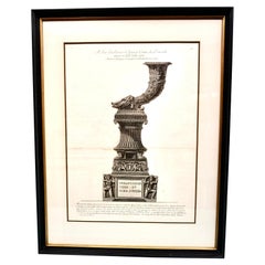
- Original Piranesi Framed Engraving of a Monument in the Form of a CornucopiaBy Giovanni Battista PiranesiLocated in San Francisco, CAGiovanni Battista Piranesi, Italian 1720-1778) Engraving on wove paper depicting an ancient Roman funeral monument in the form of a cornucopia from the Via...Category
Antique Early 19th Century French Neoclassical Prints
MaterialsPaper
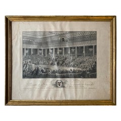
- Charles Monnet " National Assembly In The Night Of August 4-5 " EngravingLocated in Beuzevillette, FRThis engraving represents the National Assembly in the night of August 4 and 5, 1789 realized by Isodore Stanislas Herman after the work of Charles Monnet...Category
Antique Late 18th Century French Picture Frames
MaterialsPaper
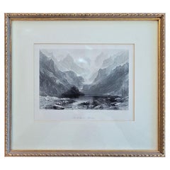
- 19C Engraving of Lake Gaube in the Pyrenees by T AllomBy Thomas AllomLocated in Dallas, TXPresenting a lovely 19C engraving of Lake Gaube in the Pyrenees by T Allom. From circa 1850. Besautiful depiction of Lake Gaube or Lac de Gaube in the F...Category
Antique Mid-19th Century French Victorian Prints
MaterialsPaper
- Original Antique Print of A Stag, Circa 1801Located in St Annes, LancashireGreat image of a stag Copper-plate engraving Published by Bunny and Gold . Dated 1801 Unframed.Category
Antique Early 1800s English Georgian Prints
MaterialsPaper