Items Similar to Engravings of the Frisian Cities of Sloten, IJlst, Workum and Hindelopen, c.1650
Want more images or videos?
Request additional images or videos from the seller
1 of 6
Engravings of the Frisian Cities of Sloten, IJlst, Workum and Hindelopen, c.1650
About the Item
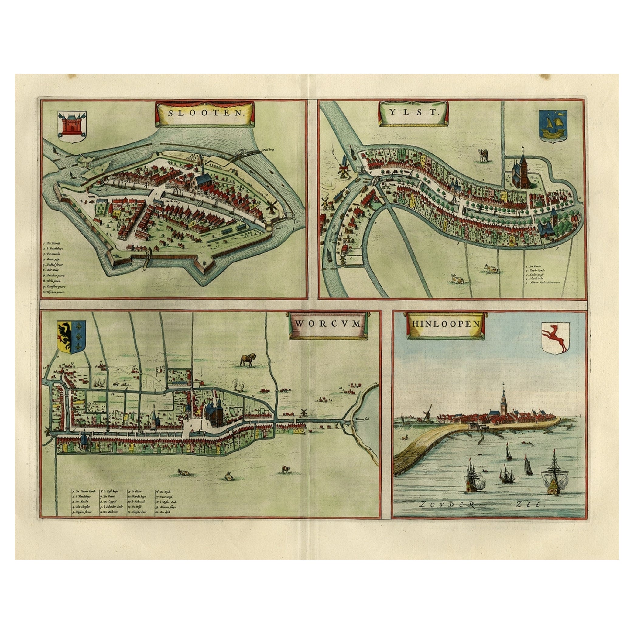
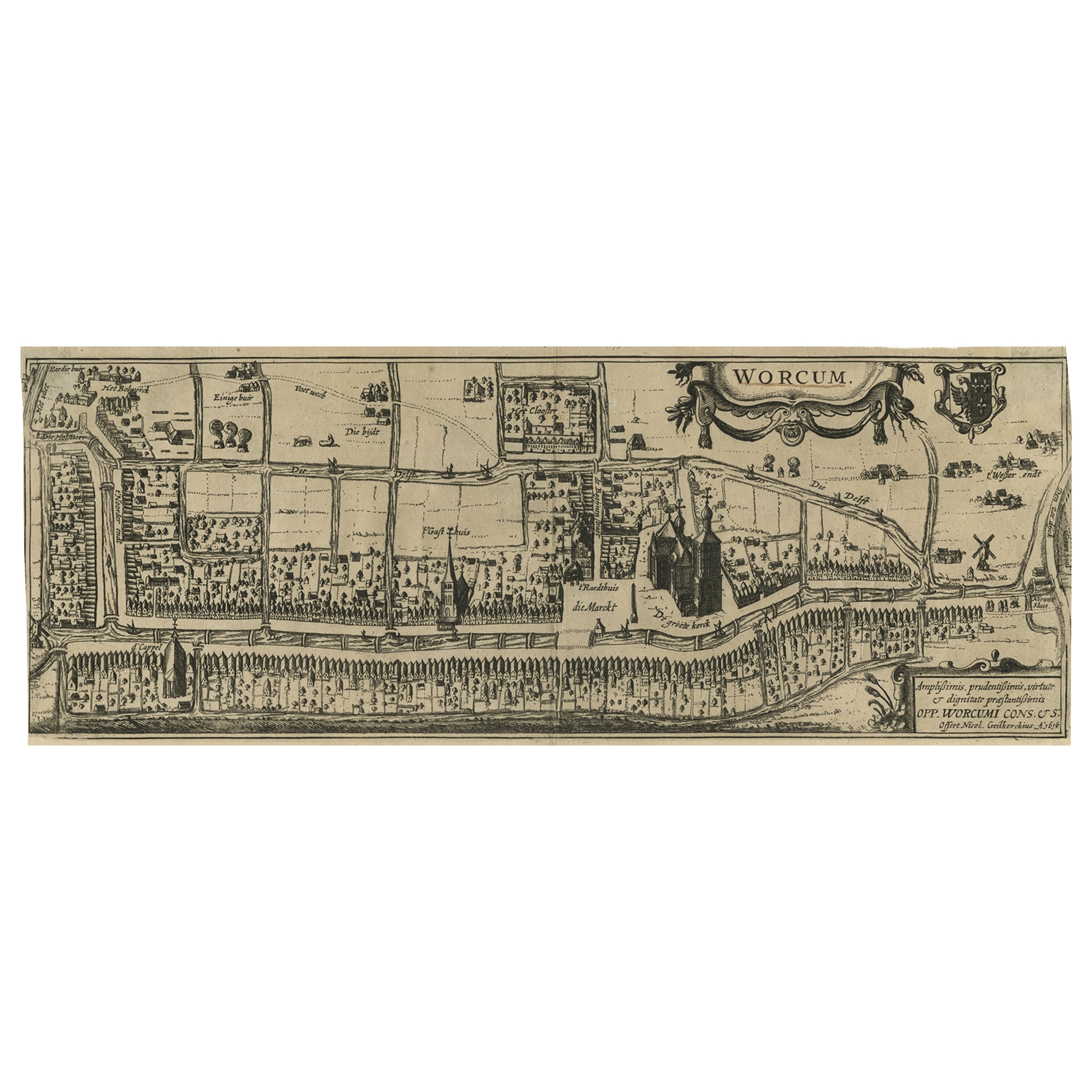
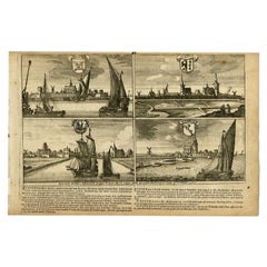
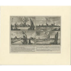
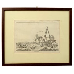
Antique print titled 'Slooten - Ylst - Worcum - Hinloopen'. Three plans and a bird's eye view on one sheet. The plans show the Frisian cities Sloten, IJlst, Workum and the view shows Hindeloopen. From the town atlas 'Toneel der Steden', published by Joan Blaeu, circa 1650.
Artists and Engravers: Joan Blaeu (23 September 1596 - 28 May 1673) was a Dutch cartographer. He was born in Alkmaar, the son of cartographer Willem Blaeu. In 1620 he became a doctor of law but he joined the work of his father. In 1635 they published the Atlas Novus (full title: Theatrum orbis terrarum, sive, Atlas novus) in two volumes. Joan and his brother Cornelius took over the studio after their father died in 1638. Joan became the official cartographer of the Dutch East India Company. Around 1649 Joan Blaeu published a collection of Dutch city maps named Tooneel der Steeden (Views of Cities). In 1651 he was voted into the Amsterdam council. In 1654 Joan published the first atlas of Scotland, devised by Timothy Pont. In 1662 he reissued the atlas with 11 volumes, and one for oceans. It was also known as Atlas Maior. A cosmology was planned as their next project, but a fire destroyed the studio completely in 1672. Joan Blaeu died in Amsterdam the following year.
Condition: Good, general age-related toning. Original folding line. Some staining and small tears/defects in margins. Latin text on verso, please study image carefully.
Date: c.1650
Overall size: 62 x 35 cm.
Image size: 50 x 39 cm.
Antique prints have long been appreciated for both their aesthetic and investment value. They were the product of engraved, etched or lithographed plates. These plates were handmade out of wood or metal, which required an incredible level of skill, patience and craftsmanship. Whether you have a house with Victorian furniture or more contemporary decor an old engraving can enhance your living space.
- Dimensions:Height: 24.41 in (62 cm)Width: 13.78 in (35 cm)Depth: 0 in (0.01 mm)
- Materials and Techniques:
- Period:
- Date of Manufacture:circa 1650
- Condition:Condition: Good, general age-related toning. Original folding line. Some staining and small tears/defects in margins. Latin text on verso, please study image carefully.
- Seller Location:Langweer, NL
- Reference Number:
About the Seller
5.0
Platinum Seller
These expertly vetted sellers are 1stDibs' most experienced sellers and are rated highest by our customers.
Established in 2009
1stDibs seller since 2017
1,940 sales on 1stDibs
Typical response time: <1 hour
- ShippingRetrieving quote...Ships From: Langweer, Netherlands
- Return PolicyA return for this item may be initiated within 14 days of delivery.
More From This SellerView All
- Antique Map of Frisian Cities Sloten, Ylst, Workum and Hindelopen by Blaeu, 1652Located in Langweer, NLAntique print titled 'Slooten - Ylst - Worcum - Hinloopen'. Three plans and a bird's eye view on one sheet. The plans show the Frisian cities Sloten, IJlst, Workum and the view shows...Category
Antique 1650s Maps
MaterialsPaper
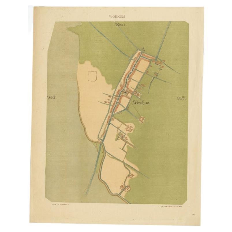
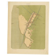
- Old Map of The Frisian City of Workum in Holland, 1916Located in Langweer, NLAntique map Workum titled 'Workum'. Antique map depicting the Frisian city of Workum, the Netherlands. Artists and Engravers: Lithograph by J. Smulders & Co, Den Haag. Condi...Category
20th Century Maps
MaterialsPaper
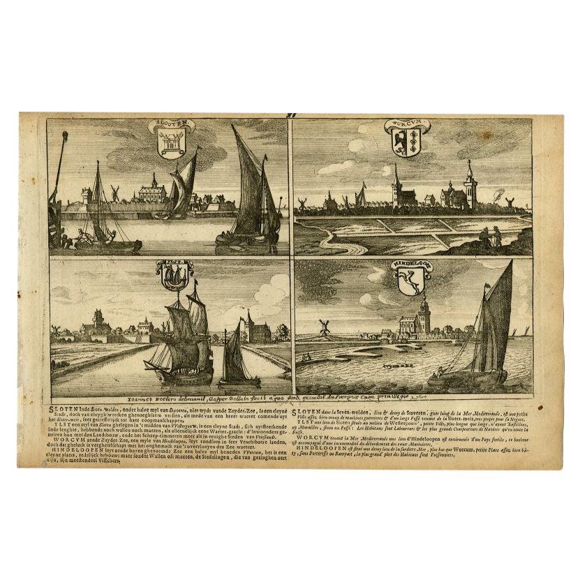
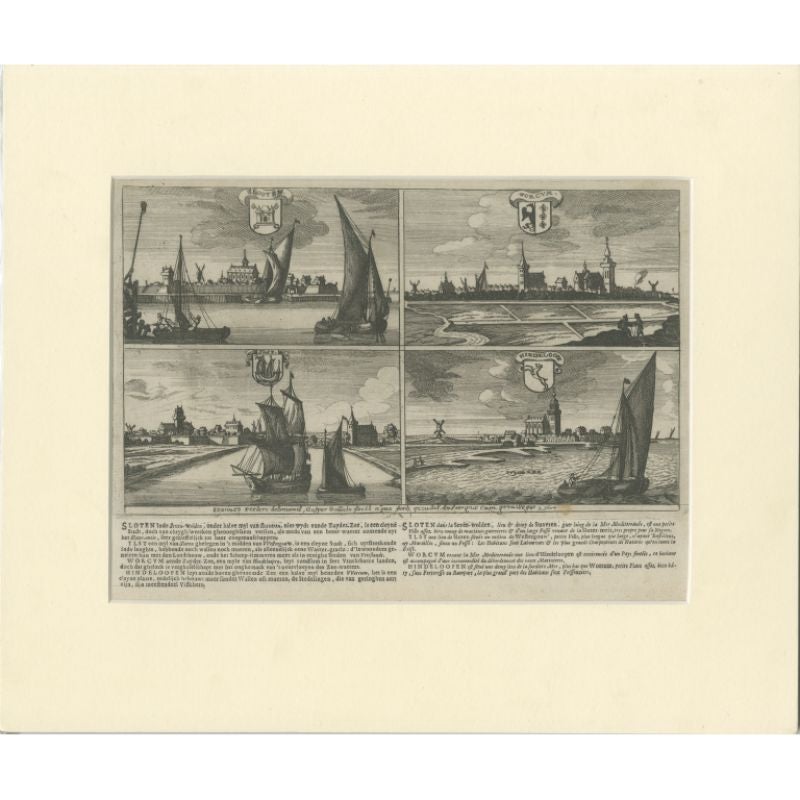
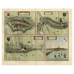
- Antique Print of Sloten, IJlst, Workum and Hindeloopen in The Netherlands, 1680Located in Langweer, NL"Antique print titled 'Slooten, Worcum, Ylst and Hindeloope'. Bird's eye views of Sloten, IJlst, Workum and Hindeloopen, Friesland, the Netherlands. This original antique print origi...Category
Antique 17th Century Prints
MaterialsPaper
- Antique Print of Sloten, IJlst, Workum and Hindeloopen in The Netherlands, 1680Located in Langweer, NLAntique print titled 'Slooten, Worcum, Ylst and Hindeloope'. Bird's eye views of Sloten, IJlst, Workum and Hindeloopen, Friesland, the Netherlands. This original antique print origin...Category
Antique 17th Century Prints
MaterialsPaper
- Antique Map of Sloten, IJlst, Workum & Hindeloopen by Blaeu, 1652Located in Langweer, NLAntique map titled: 'Sloten - Ylst - Worcum - Hinloopen.' - Three plans and a bird's eye view on one sheet. The plans show the Frisian cities Sloten, IJlst, Workum and the view shows...Category
Antique 17th Century Maps
MaterialsPaper
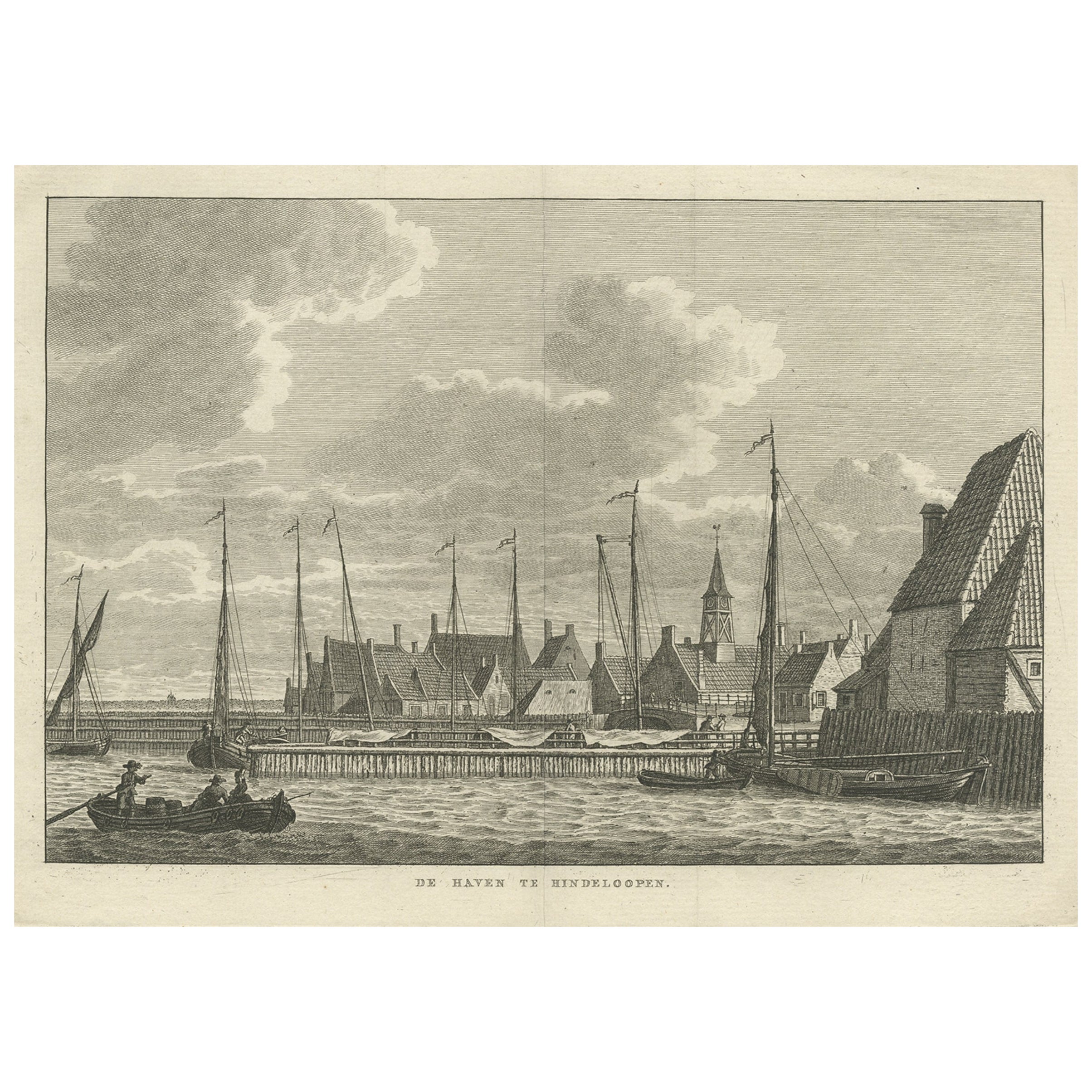
- Antique Print of the Frisian City of Hindelopen in The Netherlands, 1793Located in Langweer, NLAntique print titled 'De Haven te Hindeloopen'. Old print showing the harbour of Hindeloopen, Friesland. This print originates from 'Vaderlandsche gezigten, naar het leven geteekend ...Category
Antique 18th Century Prints
MaterialsPaper
You May Also Like
- “The Restaurant of the House of Representatives” Engraving by Harper's WeeklyLocated in Colorado Springs, COThis original wood engraving is titled “The Restaurant of the House of Representatives, Washington, DC.” It was published as a double-page image, in the August 12, 1893 issue of the famous 19th century newspaper Harper’s Weekly. The print was illustrated by Charles Stanley Reinhardt. The House Restaurant, a unique part of life in the Capitol, has been in the same location since the 1857 Capitol Expansion. Congressional members’ busy work schedule made the availability of food on site a necessity. But the restaurant also served as an informal meeting spot for members to continue conversations and deal making. This 1893 print illustrates the convivial atmosphere. Details including elegantly dressed tables...Category
Antique 1890s American Prints
MaterialsPaper
- 1876 "Gettysburg, The Repulse of Longstreet's Assault." EngravingLocated in Colorado Springs, COPresented here is an 1876 engraving of John B. Bachelder and James Walker’s Gettysburg. The Repulse of Longstreet’s Assault. The engraved scene depicts the decisive battle on the final day of the Battle of Gettysburg. Researched by the photographer and topographer John B. Bachelder and painted by James Walker, the original painting was created in 1870. This detailed engraving was done by H. B. Hall Jr. and published by James Drummond Ball. Otherwise called Pickett’s Charge, the battle occurred on July 3, 1863. Pickett’s corp commander, Lieutenant General James Longstreet was placed in charge of the attack despite his hesitations. Longstreet’s central role led to the title of the work, Repulse of Longstreet’s Assault. In an attempt to gain control of an important supply route, nine Confederate brigades charged across three-quarters of a mile of open ground against cannon fire to take Cemetery Ridge from the defending Union Army. Despite their overwhelming numbers, the Confederate forces were repelled with considerable casualties marking not only a decisive victory for the Union, but also the beginning of the slow defeat of Lee’s Army. The furthest the charging forces advanced before being repulsed would forever be known as the “High Water Mark of the Confederacy.” The Confederate army never recovered from the losses at Gettysburg and it effectively ended Lee’s campaign into Pennsylvania. The engraving gives the perspective from the Union rear, one that encompasses most of the battlefield, from Big Round Top on the left to the northern reaches of Cemetery Ridge on the right. The Confederate lines at Seminary Ridge are in the far distance, partially obscured by bursting shells. The image centers on the main Confederate assault, in the vicinity of what today are known as "The Copse" and "The Bloody Angle." The composition has elemen...Category
Antique 1870s American Prints
MaterialsPaper
- Set of Twelve Colored Engravings of the Defeat of the Spanish Armada by J. PineLocated in Essex, MABy John Pine considered the foremost heraldic and decorative engraver of his generation. Depicting the defeat of the Spanish by the English Fleet in 1588. These are after a set of tapestries that hung in the House of Commons...Category
Antique 1740s English Prints
MaterialsPaper
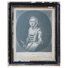
- Sarah Porter, "Queen of the Touters at Tunbridge Wells" Engraving, circa 1770Located in Lowestoft, GBAfter Vander Smissen 'Mrs Sarah Porter, Queen of the Touters at Tunbridge Wells', a mezzotint, engraved by William Pether circa 1770, glazed in ebonised, ...Category
Antique Late 18th Century English Prints
MaterialsGlass, Pine, Paper
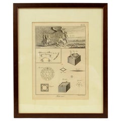
- Engraving Print from the Panckoucke Encyclopédie Nautical Subject 1782-1832Located in Milan, ITPrint by engraving on copper plate from the Panckoucke Encyclopédie méthodique, end of the 18th century,volume Marine Planches (more than 1,500 figures dealing with all subjects on the marina: planes, construction, carpentry, tree trunks, armaments of maneuvers, ropes, sails, artillery, ship maneuvers and combat tactics). This is the plate no. n. 24, pag. 69 fig. 341 ; with frame cm 38.3 x 31.5. Ship ropes are depicted. The Print has the "Benard direxit...Category
Antique 1790s French Nautical Objects
MaterialsPaper
- Engraving Print from the Panckoucke Encyclopédie Nautical Subject 1782-1832Located in Milan, ITPrint by engraving on copper plate from the Panckoucke Encyclopédie méthodique, end of the 18th century, volume Marine Planches (more than 1,500 figures dealing with all subjects on ...Category
Antique 1790s French Nautical Objects
MaterialsPaper


Recently Viewed
View AllMore Ways To Browse
17th Decor
Circa 1620
17th Century Scotland
Scottish Decor
Cornelius Company
Birds Eye View Map
Joan Blaeu
Blaeu India
Hindeloopen Furniture
Dark Brown Ring
Swedish Gustavian Chest Of Drawers
Pair Of Rosewood Cabinets
Pair Of Chest Of Drawers Italian
Knot Chain
Tall French Doors
Pair Of Italian Commodes
Pair Chest Of Drawers Italian
Lion Door