Items Similar to Saint Thomas of the United States Virgin Islands Original Lithograph Circa 1860


Want more images or videos?
Request additional images or videos from the seller
Saint Thomas of the United States Virgin Islands Original Lithograph Circa 1860
About the Item
The lithograph, created around 1860, portrays a scene titled (in Danish) "Parti af St. Thomas." It is an adaptation of an original daguerreotype captured by H. Hansen and reproduced through the lithographic technique by A. Nay. The printing process was executed by Em. Bærentzen & Co.
This piece captures a picturesque moment on the island of St. Thomas. Lithographs during this period were a popular means of replicating and distributing images, allowing for the dissemination of visual representations of various subjects, places, and events.
The collaboration between Hansen's original daguerreotype and Nay's lithographic adaptation, printed by Em. Bærentzen & Co., signifies the technological advancements in visual reproduction during the mid-19th century. This lithograph would have provided viewers of that time a glimpse into the scenes and settings of St. Thomas, encapsulating moments of interest or significance on the island.
Saint Thomas, a part of the U.S. Virgin Islands, has a storied colonial past. Discovered by Christopher Columbus in 1493, it was initially settled by the Danish in the mid-17th century. The island served as a strategic trading post due to its natural harbor, attracting European powers vying for control in the Caribbean.
The Danish West India Company established a colony on Saint Thomas in the late 17th century, primarily focusing on sugar production using enslaved labor. Throughout the 18th century, Saint Thomas, along with other nearby islands, became a hub for the transatlantic slave trade and a center for sugar cultivation.
Amid shifting colonial powers, the island changed hands between the Danish, Spanish, British, and briefly, the French. However, Denmark maintained control for the majority of the colonial period.
In 1917, amidst concerns about the strategic importance of the Caribbean during World War I, the United States purchased Saint Thomas and the rest of the Danish West Indies from Denmark. It became an official U.S. territory, known today as the United States Virgin Islands, marking the end of its colonial era.
This complex colonial history encompassed exploitation, economic development, and changes in sovereignty, leaving a lasting impact on the cultural, social, and economic landscape of Saint Thomas.
- Dimensions:Height: 11.42 in (29 cm)Width: 14.97 in (38 cm)Depth: 0 in (0.02 mm)
- Materials and Techniques:
- Period:
- Date of Manufacture:circa 1860
- Condition:Very good condition. Small defect in lower left corner, but outside the image, making this print ideal for framing. Study the image carefully.
- Seller Location:Langweer, NL
- Reference Number:
About the Seller
5.0
Platinum Seller
These expertly vetted sellers are 1stDibs' most experienced sellers and are rated highest by our customers.
Established in 2009
1stDibs seller since 2017
1,950 sales on 1stDibs
Typical response time: <1 hour
- ShippingRetrieving quote...Ships From: Langweer, Netherlands
- Return PolicyA return for this item may be initiated within 14 days of delivery.
More From This SellerView All
- Original Antique Hand-colored Map of the United States, circa 1845Located in Langweer, NLAntique map titled 'United States'. Old map of the United States, includes the last part of the North West Territory (present day Wisconsin and part of Minnesota). It also marks Ft. Crawford at the confluence of the Mississippi River and the Ouisconsin River (present day Wisconsin River). Published by Orr & Company; Amen Corner...Category
Antique Mid-19th Century Maps
MaterialsPaper
- Small Map of the United StatesLocated in Langweer, NLAntique map titled 'Amérique septe. Physique'. Small map of the United States. lithographed by C. Callewaert brothers in Brussels circa 1870.Category
Antique Mid-19th Century Maps
MaterialsPaper
- Old Decorative Pictorial Map of the United States, circa 1953Located in Langweer, NLAntique map titled 'A Pictorial Map of the United States of America Showing Principal Regional Resources, Products, and Natural Features'. This information-packed map was create by the General Drafting Company for the New Jersey Bell Telephone Company. The main map features over 700 drawings in full color including points of interest, natural resources, and agricultural products. At bottom are inset maps showing railroad lines, air routes, telephone lines, as well as a pictorial map of New Jersey...Category
20th Century Maps
MaterialsPaper
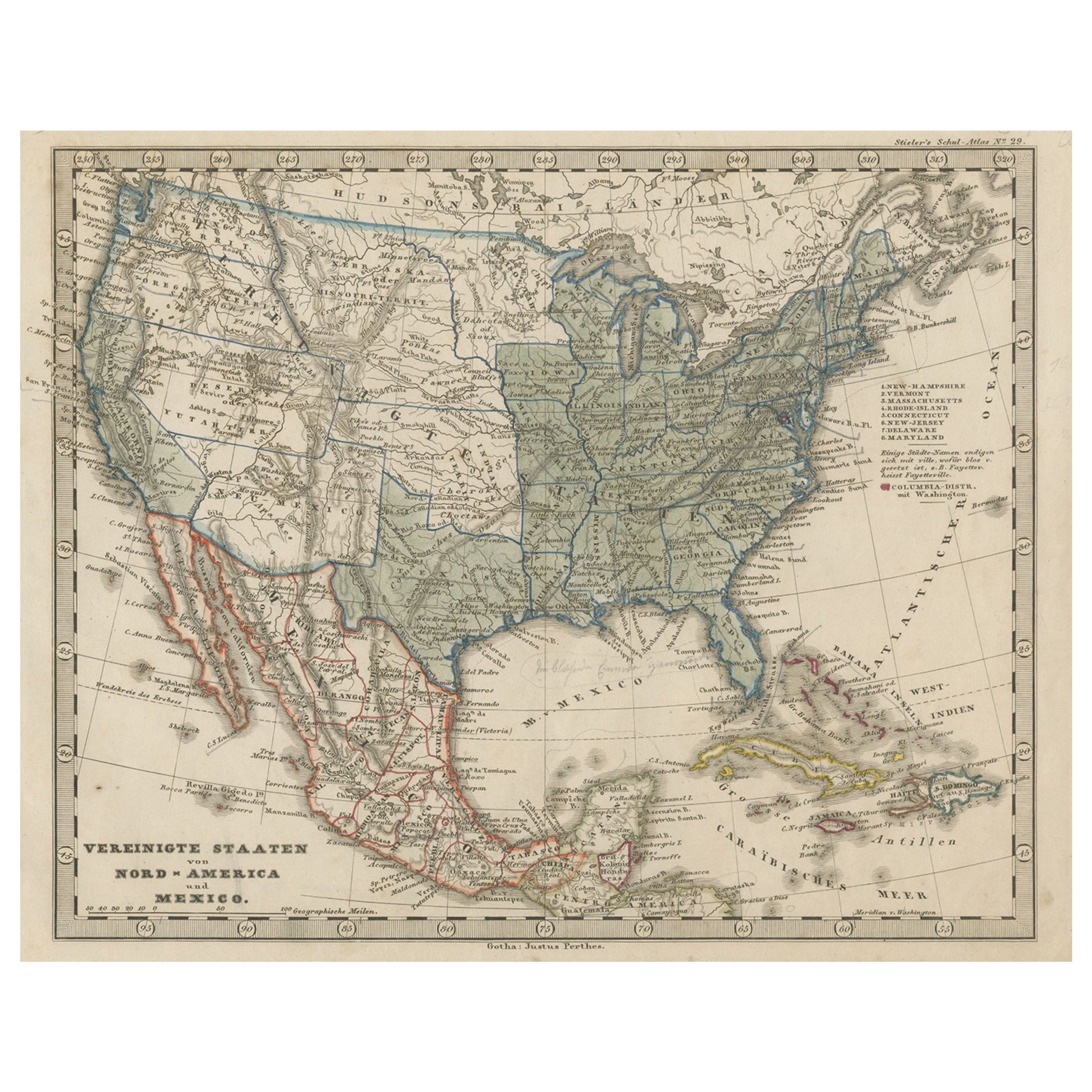
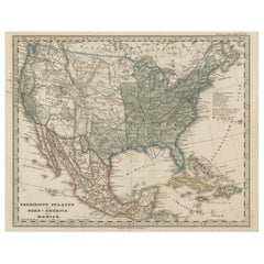
- Old Map the United States and Central America, Including Mexico, ca.1860Located in Langweer, NLAntique map titled 'Vereinigte Staaten von Nord America und Mexico'. Old map the United States and Central America, including Mexico. This print originates from 'Stieler's Schul-...Category
Antique 1860s Maps
MaterialsPaper
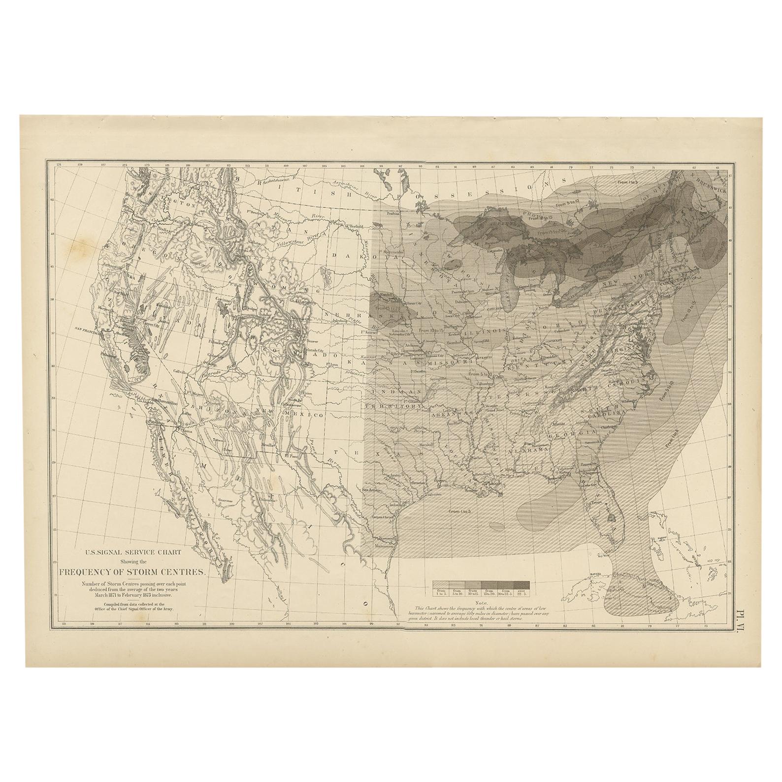
- Antique Chart of the Storm Centres of the United States, 1874Located in Langweer, NLAntique chart titled 'U.S. Signal Service chart showing the frequency of storm centres. Number of storm centres passing over each point deduced from the average of the two years Marc...Category
Antique Late 19th Century Maps
MaterialsPaper
- Antique Map of the United States by Lowry, '1852'Located in Langweer, NLAntique map titled 'United States'. Four individual sheets of the United States. This map originates from 'Lowry's Table Atlas constructed and engraved from the most recent Authoriti...Category
Antique Mid-19th Century Maps
MaterialsPaper


You May Also Like
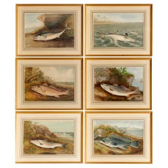
- S. A. Kilbourne "Game Fishes of the United States" 6 Framed ChromolithographsLocated in Morristown, NJAfter Samuel A. Kilbourne (American, 1836-1881), "Game Fishes of the United States", uniformly matted and framed under glass. Clockwise from upper left, The Mackerel, The Spanish M...Category
Vintage 1970s American American Classical Prints
MaterialsGlass, Wood, Paper
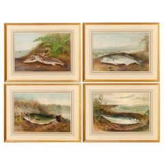
- S. A. Kilbourne "Game Fishes of the United States" 4 Framed ChromolithographsLocated in Morristown, NJAfter Samuel A. Kilbourne (American, 1836-1881), "Game Fishes of the United States", uniformly matted and framed under glass. Clockwise from upper left, The Kingfish and The Whitin...Category
Vintage 1970s American American Classical Prints
MaterialsGlass, Wood, Paper
- Original Antique Map of United States, Grattan and Gilbert, 1843Located in St Annes, LancashireGreat map of United States Drawn and engraved by Archer Published by Grattan and Gilbert. 1843 Original colour Unframed.Category
Antique 1840s English Maps
MaterialsPaper
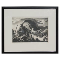
- Thomas Hart Benton Original Lithograph, 1944 - Wreck of the Ol’ ‘97By Thomas Hart BentonLocated in Phoenix, AZOriginal stone lithograph created 1944 by well-known Regionalist Thomas Hart Benton. The print is in excellent condition with full margins and pencil signed lower right. Also signed in the stone. It is matted in a 4-ply archival mat and rests in a simple black frame. Image size: 10 ½ x 15. Frame size: 18 x 23. Published by AAA. Ed: 250. Thomas Hart Benton found inspiration for his art in the ebb and flow of daily life in rural and small-town America. Wreck of the Ol’ 97, one of his best-known prints, is based on a ballad of the same title that tells the story of a rail disaster. A speeding locomotive attempting to make up lost time jumped the tracks as it descended a Virginia mountain...Category
Mid-20th Century Prints
MaterialsPaper
- N.E. View of the United States Capitol, Washington, DC Antique Proof Print 1858Located in Colorado Springs, COThis engraved print shows a view of the United States Capitol Building, in Washington, D.C. The print depicts the neoclassical building from the northeast orientation, with a bustling street scene in front. The steel engraving is a proof printing, drawn and engraved by Henry Sartain and published in 1858. Plans began in May 1854 to build a new cast-iron dome for the United States Capitol. The then-architect of the Capitol Thomas Walter and his team were sold on the aesthetics of a new dome, as well as the utility of a fire-proof one. A year later, on March 3, 1855, President Franklin Pierce...Category
Antique 1850s American Prints
MaterialsPaper
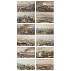
- Set of 12 Original Antique Prints of the Crimean Wars, circa 1860Located in St Annes, LancashireGreat set of 12 military prints. All related to the Crimean Wars. Lithographs in original colors after William Simpson. Published by P & D Colna...Category
Antique 1830s English Other Prints
MaterialsPaper