18th Century and Earlier Landscape Prints
35
to
30
563
329
135
419
735
177
40
595
254
77
26
7
Overall Height
to
Overall Width
to
352
88
4
1
1
568
286
254
132
121
83
75
73
71
64
61
59
51
50
49
49
42
41
40
40
961
1,837
7,362
4,193
102
118
430
422
408
719
965
1,321
750
445
603
125
87
46
39
25
574
390
71
39
38
Period: 18th Century and Earlier
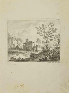
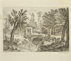
Landscape - Etching by Pierre-François Laurent - 1755
Located in Roma, IT
Landscape is an etching realized by Pierre-François Laurent in 1755.
Good condition.
Signed on Plate.
The artwork is depicted through confident strokes.
The etching was realized ...
Category
Modern 18th Century and Earlier Landscape Prints
Materials
Etching
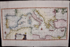
Mediterranean and Adriatic Seas: Original 18th Century Hand-colored Map by Bowen
Located in Alamo, CA
This is an original 18th century hand-colored map entitled "An Accurate Chart of The Mediterranean and Adriatic Sea's; with the Archipelago & Part of the Black Sea. Exhibiting all th...
Category
Old Masters 18th Century and Earlier Landscape Prints
Materials
Engraving
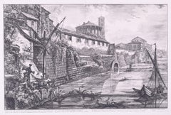
View of the Ancient Structure built by Tarquinius Superbus called the Bel Lido
Located in Fairlawn, OH
View of the Ancient Structure built by Tarquinius Superbus called the Bel Lido, and like others built by Marcus Agrippa in the time of Augustus when he ...
Category
Old Masters 18th Century and Earlier Landscape Prints
Materials
Etching
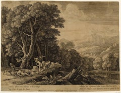
Venus Lamenting over the Death of Adonis
Located in Middletown, NY
c. 1654. Etching with engraving on thin laid paper with an early and large unidentified watermark with a sundial and a many-pointed star, and an unidentified collector's stamp in the...
Category
Old Masters 18th Century and Earlier Landscape Prints
Materials
Handmade Paper, Engraving, Etching
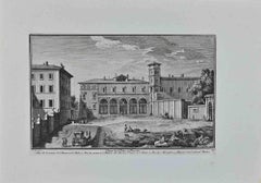
San Pietro in Vincoli - Etching by G. Vasi - Late 18th century
Located in Roma, IT
San Pietro in Vincoli is an artwork realized by Giuseppe Vasi in the late 18th century.
Etching, 33 x 45 cm.
Signed and titled in the lower part.
Good conditions!
Giuseppe V...
Category
Old Masters 18th Century and Earlier Landscape Prints
Materials
Etching
Countryside - Etching by Pierre-François Laurent - 18th Century
Located in Roma, IT
Countryside is an etching realized by Pierre-François Laurent in 18th Century.
Good conditions.
Signed on plate.
The artwork is depicted through confident strokes.
Category
Modern 18th Century and Earlier Landscape Prints
Materials
Etching
Landscape - Etching by Nicholas Cochin - 1755
Located in Roma, IT
Landscape is an etching realized by Nicholas Cochin in 1755.
Good conditions.
The artwork is depicted through confident strokes.
The etching was rea...
Category
Modern 18th Century and Earlier Landscape Prints
Materials
Etching
Europe recens deseripta a Guilielmo Blaeuw
By Willem Janszoon Bleau
Located in Mount Vernon, NY
Hand-colored engraved map by map publisher and engraver Willem Janszoon Blaeu (1571-1638), offical cartographer for the Dutch East India Company and considered one of the great maste...
Category
18th Century and Earlier Landscape Prints
Materials
Engraving
Nantucket, Brant Point Lighthouse (Limited edition giclée print)
Located in Kennett Square, PA
Brant Point Lighthouse, Nantucket (LIMITED EDITION GICLÉE PRINT)
By SPENCER VERNEY
This is one of three in a series of museum quality giclée prints ca...
Category
Impressionist 18th Century and Earlier Landscape Prints
Materials
Archival Pigment
Landscape - Etching by Pierre Quentin Chedel - 1755
Located in Roma, IT
Landscape is an etching realized by Pierre Quentin Chedel in 1755.
Good conditions.
Signed on Plate.
The artwork is depicted through confident strokes.
The etching was realized f...
Category
18th Century and Earlier Landscape Prints
Materials
Etching
The Windmill by François Vivares, after Rembrandt
Located in Middletown, NY
Engraving on cream laid paper, 8 x 5 7/8 inches (202 x 149 mm), trimmed at the platemark. Adhered at each corner to a small sheet of archival laid paper. Horizontal edge loss at the ...
Category
Old Masters 18th Century and Earlier Landscape Prints
Materials
Handmade Paper, Laid Paper, Etching
L'automne, by Franz Edmond Weirotter, after van Goyen
Located in Middletown, NY
Etching and engraving on cream laid paper, 11 3/4 x 8 1/8 inches (297 x 205 mm), margins trimmed. Scattered light surface soiling, minor loose handling creases, rubbed edges, and sma...
Category
Old Masters 18th Century and Earlier Landscape Prints
Materials
Etching, Handmade Paper, Laid Paper, Engraving
Map of the World: An Original 18th Century Hand-colored Map by E. Bowen
Located in Alamo, CA
This is an original 18th century hand-colored map entitled "A New & Correct Chart of All The Known World Laid down according to Mercator's Projection" by Emanuel Bowen. It was published in 1744 in London in John Harris's "Navigantium atque Itinerantium Bibliotheca" or "A Complete Collection of Voyages and Travels". This highly detailed and colorful map depicts the world. as it was known in the mid 18th century. A majority of the northern and central portions of Canada and America are left blank due to the purity of knowledge at the time this map was published.
The map is embellished with four Compass Roses in the lower left, lower center, lower right and center, along with many rhumb lines. There a is a decorative title cartouche in the upper left. This colorful, attractive, historical and interesting 1744 map presents the entire world on Mercator's projection as it was understood in the middle part of the 18th century, before the landmark explorations of Captain’s Cook, Vancouver, Wilkes and others. It is an example of a nautical chart, a type of map that was designed specifically for use by mariners. The map is centered on the equator and includes both the Eastern and Western Hemispheres. The continents of North America, South America, Europe, Africa, and Asia are depicted, as well as various islands in the Atlantic, Pacific, and Indian Oceans. The map is laid out according to the Mercator projection, a type of cylindrical map projection that was developed in the 16th century by Flemish cartographer Gerardus Mercator. This projection has the advantage of preserving angles and shapes, making it useful for navigation. The map presents a paucity of inland detail, particularly for the Americas, but major cities, geographical landmarks, and regions are included. Ocean currents and Tradewinds are identified, as well as the magnetic declination lines or magnetic variance, which refers to the difference between true north and compass north. The continents are color coded, enhancing the beauty of this map. The three compass roses indicate the directions of the cardinal points.
The depiction of the western coast of America, the Pacific and Australia are interesting. There was very little exploration of Australia between the navigations of William Damper in 1699 and Tobias Furneaux in 1773. Most of the maps detail relies on the 17th century Dutch expeditions to Australia's western coast, by Abel Tasman and William Janszoon. Van Diemen's Land (Tasmania) and New Guinea appear connected to the Australian continent. New Zealand appears as a single landmass. North of New Zealand there is a landmass labelled 'Ter d' St. Esprit' which probably represents the New Hebrides Islands. This map precedes the accurate exploration of the South Pacific and east coast of Australia by Captain James Cook later in the 18th century. The map includes ‘Drakes' Port,' the site where Sir Francis Drake supposedly landed in 1579 during his 1579 circumnavigation of the globe. Here he claimed territory for England, restocked, and repaired his vessels. Drake named the region New Albion. The exact location of Drake's Port is a cartographic mystery. Drake's Harbor is believed to be in the region of San Francisco Bay, Bodega Bay, San Pablo Bay...
Category
Old Masters 18th Century and Earlier Landscape Prints
Materials
Engraving
Christ and the Woman of Samaria Among Ruins by James Bretherton after Rembrandt
Located in Middletown, NY
Bretherton, James (After Rembrandt van Rijn).
Christ and the Woman of Samaria Among Ruins.
London: c 1775.
Etching on light cream laid paper, 4 3/4...
Category
Old Masters 18th Century and Earlier Landscape Prints
Materials
Handmade Paper, Etching, Laid Paper
Nantucket, Great Point Lighthouse (Limited edition giclée print)
Located in Kennett Square, PA
Great Point Lighthouse, Nantucket (LIMITED EDITION GICLÉE PRINT)
By SPENCER VERNEY
This is one of three in a series of museum quality giclée prints captured from oil paintings. This is a limited edition of 100.
The lighthouse at Great Point stands on the eastern shore of the northern most point of Nantucket. At the north end, where the island meets the sea, is a shallow hooked shoal just a few feet below the water’s surface. The strong rip formed by the tides of Nantucket sound feed bluefish and striped bass in the warm months. In the calm winds...
Category
Impressionist 18th Century and Earlier Landscape Prints
Materials
Archival Pigment
Le Tour de Clermont en Dauphine apartenant a Monsieur de Tonnerre
Located in Middletown, NY
Etching and engraving on handmade cream laid paper, 3 7/8 x 6 7/8 inches (97 x 173 mm), full margins. In good condition, consistent with age. Several small notations in pencil in t...
Category
Old Masters 18th Century and Earlier Landscape Prints
Materials
Handmade Paper, Laid Paper, Engraving, Etching
David Loggan Wadham College Oxford Collegium Wadhamense 1675 engraving
By David Loggan
Located in London, GB
To see our other views of Oxford and Cambridge, scroll down to "More from this Seller" and below it click on "See all from this Seller" - or send us a message if you cannot find the view you want.
David Loggan (1634-1692)
Wadham College Oxford
Engraving
1675
34x42cm
Loggan was born to English and Scottish parents, and was baptised in Danzig in 1634. After studying engraving in Danzig with Willem Hondius (1598-1652 or 1658), he moved to London in the late 1650s, going on to produce the engraved title-page for the folio 1662 Book of Common Prayer. He married in 1663 and moved to Nuffield in Oxfordshire in 1665. Loggan was appointed Public Sculptor to the nearby University of Oxford in the late 1660s, having been commissioned to produce bird’s-eye views of all the Oxford colleges. He lived in Holywell Street as he did this. The 'Oxonia Illustrata' was published in 1675, with the help of Robert White (1645-1704). Following its completion, Loggan began work on his equivalent work for Cambridge; the 'Cantabrigia Illustrata' was finally published in 1690, when he was made engraver to Cambridge University.
The 'Oxonia Illustrata' also includes an engraving of Winchester College (Winchester and New College share William of Wykeham as their founder) whilst the 'Cantabrigia Illustrata' includes one of Eton College (which shares its founder, Henry VIII, with King’s College).
Bird’s-eye views from this era required a particular talent as an architectural perspectivist; it was not until 1783 that it became possible for artists to ascend via hot air balloons and view the scenes they were depicting from above. Loggan thus had to rely on his imagination in conceiving the views.
Loggan’s views constitute the first accurate depictions of the two Universities, in many ways unchanged today. Whilst the Oxford engravings were produced in reasonable numbers and ran to a second edition by Henry Overton (on thicker paper and with a plate number in Roman numerals in the bottom right-hand corner), those of Cambridge were printed in much smaller numbers.
The Dutchman Pieter van der Aa published some miniature versions of the engravings for James Beverell’s guidebook to the UK, 'Les Delices de la Grande Bretagne' (c. 1708). The contemporary artist Andrew Ingamells...
Category
Realist 18th Century and Earlier Landscape Prints
Materials
Engraving
Veduta del Tempio della Fortuna Virile, from Raccolta delle più belle Vedute ...
Located in Middletown, NY
By Giuseppe Vasi after Giovanni Piranesi: Etching and engraving with hand coloring in watercolor on laid paper with an E and R watermark, full margins. Minor...
Category
Old Masters 18th Century and Earlier Landscape Prints
Materials
Watercolor, Laid Paper, Engraving, Etching
Boxthorn Japanese, Lyciym japonicum Plate 361
Located in Columbia, MO
Boxthorn Japanese, Lyciym japonicum Plate 361
1797
Hand-colored etching
Ed. 1st ed.
9 x 5.25 inches
Category
Naturalistic 18th Century and Earlier Landscape Prints
Materials
Etching
Fig-marigold Showy, Mesembryanthem spectabile Plate 396
Located in Columbia, MO
Fig-marigold Showy, Mesembryanthem spectabile Plate 396
1797
Hand-colored etching
Ed. 1st ed.
9 x 5.25 inches
Category
Naturalistic 18th Century and Earlier Landscape Prints
Materials
Etching
Cambridge map 17th century engraving after John Speed
By John Speed
Located in London, GB
To see more, scroll down to "More from this Seller" and below it click on "See all from this Seller."
Pieter van den Keere (1571 - circa 1646) after John Speed (1551 or 1552 - 1629)
Map of Cambridgeshire
Engraving
8 x 12 cm
A beautifully coloured map of Cambridgeshire, with an antique description of the county to the reverse. The map, along with many others, was published in Speed's atlas, 'The Theatre of the Empire of Great Britaine', first published in 1611. This particular miniature edition of the 'Theatre' was published in miniature by George Humble in 1627, entitled 'England Wales Scotland and Ireland Described and Abridged With ye Historic Relation of things worthy memory from a farr larger Voulume. Done by John Speed.’ Speed's original map was likely engraved for this edition by Peter van den Keere. van den Keere's maps soon came to be known as "Miniature Speeds".
John Speed was an English cartographer, chronologer and historian. The son of a citizen and Merchant Taylor in London, he rose from his family occupation to accept the task of drawing together and revising the histories, topographies and maps of the Kingdoms of Great Britain as an exposition of the union of their monarchies in the person of King James I and VI. He accomplished this with remarkable success, with the support and assistance of the leading antiquarian scholars of his generation. He drew upon and improved the shire maps of Christopher Saxton, John Norden and others, being the first to incorporate the hundred-boundaries into them, and he was the surveyor and originator of many of the town or city plans inset within them. His work helped to define early modern concepts of British national identity. His Biblical genealogies were also formally associated with the first edition of the King James Bible...
Category
18th Century and Earlier Landscape Prints
Materials
Engraving
Ireland: A Framed 17th Century Hand-colored Map by Jan Jannson
Located in Alamo, CA
This is a 17th century hand-colored map entitled "Hibernia Regnum Vulgo Ireland" by Johannes Janssonius's (Jan Jansson), published in Amsterdam in 1640. This highly detailed map depicts the Emerald Isle with an extensive display of towns, roads, mountains, rivers, lakes and county borders, etc. It includes two decorative cartouches on the left. The title cartouche includes the Irish harp and the second, in the upper left, includes a lion wearing a crown on the left, a unicorn on the right and a coat-of-arms in the middle, which includes another Irish harp. A distance scale is seen in the lower right, augmented with two putti. The map is embellished with three sailing ships and a sea monster. Western portions of Scotland and England...
Category
Old Masters 18th Century and Earlier Landscape Prints
Materials
Engraving
Milk-vetch Montpelier, Astragalus monspessulanus Plate 375
Located in Columbia, MO
Milk-vetch Montpelier, Astragalus monspessulanus Plate 375
1797
Hand-colored etching
Ed. 1st ed.
9 x 5.25 inches
Category
Naturalistic 18th Century and Earlier Landscape Prints
Materials
Etching
Landscape - Etching by Pierre Quentin Chedel - 1755
Located in Roma, IT
Landscape is an etching realized by Pierre Quentin Chedel in 1755.
Good conditions.
Signed on Plate.
The artwork is depicted through confident strokes.
The etching was realized f...
Category
18th Century and Earlier Landscape Prints
Materials
Etching
Countryside - Etching by Pierre-François Laurent - 18th Century
Located in Roma, IT
Countryside is an etching realized by Pierre-François Laurent in 18th Century.
Good conditions.
Signed in plate.
The artwork is depicted through confident strokes.
Category
Modern 18th Century and Earlier Landscape Prints
Materials
Etching
View of Emden, Germany: A 16th Century Hand-colored Map by Braun & Hogenberg
Located in Alamo, CA
This is a 16th century original hand-colored copperplate engraved map of a bird's-eye View of Embden, Germany entitled " Emuda, vulgo Embden vrbs Frisia orientalis primaria" by Georg Braun & Franz Hogenberg, in volume II of their famous city atlas "Civitates Orbis Terrarum", published in Cologne, Germany in 1575.
This is a beautifully colored and detailed map of Emden, a seaport in northwestern Germany, along the Ems River and perhaps portions of over Dollart Bay, near the border with the Netherland. The map depicts a bird's-eye view of the city from the southwest, as well as a view of the harbor and an extensive system of canals. Numerous ships of various sizes, as well as two rowboats containing numerous occupants are seen in the main waterway in the foreground and additional boats line two canals in the center of the city. Two men and two women are shown on a hill in the foreground on the right, dressed in the 16th century style of nobility. Two ornate crests are included in each corner. A title strap-work cartouche is in the upper center with the title in Latin. The crest on the right including Engelke up de Muer (The Little Angel on the Wall) was granted by Emperor Maximilian I in 1495.
This is an English translation of an excerpt of Braun's description of Embden: "In Emden, the capital of East Frisia, rich merchants live in very fine houses. The city has a broad and well-situated harbour, which in my opinion is unique in Holland. Frisia and the whole of the Netherlands, for the ships can anchor here right under the city walls. They have also extended the harbour as far as the New Town, so that up to 400 ships can now find shelter here when the sea is rough."
The emphasis on the harbor and waterways within the city highlights the importance of Emden's place as a seaport at this time. Embden developed from a Dutch/Flemish trading settlement in the 7th-8th centuries into a city as late as late 14th century. In 1494 it was granted staple rights, and in 1536 the harbour was extended. In the mid-16th century Emden's port was thought to have the most ships in Europe. Its population then was about 5,000, rising to 15,000 by the end of the 16th century. The Ems River flowed directly under the city walls, but its course was changed in the 17th century by the construction of a canal. Emden has canals within its city limits, a typical feature of Dutch towns, which also enabled the extension of the harbor. In 1744 Emden was annexed by Prussia and is now part of Germany. It was captured by French forces in 1757 during the Seven Years' War, but recaptured by Anglo-German forces in 1758. During the Napoleonic French era, Emden and the surrounding lands of East Frisia were part of the short-lived Kingdom of Holland.
References:Van der Krogt 4, 1230, State 2; Taschen, Braun and Hogenberg...
Category
Old Masters 18th Century and Earlier Landscape Prints
Materials
Engraving
------- Shining-leaved, Salvia formosa Plate 376
Located in Columbia, MO
—– Shining-leaved, Salvia formosa Plate 376
1797
Hand-colored etching
Ed. 1st ed.
9 x 5.25 inches
Category
Naturalistic 18th Century and Earlier Landscape Prints
Materials
Etching
Corn-flag Copper coloured, Gladiolus securiger Plate 383
Located in Columbia, MO
Corn-flag Copper coloured, Gladiolus securiger Plate 383
1797
Hand-colored etching
Ed. 1st ed.
9 x 5.25 inches
Category
Naturalistic 18th Century and Earlier Landscape Prints
Materials
Etching
Cyrilla Scarlet-flowered, Cyrilla pulchella Plate 374
Located in Columbia, MO
Cyrilla Scarlet-flowered, Cyrilla pulchella Plate 374
1797
Hand-colored etching
Ed. 1st ed.
9 x 5.25 inches
Category
Naturalistic 18th Century and Earlier Landscape Prints
Materials
Etching
Letter L - Etching by Luigi Vanvitelli - 18th Century
Located in Roma, IT
Letter L is an Etching realized by Luigi Vanvitelli in 18th century.
The etching belongs to the print suite “Antiquities of Herculaneum Exposed” (ori...
Category
Old Masters 18th Century and Earlier Landscape Prints
Materials
Etching
Amaryllis Waved-flowerd, Amaryllis undulatea Plate 369
Located in Columbia, MO
Amaryllis Waved-flowerd, Amaryllis undulatea Plate 369
1797
Hand-colored etching
Ed. 1st ed.
9 x 5.25 inches
Category
Naturalistic 18th Century and Earlier Landscape Prints
Materials
Etching
Castle (University College, Durham) engraving after Samuel and Nathaniel Buck
Located in London, GB
To see more, scroll down to "More from this Seller" and below it click on "See all from this Seller."
after Samuel Buck (1696 - 1779) and Nathaniel Buck (active 1724 - 1759)
View of Durham Castle...
Category
18th Century and Earlier Landscape Prints
Materials
Engraving
Marvel of Peru Common, Mirabilis jalapa Plate 371
Located in Columbia, MO
Marvel of Peru Common, Mirabilis jalapa Plate 371
1797
Hand-colored etching
Ed. 1st ed.
9 x 5.25 inches
Category
Naturalistic 18th Century and Earlier Landscape Prints
Materials
Etching
Map of the East Indies: An Original 18th Century Hand-colored Map by E. Bowen
Located in Alamo, CA
This is an original 18th century hand-colored map entitled "An Accurate Map of the East Indies Exhibiting the Course of the European Trade both on the Continent and Islands" by Emanu...
Category
Old Masters 18th Century and Earlier Landscape Prints
Materials
Engraving
Heath Recurved, Erica retorta Plate 362
Located in Columbia, MO
Heath Recurved, Erica retorta Plate 362
1797
Hand-colored etching
Ed. 1st ed.
9 x 5.25 inches
Category
Naturalistic 18th Century and Earlier Landscape Prints
Materials
Etching
Epidendrum Aloe-leaved, Epdendrum aloides Plate 387
Located in Columbia, MO
Epidendrum Aloe-leaved, Epdendrum aloides Plate 387
1797
Hand-colored etching
Ed. 1st ed.
9 x 5.25 inches
Category
Naturalistic 18th Century and Earlier Landscape Prints
Materials
Etching
Craggula Tree, Crassula cotyledon Plate 384
Located in Columbia, MO
Craggula Tree, Crassula cotyledon Plate 384
1797
Hand-colored etching
Ed. 1st ed.
9 x 5.25 inches
Category
Naturalistic 18th Century and Earlier Landscape Prints
Materials
Etching
Brunfelsia American, Brunfelsia americana Plate 393
Located in Columbia, MO
Brunfelsia American, Brunfelsia americana Plate 393
1797
Hand-colored etching
Ed. 1st ed.
9 x 5.25 inches
Category
Naturalistic 18th Century and Earlier Landscape Prints
Materials
Etching
------- Pyramidal, ------- Pyramidalis Plate 366
Located in Columbia, MO
—–---Pyramidal, -------Pyramidalis Plate 366
1797
Hand-colored etching
Ed. 1st ed.
9 x 5.25 inches
Category
Naturalistic 18th Century and Earlier Landscape Prints
Materials
Etching
Campi Phlegraei - View of a section of a part of the cone of Astruni, Italy
Located in Melbourne, Victoria
Campi Phlegraei - View of a section of a part of the cone of Astruni taken at the entrance of this volcano
Copper-line engraving with gouache. 1776.
...
Category
Naturalistic 18th Century and Earlier Landscape Prints
Materials
Engraving
Europe: An Original 18th Century Hand-colored Map by E. Bowen
Located in Alamo, CA
This is an original 18th century hand-colored map entitled "A New & Accurate Map of Europe Drawn from the Best Authorities Assisted by the Most Improved Modern Charts and Maps." by E...
Category
Old Masters 18th Century and Earlier Landscape Prints
Materials
Engraving
Vervain Three-leaved, Verbena triphylla Plate 367
Located in Columbia, MO
Vervain Three-leaved, Verbena triphylla Plate 367
1797
Hand-colored etching
Ed. 1st ed.
9 x 5.25 inches
Category
Naturalistic 18th Century and Earlier Landscape Prints
Materials
Etching
Toad-flax Clammy, Antirrhinum viscosum Plate 368
Located in Columbia, MO
Toad-flax Clammy, Antirrhinum viscosum Plate 368
1797
Hand-colored etching
Ed. 1st ed.
9 x 5.25 inches
Category
Naturalistic 18th Century and Earlier Landscape Prints
Materials
Etching
Letter of the Alphabet V - Etching by Luigi Vanvitelli - 18th Century
Located in Roma, IT
The etching belongs to the print suite “Antiquities of Herculaneum Exposed” (original title: “Le Antichità di Ercolano Esposte”), an eight-volume volume of engravings of the finds fr...
Category
Old Masters 18th Century and Earlier Landscape Prints
Materials
Etching
Letter of the Alphabet P - Etching by Luigi Vanvitelli - 18th Century
Located in Roma, IT
Letter of the Alphabet P, from the series "Antiquities of Herculaneum", is an etching on paper realized by Luigi Vanvitelli in the 18th century.
Good conditions.
The etching belon...
Category
Old Masters 18th Century and Earlier Landscape Prints
Materials
Etching
Column of Antoninus Pius, Rome Italy. Jacobs Lauro 17th century engraving
Located in Melbourne, Victoria
Lauro produced a series of engravings of the ancient monuments of Classical Rome with detailed descriptions in Latin below.
180mm by 240mm (plate mark)...
Category
Old Masters 18th Century and Earlier Landscape Prints
Materials
Etching, Engraving
Avanzo del Pronao del Tempio di Giove Tonante, from Le Antichità Romane
Located in Middletown, NY
Etching on buff laid paper with a partial indiscernible watermark, full margins. In very good condition with some minor scattered spots of foxing in the margins. Some pencil notatio...
Category
Old Masters 18th Century and Earlier Landscape Prints
Materials
Handmade Paper, Etching
China: An Original 18th Century Hand-colored Map by E. Bowen
Located in Alamo, CA
This is an original 18th century hand-colored map entitled "A New & Accurate Map of China, Drawn from Surveys made by the Jesuit Missionaries, by order of the Emperor. The whole bein...
Category
Old Masters 18th Century and Earlier Landscape Prints
Materials
Engraving
Asia Declineatio: A 17th Century Hand-colored Map of Asia by Justus Danckerts
Located in Alamo, CA
This is a scarce 17th century beautifully hand-colored copperplate engraved map of Asia entitled “Exactissima Asiae Delineatio in Praecipuas Regiones Caerterasque Partes divisa et de...
Category
Old Masters 18th Century and Earlier Landscape Prints
Materials
Engraving
Seascapes With Monument and Figures - Etching by Giuseppe Aloja - 18th Century
Located in Roma, IT
Seascapes With Monument and Figures is an Etching realized by Giuseppe Aloja (1783-1837).
The etching belongs to the print suite “Antiquities of Herculaneum Exposed” (original titl...
Category
Old Masters 18th Century and Earlier Landscape Prints
Materials
Etching
Map of the Russian Empire: An Original 18th Century Hand-colored Map by E. Bowen
Located in Alamo, CA
This is an original 18th century hand-colored map entitled "A New & Accurate Map of The Whole Russian Empire, As Contain'd Both In Europe and Asia, Drawn from Authentic Journals, Sur...
Category
Old Masters 18th Century and Earlier Landscape Prints
Materials
Engraving
Letter of the Alphabet B - Etching by Luigi Vanvitelli - 18th Century
Located in Roma, IT
Letter of the Alphabet B, from the series "Antiquities of Herculaneum", is an etching on paper realized by Luigi Vanvitelli in the 18th century.
Good conditions.
The etching belon...
Category
Old Masters 18th Century and Earlier Landscape Prints
Materials
Etching
Papaya and Moth Metamorphosis: 18th C. Hand-colored Engraving by Maria Merian
Located in Alamo, CA
This exquisite hand-colored 18th century folio-sized engraving of a papaya plant and moth metamorphosis is plate 64 from Maria Sibylla Merian's publication '...
Category
Academic 18th Century and Earlier Landscape Prints
Materials
Engraving
Letter of the Alphabet S - Etching - 18th Century
Located in Roma, IT
Letter of the Alphabet S, from the series "Antiquities of Herculaneum", is an etching on paper realized by Various Authors in the 18th century....
Category
Old Masters 18th Century and Earlier Landscape Prints
Materials
Etching
Siberia as Explored by Behring: Original 18th Century Hand-colored Map by Bowen
Located in Alamo, CA
This is an original 18th century hand-colored map entitled "An Exact Chart of all the Countries through which Capt. Behring Travelled from Tobolski, Capital of Siberia to the Country...
Category
Old Masters 18th Century and Earlier Landscape Prints
Materials
Engraving
Magdalene College, Cambridge engraving by David Loggan
By David Loggan
Located in London, GB
To see our other views of Oxford and Cambridge, scroll down to "More from this Seller" and below it click on "See all from this seller" - or send us a message if you cannot find the view you want.
David Loggan (1634 - 1692)
Magdalene College, Cambridge (1690)
Engraving
38 x 43 cm
Loggan's view of Magdalene from the 'Cantabrigia Illustrata'.
Loggan was born to English and Scottish parents, and was baptised in Danzig in 1634. After studying engraving in Danzig with Willem Hondius (1598-1652 or 1658), he moved to London in the late 1650s, going on to produce the engraved title-page for the folio 1662 Book of Common Prayer. He married in 1663 and moved to Nuffield in Oxfordshire in 1665. Loggan was appointed Public Sculptor to the nearby University of Oxford in the late 1660s, having been commissioned to produce bird’s-eye views of all the Oxford colleges. He lived in Holywell Street as he did this. The 'Oxonia Illustrata' was published in 1675, with the help of Robert White (1645-1704). Following its completion, Loggan began work on his equivalent work for Cambridge; the 'Cantabrigia Illustrata' was finally published in 1690, when he was made engraver to Cambridge University.
The 'Oxonia Illustrata' also includes an engraving of Winchester College (Winchester and New College share William of Wykeham as their founder) whilst the 'Cantabrigia Illustrata' includes one of Eton College (which shares its founder, Henry VIII, with King’s College).
Bird’s-eye views from this era required a particular talent as an architectural perspectivist; it was not until 1783 that it became possible for artists to ascend via hot air balloons and view the scenes they were depicting from above. Loggan thus had to rely on his imagination in conceiving the views.
Loggan’s views constitute the first accurate depictions of the two Universities, in many ways unchanged today. Whilst the Oxford engravings were produced in reasonable numbers and ran to a second edition by Henry Overton (on thicker paper and with a plate number in Roman numerals in the bottom right-hand corner), those of Cambridge were printed in much smaller numbers.
The Dutchman Pieter van der Aa published some miniature versions of the engravings for James Beverell’s guidebook to the UK, 'Les Delices de la Grande Bretagne' (circa 1708). The contemporary artist Andrew Ingamells...
Category
Realist 18th Century and Earlier Landscape Prints
Materials
Engraving
Letter of the Alphabet Q - Etching by Luigi Vanvitelli - 18th Century
Located in Roma, IT
Letter of the Alphabet B, from the series "Antiquities of Herculaneum", is an etching on paper realized by Luigi Vanvitelli in the 18th century.
Good conditions with slight folding....
Category
Old Masters 18th Century and Earlier Landscape Prints
Materials
Etching
Recently Viewed
View AllMore Ways To Browse
Andy Warhol Brillo
Antique Impressionist Drawing
Picasso Steel
Horse Painting Stable
American Propaganda Posters
Hunt Slonem Bunny Diamond
Frank Hudson
Oil Paintings Of Water Lilies
Sitting Room Painting
Tonalist School
Stamped Envelopes
Roman Historical Paintings
Retro Mexican Dress
Tropical Botanical Prints
Robert Marsh
Dutch Seascape Painting
Eagle Oil Painting
Oil Pastel Paintings Sunsets
