Antique Map Background
to
15
77
50
58
50
30
21
21
21
19
16
11
11
8
8
7
7
7
4
4
3
3
3
3
3
2
2
2
2
1
1
1
1
1
1
1
1
1
1
5
4
3
2
2
Sort By
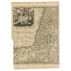
Antique Map of the Holy Land, c.1710
Located in Langweer, NL
Antique map titled 'Totius Terrae Sanctae Delineatio'. Map of the Holy Land extending to Egypt and
Category
18th Century Antique Map Background
Materials
Paper
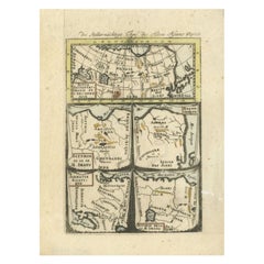
Antique Map of Northern Asia by Mallet, 1719
Located in Langweer, NL
Antique map titled 'Das Mitternächtige Theil des Alten Asien'. This sheet of five miniature maps
Category
18th Century Antique Map Background
Materials
Paper
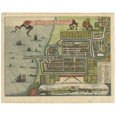
Antique Map of Batavia 'Jakarta, Indonesia' by Montanus, 1679
Located in Langweer, NL
in the background. The plan is based on the earlier, much larger map of Batavia published by Clement
Category
Late 17th Century Unknown Antique Map Background
Materials
Paper
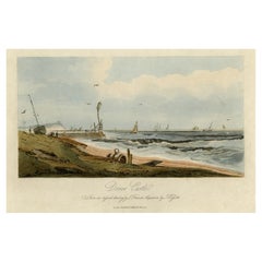
View of Dover Castle Atop the Cliffs in the Background, England, 1818
Located in Langweer, NL
cliffs in the background. Published by T. McLean in 1818.
Artists and Engravers: Made by 'J. Hassell
Category
1810s Antique Map Background
Materials
Paper
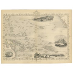
Map of Polynesia Highlighting Cultural Landscapes and Maritime Activities, 1851
Located in Langweer, NL
John Tallis & Company was a London-based map publisher that flourished during the 19th century
Category
1850s Antique Map Background
Materials
Paper
H 10.71 in W 14.26 in D 0 in
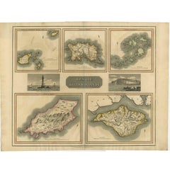
Antique Map of the British Islands by J. Thomson, 1817
Located in Langweer, NL
Group of 5 maps of the Channel Islands, Scilly, Jersey, the Isle of Mann and the Isle of Wight
Category
Early 19th Century Antique Map Background
Materials
Paper
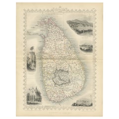
19th Century Illustrated Map of Ceylon (Sri Lanka) with Notable Landmarks
Located in Langweer, NL
John Tallis & Company is known for producing maps and atlases that were highly regarded for their
Category
1850s Antique Map Background
Materials
Paper
H 14.26 in W 10.71 in D 0 in
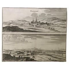
17th Century Topographical Map, French Champagne Region, Epernay, Iohan Peeters
Located in New York, NY
Fine topographical 17th century map by Iohan Peeters of the towns of Epernay and Lametz in the
Category
17th Century Dutch Antique Map Background
Materials
Paper
H 12.38 in W 15.5 in D 0 in
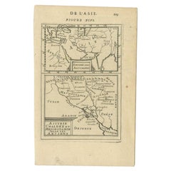
Antique Map of the Empire of the Assyriens by Mallet, 1683
By Alain Manesson Mallet
Located in Langweer, NL
Antique map titled 'Empire des Assyriens' and 'Assyrie Chaldee et Mesopotamie selon les Anciens
Category
17th Century Antique Map Background
Materials
Paper
An Ornate and Historical Tallis Map of Jamaica with Decorative Vignettes, 1851
Located in Langweer, NL
This original antique map of Jamaica is part of the renowned series created by the Tallis Company
Category
1850s Antique Map Background
Materials
Paper
H 10.71 in W 14.26 in D 0 in
An Old Illustrated Tallis Map of Central America with Volcanic Vignettes, 1851
Located in Langweer, NL
This map of Central America, part of John Tallis & Company's series from "The British Colonies" by
Category
1850s Antique Map Background
Materials
Paper
H 10.71 in W 14.26 in D 0 in
Map of Tasmania with Illustrations of Local Fauna and Colonial Landmarks, 1851
Located in Langweer, NL
John Tallis & Company was renowned for their detailed and ornate maps during the 19th century
Category
1850s Antique Map Background
Materials
Paper
H 14.26 in W 10.71 in D 0 in
Map of New Zealand Showing Maori Culture and Early Colonial Settlements, 1851
Located in Langweer, NL
John Tallis & Company were renowned for their ornate and detailed maps in the mid-19th century
Category
1850s Antique Map Background
Materials
Paper
H 14.26 in W 10.71 in D 0 in
Old Print Titled from War Comes Peace, City Amara in Africa in Background, C1630
Located in Langweer, NL
War comes Peace). A lance is used as a roost for chickens. In the background the city Amara in Africa
Category
1630s Antique Map Background
Materials
Paper
H 6.03 in W 7.29 in D 0 in
1859 "Map of the United States of America..." by J. H. Colton
By J.H. Colton
Located in Colorado Springs, CO
Presented is an 1859 “Map of the United States of America, the British Provinces, Mexico, the West
Category
1850s American Antique Map Background
Materials
Paper
Antique Map of Africa, Cartouche with Elephant Tusks and Horned Serpent, 1737
Located in Langweer, NL
Antique map of Africa titled 'Africa Secundum Legitimas Projectionis Stereographicae regulas
Category
18th Century Antique Map Background
Materials
Paper
H 21.26 in W 24.81 in D 0 in
Important and Scarce Antique Map of Asia from Jesuit Sources, C.1713
Located in Langweer, NL
Antique map titled 'L'Asie selon les nouvelles observations de Messrs de l'Academie des Sciences
Category
18th Century Antique Map Background
Materials
Paper
Antique Map of Northern India and the Bengal Gulf by Mallet, 1686
Located in Langweer, NL
Antique map titled "Partie Orientale de la Terre Ferme de l'Inde Moderne". Original antique map of
Category
17th Century Antique Map Background
Materials
Paper
Antique Map of Asia Minor including part of the Greek Archipelago and Cyprus
Located in Langweer, NL
Antique map titled 'Chersonesi quae hodie Natolia Descriptio'. Decorative, smaller map of Asia
Category
Mid-18th Century Antique Map Background
Materials
Paper
H 9.69 in W 11.42 in D 0.02 in
Antique Map of India and the Gulf of Bengal by Mallet, c.1686
Located in Langweer, NL
Antique map titled ?Partie Orientale de la Terre Ferme de l'Inde Moderne. Small map of India and
Category
17th Century Antique Map Background
Materials
Paper
Victorian Visions of the New World: A Detailed Tallis Map of North America, 1851
Located in Langweer, NL
The map presented here is an intricate example from the series of maps produced by John Tallis
Category
1850s Antique Map Background
Materials
Paper
H 14.26 in W 10.71 in D 0 in
Old Map of the Empire of the Assyriens & the Tigres and Euphrates Rivers, 1683
Located in Langweer, NL
Antique map titled 'Empire des Assyriens' and 'Assyrie Chaldee et Mesopotamie selon les Anciens
Category
1680s Antique Map Background
Materials
Paper
H 8.27 in W 5.12 in D 0 in
Lovely Antique Map Centered on Sedan and Doncheri and the Meuze River, ca.1650
Located in Langweer, NL
from a background steeped in the world of books and maps. His father was a bookseller and publisher
Category
1650s Antique Map Background
Materials
Paper
H 19.69 in W 23.23 in D 0 in
The Kingdom of Naples and Southern Italy: A Hand-Colored 18th Century Homann Map
By Johann Baptist Homann
Located in Alamo, CA
hand colored map of southern Italy and the ancient Kingdom of Naples created by Johann Baptist Homann
Category
Early 18th Century German Antique Map Background
Materials
Paper
H 20 in W 23.88 in D 0.07 in
18th Century French Map and City View of Joppe/Jaffa 'Tel Aviv' by Sanson
By Nicolas Sanson
Located in Alamo, CA
with a fortress on a hill across in the background. The map is printed from the original Sanson
Category
Early 18th Century French Antique Map Background
Materials
Paper
H 18.88 in W 23 in D 1.13 in
Álava in Northern Spain: The Geography of Basque Heritage and Terrain, 1902
Located in Langweer, NL
This original antique map is a historical depiction of the province of Álava (in Basque: Araba
Category
Early 1900s Antique Map Background
Materials
Paper
Free Shipping
H 14.77 in W 20.08 in D 0 in
Vintage Cartographic Collection Set of India Explored - W. G. Blackie's 1859
Located in Langweer, NL
Antique map titled 'India'. Original antique map of India with inset maps of Pegu, the Tenasserim
Category
Mid-19th Century Antique Map Background
Materials
Paper
H 14.57 in W 21.26 in D 0.02 in
Decorative Original Antique Panoramic View of Atjeh on Sumatra, Indonesia, 1756
Located in Langweer, NL
, Indonesia. On this engraving a pagode like building is visible in the background. In the foreground sailing
Category
1750s Antique Map Background
Materials
Paper
H 10.36 in W 14.97 in D 0 in
Rare Large Etching of a Market of War Horses, Ca.1720
Located in Langweer, NL
background is the city gate of a city. At the bottom of the margin a six-line text in Latin and a six-line
Category
1720s Antique Map Background
Striking Antique View of Kozhikode, also known as Calicut, in Kerala, India
Located in Langweer, NL
background, with truly exceptional detail of the buildings, elephants, palm trees, and landscape. This
Category
Mid-17th Century Antique Map Background
Materials
Paper
H 5.71 in W 6.89 in D 0.02 in
Original Antique Engraving of Sakai in the Osaka Prefecture, Japan, 1669
Located in Langweer, NL
background several Castles, a temple, the King's court etc. Arnoldus Montanus' "Gedenkwaerdige Gesantschappen
Category
1660s Antique Map Background
Materials
Paper
Old Print of a Partridge in Front of The Walled City of Azemmour, Morocco, c1630
Located in Langweer, NL
and a city view in the background.
Artists and engravers: Authors: Daniel Meisner and Eberhart
Category
1630s Antique Map Background
Materials
Paper
H 5.99 in W 7.49 in D 0 in
Old Engraving of the Trarbach Battle in Rhineland-Palatinate, Germany, c.1710
Located in Langweer, NL
fell to the allied forces whereby the famous Baron de Trogne lost his life.
Background of this
Category
1710s Antique Map Background
Materials
Paper
H 7.88 in W 9.45 in D 0 in
"San Francisco, Upper California” 1851 Antique Map of San Francisco
Located in Colorado Springs, CO
Methodist church is depicted in the center foreground. In the background, ships fill the bustling harbor
Category
1850s American Antique Map Background
Materials
Paper
Original Antique Poster Norvege Norway Midnight Sun Stavkirke Church Travel Map
Located in London, GB
traditional wooden Norwegian Stavkirke church with snow topped mountains in the background, a tree on the side
Category
1610s Norwegian Antique Map Background
Materials
Paper
H 38.98 in W 25.6 in D 0.04 in
North and South America: An 18th Century Hand-colored Map by Johann Homann
By Johann Baptist Homann
Located in Alamo, CA
This early 18th century hand-colored copperplate map of North and South America entitled "Totius
Category
Early 18th Century Old Masters Antique Map Background
Materials
Engraving
Roman Hills, Aqueducts and Roads: An Early 18th Century Map by Jan Goeree
Located in Alamo, CA
This richly engraved map of Rome and its environs entitled "Urbis Cum Vicis Seu Pagis Adiacentibus
Category
Early 18th Century Old Masters Antique Map Background
Materials
Engraving
View of Meissen, Germany: A 16th Century Hand-colored Map by Braun & Hogenberg
By Franz Hogenberg
Located in Alamo, CA
This is a 16th century original hand-colored copperplate engraved map of View of View of Meissen
Category
16th Century Old Masters Antique Map Background
Materials
Engraving
Antique Map of Italy Drawn & Engraved by R. Scott for Thomsons, Edinburgh 1814
Located in London, GB
This is a magnificent museum quality antique hand-coloured map of Italy, dating from 1814.
This
Category
1810s Scottish Antique Map Background
Materials
Other
H 30.52 in W 23.63 in D 0.79 in
18th Century French Map and City View of Joppe/Jaffa (Tel Aviv) by Sanson
By Nicholas Sanson d'Abbeville
Located in Alamo, CA
with a fortress on a hill across in the background. The map is printed from the original Sanson
Category
Early 1700s Antique Map Background
Materials
Engraving
H 18.88 in W 23 in D 1.13 in
Old Decorative Maritime Print of Ships in an Harbour, Possibly England, C.1860
Located in Langweer, NL
background various vessels. Source unknown, to be determined.
Artists and Engravers: Engraved by T.A
Category
19th Century Antique Map Background
Materials
Paper
H 14.18 in W 21.26 in D 0 in
Antique Maritime Print with Various Vessels, circa 1860
Located in Langweer, NL
background various vessels. Source unknown, to be determined.
Artists and Engravers: Engraved by T.A
Category
19th Century Antique Map Background
Materials
Paper
Antique Maritime Print with Ships in the View of a Harbour, circa 1860
Located in Langweer, NL
background various vessels. Source unknown, to be determined.
Artists and Engravers: Engraved by T.A
Category
19th Century Antique Map Background
Materials
Paper
Antique Portrait of Willem Van Braam by Sallieth, circa 1780
Located in Langweer, NL
Willem van Braam, standing near a canon. In the background, a ship. Made after a drawing by J. Craco
Category
18th Century Antique Map Background
Materials
Paper
Original Antique Advertising Poster Lloyds France Maritime Transports Insurance
Located in London, GB
maritime insurance and immediate settlement of claims featuring a map of France showing the rivers and
Category
1920s French Antique Map Background
Materials
Paper
H 46.86 in W 31.89 in D 0.04 in
Antique Print of a Dutch Fortress in Manado Bay, Sulawesi, Indonesia, 1833
Located in Langweer, NL
background. Manado is now the capital of the North Sulawesi province of Indonesia. This print originates from
Category
19th Century Antique Map Background
Materials
Paper
Rare Hand Colored "Cabane Des Hold" - 1st Ed "Description de l’Univers" C. 1683
By Alain Manesson Mallet
Located in Soquel, CA
military engineering and mathematical background led to an appointment teaching mathematics at la Petite
Category
1680s Realist Antique Map Background
Materials
Paper, Ink, Gouache
H 11.5 in W 9.07 in D 0.07 in
19th Century Romantic Movement Painting "The Explorer" Unsigned
Located in Vancouver, British Columbia
ocean's edge, either lost, shipwrecked, or possibly exploring. He gazes at a map, despondently, his
Category
Mid-19th Century British Romantic Antique Map Background
Materials
Canvas
Antique Print with Two Views of the Cape of Good Hope
Located in Langweer, NL
Good Hope, with Dutch ships in the harbor and Table Mountain in the background. A night view of the
Category
Early 18th Century Antique Map Background
Materials
Paper
Early 18th Century Globe Terrestre Engraving
By Francois Halma
Located in Soquel, CA
in the background. Displayed in a black wood frame. Image, 7.25"H x 5.25"L.
Cartographer and
Category
Early 1700s Realist Antique Map Background
Materials
Paper, Ink
Two Antique Views of the Ruins of the Tower of Babel, Babylon, 1683
Located in Langweer, NL
engineering and mathematical background led to his position teaching mathematics at court. His major
Category
1680s Antique Map Background
Materials
Paper
Siege of Szigetvár, 1566: Lafreri's Rare Handcolored Engraving Published in 1585
Located in Langweer, NL
references for this rare map: Bifolco/Ronca (2018), plate 551; Ganado, Malta NL Coll. pp. 201/42; see Meurer
Category
16th Century Antique Map Background
Materials
Paper
Free Shipping
H 14.57 in W 19.1 in D 0 in
View Of Kinnungam - Hand Watercolored Etching by A. Leide
By Pieter Van Der Aa
Located in Roma, IT
consist of views, maps, and street plans, reissues of maps by the principal cities including Beijing
Category
Early 18th Century Antique Map Background
Materials
Etching
H 9.06 in W 13.19 in D 0.08 in
View Of Tongling - Hand Watercolored Etching by A. Leide
By Pieter Van Der Aa
Located in Roma, IT
comprehensive geographical work ever produced. The volume contained plates that generally consist of views, maps
Category
Early 18th Century Antique Map Background
Materials
Etching
H 9.06 in W 13.19 in D 0.08 in
Original Antique Poster Midnight Sun Norway Travel Gronoy Bolgen Mountain View
Located in London, GB
shining over the calm water and mountain in the background, the bold lettering and winged cog Norwegian
Category
Early 1900s Norwegian Antique Map Background
Materials
Paper
H 38.98 in W 25.99 in D 0.04 in
Pieter van der Aa: Cambridge from the East, after David Loggan
By Pieter Van Der Aa
Located in London, GB
and Cambridge. A wide Cambridgeshire sky opens out over the harvest scene; in the background, the
Category
Early 18th Century Antique Map Background
Materials
Engraving
Colored Antique Print of various Water Plants including Coral in Southeast Asia
By F. Valentijn
Located in Langweer, NL
the background sailing vessels.
François Valentyn or Valentijn (17 April 1666 – 6 August 1727) was
Category
Mid-18th Century Antique Map Background
Materials
Paper
H 13.19 in W 15.36 in D 0.02 in
1850s Antique Floral Turkish Oushak Rug
Located in Los Angeles, US
rugs may have put the city on the map, exquisite room-sized carpets have contributed to its enduring
Category
19th Century Tribal Antique Map Background
Materials
Wool
Original Vintage Art Deco Style Poster Aerotransport Swedish Airlines VI Flyver
By Ernst Mentze
Located in London, GB
umbrella in one hand and three planes on leashes in the other, each plane flying over a map of Europe
Category
1920s Swedish Art Deco Antique Map Background
Materials
Paper
H 33.67 in W 20.48 in D 0.01 in
A truly delightful miniature terrestrial pocket globe
By Nathaniel Mills
Located in ZWIJNDRECHT, NL
turning overhead. In line with its counterpart, the terrestrial globe, celestial globes are mapped by a
Category
Mid-18th Century British Dutch Colonial Antique Map Background
Materials
Other
- 1
Get Updated with New Arrivals
Save "Antique Map Background", and we’ll notify you when there are new listings in this category.
Antique Map Background For Sale on 1stDibs
Choose from an assortment of styles, material and more with respect to the antique map background you’re looking for at 1stDibs. Each antique map background for sale was constructed with extraordinary care, often using paper, fabric and wool. You’ve searched high and low for the perfect antique map background — we have versions that date back to the 18th Century alongside those produced as recently as the 20th Century are available. An antique map background, designed in the Georgian, Art Deco or louis xv style, is generally a popular piece of furniture. Johann Baptist Homann, A. Secola and Asa Smith each produced at least one beautiful antique map background that is worth considering.
How Much is a Antique Map Background?
Prices for an antique map background start at $106 and top out at $275,000 with the average selling for $1,175.
