Cartographer Tool
1
to
3
45
1
24
16
12
11
9
7
6
5
4
3
2
2
2
2
2
2
1
1
1
1
1
1
1
1
1
6
1
Sort By
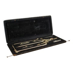
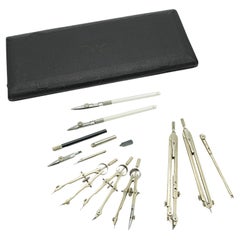
Vintage Drawing Set, German, Architect, Cartographer, Tools, Lotter, circa 1950
Located in Hele, Devon, GB
This is a vintage technical drawing set. A German, silver nickel set of architect or cartographer
Category
Mid-20th Century German More Desk Accessories
Materials
Nickel
H 0.99 in W 10.63 in D 4.53 in
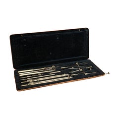
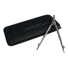
Quality Antique Drawing Instrument Set, German, Architect, Cartographer, Riefler
Located in Hele, Devon, GB
This is a quality antique drawing instrument set. A German, architect's or cartographer's tool case
Category
Early 20th Century German More Desk Accessories
Materials
Nickel
H 1.19 in W 10.24 in D 4.34 in
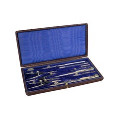
Antique Cartographer's Instrument Set, English, Surveyor's Tool Case, circa 1920
Located in Hele, Devon, GB
This is an antique cartographer's instrument set. An English, silver nickel surveyor's tool case
Category
Early 20th Century British More Desk Accessories
Materials
Nickel
H 0.99 in W 8.27 in D 4.14 in
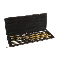
Antique Drawing Instrument Set, German, Cartographer, Technical, Richter
Located in Hele, Devon, GB
This is an antique drawing instrument set. A German, brass cartographer's or architect's technical
Category
Early 20th Century German More Desk Accessories
Materials
Nickel
H 0.99 in W 10.44 in D 4.34 in
Vintage Cartographer's Set, English, Nickel, Architect, Draughtsman, circa 1950
Located in Hele, Devon, GB
This is a vintage cartographer's set. An English, nickel architect's or draughtsman's case by
Category
Mid-20th Century British Mid-Century Modern Desk Sets
Materials
Nickel
H 0.99 in W 11.82 in D 5.32 in
Vintage Technical Drawing Set, German, Architect, Cartographer, Riefler, 1930
Located in Hele, Devon, GB
This is a vintage technical drawing set. A German, silver nickel architect or cartographer
Category
Early 20th Century German Art Deco Scientific Instruments
Materials
Nickel
H 0.79 in W 5.71 in D 2.76 in
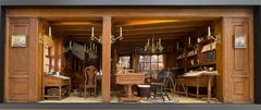
18th Century New England Cartographer's Office - Kupjack Studios Miniature Room
By Henry "Hank" Kupjack
Located in Chicago, IL
. Advances in geography enabled cartographers to map these new discoveries with increasing accuracy. The
Category
Early 2000s Contemporary Mixed Media
Materials
Mixed Media
H 14 in W 26.25 in D 14.75 in
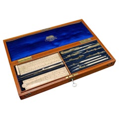
Antique Draughtsman's Tool Set, English, Cartography, Instruments, Edwardian
Located in Hele, Devon, GB
This is an antique master draughtsman's tool set. An English, case of cartographer's drawing
Category
Early 20th Century British Edwardian Desk Sets
Materials
Wood
H 1.97 in W 14.38 in D 5.32 in
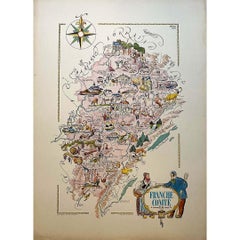
Jacques Liozu's 1951 illustrated map of the region of Franche-Comté
By Jacques Liozu
Located in PARIS, FR
precision. Jacques Liozu, a renowned French artist and cartographer, created this map to highlight the
Category
1950s Prints and Multiples
Materials
Paper, Lithograph
1861 Original vintage map of Paris - Historical cartography
Located in PARIS, FR
, a renowned cartographer of his time, this plan accurately depicts the topography of Paris, including
Category
1860s Prints and Multiples
Materials
Paper, Lithograph
H 33.86 in W 42.92 in
18th Century Cartographic Depiction of Upper India and Ceylon, 1835
Located in Langweer, NL
,' masterfully crafted by the renowned 18th-century French cartographer, Charles Marie Rigobert Bonne. This pair
Category
Antique 1830s Maps
Materials
Paper
Free Shipping
H 10.04 in W 14.57 in D 0 in
Jacques Liozu's 1951 illustrated map of Central and Eastern Europe
By Jacques Liozu
Located in PARIS, FR
beauty and precision. Jacques Liozu, the famous French artist-cartographer, created this map to
Category
1950s Prints and Multiples
Materials
Paper, Lithograph
Jacques Liozu's 1951 illustrated map of the region of Pays d'Ouest
By Jacques Liozu
Located in PARIS, FR
skilfully combines art and geography. Jacques Liozu, the famous French artist-cartographer, created this map
Category
1950s Prints and Multiples
Materials
Paper, Lithograph
Jacques Liozu's 1951 illustrated map of South America
By Jacques Liozu
Located in PARIS, FR
skilfully blends art and geography. French artist and cartographer Jacques Liozu created this map to
Category
1950s Prints and Multiples
Materials
Paper, Lithograph
Vintage Captain's Dividers, Display Ornament, Brass, Cartography, Navigation
Located in Hele, Devon, GB
tool set upon mahogany plinth, dating to the late 20th century, circa 1970.
Fascinating desk display
Category
Late 20th Century British Desk Sets
Materials
Brass
H 7.49 in W 6.5 in D 3.94 in
Original Hand-Colored Antique Map of Tartary and Northern India
Located in Langweer, NL
de l'nde" was crafted by Louis Brion de la Tour, a prominent French cartographer, and geographer in
Category
Antique 1780s Prints
Materials
Paper
Griffin's 1955 Northern Ireland original map - Tourism - Geography
Located in PARIS, FR
the dedication of the cartographers at Griffin, a renowned mapmaking company. The choice of Birmingham
Category
1950s Prints and Multiples
Materials
Linen, Lithograph, Paper
Antique Decorative Coloured Map of North America, 1882
Located in Langweer, NL
of European cartographers who may not accurately represent the sovereignty or territories of these
Category
Antique 1880s Maps
Materials
Paper
Antique Decorative Coloured Map Marocco, Algeria and Tunis, 1882
Located in Langweer, NL
were perceived and understood by Western cartographers in the 19th century.
The map of Morocco
Category
Antique 1880s Maps
Materials
Paper
Free Shipping
H 14.97 in W 22.45 in D 0 in
Victorian Visions of the New World: A Detailed Tallis Map of North America, 1851
Located in Langweer, NL
-century maps that were not only tools for navigation but also for education and display, reflecting the
Category
Antique 1850s Maps
Materials
Paper
H 14.26 in W 10.71 in D 0 in
Antique Map of the City of Leuven, Belgium, with Original Coloring, 1609
Located in Langweer, NL
Guicciardini and was published by Willem Janszoon Blaeu in 1609. Blaeu was a notable Dutch cartographer, atlas
Category
Antique Early 17th Century Maps
Materials
Paper
H 11.74 in W 13.94 in D 0.02 in
Map of Rhône: Culture and Commerce in Lyon's Silk and Wine Legacy, 1852
Located in Langweer, NL
French geographer and cartographer known for his richly illustrated maps.
The map is a steel engraving
Category
Antique 1850s Maps
Materials
Paper
Jacques Liozu's 1951 illustrated map of Asia
By Jacques Liozu
Located in PARIS, FR
French artist-cartographer, created this map to highlight the geographical and cultural diversity of Asia
Category
1950s Prints and Multiples
Materials
Paper, Lithograph
Old Map of Vaucluse, France: A Cartographic Celebration of Viticulture, 1852
Located in Langweer, NL
French geographer and cartographer known for his richly illustrated maps.
The map is a steel engraving
Category
Antique 1850s Maps
Materials
Paper
H 14.18 in W 20.99 in D 0 in
1852 Map of Haut-Rhin: An Illustrated Gateway to Alsace's Viticultural Splendors
Located in Langweer, NL
French geographer and cartographer known for his richly illustrated maps.
The map is a steel engraving
Category
Antique 1850s Maps
Materials
Paper
H 14.18 in W 20.75 in D 0 in
Jacques Liozu's 1951 illustrated map of Australia and Oceania
By Jacques Liozu
Located in PARIS, FR
. Jacques Liozu, a talented French artist-cartographer, created this map with a meticulousness and attention
Category
1950s Prints and Multiples
Materials
Paper, Lithograph
H 16.15 in W 22.05 in
Vintage Travelling Surveyor's Set, English, Pocket Drawing Instrument Case, 1930
Located in Hele, Devon, GB
the early 20th century, circa 1930.
Charming set for the travelling cartographer
Displays a
Category
Early 20th Century British More Desk Accessories
Materials
Nickel
H 0.79 in W 8.27 in D 3.15 in
Antique Technical Drawing Set, German, Architect, Cartography, Wichmann
Located in Hele, Devon, GB
This is an antique technical drawing set. A German, architect's or cartographer's instrument case
Category
Early 20th Century German Edwardian Scientific Instruments
Materials
Nickel
H 0.99 in W 11.03 in D 4.53 in
Álava in Northern Spain: The Geography of Basque Heritage and Terrain, 1902
Located in Langweer, NL
. Benito Chias y Carbo, a known cartographer.
The map features various elements common to geographic maps
Category
Antique Early 1900s Maps
Materials
Paper
Free Shipping
H 14.77 in W 20.08 in D 0 in
Authentic 1644 Janssonius Map of the Champagne Region (Campania) in France
Located in Langweer, NL
, engraved in 1644, is a work by the esteemed cartographer Johannes Janssonius. It depicts the historic
Category
Antique 1640s Maps
Materials
Paper
Free Shipping
H 21.86 in W 25.99 in D 0 in
The Illustrated Map of the Var Department from the Atlas National Illustré, 1856
Located in Langweer, NL
French geographer and cartographer known for his richly illustrated maps.
The map of 'Dépt. du Var' from
Category
Antique 1850s Maps
Materials
Paper
H 14.18 in W 20.87 in D 0 in
1644 Janssonius Original Wine Regions Map: The Ducal and Comital Burgundy
Located in Langweer, NL
noted cartographer Johannes Janssonius. The title "Utriusque Burgundiae, tum ducatus tum comitatus
Category
Antique 1640s Maps
Materials
Paper
Free Shipping
H 19.1 in W 22.84 in D 0 in
Vintage Instrument Set, German, Technical Drawing, Riefler, Munich, circa 1950
Located in Hele, Devon, GB
tooling
From the renowned and well-established C. Riefler of Nesselwang & München in Bavaria
This is a
Category
Mid-20th Century German More Desk Accessories
Materials
Nickel
H 0.99 in W 8.67 in D 3.15 in
Levasseur's 1852 Cartographic Portrait of Gironde: Celebrating the Bordeaux Wine
Located in Langweer, NL
French geographer and cartographer known for his richly illustrated maps.
The map is a steel engraving
Category
Antique 1850s Maps
Materials
Paper
H 20.67 in W 14.06 in D 0 in
Antique Map of Scotland by Cary, '1811'
Located in Langweer, NL
country as understood in the early 19th century. Published by the renowned cartographer J. Cary, known for
Category
Antique Early 19th Century Maps
Materials
Linen, Paper
1859 Antique Swiss Panorama: Blackie's Detailed Map of Switzerland
Located in Langweer, NL
Geography', published in 1859 by the renowned cartographer W. G. Blackie. This map presents a detailed and
Category
Antique Mid-19th Century Maps
Materials
Paper
Cartographer's Set, English, Architect, Draughtsman, AG Thornton, circa 1920
Located in Hele, Devon, GB
site
This is a superb antique cartographer's set with a comprehensive selection of tools for the
Category
Early 20th Century British More Desk Accessories
Materials
Nickel
H 0.99 in W 8.47 in D 5.71 in
Antique Library Table, English, William IV, Mahogany, Cartographers, circa 1835
Located in Hele, Devon, GB
This is an antique library table, an English, William IV, mahogany cartographer's table dating to
Category
Antique 19th Century English William IV Conference Tables
Materials
Mahogany
H 31.11 in W 65.36 in D 52.76 in
Antique Technical Drawing Set, Cartographer, Architect, Harling of London, 1900
Located in Hele, Devon, GB
This is an antique technical drawing set. An English, silver nickel cartographer's or architect's
Category
Early 20th Century British More Desk Accessories
Materials
Nickel
H 0.99 in W 7.88 in D 5.52 in
Antique Draughtsman's Set, Drawing Instrument, Tools, Jackson Bros, Victorian
Located in Hele, Devon, GB
This is an antique draughtsman's set. An English, silver nickel drawing instrument or tool set by
Category
Antique Late 19th Century British More Desk Accessories
Materials
Nickel
H 0.79 in W 5.52 in D 2.76 in
Antique Architects Desk, Adjustable, Georgian, Mahogany, Draughtsman, circa 1810
Located in Hele, Devon, GB
or cartographer's desk dating to the early 19th century, circa 1810.
A versatile and charming
Category
Antique Early 19th Century English Georgian Desks
Materials
Mahogany
H 32.68 in W 40.56 in D 27.56 in
Small Antique Cartographer's Tool Set, German, Draughtsman's Instrument, Riefler
Located in Hele, Devon, GB
This is a small antique cartographer's tool set. A German, brass draughtsmen's instrument case by
Category
Antique Late 19th Century German More Desk Accessories
Materials
Brass
H 0.79 in W 6.7 in D 2.17 in
Antique Cartographer's Set, English, Architect, Draughtsman Tool Case, Edwardian
Located in Hele, Devon, GB
This is a superb antique cartographer's set with a comprehensive selection of tools for the architect
Category
Early 20th Century British More Desk Accessories
Materials
Nickel
H 0.99 in W 6.7 in D 5.71 in
Antique Technical Drawing Set, Architect, Cartographer, Instruments, ANCSL, 1920
Located in Hele, Devon, GB
This is an antique technical drawing set. An English, architect's or cartographer's instrument case
Category
Early 20th Century British More Desk Accessories
Materials
Brass
H 1.78 in W 12.8 in D 4.34 in
Vintage Drawing Set, English, Draughtsman, Cartographer, Instrument, circa 1950
Located in Hele, Devon, GB
This is a vintage drawing set. An English, boxed draughtsman's or cartographer's instrument
Category
Mid-20th Century English Scientific Instruments
Materials
Wood
H 0.99 in W 7.88 in D 4.53 in
George III Pocket Globe and Case by John and William Cary
By John & William Cary
Located in Sutton Coldfield, GB
cartographers and globe makers was founded by John Cary (c.1754-1835), a map engraver and seller. At the age of
Category
Antique 1790s English Globes
Materials
Copper
Get Updated with New Arrivals
Save "Cartographer Tool", and we’ll notify you when there are new listings in this category.
Cartographer Tool For Sale on 1stDibs
Choose from an assortment of styles, material and more with respect to the cartographer tool you’re looking for at 1stDibs. Frequently made of metal, nickel and brass, every cartographer tool was constructed with great care. Your living room may not be complete without a cartographer tool — find older editions for sale from the 20th Century and newer versions made as recently as the 20th Century. When you’re browsing for the right cartographer tool, those designed in Art Deco styles are of considerable interest.
How Much is a Cartographer Tool?
Prices for a cartographer tool start at $369 and top out at $1,039 with the average selling for $436.
More Ways To Browse
Antique Pocket Globe
Antique Map Drawer
Georgian Architects Desk
Antique Army Compass
Victorian Celluloid
Celluloid Victorian
William C Palmer
Surveyors Compass
Architect Ruler
Gold Desktop Accessories
1820 World Map
Antique Astronomy Book
Vintage Canister Set
Vintage Dividers Tools
Antique Surveyor Compass
Blue Canister Set
Vintage Canister With Lid
Collins Brothers
