Large Old Map
7
to
41
376
164
205
176
134
97
89
88
54
52
47
38
35
25
23
22
17
16
16
15
15
13
12
12
12
10
9
7
7
5
4
4
4
4
4
4
4
4
3
3
3
3
2
2
2
2
2
2
2
2
2
2
1
1
1
1
1
1
1
1
42
42
15
11
10
Sort By
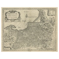
Old Map of Prussia, Embellished with a Large Cartouche and Compass Rose, ca.1680
Located in Langweer, NL
Antique map titled 'Prussiae nova Tabula'.
Later edition of Blaeu's map of Prussia, embellished
Category
Antique 1680s Maps
Materials
Paper
H 17.13 in W 21.86 in D 0 in
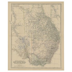
Old Map of Southern Australia, with an Inset Map of Cape York Peninsula, 1882
Located in Langweer, NL
Antique map titled 'South Australia, New South Wales, Victoria & Queensland'.
Old map of
Category
Antique 1880s Maps
Materials
Paper
H 24.22 in W 19.53 in D 0 in
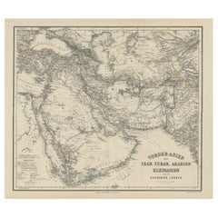
Old German Antique Map of Iran and Arabia, 1866
Located in Langweer, NL
'. Large map centered on Iran. It shows the area from Turkey to Mumbai in India. Includes Arabia, the
Category
Antique 19th Century Maps
Materials
Paper
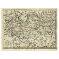
Authentic Old Map of Persia with Original Border Coloring, 1745
Located in Langweer, NL
Title: "Kaartje van Persien na de stelling van den Heer Guillaume de L'Isle"
Translates to "Map
Category
Antique 1740s Maps
Materials
Paper
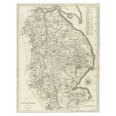
Large Antique County Map of Lincolnshire, England
Located in Langweer, NL
Antique map titled 'A Map of Lincolnshire from the best Authorities'. Original old county map of
Category
Antique Early 19th Century Maps
Materials
Paper
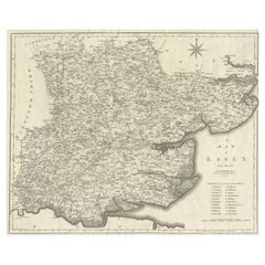
Large Antique County Map of Essex, England
Located in Langweer, NL
Antique map titled 'A Map of Essex from the best Authorities'. Original old county map of Essex
Category
Antique Early 19th Century Maps
Materials
Paper
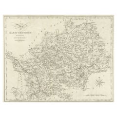
Large Antique County Map of Hertfordshire, England
Located in Langweer, NL
Antique map titled 'A Map of Hartfordshire from the best Authorities'. Original old county map of
Category
Antique Early 19th Century Maps
Materials
Paper
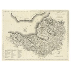
Large Antique County Map of Somersetshire, England
Located in Langweer, NL
Antique map titled 'A Map of Somersetshire from the best Authorities'. Original old county map of
Category
Antique Early 19th Century Maps
Materials
Paper
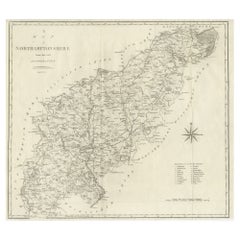
Large Antique County Map of Northamptonshire, England
Located in Langweer, NL
Antique map titled 'A Map of Northamptonshire from the best Authorities'. Original old county map
Category
Antique Early 19th Century Maps
Materials
Paper
Large Antique County Map of Ruthlandshire, England
Located in Langweer, NL
Antique map titled 'A Map of Ruthlandshire from the best Authorities'. Original old county map of
Category
Antique Early 19th Century Maps
Materials
Paper
Large Antique County Map of Norfolk, England
Located in Langweer, NL
Antique map titled 'A Map of Norfolk from the best Authorities'. Original old county map of Norfolk
Category
Antique Early 19th Century Maps
Materials
Paper
Large Antique County Map of Middlesex, England
Located in Langweer, NL
Antique map titled 'A Map of Middlesex from the best Authorities'. Original old county map of
Category
Antique Early 19th Century Maps
Materials
Paper
Large Antique County Map of Cambridgeshire, England
Located in Langweer, NL
Antique map titled 'A Map of Cambridgeshire from the best Authorities'. Original old county map of
Category
Antique Early 19th Century Maps
Materials
Paper
Large Antique County Map of Huntingdonshire, England
Located in Langweer, NL
Antique map titled 'A Map of Huntingdonshire from the best Authorities'. Original old county map of
Category
Antique Early 19th Century Maps
Materials
Paper
Large Antique Map of England and Wales
Located in Langweer, NL
Antique map titled 'An Accurate Map of England and Wales'. Original old map of England and Wales
Category
Antique Early 19th Century Maps
Materials
Paper
Large Antique County Map of Westmorland, England
Located in Langweer, NL
Antique map titled 'A Map of Westmoreland from the best Authorities'. Original old county map of
Category
Antique Early 19th Century Maps
Materials
Paper
Large Antique County Map of Nottinghamshire, England
Located in Langweer, NL
Antique map titled 'A Map of Nottinghamshire from the best Authorities'. Original old county map of
Category
Antique Early 19th Century Maps
Materials
Paper
Large Antique County Map of Suffolk, England
Located in Langweer, NL
Antique map titled 'A Map of Suffolk from the best Authorities'. Original old county map of Suffolk
Category
Antique Early 19th Century Maps
Materials
Paper
Large Antique County Map of Surrey, England
Located in Langweer, NL
Antique map titled 'A Map of Surry from the best Authorities'. Original old county map of Surrey
Category
Antique Early 19th Century Maps
Materials
Paper
Large Antique County Map of Buckinghamshire, England
Located in Langweer, NL
Antique map titled 'A Map of Buckinghamshire from the best Authorities'. Original old county map of
Category
Antique Early 19th Century Maps
Materials
Paper
Large Antique County Map of Warwickshire, England
Located in Langweer, NL
Antique map titled 'A Map of Warwickshire from the best Authorities'. Original old county map of
Category
Antique Early 19th Century Maps
Materials
Paper
Large Antique County Map of Derbyshire, England
Located in Langweer, NL
Antique map titled 'A Map of Derbyshire from the best Authorities'. Original old county map of
Category
Antique Early 19th Century Maps
Materials
Paper
Large Antique County Map of Worcestershire, England
Located in Langweer, NL
Antique map titled 'A Map of Worcestershire from the best Authorities'. Original old county map of
Category
Antique Early 19th Century Maps
Materials
Paper
Large Antique County Map of Northumberland, England
Located in Langweer, NL
Antique map titled 'A Map of Northumberland from the best Authorities'. Original old county map of
Category
Antique Early 19th Century Maps
Materials
Paper
Large Antique County Map of Cumberland, England
Located in Langweer, NL
Antique map titled 'A Map of Cumberland from the best Authorities'. Original old county map of
Category
Antique Early 19th Century Maps
Materials
Paper
Large Antique County Map of Durham, England
Located in Langweer, NL
Antique map titled 'A Map of Durham from the best Authorities'. Original old county map of Durham
Category
Antique Early 19th Century Maps
Materials
Paper
Large Antique 1859 Map of North America
Located in Sag Harbor, NY
This Map was made by Augustus Mitchell in 1859 It is in amazing condition for being 163 years old
Category
Antique Mid-19th Century American Maps
Materials
Canvas, Paper
Original Old Map of Eastern China, Also Depicting Taiwan 'Formosa', 1922
Located in Langweer, NL
Large map of China titled 'China - Peking'. Old map of eastern China depicting Kiangsi, Chekiang
Category
20th Century Maps
Materials
Paper
H 23.23 in W 17.92 in D 0 in
Large Antique County Map of North Wales, England
Located in Langweer, NL
Antique map titled 'A Map of North Wales from the best Authorities'. Original old county map of
Category
Antique Early 19th Century Maps
Materials
Paper
Large Antique County Map of South Wales, England
Located in Langweer, NL
Antique map titled 'A Map of South Wales from the best Authorities'. Original old county map of
Category
Antique Early 19th Century Maps
Materials
Paper
Large Antique County Map of Wiltshire, England, 1805
Located in Langweer, NL
Antique map titled 'A Map of Wiltshire from the best Authorities'. Original old county map of
Category
Antique Early 19th Century Maps
Materials
Paper
Large Antique County Map of Leicestershire, England, 1805
Located in Langweer, NL
, England, with this original old county map engraved by the renowned cartographer John Cary. Titled 'A Map
Category
Antique Early 19th Century Maps
Materials
Paper
An Old Illustrated Tallis Map of Central America with Volcanic Vignettes, 1851
Located in Langweer, NL
This map of Central America, part of John Tallis & Company's series from "The British Colonies" by
Category
Antique 1850s Maps
Materials
Paper
H 10.71 in W 14.26 in D 0 in
Original Antique Map of North and South America in Attractive Old Coloring
By Isaak Tirion
Located in Langweer, NL
Antique map titled 'Nieuwe Kaart van America'. Beautiful map of America. The fabled Quivira is used
Category
Antique Mid-18th Century Maps
Materials
Paper
H 16.15 in W 19.69 in D 0.02 in
Large Original Antique Map of Colorado, USA circa 1900
Located in St Annes, Lancashire
Fabulous map of Colorado
Original color
Engraved and printed by the George F. Cram Company
Category
Antique 1890s American Maps
Materials
Paper
Antique Map of the Old Land of Batavia and Friesland by Halma, 1718
Located in Langweer, NL
Antique map Friesland titled 'Descriptio veteris Agri Batavi et Frisii (..)'. Old map of Friesland
Category
Antique 18th Century Maps
Materials
Paper
Old Map of Region Champagne-Ardenne with Reims, Troyes & Épernay in France, 1759
Located in Langweer, NL
. Apart from the atlases the firm published a very large number of individual maps. The Homanns produced a
Category
Antique 1750s Maps
Materials
Paper
H 24.93 in W 21.07 in D 0 in
Original Old Map East of Stockholm, the Island Ljusterö and Värmdö, Sweden, 1720
Located in Langweer, NL
atlases the firm published a very large number of individual maps. The Homanns produced a Neuer Atlas in
Category
Antique 1720s Maps
Materials
Paper
H 21.11 in W 24.89 in D 0 in
Large Antique County Map of Warwickshire, England, with Hand Coloring
Located in Langweer, NL
Antique map titled 'A Map of Warwickshire from the best Authorities'. Original old county map of
Category
Antique Early 19th Century Maps
Materials
Paper
H 22.17 in W 17.21 in D 0.02 in
Large Antique County Map of Leicestershire, England, with Outline Coloring
Located in Langweer, NL
Antique map titled 'A Map of Leicestershire from the best Authorities'. Original old county map of
Category
Antique Early 19th Century Maps
Materials
Paper
H 22.21 in W 17.21 in D 0.02 in
Large Antique Map of Kyoto in Japan by Kobayashi, '1905'
Located in Langweer, NL
Old map of Kyoto, Japan. Published by Kobayashi, 1905.
Category
Early 20th Century Maps
Materials
Paper
Old Color Engraving of Blaeu's first Map of Brazil, North Oriented to the Right
By Willem Blaeu
Located in Langweer, NL
Antique map titled 'Novus Brasiliae Typus'. Fine old color example of Blaeu's first map of Brazil
Category
Antique Mid-17th Century Maps
Materials
Paper
H 19.3 in W 22.84 in D 0.02 in
Old Map of the American Railroad Network and All Weather Roads on Verso, 1931
Located in Langweer, NL
This is the “New Census Edition” of Clason’s United States Green Guide. It features two large maps
Category
Vintage 1930s Maps
Materials
Paper
H 20.71 in W 32.8 in D 0 in
Old Map of the UK & Ireland, Insets of Orkney, Shetland and Faroe Islands, 1786
Located in Langweer, NL
".
Hand-colored engraved map with 2 (large) decorative cartouches, inset map of the Orkney, Shetland and
Category
Antique 1780s Maps
Materials
Paper
H 23.31 in W 18.59 in D 0 in
Detailed Old Map of the Seven Provinces of the Belgian/Dutch Federation, ca.1748
Located in Langweer, NL
atlases the firm published a very large number of individual maps. The Homanns produced a Neuer Atlas in
Category
Antique 18th Century Maps
Materials
Paper
H 25.2 in W 21.07 in D 0 in
Old Decorative Map of Austria, Centered on the Danube River and Vienna, Ca.1720
Located in Langweer, NL
atlases the firm published a very large number of individual maps. The Homanns produced a Neuer Atlas in
Category
Antique 1720s Maps
Materials
Paper
H 20.87 in W 24.02 in D 0 in
Huge Old Map of Java, Indonesia, Published by the Dutch in Colonial Times, 1728
Located in Langweer, NL
large-scale map of Java is richly engraved with details of agricultural fields, roads, temples, and
Category
Antique 18th Century Maps
Materials
Paper
H 68.12 in W 21.07 in D 0 in
Large Map of Castile's Southern Realms - Granada, Andalusia, and Murcia, 1652
Located in Langweer, NL
This antique map, titled 'Les Etats de la Couronne de Castille', represents the southern regions of
Category
Antique Mid-17th Century Maps
Materials
Paper
H 17.64 in W 23.75 in D 0.02 in
Large Antique County Map of the East Riding of Yorkshire, England
Located in Langweer, NL
Antique map titled 'A Map of the East Riding of Yorkshire from the best Authorities'. Original old
Category
Antique Early 19th Century Maps
Materials
Paper
Original Old China Map, From Korea and the Sea of Japan to Teypin Island, 1803
Located in Langweer, NL
and the Tributary Kingdoms of Corea, Tonkin'.
Old map depicting China, extending from Korea and
Category
Antique Early 1800s Maps
Materials
Paper
H 10.63 in W 12.01 in D 0 in
Large Antique County Map of Cornwall and the Isles of Scilly, England
Located in Langweer, NL
Antique map titled 'A Map of Cornwall from the best Authorities'. Original old county map of
Category
Antique Early 19th Century Maps
Materials
Paper
H 17.37 in W 21.66 in D 0.02 in
Extremely Large Hand-Drawn Manuscript Map of Surinam, 1830, History of Slavery
Located in Amsterdam, NL
A unique large hand-drawn map of Surinam by Albrecht Helmut Hiemcke (German, 1760-1839
Category
Antique Mid-19th Century Surinamer Maps
Materials
Paper
Free Shipping
H 34.85 in W 97.05 in D 0.08 in
Large Antique County Map of the West Riding of Yorkshire 'South Part', England
Located in Langweer, NL
Authorities'. Original old county map of the south part of the West Riding of Yorkshire, England. Engraved by
Category
Antique Early 19th Century Maps
Materials
Paper
H 16.46 in W 21.66 in D 0.02 in
Large Antique County Map of the West Riding of Yorkshire 'North Part', England
Located in Langweer, NL
Authorities'. Original old county map of the north part of the West Riding of Yorkshire, England. Engraved by
Category
Antique Early 19th Century Maps
Materials
Paper
H 16.54 in W 21.38 in D 0.02 in
Antique Map of England and London with Two Large Allegorical Views, c.1720
Located in Langweer, NL
Antique map titled 'Nouvelle Carte du gouvernement civil d'Angleterre (..)'. Old plan of London
Category
Antique 18th Century Maps
Materials
Paper
No Reserve
H 16.54 in W 19.69 in D 0 in
Decorative Ancient World Map with Large Parts of the World Still Unknown, c 1731
Located in Langweer, NL
marvelous world map, based upon 2000 year old geography. From an early edition of Cellarius' Notitia Orbis
Category
Antique 1730s Maps
Materials
Paper
H 9.45 in W 14.57 in D 0 in
Large Antique Map of Asia The Royal Atlas of Modern Geography by Johnston, 1882
Located in Langweer, NL
Antique map titled 'Asia'. Old map of the Asian continent. This map originates from 'The Royal
Category
Antique 19th Century Maps
Materials
Paper
H 19.53 in W 24.22 in D 0 in
Large 17th Century Hand Colored Map of England and the British Isles by de Wit
By Frederick de Wit
Located in Alamo, CA
A large hand colored 17th century map of England and the British Isles by Frederick de Wit entitled
Category
Antique Late 17th Century Dutch Maps
Materials
Paper
H 35 in W 30.5 in D 2 in
Antique Map of New Zealand, 1895
Located in Langweer, NL
Antique map titled 'Neu-Seeland.' Map of New Zealand. With inset maps of the large cities. This
Category
Antique 19th Century Maps
Materials
Paper
German Antique Map of Australia, Meyers, 1885
Located in Langweer, NL
Australien.' (Map of Australia. With inset maps of the large cities and Tasmania.) This attractive
Category
Antique 19th Century Maps
Materials
Paper
- 1
Get Updated with New Arrivals
Save "Large Old Map", and we’ll notify you when there are new listings in this category.
More Ways To Browse
Antique Army Compass
Royal Gouda
Antique Spiegel Furniture
Old Antique Map
Large Spanish Bowl
17th Century Scottish Furniture
Maps Oregon
Scan Globe
Antique Micrometer
Antique Micrometers
Bishop Throne
Antique Illinois Map
Antique Furniture County Durham
Missouri Antique Map
Moses Red Sea
Vintage Office Furniture New York
Map Of German
Antique Old World Maps
