Items Similar to Large Antique Map of Asia The Royal Atlas of Modern Geography by Johnston, 1882


Want more images or videos?
Request additional images or videos from the seller
Large Antique Map of Asia The Royal Atlas of Modern Geography by Johnston, 1882
About the Item
Antique map titled 'Asia'. Old map of the Asian continent. This map originates from 'The Royal Atlas of Modern Geography, Exhibiting, in a Series of Entirely Original and Authentic Maps, the Present Condition of Geographical Discovery and Research in the Several Countries, Empires, and States of the World' by A.K. Johnston. Published by W. and A.K. Johnston, 1882.
Artists and Engravers: Alexander Keith Johnston LLD (1804-1871) was a Scottish geographer. He was a pupil of the Edinburgh engraver and mapmaker, James Kirkwood. In 1826, he joined his brother William (who would become Sir William Johnston, Lord Provost of Edinburgh) in a printing and engraving business, forming the well-known cartographical firm of W. and A. K. Johnston.
Condition: Good, general age-related toning. Please study image carefully.
Date: 1882
Overall size: 61.5 x 49.6 cm.
Image size: 57.3 x 44.3 cm.
We sell original antique maps to collectors, historians, educators and interior decorators all over the world. Our collection includes a wide range of authentic antique maps from the 16th to the 20th centuries. Buying and collecting antique maps is a tradition that goes back hundreds of years. Antique maps have proved a richly rewarding investment over the past decade, thanks to a growing appreciation of their unique historical appeal. Today the decorative qualities of antique maps are widely recognized by interior designers who appreciate their beauty and design flexibility. Depending on the individual map, presentation, and context, a rare or antique map can be modern, traditional, abstract, figurative, serious or whimsical. We offer a wide range of authentic antique maps for any budget.
- Dimensions:Height: 19.53 in (49.6 cm)Width: 24.22 in (61.5 cm)Depth: 0 in (0.01 mm)
- Materials and Techniques:
- Period:
- Date of Manufacture:1882
- Condition:
- Seller Location:Langweer, NL
- Reference Number:
About the Seller
5.0
Platinum Seller
These expertly vetted sellers are 1stDibs' most experienced sellers and are rated highest by our customers.
Established in 2009
1stDibs seller since 2017
1,950 sales on 1stDibs
Typical response time: <1 hour
- ShippingRetrieving quote...Ships From: Langweer, Netherlands
- Return PolicyA return for this item may be initiated within 14 days of delivery.
More From This SellerView All
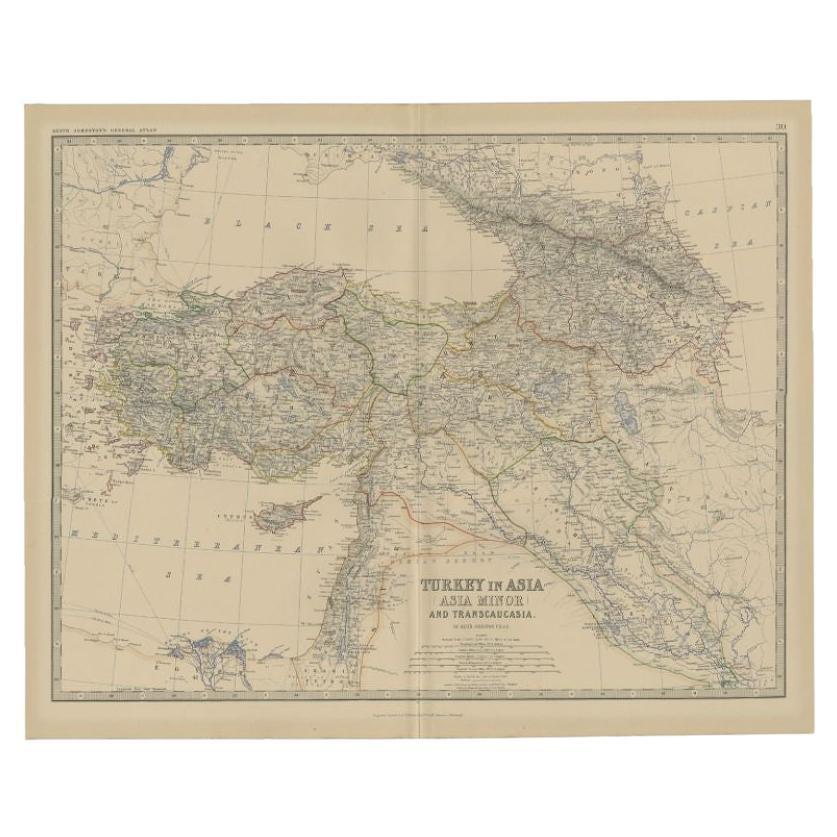
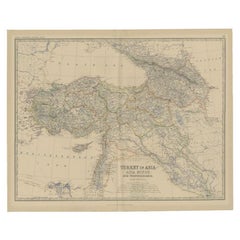
- Antique Map of Turkey in Asia by Johnston, 1882Located in Langweer, NLAntique map titled 'Turkey in Asia (Asia Minor) and Transcaucasia'. Old map of Turkey in Asia (Asia Minor). This map originates from 'The Royal Atlas of Modern Geography, Exhibiting,...Category
Antique 19th Century Maps
MaterialsPaper
- Antique Map of Switzerland by Johnston, 1882Located in Langweer, NLAntique map titled 'Switzerland and the Alps of Savoy and Piedmont'. Old map of Switzerland and the Alps of Savoy and Piedmont. This map originates from 'The Royal Atlas of Modern Ge...Category
Antique 19th Century Maps
MaterialsPaper
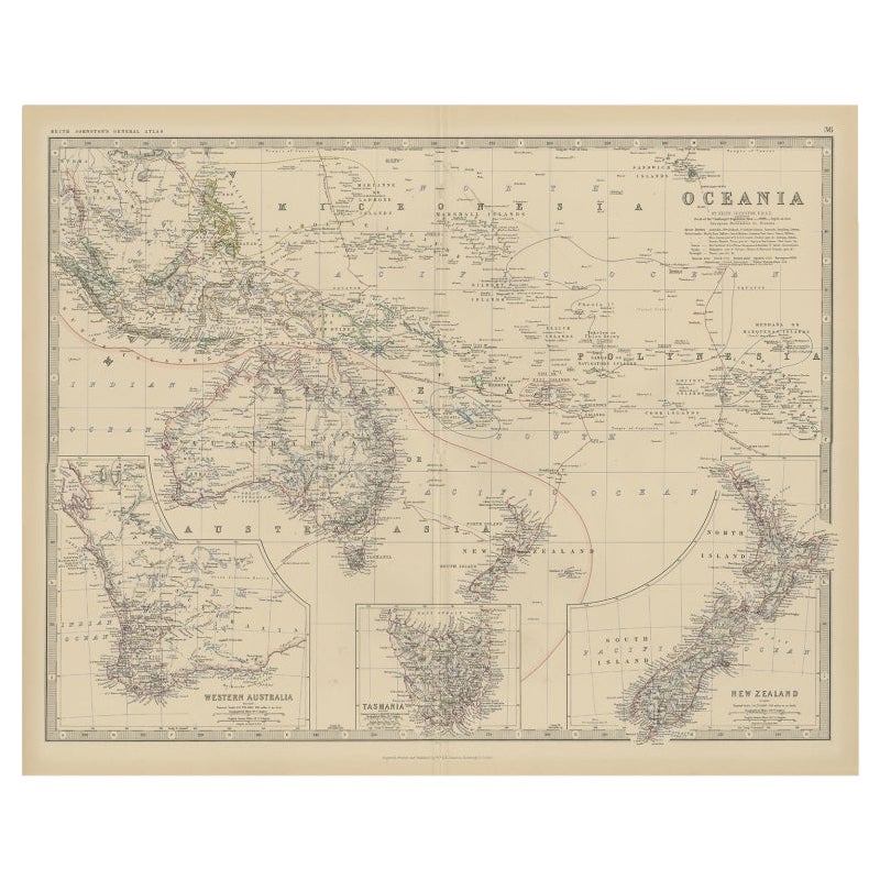
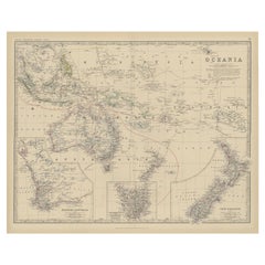
- Antique Map of Oceania by Johnston, 1882Located in Langweer, NLAntique map titled 'Oceania'. Old map of Oceania with inset maps of Western Australia, Tasmania and New Zealand. This map originates from 'The Royal Atlas of Modern Geography, Exhibi...Category
Antique 19th Century Maps
MaterialsPaper
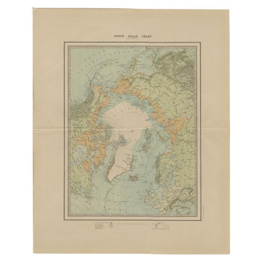
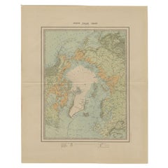
- Antique Map of the North Pole by Johnston, 1882Located in Langweer, NLAntique map titled 'North Pole Chart'. Old map of the North Pole showing the various regions and political boundaries. This map originates from 'The Royal A...Category
Antique 19th Century Maps
MaterialsPaper
- Antique Map of the German Empire by Johnston, 1882By Alexander Keith JohnstonLocated in Langweer, NLAntique map titled 'Empire of Germany'. Old map of the German Empire with an inset map of Berlin and Potsdam. This map originates from 'The Royal Atlas o...Category
Antique 19th Century Maps
MaterialsPaper
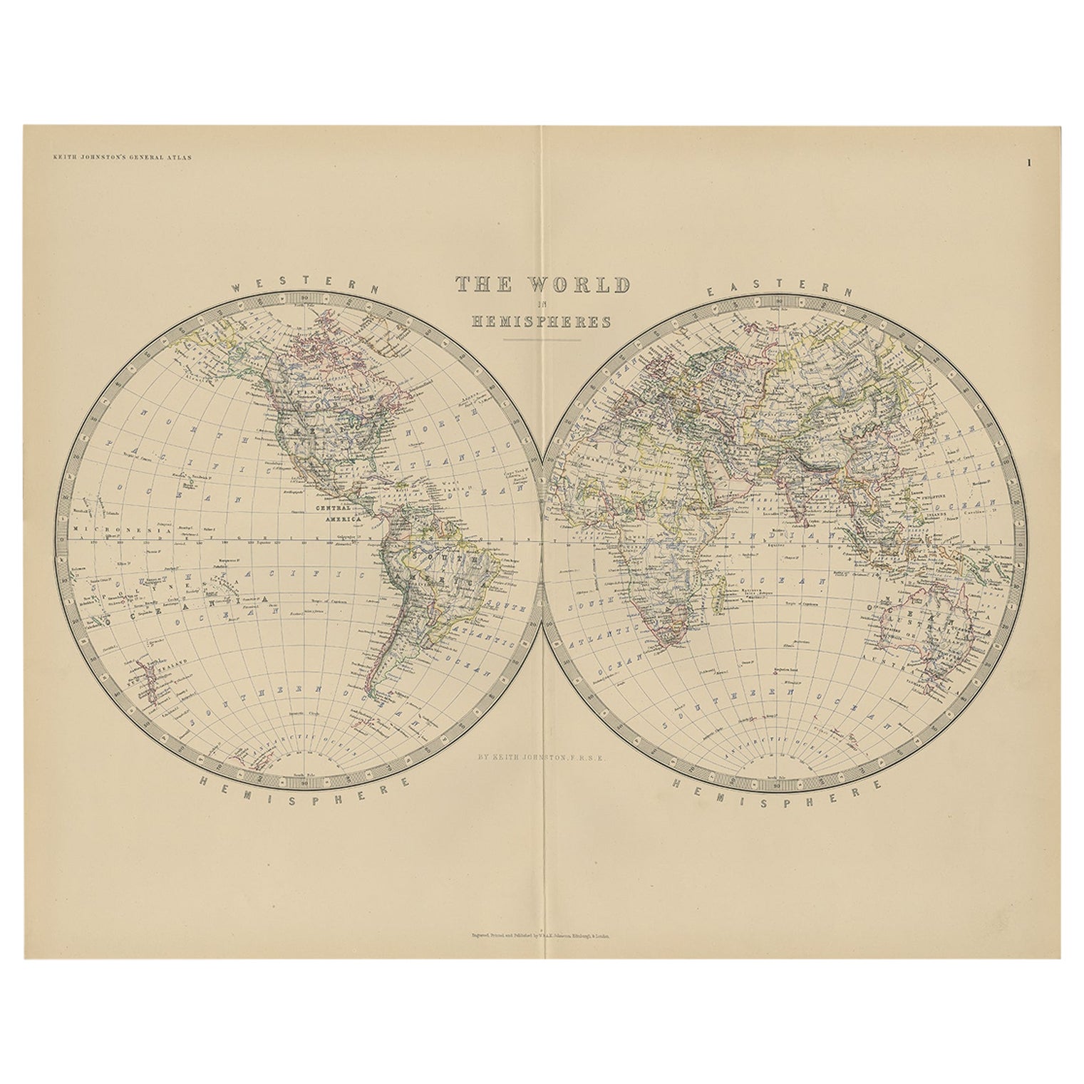
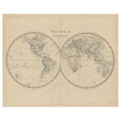
- Antique World Map by Johnston, 1882Located in Langweer, NLAntique map titled 'The World in Hemispheres'. Old double-hemisphere world map. This map originates from 'The Royal Atlas of Modern Geography, Exhibiting, in a Series of Entirely Ori...Category
Antique 19th Century Maps
MaterialsPaper


You May Also Like
- Geographical Antique Map of Principality of MonacoBy Bruno SantiniLocated in Alessandria, PiemonteST/609 - Interesting antique color map of Monaco Principality in French language : "Carte qui contient le Principauté de Piémont, le Monferrat et la comté de...Category
Antique Late 18th Century Italian Other Maps
MaterialsPaper
- Large Original Antique Map of Asia by Sidney Hall, 1847Located in St Annes, LancashireGreat map of Asia Drawn and engraved by Sidney Hall Steel engraving Original colour outline Published by A & C Black. 1847 Unframed Free shippingCategory
Antique 1840s Scottish Maps
MaterialsPaper
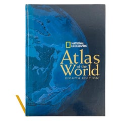
- National Geographic Atlas of the World, Eighth Edition Hardcover BookLocated in North Hollywood, CANational Geographic Atlas of the World, Eighth Edition National Geographic This is a beautiful large library or hardcover coffee table book. Title: National Geographic Atlas of th...Category
Early 2000s Maltese Mid-Century Modern Books
MaterialsPaper
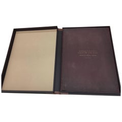
- 1877 "Geological and Geographical Atlas of Colorado" by F. V. HaydenLocated in Colorado Springs, COThis is F. V. Hayden's Geological and Geographical Atlas of Colorado and Portions of Adjacent Territory, an unmatched geological record for its time. Published by the Department of the Interior in 1877, the Atlas of Colorado consists of twenty double elephant sized sheets, divided into two series. The first series, four sheets, embrace the entire area on a scale of twelve miles to an inch, and include Triangulations, Drainage, an Economic Map, and a General Geological map...Category
Antique 1870s American Maps
MaterialsPaper
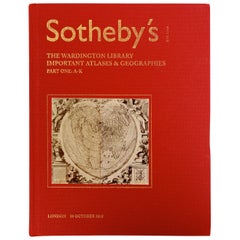
- Sotheby's The Wardington Library, Important Atlases and Geographies, Part 1 A-KLocated in valatie, NYSotheby's: The Wardington Library, Important Atlases and Geographies. Part One: A-K., London, 18 October 2005. 1st Ed hardcover catalog with 244 lots photographed in color and fully ...Category
Early 2000s English Books
MaterialsPaper
- Set of 4 Antique Geographical Maps French-German War 1870-71Located in Casale Monferrato, ITElegant late 19th century set of four antique geographical maps relating to the positioning of the armies in the Franco-German War 1870-71. A...Category
Antique 1890s Italian Maps
MaterialsPaper


Recently Viewed
View AllMore Ways To Browse
Royal Presentation
Large Map Of The World
Large Maps On Paper
Large World Map
16th Century Scotland
Scottish Lord
Large Antique World Maps
Large Antique World Map
Antique World Map Large
Large Antique Map Of The World
Antique Map Edinburgh
Antique Map Of Edinburgh
Antique Map Series
Alexander Keiths
Old Asia Map
James Johnston
Johnston James
Antique And Collectable Fairs