Old Map
34
to
313
2,174
638
1,240
792
739
496
454
397
275
220
139
106
96
94
78
76
75
72
71
71
66
59
44
39
35
35
35
32
28
28
27
25
24
23
21
20
18
17
16
14
14
14
14
14
14
13
12
12
12
12
11
11
10
10
9
9
8
7
7
6
6
2
2
2
42
42
34
24
23
Sort By
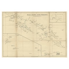
Rare Old Map of the British Solomon Islands Protectorate, 1925
Located in Langweer, NL
Antique map titled 'British Solomon Islands Protectorate'.
Old map of the British Solomon
Category
Vintage 1920s Maps
Materials
Paper
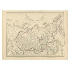
Northern Asia, Asiatic Russia, Old Map of Russia in Asia, 1849
Located in Langweer, NL
Antique map titled 'Northern Asia - Asiatic Russia'.
Old map of Russia in Asia. This map
Category
Antique 1840s Maps
Materials
Paper
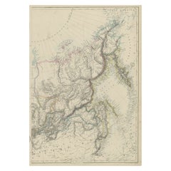
Old Map of Russia Originating from the 'Weekly Dispatch Atlas', ca.1865
Located in Langweer, NL
Antique map titled 'Russia in Asia, E Sheet'.
Old map of Russia originating from the 'Weekly
Category
Antique 1860s Maps
Materials
Paper
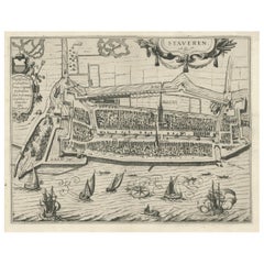
Rare Old Map of the City of Stavoren, Friesland, the Netherlands, 1616
Located in Langweer, NL
Antique map titled 'Staveren'.
Old map of the city of Stavoren, Friesland. This map originates
Category
Antique 1610s Maps
Materials
Paper
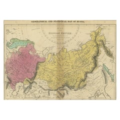
Old Map of the Russian Empire, with English Language Text, Ca.1820
Located in Langweer, NL
Antique map titled 'Geographical, Statistical and Historical Map of Russia'.
Old map of the
Category
Antique 1820s Maps
Materials
Paper
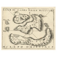
Small Old Map Depicting the Banda Islands or the Spice Islands, Indonesia, 1706
Located in Langweer, NL
Antique map titled 'Isole di Banda Nelle Molucche'.
Small old map depicting the Banda Islands
Category
Antique Early 1700s Maps
Materials
Paper
H 7.09 in W 8.86 in D 0 in
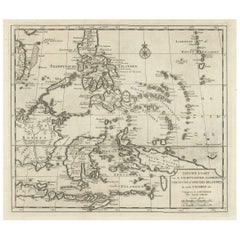
Old Map of the Philippines and Part of Indonesia 'Spice Islands', 1744
Located in Langweer, NL
mede Celebes etc'.
Old map of the Philippines and part of Indonesia. Originates from 'Nieuwe Hand
Category
Antique 1740s Maps
Materials
Paper
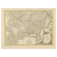
Original Old Map of Present-Day Mongolia, Northeast China and Korea
Located in Langweer, NL
, rue S. Jacques a la Ville de Bordeaux. Avec privilege du Roy. 1771'. Original old map of the region
Category
Antique Late 18th Century Maps
Materials
Paper
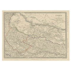
Original Old Map Northeast India, incl Part of Himalayas and China, 1853
Located in Langweer, NL
Antique map titled 'India X'.
Old map of the the northeast region of India, including part of
Category
Antique 1850s Maps
Materials
Paper
Old Map of the Alsace 'Elzas' Region with Lotharingen 'Lorraine', France, c1650
Located in Langweer, NL
Antique map titled 'Alsatia superior cum Suntgoia et Brisgoia'.
Old map of the Alsace (or Elzas
Category
Antique 1650s Maps
Materials
Paper
H 19.69 in W 23.04 in D 0 in
Original Old Map of the Coast of Syria and Phoenicia, 1773
Located in Langweer, NL
Antique map titled 'Kaart van de Zee Kust van Syrië (..)'.
Old map of the coast of Syria and
Category
Antique 1770s Maps
Materials
Paper
Old Map of the Oceans Around Australia, Indonesia and New Zealand, 1880
Located in Langweer, NL
Antique map titled 'Océanie'.
Old map of the oceans around Australia, Indonesia and New Zealand
Category
Antique 1880s Maps
Materials
Paper
Old Map Depicting Turkey, Persia, Arab and Black Sea Etc, 1778
Located in Langweer, NL
Antique map titled 'Turquie d'Asie, Arabie, Perse, Tartarie Independante'.
Old map of Turkey in
Category
Antique 1770s Maps
Materials
Paper
Old Map of the Austrian Empire with Decorative Vignette of Vienna, 1880
Located in Langweer, NL
Antique map titled 'Empire d'Autriche'.
Old map of the Austrian Empire. With decorative
Category
Antique 1880s Maps
Materials
Paper
Old Map of Southern India and Ceylon 'Sri Lanka', 1882
Located in Langweer, NL
Antique map titled 'India (Southern Sheet)'.
Old map of Southern India and Ceylon (Sri Lanka
Category
Antique 1880s Maps
Materials
Paper
Old Map of the Black Sea, The Krim, Ukraine, Russia, etc in Historic Times, 1848
Located in Langweer, NL
Antique map titled 'Pontus Euxinus'. Old map of the black Sea and surroundings originating from
Category
Antique 1840s Maps
Materials
Paper
H 9.77 in W 12.52 in D 0 in
Old Map of the Bangka Belitun Islands, Greater Sunda Islands, Indonesia, 1705
Located in Langweer, NL
'.
Old map of the Bangka Belitun Islands, part of the Greater Sunda Islands, including present-day Java
Category
Antique Early 1700s Maps
Materials
Paper
H 8.86 in W 12.6 in D 0 in
Old Map the United States and Central America, Including Mexico, ca.1860
Located in Langweer, NL
Antique map titled 'Vereinigte Staaten von Nord America und Mexico'.
Old map the United States
Category
Antique 1860s Maps
Materials
Paper
Old Map of Tartary with Persia, Siberia, the Mogul Territories & China, ca.1717
Located in Langweer, NL
, Tibet, Lassa & c'.
Old map depicting east of the Caspian Sea with parts of Persia, Siberia, the Mogul
Category
Antique 1710s Maps
Materials
Paper
H 8.27 in W 11.03 in D 0 in
Old Map of the Western Region of the Kingdom of Algiers, Algeria, 1773
Located in Langweer, NL
Antique map titled 'Kaart van het Westelyk Gedeelte van het Ryk van Algiers'.
Old map of the
Category
Antique 1770s Maps
Materials
Paper
Old Map of the Eastern Region of the Kingdom of Algiers, Algeria, 1773
Located in Langweer, NL
Antique map titled 'Kaart van het Oostelyke Deel van het Ryk van Algiers'.
Old map of the
Category
Antique 1770s Maps
Materials
Paper
Old Map of Algiers, with Surrounding Cities and the Bay of Algiers, 1773
Located in Langweer, NL
Antique print titled 'Plan van de Stad Algiers'.
Old map of Algiers, also depicting surrounding
Category
Antique 1770s Maps
Materials
Paper
Old Map of North Africa Depicting Libya, Morocco, Algeria, Tunis Etc, 1922
Located in Langweer, NL
Antique map of Africa titled 'Northern Africa'.
Old map of North Africa depicting Libya
Category
Vintage 1920s Maps
Materials
Paper
H 17.92 in W 23.23 in D 0 in
Old Map of the British Isles with the Faroes and Shetlands, Showing Cock Fights
Located in Langweer, NL
Antique map titled 'Les Isles Britaniques ou sont les Royaumes d'Angleterre (..)'. Original old map
Category
Antique Early 18th Century Maps
Materials
Paper
H 10.36 in W 14.57 in D 0.02 in
Old Map of the Bourbonnais Region of France, ca.1630
Located in Langweer, NL
Antique map titled 'Bourbonois - Borbonium Ducatus'.
Old map of the Bourbonnais region of
Category
Antique 1630s Maps
Materials
Paper
Old Map of The Southern Part of Norway, Covering the Region Around Bergen, c1650
Located in Langweer, NL
Antique map titled 'Nova et Accurata Tabula Episcopatuum Stavangriensis et Asloiensis'.
Old map
Category
Antique 1650s Maps
Materials
Paper
H 15.75 in W 19.49 in D 0 in
Old Map of Turkey in Europe, incl Romania, Servia, Montenegro & Bulgaria, 1882
Located in Langweer, NL
Antique map titled 'Turkey in Europe'.
Old map of Turkey in Europe, also depicting part of
Category
Antique 1880s Maps
Materials
Paper
H 19.53 in W 24.14 in D 0 in
A Variety of Eleven Wonderful Old Maps, Framed
Located in San Francisco, CA
A Variety of Eleven Wonderful Old Maps, Framed
Category
20th Century Decorative Art
Materials
Paper
Colourful Old Map of the Austrian Empire, with an Inset Map of Vienna, 1846
Located in Langweer, NL
Antique map titled 'Austrian Empire'.
Old map of the Austrian Empire, with an inset map of
Category
Antique 1840s Maps
Materials
Paper
H 13.78 in W 17.13 in D 0 in
Old Map of Southern Australia, with an Inset Map of Cape York Peninsula, 1882
Located in Langweer, NL
Antique map titled 'South Australia, New South Wales, Victoria & Queensland'.
Old map of
Category
Antique 1880s Maps
Materials
Paper
H 24.22 in W 19.53 in D 0 in
Original Old Map of Eastern China, Also Depicting Taiwan 'Formosa', 1922
Located in Langweer, NL
Large map of China titled 'China - Peking'. Old map of eastern China depicting Kiangsi, Chekiang
Category
20th Century Maps
Materials
Paper
H 23.23 in W 17.92 in D 0 in
Original Old Map of South East England Incl London, Oxford, Cambridge, Etc, 1633
Located in Langweer, NL
'.
Old map of south east England. Includes London, Salisbury, Oxford, Cambridge, Leicester and Norwich
Category
Antique 1630s Maps
Materials
Paper
H 16.15 in W 21.26 in D 0 in
Old Map of South East Asia Showing the Malay Archipelago, incl Borneo etc, 1922
Located in Langweer, NL
Antique map of South East Asia titled 'Malay Archipelago'.
Old map of South East Asia depicting
Category
Vintage 1920s Maps
Materials
Paper
H 17.92 in W 23.23 in D 0 in
Old Map of Southern Russia, Incl the Extent of the Kingdom of Poland, 1882
Located in Langweer, NL
Antique map titled 'South-West Russia'.
Old map of southern Russia, also showing the extent of
Category
Antique 1880s Maps
Materials
Paper
H 19.53 in W 24.1 in D 0 in
Old Map of Spain and Portugal, with an Inset Map of the Region of Madrid, 1846
Located in Langweer, NL
Antique map titled 'Kingdom of Spain and Portugal'.
Old map of Spain and Portugal, with an
Category
Antique 1840s Maps
Materials
Paper
H 13.78 in W 17.13 in D 0 in
Old Map of the Western Part of Central Europe, c.1680
Located in Langweer, NL
Antique map titled 'Carta nova accurate del Passagio et strada dalli Paesi Bassi'. Old map of the
Category
Antique 17th Century Maps
Materials
Paper
Old Map of the Mughal Empire, Persia in the West to Lake Chimay etc., ca.1685
Located in Langweer, NL
Antique map titled 'L'Empire du Grand Mogol'. Old map of India and Central Asia.
The map
Category
Antique 1680s Maps
Materials
Paper
H 9.85 in W 14.57 in D 0 in
Old Map of Java, Indonesia by Stemler, 1875
By Stemler
Located in Langweer, NL
Antique map titled 'Hoofddriehoeken - Java en madoera.' (Main triangles measured by the
Category
Antique 19th Century Maps
Materials
Paper
Old Map of the Province of Groningen, the Netherlands & inset of Islands, C.1680
Located in Langweer, NL
'.
Old map of the province of Groningen, the Netherlands. With an inset map of the northern tip of Emden
Category
Antique 1680s Maps
Materials
Paper
H 20.67 in W 24.41 in D 0 in
Old Map of Part of France: Poitou, Berry, Bourbonnais, and Nivernais in 1768
Located in Langweer, NL
The map with text neatly mounted on both sides of the map on the plate, is a section of an old map
Category
Antique 1760s Maps
Materials
Paper
H 13.19 in W 20.28 in D 0 in
Old Map Focusing on the Wine Region of Metz, the Moselle Region of France, 1657
Located in Langweer, NL
Antique map of France titled 'Territorium Metense'.
Old map focusing on the wine region
Category
Antique 1650s Maps
Materials
Paper
H 19.69 in W 23.63 in D 0 in
Detailed Original Old Map of the Southern Region of the Kingdom of Algiers 1773
Located in Langweer, NL
Antique map titled 'Kaart van het Zuidelyk Gedeelte van het Ryk Algiers'.
Old map of the
Category
Antique 18th Century Maps
Materials
Paper
H 16.34 in W 10.24 in D 0 in
Old Map of North India From Kandahar East to Burma 'Pegu' and South to Goa, 1776
Located in Langweer, NL
Description: Antique map titled 'Indes Iere Feuille'.
Old map of northern India. Covers the
Category
Antique 1770s Maps
Materials
Paper
H 14.77 in W 19.1 in D 0 in
Old Map by Blaeu of the City of Franeker, Friesland, The Netherlands, 1649
Located in Langweer, NL
Antique map titled 'Franekera'.
Old map of the city of Franeker, Friesland. Also shows two
Category
Antique 1640s Maps
Materials
Paper
H 21.82 in W 25.63 in D 0 in
Old Map of Ceylon 'Sri Lanka' with The North Oriented to The Left, 1731
Located in Langweer, NL
Description: Antique map Ceylon titled 'Nieuwe Kaart van t Eland Ceilon'.
Old map of present
Category
Antique 1730s Maps
Materials
Paper
Old Map of the Chinese Empire and Japan, 1882
Located in Langweer, NL
An original antique map titled "The Chinese Empire and Japan," dating from an 1882 atlas by Blackie
Category
Antique 1880s Maps
Materials
Paper
Old Map of the Moluccas, Known as the Famous Spice Islands, Indonesia, ca.1730
Located in Langweer, NL
Antique map titled 'Insularum Moluccarum Nova Descriptio.'
Old map of the Moluccas. The famous
Category
Antique 1730s Maps
Materials
Paper
H 17.33 in W 23 in D 0 in
Authentic Old Map of Sumatra, Malaysia and Singapore, 1745
Located in Langweer, NL
L'Isle" translates to "Map of the Island of Sumatra and the Malayan Coast based on the work of G. de
Category
Antique 1740s Maps
Materials
Paper
Old Map of the French department of Tarn, France
By Victor Levasseur
Located in Langweer, NL
Antique map titled 'Dépt. du Tarn'. Map of the French department of Tarn, France. This area
Category
Antique Mid-19th Century Maps
Materials
Paper
Old Map of the City of Franeker, Friesland by the Famous Mapmaker Blaeu, 1652
Located in Langweer, NL
Antique map titled 'Franekera'. Old map of the city of Franeker, Friesland. Also shows two
Category
Antique 1650s Maps
Materials
Paper
H 21.82 in W 25.63 in D 0 in
Old Map of the French Department of Loiret, France
By Victor Levasseur
Located in Langweer, NL
Antique map titled 'Dépt. du Loiret'. Map of the French department of Loiret, France. Surrounding
Category
Antique Mid-19th Century Maps
Materials
Paper
Old Map of the French Department of Nièvre, France
By Victor Levasseur
Located in Langweer, NL
Antique map titled 'Dept. de la Nièvre'. Map of the French department of Nievre, France. Part of
Category
Antique Mid-19th Century Maps
Materials
Paper
Old Map of the French Department of Cantal, France
By Victor Levasseur
Located in Langweer, NL
Antique map titled 'Dépt. du Cantal'. Map of the French department of Cantal, France. This area of
Category
Antique Mid-19th Century Maps
Materials
Paper
Old Map of the French department of Ariège, France
By Victor Levasseur
Located in Langweer, NL
Antique map titled 'Dépt. de l'Ariège'. Map of the French department of Ariege, France. This area
Category
Antique Mid-19th Century Maps
Materials
Paper
Old Map of the French department of Creuse, France
By Victor Levasseur
Located in Langweer, NL
Antique map titled 'Dépt. de la Creuse'. Map of the French department of Creuse, France. This
Category
Antique Mid-19th Century Maps
Materials
Paper
Old Map of the French Department of Ardèche, France
By Victor Levasseur
Located in Langweer, NL
Antique map titled 'Dépt. de l'Ardèche'. Map of the Department of Ardèche, France. This region is
Category
Antique Mid-19th Century Maps
Materials
Paper
Old Map of the French Department of Indre, France
By Victor Levasseur
Located in Langweer, NL
Antique map titled 'Dept. de l'Indre'. Map of the French department of Indre, France. Part of the
Category
Antique Mid-19th Century Maps
Materials
Paper
Old Map of Turkmenistan, Uzbekistan, Afghanistan, Tajikistan, Kyrgyzstan, 1757
Located in Langweer, NL
Antique map titled 'Kort over det Lille Bukarie og de naest graensende Lande. af Engelske
Category
Antique 1750s Maps
Materials
Paper
H 9.06 in W 13.78 in D 0 in
Old Map of Japan with the Track from Yedo to the Mount Fusi-Yama, 1861
Located in Langweer, NL
Antique map titled ?Japan?. Old map of Japan to illustrate a journey from the City of Yedo to the
Category
Antique 19th Century Maps
Materials
Paper
Old Map Covering All of Southeast Asia from Persia to the Timor Island, 1712
Located in Langweer, NL
Description: Antique map titled 'A New Map of the East Indies'. Old map covering all of Southeast
Category
Antique 1710s Maps
Materials
Paper
H 17.33 in W 22.45 in D 0 in
- 1
- ...
Get Updated with New Arrivals
Save "Old Map", and we’ll notify you when there are new listings in this category.
Old Map For Sale on 1stDibs
With a vast inventory of beautiful furniture at 1stDibs, we’ve got just the old map you’re looking for. Frequently made of paper, glass and wood, every old map was constructed with great care. There are 298 variations of the antique or vintage old map you’re looking for, while we also have 4 modern editions of this piece to choose from as well. You’ve searched high and low for the perfect old map — we have versions that date back to the 18th Century alongside those produced as recently as the 21st Century are available. When you’re browsing for the right old map, those designed in mid-century modern and Hollywood Regency styles are of considerable interest. Victor Levasseur, F. Valentijn and Cera each produced at least one beautiful old map that is worth considering.
How Much is an Old Map?
An old map can differ in price owing to various characteristics — the average selling price 1stDibs is $556, while the lowest priced sells for $72 and the highest can go for as much as $142,836.
More Ways To Browse
Antique Map Vietnam
Serbia Antique Map
Antique Bavaria China
Kolkata Antique Furniture
Antique Maps Scandinavia
Antique Maps Of Ukraine
Antique Map Copenhagen
Map Ukraine
Ukraine Antique Map
Guyana Antique Map
Fournaise Antique
Used Office Furniture Winnipeg
Antique Map Of Bermuda
East Coast Australia Charts
Antique Furniture Queensland
Goa France
Laos Antique Map
Antique Map Bermuda
