Topographic Map
16
to
79
351
304
251
218
178
135
102
94
65
60
52
44
35
26
23
19
18
17
15
14
13
11
10
10
10
9
9
8
8
6
5
5
4
3
3
3
3
3
2
2
2
2
2
2
1
1
1
1
1
1
1
1
86
34
34
14
14
Sort By
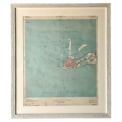
Vintage Coastal Topographical Map of Key West
Located in west palm beach, FL
A fabulous vintage Boho framed topographical map. A vintage look at the Straights of Florida
Category
Mid-20th Century North American Decorative Art
Materials
Wood, Paper
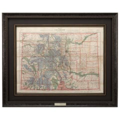
1907 Map of Colorado, Antique Topographical Map, by Louis Nell
Located in Colorado Springs, CO
This highly detailed pocket map is a topographical map of the state of Colorado by Louis Nell from
Category
Antique Early 1900s American Maps
Materials
Paper
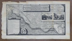
Topographical Map of Pompeii, 1785, by Francesco Piranesi, Reprint
By Francesco Piranesi
Located in Larchmont, NY
Francesco Piranesi (Italian, 1758-1810)
Topographical Map of Pompeii
Originally executed 1785
Category
1780s Realist More Art
Materials
Engraving
H 48.25 in W 26.325 in D 1.5 in
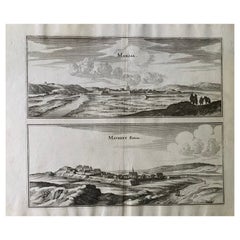
17th Century Topographical Map, Champagne-Ardenne, Marsal, Maubert Iohan Peeters
Located in New York, NY
Fine topographical 17th century map by Iohan Peeters of Marsal and Maubert Fontaine in the
Category
Antique 17th Century Dutch Maps
Materials
Paper
H 12.5 in W 15.5 in D 0 in
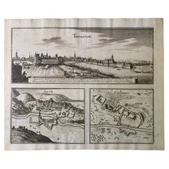
17th Century Toulouse, Savve, Sommieres Topographical Map by Iohan Peeters
Located in New York, NY
Fine topographical 17th century map of Toulouse, Savve and Sommieres by Iohan Peeters
Beautiful
Category
Antique 17th Century Dutch Maps
Materials
Paper
H 12.38 in W 14.88 in D 0 in
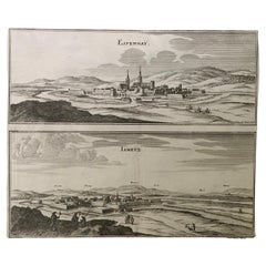
17th Century Topographical Map, French Champagne Region, Epernay, Iohan Peeters
Located in New York, NY
Fine topographical 17th century map by Iohan Peeters of the towns of Epernay and Lametz in the
Category
Antique 17th Century Dutch Maps
Materials
Paper
H 12.38 in W 15.5 in D 0 in
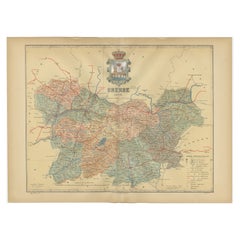
Orense in Depth: A 1902 Topographical Map of Galicia's Mountainous Province
Located in Langweer, NL
the map:
Description:
- The map is a colorful, topographic illustration, highlighting the varied
Category
Antique Early 1900s Maps
Materials
Paper
Free Shipping
H 14.77 in W 20.08 in D 0 in
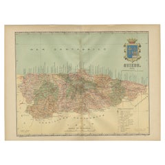
The Lay of the Land: A 1901 Topographic Map of Oviedo, Asturias
Located in Langweer, NL
The province depicted on the historical map on offer, Oviedo, corresponds to the modern-day
Category
Antique Early 1900s Maps
Materials
Paper
Free Shipping
H 14.77 in W 20.08 in D 0 in
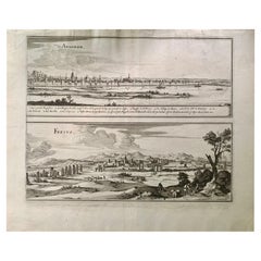
17th Century Topographical Map of Cote D'azur, Avignon, Frejus by Iohan Peeters
Located in New York, NY
Fine topographical 17th century map by Iohan Peeters of the towns of Avignon and Frejus in the Cote
Category
Antique 17th Century Dutch Maps
Materials
Paper
H 12.5 in W 15 in D 0 in
1861 Topographical Map of the District of Columbia, by Boschke, Antique Map
Located in Colorado Springs, CO
Presented is an original map of Albert Boschke's extremely sought-after "Topographical Map of the
Category
Antique 1860s American Historical Memorabilia
Materials
Paper
H 53.25 in W 53.75 in D 3.5 in
Louis Vuitton Men's Large Navy Paris Topographical Map Globe T-Shirt Tee Sh125lv
By Louis Vuitton
Located in Dix hills, NY
Date Code/Serial Number: CA36929
Made In: Italy
Measurements: Length: 22.5" Width: .2" Height: 29.5"
Size: Large
OVERALL EXCELLENT CONDITION
( 9/10 or A )
Men's Large
Shoulders:...
Category
21st Century and Contemporary T-Shirts
Antique Map of Principality of Monaco
By Antonio Vallardi Editore
Located in Alessandria, Piemonte
ST/619 - "Old Geographical Atlas of Italy - Topographic map of ex-Principality of Monaco" -
ediz
Category
Antique Late 19th Century Italian Other Prints
Materials
Paper
The Map of A Myth X
Located in MADRID, ES
are to express the emotions of the times and place.
A topographical map of Hong Kong by the War
Category
2010s Abstract Paintings
Materials
Oil, Acrylic
Topographical and Infrastructure Map of the Province of Valencia, 1901
Located in Langweer, NL
A historical map of the province of Valencia, dated 1901. The map includes intricate details such
Category
Antique Early 1900s Maps
Materials
Paper
Free Shipping
H 20.08 in W 14.77 in D 0 in
Large Topographical and Geological Map of the Teshio Oil Field, '1936'
Located in Langweer, NL
Topographical and geological map of the Teshio oil field. Shows location of oil well, oil sand
Category
20th Century Maps
Materials
Linen, Paper
H 72.64 in W 38.39 in D 0.02 in
Vintage Swedish Topographic School Map of European Alps, Made in Sweden 1922
Located in Los Angeles, CA
Vintage Swedish Topographic School map of European Alps, Made in Sweden 1922
This vintage
Category
Vintage 1920s Swedish Maps
Materials
Linen, Wood, Paper
Italian modern Topographic geographical map in wood frame of Europe, 1950s-1990s
Located in MIlano, IT
Italian modern Topographic geographical map in wood frame of Europe, 1950-1990s
Three-dimensional
Category
Late 20th Century Italian Modern Decorative Art
Materials
Wood, Paper
H 28.94 in W 38.98 in D 0.79 in
Topographical and Administrative Cartography of Segovia in Spain, 1902
Located in Langweer, NL
An original old map of the province of Segovia from the year 1902. Segovia is a historic area
Category
Antique Early 1900s Maps
Materials
Paper
Free Shipping
H 14.77 in W 20.08 in D 0 in
17th Century Topographical Engraving Nantes & St. Malo, France, by Iohan Peeters
Located in New York, NY
The ancient city of Saint Malo in North Western France has long been associated with adventure on the high seas, piracy and exploration. It was the birthplace of several important in...
Category
Antique 17th Century Dutch Maps
Materials
Paper
H 12.38 in W 15 in D 0 in
Forest Park Letter Pressed Map with Embossed Trails in Salvaged Fir Frame
Located in Portland, OR
Beautiful Minimalist limited edition letter pressed topographic map of Portland's Forest Park with
Category
2010s American Organic Modern Prints
Materials
Fir
1849 Map of "Europaische Russland", 'Meyer Map of European Russia', Ric. R017
Located in Norton, MA
. Throughout, the map identifies various cities, towns, rivers and assortment of additional topographical
Category
Antique 19th Century Unknown Maps
Materials
Paper
H 11.82 in W 9.06 in D 0.4 in
Antique Map of New Jersey
Located in Langweer, NL
topographical features. This map originates from 'Colton's General Atlas Of The World'. Published 1855.
Category
Antique Mid-19th Century Maps
Materials
Paper
Antique Map of Scotland With an Inset Map of the Shetland Islands, 1854
Located in Langweer, NL
: Large Antique map titled 'Scotland with its Islands, drawn from the Topographical surveys by James Wyld
Category
Antique 1850s Maps
Materials
Paper
Antique Map of Alaska '1904'
Located in Langweer, NL
Navigation Use**: With its detailed topographic information, the map would have served important functions
Category
Early 20th Century Maps
Materials
Paper
Antique Map of Sweden by Bowen, 1747
Located in Langweer, NL
Antique map titled 'A New & Accurate Map of Sweden'. This map covers Sweden and Finland (shown as
Category
Antique 18th Century Maps
Materials
Paper
Antique Map of Central Asia, Finely Engraved, 1841
Located in Langweer, NL
Antique map titled 'Central Asia, Middle Division'. A finely engraved and attractive mid 19th
Category
Antique 19th Century Maps
Materials
Paper
Antique Map of Overijssel by Visscher, c.1652
Located in Langweer, NL
long period with a wide range of interests as print sellers, publishers of books, maps, topographical
Category
Antique 17th Century Maps
Materials
Paper
Antique Map of Overijssel by Visscher, c.1660
Located in Langweer, NL
long period with a wide range of interests as print sellers, publishers of books, maps, topographical
Category
Antique 17th Century Maps
Materials
Paper
Antique Map of Russia by N. Sanson, 1705
Located in Langweer, NL
A strongly engraved map of European Russia showing its political divisions, major topographical
Category
Antique Early 18th Century Maps
Materials
Paper
Wave Hill - Hand Made Paper Work With Geographical Maps From Wave Hill in NYC
By Tessa Grundon
Located in New York, NY
, on top of which Grundon etched her own personal interpretation of topographic maps from the
Category
21st Century and Contemporary Contemporary Abstract Drawings and Waterco...
Materials
Handmade Paper, Mixed Media, Wax
Antique Map of Siberia and Russia, c.1885
Located in Langweer, NL
Antique map titled 'Siberie ou Russie d?Asie'. This is a fine example of J. Migeon's map of Russia
Category
Antique 19th Century Maps
Materials
Paper
Antique Map of the Rhine centered on Cologne, Germany
Located in Langweer, NL
topographic information, the map names hundreds of cities, towns, rivers and lakes. Putti display coats of
Category
Antique Early 18th Century Maps
Materials
Paper
Antique Map of Moscovy 'Russia' by E. Bowen, 1747
Located in Langweer, NL
Beautiful map of European Russia by the English cartographer Emmanuel Bowen. It depicts the
Category
Antique Mid-18th Century Maps
Materials
Paper
Antique Map of Italy by R. Bonne, circa 1780
Located in Langweer, NL
Beautiful map of Italy, Corsica, Sardinia and Sicily. Highly detailed, showing towns, rivers, some
Category
Antique Late 18th Century Maps
Materials
Paper
Antique Map of Flanders and Zeeland by Merian, 1659
Located in Langweer, NL
Antique map titled 'Flandria et Zeelandia Comitatus'. Original antique map of Flanders, Belgium
Category
Antique 17th Century Maps
Materials
Paper
Antique Map of Japan by J.N. Bellin, 1752
Located in Langweer, NL
of the 18th century, the map includes Provincial borders, many place names and topographical details
Category
Antique Mid-18th Century Maps
Materials
Paper
Antique Map of South America by Wyld, circa 1850
By J. Wyld
Located in Langweer, NL
the map present data from Humboldt's report in the form of topographical profiles: "Section of the
Category
Antique Mid-19th Century British Maps
Materials
Paper
1859 Classic Map of France: Blackie's Imperial Geographic Masterpiece
Located in Langweer, NL
cultural and economic centers.
4. **Topographical Features**: The map would typically showcase France's
Category
Antique Mid-19th Century Maps
Materials
Paper
H 21.26 in W 14.57 in D 0.02 in
Antique Map Depicting Burma, Siam, Annam (Vietnam) and Japan, 1882
Located in Langweer, NL
The image shows two maps side by side from the 1882 atlas by Blackie & Son. On the left, the map is
Category
Antique 1880s Maps
Materials
Paper
Free Shipping
H 14.97 in W 22.45 in D 0 in
Antique Map of the Burgundy Region by Merian, 1646
Located in Langweer, NL
Antique map titled 'Utriusque Burgundiae tum Ducatus tum Comitatus descriptio'. Old map of the
Category
Antique 17th Century Maps
Materials
Paper
Antique Map of Switzerland by N. Visscher, circa 1690
Located in Langweer, NL
Beautifully detailed map of Switzerland and surrounding regions in present-day France, Germany, and
Category
Antique Late 17th Century Maps
Materials
Paper
1859 Antique Swiss Panorama: Blackie's Detailed Map of Switzerland
Located in Langweer, NL
topography, political divisions, and key landmarks.
**Key Features of the Map:**
1. **Topographical Detail
Category
Antique Mid-19th Century Maps
Materials
Paper
Antique Map of Southeastern France by Vaugondy, c.1790
Located in Langweer, NL
with decorative cartouche. Map includes topographical detail as well as a reference to the departments
Category
Antique 18th Century Maps
Materials
Paper
Original Antique Poly-Olbion Map of Denbighshire and Flintshire, Wales
Located in Langweer, NL
Rare and original antique map of Denbighshire and Flintshire, Wales. From the 'Poly-Olbion,' an
Category
Antique Mid-17th Century Maps
Materials
Paper
H 10.36 in W 13.51 in D 0.02 in
Antique 19th Century Map of China by Blackie & Son, 1882
Located in Langweer, NL
the north, depicted in a light yellow shade. The map shows a diverse range of topographical details
Category
Antique 1880s Maps
Materials
Paper
Original Antique Coloured Map of Western Africa, Published in 1882
Located in Langweer, NL
at the time.
3. **Topographical Features**: The map includes detailed topographical information
Category
Antique 1880s Maps
Materials
Paper
No Reserve
H 14.97 in W 22.45 in D 0 in
Antique Map of Russia and Siberia by Migeon, 1880
Located in Langweer, NL
Antique map titled 'Sibérie ou Russie d'Asie'. Migeon's map covers the Russian empire in Asia from
Category
Antique 19th Century Maps
Materials
Paper
Antique Map of Northern Europe by Bonne, c.1780
Located in Langweer, NL
Antique map titled 'Le Nord de L'Europe, Contenant Le Danemark, La Norwege; La Suede et La Laponie
Category
Antique 18th Century Maps
Materials
Paper
Antique Decorative Coloured Map of South Africa and Madagascar, 1882
Located in Langweer, NL
The map of South Africa is from the Blackie & Son Atlas, published in 1882. This historical map is
Category
Antique 1880s Maps
Materials
Paper
Free Shipping
H 14.97 in W 22.45 in D 0 in
Map Devonshire Richard Creighton J&C Walker Sculp Samuel Lewis
Located in BUNGAY, SUFFOLK
Engraved by J&C Walker Sculp
Published in Samuel Lewis Topographical Dictionary 1831, and there were a
Category
Antique 19th Century English Victorian Maps
Materials
Paper
Ancient Iberia: Hispania Map from Spruner-Menke Atlas Antiquus, 1880
Located in Langweer, NL
particular map showcases the Iberian Peninsula with its ancient Roman provincial divisions, topographical
Category
Antique 1880s Maps
Materials
Paper
No Reserve
H 15.56 in W 18.51 in D 0 in
Antique Map of Italy with an Inset of Rome, 1812
Located in Langweer, NL
Antique map titled 'Italie Ancienne'.
Old map of ancient Italy, with an inset map of the region
Category
Antique 19th Century Maps
Materials
Paper
Antique Map of the City of Franeker by Bast, 1598
Located in Langweer, NL
Antique map titled 'Franeker'. Very rare and early map of the city of Franeker, Friesland. With
Category
Antique 16th Century Maps
Materials
Paper
Antique Map of the City of Leeuwarden by Merian, 1659
Located in Langweer, NL
Antique map titled 'Leurwaerden'. This print depicts the city of Leeuwarden (Friesland, The
Category
Antique 17th Century Maps
Materials
Paper
Antique Map of the City of Groningen by Merian, 1659
Located in Langweer, NL
Antique map titled 'Gröningen'. This print depicts the city of Groningen, the Netherlands. This
Category
Antique 17th Century Maps
Materials
Paper
Antique Map of the City of Leeuwarden by Merian, 1659
Located in Langweer, NL
Antique map titled 'Leurwaerden'. This print depicts the city of Leeuwarden (Friesland, The
Category
Antique 17th Century Maps
Materials
Paper
Antique Map of the City of Gorinchem by Merian, 1659
Located in Langweer, NL
Antique map titled 'Gorckum'. This print depicts the city of Gorinchem (or Gorcum/Gorkum, The
Category
Antique 17th Century Maps
Materials
Paper
Antique Map of the City of Workum by Merian, 1654
Located in Langweer, NL
Antique map titled 'Worcum'. Old map of the city of Workum, Friesland. Originates from 'Topographia
Category
Antique 17th Century Maps
Materials
Paper
Uncommon Antique Map of the English Channel Coastline, ca.1709
Located in Langweer, NL
Antique map titled 'Partie de L'Angleterre' Uncommon map of the English Channel coastline with many
Category
Antique Early 1700s Maps
Materials
Paper
Antique Map of Flintshire in Wales, United Kingdom, c.1850
Located in Langweer, NL
Antique map titled 'Flintshire'. Antique map of Flintshire with a inlay plan of Flintshire town
Category
Antique 19th Century Maps
Materials
Paper
- 1
- ...
Get Updated with New Arrivals
Save "Topographic Map", and we’ll notify you when there are new listings in this category.
