Wine Map France
to
49
242
20
148
130
108
87
53
23
21
18
17
12
9
9
8
6
5
5
5
4
3
3
2
2
2
1
1
1
1
1
1
1
1
1
1
71
42
42
4
3
Sort By
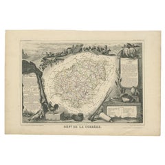
Antique Map of the Famous French Wine Area of Correze, 1854
Located in Langweer, NL
Antique map titled 'Dépt. da la Corrèze'. Map of the French department of Correze, France. This
Category
Antique 19th Century Maps
Materials
Paper
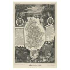
Antique Map of Jura, a Famous Wine Area in France, 1854
Located in Langweer, NL
Antique map titled 'Dépt. du Jura'. Map of the French department Jura, France.
Jura is a
Category
Antique 19th Century Maps
Materials
Paper
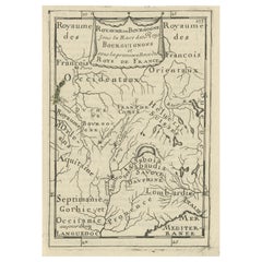
Nice Detailed Antique Miniature Map of the Burgundy Wine Region, France, ca.1683
Located in Langweer, NL
miniature map of the Burgundy region, France. Originates from Mallet's 'Description de l'Univers
Category
Antique 1680s Maps
Materials
Paper
H 7.49 in W 5.32 in D 0 in
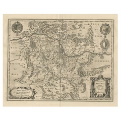
Old Map Focusing on the Wine Region of Metz, the Moselle Region of France, 1657
Located in Langweer, NL
Antique map of France titled 'Territorium Metense'.
Old map focusing on the wine region
Category
Antique 1650s Maps
Materials
Paper
H 19.69 in W 23.63 in D 0 in
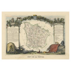
Old Map of the French Department of Nièvre, France
By Victor Levasseur
Located in Langweer, NL
Antique map titled 'Dept. de la Nièvre'. Map of the French department of Nievre, France. Part of
Category
Antique Mid-19th Century Maps
Materials
Paper
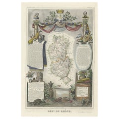
Map of Rhône: Culture and Commerce in Lyon's Silk and Wine Legacy, 1852
Located in Langweer, NL
French geographer and cartographer known for his richly illustrated maps.
The map is a steel engraving
Category
Antique 1850s Maps
Materials
Paper
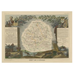
Old Map of the French Department of Indre, France
By Victor Levasseur
Located in Langweer, NL
Antique map titled 'Dept. de l'Indre'. Map of the French department of Indre, France. Part of the
Category
Antique Mid-19th Century Maps
Materials
Paper
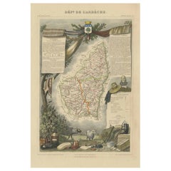
Old Map of the French Department of Ardèche, France
By Victor Levasseur
Located in Langweer, NL
Antique map titled 'Dépt. de l'Ardèche'. Map of the Department of Ardèche, France. This region is
Category
Antique Mid-19th Century Maps
Materials
Paper
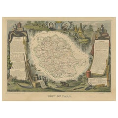
Old Map of the French department of Tarn, France
By Victor Levasseur
Located in Langweer, NL
Antique map titled 'Dépt. du Tarn'. Map of the French department of Tarn, France. This area
Category
Antique Mid-19th Century Maps
Materials
Paper
Old Map of the French Department of Loiret, France
By Victor Levasseur
Located in Langweer, NL
Antique map titled 'Dépt. du Loiret'. Map of the French department of Loiret, France. Surrounding
Category
Antique Mid-19th Century Maps
Materials
Paper
Antique Map of Cher in France, 1854
By Victor Levasseur
Located in Langweer, NL
Antique map titled 'Dépt. des Bses. Pyrénées'. Map of the French department of Basses Pyrenees
Category
Antique Mid-19th Century Maps
Materials
Paper
Old Map of the French Department of L'ain, France
By Victor Levasseur
Located in Langweer, NL
Antique map titled 'Dépt. de l'Ain'. Map of the French department of l'Ain, France. This area of
Category
Antique Mid-19th Century Maps
Materials
Paper
Antique Map of Nièvre ‘France’ by V. Levasseur, 1854
Located in Langweer, NL
quality of these wines. This map originates from ‘Atlas National de la France Illustré’. Published by A
Category
Antique Mid-19th Century Maps
Materials
Paper
Antique Map of Moselle ‘France’ by V. Levasseur, 1854
Located in Langweer, NL
Antique map titled 'Dépt. de la Moselle'. Map of the French department of Moselle, France. This
Category
Antique Mid-19th Century Maps
Materials
Paper
Antique Map of Lot ‘France’ by V. Levasseur, 1854
Located in Langweer, NL
Antique map titled 'Dépt. du Lot'. Map of the French department of Lot, France. This area of France
Category
Antique Mid-19th Century Maps
Materials
Paper
Antique Map of Meurthe ‘France’ by V. Levasseur, 1854
Located in Langweer, NL
Lorraine and the Alsace-Lorraine wine region. This map originates from ‘Atlas National de la France
Category
Antique Mid-19th Century Maps
Materials
Paper
Antique Map of Corrèze ‘France’ by V. Levasseur, 1854
By Victor Levasseur
Located in Langweer, NL
Antique map titled 'Dépt. da la Corrèze'. Map of the French department of Correze, France. This
Category
Antique Mid-19th Century Maps
Materials
Paper
Antique Map of Loire ‘France’ by V. Levasseur, 1854
Located in Langweer, NL
Antique map titled 'Dépt. de la Loire'. Map of the French department of Loire, France. This area of
Category
Antique Mid-19th Century Maps
Materials
Paper
Antique Map of Hérault ‘France’ by V. Levasseur, 1854
Located in Langweer, NL
Antique map titled 'Dépt. de l'Hérault'. Map of the French department of Herault, France. This area
Category
Antique Mid-19th Century Maps
Materials
Paper
Antique Map of Loire ‘France’ by V. Levasseur, 1854
Located in Langweer, NL
Antique map titled 'Dépt. de la Loire'. Map of the French department of Loire, France. This area of
Category
Antique Mid-19th Century Maps
Materials
Paper
Antique Map of Indre ‘France’ by V. Levasseur, 1854
Located in Langweer, NL
Antique map titled 'Dépt. de l'Indre'. Map of the French department of Indre, France. Part of the
Category
Antique Mid-19th Century Maps
Materials
Paper
Antique Map of Aude ‘France’ by V. Levasseur, 1854
By Victor Levasseur
Located in Langweer, NL
Antique map titled 'Dépt. de 'l'Aude'. Map of the French department of Aude, France. This area of
Category
Antique Mid-19th Century Maps
Materials
Paper
Antique Map of Mayenne ‘France’ by V. Levasseur, 1854
Located in Langweer, NL
Antique map titled 'Dépt. de la Mayenne'. Map of the French department of Mayenne, France. This
Category
Antique Mid-19th Century Maps
Materials
Paper
Antique Map of Landes ‘France’ by V. Levasseur, 1854
By Victor Levasseur
Located in Langweer, NL
Antique map titled 'Dépt. des Landes'. Map of the French department Landes, France. This area is
Category
Antique Mid-19th Century Maps
Materials
Paper
Antique Map of Meuse ‘France’ by V. Levasseur, 1854
Located in Langweer, NL
Antique map titled 'Dépt. de la Meuse'. Map of the French department of Meuse, France. This area
Category
Antique Mid-19th Century Maps
Materials
Paper
Antique Map of Marne ‘France’ by V. Levasseur, 1854
Located in Langweer, NL
Antique map titled 'Dépt. de la Marne'. Map of the French department of Marne, France. This
Category
Antique Mid-19th Century Maps
Materials
Paper
Antique Map of Vendée ‘France’ by V. Levasseur, 1854
By Victor Levasseur
Located in Langweer, NL
Antique map titled 'Dépt. de la Vendée'. Map of the French department of Vendee, France. Vendee is
Category
Antique Mid-19th Century Maps
Materials
Paper
Antique Map of Gard ‘France’ by V. Levasseur, 1854
By Victor Levasseur
Located in Langweer, NL
Antique map titled 'Dépt. du Gard'. Map of the French department of Gard, France. This area of
Category
Antique Mid-19th Century Maps
Materials
Paper
Antique Map of Tarn and Garonne in France, 1854
By Victor Levasseur
Located in Langweer, NL
Antique map titled 'Dépt. de Tarn et Garonne'. Map of the French department of Tarn et Garonne
Category
Antique Mid-19th Century Maps
Materials
Paper
Antique Map of Loiret ‘France’ by V. Levasseur, 1854
Located in Langweer, NL
Antique map titled 'Dépt. du Loiret'. Map of the French department of Loiret, France. Surrounding
Category
Antique Mid-19th Century Maps
Materials
Paper
Antique Map of Var 'France' by V. Levasseur, 1854
By Victor Levasseur
Located in Langweer, NL
Antique map titled 'Dépt. du Var'. Map of the French department of Var, the heart of the French
Category
Antique Mid-19th Century Maps
Materials
Paper
Antique Map of Tarn 'France' by V. Levasseur, 1854
By Victor Levasseur
Located in Langweer, NL
Antique map titled 'Dépt. du Tarn'. Map of the French department of Tarn, France. This area
Category
Antique Mid-19th Century Maps
Materials
Paper
Antique Map of Ain ‘France’ by V. Levasseur, 1854
By Victor Levasseur
Located in Langweer, NL
Antique map titled 'Dépt. de l'Ain'. Map of the French department of l'Ain, France. This area of
Category
Antique Mid-19th Century Maps
Materials
Paper
Antique Map of Jura ‘France’ by V. Levasseur, 1854
By Victor Levasseur
Located in Langweer, NL
Antique map titled 'Dépt. du Jura'. Map of the French department Jura, France. The Jura wines are
Category
Antique Mid-19th Century Maps
Materials
Paper
Antique Map of Gironde ‘France’ by V. Levasseur, 1854
By Victor Levasseur
Located in Langweer, NL
Antique map titled 'Dépt. de la Gironde'. Map of the French department of Gironde. This coastal
Category
Antique Mid-19th Century Maps
Materials
Paper
Antique Map of Allier ‘France’ by V. Levasseur, 1854
By Victor Levasseur
Located in Langweer, NL
Antique map titled 'Dépt. de l'Allier'. Map of the French department of l'Allier, France. This area
Category
Antique Mid-19th Century Maps
Materials
Paper
Hand Colored Antique Map of the Department of Vaucluse, France
By Victor Levasseur
Located in Langweer, NL
Antique map titled 'Dépt de Vaucluse'. Map of the French department of Vaucluse, France. Vaucluse
Category
Antique Mid-19th Century Maps
Materials
Paper
Hand Colored Antique Map of the Department of Nièvre, France
By Victor Levasseur
Located in Langweer, NL
Antique map titled 'Dept. de la Nièvre'. Map of the French department of Nievre, France. Part of
Category
Antique Mid-19th Century Maps
Materials
Paper
Hand Colored Antique Map of the Department of Correze, France
By Victor Levasseur
Located in Langweer, NL
Antique map titled 'Dépt. de la Corrèze'. Map of the French department of Correze, France. This
Category
Antique Mid-19th Century Maps
Materials
Paper
Hand Colored Antique Map of the Department of Aude, France
By Victor Levasseur
Located in Langweer, NL
Antique map titled 'Dépt. de l'Aude'. Map of the French department of Aude, France. This area of
Category
Antique Mid-19th Century Maps
Materials
Paper
Hand Colored Antique Map of the Department of Indre, France
By Victor Levasseur
Located in Langweer, NL
Antique map titled 'Dept. de l'Indre'. Map of the French department of Indre, France. Part of the
Category
Antique Mid-19th Century Maps
Materials
Paper
Antique Map of the Indre Region in France, ca. 1852
Located in Langweer, NL
Antique map titled 'Dépt. de l'Indre'.
Map of the French department of Indre, France. Part of
Category
Antique Mid-19th Century Maps
Materials
Paper
Antique Map of Basses Pyrénées ‘France’ by V. Levasseur, 1854
By Victor Levasseur
Located in Langweer, NL
Antique map titled 'Dépt. des Bses. Pyrénées'. Map of the French department of Basses Pyrenees
Category
Antique Mid-19th Century Maps
Materials
Paper
Hand Colored Antique Map of the Department of Marne, France
By Victor Levasseur
Located in Langweer, NL
Antique map titled 'Dépt. de la Marne'. Map of the French department of Marne, France. This
Category
Antique Mid-19th Century Maps
Materials
Paper
Hand Colored Antique Map of the Department of Ardèche, France
By Victor Levasseur
Located in Langweer, NL
Antique map titled 'Dépt. de l'Ardèche'. Map of the Department of Ardèche, France. This region is
Category
Antique Mid-19th Century Maps
Materials
Paper
Hand Colored Antique Map of the Department of Gard, France
By Victor Levasseur
Located in Langweer, NL
Antique map titled 'Départ. Du Gard'. Map of the French department of Gard, France. This area of
Category
Antique Mid-19th Century Maps
Materials
Paper
Antique Map of Haute Marne ‘France’ by V. Levasseur, 1854
Located in Langweer, NL
Antique map titled 'Dépt. de la Hte. Marne'. Map of the French department of Haute Marne, France
Category
Antique Mid-19th Century Maps
Materials
Paper
Hand Colored Antique Map of the department of Loiret, France
By Victor Levasseur
Located in Langweer, NL
Antique map titled 'Dépt. du Loiret'. Map of the French department of Loiret, France. Surrounding
Category
Antique Mid-19th Century Maps
Materials
Paper
Antique Map of Loire Inferieure ‘France’ by V. Levasseur, 1854
Located in Langweer, NL
Antique map titled 'Dépt. de la Loire Inferieure'. Map of the French department of Loire Inferieure
Category
Antique Mid-19th Century Maps
Materials
Paper
Antique Map of Bas-Rhin ‘France’ by V. Levasseur, 1854
By Victor Levasseur
Located in Langweer, NL
Antique map titled 'Dépt. du Bas Rhin'. Map of the French department of Bas-Rhin, France. Part of
Category
Antique Mid-19th Century Maps
Materials
Paper
Antique Map of Haute Loire ‘France’ by V. Levasseur, 1854
Located in Langweer, NL
Antique map titled 'Dépt. de la Haute Loire'. Map of the French department of Haute Loire, France
Category
Antique Mid-19th Century Maps
Materials
Paper
Antique Map of Haute-Saone, France by V. Levasseur, 1854
By Victor Levasseur
Located in Langweer, NL
Antique map titled 'Dépt. de la Hte. Saône'. Map of the French department of Haute-Saone, France
Category
Antique Mid-19th Century Maps
Materials
Paper
Antique Map of Haut-Rhin, France by V. Levasseur, 1854
By Victor Levasseur
Located in Langweer, NL
Antique map titled 'Dépt. du Haut Rhin'. Map of the French department of Haut-Rhin, France. This
Category
Antique Mid-19th Century Maps
Materials
Paper
Antique Map of Haute-Garonne ‘France’ by V. Levasseur, 1854
Located in Langweer, NL
Antique map titled 'Dépt. de la Hte. Garonne'. Map of the French department of Haute-Garonne
Category
Antique Mid-19th Century Maps
Materials
Paper
Antique Map of the Dordogne ‘France’ by V. Levasseur, 1854
Located in Langweer, NL
Antique map titled 'Dépt. de la Dordogne'. Map of the French department of Dordogne, France. This
Category
Antique Mid-19th Century Maps
Materials
Paper
17th Century Topographical Map, French Champagne Region, Epernay, Iohan Peeters
Located in New York, NY
Champagne Region of North Eastern France.
Fabulous period engraving for a Wine Cellar, Bar, Dining Room
Category
Antique 17th Century Dutch Maps
Materials
Paper
H 12.38 in W 15.5 in D 0 in
Antique Map of the Department De Tarn, 'France' by v. Levasseur, c. 1852
Located in Langweer, NL
Antique map titled 'Dépt Du Tarn'. Map of the French department of Du tarn, France.
This area
Category
Antique Mid-19th Century French Maps
Materials
Paper
H 14.57 in W 21.66 in D 0.01 in
Antique Map of Côte d'Or ‘France’ by V. Levasseur, 1854
By Victor Levasseur
Located in Langweer, NL
Antique map titled 'Dépt. de la Côte d'Or'. Map of the French department of Cote D’Or, France. Part
Category
Antique Mid-19th Century Maps
Materials
Paper
Antique Map of the Pyrenees Orientales 'France' by V. Levasseur, 1854
By Victor Levasseur
Located in Langweer, NL
Antique map titled 'Dépt. des Pyréneés Orles'. Map of the French department of Pyrenees Orientales
Category
Antique Mid-19th Century Maps
Materials
Paper
H 13.98 in W 20.67 in D 0.02 in
Hand Colored Antique Map of the Department of Haute Marne, France
By Victor Levasseur
Located in Langweer, NL
Antique map titled 'Dépt. de la Hte Marne'. Map of the French department of Haute Marne, France
Category
Antique Mid-19th Century Maps
Materials
Paper
- 1
Get Updated with New Arrivals
Save "Wine Map France", and we’ll notify you when there are new listings in this category.
Wine Map France For Sale on 1stDibs
Find many varieties of an authentic wine map France available at 1stDibs. Each wine map France for sale was constructed with extraordinary care, often using paper. You’ve searched high and low for the perfect wine map France — we have versions that date back to the 18th Century alongside those produced as recently as the 20th Century are available. A well-made wine map France has long been a part of the offerings for many furniture designers and manufacturers, but those produced by Abraham Ortelius are consistently popular.
How Much is a Wine Map France?
The average selling price for a wine map France at 1stDibs is $743, while they’re typically $139 on the low end and $2,175 for the highest priced.
More Ways To Browse
Vintage Glass Cockerel
Vintage Grape Pitcher
Vintage French Grape Basket
Vintage Picnic Basket
Buy Glass Bottles
Epernay France
Riverside Drive
Vintage Map Co
Antique Copper Measuring Jugs
Antique Copper Measuring Jugs Copper
Howard 7 Son
Orient Day Date
Antique Basque
Heinrich And Co Gold
Antique Wooden Horse On Wheels
Coat Of Arms Stained Glass
Cheese Cow
Map Of France Miniature
