Items Similar to Antique French Map of Asia with Original Border Colouring, c.1785

Want more images or videos?
Request additional images or videos from the seller
1 of 7
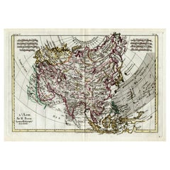
Antique French Map of Asia with Original Border Colouring, c.1785
About the Item
Antique map titled 'L'Asie divisee en ses principaux Etats.' (Map of Asia and its principal states). This map originates from an Atlas by Didier Robert de Vaugondy or his successor De Lamarche, published ca. 1785.
Artists and Engravers: Gilles Robert de Vaugondy (1688�1766), also known as Le Sieur or Monsieur Robert, and his son, Didier Robert de Vaugondy (c.1723�1786), were leading mapmakers in France during the 18th century.
Condition: Good. General age related toning and light staining. Original fold line from binding as issued. Please study image carefully.
Date: c.1785
Overall size: 28 x 22 cm.
Image size: 23 x 19.5 cm.
We sell original antique maps to collectors, historians, educators and interior decorators all over the world. Our collection includes a wide range of authentic antique maps from the 16th to the 20th centuries. Buying and collecting antique maps is a tradition that goes back hundreds of years. Antique maps have proved a richly rewarding investment over the past decade, thanks to a growing appreciation of their unique historical appeal. Today the decorative qualities of antique maps are widely recognized by interior designers who appreciate their beauty and design flexibility. Depending on the individual map, presentation, and context, a rare or antique map can be modern, traditional, abstract, figurative, serious or whimsical. We offer a wide range of authentic antique maps for any budget.
- Dimensions:Height: 8.67 in (22 cm)Width: 11.03 in (28 cm)Depth: 0 in (0.01 mm)
- Materials and Techniques:
- Period:
- Date of Manufacture:circa 1785
- Condition:
- Seller Location:Langweer, NL
- Reference Number:
About the Seller
5.0
Platinum Seller
These expertly vetted sellers are 1stDibs' most experienced sellers and are rated highest by our customers.
Established in 2009
1stDibs seller since 2017
1,940 sales on 1stDibs
Typical response time: <1 hour
- ShippingRetrieving quote...Ships From: Langweer, Netherlands
- Return PolicyA return for this item may be initiated within 14 days of delivery.
More From This SellerView All
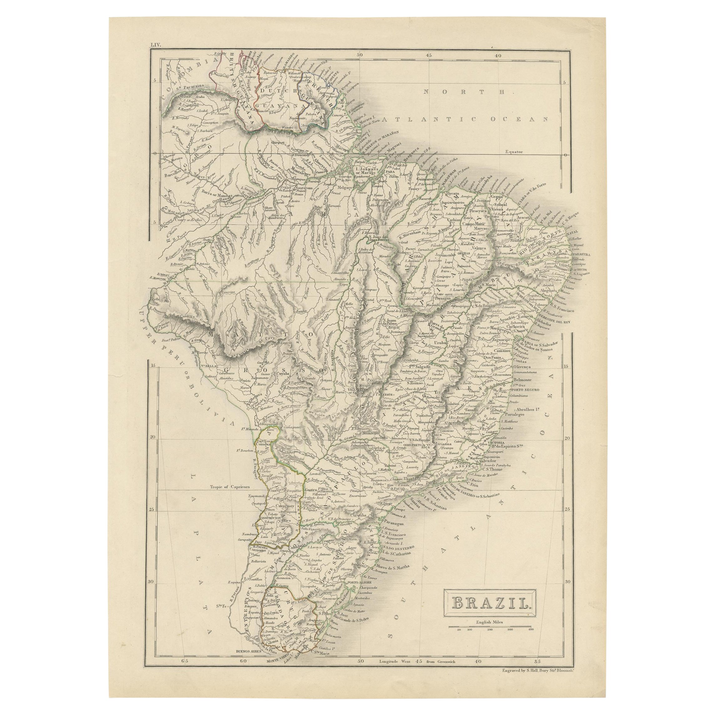
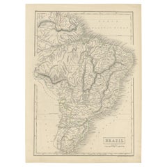
- Antique Map of Brazil with Original Outline Hand-Colouring, c.1844Located in Langweer, NLAntique map titled 'Brazil'. Beautiful map with outline color of Brazil, engraved by S. Hall. Artists and Engravers: Sydney Hall (1788-1831) was one of the most recognised and prolific British map...Category
Antique 19th Century Maps
MaterialsPaper
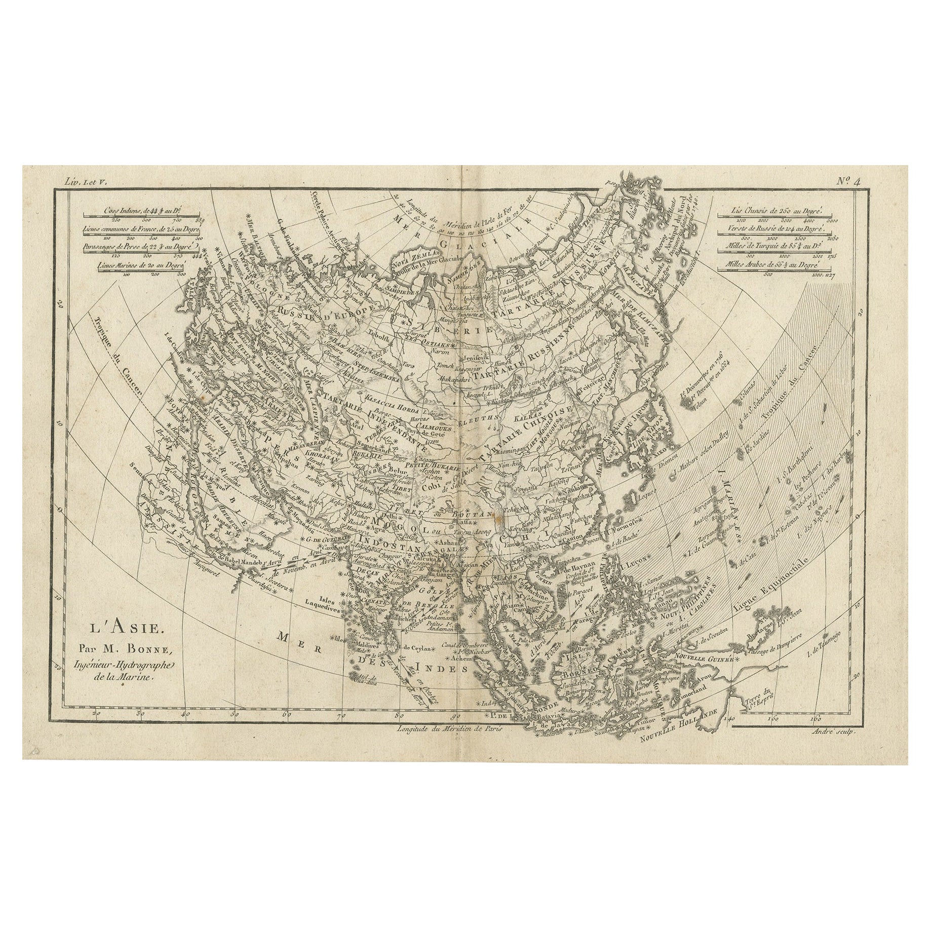
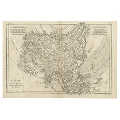
- Original Antique Map of AsiaLocated in Langweer, NLAntique map titled 'l'Asie'. Original antique map of Asia. Engraved by André after Bonne. Published circa 1780.Category
Antique Late 18th Century Maps
MaterialsPaper
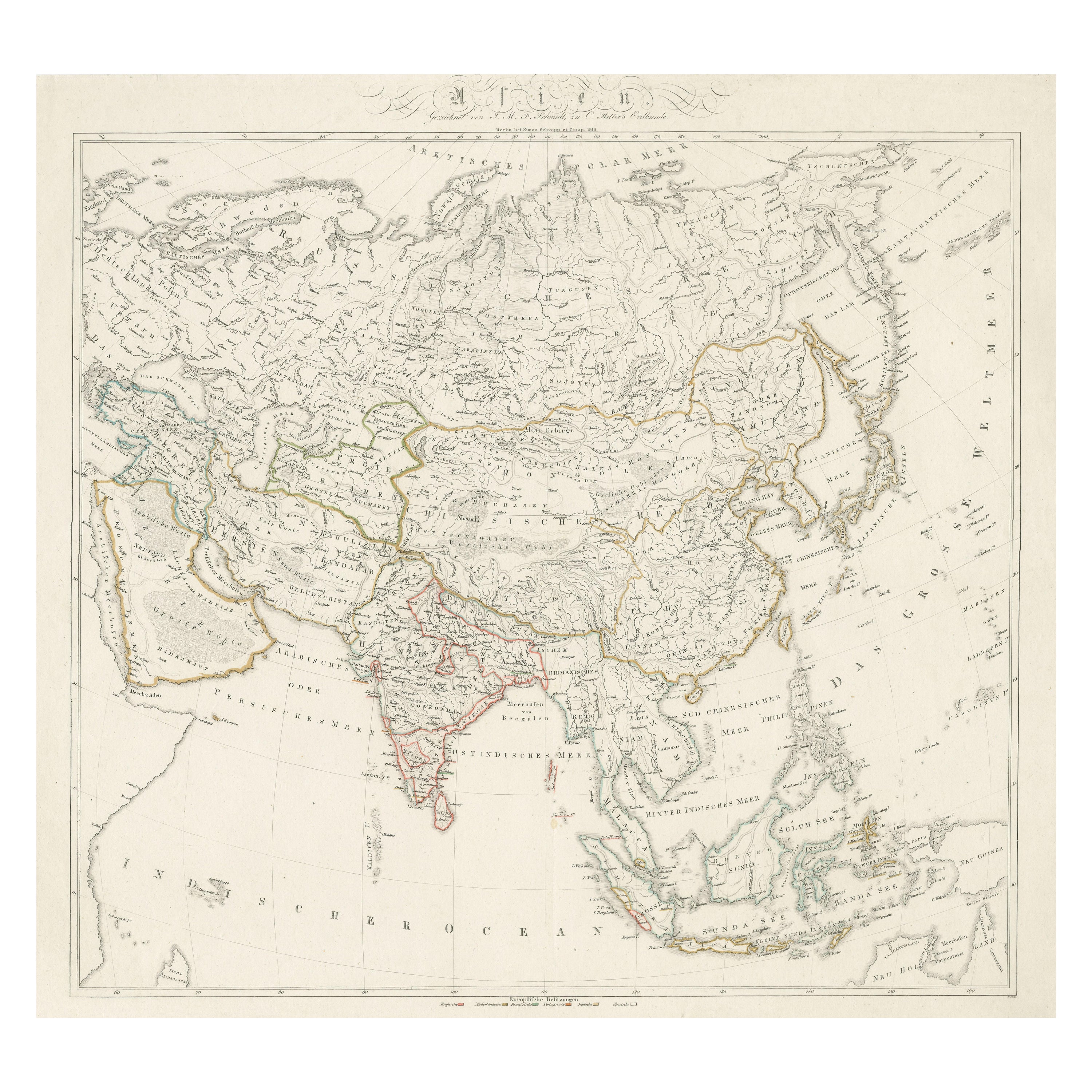
- Original Antique Map of AsiaLocated in Langweer, NLAntique map titled 'Asien'. Original old map of Asia. Published in Berlin by Simon Schropp et Comp, 1819.Category
Antique Early 19th Century Maps
MaterialsPaper
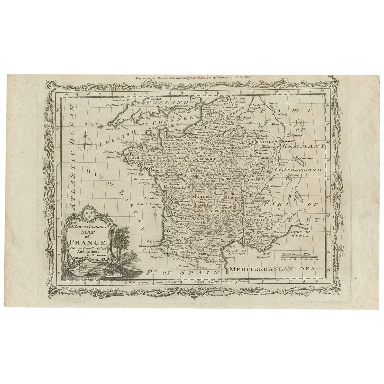
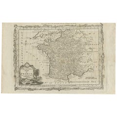
- Antique Map of France by T. Bowen, 1785Located in Langweer, NLDecorative antique map of France titled 'A new and accurate map of France, Drawn from the latest Authorities by T. Bowen'. Engraved for Moore’s new and complete collection of Voyages...Category
Antique Late 18th Century Maps
MaterialsPaper
- Attractive Antique Map of Asia with Borders Hand-Coloured, c.1780Located in Langweer, NLAntique map titled 'L'Asie.' This map shows the Asia continent. Originates from 'Atlas de toutes les parties du Globe Terrestre (..)', published by M. Bonne in Paris, c. 1780. ...Category
Antique 18th Century Maps
MaterialsPaper
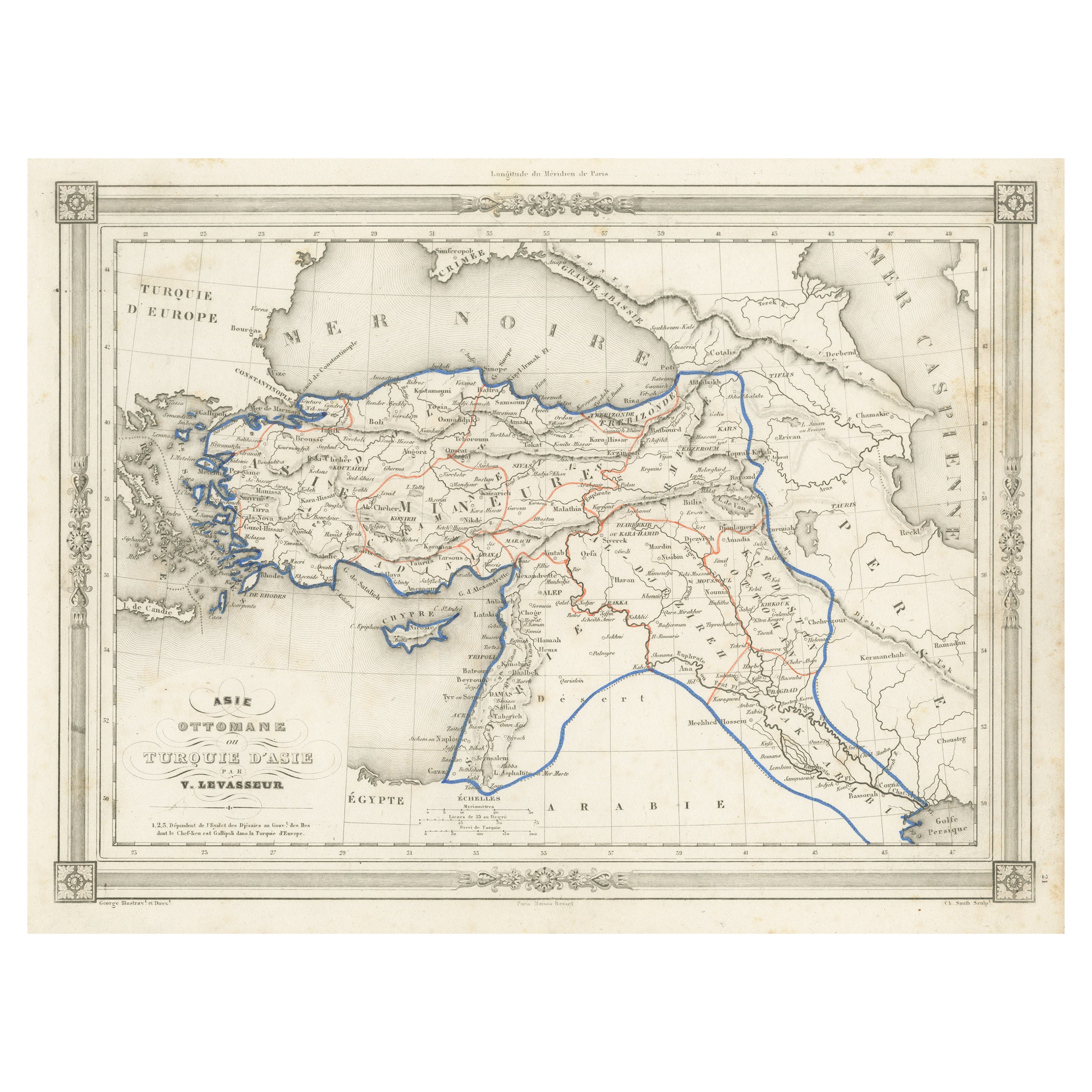
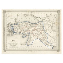
- Antique Map of Turkey in Asia, with Frame Style BorderLocated in Langweer, NLAntique map titled 'Asie Ottomane ou Turquie d'Asie'. Attractive map of Turkey in Asia. The map covers the Asian territories claimed by the Turkish Ottoman Empire c.1850 from the Bla...Category
Antique Mid-19th Century Maps
MaterialsPaper

You May Also Like
- Original Antique Map of Asia. C.1780Located in St Annes, LancashireGreat map of Asia Copper-plate engraving Published C.1780 Two small worm holes to right side of map Unframed.Category
Antique Early 1800s English Georgian Maps
MaterialsPaper

- Original Antique Map of South East Asia, Arrowsmith, 1820Located in St Annes, LancashireGreat map of South East Asia Drawn under the direction of Arrowsmith Copper-plate engraving Published by Longman, Hurst, Rees, Orme and Brown, 1820 Unframed.Category
Antique 1820s English Maps
MaterialsPaper
- Original Antique Map of France, Arrowsmith, 1820Located in St Annes, LancashireGreat map of France Drawn under the direction of Arrowsmith. Copper-plate engraving. Published by Longman, Hurst, Rees, Orme and Brown, 1820 Unframed.Category
Antique 1820s English Maps
MaterialsPaper
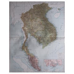
- Large Original Vintage Map of S.E Asia, with a Vignette of SingaporeLocated in St Annes, LancashireGreat map of South East Asia Original color. Good condition Published by Alexander Gross Unframed.Category
Vintage 1920s English Maps
MaterialsPaper
- Antique French Map of Asia Including China Indoneseia India, 1783Located in Amsterdam, Noord HollandVery nice map of Asia. 1783 Dedie au Roy. Additional information: Country of Manufacturing: Europe Period: 18th century Qing (1661 - 1912) Condition: Overall Condition B (Good Used)...Category
Antique 18th Century European Maps
MaterialsPaper
- Original Antique Map of South East Asia by Becker, circa 1840Located in St Annes, LancashireGreat map of South East Asia Steel engraving with original color outline Engraved by Becker Published by Virtue, circa 1840. Unframed.Category
Antique 1840s English Other Maps
MaterialsPaper