Antique Map Border

34
to
78
407
193
339
203
163
121
82
65
63
63
42
33
31
29
28
28
23
19
19
18
16
15
15
13
9
7
6
6
5
5
4
4
4
3
3
3
3
3
2
2
2
2
2
2
2
2
2
1
1
1
13
8
3
3
3
Sort By
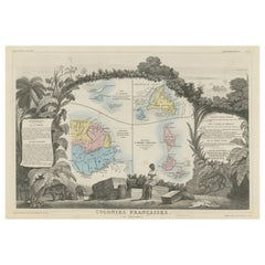
Original Steel Engraved Map of French Colonies in America, 1854
Located in Langweer, NL
Antique map titled 'Colonies Francaises (en Amerique)'. Detailed map bordered by vignettes showing
Category

Mid-19th Century Antique Map Border

Materials

Paper

Antique Original Steel Engraved Map of French Colonies in America, 1854
Original Steel Engraved Map of French Colonies in America, 1854
Free Shipping
H 13.12 in W 18.71 in D 0.02 in
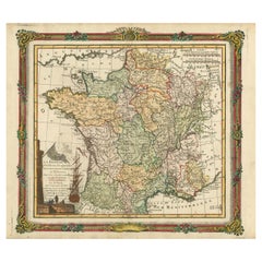
Antique Map of France with Decorative Border, 1766
Located in Langweer, NL
Antique map titled 'La France, divisée en ses quarante Gouvernemens Généraux.' Attractive map of
Category

18th Century Antique Map Border

Materials

Paper

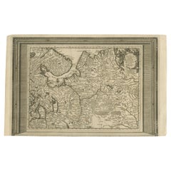
Antique Map of European Russia with Picture Frame Border
Located in Langweer, NL
Antique map titled 'La Moscovie Septentrionale (..)'. Decorative example of van der Aa's map of the
Category

Early 18th Century Antique Map Border

Materials

Paper

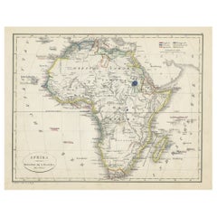
Antique Map of Africa with European Language Borders, 1852
Located in Langweer, NL
Antique map titled 'Afrika'. Map of Africa. This map originates from 'School-Atlas van alle deelen
Category

19th Century Antique Map Border

Materials

Paper

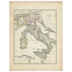
Antique Map of Italy with Hand-Colored Borders, 1852
Located in Langweer, NL
Antique map titled 'Italië'. Map of Italy. This map originates from 'School-Atlas van alle deelen
Category

19th Century Antique Map Border

Materials

Paper

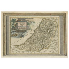
Antique Map of the Holy Land with Picture Frame Border
Located in Langweer, NL
Antique map titled 'Terre Sainte Suivant les Nouvelles Observations (..)'. Original old map of the
Category

Early 18th Century Antique Map Border

Materials

Paper

Antique Map of the Holy Land with Picture Frame Border
Free Shipping
H 11.66 in W 17.01 in D 0.02 in
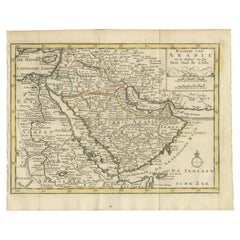
Authentic Old Map of Arabia with Original Border Coloring, 1745
Located in Langweer, NL
Title: "Kaartje van Arabië na de stelling van den Heer Guillaume de L'Isle" Translates to "Map of
Category

1740s Antique Map Border

Materials

Paper

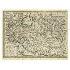
Authentic Old Map of Persia with Original Border Coloring, 1745
Located in Langweer, NL
Title: "Kaartje van Persien na de stelling van den Heer Guillaume de L'Isle" Translates to "Map
Category

1740s Antique Map Border

Materials

Paper

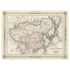
Antique Map of China and Japan, with Frame Style Border
Located in Langweer, NL
Antique map titled 'Empires Chinois et Japonnais'. Attractive map of China and Japan. This map
Category

Mid-19th Century Antique Map Border

Materials

Paper

Antique Map of Spain and Portugal, with Frame Style Border
Located in Langweer, NL
Antique map titled 'Espagne et Portugal'. Attractive map of Spain and Portugal. The map covers all
Category

Mid-19th Century Antique Map Border

Materials

Paper

Antique Map of Turkey in Asia, with Frame Style Border
Located in Langweer, NL
Antique map titled 'Asie Ottomane ou Turquie d'Asie'. Attractive map of Turkey in Asia. The map
Category

Mid-19th Century Antique Map Border

Materials

Paper

Antique Map of Russia in Europe, with Frame Style Border
Located in Langweer, NL
Antique map titled 'Russie d'Europe'. Attractive map of Russia in Europe, covers the European
Category

Mid-19th Century Antique Map Border

Materials

Paper

Authentic Old Map of Southeast Asia with Original Border Coloring, 1745
Located in Langweer, NL
"Map of the East-Indies based on the work of Mr. Guillaume de L'Isle." Guillaume de L'Isle was a
Category

1740s Antique Map Border

Materials

Paper

Antique Map of Greece and Its Colonies, with Frame Style Border
Located in Langweer, NL
Antique map titled 'La Grèce'. Attractive map of Greece and its Colonies. The map covers from the
Category

Mid-19th Century Antique Map Border

Materials

Paper

Antique French Map of Asia with Original Border Colouring, c.1785
Located in Langweer, NL
Antique map titled 'L'Asie divisee en ses principaux Etats.' (Map of Asia and its principal states
Category

18th Century Antique Map Border

Materials

Paper

Attractive Antique Map of Asia with Borders Hand-Coloured, c.1780
Located in Langweer, NL
Antique map titled 'L'Asie.' This map shows the Asia continent. Originates from 'Atlas de
Category

18th Century Antique Map Border

Materials

Paper

1842 Wall Map of the United States by J. H. Young, Published by S. A. Mitchell
Located in Colorado Springs, CO
mountains and rivers, and state population and area statistical tables fill the map’s border. At top is
Category

1840s American Antique Map Border

Materials

Paper

Antique Map of Russia in Asia and Siberia, with Frame Style Border
Located in Langweer, NL
Antique map titled 'Sibérie ou Russie d'Asie'. Attractive map of Russia in Asia and Siberia. This
Category

Mid-19th Century Antique Map Border

Materials

Paper

Antique Map of France with Beautiful Title Cartouche and Border, c.1740
Located in Langweer, NL
Sciences etc.'. Rare map of France with beautiful title cartouche and decorative border. Artists and
Category

18th Century Antique Map Border

Materials

Paper

Antique Map of Germany with Its Bordering Kingdoms and Provinces by N. Visscher
Located in Langweer, NL
Antique map covering the central part of Europe with Germany in the centre and the Netherlands in
Category

Late 17th Century Antique Map Border

Materials

Paper

Detailed Antique Cartography of Asian Russia, 1882
Located in Langweer, NL
. The map's borders and title are adorned with ornate details befitting the atlas's comprehensive nature
Category

1880s Antique Map Border

Materials

Paper

"Clason's Guide Map of Montana" by The Clason Map Company, Circa 1920s
Located in Colorado Springs, CO
Presented is “Clason's Guide Map of Montana,” published in the early 1920s by the Clason Map
Category

1920s American Art Deco Antique Map Border

Materials

Paper

Antique Map of Friesland Also Know as the Peacock Map, C.1580
Located in Langweer, NL
Antique map titled ?Frisia Occidentalis?. Original antique map of the province of Friesland, the
Category

18th Century Antique Map Border

Materials

Paper

1864 Map of North America, Antique Hand-Colored Map, by Adolphe Hippolyte Dufour
Located in Colorado Springs, CO
Offered is a map of North America entitled Amerique du Nord from 1864. This rare, separately
Category

1860s French Antique Map Border

Materials

Paper

Original Antique Woodcut Map of Persia
Located in Langweer, NL
Antique map titled 'Tabula V Asiae'. Important early woodcut map of Persia, depicting the area of
Category

16th Century Antique Map Border

Materials

Paper

Original Antique Woodcut Map of Persia
H 14.97 in W 19.02 in D 0.02 in
Colored wall map of the WORLD
By Chambon
Located in ZWIJNDRECHT, NL
huge wall map of the world in two hemispheres printed on two sheets, depicting the Eastern and Western
Category

Mid-18th Century French French Provincial Antique Map Border

Materials

Wood, Paper

Colored wall map of the WORLD
Free Shipping
H 45 in W 57 in D 0.8 in
A Decorative Detailed Map of the Crimea, with an Inset Map of Sebastopol, c 1851
Located in Langweer, NL
, detailed and historically interesting mid 19th century map of the Crimea -- with an inset plan of
Category

1850s Antique Map Border

Materials

Paper

1875 "North America" Map by J. Bartholomew
Located in Colorado Springs, CO
rivers, mountain ranges, and cities are labeled on the map, and country borders are emphasized in red
Category

1870s Scottish Antique Map Border

Materials

Paper

1851 Map of "Independent Tartary", Ric. R018
Located in Norton, MA
1851 Map of Independent Tartary "Russia" Ric.r018 A highly decorative 1851 map of
Category

19th Century Unknown Antique Map Border

Materials

Paper

Antique Decorative Coloured Map of North America, 1882
Located in Langweer, NL
are several points of interest about this map: 1. **Political Borders**: The map likely shows the
Category

1880s Antique Map Border

Materials

Paper

Antique Decorative Coloured Map of North America, 1882
No Reserve
H 14.97 in W 22.45 in D 0 in
Antique Map of the Northwestern Coast of Spain
Located in Langweer, NL
Antique map titled 'Gallaecia Regnum'. Original old map of the northwestern coast of Spain
Category

Mid-17th Century Antique Map Border

Materials

Paper

Antique Map of the Northwestern Coast of Spain
H 19.53 in W 22.92 in D 0.02 in
Antique Map of Asia by V. Levasseur, 1854
By Victor Levasseur
Located in Langweer, NL
Antique map titled 'Asie'. Map of the main Asian continent. The decorated border shows various
Category

Mid-19th Century Antique Map Border

Materials

Paper

Antique Map of Asia by V. Levasseur, 1854
H 13.98 in W 20.67 in D 0.02 in
1908 "Map of Texas" by The Kenyon Company
Located in Colorado Springs, CO
prominently on this fantastic map. Although uncolored, the bordering states of New Mexico, Oklahoma, Arkansas
Category

Early 1900s American Antique Map Border

Materials

Paper

Large Antique Map of the Asian Continent, 1814
Located in Langweer, NL
Antique map titled 'Asia'. Large antique map of the Asian continent. Drawn under the direction of
Category

19th Century Antique Map Border

Materials

Paper

1858 Colton's Map of New York, Ric.B011
Located in Norton, MA
An 1858 Colton's map of New York Ric.b011 Colton’s New York, 1858 - A large original color
Category

19th Century Unknown Antique Map Border

Materials

Paper

1858 Colton's Map of New York, Ric.B011
H 17.33 in W 27.56 in D 0.4 in
Antique Map of Persia, Afghanistan and Balochistan, 1859
Located in Langweer, NL
The antique map titled "Persia, Afghanistan and Beloochistan" is a remarkable historical document
Category

Mid-19th Century Antique Map Border

Materials

Paper

Antique Map of Pomerania by Schenk, circa 1750
Located in Langweer, NL
straddles the modern border between northeastern Germany and Poland. Crafted with ornamental flair, this map
Category

Mid-18th Century Antique Map Border

Materials

Paper

Antique Map of Pomerania by Schenk, circa 1750
H 20.67 in W 24.02 in D 0.02 in
Antique Map of South America by Kelly, 1835
Located in Langweer, NL
Antique map titled 'South America'. Old map of South America engraved by A. Findley. With
Category

19th Century Antique Map Border

Materials

Paper

Antique Map of Northern Asia by Mallet, 1719
Located in Langweer, NL
Antique map titled 'Das Mitternächtige Theil des Alten Asien'. This sheet of five miniature maps
Category

18th Century Antique Map Border

Materials

Paper

Antique Lithography Map, Black Sea, English, Framed, Cartography, Victorian
Located in Hele, Devon, GB
Major locations, regional borders and tributaries annotate the map Superb illustrations showcase six
Category

Mid-19th Century British Early Victorian Antique Map Border

Materials

Wood

Antique Lithography Map, South America, English, Framed, Cartography, Victorian
Located in Hele, Devon, GB
, later frames Major locations, coloured borders and associated islands annotate the map Superb
Category

Mid-19th Century British Early Victorian Antique Map Border

Materials

Wood

Old Map of the Chinese Empire and Japan, 1882
Located in Langweer, NL
An original antique map titled "The Chinese Empire and Japan," dating from an 1882 atlas by Blackie
Category

1880s Antique Map Border

Materials

Paper

Old Map of the Chinese Empire and Japan, 1882
No Reserve
H 14.97 in W 22.45 in D 0 in
Antique Lithography Map, Durham, English, Framed, Cartography, Early Georgian
Located in Hele, Devon, GB
This is an antique lithography map of Durham. An English, framed engraving of cartographic interest
Category

Early 18th Century British Georgian Antique Map Border

Materials

Wood

Large Antique Map of the State of Texas, 1861
Located in Langweer, NL
surveyed. The map also includes an inset of Sabine Lake on the border of Texas and Louisiana and another
Category

Mid-19th Century Antique Map Border

Materials

Paper

Large Antique Map of the State of Texas, 1861
Free Shipping
H 18.04 in W 26.58 in D 0.02 in
Antique Decorative Coloured Map Marocco, Algeria and Tunis, 1882
Located in Langweer, NL
The maps is from the 1882 atlas by Blackie & Son and offers a detailed view of the North African
Category

1880s Antique Map Border

Materials

Paper

Colton's Map of Illinois, with an Inset of Chicago
Located in Langweer, NL
Antique map titled 'Colton's Illinois'. Antique map of Illinois, a state in the Midwestern United
Category

Mid-19th Century Antique Map Border

Materials

Paper

Original Antique Hand- Map of Africa by Allard '1697'
Located in Langweer, NL
is the 3rd state of the map, with climate notation added in border (1697, Betz 162, Norwich 54). Very
Category

Late 17th Century Antique Map Border

Materials

Paper

Detailed Antique Map of Northern Sumatra, Indonesia, circa 1825
Located in Langweer, NL
Antique map titled 'Partie de l'Ile de Sumatra'. Chart showing the northern part of Sumatra
Category

19th Century Antique Map Border

Materials

Paper

Colorful Detailed Antique Map of Europe, Published in 1882
Located in Langweer, NL
"The Antique Map of Europe from 'The Comprehensive Atlas and Geography of the World,' published in
Category

1880s Antique Map Border

Materials

Paper

Original 1882 Map of Arabia, Red Sea & Persian Gulf
Located in Langweer, NL
This print is a historically significant map titled "Arabia, the Red Sea, and the Persian Gulf
Category

1880s Antique Map Border

Materials

Paper

Original Antique Decorative Map of Japan, Fullarton, C.1870
Located in St Annes, Lancashire
Great map of Japan Wonderful figural border From the celebrated Royal Illustrated Atlas
Category

1870s Scottish Antique Map Border

Materials

Paper

Antique Map of the Lorraine Region 'France' (c.1735)
Located in Langweer, NL
Antique map titled 'Carte du Duche de Lorraine - Kaart van Lotharingen'. A detailed map of the
Category

Mid-18th Century Antique Map Border

Materials

Paper

Madrid 1901: A Historical Map of Spain's Capital Province
Located in Langweer, NL
The map is of the province of Madrid, the capital region of Spain, as it appeared in 1901. Here are
Category

Early 1900s Antique Map Border

Materials

Paper

Madrid 1901: A Historical Map of Spain's Capital Province
Free Shipping
H 20.08 in W 14.77 in D 0 in
Antique Map of Vienne 'France' by V. Levasseur, 1854
By Victor Levasseur
Located in Langweer, NL
beautiful narrative border illustration of this otherwise peaceful pastoral region. This map originates from
Category

Mid-19th Century Antique Map Border

Materials

Paper

Map Bedfordshire WilliamSchmollinger Dunstable Priory Woburn Abbey Moules Gothic
Located in BUNGAY, SUFFOLK
Artist William Schmollinger (1811-1869) London : George Virtue, 1832. A highly attractive map in
Category

19th Century English Victorian Antique Map Border

Materials

Paper

Map Bedfordshire WilliamSchmollinger Dunstable Priory Woburn Abbey Moules Gothic
Located in BUNGAY, SUFFOLK
ARTIST William Schmollinger (1811-1869) London : George Virtue, 1832. A highly attractive map in
Category

19th Century English Victorian Antique Map Border

Materials

Paper

Antique Map of Japan by J.N. Bellin, 1752
Located in Langweer, NL
of the 18th century, the map includes Provincial borders, many place names and topographical details
Category

Mid-18th Century Antique Map Border

Materials

Paper

Antique Map of Japan by J.N. Bellin, 1752
H 10.36 in W 14.73 in D 0.02 in
Rare Antique Map of the Moghul Empire, ca.1725
Located in Langweer, NL
Antique map titled 'Oost-Indize Voyagie door William Hawkins van Suratte gedaan na 't Hof van den
Category

1720s Antique Map Border

Materials

Paper

Antique Map of the Bay of Bantam, c.1720
Located in Langweer, NL
Rare, untitled miniature map of the Bay of Bantam with various Islands including Pulo Dua and Pulo
Category

18th Century Antique Map Border

Materials

Paper

1859 Antique Swiss Panorama: Blackie's Detailed Map of Switzerland
Located in Langweer, NL
era, the map is likely adorned with decorative borders, an elegant title script, and possibly other
Category

Mid-19th Century Antique Map Border

Materials

Paper

  • 1
Get Updated with New Arrivals
Save "Antique Map Border", and we’ll notify you when there are new listings in this category.

Antique Map Border For Sale on 1stDibs

With a vast inventory of beautiful furniture at 1stDibs, we’ve got just the antique map border you’re looking for. Frequently made of paper, every antique map border was constructed with great care. Your living room may not be complete without an antique map border — find older editions for sale from the 18th Century and newer versions made as recently as the 19th Century.

How Much is a Antique Map Border?

The average selling price for an antique map border at 1stDibs is $362, while they’re typically $58 on the low end and $5,950 for the highest priced.

Read More

Pamela Shamshiri Shares the Secrets behind Her First-Ever Book and Its Effortlessly Cool Interiors

The sought-after designer worked with the team at Hoffman Creative to produce a monograph that beautifully showcases some of Studio Shamshiri's most inspiring projects.

Moroccan Artworks and Objects Take Center Stage in an Extraordinary Villa in Tangier

Italian writer and collector Umberto Pasti opens the doors to his remarkable cave of wonders in North Africa.

Montecito Has Drawn Royalty and Celebrities, and These Homes Are Proof of Its Allure

Hollywood A-listers, ex-pat aristocrats and art collectors and style setters of all stripes appreciate the allure of the coastal California hamlet — much on our minds after recent winter floods.

Whaam! Blam! Pow! — a New Book on Pop Art Packs a Punch

Publishing house Assouline and writer Julie Belcove have teamed up to trace the history of the genre, from Roy Lichtenstein, Andy Warhol and Yayoi Kusama to Mickalene Thomas and Jeff Koons.

The Sparkling Legacy of Tiffany & Co. Explained, One Jewel at a Time

A gorgeous new book celebrates — and memorializes — the iconic jeweler’s rich heritage.

What Makes a Gem-Encrusted Chess Set Worth $4 Million?

The world’s most opulent chess set, weighing in at 513 carats, is literally fit for a king and queen.

Tauba Auerbach’s Geometric Pop-Up Book Is Mighty Rare, Thanks to a Hurricane

This sculptural art book has an epic backstory of its own.

Step inside the Storied Mansions of Palm Beach’s Most Effervescent Architect

From Spanish-style courtyards to fanciful fountains, these acclaimed structures abound in surprising and elegant details.