Items Similar to Antique French Map of Asia Including China Indoneseia India, 1783


Want more images or videos?
Request additional images or videos from the seller
1 of 5
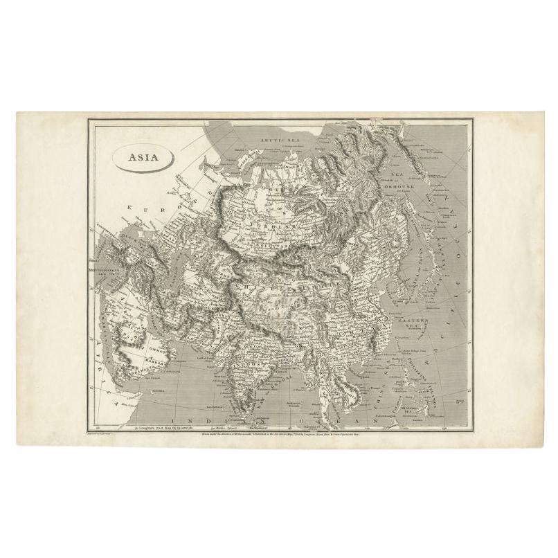
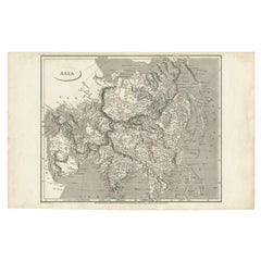
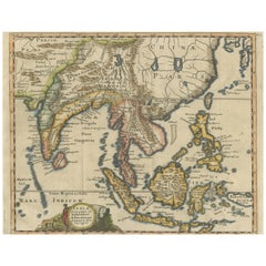
Antique French Map of Asia Including China Indoneseia India, 1783
About the Item
Very nice map of Asia. 1783 Dedie au Roy.
Additional information:
Country of Manufacturing: Europe
Period: 18th century Qing (1661 - 1912)
Condition: Overall Condition B (Good Used): Some trace of use
Dimension: 70 W x 54 H cm
- Dimensions:Height: 21.26 in (54 cm)Width: 27.56 in (70 cm)Depth: 0.04 in (1 mm)
- Materials and Techniques:
- Place of Origin:
- Period:
- Date of Manufacture:1783
- Condition:Overall Condition B (Good Used): Some trace of use.
- Seller Location:Amsterdam, NL
- Reference Number:
About the Seller
5.0
Gold Seller
These expertly vetted sellers are highly rated and consistently exceed customer expectations.
Established in 2015
1stDibs seller since 2019
158 sales on 1stDibs
Typical response time: 8 hours
- ShippingRetrieving quote...Ships From: Amsterdam, Netherlands
- Return PolicyA return for this item may be initiated within 14 days of delivery.
More From This SellerView All
- Antique 1803 Italian Map of Asia Including China Indoneseia IndiaLocated in Amsterdam, Noord HollandAntique 1803 Italian Map of Asia Including China Indoneseia India Very nice map of Asia. 1803. Additional information: Type: Map Country of Manufacturing: Europe Period: 19th centu...Category
Antique 19th Century European Maps
MaterialsPaper
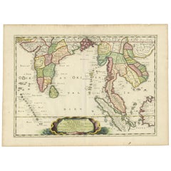
- Antique Carte de L'Inde Myanmar, Malaysia Vietnam Map of Asia the Chinese EmpireLocated in Amsterdam, Noord HollandAntique Carte de L'Inde Myanmar, Malaysia Vietnam Map of Asia the Chinese Empire Very nice map of Asia. Additional information: Type: Map Country of Man...Category
Antique 18th Century European Maps
MaterialsPaper
- Super Rare Antique French Map of Chine and the Chinese Empire, 1780Located in Amsterdam, Noord HollandSuper Rare Antique French Map of Chine and the Chinese Empire, 1780 Very nice map of Asia. 1780 Made by Bonne. Additional information: Type: Map ...Category
Antique 18th Century European Maps
MaterialsPaper
- Antique Chinese Tin Toy Chinese MS 705 Trolley Bus Shanghai-Rare, 1950/1960Located in Amsterdam, Noord HollandOne of the absolute rarest antique Chinese toys made. Antique Red China Tin Toy clockwork. Chinese MS 705 Trolley Bus Shanghai-Rare! Additional informatio...Category
20th Century Chinese Toys and Dolls
MaterialsPorcelain
- Antique Chinese Calligraphy Ink Stones in Box Great Condition, ca 1900-1930Located in Amsterdam, Noord HollandAntique Chinese Calligraphy Ink Stones in Box Great Condition, ca 1900-1930. Very interesting Additional information: Type: Boxes Region ...Category
Antique 19th Century Chinese Nautical Objects
MaterialsPorcelain
- Antique Chinese Tin Toy Car Mini Sedan MF152 Shanghai, 1950/1960Located in Amsterdam, Noord HollandOne of the absolute rarest antique Chinese toys made. This is a most unusually made antique toy from the 1950/1960s . A Mini sedan Shanghai car with the nr MF 152 Additional informa...Category
20th Century Chinese Toys and Dolls
MaterialsPorcelain


You May Also Like
- Antique Map of Asia including Arabia, 1806Located in Langweer, NLAntique map titled 'Asia'. Original antique map of the Asian continent engraved by E. Jones. Artists and Engravers: Drawn under the direction of Mr. Arrowsmith. Published in 1806...Category
Antique 19th Century Maps
MaterialsPaper
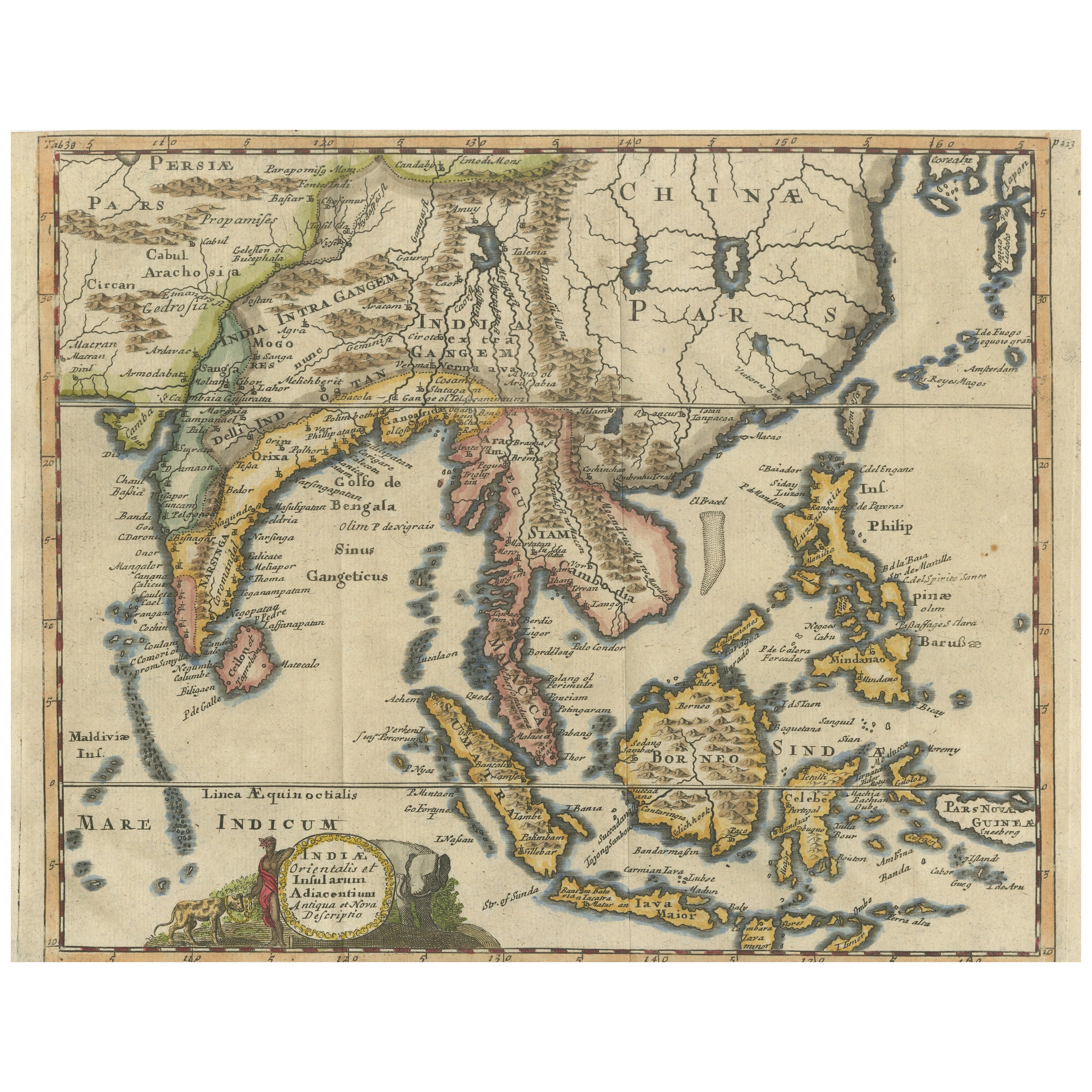
- Antique Map of Southeast Asia, China, Philippines and IndiaLocated in Langweer, NLAntique map titled 'Indiae Orientalis et Insularum Adiacentium'. Decorative map of Southeast Asia, China, Philippines, and India. A native holds a wild dog or hyena on a chain, while...Category
Antique Early 18th Century Maps
MaterialsPaper
- Antique Map of India to Southeast AsiaLocated in Langweer, NLAntique map titled 'Indes en-decà et au-delà du Gange'. Original old map of India to Southeast Asia, showing India, Nepal, Bhutan, Sri Lanka (Ceylon), Myanmar (Birma), part of Indone...Category
Antique Mid-19th Century Maps
MaterialsPaper
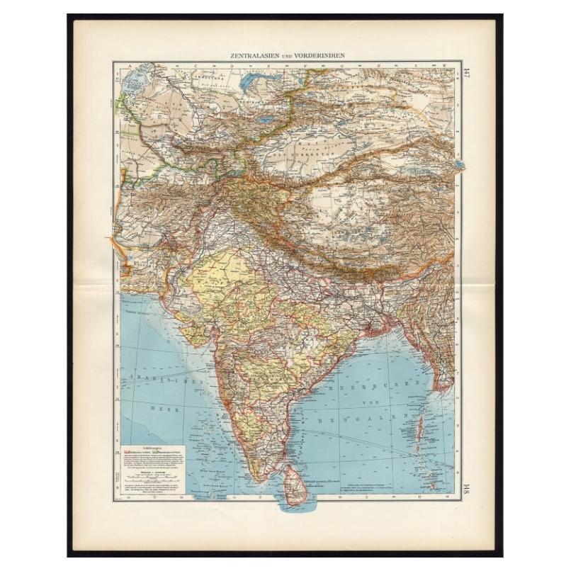
- Antique Map of Central Asia and India, 1904Located in Langweer, NLAntique map titled 'Zentralasien und Vorderindien'. Map of Central Asia and India. This large antique map is taken from; 'Andrees Allgemeiner Handatlas in 126 Haupt-Und 139 Nebenkart...Category
20th Century Maps
MaterialsPaper
- Antique Map of India and Southeast Asia by Sanson '1654'Located in Langweer, NLAntique map titled 'Partie Meridionale de l'Inde'. Early map of India and Southeast Asia. The map shows most of modern India, Bangladesh and Burma, the whole of Sri Lanka, Thailand, ...Category
Antique Mid-17th Century Maps
MaterialsPaper
- Antique Map of India and Southeast Asia by Balbi '1847'Located in Langweer, NLAntique map titled 'India en deçà et au delà du Gange'. Original antique map of India and Souteast Asia. This map originates from 'Abrégé de Géographie (..)' by Adrien Balbi. Publish...Category
Antique Mid-19th Century Maps
MaterialsPaper


Recently Viewed
View AllMore Ways To Browse
Winkler Prins
A Plan City And Castle Of Batavia
Very Large Map
John Speed Isle Of Wight Maps
Old Nautical Maps
Malacca Strait Map
Cheshire Map
Scottish Antique Historical
Ree Brown
Antique Alabama Map
Antique Map Of Bermuda
Herefordshire Antique Map
Hertfordshire Antique Map
Antique Map Of Alabama
Australasia Antique Map
Huntingdonshire Antique Map
Vintage Road Maps Collectables
Antique Maps Perth