Items Similar to Antique Map of American Cities, Vignette of New York City, circa 1920


Want more images or videos?
Request additional images or videos from the seller
1 of 5
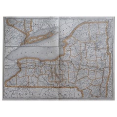
Antique Map of American Cities, Vignette of New York City, circa 1920
About the Item
Great maps of American Cities
Unframed
Original color
By John Bartholomew and Co. Edinburgh Geographical Institute
Published, circa 1920
- Dimensions:Height: 18 in (45.72 cm)Width: 23 in (58.42 cm)Depth: 0.07 in (1.78 mm)
- Materials and Techniques:Paper,Other
- Place of Origin:
- Period:
- Date of Manufacture:1920
- Condition:Wear consistent with age and use.
- Seller Location:St Annes, GB
- Reference Number:1stDibs: LU1836334805862
About the Seller
4.9
Platinum Seller
These expertly vetted sellers are 1stDibs' most experienced sellers and are rated highest by our customers.
1stDibs seller since 2016
2,554 sales on 1stDibs
Typical response time: <1 hour
Associations
International Confederation of Art and Antique Dealers' Associations
- ShippingRetrieving quote...Ships From: St Annes, United Kingdom
- Return PolicyA return for this item may be initiated within 3 days of delivery.
Auctions on 1stDibs
Our timed auctions are an opportunity to bid on extraordinary design. We do not charge a Buyer's Premium and shipping is facilitated by 1stDibs and/or the seller. Plus, all auction purchases are covered by our comprehensive Buyer Protection. Learn More
More From This SellerView All
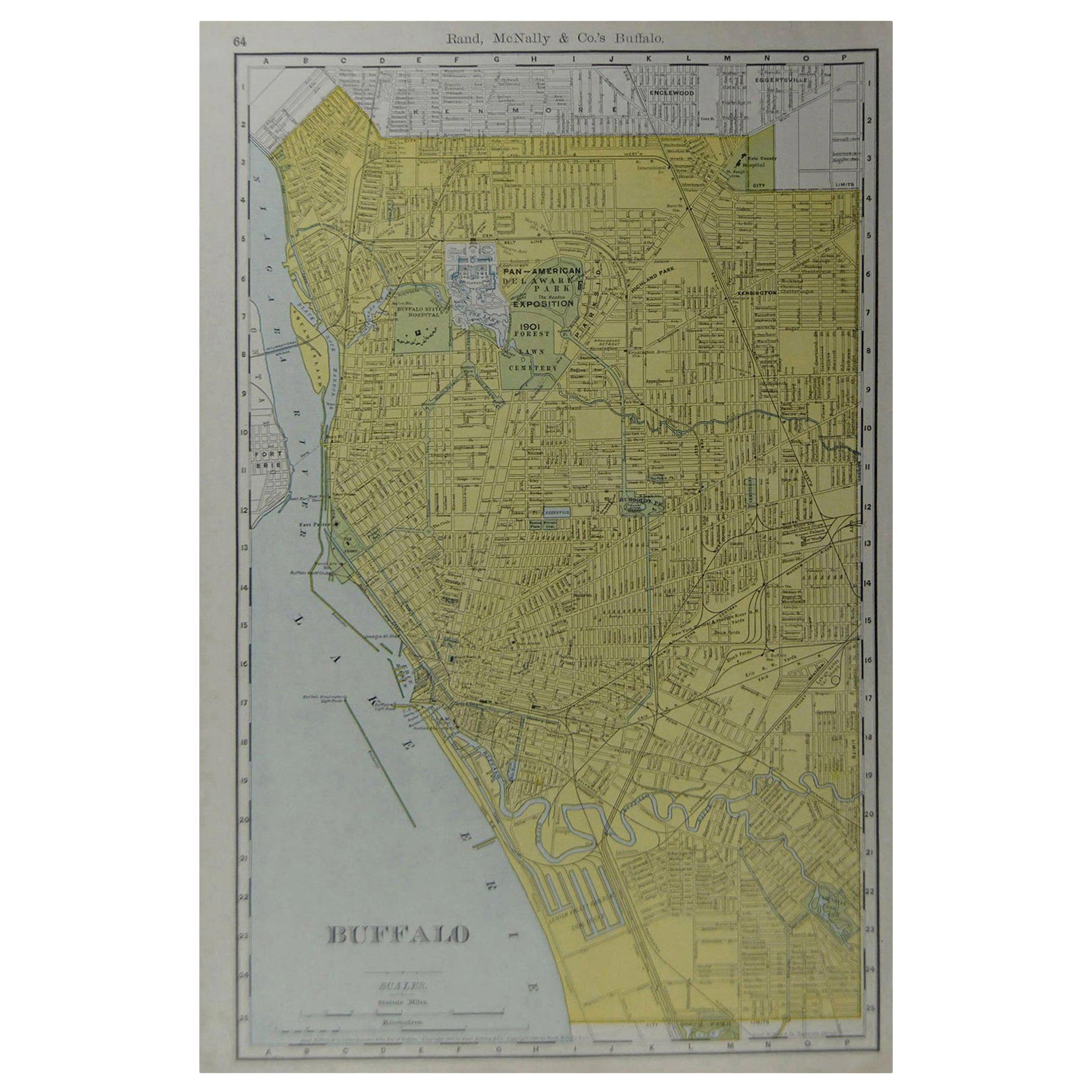
- Original Antique City Plan of Buffalo, New York, USA, circa 1900By Rand McNally & Co.Located in St Annes, LancashireFabulous colorful map of Buffalo Original color By Rand, McNally & Co. Published, circa 1900. Unframed Free shipping.Category
Antique Early 1900s American Maps
MaterialsPaper
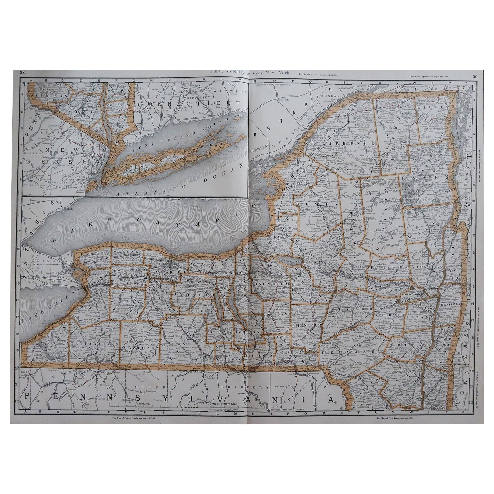
- Large Original Antique Map of New York, USA, 1894By Rand McNally & Co.Located in St Annes, LancashireFabulous map of New York. Original color. By Rand, McNally & Co. Published, 1894 Unframed Free shipping.Category
Antique 1890s American Maps
MaterialsPaper
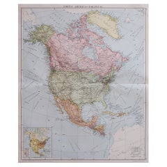
- Large Original Vintage Map of North America, circa 1920Located in St Annes, LancashireGreat map of North America Original color. Good condition Published by Alexander Gross Unframed.Category
Vintage 1920s English Edwardian Maps
MaterialsPaper
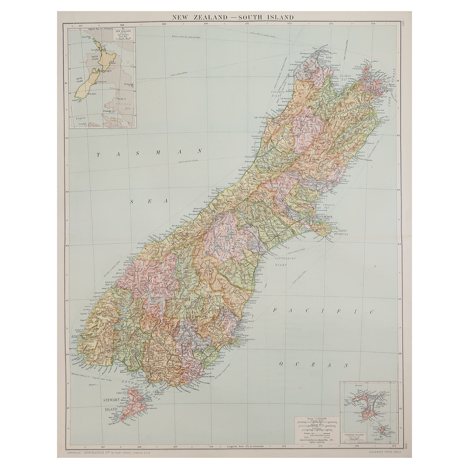
- Large Original Vintage Map of New Zealand, South Island, circa 1920Located in St Annes, LancashireGreat map of South Island, New Zealand Original color. Good condition / repair to a minor tear on right edge Published by Alexander Gross Unframed.Category
Vintage 1920s English Edwardian Maps
MaterialsPaper
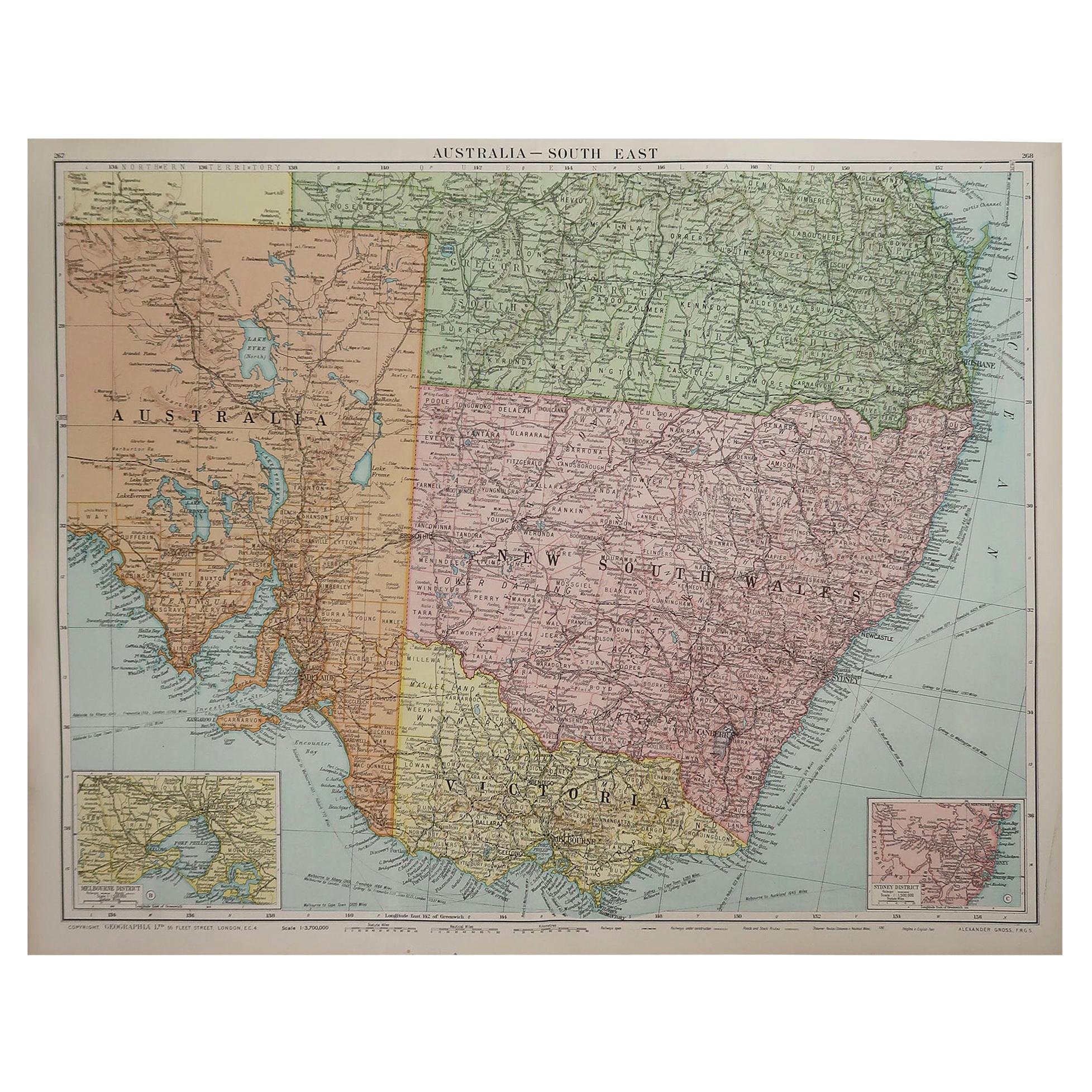
- Large Original Vintage Map of New South Wales, Australia, circa 1920Located in St Annes, LancashireGreat map of New South Wales Original color. Good condition Published by Alexander Gross Unframed.Category
Vintage 1920s English Edwardian Maps
MaterialsPaper
- Original Antique Map of The United States of America, circa 1890Located in St Annes, LancashireGreat map of the USA By The Stanford's Geographical Establishment Original colour Unframed.Category
Antique 1890s English Victorian Maps
MaterialsPaper


You May Also Like
- Antique Map of North America by Dufour 'circa 1834'Located in Langweer, NLAntique map titled 'Amérique Septentrionale'. Uncommon map of North America. Published by or after A.H. Dufour, circa 1834. Source unknown, to be determined.Category
Antique Mid-19th Century Maps
MaterialsPaper
- Antique Map of South America by Wyld, circa 1850By J. WyldLocated in Langweer, NLBeautiful folding map of South America titled 'Colombia Prima or South America Drawn from the Large Map in Eight Sheets by Louis Stanislas D ' Arcy Delarochette'. Three insets in the...Category
Antique Mid-19th Century British Maps
MaterialsPaper
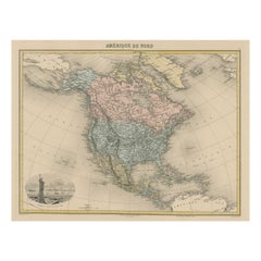
- Antique Map of North America with Vignette of the Statue of Liberty, New YorkLocated in Langweer, NLAntique map titled 'Amérique du Nord'. Original antique map of North America. Meticulous information from the new Alaska Territory and through the Caribbean Windward Islands. Very go...Category
Antique Late 19th Century Maps
MaterialsPaper
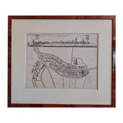
- Antique City View and Map of IJlst, City in Friesland, Holland, Framed, 1664Located in Langweer, NLAntique map titled 'Ylst'. Old map and city view of the city of IJlst, Friesland. This map originates from 'Beschrijvinge van de Heerlyckheydt van Frieslandt' by B. Schotanus à Sterr...Category
Antique 17th Century Maps
MaterialsPaper
- Antique Map of Coiba Island, Panama, South America, C.1740Located in Langweer, NLAntique map titled 'Plan de la partie orientale de l'Isle de Quibo'. Map of the eastside of Coiba Island (Quibo), Panama, showing the shoreline around Port de Dames indicating soft s...Category
Antique 18th Century Maps
MaterialsPaper
- Antique Map of Asia by Dufour, circa 1834Located in Langweer, NLAntique map titled 'Asie par A.H. Dufour'. Uncommon map of Asia. Published by or after A.H. Dufour, circa 1834. Source unknown, to be determined.Category
Antique Mid-19th Century Maps
MaterialsPaper


Recently Viewed
View AllMore Ways To Browse
Map Of Barbados
Nantucket Chart
Nautical Martinique
Vintage Schoolroom
Antique Furniture Denver Co
Antique Maps Washington Dc
Daniel Bautista
Denoyer Geppert Anatomy
Map Cleveland
Map Montana
Montana Maps
Antique Chesapeake Bay Map
Antique Map Of Chesapeake Bay
J Thayer
Rand McNally & Co. On Sale
Bolivia Antique Map
Irish Canterbury Furniture
Irish Canterbury