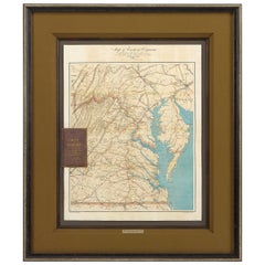
Antique Map Of Chesapeake Bay

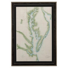
1856 U.S. Coast Survey Map of Chesapeake Bay and Delaware Bay
Located in Colorado Springs, CO
Presented is U.S. Coast Survey nautical chart or maritime map of Chesapeake Bay and Delaware Bay
Category

1850s American Antique Map Of Chesapeake Bay

Materials

Paper

Large Custom Framed 1857 U.S. Coast Survey of the Chesapeake Bay
Located in Bridgeport, CT
An antique 1850's nautical map with hand-painted color accents entitled “Chesapeake Bay; Sheet no
Category

1850s American American Classical Antique Map Of Chesapeake Bay

Materials

Paper

People Also Browsed

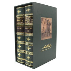
Personal Memoirs of U. S. Grant, Two-Volume Set, 1885-86
Located in Colorado Springs, CO
Grant, Ulysses S., Personal Memoirs of U.S. Grant. New York: Charles L. Webster and Co., 1885-1886. Two volume set. Octavo, beautifully rebound in quarter green leather and cloth boa...
Category

1880s American Antique Map Of Chesapeake Bay

Materials

Leather, Paper

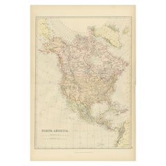
Antique Decorative Coloured Map of North America, 1882
Located in Langweer, NL
This original antique map of North America is from the Blackie & Son Atlas published in 1882. Here are several points of interest about this map: 1. **Political Borders**: The map l...
Category

1880s Antique Map Of Chesapeake Bay

Materials

Paper

Antique Decorative Coloured Map of North America, 1882
No Reserve
H 14.97 in W 22.45 in D 0 in
The Holy Bible, Containing the Old and New Testaments, 1887
Located in Colorado Springs, CO
The Holy Bible, Containing the Old and New Testaments, Translated out of the Original Tongues: And with the Former Translations Diligently Compared and Revised, by His Majesty’s Spec...
Category

1880s English Late Victorian Antique Map Of Chesapeake Bay

Materials

Leather, Paper

The Holy Bible, Standard Edition, Illustrated Family Bible, 1885
Located in Colorado Springs, CO
The “Standard” Edition of The Holy Bible, Containing the Old and New Testaments and Apocrypha, Translated out of the Original Tongues, Together with Cruden’s Complete Concordance… an...
Category

1880s American Late Victorian Antique Map Of Chesapeake Bay

Materials

Leather, Paper

Antique Map of The United States of North America, 1882
Located in Langweer, NL
This is a historical map titled "The United States of North America, Central Part" from the 1882 Blackie Atlas. It depicts the continental United States with a high level of detail, ...
Category

1880s Antique Map Of Chesapeake Bay

Materials

Paper

Antique Map of The United States of North America, 1882
Free Shipping
H 14.97 in W 22.45 in D 0 in
Portrait of Anna de Hooghe - Flemish art Old Master portrait oil painting
By Jacob Ferdinand Voet 1
Located in London, GB
This strong Flemish Old Master portrait oil painting is attributed to Ferdinand Voet. The sitter is Anna De Hooghe, the fourth wife of artist Ludolf Bakhuizen (1631-1708), a German-b...
Category

17th Century Old Masters Antique Map Of Chesapeake Bay

Materials

Oil

19 century Maritime Painting with Schooner at Sea (Restored)
Located in San Francisco, CA
19 century Maritime painting with schooner at sea No visible signature Restored 17.25 x 31.25 unframed, 24 x 38 framed
Category

19th Century Antique Map Of Chesapeake Bay

Materials

Oil

Original Antique Map of the American State of Washington, 1889
Located in St Annes, Lancashire
Great map of Washington Drawn and Engraved by W. & A.K. Johnston Published By A & C Black, Edinburgh. Original colour Unframed.
Category

1880s Scottish Victorian Antique Map Of Chesapeake Bay

Materials

Paper

Memoirs of General William T. Sherman, First Edition, Two-Volume Set, 1875
Located in Colorado Springs, CO
Sherman, William T. Memoirs of General W. T. Sherman, Written By Himself. New York: D. Appleton and Company, 1875. First edition. In two volumes. Rebound in quarter blue leather and ...
Category

1870s American Antique Map Of Chesapeake Bay

Materials

Leather, Paper

Antique Map of the Spice Islands 'Moluccas', Indonesia by W. Blaeu, circa 1640
By Willem Blaeu
Located in Langweer, NL
Antique map titled 'Moluccae Insulae Celeberrimae'. Highly decorative antique map of the Spice Islands (Moluccas) published by W. Blaeu (circa 1640). This map features a large inset ...
Category

Mid-17th Century Antique Map Of Chesapeake Bay

Materials

Paper

Art Deco Fortune Magazine Cover October 1938
Located in Dallas, TX
Presenting a fabulous Original Art Deco Fortune Cover October 1938. The cover of Fortune Magazine for October 1938, framed and matted. This is an original cover, not a re-print...
Category

Early 20th Century American Art Deco Antique Map Of Chesapeake Bay

Materials

Paper

Original Steel Engraved Map of French Colonies in America, 1854
Located in Langweer, NL
Antique map titled 'Colonies Francaises (en Amerique)'. Detailed map bordered by vignettes showing local animals, produce and activities of the various French Colonies in America. Th...
Category

Mid-19th Century Antique Map Of Chesapeake Bay

Materials

Paper

Original Steel Engraved Map of French Colonies in America, 1854
Free Shipping
H 13.12 in W 18.71 in D 0.02 in
Tsunami
By Peter Milton
Located in New York, NY
TSUNAMI is an archival digital print created in 2015. This original print was directly drawn into the computer by Peter Milton and printed digitally. It is signed, titled, and date...
Category

21st Century and Contemporary Contemporary Antique Map Of Chesapeake Bay

Materials

Digital

Vintage Warren Fischer Abstract Pastel Drawing on Paper
By Warren Fischer
Located in Miami, FL
Vintage Warren Fischer Abstract pastel drawing on paper Offered for sale is an original 1990s Warren Fischer abstract pastel drawing from the late artist's personal portfolio. The...
Category

1990s American Modern Antique Map Of Chesapeake Bay

Materials

Paper

Orignal Hand-Colored Antique Map of Chili by W. Blaeu, 1658
By Willem Blaeu
Located in Langweer, NL
Very decorative antique map of Chili published by W. Blaeu, 1658. This map depicts Chile from Copiapo southward to the island of Chiloé with ships and sea monsters adorning the sea. ...
Category

Mid-17th Century Antique Map Of Chesapeake Bay

Materials

Paper

Orignal Hand-Colored Antique Map of Chili by W. Blaeu, 1658
Free Shipping
H 21.86 in W 25.99 in D 0.02 in
Antique Map of British North America, The Dominion of of Canada, 1882
Located in Langweer, NL
This map is titled "British North America, Dominion of Canada," from the 1882 Blackie Atlas. It features the geographical area that comprises modern-day Canada, with notable features...
Category

1880s Antique Map Of Chesapeake Bay

Materials

Paper

Recent Sales

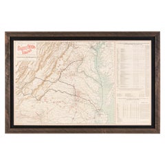
Antique Map of Virginia, Showing the Location of Civil War Battle Fields, 1902
Located in Colorado Springs, CO
details a total of 105 battlefields in Virginia, West Virginia, and Maryland. The Chesapeake Bay and the
Category

Early 1900s American Antique Map Of Chesapeake Bay

Materials

Paper

1862 Pocket Map of Eastern Virginia Representing the Seat of the Civil War
Located in Colorado Springs, CO
. This large chromolithographed pocket map covers the area from the Chesapeake Bay to Lexington, VA. The
Category

1860s Antique Map Of Chesapeake Bay

Florida and Virginia: A 17th Century Hand-colored Map by Hondius after Mercator
By Gerard Mercator
Located in Alamo, CA
from the Chesapeake Bay south to St. Augustine, including present day North and South Carolina and
Category

Early 17th Century Dutch Antique Map Of Chesapeake Bay

Materials

Paper

Caarte Van West Indien, Soo Vaste landen als Eylanden, ...
By Joan Vingboons
Located in New York, NY
detail in and around the Chesapeake Bay (the Delaware Bay is now shown) These details are not found on
Category

Late 17th Century Other Art Style Antique Map Of Chesapeake Bay

Materials

Engraving

Marquis De La Fayette in the American Revolution by C Tower in 2 Volumes
Located in Dallas, TX
de La Fayette in the Chesapeake Bay in 1781’. Marie-Joseph Paul Yves Roch Gilbert du Motier
Category

Early 20th Century American American Classical Antique Map Of Chesapeake Bay

Materials

Paper

Chesapeake Bay and Delaware Bay Map, Antique Maritime Map, circa 1851
Located in Colorado Springs, CO
1851 U.S. Coast Survey Map of the Chesapeake Bay and Delaware Bay, published for the U.S.C.S 1851
Category

1850s American Antique Map Of Chesapeake Bay

Materials

Paper

1893 Antique Map Showing the Location of the Natural Oyster Grounds of Maryland
Located in Colorado Springs, CO
This map is an 1893 map of Maryland, a chart focused on the oyster fishing beds of the Chesapeake
Category

1890s American Antique Map Of Chesapeake Bay

Materials

Paper

1650 "Virginiae Partis Australis et Floridae Partis Orientalis..., " Jan Jansson
Located in Colorado Springs, CO
, close to areas of early British settlements along the Chesapeake Bay, including Cape Henry and Cape Fear
Category

1650s Antique Map Of Chesapeake Bay

Materials

Paper

Florida and Virginia: A 17th Century Hand-colored Map by Hondius after Mercator
By Gerard Mercator
Located in Alamo, CA
from the Chesapeake Bay south to St. Augustine, including present day North and South Carolina and
Category

Early 17th Century Antique Map Of Chesapeake Bay

Materials

Engraving

Virginie (Virginia)
By Alain Manesson Mallet
Located in New York, NY
engraving of the Chesapeake Bay region is from Mallet's first edition, printed in Paris in 1683. Among
Category

17th Century Realist Antique Map Of Chesapeake Bay

Materials

Engraving

Get Updated with New Arrivals
Save "Antique Map Of Chesapeake Bay", and we’ll notify you when there are new listings in this category.

Read More

Pamela Shamshiri Shares the Secrets behind Her First-Ever Book and Its Effortlessly Cool Interiors

The sought-after designer worked with the team at Hoffman Creative to produce a monograph that beautifully showcases some of Studio Shamshiri's most inspiring projects.

Moroccan Artworks and Objects Take Center Stage in an Extraordinary Villa in Tangier

Italian writer and collector Umberto Pasti opens the doors to his remarkable cave of wonders in North Africa.

Montecito Has Drawn Royalty and Celebrities, and These Homes Are Proof of Its Allure

Hollywood A-listers, ex-pat aristocrats and art collectors and style setters of all stripes appreciate the allure of the coastal California hamlet — much on our minds after recent winter floods.

Whaam! Blam! Pow! — a New Book on Pop Art Packs a Punch

Publishing house Assouline and writer Julie Belcove have teamed up to trace the history of the genre, from Roy Lichtenstein, Andy Warhol and Yayoi Kusama to Mickalene Thomas and Jeff Koons.

The Sparkling Legacy of Tiffany & Co. Explained, One Jewel at a Time

A gorgeous new book celebrates — and memorializes — the iconic jeweler’s rich heritage.

What Makes a Gem-Encrusted Chess Set Worth $4 Million?

The world’s most opulent chess set, weighing in at 513 carats, is literally fit for a king and queen.

Tauba Auerbach’s Geometric Pop-Up Book Is Mighty Rare, Thanks to a Hurricane

This sculptural art book has an epic backstory of its own.

Step inside the Storied Mansions of Palm Beach’s Most Effervescent Architect

From Spanish-style courtyards to fanciful fountains, these acclaimed structures abound in surprising and elegant details.