Items Similar to Antique Map of the Coast of Kerguelens Island by Cook, 1803


Want more images or videos?
Request additional images or videos from the seller
1 of 5
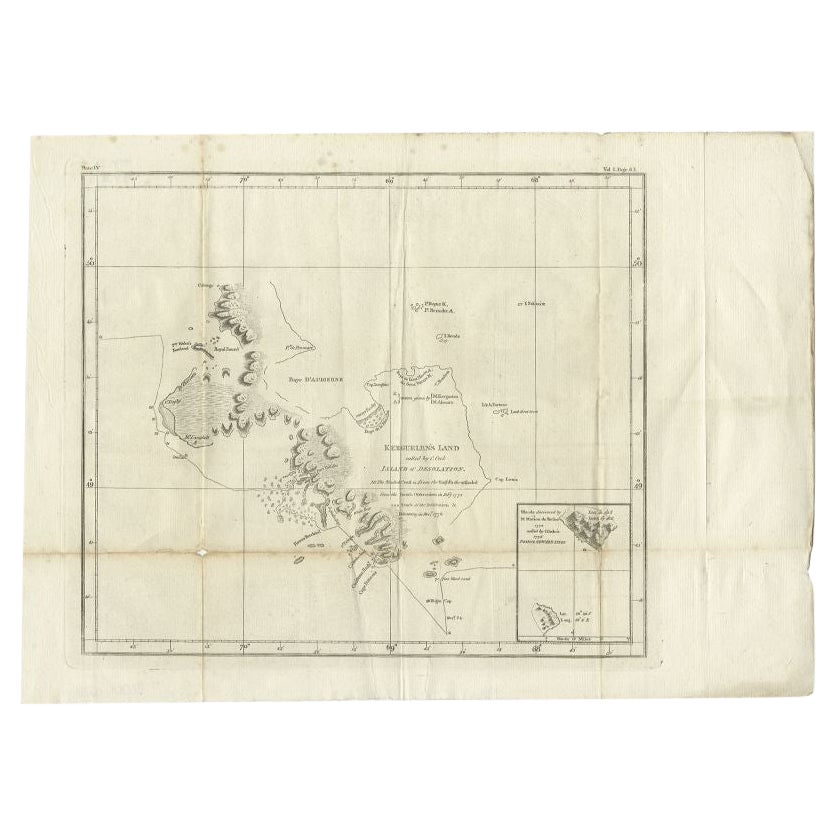
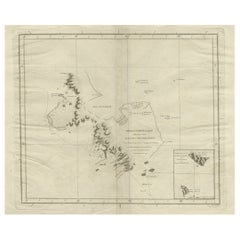
Antique Map of the Coast of Kerguelens Island by Cook, 1803
About the Item
Antique map Desolation Islands titled 'Van Kerguelens Land door Cook genaamd (..)'. Antique map of Kerguelens island coast, known today as the Desolation islands. Originates from 'Reizen Rondom de Waereld door James Cook (..)'.
Artists and Engravers: Translated by J.D. Pasteur. Published by Honkoop, Allart en Van Cleef.
Condition: Good, general age-related toning. Some wear, please study image carefully.
Date: 1803
Overall size: 43 x 25.5 cm.
Image size: 28 x 23.5 cm
We sell original antique maps to collectors, historians, educators and interior decorators all over the world. Our collection includes a wide range of authentic antique maps from the 16th to the 20th centuries. Buying and collecting antique maps is a tradition that goes back hundreds of years. Antique maps have proved a richly rewarding investment over the past decade, thanks to a growing appreciation of their unique historical appeal. Today the decorative qualities of antique maps are widely recognized by interior designers who appreciate their beauty and design flexibility. Depending on the individual map, presentation, and context, a rare or antique map can be modern, traditional, abstract, figurative, serious or whimsical. We offer a wide range of authentic antique maps for any budget.
- Dimensions:Height: 10.04 in (25.5 cm)Width: 16.93 in (43 cm)Depth: 0 in (0.01 mm)
- Materials and Techniques:
- Period:
- Date of Manufacture:1803
- Condition:
- Seller Location:Langweer, NL
- Reference Number:
About the Seller
5.0
Platinum Seller
These expertly vetted sellers are 1stDibs' most experienced sellers and are rated highest by our customers.
Established in 2009
1stDibs seller since 2017
1,960 sales on 1stDibs
Typical response time: <1 hour
- ShippingRetrieving quote...Ships From: Langweer, Netherlands
- Return PolicyA return for this item may be initiated within 14 days of delivery.
More From This SellerView All
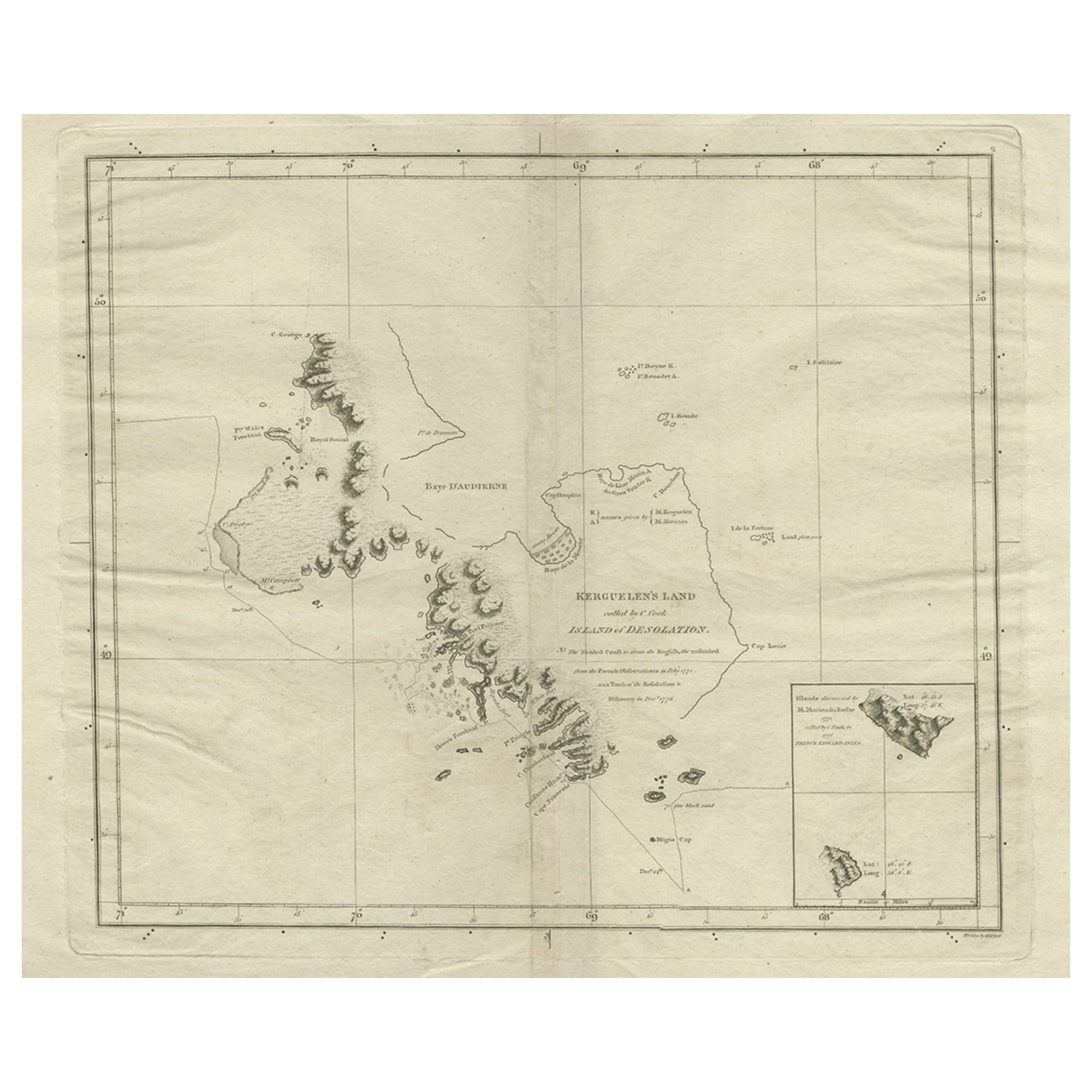
- Antique Map of Kerguelens Island Coast by Cook, 1784By James CookLocated in Langweer, NLAntique print titled 'Kerguelen's Land (..)'. Antique map of Kerguelens island coast, known today as the Desolation islands. Originates from 'A Voyage to the Pacific Ocean: Undertaken, by the Command of His Majesty, for Making Discoveries in the Northern Hemisphere (..)' published in Dublin. Artists and Engravers: James Cook...Category
Antique 18th Century Prints
MaterialsPaper
- Antique Map of Kerguelens Island Coast in the Indian Ocean by Cook, 1785By James CookLocated in Langweer, NLAntique print titled 'Kerguelen's Land (..)'. Antique map of Kerguelens island coast, known today as the Desolation islands. Originates from 'Voyage to the Pacific Ocean, undertaken ...Category
Antique 18th Century Prints
MaterialsPaper
- Antique Map of the Friendly Islands by Cook, 1803Located in Langweer, NLAntique map Friendly Islands titled 'Kaart van de Vrienden Eilanden'. Antique map of the Friendly Islands depicting Rotterdam or Anamocka, Middelburg or Eaoowe and Amsterdam or Tonga...Category
Antique 19th Century Maps
MaterialsPaper
- Antique Map of the Friendly Islands by Cook, 1803Located in Langweer, NLAntique map Friendly Islands titled 'Kaart van de Vrienden-Eilanden'. Antique map of the Friendly Islands depicting Rotterdam or Anamocka, Middelburg or Eaoowe and Amsterdam or Tonga...Category
Antique 19th Century Maps
MaterialsPaper
- Antique Map of Suffren Island by Cook, 1803Located in Langweer, NLAntique map Australia titled 'Gezigt van het Eil. Suffren'. Antique map of Suffren Island. Originates from 'Reizen Rondom de Waereld door James C...Category
Antique 19th Century Maps
MaterialsPaper
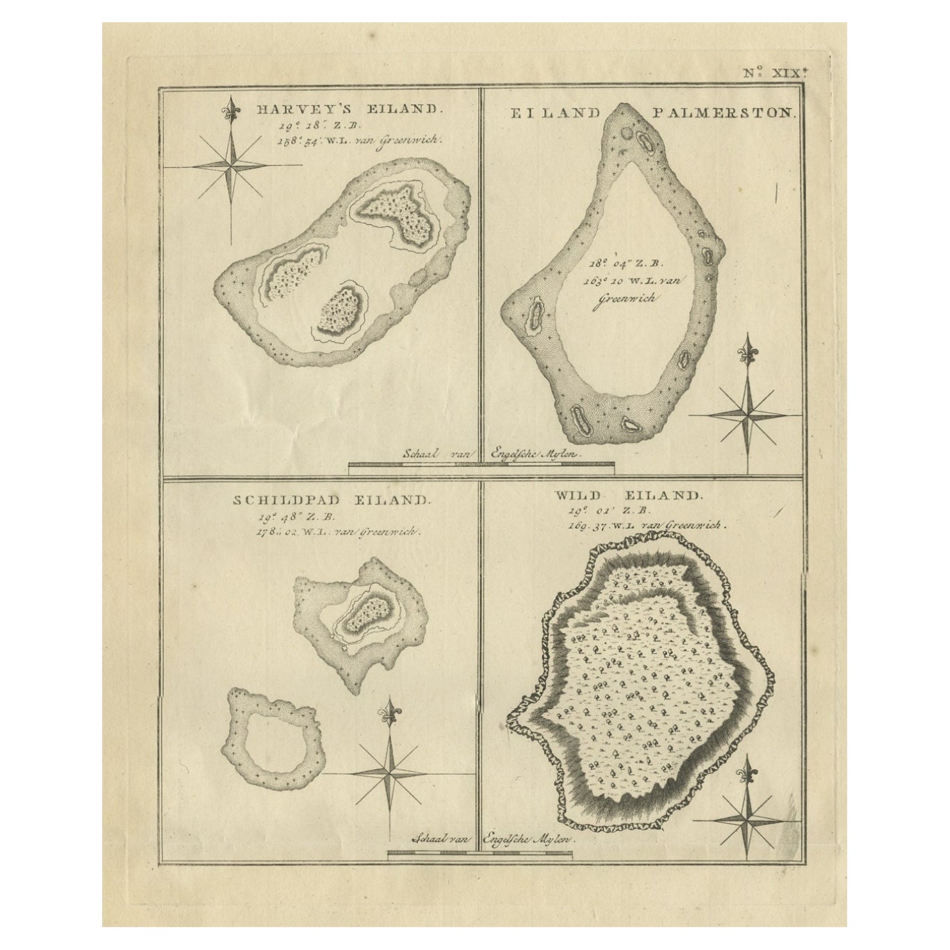
- Antique Map of Harvey Island and Surroundings by Cook, 1803Located in Langweer, NLAntique map Oceania titled 'Harvey's Eiland...''. This map originates from 'Reizen Rondom de Waereld door James Cook''. Old engraving by James Cook 1778. Engraved by Robert Bern...Category
Antique 19th Century Maps
MaterialsPaper


You May Also Like
- Antique 1803 Italian Map of Asia Including China Indoneseia IndiaLocated in Amsterdam, Noord HollandAntique 1803 Italian Map of Asia Including China Indoneseia India Very nice map of Asia. 1803. Additional information: Type: Map Country of Manufacturing: Europe Period: 19th centu...Category
Antique 19th Century European Maps
MaterialsPaper
- 1854 Map of Massachusetts, Connecticut and Rhode Island, Antique Wall MapLocated in Colorado Springs, COThis striking wall map was published in 1854 by Ensign, Bridgman & Fanning and has both full original hand-coloring and original hardware. This impression is both informative and highly decorative. The states are divided into counties, outlined in red, green, and black, and subdivided into towns. Roads, canals, and railroad lines are prominently depicted, although they are not all labeled. The mapmakers also marked lighthouses, banks, churches, and prominent buildings, with a key at right. The map is an informative and comprehensive overview of the infrastructural development of New England prior to the Civil War. Physical geographies depicted include elevation, conveyed with hachure marks, rivers and lakes. The impression features an inset map of Boston...Category
Antique 19th Century American Maps
MaterialsPaper
- 1861 Topographical Map of the District of Columbia, by Boschke, Antique MapLocated in Colorado Springs, COPresented is an original map of Albert Boschke's extremely sought-after "Topographical Map of the District of Columbia Surveyed in the Years 1856 ...Category
Antique 1860s American Historical Memorabilia
MaterialsPaper
- Large Original Vintage Map of The Pacific Islands Including HawaiiLocated in St Annes, LancashireGreat map of The Pacific Islands Unframed Original color By John Bartholomew and Co. Edinburgh Geographical Institute Published, circa 1...Category
Vintage 1920s British Maps
MaterialsPaper
- Northwest Coast and Isle of Man MapLocated in Cheshire, GBGreenville Collins Northwest Coast and Isle of Man. hand coloured chart, encased in an ebonised frame. Dimensions Height 26.5 Inches Width 30 Inches Depth 1 InchesCategory
Early 20th Century British Maps
MaterialsPaper
- Original Antique Decorative Map of South America-West Coast, Fullarton, C.1870Located in St Annes, LancashireGreat map of Chili, Peru and part of Bolivia Wonderful figural border From the celebrated Royal Illustrated Atlas Lithograph. Original color. Published by Fullarton, Edi...Category
Antique 1870s Scottish Maps
MaterialsPaper


Recently Viewed
View AllMore Ways To Browse
Antique Cook
1803 Furniture
Cook Islands
Antique Nautical Map
Antique Nautical Maps
Map Of Arabia
Antique Stand Up Scale
Civil War Map
Antique Furniture Cyprus
Antique Linen Map
Antique Nautical Charts
British Isles Antique Map
Georgia Map
Map Of West Indies
Scottish Coat Of Arms
Speed Map
West Indies Map
Antique Map Of South Africa