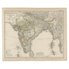
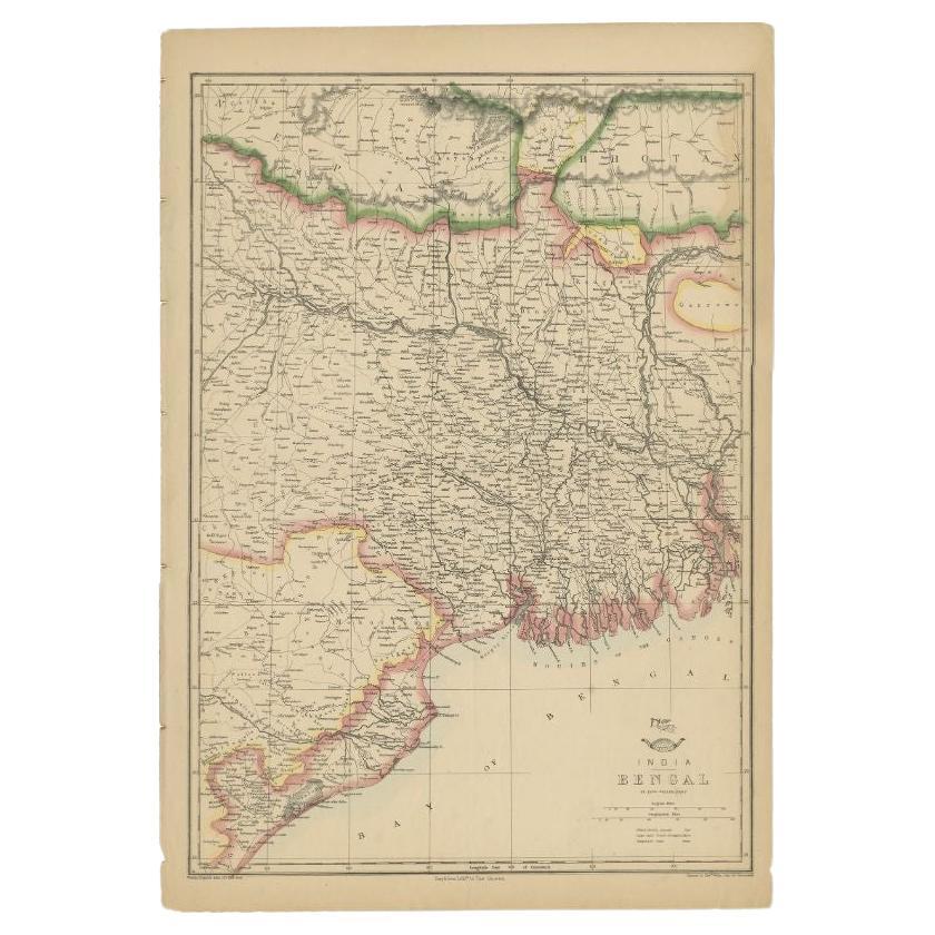
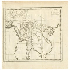
Antique Map of India and Burma at The Time of the British Empire, 1834
View Similar Items


Want more images or videos?
Request additional images or videos from the seller
1 of 5
Antique Map of India and Burma at The Time of the British Empire, 1834
About the Item
- Dimensions:Height: 17.33 in (44 cm)Width: 14.38 in (36.5 cm)Depth: 0 in (0.01 mm)
- Materials and Techniques:
- Period:
- Date of Manufacture:1834
- Condition:
- Seller Location:Langweer, NL
- Reference Number:Seller: BG-067541stDibs: LU3054326359152
About the Seller
5.0
Platinum Seller
These expertly vetted sellers are 1stDibs' most experienced sellers and are rated highest by our customers.
Established in 2009
1stDibs seller since 2017
1,965 sales on 1stDibs
More From This SellerView All
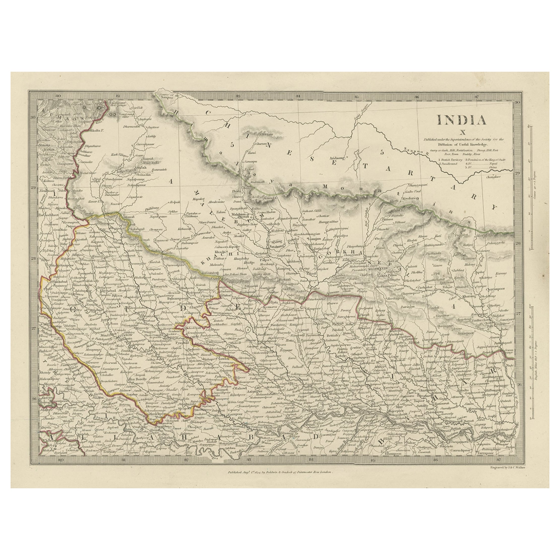
- Original Antique Map of Part of the Bahar Region (India), 1834Located in Langweer, NLAntique map titled 'India X'. Old steel engraved map of part of the Bahar region, it also shows part of Nepal. Artists and Engravers: Engraved by J. & C. Walker. Published under th...Category
Antique 19th Century Maps
MaterialsPaper
- Antique Map of the Burmese Empire by Wyld, '1845'Located in Langweer, NLAntique map titled 'Map of Burman Empire, Siam, Cochin China and Ton-King'. Original antique map of the Burmese Empire. This map originates from 'An Atlas of the World, Comprehending...Category
Antique Mid-19th Century Maps
MaterialsPaper
 $220 Sale Price20% Off
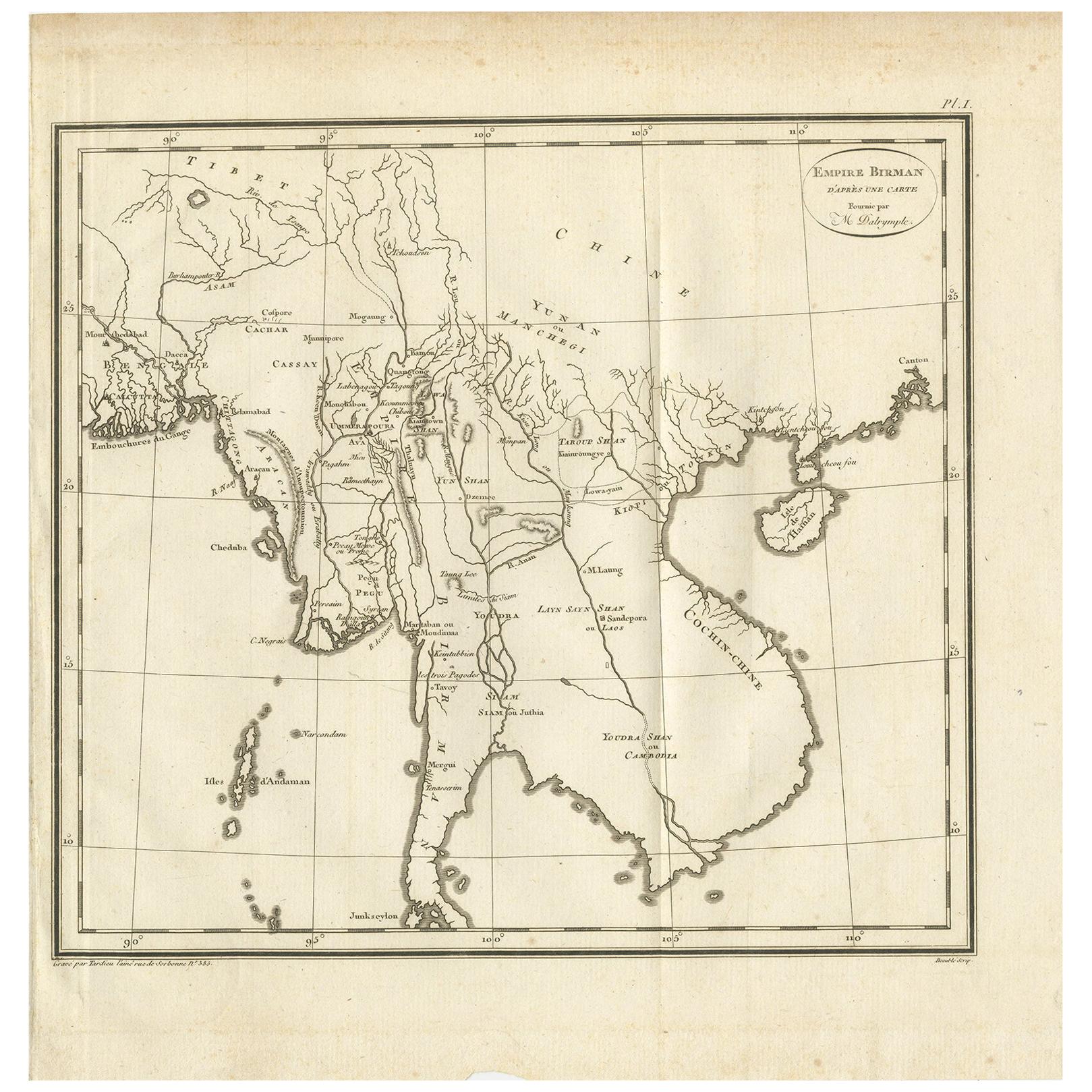
 - Antique Map of the Burmese Empire by Symes, '1800'Located in Langweer, NLAntique map titled 'Empire Birman d'après une carte'. Map of the Burmese Empire. This map originates from 'Relation de l'Ambassade Anglaise, envoyée en 1795 dans le Royaume d'Ava, ou...Category
Antique Early 19th Century Maps
MaterialsPaper
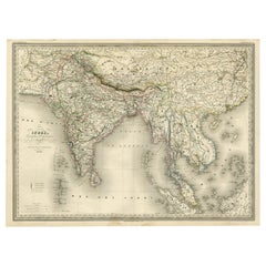
- Superb, Large Map of British India, Chinese Empire, Indochina, Malaysia, 1860Located in Langweer, NLAntique map titled 'Indes, colonies Anglaises.' Large map of the East Indies, British Colonies. A superb, large-scale map of British India, the Chinese Empire, Indochina, the Malay Peninsula, and parts of Sumatra and Borneo. This large original antique map originates from: 'Atlas Universel Physique, Historique et Politique de Geeographie Ancienne et Moderne ' by H. Dufour. Published 1860. Artists and Engravers: Made by 'Charles Dyonnet' after 'Dufour'. Charles Dyonnet (1822 - c. 1880) was an extremely active Paris based engraver working in the mid to late 19th century. From his offices at 220 Rue St. Jacques, Paris, Dyonnet engraved numerous maps for many of the most prominent 19th French cartographic publishers including Vuillemin, Dufour, Fremin and Duvotenay. From 1850-1861, he held the coveted position of 'Graveur du Depot de la Marine' and in this position engraved numerous French naval and military maps...Category
Antique 1860s Maps
MaterialsPaper
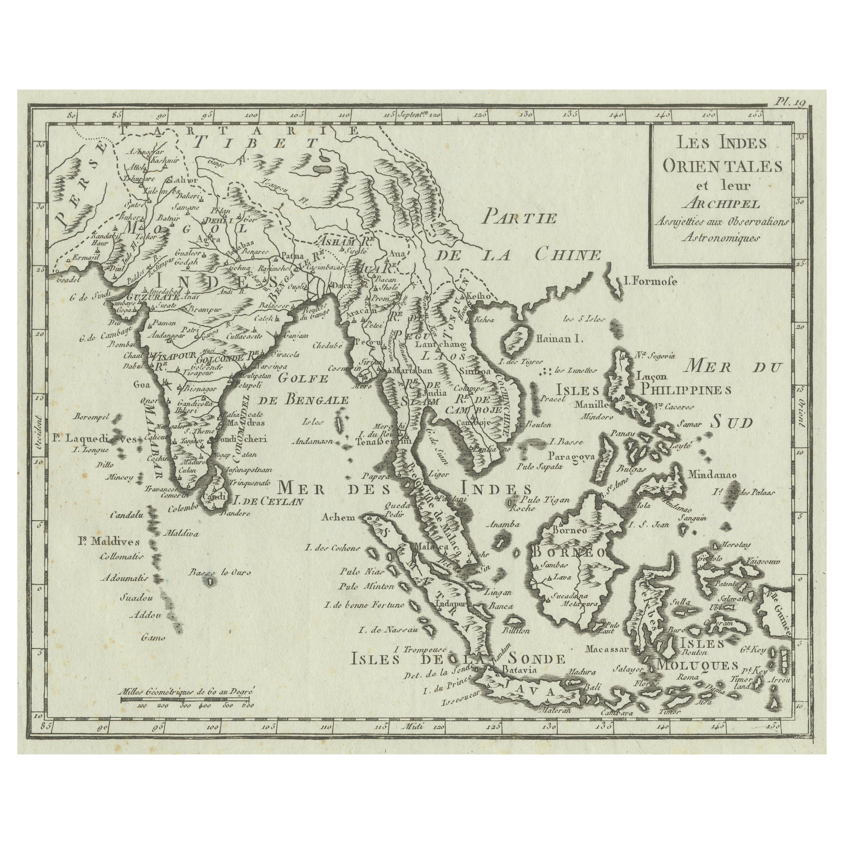
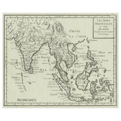
- Antique Map of India, the East Indies and the PhilippinesLocated in Langweer, NLAntique map titled 'Les Indes Orientales et leur Archipel'. Original antique map of India, the East Indies and the Philippines. Source unknown, to be determined. Published circa 1760.Category
Antique Mid-18th Century Maps
MaterialsPaper
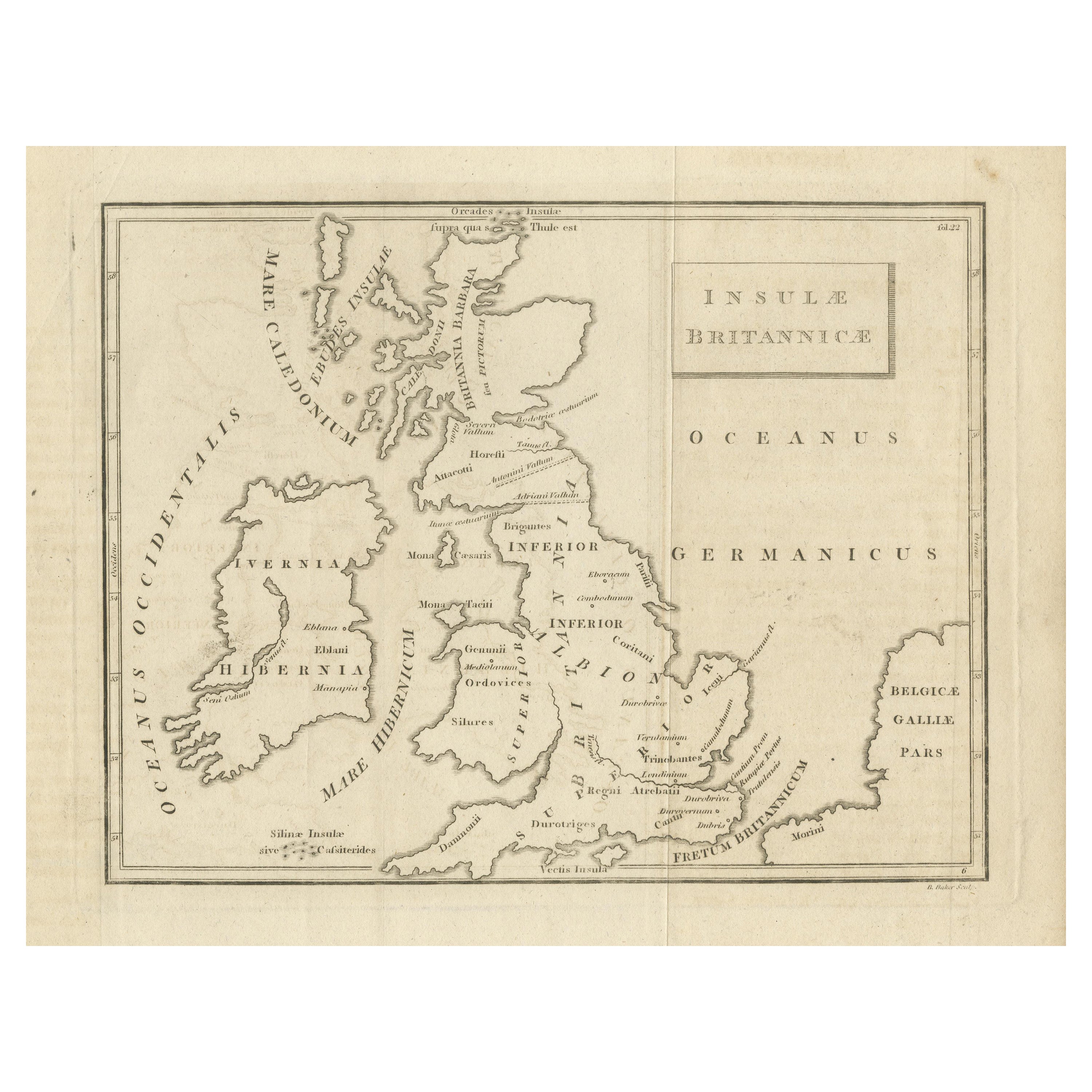
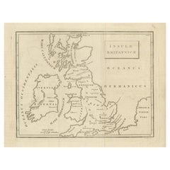
- Antique Map of the British Isles According to the Geography of the Roman EmpireLocated in Langweer, NLAntique map titled 'Insulae Britannicae'. Interesting map of Britain, Scotland, and Ireland. It shows a rudimentary outline of the islands according to the geography of the Roman Emp...Category
Antique Late 18th Century Maps
MaterialsPaper
You May Also LikeView All
- Original Antique Map of India. C.1780Located in St Annes, LancashireGreat map of India Copper-plate engraving Published C.1780 Three small worm holes to right side of map and one bottom left corner Unframed.Category
Antique Early 1800s English Georgian Maps
MaterialsPaper

- The Holy Land at the Time of Jesus: A 17th Century Dutch Map by VisscherBy Nicolaes Visscher IILocated in Alamo, CAThis detailed Dutch map entitled "Het Beloofe de Landt Canaan door wandelt van onsen Salichmaecker Iesu Christo, nessens syne Apostelen" by Nicolaes Visscher was published in Amsterd...Category
Antique Mid-17th Century Dutch Maps
MaterialsPaper
- Map of the Republic of GenoaLocated in New York, NYFramed antique hand-coloured map of the Republic of Genoa including the duchies of Mantua, Modena, and Parma. Europe, late 18th century. Dimension: 25...Category
Antique Late 18th Century European Maps
- Antique Map of Principality of MonacoBy Antonio Vallardi EditoreLocated in Alessandria, PiemonteST/619 - "Old Geographical Atlas of Italy - Topographic map of ex-Principality of Monaco" - ediz Vallardi - Milano - A somewhat special edition ---Category
Antique Late 19th Century Italian Other Prints
MaterialsPaper
 $229 Sale Price74% Off
 - Large 17th Century Hand Colored Map of England and the British Isles by de WitBy Frederick de WitLocated in Alamo, CAA large hand colored 17th century map of England and the British Isles by Frederick de Wit entitled "Accuratissima Angliæ Regni et Walliæ Principatus", published in Amsterdam in 1680. It is a highly detailed map of England, Scotland, the Scottish Isles...Category
Antique Late 17th Century Dutch Maps
MaterialsPaper
- Antique 18th Century Map of the Province of Pensilvania 'Pennsylvania State'Located in Philadelphia, PAA fine antique of the colony of Pennsylvania. Noted at the top of the sheet as a 'Map of the province of Pensilvania'. This undated and anonymous map is thought to be from the Gentleman's Magazine, London, circa 1775, although the general appearance could date it to the 1760's. The southern boundary reflects the Mason-Dixon survey (1768), the western boundary is placed just west of Pittsburgh, and the northern boundary is not marked. The map has a number of reference points that likely refer to companion text and appear to be connected to boundaries. The western and southern boundaries are marked Q, R, S, for example. A diagonal line runs from the Susquehanna R to the Lake Erie P. A broken line marked by many letters A, B, N, O, etc., appears in the east. There are no latitude or longitude markings, blank verso. Framed in a shaped contemporary gilt wooden frame and matted under a cream colored matte. Bearing an old Graham Arader Gallery...Category
Antique 18th Century British American Colonial Maps
MaterialsPaper


Recently Viewed
View AllMore Ways To Browse
Burma Antique Map
Devonia Antique
J Thayer
Map Of Antigua
Nicolas De Fer
Antiques From Guatemala
Sumba Map
Used Furniture Cabo San Lucas
Antique Maps Washington Dc
Antique Map Tennessee
Heinrich Kiepert On Sale
Georgetown Map
Large Original Antique Map Of Philadelphia
Tanzania Antique Map
Abraham Ortelius On Sale
William Wyld
Antique Chesapeake Bay Map
Antique Map Of Chesapeake Bay