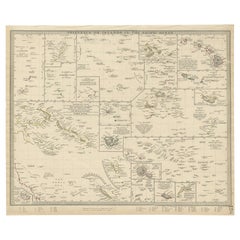
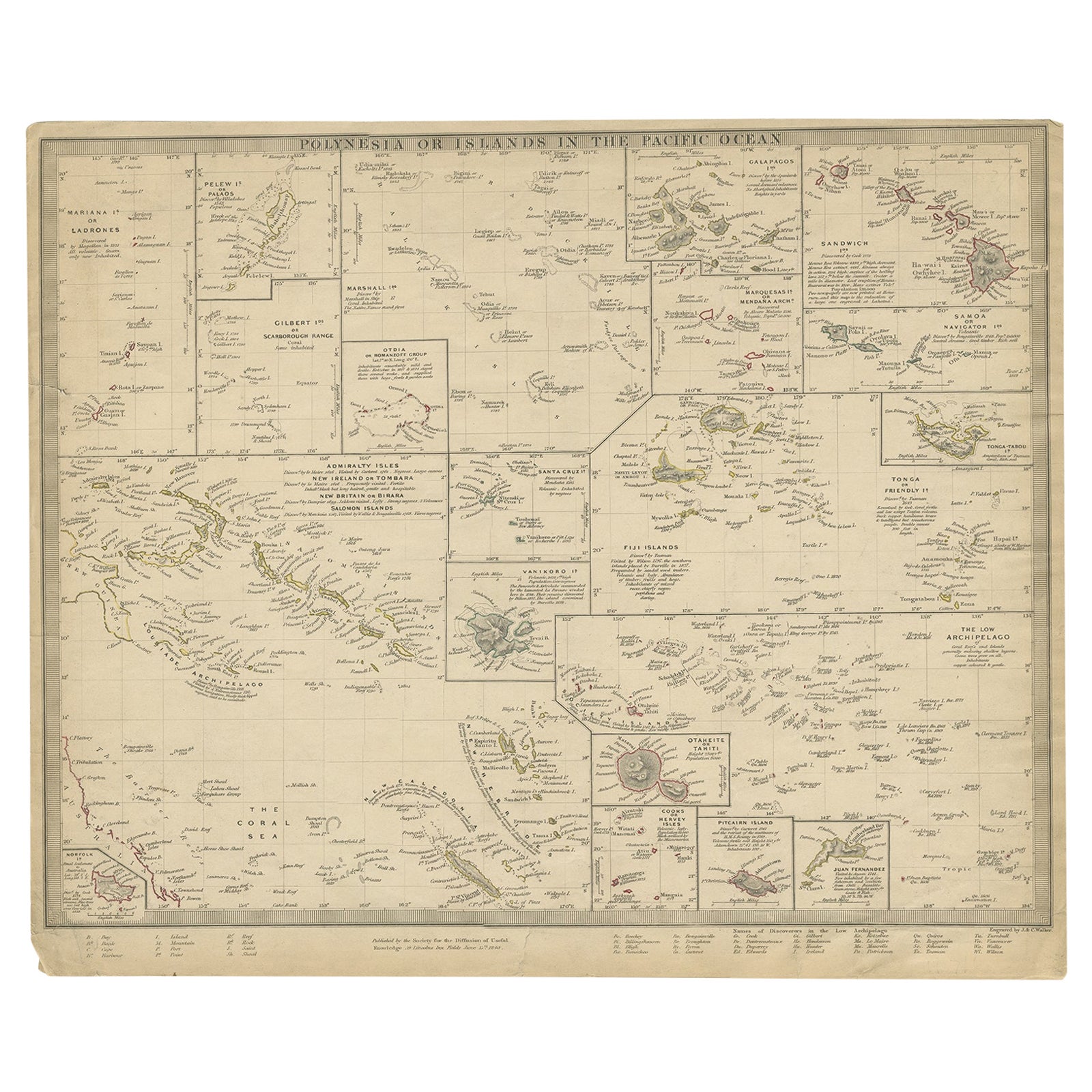
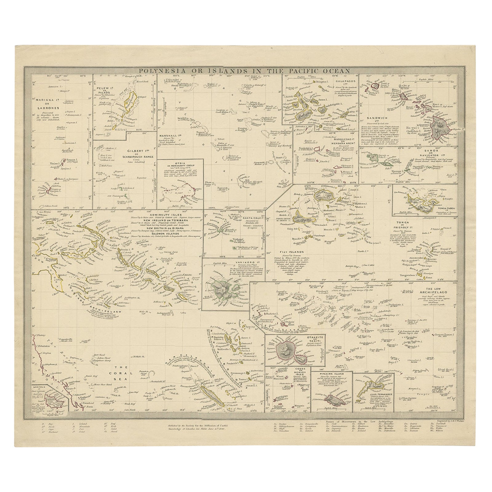
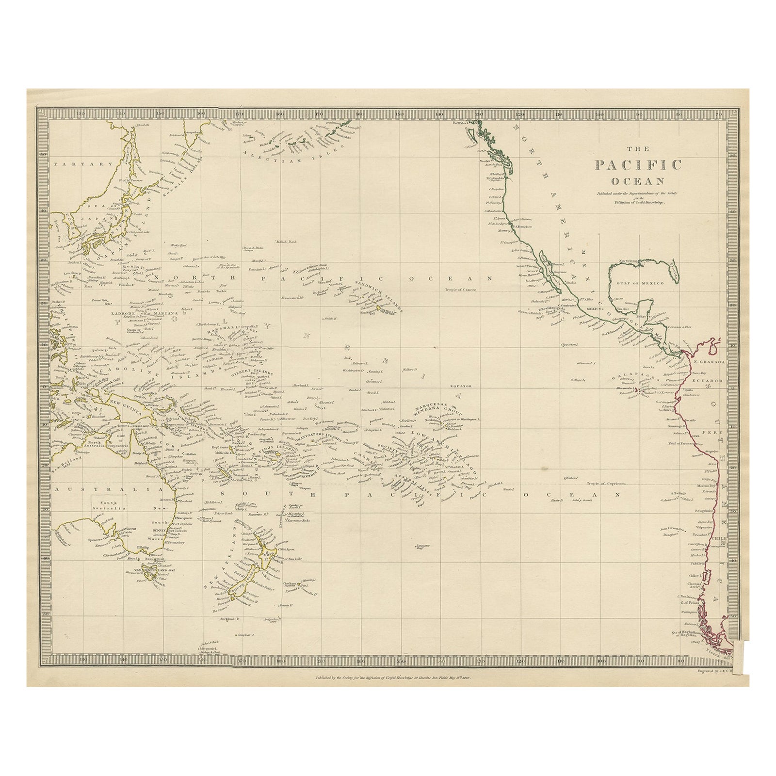
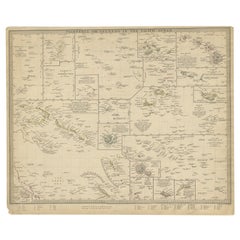
Antique Map of Polynesia by Walker, 1840
View Similar Items


Want more images or videos?
Request additional images or videos from the seller
1 of 5
Antique Map of Polynesia by Walker, 1840
About the Item
- Dimensions:Height: 13.39 in (34 cm)Width: 16.15 in (41 cm)Depth: 0 in (0.01 mm)
- Materials and Techniques:
- Period:
- Date of Manufacture:1840
- Condition:
- Seller Location:Langweer, NL
- Reference Number:Seller: BG-008391stDibs: LU3054327616232
About the Seller
5.0
Platinum Seller
These expertly vetted sellers are 1stDibs' most experienced sellers and are rated highest by our customers.
Established in 2009
1stDibs seller since 2017
1,961 sales on 1stDibs
More From This SellerView All
- Antique Map of Polynesia by Walker, 1840Located in Langweer, NLAntique map titled 'Polynesia or Islands in the Pacific Ocean'. This map depicts various islands including the Lousiade Archipelago, Tahiti, Pitcairn Island, Juan Fernandez, The low ...Category
Antique 19th Century Maps
MaterialsPaper
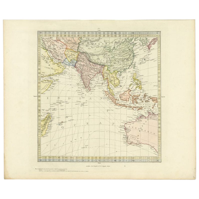
- Antique Map of Southern Asia by Walker, c.1840Located in Langweer, NL"Original antique map of Southern Asia, the East Indies and the Indian Ocean. Also shows part of Australia. Published circa 1840. Artists and Engravers: ...Category
Antique 19th Century Maps
MaterialsPaper
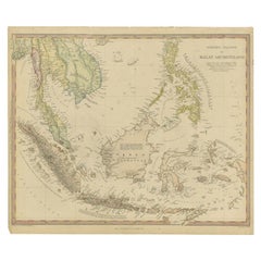
- Antique Map of the East Indies by Walker, c.1840Located in Langweer, NLOriginal antique map of the East Indies including Borneo, Celebes, Java, Sumatra and surrounding islands. Published circa 1840. Artists and Engravers: Engraved by J. & C. Walker ...Category
Antique 19th Century Maps
MaterialsPaper
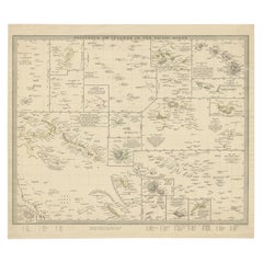
- Antique Map of Polynesia with Details of Many Islands, 1840Located in Langweer, NLAntique map titled 'Polynesia or Islands in the Pacific Ocean'. This map depicts various islands including the Lousiade Archipelago, Tahiti, Pitcairn Island, Juan Fernandez, The lo...Category
Antique 19th Century Maps
MaterialsPaper
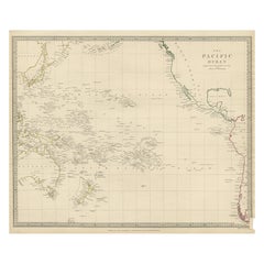
- Antique Map of Australasia, New Zealand, Polynesia & the Pacific Ocean, 1840Located in Langweer, NLAntique map titled 'The Pacific Ocean'. This map depicts Australasia, New Zealand, Polynesia and islands in the Pacific Ocean including the Sandwich Islands. Artists and Engravers: Published by the Society for the Diffusion of Useful Knowledge, 1840. Engraved by J. & C. Walker. Condition: Good, general age-related toning. Few tiny tears...Category
Antique 1840s Maps
MaterialsAbalone, Paper
- Antique Map of Eastern Polynesia, 1849Located in Langweer, NLAntique map titled 'Ost-Polynesien'. Interesting variant issue, with large detailed insets top right of Hawaii volcanos near Kilauea. Insets lower right of Honolulu harbour, island o...Category
Antique Mid-19th Century Maps
MaterialsPaper
 $154 Sale Price30% Off

You May Also LikeView All
- Original Antique Map of Ireland- Kerry. C.1840Located in St Annes, LancashireGreat map of Kerry Steel engraving Drawn under the direction of A.Adlard Published by How and Parsons, C.1840 Unframed.Category
Antique 1840s English Maps
MaterialsPaper

- Original 1891 Walker MapLocated in Norwell, MAOriginal 1891 map of Massachusetts by Walker. Towns include Cambridge, Boston, Dedham, Ashland, Brookline, Newton etc... burl wood frame. Measures...Category
Antique 19th Century Maps
- Original Antique Map of South East Asia by Becker, circa 1840Located in St Annes, LancashireGreat map of South East Asia Steel engraving with original color outline Engraved by Becker Published by Virtue, circa 1840. Unframed.Category
Antique 1840s English Other Maps
MaterialsPaper
- Original Antique English County Map, Hampshire, J & C Walker, 1851Located in St Annes, LancashireGreat map of Hampshire Original colour By J & C Walker Published by Longman, Rees, Orme, Brown & Co. 1851 Unframed.Category
Antique 1850s English Other Maps
MaterialsPaper

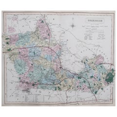
- Original Antique English County Map, Berkshire. J & C Walker, 1851Located in St Annes, LancashireGreat map of Berkshire Original colour By J & C Walker Published by Longman, Rees, Orme, Brown & Co. 1851 Unframed.Category
Antique 1850s English Other Maps
MaterialsPaper
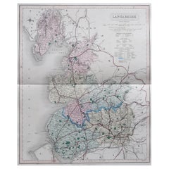
- Original Antique English County Map, Lancashire, J & C Walker, 1851Located in St Annes, LancashireGreat map of Lancashire Original colour By J & C Walker Published by Longman, Rees, Orme, Brown & Co. 1851 Unframed.Category
Antique 1850s English Other Maps
MaterialsPaper


Recently Viewed
View AllMore Ways To Browse
Santa Cruz Island
Antique Victorian Santa
Antique Furniture Santa Cruz
Antique Map Of Michigan
Astrology Map
Yugoslavia Map
Antique Map Bermuda
William Dampier
Denver Map
Vintage Schoolroom
Antique Alabama Map
Antique Maps Perth
Antique Maps Surrey
Moldova Antique Map
Trinidad Map
Berkshire Antique Map
Australasia Antique Map
Seville Map