Items Similar to Antique Map of Southern Europe by F. Delamarche, 1837


Want more images or videos?
Request additional images or videos from the seller
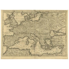
Antique Map of Southern Europe by F. Delamarche, 1837
About the Item
Title: Géographie des Hébreux ou Tableau de la Dispersion des enfants de Noé
- **Origin**: From 'Atlas De La Géographie Ancienne' by F. Delamarche
- **Date of Publication**: 1837
Description: This exquisite antique map offers a unique glimpse into the historical and biblical geography as understood in the early 19th century. It depicts the dispersion of Noah's descendants post the Biblical flood, as described in Hebrew traditions. This map is not only a cartographic representation but also a piece of historical art.
The map is detailed, highlighting various regions, territories, and significant landmarks relevant to the biblical narrative. The craftsmanship is evident in the elegant script and the careful detailing of geographical features.
This map is a remarkable find for collectors interested in biblical history, antique maps, or the work of F. Delamarche. It offers both aesthetic beauty and historical value, making it a prized piece for any collection.
---
This description aims to provide potential collectors or enthusiasts with comprehensive information about the map, emphasizing its historical significance, condition, and collector's value.
- Dimensions:Height: 13.12 in (33.3 cm)Width: 19.1 in (48.5 cm)Depth: 0.02 in (0.5 mm)
- Materials and Techniques:
- Period:
- Date of Manufacture:1837
- Condition:Minor structural damages. Preserved in good condition, considering its age. Some aging and weathering consistent with antique paper items are present, adding to its historical authenticity.
- Seller Location:Langweer, NL
- Reference Number:
About the Seller
5.0
Platinum Seller
These expertly vetted sellers are 1stDibs' most experienced sellers and are rated highest by our customers.
Established in 2009
1stDibs seller since 2017
1,950 sales on 1stDibs
Typical response time: <1 hour
- ShippingRetrieving quote...Ships From: Langweer, Netherlands
- Return PolicyA return for this item may be initiated within 14 days of delivery.
More From This SellerView All
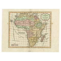
- Antique Map of Africa by Delamarche, 1806Located in Langweer, NLAntique map titled 'L'Afrique'. Decorative map of Africa by Robert de Vaugondy, revised and published by Delamarche. Source unknown, to be determined. Artists and Engravers: Charl...Category
Antique 19th Century Maps
MaterialsPaper
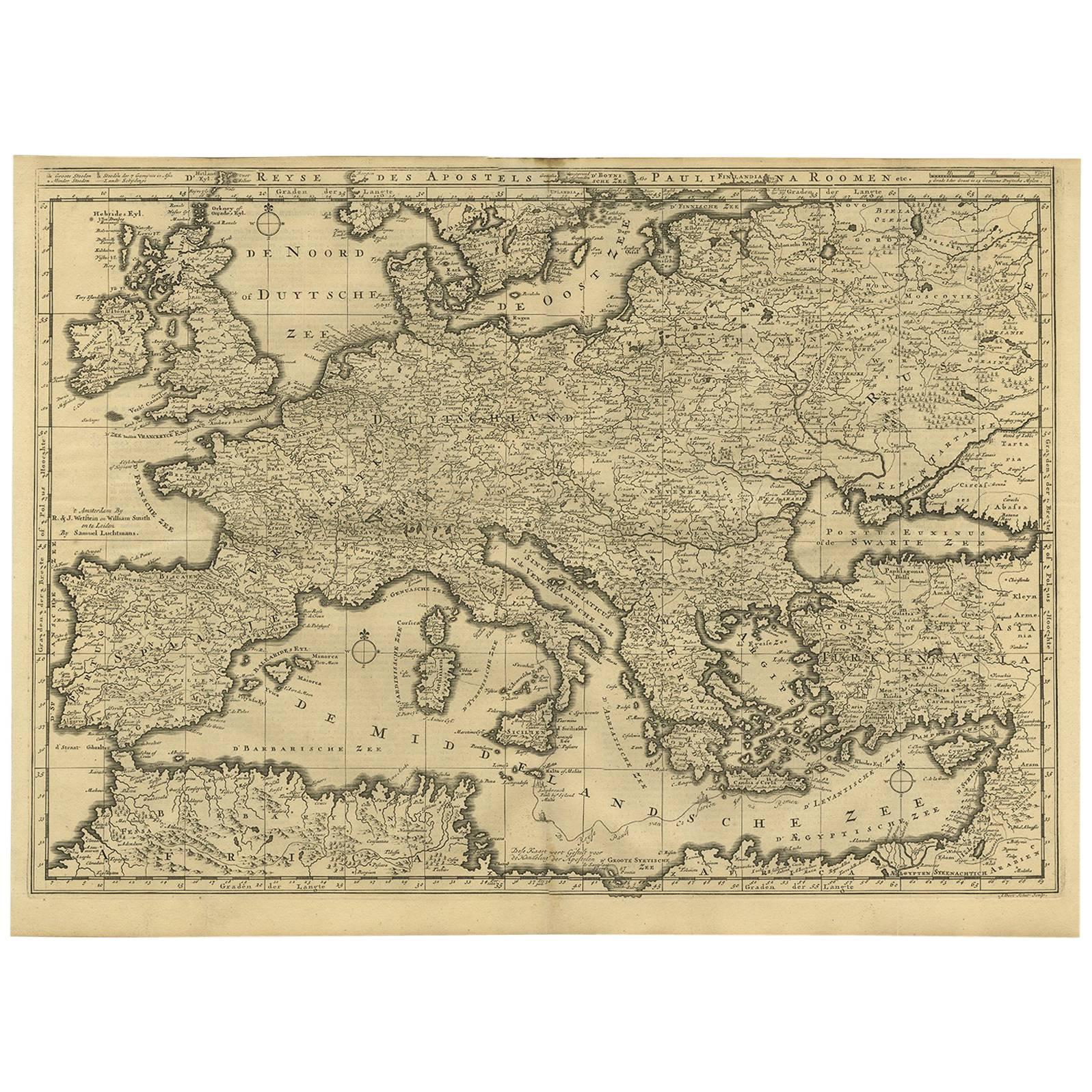
- Rare Antique Bible Map of Southern Europe by A. Schut, 1743Located in Langweer, NLAntique map of the Mediterranean and a large part of Europe, illustrating the voyage of St. Paul to Rome. This map originates from ‘Biblia Sacra, dat is, de H. Schriftuer van het Oud...Category
Antique Mid-18th Century Maps
MaterialsPaper
- Antique Map of Southern Africa by Levasseur, 1875Located in Langweer, NLAntique map titled 'Afrique Méridionale'. Large map of Southern Africa. This map originates from 'Atlas de Géographie Moderne Physique et Politique' b...Category
Antique Late 19th Century Maps
MaterialsPaper
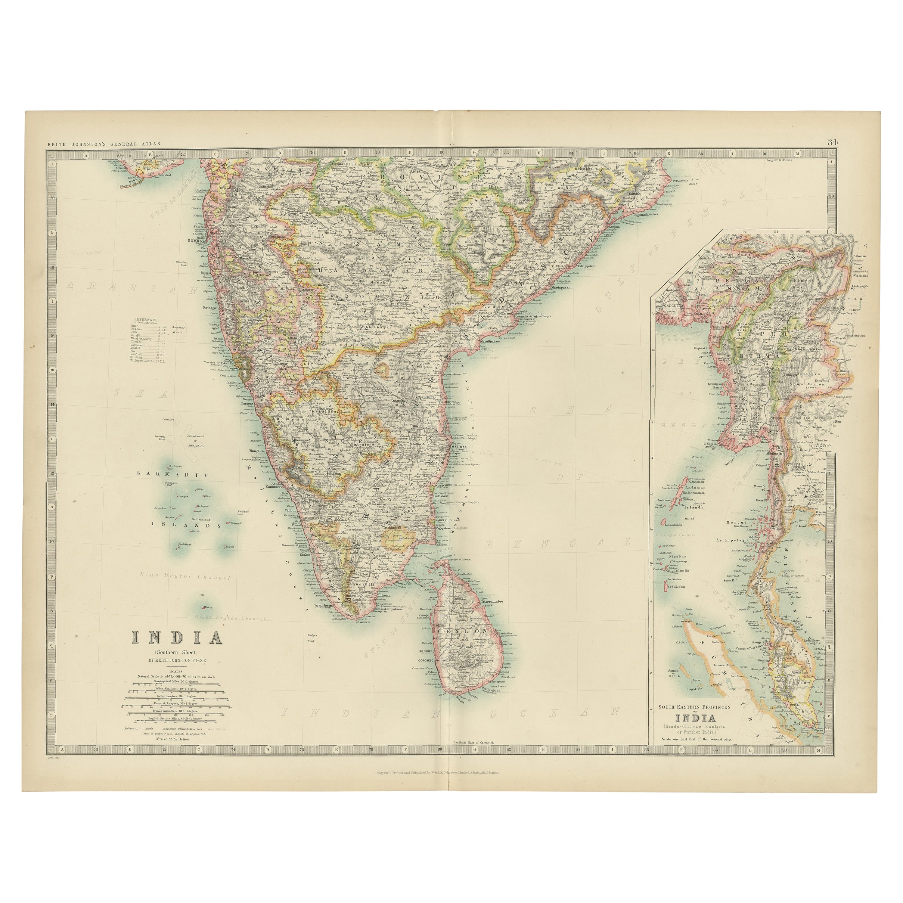
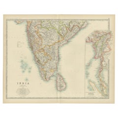
- Antique Map of India ( Southern ) by Johnston (1909)Located in Langweer, NLAntique map titled 'India'. Original antique map of India Southern sheet. With inset maps of south eastern provinces of India. This map originates from the ‘Royal Atlas of Modern Geo...Category
Early 20th Century Maps
MaterialsPaper
- Antique Map of the Northern Coast of Africa and Southern Europe, circa 1745By Covens & MortierLocated in Langweer, NLAntique map titled 'In Notitiam Ecclesiasticam Africae Tabula Geographica'. Very decorative hand-colored map of the northern coast of Africa, Spain, Italy and the Mediterranean with the islands of Sardinia, Corsica, Majorca, Minorca etc. Sicily features a smoking Mount Aetna. Embellished with three architectural cartouches...Category
Antique Mid-18th Century Maps
MaterialsPaper
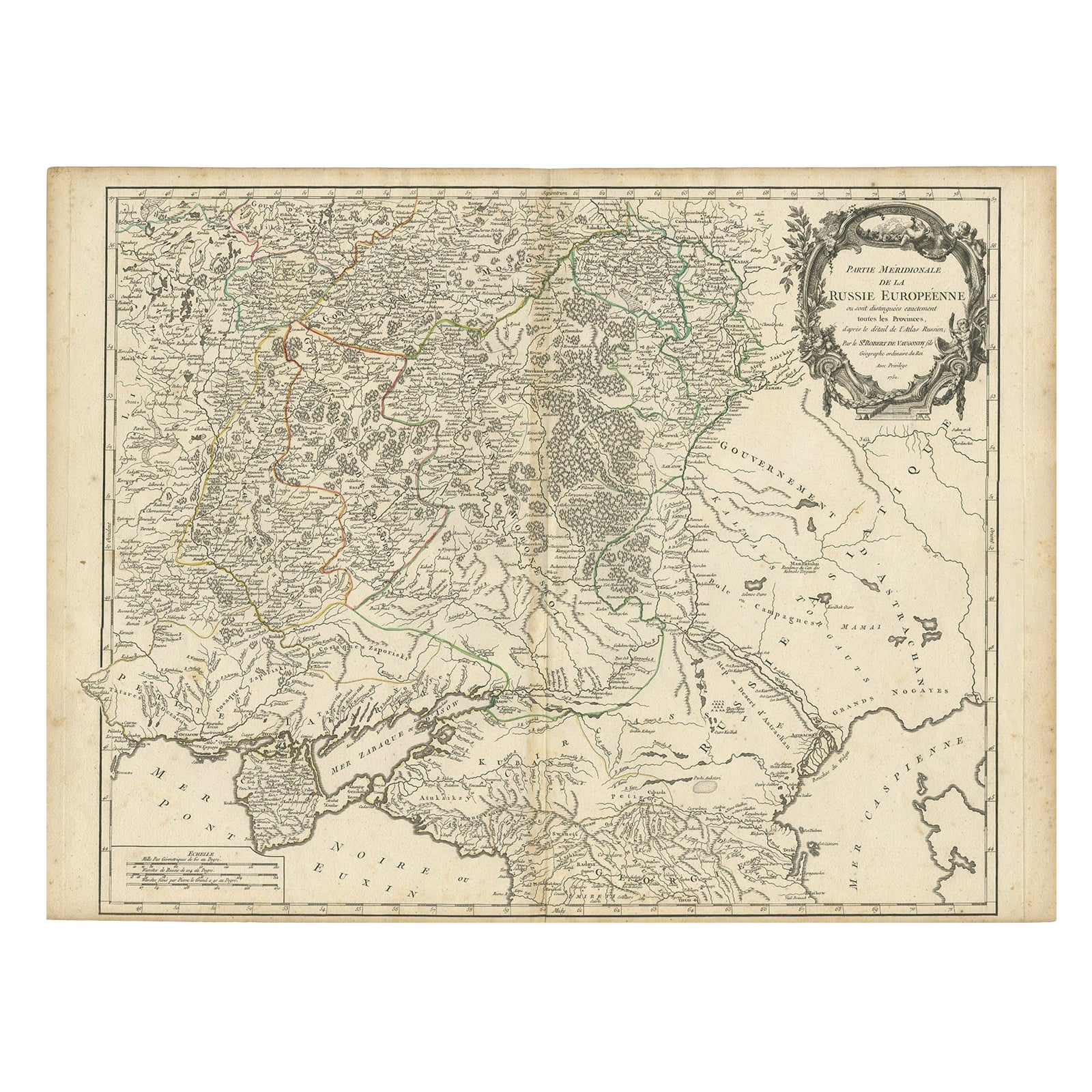
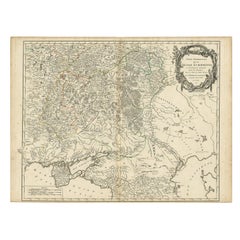
- Detailed Antique Map of the Southern Part of European Russia and Ukraine, 1752Located in Langweer, NLAntique map titled 'Partie meridionale de la Russie Européenne'. Detailed map of the southern part of European Russia by Robert de Vaugondy. It covers from Moscow south to Georgia and from Poland east to the Volga River, including Crimea and Ukraine. Artists and engravers: Gilles Robert de Vaugondy (1688-1766) was the head of a leading family of geographers in eighteenth century France. Gilles got his start when he jointly inherited the shop of Pierre-Moullart Sanson, grandson of the famous geographer Nicholas Sanson. The inheritance included the business, its stock of plates, and a roller press...Category
Antique 1750s Maps
MaterialsPaper


You May Also Like
- Southern & Eastern Europe: A Large 17th C. Hand-colored Map by Sanson & JaillotBy Nicolas SansonLocated in Alamo, CAThis large hand-colored map entitled "Estats de L'Empire des Turqs en Europe, ou sont les Beglerbeglicz our Gouvernements" was originally created by Nicholas Sanson d'Abbeville and t...Category
Antique 1690s French Maps
MaterialsPaper
- America "Amérique Septentrionale": A 19th Century French Map by DelamarcheBy Maison Delamarche 1Located in Alamo, CAThis framed mid 19th century map of North America entitled "Amérique Septentrionale" by Felix Delamarche was published in Paris in 1854 by Quay de l'Horloge du Palais, avec les Carte...Category
Antique Mid-19th Century American Other Maps
MaterialsPaper
- Antique Map of Italy by Andriveau-Goujon, 1843By Andriveau-GoujonLocated in New York, NYAntique Map of Italy by Andriveau-Goujon, 1843. Map of Italy in two parts by Andriveau-Goujon for the Library of Prince Carini at Palazzo Carini i...Category
Antique 1840s French Maps
MaterialsLinen, Paper
- Antique Map of Principality of MonacoBy Antonio Vallardi EditoreLocated in Alessandria, PiemonteST/619 - "Old Geographical Atlas of Italy - Topographic map of ex-Principality of Monaco" - ediz Vallardi - Milano - A somewhat special edition ---Category
Antique Late 19th Century Italian Other Prints
MaterialsPaper
- Southern Greece: A Large 17th C. Hand-colored Map by Sanson and JaillotBy Nicolas SansonLocated in Alamo, CAThis large original hand-colored copperplate engraved map of southern Greece and the Pelopponese Peninsula entitled "La Moree Et Les Isles De Zante, Cefalonie, Ste. Marie, Cerigo & C...Category
Antique 1690s French Maps
MaterialsPaper
- Original Antique Map of Russia By Arrowsmith. 1820Located in St Annes, LancashireGreat map of Russia Drawn under the direction of Arrowsmith Copper-plate engraving Published by Longman, Hurst, Rees, Orme and Brown, 1820 Unframed.Category
Antique 1820s English Maps
MaterialsPaper


Recently Viewed
View AllMore Ways To Browse
Southern Used Furniture
Southern Antique
Southern Antique Furniture
Antique Southern Furniture
Southern Antiques
Southern 19th Century
Map Europe
Maps Europe
Map Of Europe
Maps Of Europe
Antique European Maps
Antique European Map
Antique Maps Europe Maps
Europe Map Antique
Antique Europe Map
Antique Maps Of Europe
Antique Map Europe
Antique Map Of Europe