Items Similar to Antique Map of the Straits of Gibraltar by J. Gascoyne, circa 1716

Want more images or videos?
Request additional images or videos from the seller
1 of 5
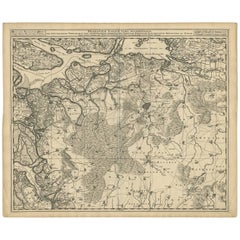
Antique Map of the Straits of Gibraltar by J. Gascoyne, circa 1716
About the Item
Antique map titled 'A Chart of the Straits of Gibraltar'. This chart shows the tides running through the Straits of Gibraltar, between southern Spain and northern Africa. Tide tables appear at top and bottom. Originates from 'The English Pilot' by J. Gascoyne.
- Dimensions:Height: 17.92 in (45.5 cm)Width: 21.66 in (55 cm)Depth: 0.02 in (0.5 mm)
- Materials and Techniques:
- Period:
- Date of Manufacture:circa 1716
- Condition:Repairs at the folding line and right edge. Please study image carefully.
- Seller Location:Langweer, NL
- Reference Number:
About the Seller
5.0
Platinum Seller
These expertly vetted sellers are 1stDibs' most experienced sellers and are rated highest by our customers.
Established in 2009
1stDibs seller since 2017
1,948 sales on 1stDibs
Typical response time: <1 hour
- ShippingRetrieving quote...Ships From: Langweer, Netherlands
- Return PolicyA return for this item may be initiated within 14 days of delivery.
More From This SellerView All
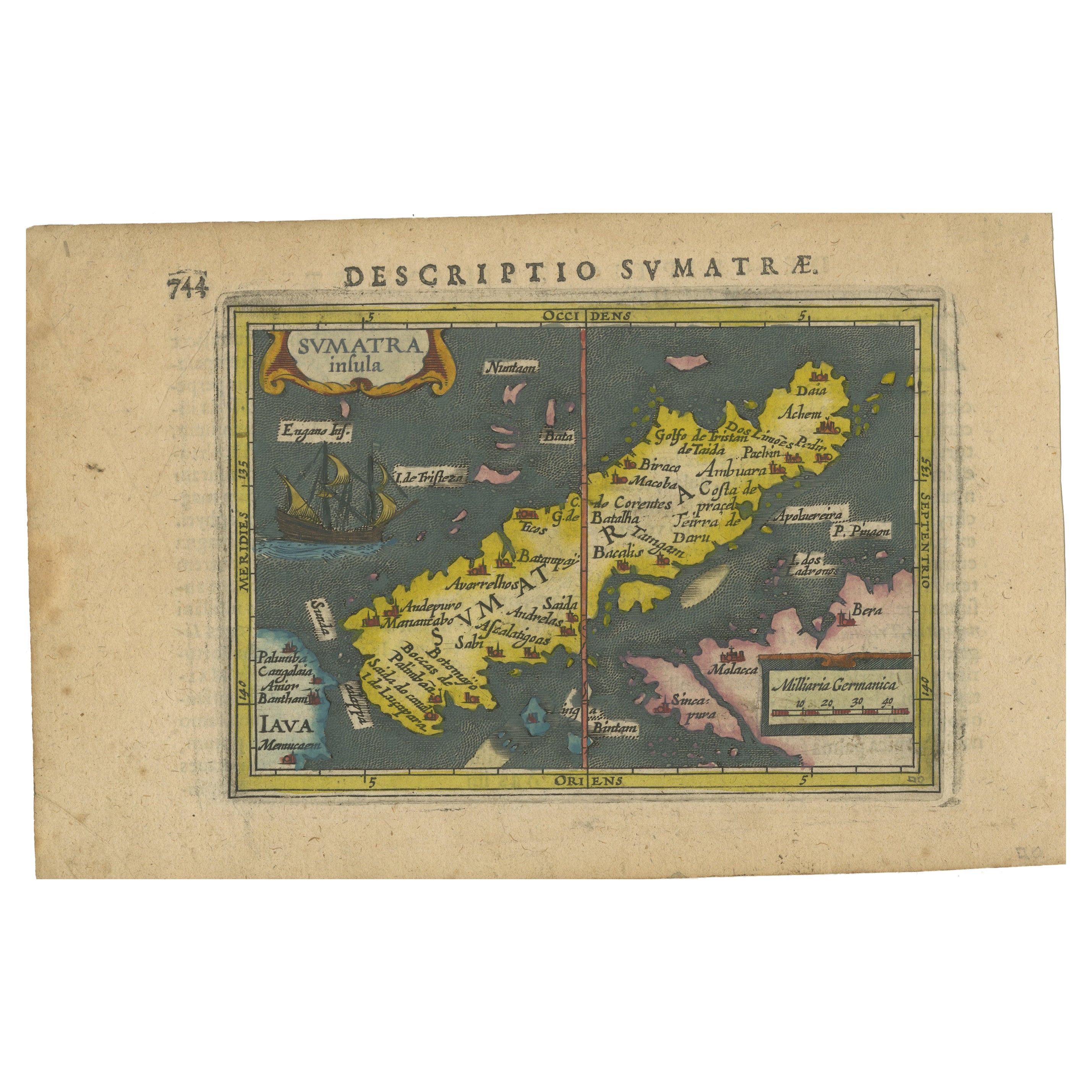
- 1616 Bertius Map of Sumatra, Singapore and the Straits of MalaccaLocated in Langweer, NLTitle: "1616 Bertius Map of Sumatra and the Straits of Malacca" Description: This is an exquisite 1616 original antique map by Petrus Bertius, titled "Sumatra Insula," showcasing Su...Category
Antique Early 17th Century Maps
MaterialsPaper
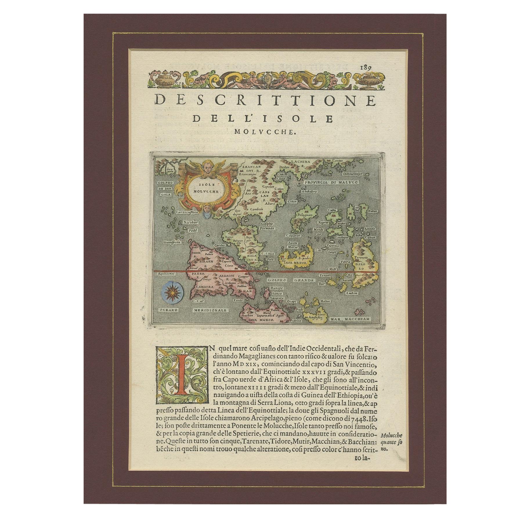
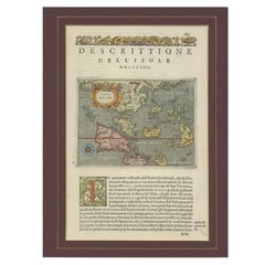
- Antique Map of the Moluccas by Porcacchi, 'circa 1620'Located in Langweer, NLAntique map titled 'Isole Molucche'. The map depicts the East Indies and Indochina, including modern-day Indonesia and the Philippines. The area covered stretches from the Bay of Bengal...Category
Antique Early 17th Century Maps
MaterialsPaper
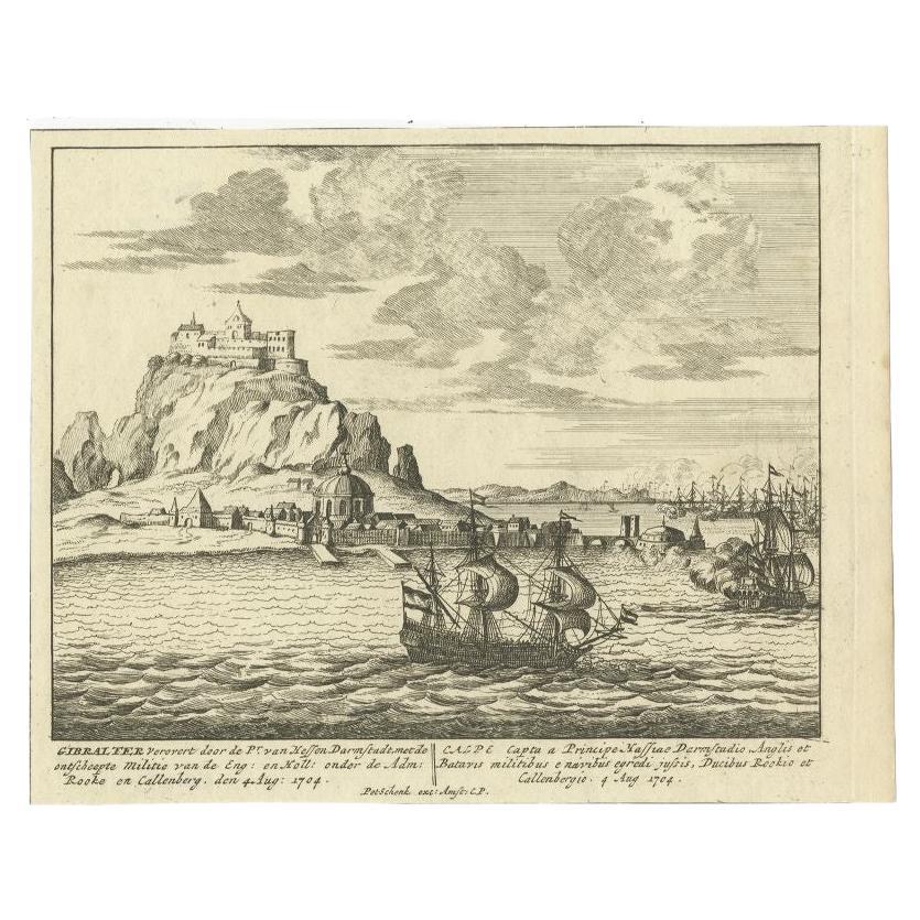
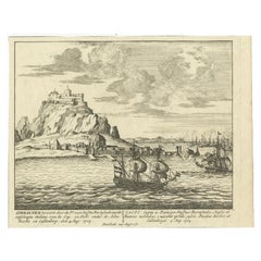
- Antique Print of Gibraltar, c.1720Located in Langweer, NLAntique print titled 'Gibraltar verovert door de Pr. van Hessen Darmstadt (..)'. Copper engraving of the capture of the fortified town of Gibraltar in 1704 during the War of the Span...Category
Antique 18th Century Prints
MaterialsPaper
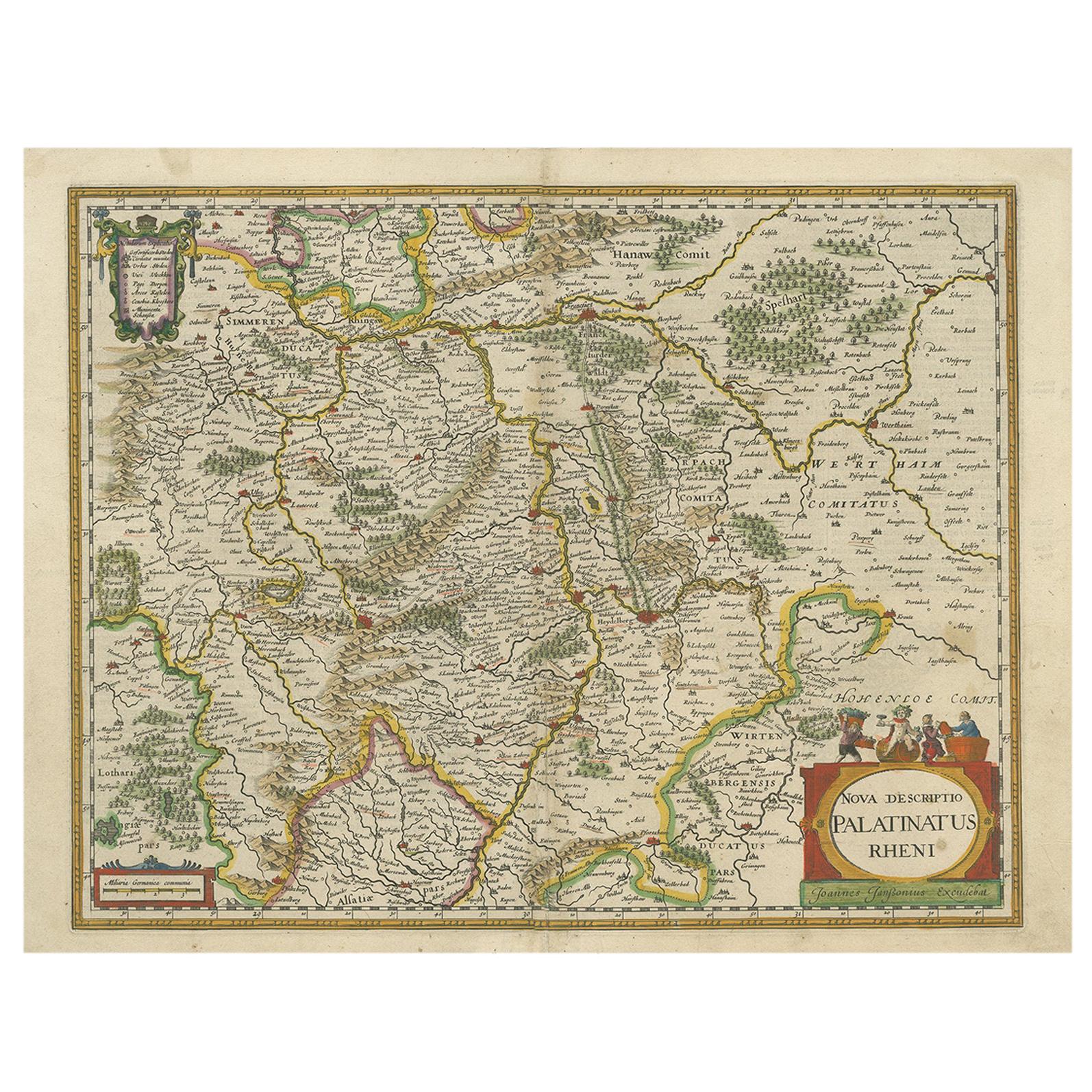
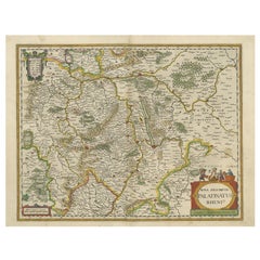
- Antique Map of the Rhine-Palatinate by Janssonius, circa 1630Located in Langweer, NLAntique map titled 'Nova Descriptio Palatinatus Rheni'. Detailed map of the Rhine-Palatinate, a state of Germany located in the west of the country. The map tracks the course of the ...Category
Antique Mid-17th Century Maps
MaterialsPaper
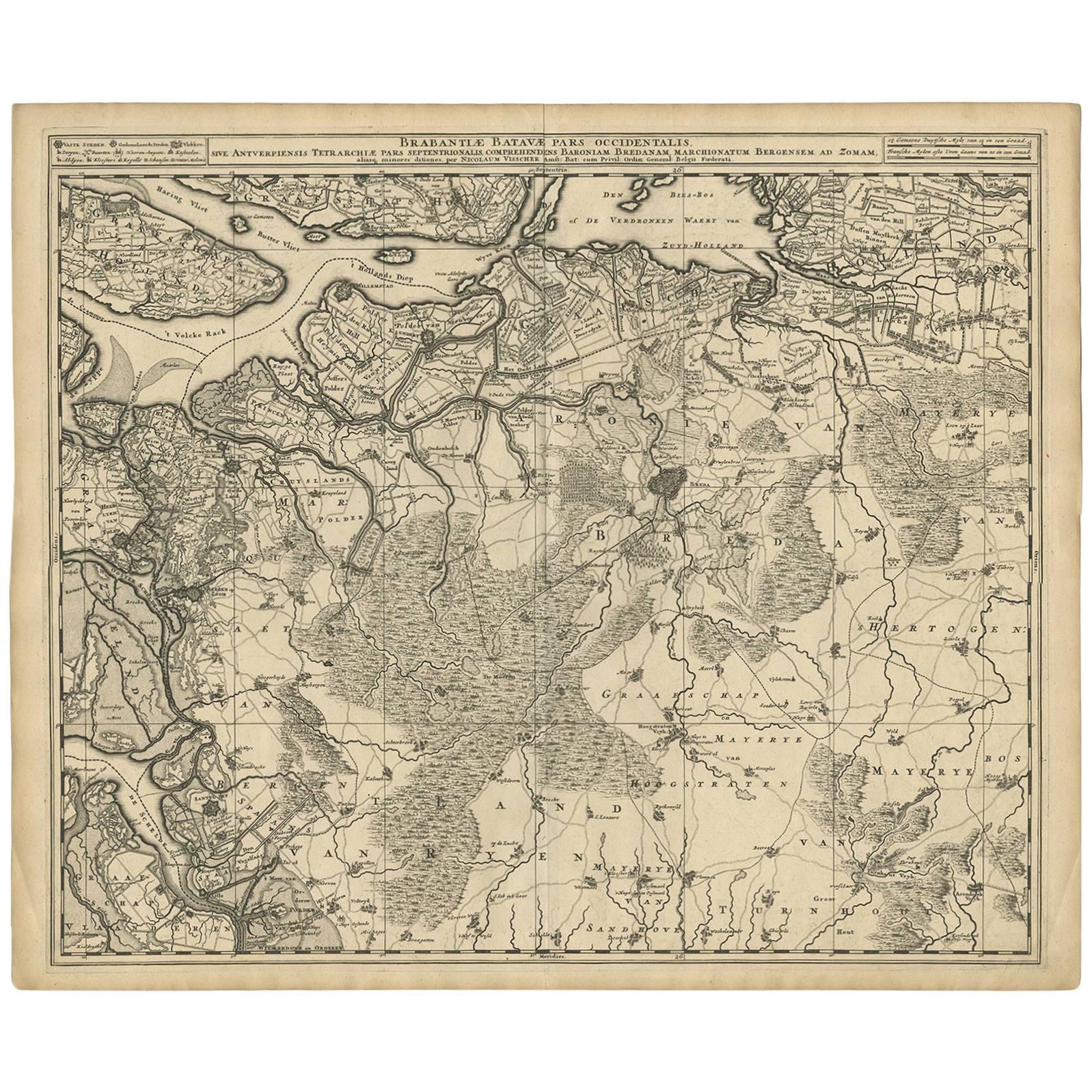
- Antique Map of Brabant 'The Netherlands' by N. Visscher, circa 1690Located in Langweer, NLAntique map titled 'Brabantiae Batavae Pars Occidentalis (..)'. Highly detailed map of the region between Bergen Op Zoom, Breda, Hoogstraten and Sandvliet, The Netherlands. Published...Category
Antique Late 17th Century Maps
MaterialsPaper
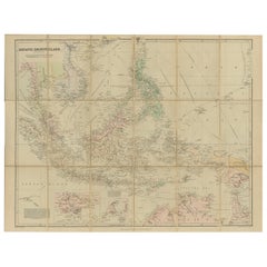
- Antique Map of the Asiatic Archipelago by E. Stanford, circa 1910Located in Langweer, NLAntique folding map titled 'London Atlas Map of the Asiatic Archipelago'. Centered on the Philippines and Borneo, the map shows a number of different seasonal passages through the region to Hong Kong and Macao. With inset maps of Singapore...Category
20th Century Maps
MaterialsPaper

You May Also Like
- 1861 Topographical Map of the District of Columbia, by Boschke, Antique MapLocated in Colorado Springs, COPresented is an original map of Albert Boschke's extremely sought-after "Topographical Map of the District of Columbia Surveyed in the Years 1856 ...Category
Antique 1860s American Historical Memorabilia
MaterialsPaper
- "Clason's Guide Map of Montana" by The Clason Map Company, Circa 1920sLocated in Colorado Springs, COPresented is “Clason's Guide Map of Montana,” published in the early 1920s by the Clason Map Company. Issued as a folding map, this map identifies county boundaries, county seats, Na...Category
Vintage 1920s American Art Deco Maps
MaterialsPaper
- Original Antique Map of The United States of America, circa 1890Located in St Annes, LancashireGreat map of the USA By The Stanford's Geographical Establishment Original colour Unframed.Category
Antique 1890s English Victorian Maps
MaterialsPaper
- Large Original Antique Map of the World, Fullarton, circa 1870Located in St Annes, LancashireGreat map of the World. From the celebrated Royal Illustrated Atlas Lithograph. Original color. Published by Fullarton, Edinburgh, circa 1870. Unframed.Category
Antique 1870s Scottish Maps
MaterialsPaper
- Original Antique Map of Belgium by Tallis, Circa 1850Located in St Annes, LancashireGreat map of Belgium Steel engraving Many lovely vignettes Published by London Printing & Publishing Co. ( Formerly Tallis ), C.1850 Origin...Category
Antique 1850s English Maps
MaterialsPaper
- Large Original Antique Map of The Environs of Dublin, Ireland, circa 1880Located in St Annes, LancashireGreat map of The Environs of Dublin Published circa 1880 Unframed Free shipping.Category
Antique 1880s Scottish Maps
MaterialsPaper


Recently Viewed
View AllMore Ways To Browse
Map Spain
Maps Spain
Map Of Spain
18th Century Southern Antiques
Antique African Table
Antique Map Spain
Antique Maps Spain
Antique Spain Map
Spain Antique Map
Antique Maps Of Spain
Antique Map Of Spain
Antique Map Table
Antique Pilot
Map Southern Africa
Gibraltar Antiques
Antique Chart Table
Gibraltar Antique Map
Antique Prints Maps