Items Similar to British Possessions on the North West Coast of South America, 1860


Want more images or videos?
Request additional images or videos from the seller
1 of 6
British Possessions on the North West Coast of South America, 1860
About the Item
The antique print is a page from an 1860 A Fullarton atlas, providing a comprehensive view of the British possessions on the northwest coast of South America during that time. It features a detailed map of the Island of Trinidad, as well as maps of British Guiana with routes by Sir Robert Schomburgk.
The print includes ornate vignettes that showcase both the region's rich biodiversity with illustrations of local birds such as the Scarlet Ibis and Hummingbirds of Trinidad, and the giant water lily known as Victoria Regia.
In addition to the natural history, the print also portrays cultural elements through depictions of the indigenous populations, specifically the Macusi and Caribisi Indians. It illustrates various aspects of their life, from the preparation of cassava and coffee to their dwellings, costumes, and idols. An image of a sugar mill points to the colonial economic activities prevalent at the time.
This print is not only a map but a historical document, rich with ethnographic and botanical illustrations, reflecting the colonial perspective and interests of the British Empire in 1860. The quality and detail suggest it was a significant educational tool and a piece of art, likely intended for a well-informed audience with an interest in the geography and cultures of British colonies.
- Dimensions:Height: 18.51 in (47 cm)Width: 12.41 in (31.5 cm)Depth: 0 in (0.02 mm)
- Materials and Techniques:
- Period:
- Date of Manufacture:1860
- Condition:The edges of the print show some signs of wear, which is common for documents of this age. Slight discoloration or foxing – the brown spots that often appear on old paper – but not extensive. There's a natural patina.
- Seller Location:Langweer, NL
- Reference Number:
About the Seller
5.0
Platinum Seller
These expertly vetted sellers are 1stDibs' most experienced sellers and are rated highest by our customers.
Established in 2009
1stDibs seller since 2017
1,940 sales on 1stDibs
Typical response time: <1 hour
- ShippingRetrieving quote...Ships From: Langweer, Netherlands
- Return PolicyA return for this item may be initiated within 14 days of delivery.
More From This SellerView All
- Antique Map of the West Coast of North America & North East Coast of Asia '1772'Located in Langweer, NLAntique map titled 'Carte des nouvelles decouvertes/ Extrait d'une Carte Japonoise de l'Universe'. Map of the West Coast of North America and North-East Coast of Asia, based upon Buache's report of the various Russian Discoveries between 1731 and 1742 including the various explorers routes and notes. The lower map is based upon a Japanese map...Category
Antique Late 18th Century Maps
MaterialsPaper
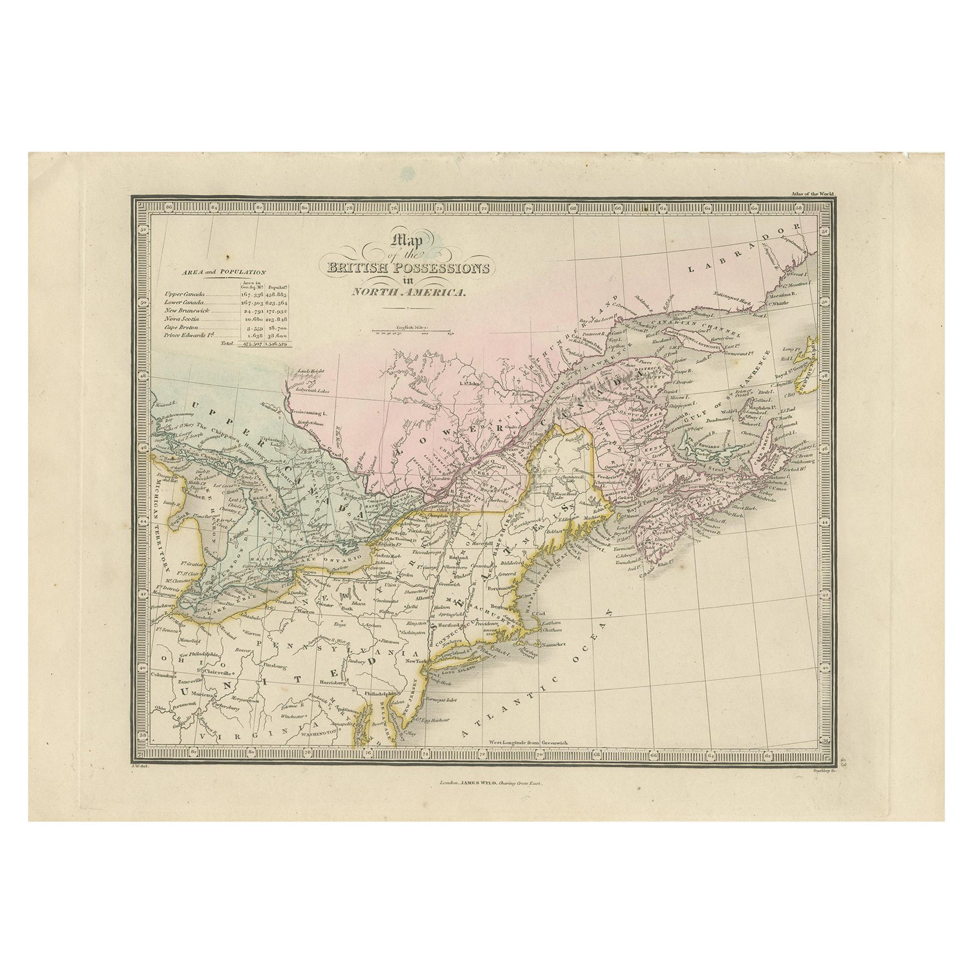
- Antique Map of the British Possessions in North America by Wyld '1845'Located in Langweer, NLAntique map titled 'Map of The British Possessions in North America'. Original antique map of the British Possessions in North America. This map originates from 'An Atlas of the Worl...Category
Antique Mid-19th Century Maps
MaterialsPaper
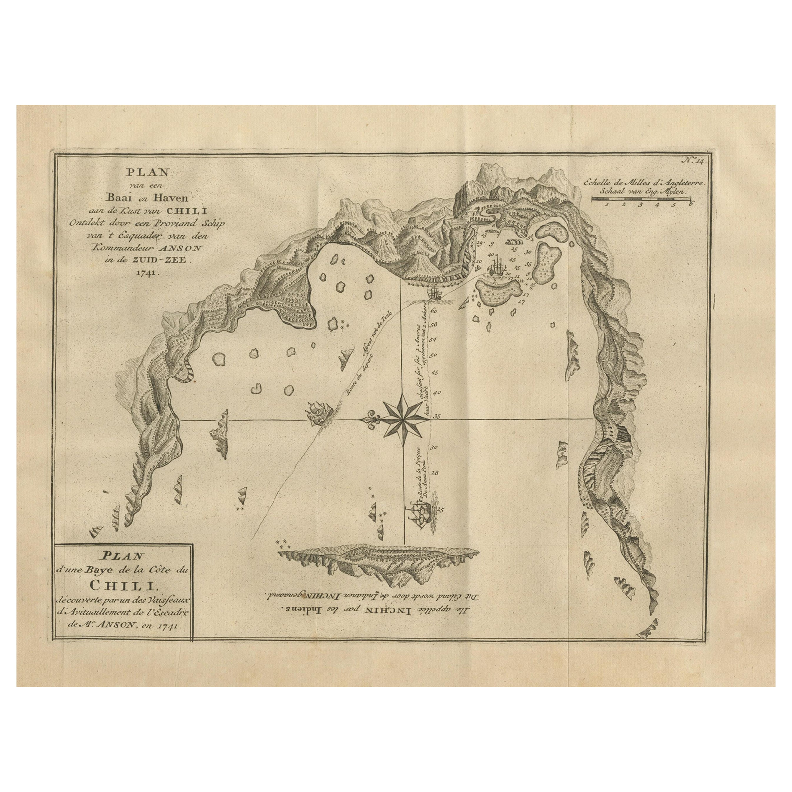
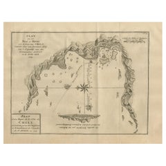
- Antique Map of a Bay on the Coast of Chile, South America, c.1749Located in Langweer, NLAntique map titled 'Plan van een Baai en Haven aan de Kust van Chili (..) - Plan d'une Baye de la Côte du Chili (..)'. Original antique map of a bay on the coast of Chile discovered ...Category
Antique 18th Century Maps
MaterialsPaper
- Antique Map of North America Including the West IndiesLocated in Langweer, NLOriginal antique map titled 'Nord-America'. Old map of North America and the West Indies. Also showing British Overseas Territories and Hudson Bay. This map originates from Stiel...Category
Antique Mid-19th Century Maps
MaterialsPaper
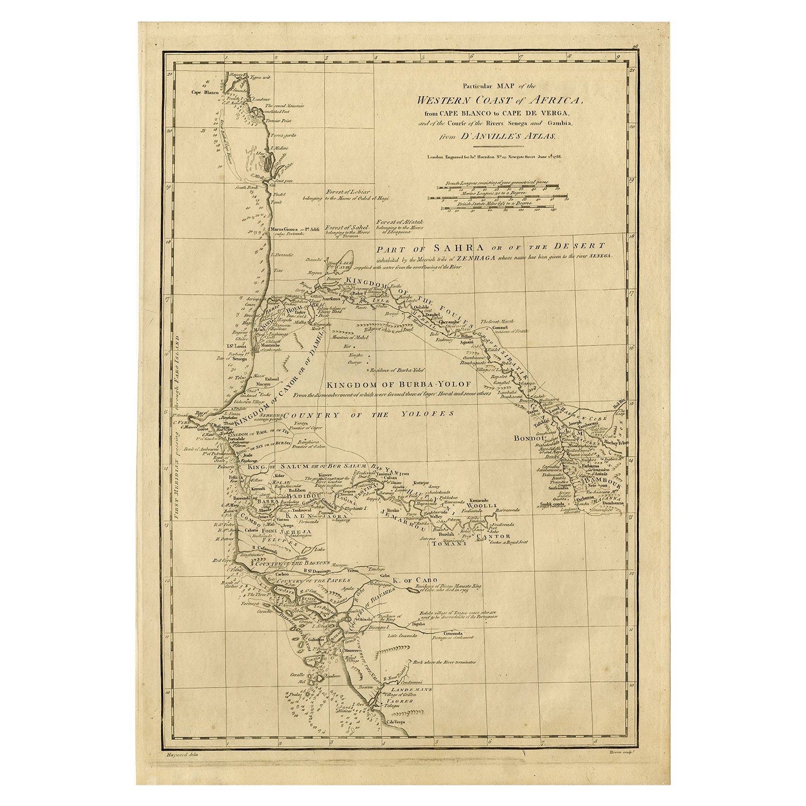
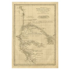
- Map of the West African coast from the North of Mauretania to Guinee, 1788Located in Langweer, NLAntique map titled 'Particular Map of the Western Coast of Africa, from Cape Blanco to Cape de Verga, and of the Course of the Rivers Senega and Gambia.' Map of the African coast...Category
Antique 1780s Maps
MaterialsPaper
- Early Coastal Views of Various Islands of the American West Coast, 1803Located in Langweer, NLAntique print America titled 'Gezigten der West-Kust van Amerika'. Coastal views of various islands of the American coast. Originates from 'Reizen Rondom de Waereld door James Co...Category
Antique Early 1800s Maps
MaterialsPaper


You May Also Like
- Original Antique Decorative Map of South America-West Coast, Fullarton, C.1870Located in St Annes, LancashireGreat map of Chili, Peru and part of Bolivia Wonderful figural border From the celebrated Royal Illustrated Atlas Lithograph. Original color. Published by Fullarton, Edi...Category
Antique 1870s Scottish Maps
MaterialsPaper
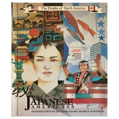
- The Peoples of North America, the Japanese AmericansLocated in North Hollywood, CAThe peoples of North America, the Japanese Americans. Discusses the history, culture, and religion of the Japanese, factors encouraging their emigra...Category
20th Century American Japonisme Books
MaterialsPaper
- Long Vintage South West Native American Silver Turquoise ring NavajoLocated in London, GBLong Vintage South West Native American Silver l Turquoise ring Navajo Condition: FineCategory
20th Century American Native American Objects
MaterialsSilver
- Large Original Vintage Map of British Island Possessions, circa 1920Located in St Annes, LancashireGreat map of British Island Possessions Original color. Good condition Published by Alexander Gross Unframed.Category
Vintage 1920s English Maps
MaterialsPaper
- New Map of North America from the Latest Discoveries, 1763Located in Philadelphia, PAA fine antique 18th century map of the North American seaboard. Entitled "A New Map of North America from the Latest Discoveries 1763". By the Cartographer/Engraver - John Spil...Category
Antique Mid-18th Century English Georgian Maps
MaterialsPaper
- Vintage Chunky Navajo South West Native American Silver Turquoise Nugget ringLocated in London, GBChunky Vintage Navajo South West Native American Silver Turquoise ring with large Turquoise nugget, adjustable size Conditi...Category
20th Century American Native American Objects
MaterialsSilver


Recently Viewed
View AllMore Ways To Browse
18th Century Revolutionary
Wenceslas Hollar
Bad Bentheim
English County Maps By Blaeu
Von Meer
Minature Map
Anguilla Map
James Calvert Smith
Montenegro Antique Map
Mozambique Antique Map
Nottinghamshire Antique Map
Panama Antique Map
Wisconsin Map
Antique Map Sydney
Historical Balkan Map
Map Of Majorca
Yorkshire Ridings Map
Antique Map Dordogne