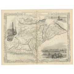
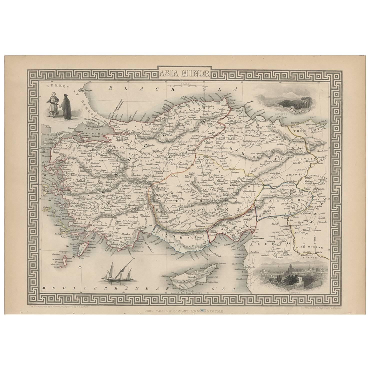
An Illustrated Map of Kabul, Punjab, and Baluchistan by Tallis, 1851
View Similar Items


Want more images or videos?
Request additional images or videos from the seller
1 of 6
An Illustrated Map of Kabul, Punjab, and Baluchistan by Tallis, 1851
About the Item
- Dimensions:Height: 10.71 in (27.2 cm)Width: 14.26 in (36.2 cm)Depth: 0 in (0.02 mm)
- Materials and Techniques:
- Period:
- Date of Manufacture:1851
- Condition:Good given age. Original fold in middle as published. General age-related toning, please study scan carefully.
- Seller Location:Langweer, NL
- Reference Number:Seller: BG-13736-151stDibs: LU3054339298472
About the Seller
5.0
Platinum Seller
These expertly vetted sellers are 1stDibs' most experienced sellers and are rated highest by our customers.
Established in 2009
1stDibs seller since 2017
1,957 sales on 1stDibs
More From This SellerView All
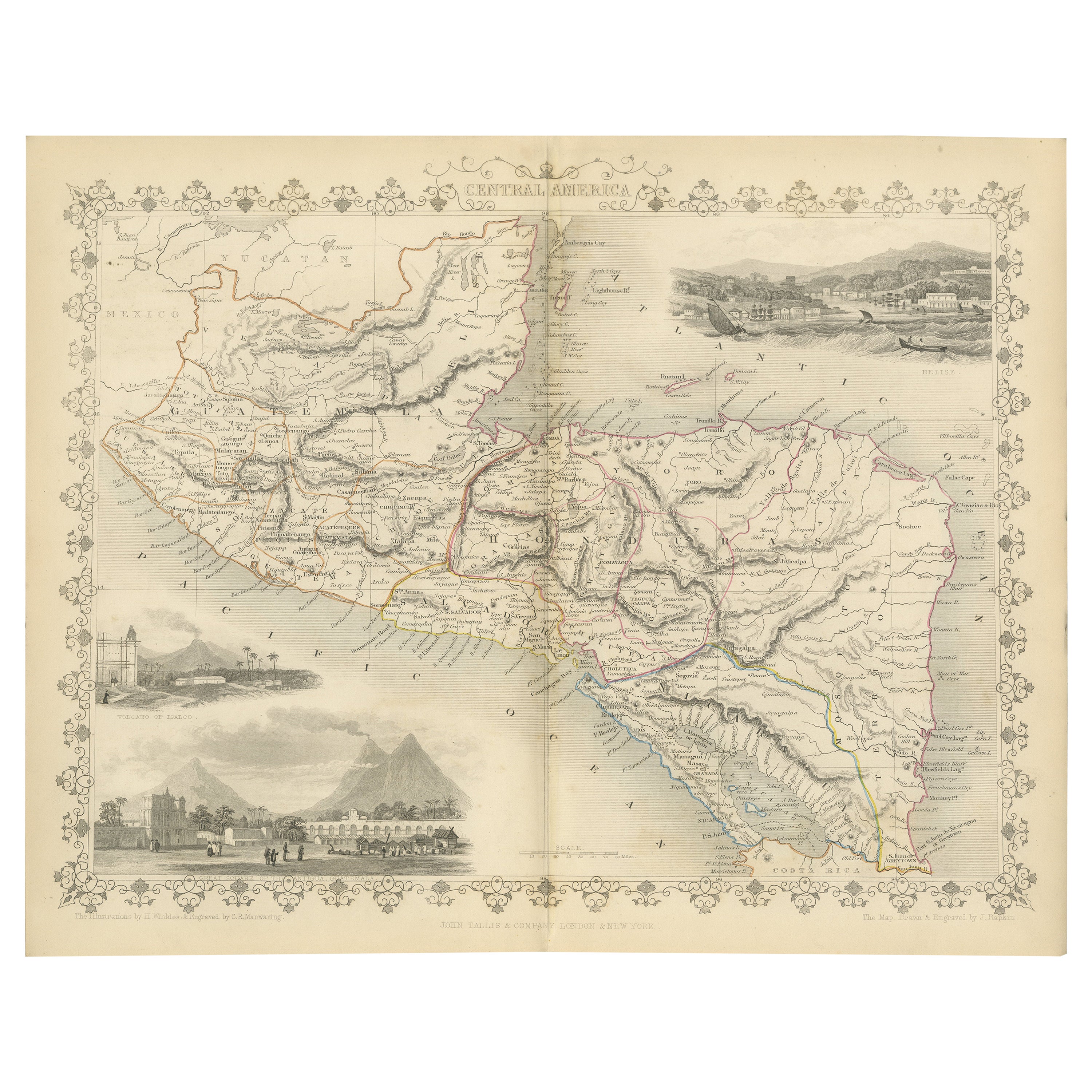
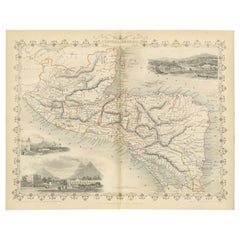
- An Old Illustrated Tallis Map of Central America with Volcanic Vignettes, 1851Located in Langweer, NLThis map of Central America, part of John Tallis & Company's series from "The British Colonies" by Robert Montgomery Martin, is a fine example of mid-19th century cartography and wou...Category
Antique 1850s Maps
MaterialsPaper
- Antique Map of Belgium by J. Tallis, circa 1851Located in Langweer, NLA highly decorative and detailed mid-19th century map of Belgium which was drawn and engraved by J. Rapkin (vignettes by J. Marchant and J. B. Allen) an...Category
Antique Mid-19th Century Maps
MaterialsPaper
 $221 Sale Price20% Off
 - Antique Map of Switzerland by J. Tallis, circa 1851Located in Langweer, NLA decorative and detailed mid-19th century map of Switzerland which was drawn and engraved by J. Rapkin (vignettes by A. H. Wray & J. B. Allen) and published in John Tallis's Illustr...Category
Antique Mid-19th Century Maps
MaterialsPaper
 $243 Sale Price20% Off
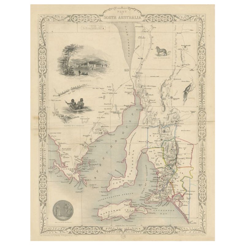
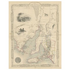
 - Antique Map of South Australia by Tallis, 1851By Thomas KitchinLocated in Langweer, NLAntique map Australia titled 'Part of South Australia'. Decorative map of part of South Australia, surrounded by illustrations of Adelaide, natives on a catamaran, an Australian dog and a nymphicus bird illustrated. Originates from 'The Illustrated Atlas, And Modern History Of The World Geographical, Political, Commercial & Statistical, Edited By R. Montgomery Martin'. Published; John Tallis London, New York, Edinburgh & Dublin. 1851. Drawn and Engraved by J. Rapkin. Artists and Engravers: John Tallis (1817-1876) was a British map...Category
Antique 19th Century Maps
MaterialsPaper
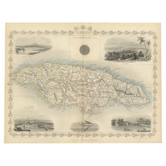
- An Ornate and Historical Tallis Map of Jamaica with Decorative Vignettes, 1851Located in Langweer, NLThis original antique map of Jamaica is part of the renowned series created by the Tallis Company, known for their detailed and decorative maps ...Category
Antique 1850s Maps
MaterialsPaper
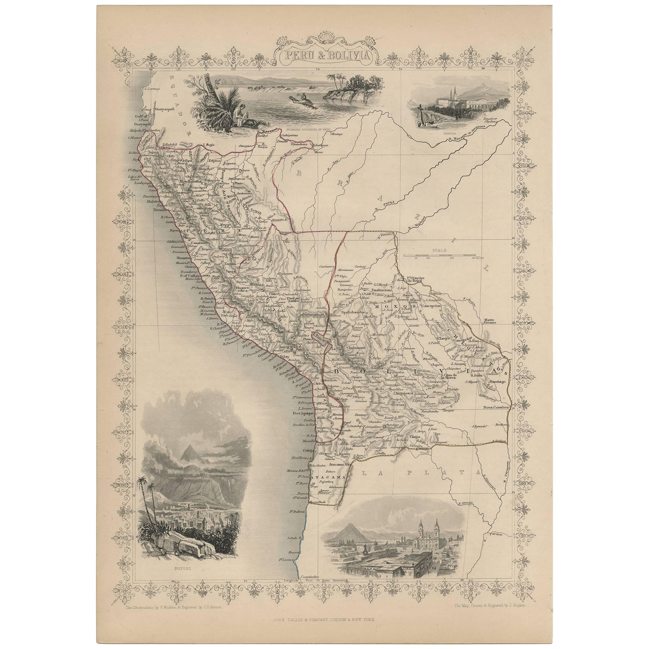
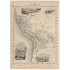
- Antique Map of Peru and Bolivia by J. Tallis, circa 1851Located in Langweer, NLA decorative and detailed mid-19th century map of Peru and Bolivia, South America which was drawn and engraved by J. Rapkin (vignettes by H. Winkles &J. H. Kernot) and published in J...Category
Antique Mid-19th Century Maps
MaterialsPaper
 $243 Sale Price20% Off
You May Also LikeView All
- Original Antique Map of Belgium by Tallis, Circa 1850Located in St Annes, LancashireGreat map of Belgium Steel engraving Many lovely vignettes Published by London Printing & Publishing Co. ( Formerly Tallis ), C.1850 Origin...Category
Antique 1850s English Maps
MaterialsPaper
- Illustrated Map of London from ExhibtionLocated in Alton, GBDetailed illustrated map of London from the great exhibition of industry of all nations 1851.Category
Antique 19th Century Maps
MaterialsPaper
- Original Antique Map / City Plan of Brussels by Tallis, circa 1850Located in St Annes, LancashireGreat map of Brussels. Steel engraving. Published by London Printing & Publishing Co. (Formerly Tallis), C.1850 Free shipping.Category
Antique 1850s English Maps
MaterialsPaper
- 1851 Map of "Independent Tartary", Ric. R018Located in Norton, MA1851 Map of Independent Tartary "Russia" Ric.r018 A highly decorative 1851 map of Independent Tartary by John Tallis and John Rapkin. Covers the regions between the Caspian Sea and Lake Bakquash and between Russia and Afghanistan. These include the ancient Silk Route kingdoms of Khiva, Tartaria, Kokand, and Bokhara. Today this region roughly includes Kazakhstan, Uzbekistan, Turkmenistan, Kyrgyzstan, and Tajikistan. This wonderful map offers a wealth of detail for anyone with an interest in the Central Asian portion of the ancient Silk Road. Identifies various caravan routes, deserts, wells, and stopping points, including the cities of Bokhara and Samarkand. Three vignettes by W. Bragg decorate the map, these including an image of Tartars on a Journey, a horseback Bride Chase, and a tartar camp site. Surrounded by a vine motif border. Engraved by J. Rapkin for John Tallis's 1851 Illustrated Atlas . Tartary Antique Map...Category
Antique 19th Century Unknown Maps
MaterialsPaper
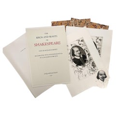
- The Birds and Beasts of Shakespeare - an illustrated portfolioLocated in Middletown, NYCheloniidae Press - Kinney, Arthur F. (texts); Alan James Robinson (ill.). The Birds and Beasts of Shakespeare. Easthampton, Massachusetts: Cheloniidae Press, 1990. Printed to ma...Category
Late 20th Century American Books
MaterialsGold Leaf
- "San Francisco, Upper California” 1851 Antique Map of San FranciscoLocated in Colorado Springs, COThis is a pictorial lettersheet view of the city and harbor of San Francisco. This lithograph was printed on grey wove paper, across a double sheet, by famed lithographers Britton & ...Category
Antique 1850s American Prints
MaterialsPaper
 $1,200 Sale Price20% Off


Recently Viewed
View AllMore Ways To Browse
Pakistan Antique Map
John Tallis Map
Antique Map Dordogne
Antique Map Of Cornwall
Antique Maps Cornwall
Cannon Authentic
Mozambique Antique Map
Wenceslas Hollar
Antique Map Of Bermuda
Antique Maps Of Lithuania
Barbados Map
Map Of Barbados
Wisconsin Map
Antique Map Bahamas
Antique Map Puzzle
Azores Map
Gabon Antique Map
Malacca Strait Map