Items Similar to Map Berkshire C&J Greenwood Windsor Castle JDower Polling Hundreds
Want more images or videos?
Request additional images or videos from the seller
1 of 10
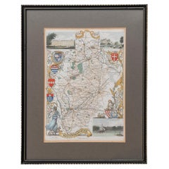
Map Berkshire C&J Greenwood Windsor Castle JDower Polling Hundreds
About the Item
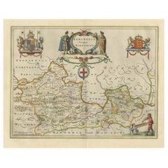
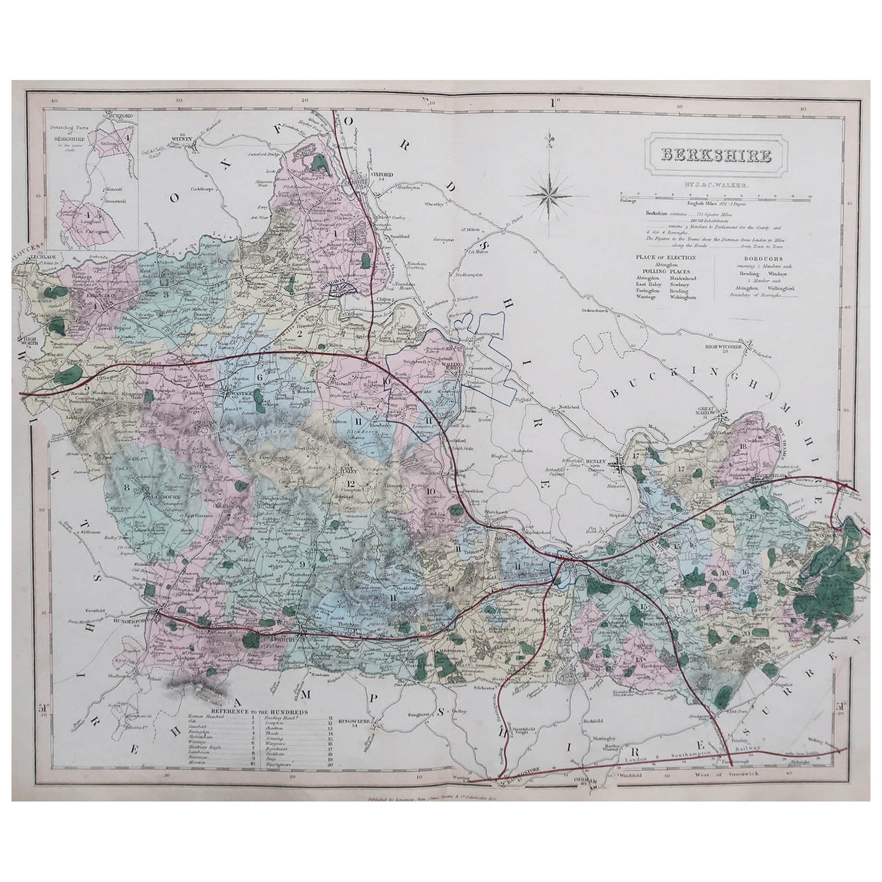
Map of the County of Berkshire from an Actual Survey made in the Years 1822 & 1823 by C&J Greenwood
Published by the Proprietors Greenwood & Co 13 Regent Street Pall Mall London July 4th 1829
A large colored map of Berkshire: with a black & white vignette of the East View of Windsor Castle top right; a list of Polling Places below; a list of the Hundreds bottom right; a key bottom left; & title top left.
Artist : Engraved by J. Dower, 6, Cumming Place, Pentonville. Measures: 86cm 34" long.
PROVENANCE: Published by Greenwood & Co, Regent Street, Pall Mall, London
- Dimensions:Height: 33.86 in (86 cm)Width: 29.93 in (76 cm)Depth: 1.19 in (3 cm)
- Style:Georgian (Of the Period)
- Materials and Techniques:
- Place of Origin:
- Period:
- Date of Manufacture:1829
- Condition:Wear consistent with age and use.
- Seller Location:BUNGAY, GB
- Reference Number:1stDibs: LU3867332633982
About the Seller
5.0
Vetted Seller
These experienced sellers undergo a comprehensive evaluation by our team of in-house experts.
Established in 1985
1stDibs seller since 2018
85 sales on 1stDibs
Typical response time: 12 hours
- ShippingRetrieving quote...Ships From: BUNGAY, United Kingdom
- Return PolicyA return for this item may be initiated within 7 days of delivery.
More From This SellerView All
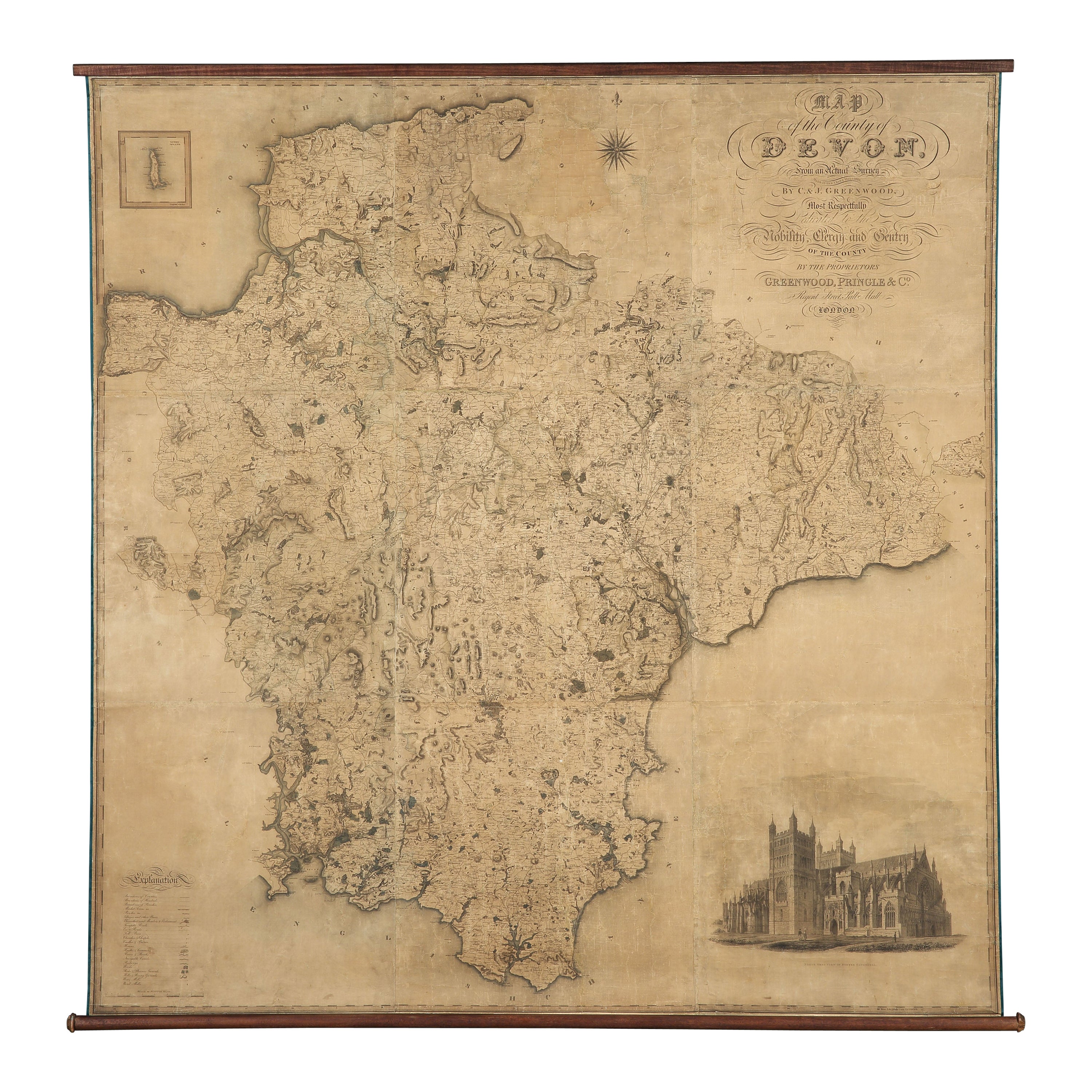
- Map Hanging Wall County of Devon C&J Greenwood 1827 Exeter Cathedral Lundy IsleLocated in BUNGAY, SUFFOLKC & J GREENWOOD MAP OF THE COUNTY OF DEVON, FROM AN ORIGINAL SURVEY, PUBLISHED 1827, WITH ENGRAVING OF EXETER CATHEDRAL AND MAP OF LUNDY INSET, 6ft 2 ...Category
Antique 1820s English Early Victorian Maps
MaterialsPaper
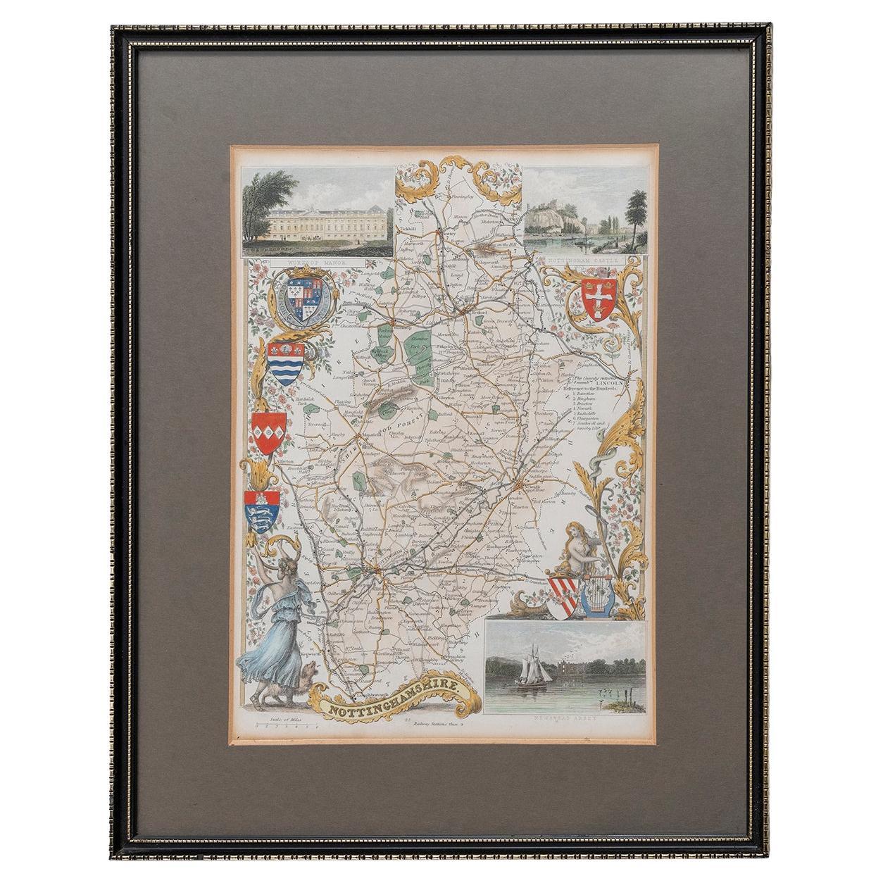
- Map Nottinghamshire Worksop Manor Newstead Abbey Nottingham Castle Shields H37cmLocated in BUNGAY, SUFFOLKMap of Nottinghamshire with engravings of Worksop Manor Nottingham Castle Newstead Abbey BIBLIOGRAPHY published in Barclay's Universal English Dicti...Category
Antique 19th Century English Victorian Maps
MaterialsPaper
- Map Bedfordshire General FramedLocated in BUNGAY, SUFFOLKA general map of Bedfordshire with its hundreds A scale of 5 miles in the original green mount and traditional black and gold frame. Measures: 36cm 14" high.Category
Antique 18th Century English Georgian Maps
MaterialsPaper
- Map Bedfordshire No 3 General FramedLocated in BUNGAY, SUFFOLKA general map of Bedfordshire with its hundreds. Measure: 37cm 14 1/2" high A scale of 5 miles. in the original green mount and traditional black and gold frame. charming map with...Category
Antique 18th Century English Georgian Maps
MaterialsPaper
- Map North Wales Robert Marsden AngleseyLocated in BUNGAY, SUFFOLKMap of North Wales by Robert Marsden Including Anglesey Charming topography and detail and colouring just purchased more information to follow.Category
Antique 18th Century English Georgian Maps
MaterialsPaper
- Map SussexLocated in BUNGAY, SUFFOLKMap of Sussex with explanation Maker unknown.Category
Antique 19th Century English Victorian Maps
MaterialsPaper


You May Also Like
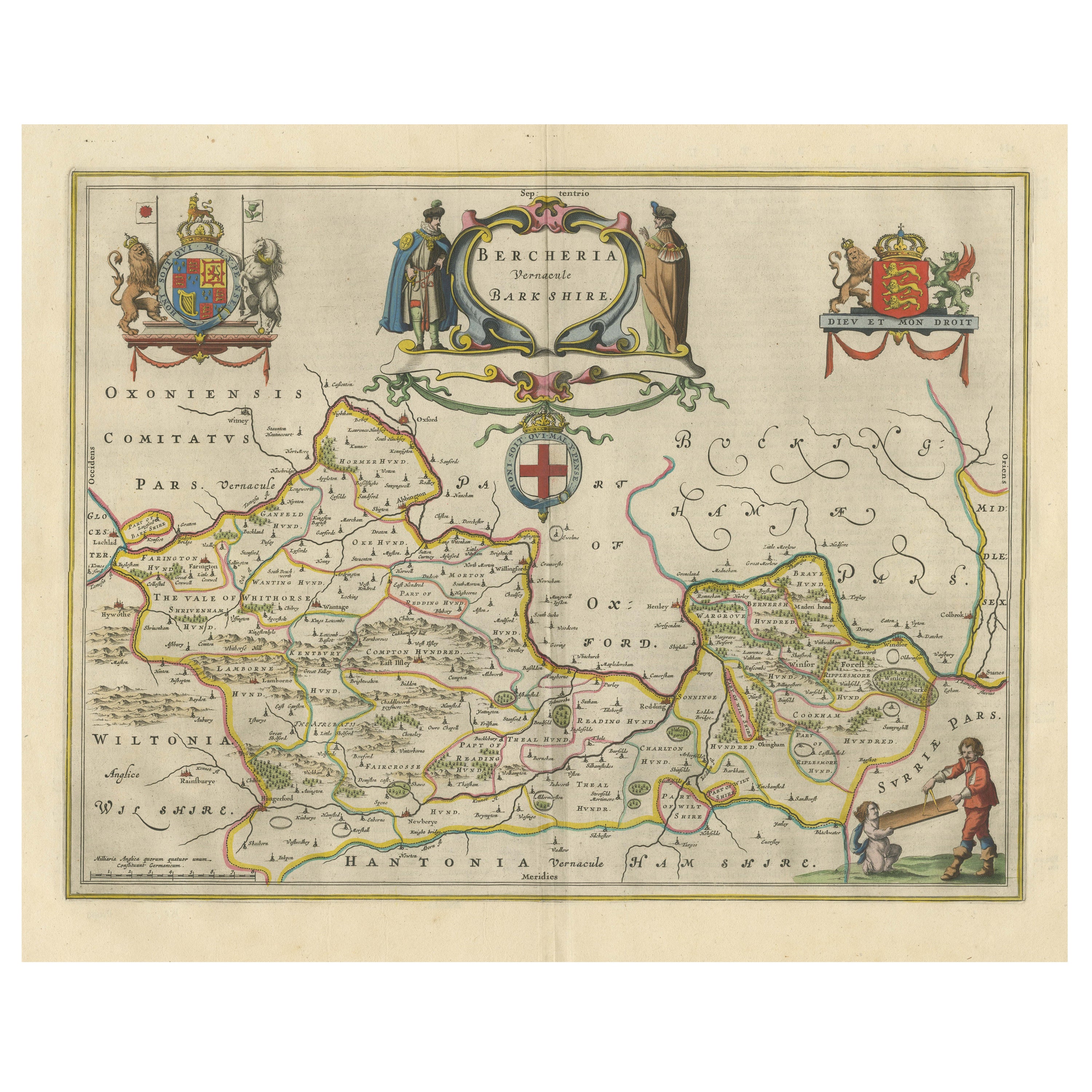
- Antique Map of Berkshire, South East EnglandBy Joan (Johannes) BlaeuLocated in Langweer, NLAntique map titled 'Bercheria vernacule Barkshire'. Original old map of Berkshire, a historic county in South East England. Published circa 1665 by J. Blaeu. Willem Jansz. Blaeu and ...Category
Antique Mid-17th Century Maps
MaterialsPaper
- Original Antique English County Map, Berkshire. J & C Walker, 1851Located in St Annes, LancashireGreat map of Berkshire Original colour By J & C Walker Published by Longman, Rees, Orme, Brown & Co. 1851 Unframed.Category
Antique 1850s English Other Maps
MaterialsPaper
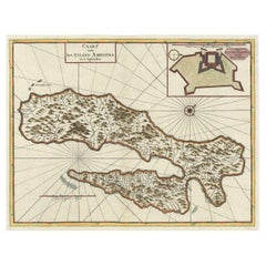
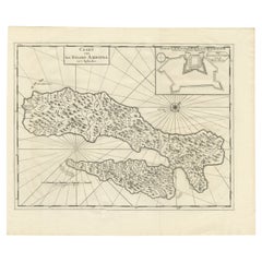
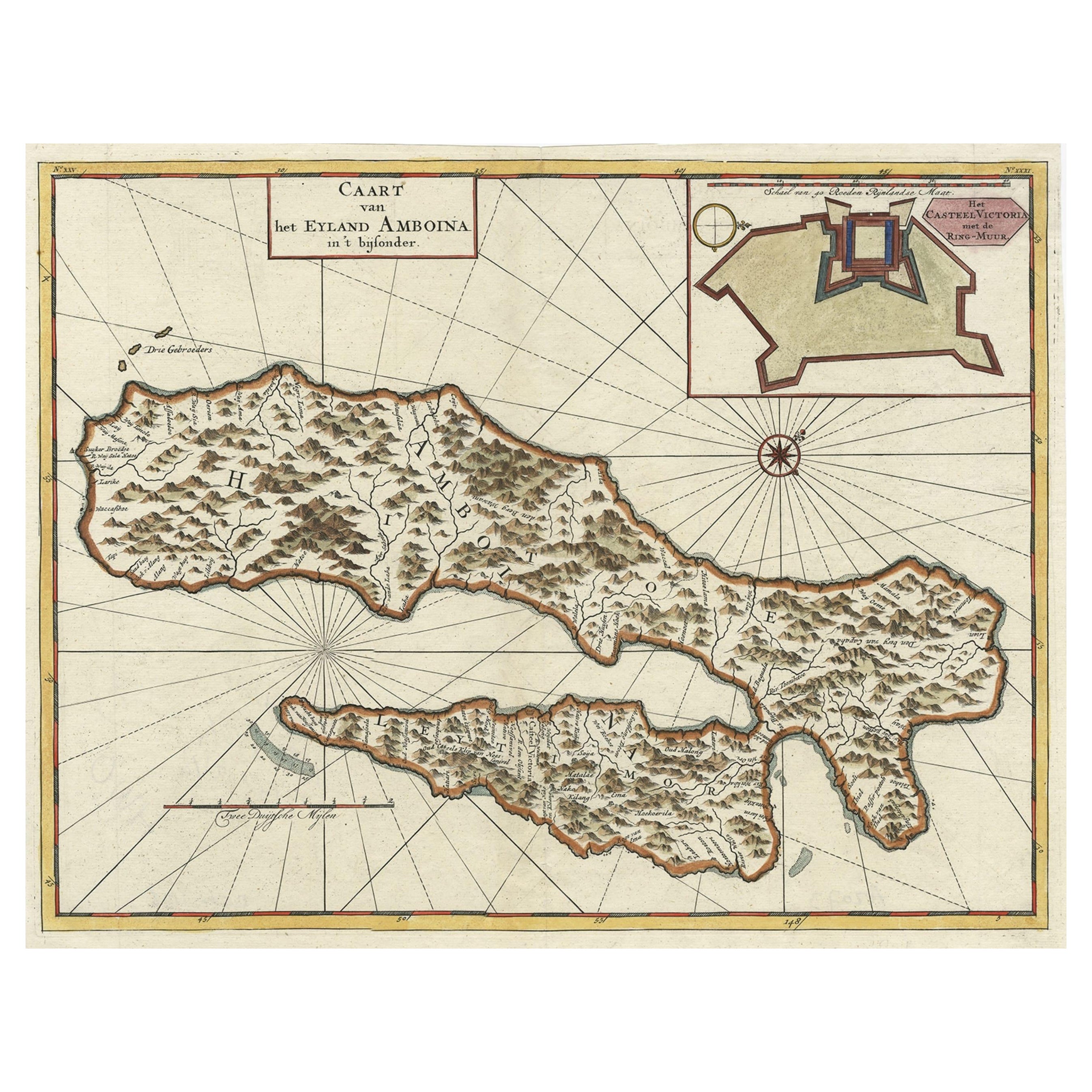
- Antique Map of Ambon Island, Indonesia with Inset of Castle Victoria, 1726Located in Langweer, NLAntique map titled 'Caart van het Eyland Amboina (..).' Detailed map of the Ambon Island and Timor, Molucca Islands, by Francois Valentyn. With an inset of castle Victoria. This map ...Category
Antique 18th Century Maps
MaterialsPaper
- Antique Map of Italy with Vignette of Saint Angu Castle in Rome, 1880Located in Langweer, NLAntique map titled 'Italie Septentrionale'. Old map of Italy with a decorative vignette of Saint Angu castle in Rome. This map originates from 'G...Category
Antique 19th Century Maps
MaterialsPaper
- Antique Map of Ambon with Inset of the Victoria Castle, Moluku, Indonesia, 1726Located in Langweer, NLAntique map titled 'Caart van het Eyland Ambonia in het bijsonder. ' This is a print of an antique map of the Islands Ambon and Timor, one of the Moluccan Islands, Indonesia, with an...Category
Antique 18th Century Maps
MaterialsPaper
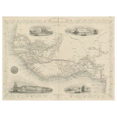
- Antique Map of Western Africa with Vignettes of Cape Coast Castle etc, ca.1851Located in Langweer, NLAntique map titled ‘Western Africa’. Includes decorative vignettes titled Christiansborg, Cape Coast Castle, Sierra Leone and Bakel. Originates from 'The Illustrated Atlas, And Modern History Of The World Geographical, Political, Commercial & Statistical, Edited By R. Montgomery Martin'. Published; John Tallis London, New York, Edinburgh & Dublin. 1851. Drawn and Engraved by J. Rapkin. Artists and Engravers: John Tallis (1817-1876) was a British map...Category
Antique 1850s Maps
MaterialsPaper