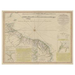
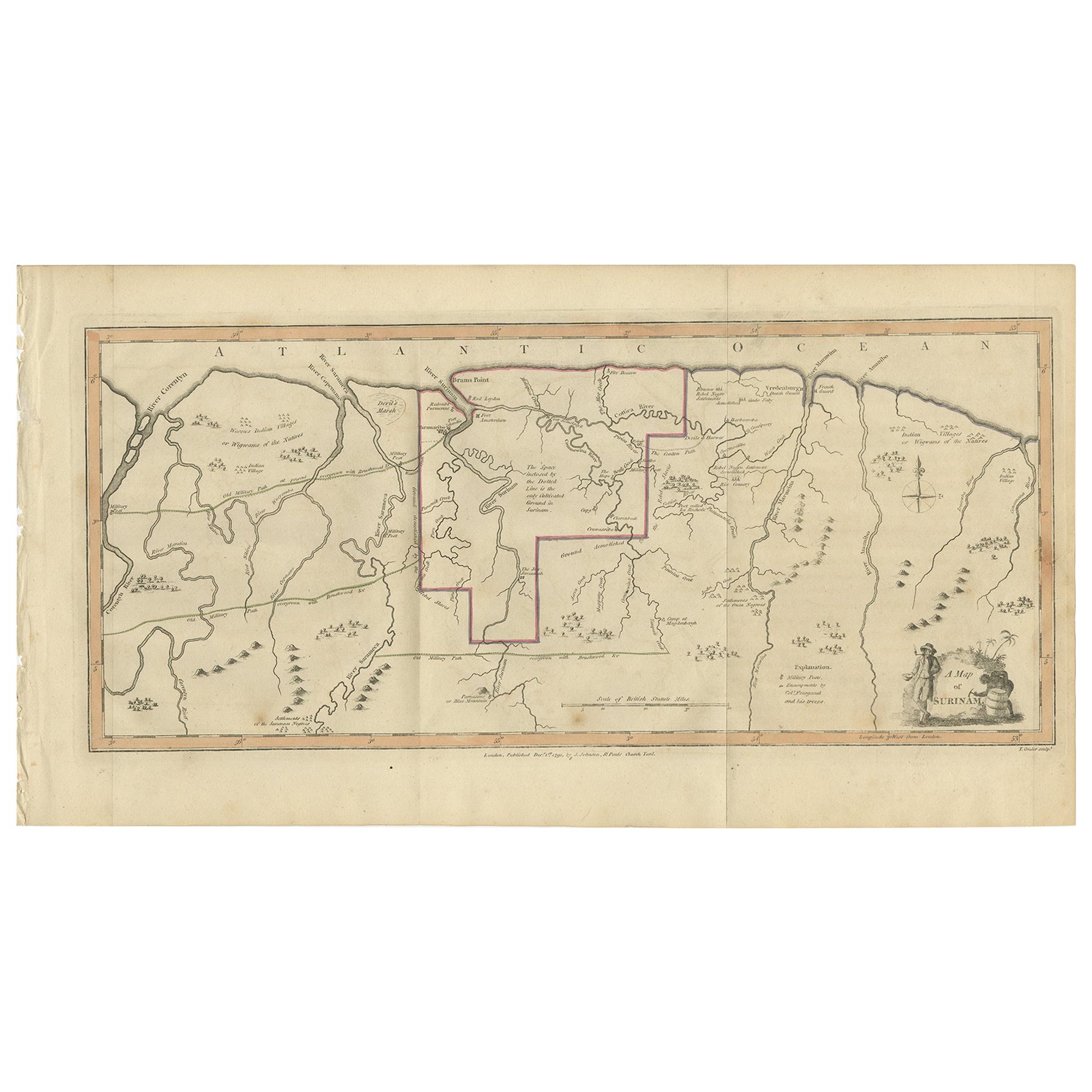
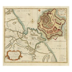
Old Map of the Coast of Guyana and Surinam, South America, 1783
View Similar Items

Want more images or videos?
Request additional images or videos from the seller
1 of 7
Old Map of the Coast of Guyana and Surinam, South America, 1783
About the Item
- Dimensions:Height: 23.04 in (58.5 cm)Width: 30.91 in (78.5 cm)Depth: 0 in (0.02 mm)
- Materials and Techniques:
- Period:1780-1789
- Date of Manufacture:1783
- Condition:Repaired: Some tears professionally restored (slightly affecting image). Condition: Good, some tears professionally restored (slightly affecting image). Please study image carefully.
- Seller Location:Langweer, NL
- Reference Number:Seller: BG-06206 1stDibs: LU3054327385012
About the Seller
5.0
Platinum Seller
These expertly vetted sellers are 1stDibs' most experienced sellers and are rated highest by our customers.
Established in 2009
1stDibs seller since 2017
1,961 sales on 1stDibs
More From This SellerView All
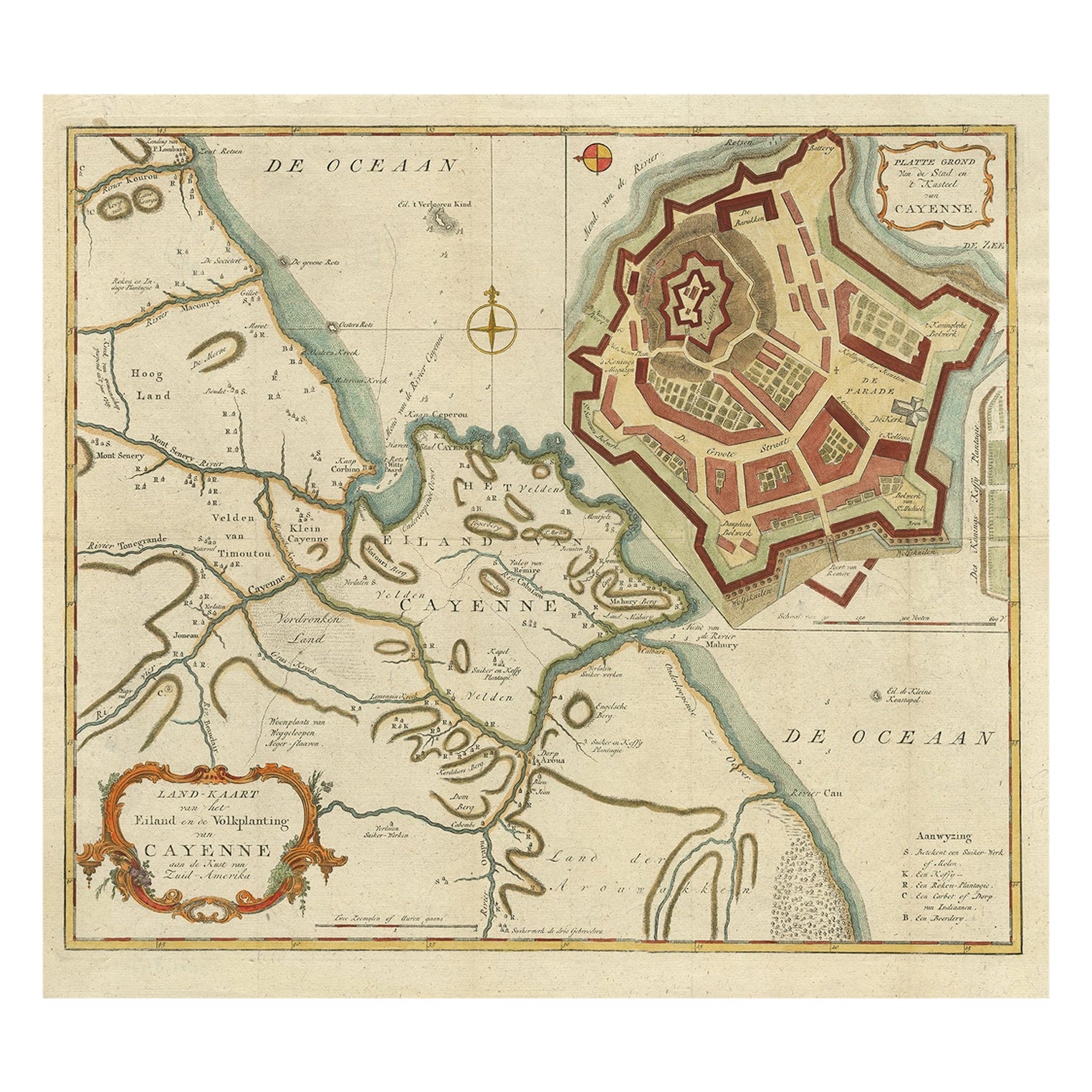
- Striking Antique Map of Cayenne in French Guyana, South America, ca.1760Located in Langweer, NLDescription: Antique map titled 'Land-kaart van het Eiland en de Volkplanting van Cayenne aan de Kust van Zuid-Amerika'. Striking map of the island and settlement of Cayenne in F...Category
Antique 1760s Maps
MaterialsPaper
 $1,198 Sale Price20% Off
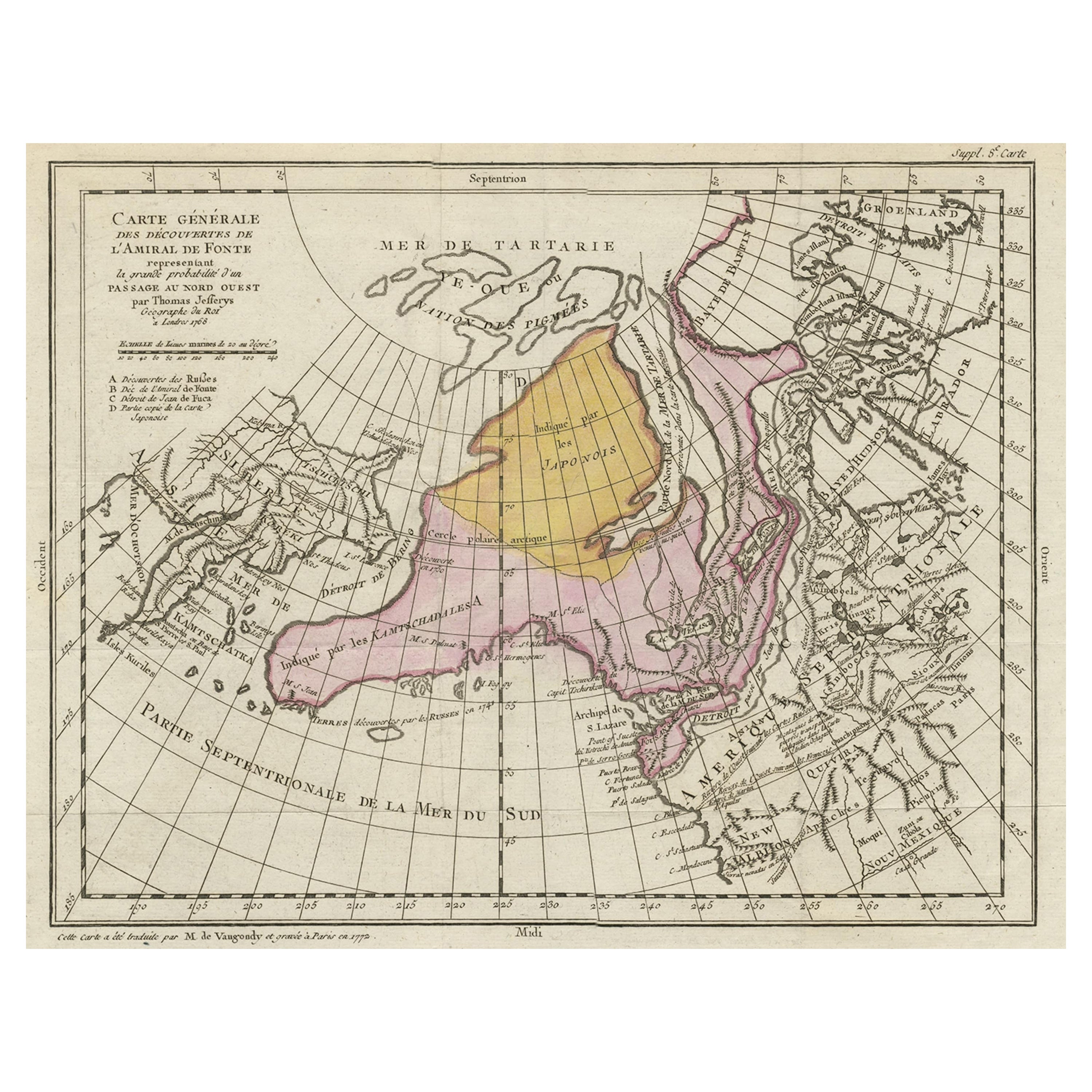
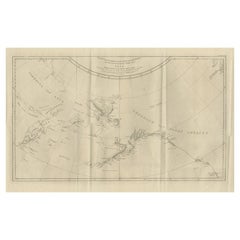
 - Interesting Old Map of the Nw Coast of America and the Ne Coast of Asia, ca.1772Located in Langweer, NLAntique map titled 'Carte Generale des Decouvertes de l'Amiral de Fonte (..)'. Original antique map of the discoveries of Admiral de Fonte, showing the possibility of a north-west passage. Interesting map of the NW Coast...Category
Antique 1770s Maps
MaterialsPaper
 $648 Sale Price20% Off
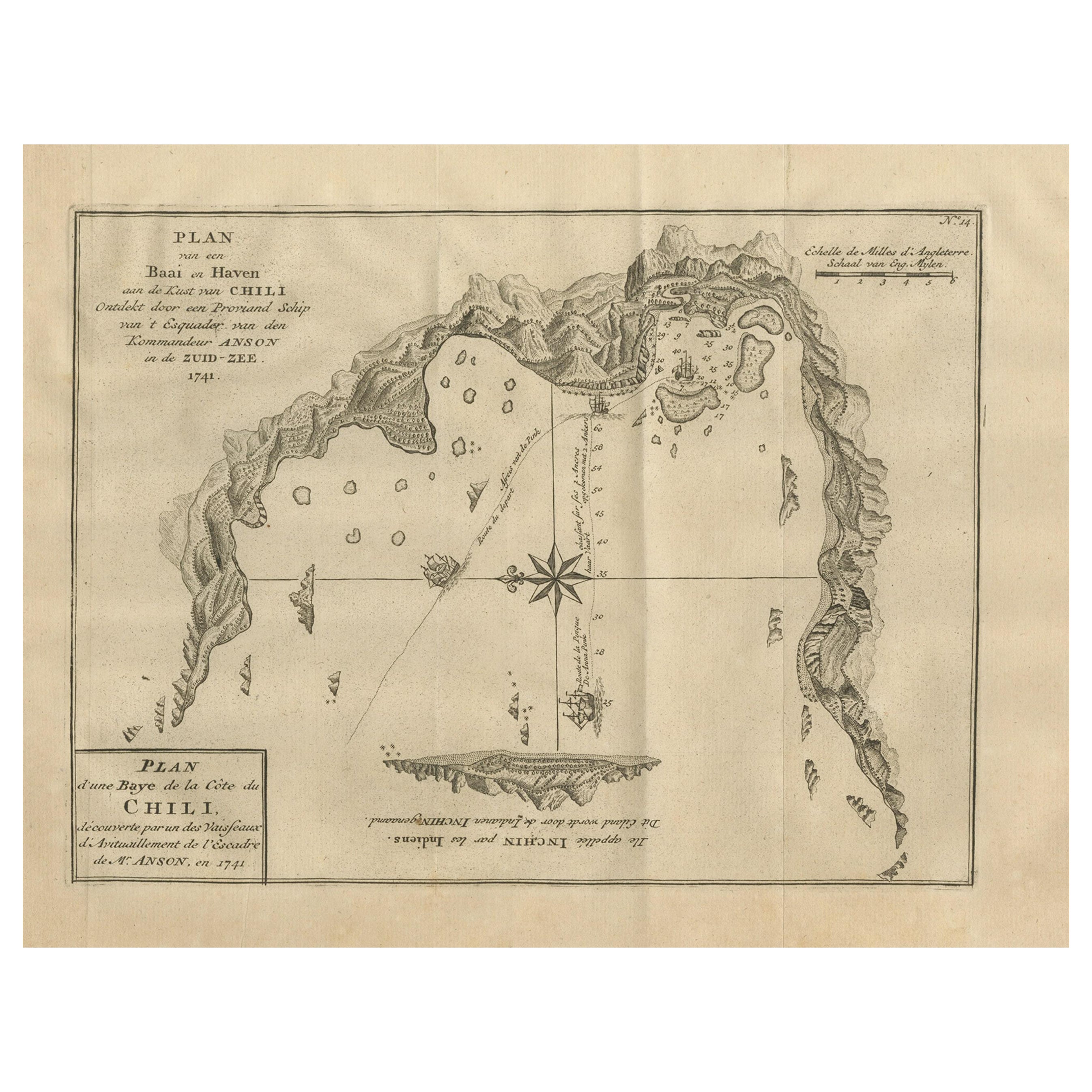
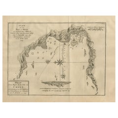
 - Antique Map of a Bay on the Coast of Chile, South America, c.1749Located in Langweer, NLAntique map titled 'Plan van een Baai en Haven aan de Kust van Chili (..) - Plan d'une Baye de la Côte du Chili (..)'. Original antique map of a bay on the coast of Chile discovered ...Category
Antique 18th Century Maps
MaterialsPaper
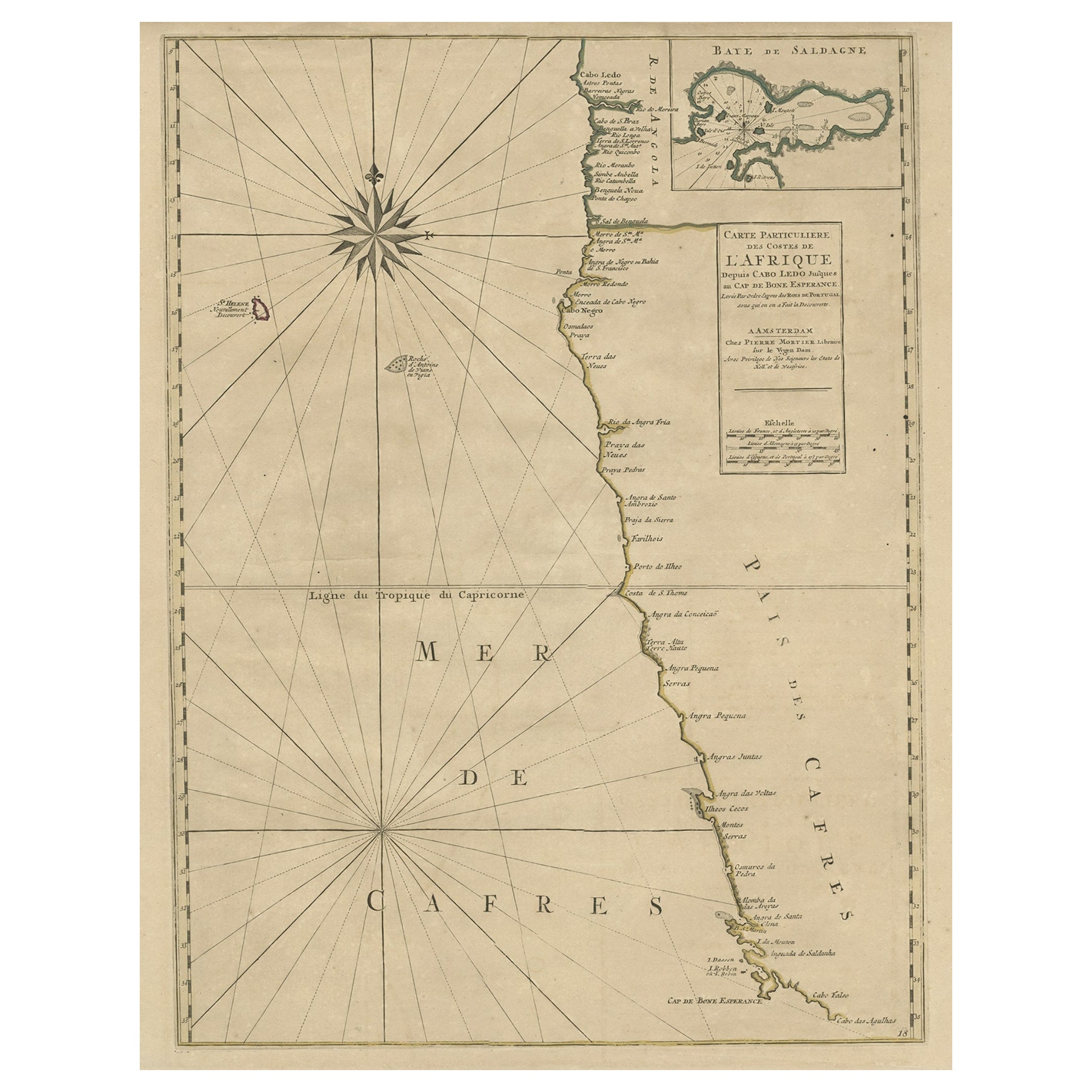
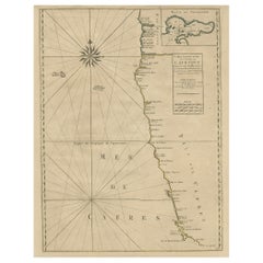
- Old Map of the Namibia and South Africa Coasts & Inset of Saldanha Bay, ca.1700Located in Langweer, NLAntique map titled 'Carte particuliere des Costes de l'Afrique'. Map of the coasts of Namibia and South Africa. With an inset map of Saldanha Bay. Artists and Engravers: Publ...Category
Antique Early 1700s Maps
MaterialsPaper
 $568 Sale Price20% Off
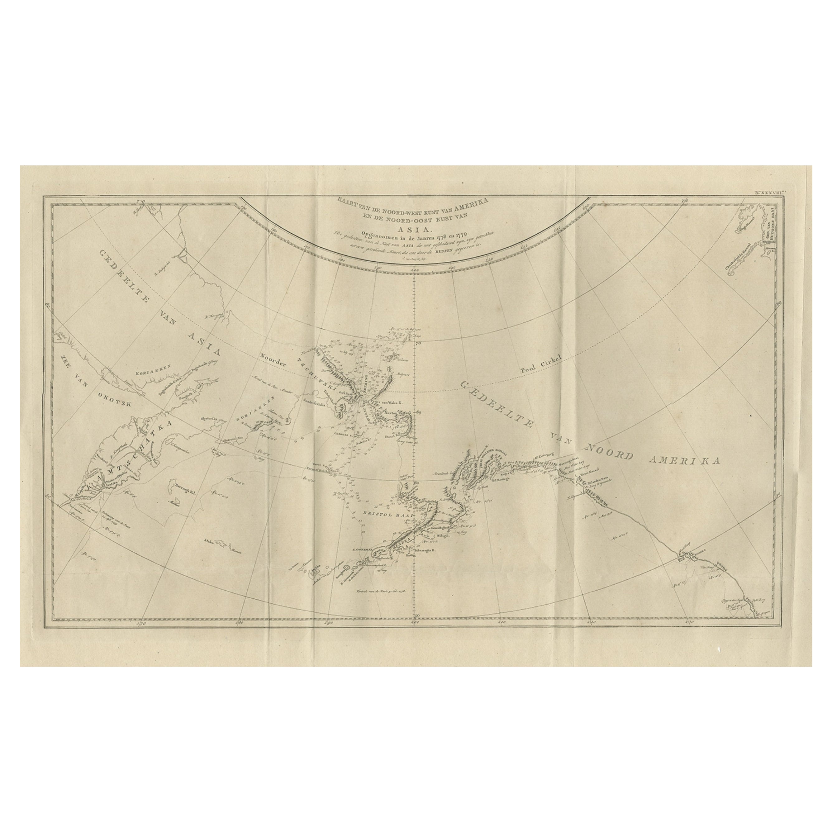
 - Old Map Showing the Tracks of Cook Between North America and Asia's Coast, 1803Located in Langweer, NLDescription: Antique map titled 'Kaart van de Noord-West kust van Amerika en de Noord-Oost kust van Asia'. Antique chart depicting America's northwest coast and Asia's northeast ...Category
Antique Early 1800s Maps
MaterialsPaper
 $843 Sale Price20% Off
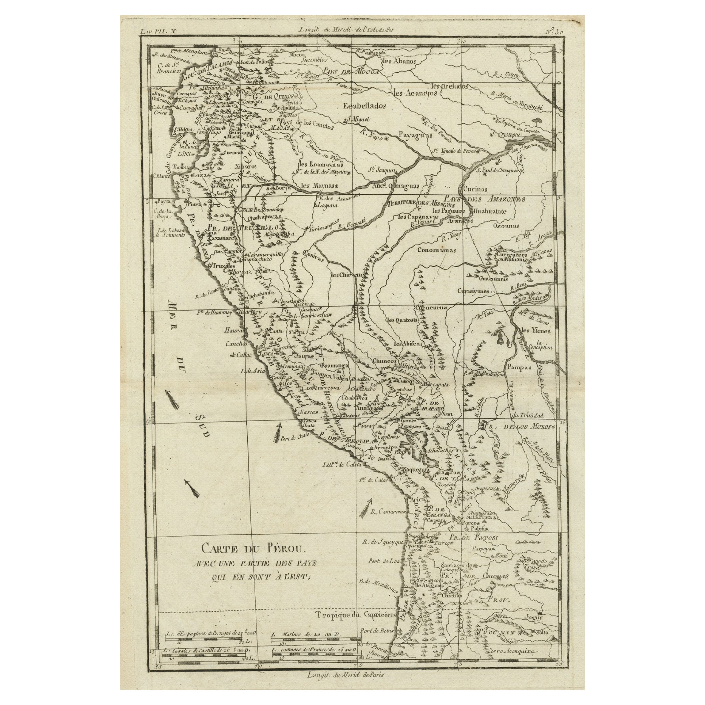
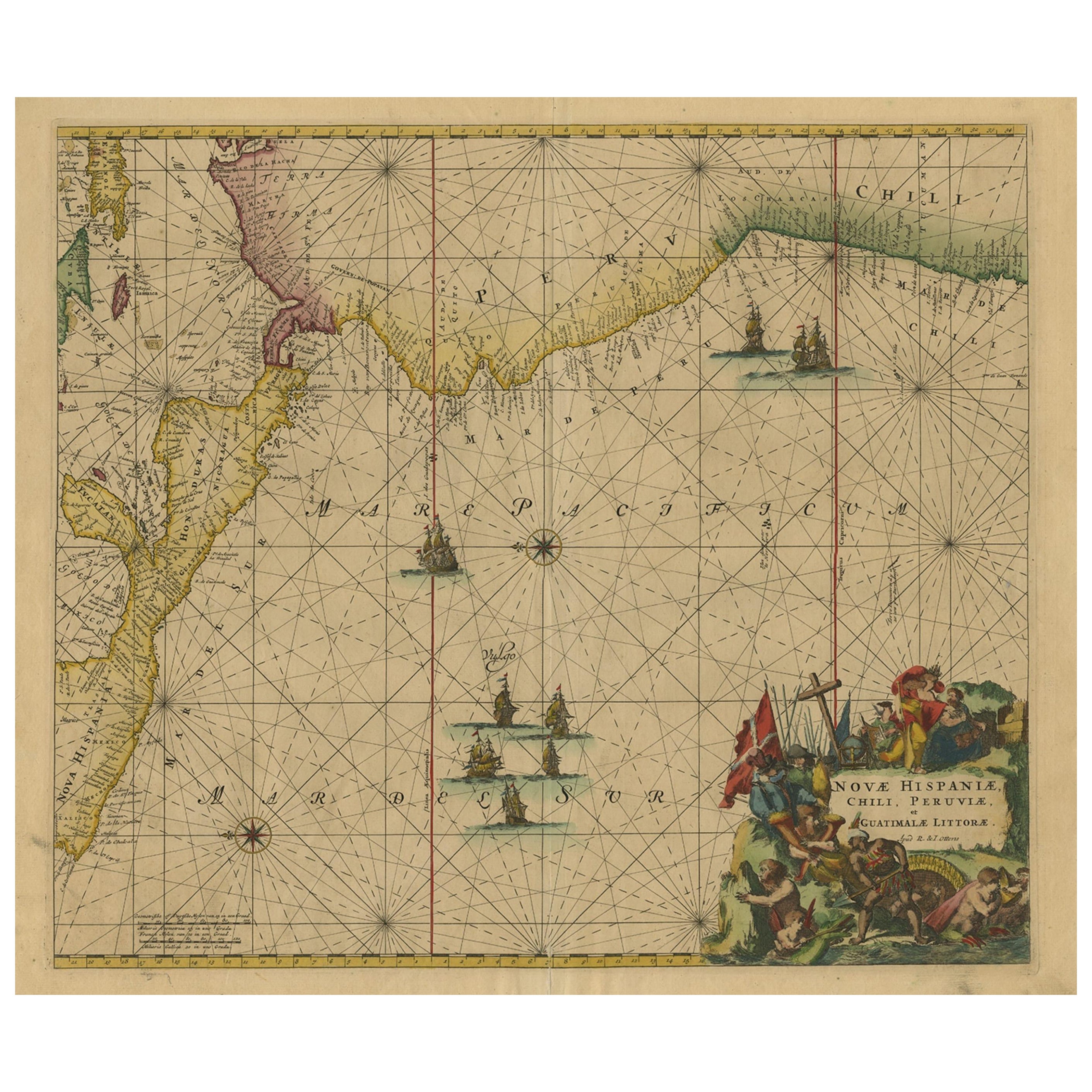
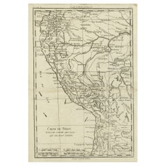
 - Map of the Western Coast of South America from Ecuador into Chili, ca.1780Located in Langweer, NLAntique map titled 'Carte du Perou avec une partie des pays qui en sont a l'est.' Map of the western coast of South America extending from Ecuador, through Peru and present-day B...Category
Antique 1780s Maps
MaterialsPaper
You May Also LikeView All
- Original Antique Map of South America. C.1780Located in St Annes, LancashireGreat map of South America Copper-plate engraving Published C.1780 Two small worm holes to left side of map Unframed.Category
Antique Early 1800s English Georgian Maps
MaterialsPaper

- Original Antique Map of South America, circa 1830Located in St Annes, LancashireGreat map of South America Copper plate engraving Published by Butterworth, Livesey & Co., circa 1830 Unframed.Category
Antique Early 1800s English Other Maps
MaterialsPaper

- Old Nautical Map of CorsicaLocated in Alessandria, PiemonteST/556/1 - Old map of Corsica isle, surveyed by Captain Hell, of the French Royal Navy in 1824, engraved and published on 1874, with additions and corre...Category
Antique Early 19th Century English Other Prints
MaterialsPaper
 $354 Sale Price20% Off
 - Old Horizontal Map of EnglandBy TassoLocated in Alessandria, PiemonteST/520 - Old rare Italian map of England, dated 1826-1827 - by Girolamo Tasso, editor in Venise, for the atlas of M.r Le-Sage.Category
Antique Early 19th Century Italian Other Prints
MaterialsPaper
 $239 Sale Price20% Off
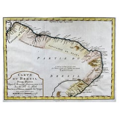
 - Krevelt, Map, Coast of Brazil, South America, Amazon, Hand ColouredLocated in Norwich, GBCarte Du Bresil Prem. Partie Depuis la Riviere des Amazones jusqu' à la Baie de Tous les Saints Pour servir à l'Histoire des Etablissemens Europeens. A. v. Krevelt, sculpsit, ...Category
Antique Late 18th Century French Prints
MaterialsPaper
- New Map of North America from the Latest Discoveries, 1763Located in Philadelphia, PAA fine antique 18th century map of the North American seaboard. Entitled "A New Map of North America from the Latest Discoveries 1763". By the Cartographer/Engraver - John Spil...Category
Antique Mid-18th Century English Georgian Maps
MaterialsPaper

Recently Viewed
View AllMore Ways To Browse
Guyana Antique Map
Antique Map Of Michigan
Astrology Map
Yugoslavia Map
Antique Map Bermuda
William Dampier
Denver Map
Vintage Schoolroom
Antique Alabama Map
Antique Maps Perth
Antique Maps Surrey
Moldova Antique Map
Trinidad Map
Berkshire Antique Map
Australasia Antique Map
Seville Map
Rand Mcnally Vintage Maps
Antique Nantucket Map