Items Similar to Old View of the Queen Charlotte's Islands 'Santa Cruz Islands, Solomon', 1774

Want more images or videos?
Request additional images or videos from the seller
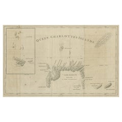
Old View of the Queen Charlotte's Islands 'Santa Cruz Islands, Solomon', 1774
About the Item
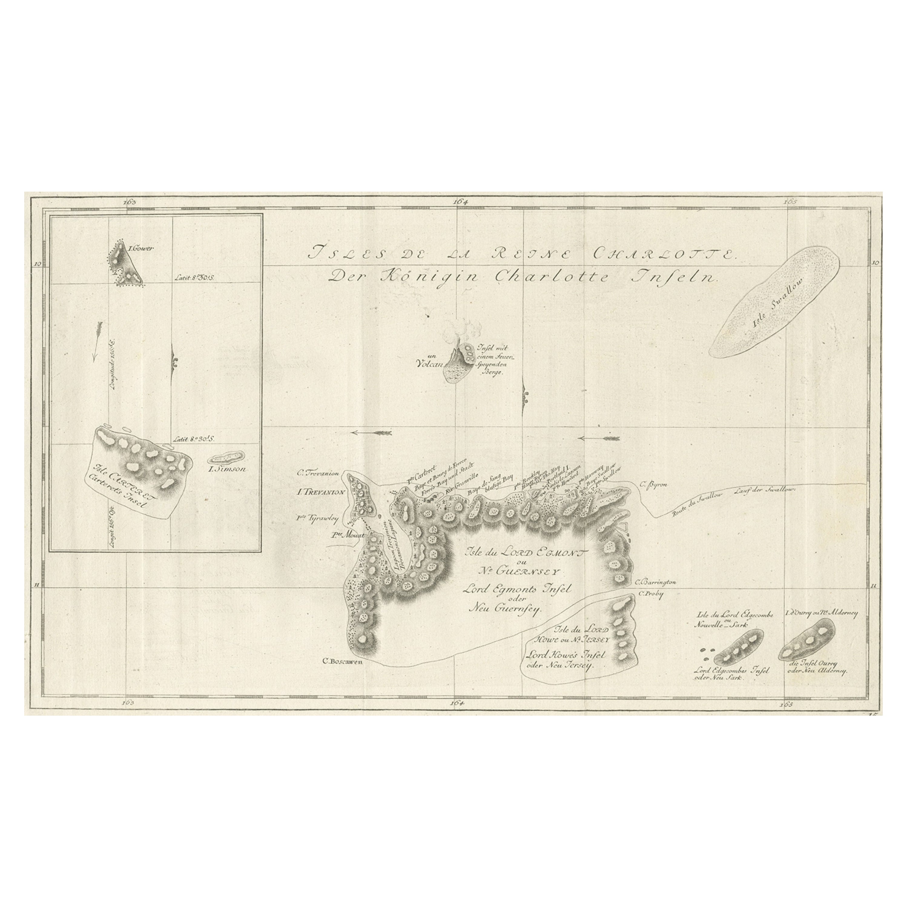
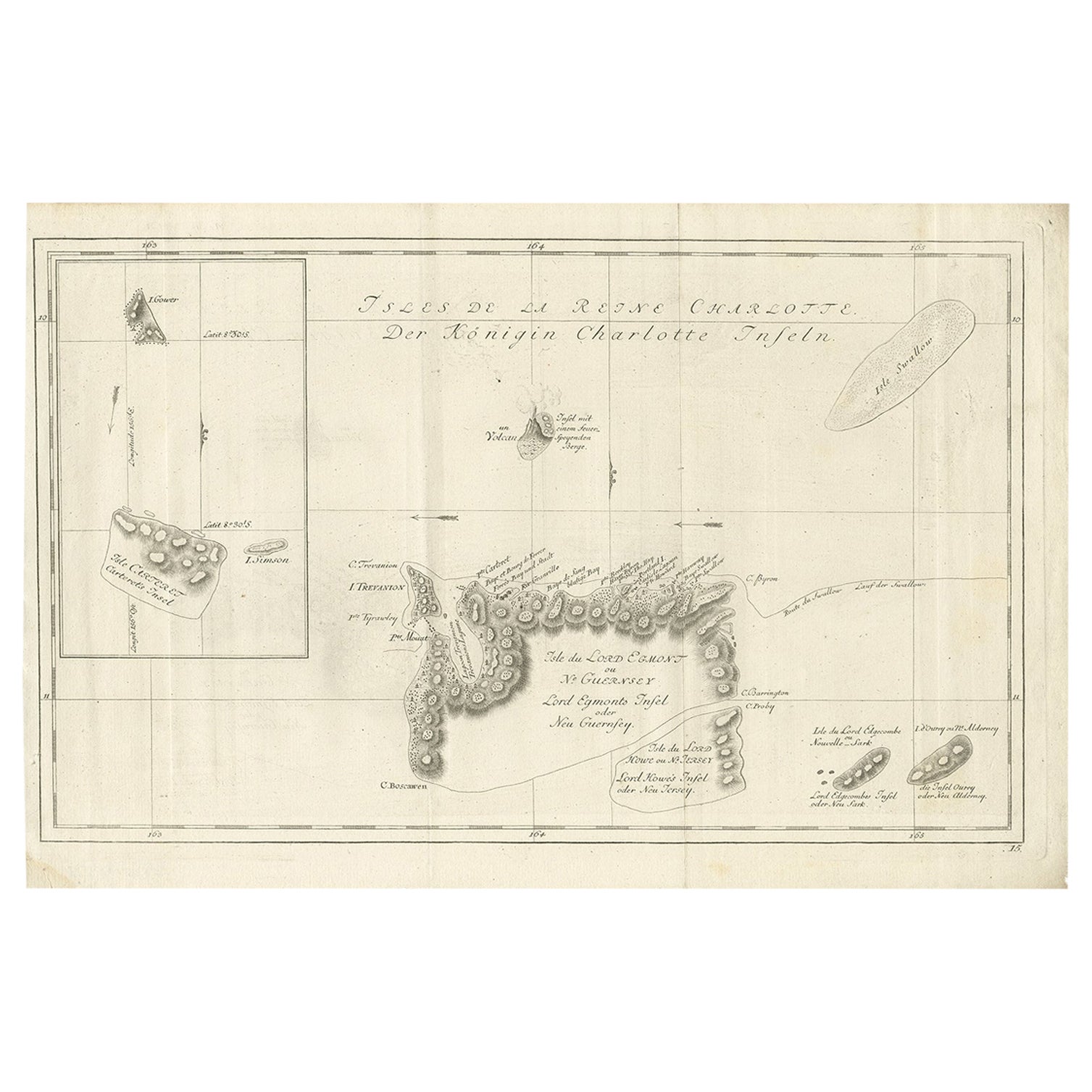
Antique map titled 'Cote Septentrional de la plus grande des Isles de la Reine Charlotte (..)'.
Map and coastal view of the islands within the Queen Charlotte's Islands (Santa Cruz Islands, Solomon Islands) by Phillip Carteret, July-August 1767 on the Swallow. The first European to Nukutavake was Englishman Samuel Wallis in 1767. He named it Queen Charlotte Island (French/ Reine Charlotte). Originates from 'Geschichte der See-Reisen und Entdeckungen im Süd-Meer welche auf Befehl Sr. Großbrittanischen Majestät unternommen, und von Commodore Byron, Capitain Wallis, Capitain Carteret und Capitain Coockim Dolphin, der Swallow, und dem Endeavour nach einander ausgeführt worden sind (..)'.
Artists and Engravers: Published by Haude & Spener, Berlin.
- Dimensions:Height: 10.63 in (27 cm)Width: 12.6 in (32 cm)Depth: 0 in (0.02 mm)
- Materials and Techniques:
- Period:1770-1779
- Date of Manufacture:1774
- Condition:Wear consistent with age and use. Condition: Very good, general age-related toning. Please study image carefully.
- Seller Location:Langweer, NL
- Reference Number:
About the Seller
5.0
Platinum Seller
These expertly vetted sellers are 1stDibs' most experienced sellers and are rated highest by our customers.
Established in 2009
1stDibs seller since 2017
1,950 sales on 1stDibs
Typical response time: <1 hour
- ShippingRetrieving quote...Ships From: Langweer, Netherlands
- Return PolicyA return for this item may be initiated within 14 days of delivery.
More From This SellerView All
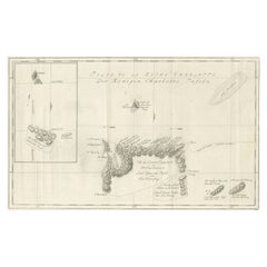
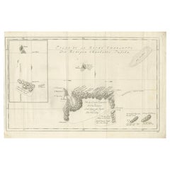
- Original Antique Chart of the Santa Cruz Islands, 1774Located in Langweer, NLAntique print titled 'Isles de la Reine Charlotte (..)'. A detailed chart of the Santa Cruz islands, to the north of the New Hebrides, with Carte...Category
Antique 1770s Maps
MaterialsPaper
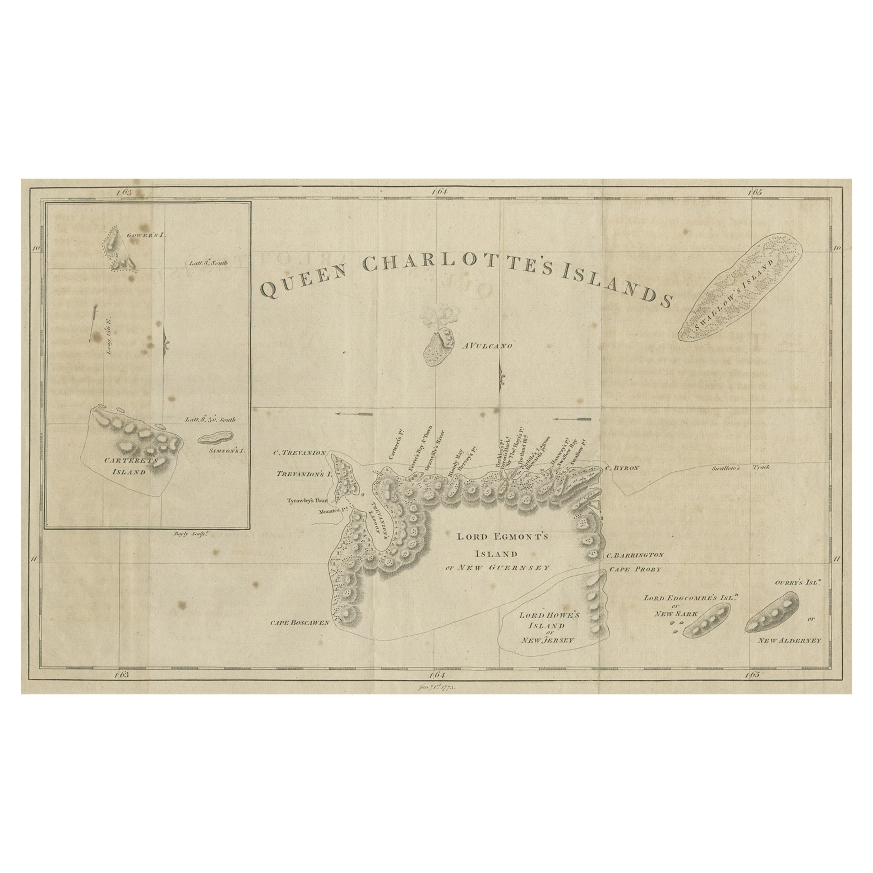
- Map of Queen Charlotte's, Carteret's, Simson's and Gower's Islands, Canada, 1773Located in Langweer, NLAntique map Canada titled 'Queen Charlotte's Islands'. Old map of Queen Charlotte's Islands, Canada. With an inset map of Carteret's, Simson's a...Category
Antique 1770s Maps
MaterialsPaper
- Antique Map of the Islands Within the Queen Charlotte's IslandsLocated in Langweer, NLAntique map titled 'Cote Septentrional de la plus grande des Isles de la Reine Charlotte (..)'. Map and coastal view of the islands within the Queen Charlotte's Islands (Santa Cruz I...Category
Antique Late 18th Century Maps
MaterialsPaper
- Antique Map of the Santa Cruz Islands by Hawkesworth, 1774Located in Langweer, NLAntique print titled 'Isles de la Reine Charlotte (..)'. A detailed chart of the Santa Cruz islands, to the north of the New Hebrides, with Carteret'...Category
Antique 18th Century Maps
MaterialsPaper
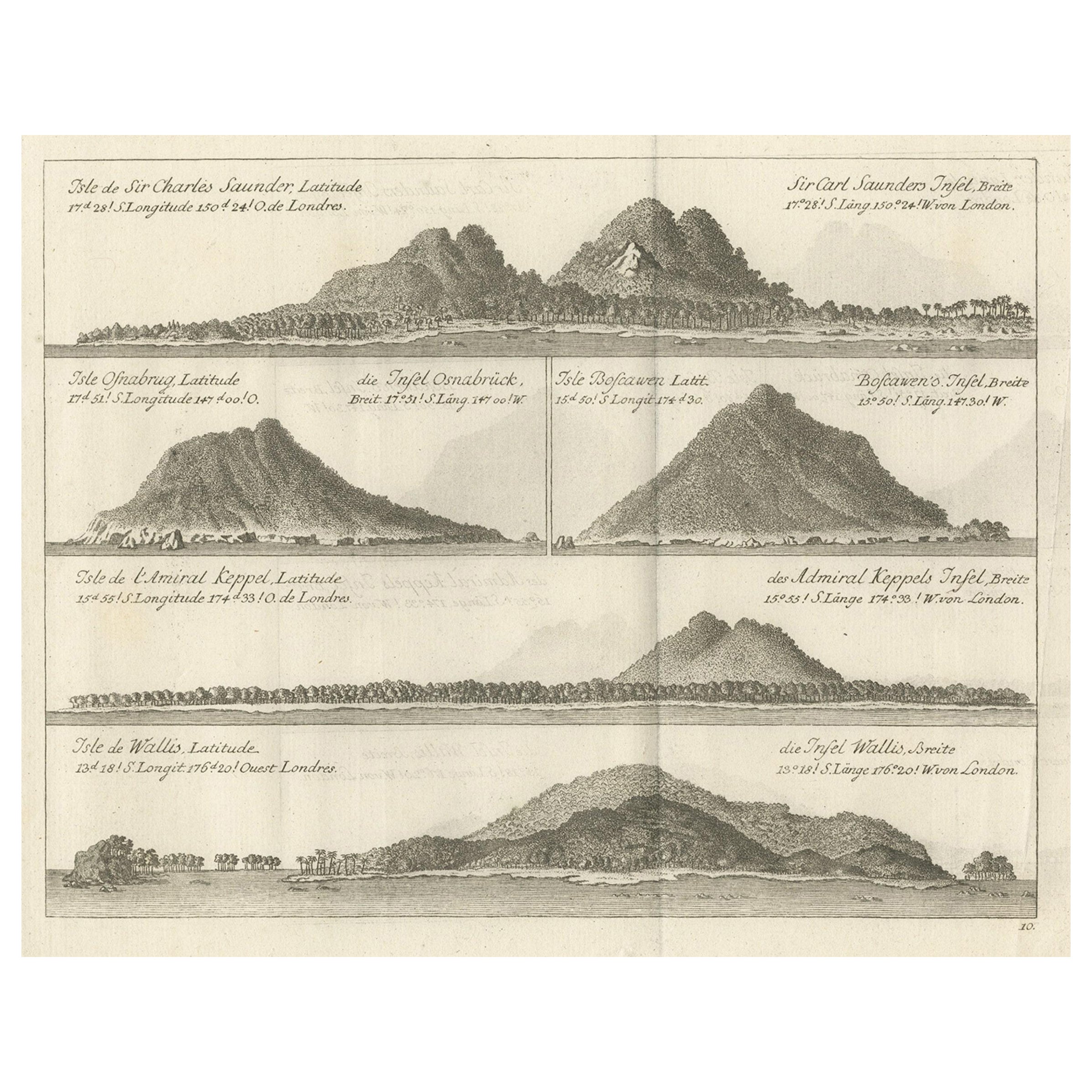
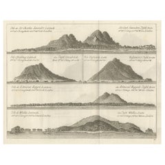
- Views of Saunders, Osnaburg, Boscawens, Admiral Keppel's & Wallis Island, c.1774Located in Langweer, NLAntique print titled 'Isles de Sir Charles Saunder Latitude (..)'. Coastal views of Sir Charles Saunders Island ; Osnaburg Island [Mehetia, in French Polynesia] ; Boscawens Islan...Category
Antique 1770s Maps
MaterialsPaper
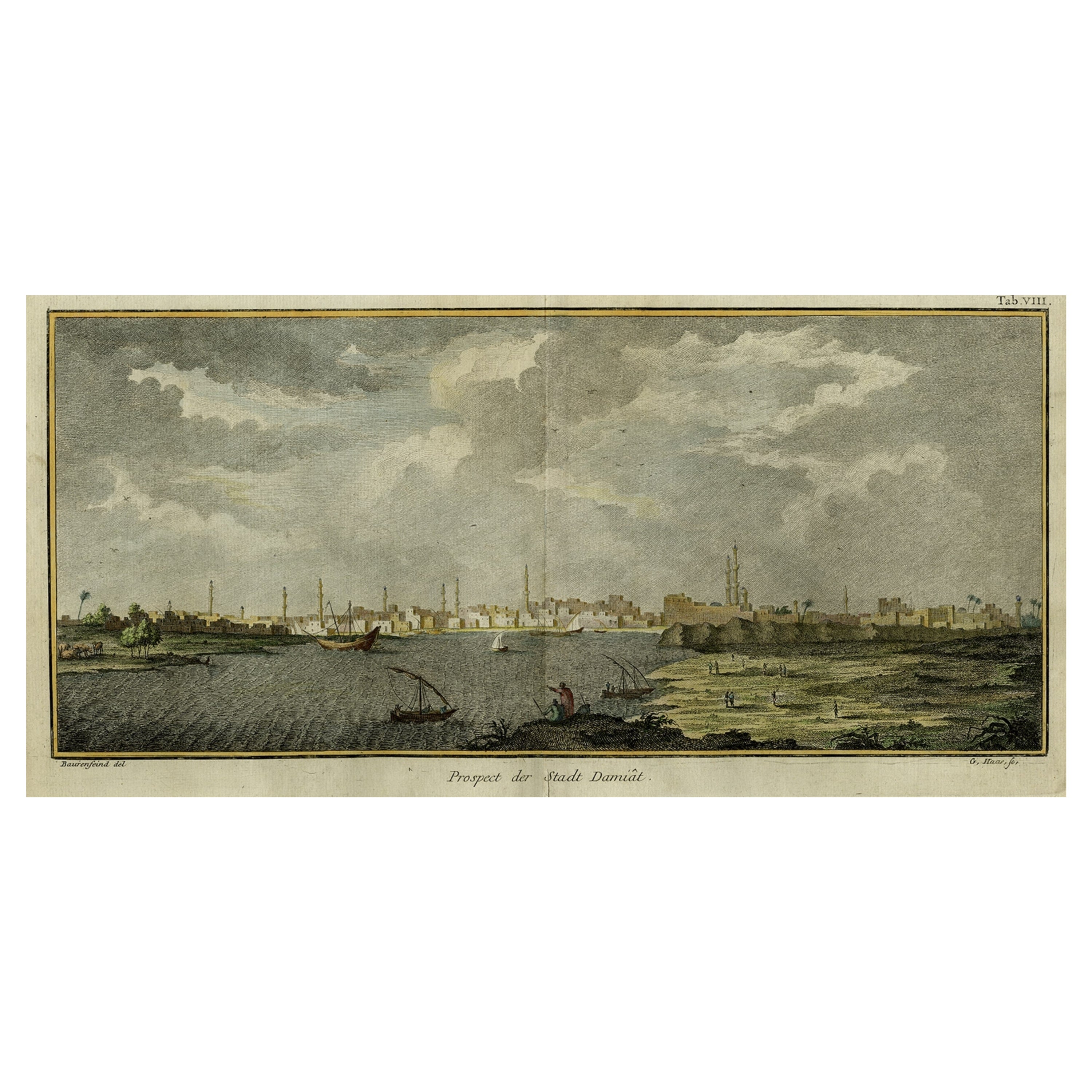
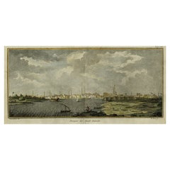
- Original Antique View of the City of Damietta, Egypt, 1774Located in Langweer, NLAntique print, titled: 'Prospect der Stadt Damiat.' - Tab VIII. View of the city of Damietta, Egypt. From 'Reisebeschreibung von Arabien und anderen umliegenden Landern (1774-1778)...Category
Antique 1770s Prints
MaterialsPaper

You May Also Like
- Vintage "View of the Center of Paris Taken from the Air" Lithograph MapLocated in San Diego, CAA very stylish "View of the Center of Paris Taken from the Air" lithograph map published by the Paris Ministry of Tourism, circa early 1950s. The piece measures 27" x 43" and shows...Category
20th Century French Mid-Century Modern Prints
MaterialsPaper
- Old Nautical Print Depicting the Bombardment of Cadiz by the French Navy 1823Located in Milan, ITPrint by engraving on copper plate of the first half of the 19th century, depicting the bombardment of Cadiz by the French Navy, 23 September 1823. The print is signed peint par Crep...Category
Antique 1830s French Nautical Objects
MaterialsPaper
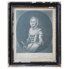
- Sarah Porter, "Queen of the Touters at Tunbridge Wells" Engraving, circa 1770Located in Lowestoft, GBAfter Vander Smissen 'Mrs Sarah Porter, Queen of the Touters at Tunbridge Wells', a mezzotint, engraved by William Pether circa 1770, glazed in ebonised, ...Category
Antique Late 18th Century English Prints
MaterialsGlass, Pine, Paper
- N.E. View of the United States Capitol, Washington, DC Antique Proof Print 1858Located in Colorado Springs, COThis engraved print shows a view of the United States Capitol Building, in Washington, D.C. The print depicts the neoclassical building from the northeast orientation, with a bustling street scene in front. The steel engraving is a proof printing, drawn and engraved by Henry Sartain and published in 1858. Plans began in May 1854 to build a new cast-iron dome for the United States Capitol. The then-architect of the Capitol Thomas Walter and his team were sold on the aesthetics of a new dome, as well as the utility of a fire-proof one. A year later, on March 3, 1855, President Franklin Pierce...Category
Antique 1850s American Prints
MaterialsPaper
- Hand-Colored 18th Century Homann Map of Denmark and Islands in the Baltic SeaBy Johann Baptist HomannLocated in Alamo, CAAn 18th century copper plate hand-colored map entitled "Insulae Danicae in Mari Balthico Sitae utpote Zeelandia, Fionia, Langelandia, Lalandia, Falstria, Fembria Mona" created by Joh...Category
Antique Early 18th Century German Maps
MaterialsPaper
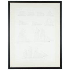
- "Balance of Sail" Print by Day & Son, Lithographers to the Queen, Dated 1864By Vincent Brooks, Day and SonsLocated in London, GBA Victorian framed print of "Balance of Sail" by Day and Son, lithographers to the Queen. The bottom of the print is inscribed: LONDON. PUBL...Category
Antique Mid-19th Century European Prints