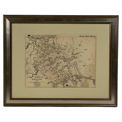
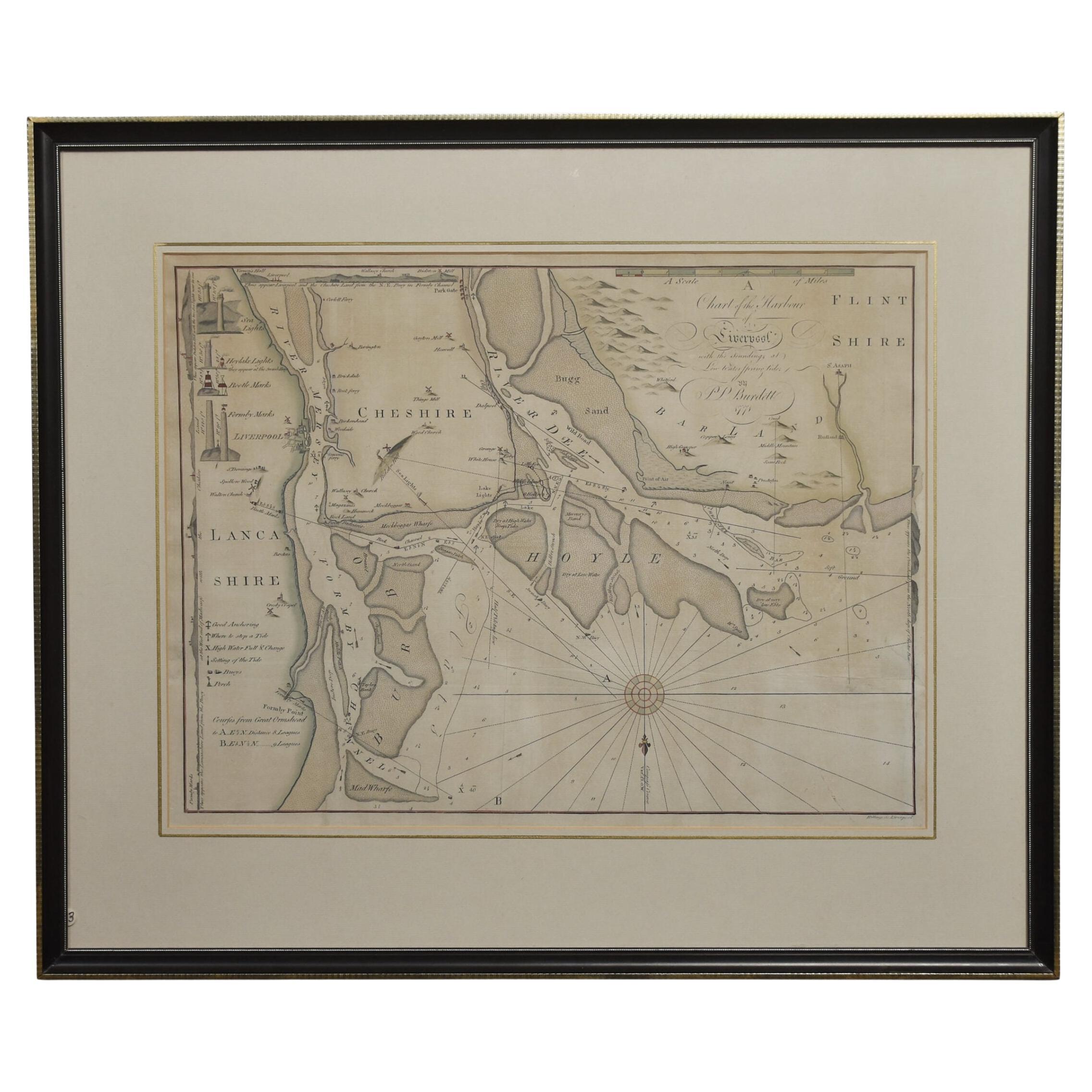
Original 1913 Chart of Boston Harbor
View Similar Items


Want more images or videos?
Request additional images or videos from the seller
1 of 15
Original 1913 Chart of Boston Harbor
About the Item
- Dimensions:Height: 24 in (60.96 cm)Width: 30 in (76.2 cm)Depth: 2 in (5.08 cm)
- Materials and Techniques:
- Period:1910-1919
- Date of Manufacture:1913
- Condition:
- Seller Location:Norwell, MA
- Reference Number:Seller: 81811stDibs: LU1741235627422
About the Seller
5.0
Vetted Seller
These experienced sellers undergo a comprehensive evaluation by our team of in-house experts.
Established in 1967
1stDibs seller since 2015
347 sales on 1stDibs
Typical response time: 2 hours
More From This SellerView All
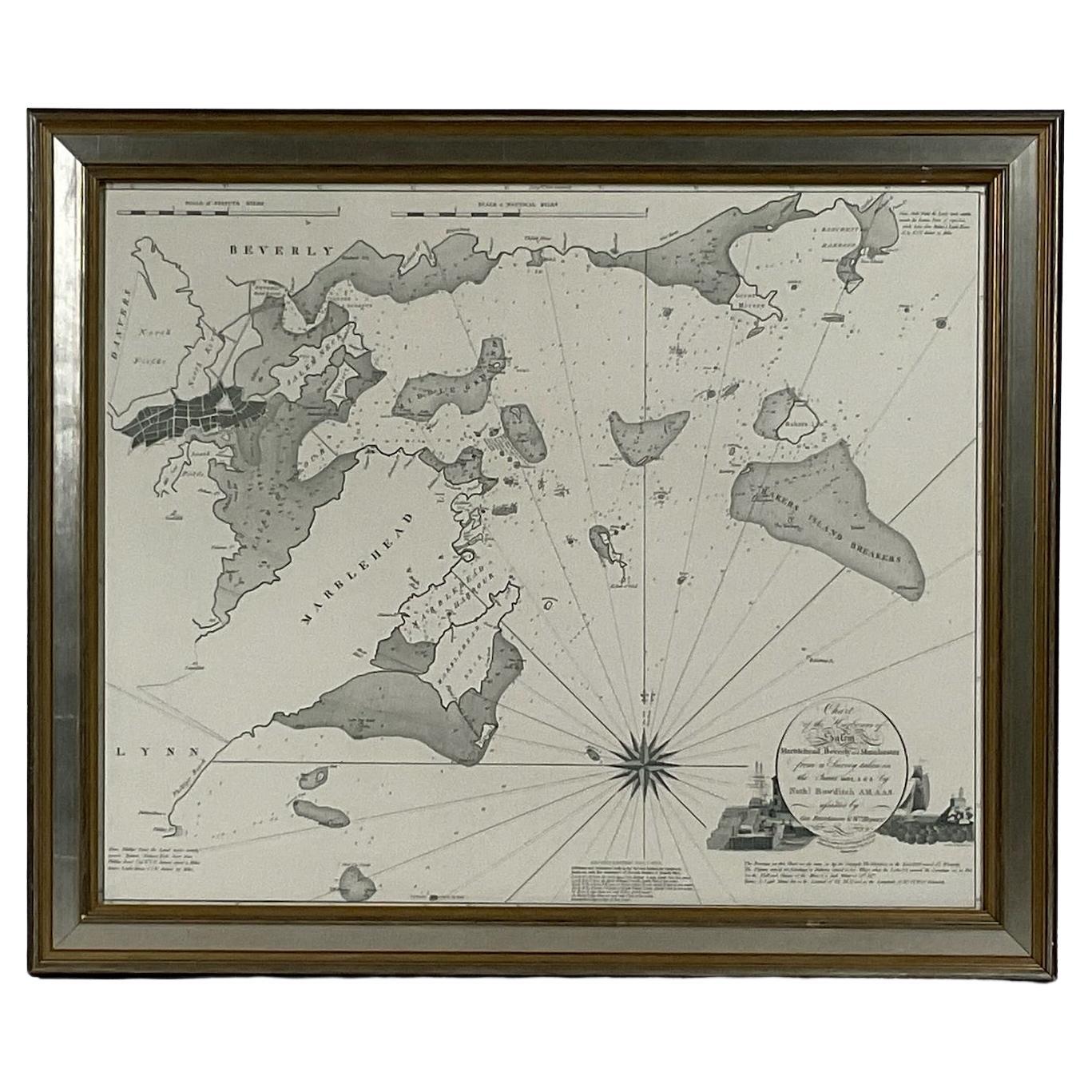
- Chart of Boston's North ShoreLocated in Norwell, MARarely found restrike of an 1804 chart by Nathanael Bowditch of the Harbors of Salem, Marblehead, Beverly, and Manchester. Showing the Islands of Great Misery, Satan, Cuney, Winter,...Category
Vintage 1980s North American Maps
MaterialsPaper
- 1898 Chart of Boston BayLocated in Norwell, MAOriginal 1898 chart showing Massachusetts Bay with the coast from Cape Ann to Cape Cod. This is a U.S. Navy Geodetic survey chart. All towns are noted along the coast. Framed with gl...Category
Antique 1890s Nautical Objects
MaterialsPaper
 $1,495
 - Copy of 1901 Chart of Boston HarborLocated in Norwell, MALater copy after an original Boston Harbor chart by George Eldridge of Vineyard Haven and Boston. Detailed chart of Boston Harbor from the Neponset River in Quincy south down to Kimb...Category
Vintage 1910s North American Prints
MaterialsPaper
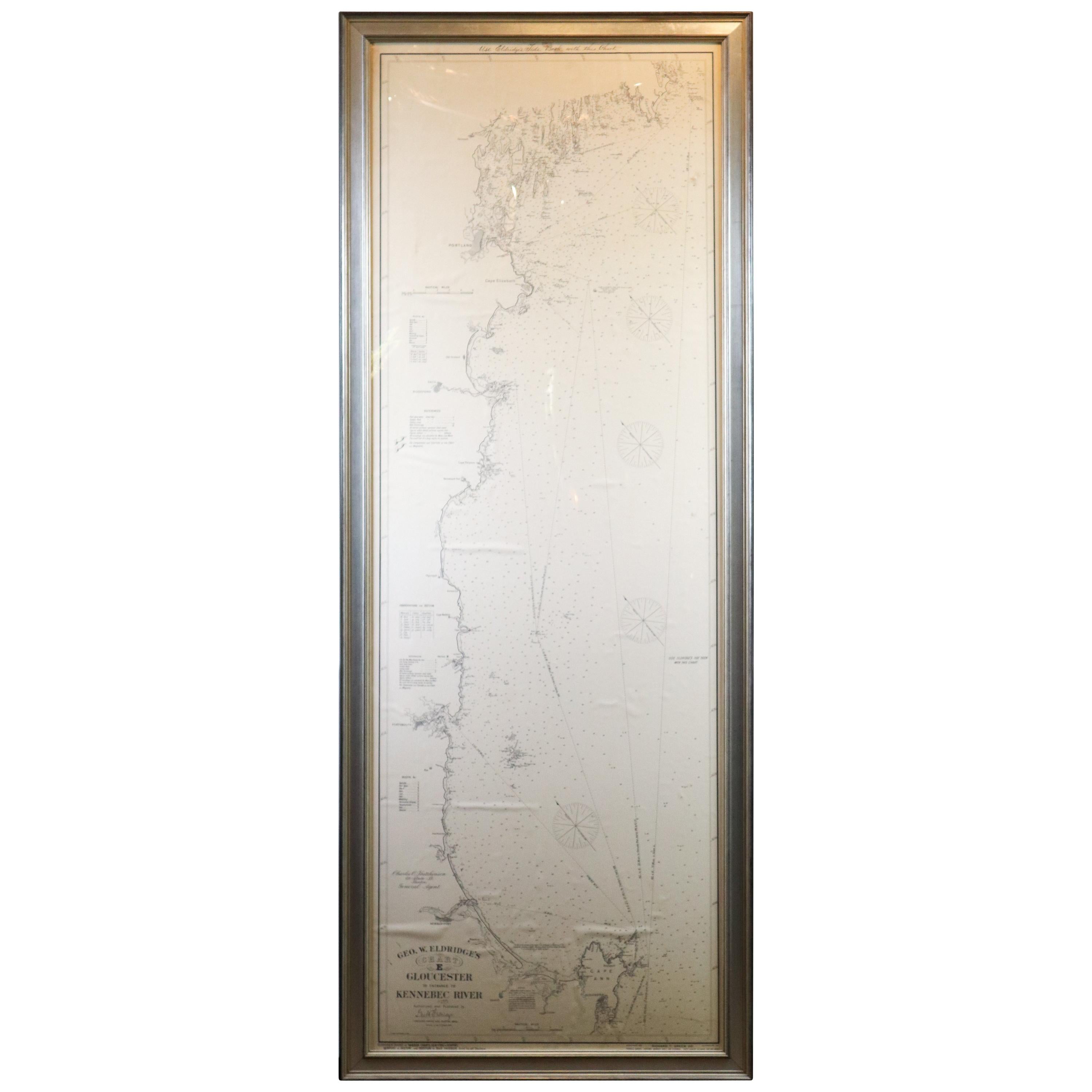
- Original 1910 George Eldridge ChartLocated in Norwell, MAOriginal framed 1910 George Eldridge chart "E" showing Gloucester to the Kennebec river. Showing the coast of Maine in great detail. Towns include Bath, Camden, Portland, the Coastal...Category
20th Century Unknown Maps
- Original Imray & Son Chart of North Atlantic, 1876Located in Norwell, MANautical chart of the North Atlantic showing the Eastern United States coast, Caribbean Islands, South America (Venezuela and ), British Possessions (Canada - Gulf of Lawrence, Newfo...Category
Antique 1870s Nautical Objects
MaterialsPaper
- 1865 Chart of the Islands of MadeiraLocated in Norwell, MARare James Imray chart from 1865 titled "Chart of the Islands of Madeira, Porto Santo and Dezerea" drawn from the survey made by Captain Ate Vidal Royal Navy, London. Published by Ja...Category
Antique 1860s European Maps
MaterialsPaper


You May Also Like
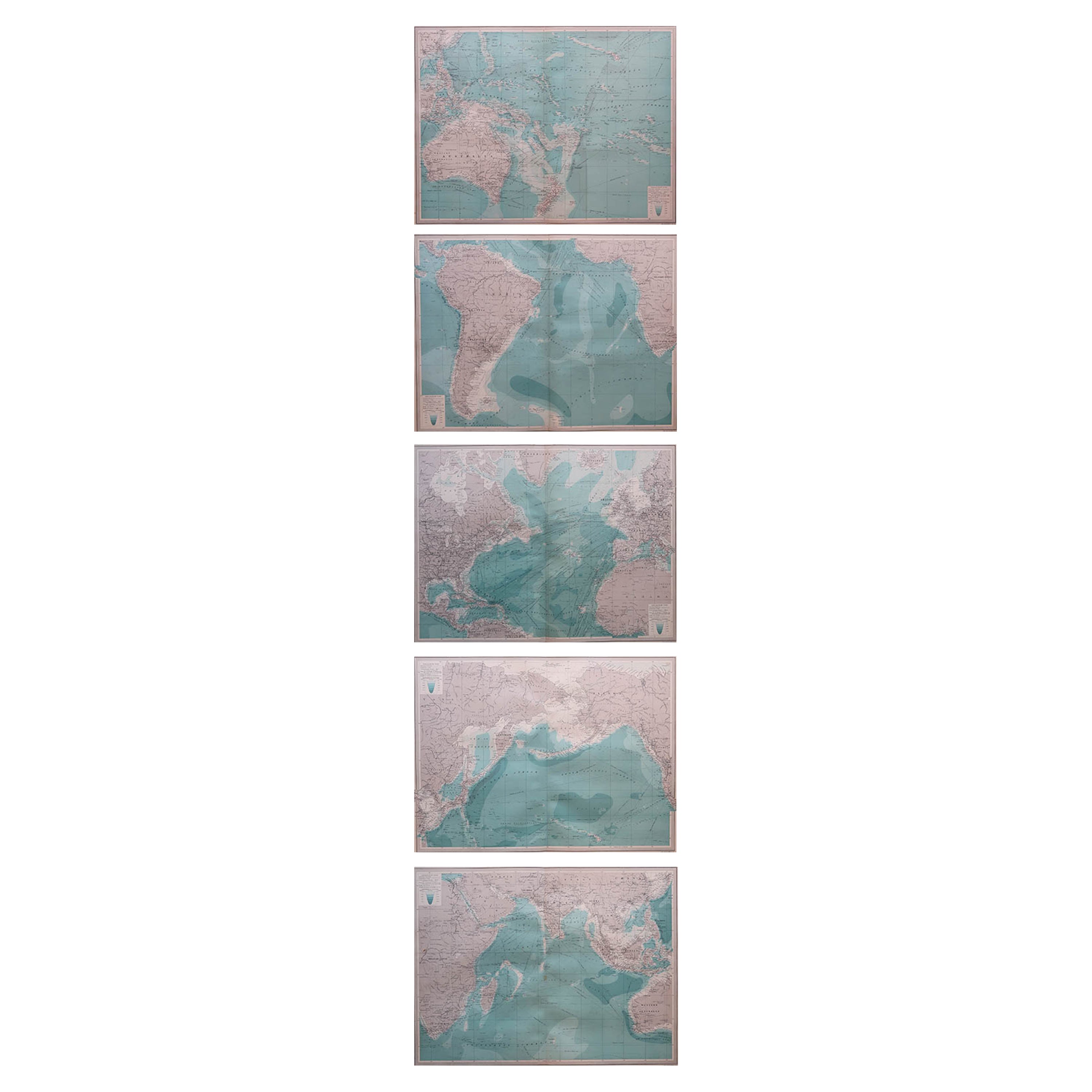
- Set of 5 Large Original Vintage Sea Charts, circa 1920Located in St Annes, Lancashire5 great maps or charts of the oceans I particularly like the color of these maps Unframed Original color By John Bartholomew and Co. Edinburgh Geographical Institute Published, ...Category
Vintage 1920s British Maps
MaterialsPaper

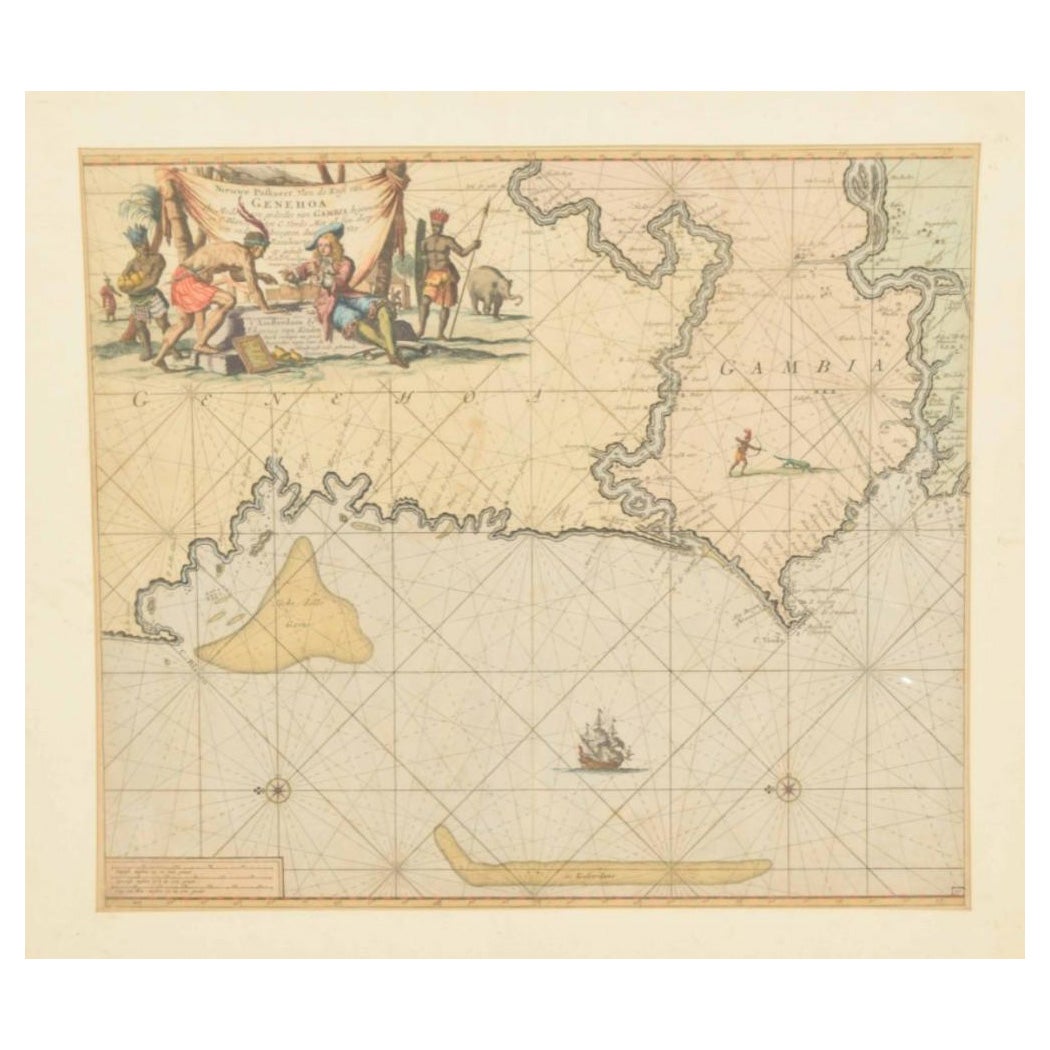
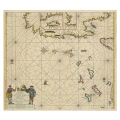
- Original Hand-Coloured Nautical Chart of West-Africa, c.1680Located in Langweer, NLNIEUWE PASKAERT VAN DE KUST VAN GENEHOA (Senegal) alsmede een gedeelte van Gambia beginnende an C. Blanco tot C. Verde (...). Amsterdam, Johannus van Keulen, c. 1680. Large folio...Category
Antique 17th Century Maps
MaterialsPaper
 $1,288 Sale Price20% Off
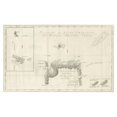
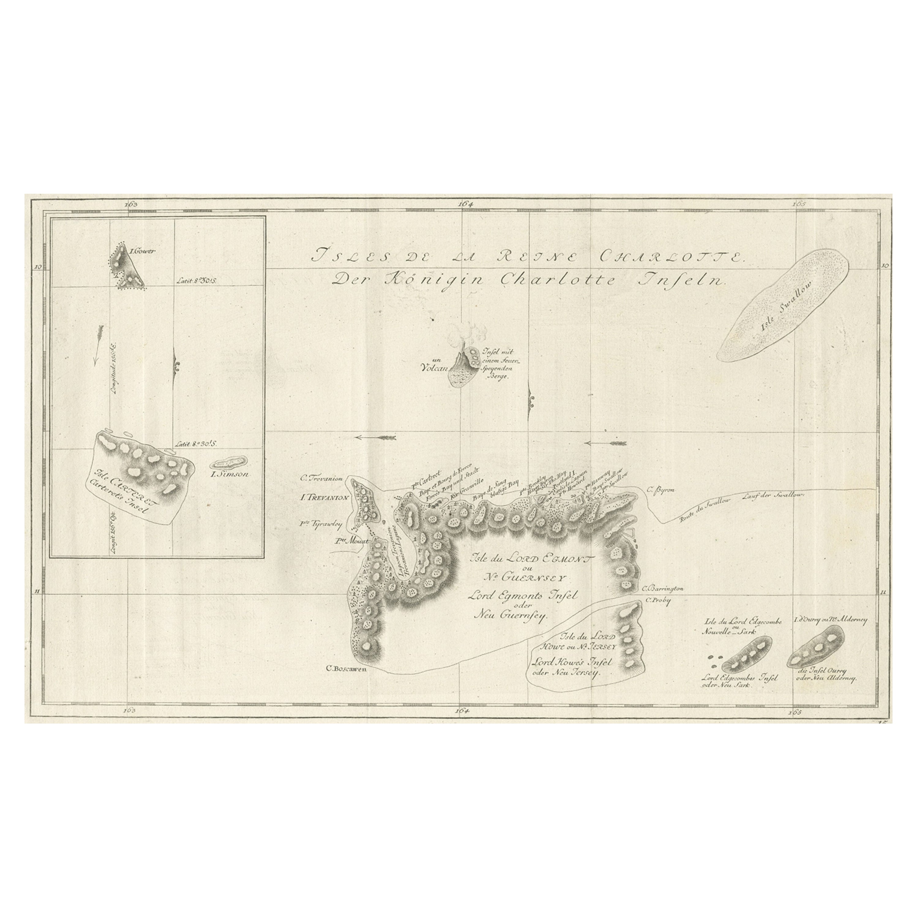
 - Original Antique Chart of the Santa Cruz Islands, 1774Located in Langweer, NLAntique print titled 'Isles de la Reine Charlotte (..)'. A detailed chart of the Santa Cruz islands, to the north of the New Hebrides, with Carte...Category
Antique 1770s Maps
MaterialsPaper
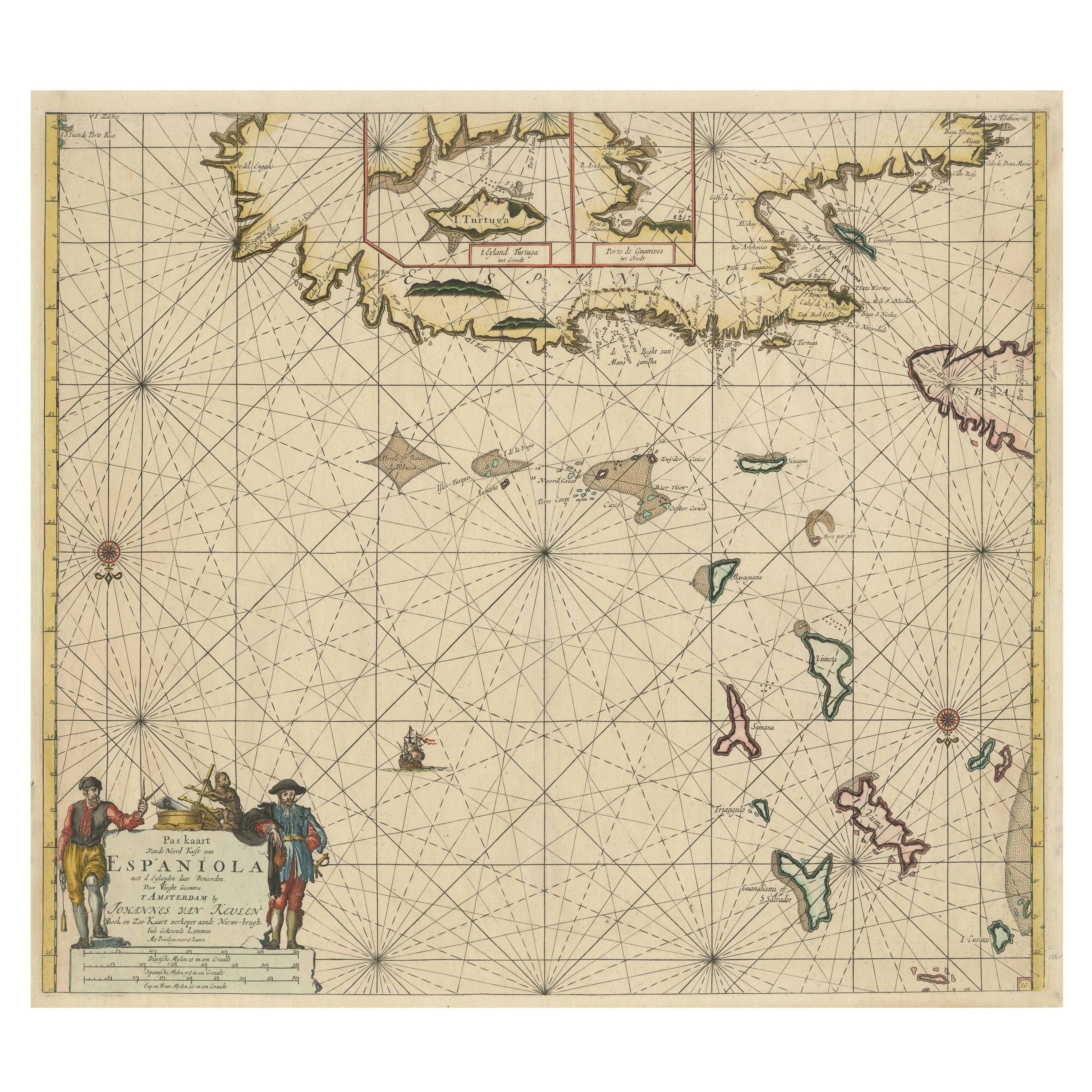
- Original Antique Sea Chart of the Northern Part of Hispaniola, Western CubaLocated in Langweer, NLAntique map titled 'Pas kaart van de Noord Kust van Espaniola (..)'. Beautiful sea chart of the northern part of Hispaniola, western Cuba. The map includes the Turks & Caicos Islands and southern part of the Bahamas. Shows Guanahami or S. Salvador. Guanahani is an island in the Bahamas that was the first land in the New World sighted and visited by Christopher Columbus' first voyage, on October 12, 1492. It is not known precisely which island it was, and several theories have been put forth by historians. Guanahani is the native Taíno name; Columbus called it San Salvador. Originates from 'De Nieuwe Groote Lightende Zee-Fakkel'. Published by J. van Keulen, circa 1684. The Van Keulens were a family of chartmakers and publishers. The firm, In de Gekroonde Lootsman (In the Crowned Pilot), was founded in 1678 by Johannes van Keulen (1654-1715). Van Keulen originally registered his business as a vendor of books and instruments (specifically cross-staffs). In 1680, however, he gained a privilege from the States of Holland and West Friesland for the publication of pilot guides and sea atlases. In that year, van Keulen released his Zee-Atlas (Sea Atlas), which secured him a name in the competitive maritime publishing market. In 1681, he published the first volume of Nieuwe Lichtende Zee-Fakkel (New Shining Sea Torch). This would be the first of an eventual five volumes originally published between 1680 and 1684. A sixth volume was added in 1753. The Zee-Fakkel won van Keulen lasting fame. The atlas had charts compiled by Claes Jansz Vooght and artwork from Jan Luyken...Category
Antique Late 17th Century Maps
MaterialsPaper
 $1,683 Sale Price20% Off
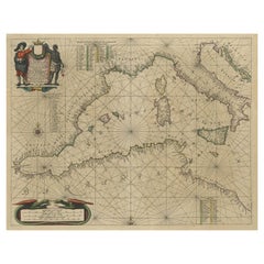
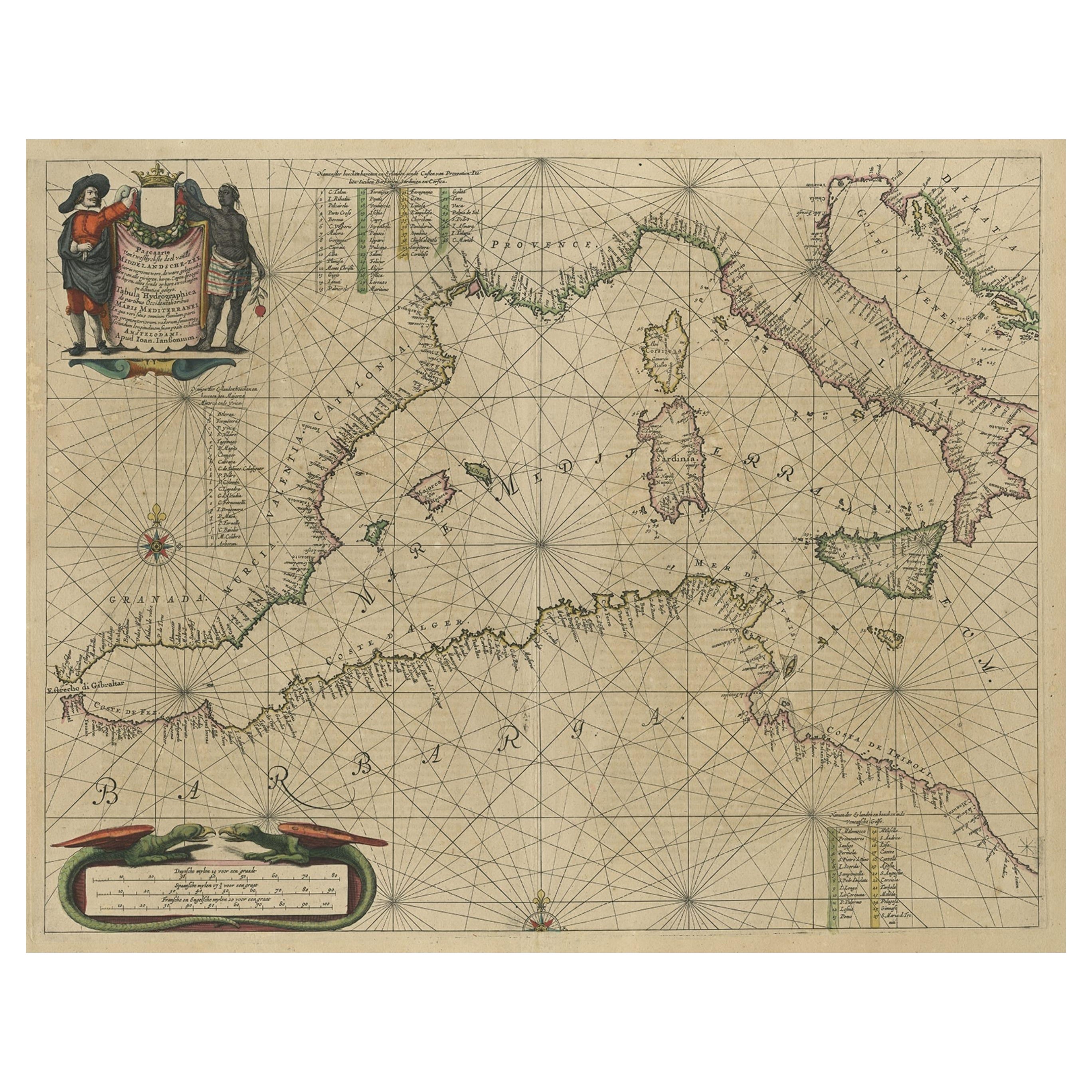
 - Original Antique Engraving of a Sea Chart of the Western Mediterranean, ca.1650Located in Langweer, NLAntique map titled 'Pascaerte van 't westlyckste deel vande Middelandsche-Zee (..)'. Sea chart of the Western Mediterranean. The map extends from the Straits of Gibralter to Italy ...Category
Antique 1650s Maps
MaterialsPaper
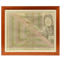
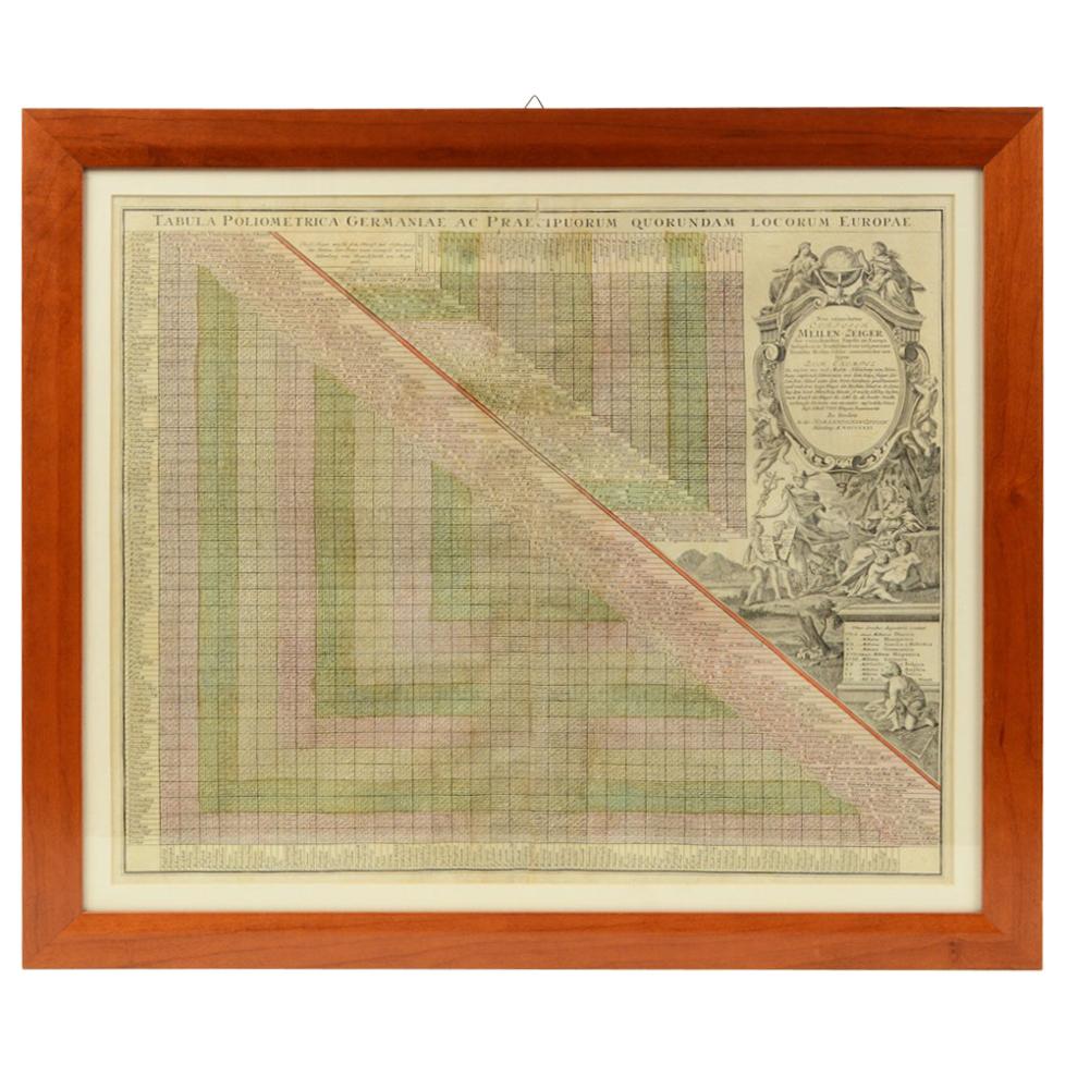
- 1731 Original German Engraving Print Chart of European Distances by T. MayerLocated in Milan, ITTabula Poliometrica Germaniae ac Praecipuorum quorundam locorum Europae Nuremberg, 1731. Author: T. Mayer; publisher: Homman. Chart printed by engraving on copper plate, coeval color...Category
Antique 1730s German Scientific Instruments
MaterialsGlass, Wood, Paper